Elk Creek
Map
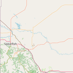
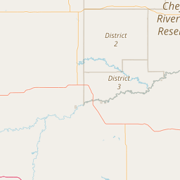
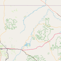
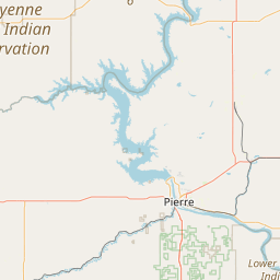
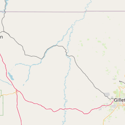
Leaflet | <a href="https://www.openstreetmap.org/copyright">© OpenStreetMap contributors</a>
Item
| Property | Value |
|---|---|
| id | 354344 |
| downstream_mainstem_id | https://geoconnex.us/ref/mainstems/322818 |
| encompassing_mainstem_basins | ['https://geoconnex.us/ref/mainstems/322818', 'https://geoconnex.us/ref/mainstems/312532', 'https://geoconnex.us/ref/mainstems/312091'] |
| featuretype | ['https://www.opengis.net/def/schema/hy_features/hyf/HY_FlowPath', 'https://www.opengis.net/def/schema/hy_features/hyf/HY_WaterBody'] |
| fid | 16651 |
| head_2020huc12 | 101201110601 |
| head_nhdpv1_comid | 14553199 |
| head_nhdpv2_comid | https://geoconnex.us/nhdplusv2/comid/14553199 |
| head_nhdpv2huc12 | https://geoconnex.us/nhdplusv2/huc12/101201110601 |
| head_rf1id | 28381 |
| lengthkm | 215.4 |
| name_at_outlet | Elk Creek |
| name_at_outlet_gnis_id | 1265198 |
| new_mainstemid | |
| outlet_2020huc12 | 101201110807 |
| outlet_drainagearea_sqkm | 1577.6 |
| outlet_nhdpv1_comid | 14555593 |
| outlet_nhdpv2_comid | https://geoconnex.us/nhdplusv2/comid/14555593 |
| outlet_nhdpv2huc12 | https://geoconnex.us/nhdplusv2/huc12/101201110807 |
| outlet_rf1id | 28381 |
| superseded | False |
| uri | https://geoconnex.us/ref/mainstems/354344 |
Graph Results
| monitoringLocation | https://sta.geoconnex.dev/collections/USGS/Things/items/'USGS-06425500' |
|---|---|
| siteName | USGS-06425500 |
| datasetDescription | Discharge / USGS-06425500-3d899030223f41baa32293a8b2cc2c56 |
| type | Stream |
| url | https://waterdata.usgs.gov/monitoring-location/06425500/#parameterCode=00060 |
| variableMeasured | Discharge / USGS-06425500-3d899030223f41baa32293a8b2cc2c56 |
| variableUnit | ft^3/s |
| measurementTechnique | observation |
| temporalCoverage | 2024-08-30T09:15:00Z/2024-09-09T18:00:00Z |
| distributionName | USGS SensorThings API |
| distributionURL | https://labs.waterdata.usgs.gov/sta/v1.1/Datastreams('3d899030223f41baa32293a8b2cc2c56')?$expand=Thing,Observations |
| distributionFormat | application/json |
| wkt | POINT (-102.503221710144 44.2483176762718) |
| monitoringLocation | https://sta.geoconnex.dev/collections/USGS/Things/items/'USGS-06425500' |
|---|---|
| siteName | USGS-06425500 |
| datasetDescription | Discharge / USGS-06425500-3d899030223f41baa32293a8b2cc2c56 |
| type | Stream |
| url | https://waterdata.usgs.gov/monitoring-location/06425500/#parameterCode=00060 |
| variableMeasured | Discharge / USGS-06425500-3d899030223f41baa32293a8b2cc2c56 |
| variableUnit | ft^3/s |
| measurementTechnique | observation |
| temporalCoverage | 2024-08-30T09:15:00Z/2024-09-09T18:00:00Z |
| distributionName | USGS Instantaneous Values Service |
| distributionURL | https://waterservices.usgs.gov/nwis/iv/?sites=USGS:06425500¶meterCd=00060&format=rdb |
| distributionFormat | text/tab-separated-values |
| wkt | POINT (-102.503221710144 44.2483176762718) |
| monitoringLocation | https://sta.geoconnex.dev/collections/USGS/Things/items/'USGS-06425500' |
|---|---|
| siteName | USGS-06425500 |
| datasetDescription | Gage height / USGS-06425500-18da94a235204bd48350849058539cd6 |
| type | Stream |
| url | https://waterdata.usgs.gov/monitoring-location/06425500/#parameterCode=00065 |
| variableMeasured | Gage height / USGS-06425500-18da94a235204bd48350849058539cd6 |
| variableUnit | ft |
| measurementTechnique | observation |
| temporalCoverage | 2024-08-30T09:15:00Z/2024-09-09T18:00:00Z |
| distributionName | USGS SensorThings API |
| distributionURL | https://labs.waterdata.usgs.gov/sta/v1.1/Datastreams('18da94a235204bd48350849058539cd6')?$expand=Thing,Observations |
| distributionFormat | application/json |
| wkt | POINT (-102.503221710144 44.2483176762718) |
| monitoringLocation | https://sta.geoconnex.dev/collections/USGS/Things/items/'USGS-06425500' |
|---|---|
| siteName | USGS-06425500 |
| datasetDescription | Gage height / USGS-06425500-18da94a235204bd48350849058539cd6 |
| type | Stream |
| url | https://waterdata.usgs.gov/monitoring-location/06425500/#parameterCode=00065 |
| variableMeasured | Gage height / USGS-06425500-18da94a235204bd48350849058539cd6 |
| variableUnit | ft |
| measurementTechnique | observation |
| temporalCoverage | 2024-08-30T09:15:00Z/2024-09-09T18:00:00Z |
| distributionName | USGS Instantaneous Values Service |
| distributionURL | https://waterservices.usgs.gov/nwis/iv/?sites=USGS:06425500¶meterCd=00065&format=rdb |
| distributionFormat | text/tab-separated-values |
| wkt | POINT (-102.503221710144 44.2483176762718) |