Sweetwater River
Map

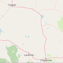


Leaflet | <a href="https://www.openstreetmap.org/copyright">© OpenStreetMap contributors</a>
Item
| Property | Value |
|---|---|
| id | 354423 |
| downstream_mainstem_id | https://geoconnex.us/ref/mainstems/314333 |
| encompassing_mainstem_basins | ['https://geoconnex.us/ref/mainstems/314333', 'https://geoconnex.us/ref/mainstems/313255', 'https://geoconnex.us/ref/mainstems/312532', 'https://geoconnex.us/ref/mainstems/312091'] |
| featuretype | ['https://www.opengis.net/def/schema/hy_features/hyf/HY_FlowPath', 'https://www.opengis.net/def/schema/hy_features/hyf/HY_WaterBody'] |
| fid | 17707 |
| head_2020huc12 | 101800060101 |
| head_nhdpv1_comid | 15950100 |
| head_nhdpv2_comid | https://geoconnex.us/nhdplusv2/comid/15950100 |
| head_nhdpv2huc12 | https://geoconnex.us/nhdplusv2/huc12/101800060101 |
| head_rf1id | 59014 |
| lengthkm | 371.8 |
| name_at_outlet | Sweetwater River |
| name_at_outlet_gnis_id | 1609188 |
| new_mainstemid | |
| outlet_2020huc12 | 101800061106 |
| outlet_drainagearea_sqkm | 7475.7 |
| outlet_nhdpv1_comid | 15976274 |
| outlet_nhdpv2_comid | https://geoconnex.us/nhdplusv2/comid/15976274 |
| outlet_nhdpv2huc12 | https://geoconnex.us/nhdplusv2/huc12/101800061104 |
| outlet_rf1id | 25831 |
| superseded | False |
| uri | https://geoconnex.us/ref/mainstems/354423 |
Graph Results
| monitoringLocation | https://sta.geoconnex.dev/collections/USGS/Things/items/'USGS-06638090' |
|---|---|
| siteName | USGS-06638090 |
| datasetDescription | Discharge cubic feet per second / USGS-06638090-1687ca96741f46a5909ccf3aa69ee598 |
| type | Stream |
| url | https://waterdata.usgs.gov/monitoring-location/06638090/#parameterCode=00060 |
| variableMeasured | Discharge |
| variableUnit | ft^3/s |
| measurementTechnique | observation |
| temporalCoverage | 2024-08-30T09:15:00Z/2024-09-09T18:30:00Z |
| distributionName | USGS Instantaneous Values Service |
| distributionURL | https://waterservices.usgs.gov/nwis/iv/?sites=USGS:06638090¶meterCd=00060&format=rdb |
| distributionFormat | text/tab-separated-values |
| wkt | POINT (-108.250698237155 42.5038205142596) |
| monitoringLocation | https://sta.geoconnex.dev/collections/USGS/Things/items/'USGS-06638090' |
|---|---|
| siteName | USGS-06638090 |
| datasetDescription | Discharge cubic feet per second / USGS-06638090-1687ca96741f46a5909ccf3aa69ee598 |
| type | Stream |
| url | https://waterdata.usgs.gov/monitoring-location/06638090/#parameterCode=00060 |
| variableMeasured | Discharge |
| variableUnit | ft^3/s |
| measurementTechnique | observation |
| temporalCoverage | 2024-08-30T09:15:00Z/2024-09-09T18:30:00Z |
| distributionName | USGS SensorThings API |
| distributionURL | https://labs.waterdata.usgs.gov/sta/v1.1/Datastreams('1687ca96741f46a5909ccf3aa69ee598')?$expand=Thing,Observations |
| distributionFormat | application/json |
| wkt | POINT (-108.250698237155 42.5038205142596) |
| monitoringLocation | https://sta.geoconnex.dev/collections/USGS/Things/items/'USGS-06638090' |
|---|---|
| siteName | USGS-06638090 |
| datasetDescription | Gage height / USGS-06638090-535646a630354953abf245096ddcf302 |
| type | Stream |
| url | https://waterdata.usgs.gov/monitoring-location/06638090/#parameterCode=00065 |
| variableMeasured | Gage height / USGS-06638090-535646a630354953abf245096ddcf302 |
| variableUnit | ft |
| measurementTechnique | observation |
| temporalCoverage | 2024-08-30T09:15:00Z/2024-09-09T18:30:00Z |
| distributionName | USGS Instantaneous Values Service |
| distributionURL | https://waterservices.usgs.gov/nwis/iv/?sites=USGS:06638090¶meterCd=00065&format=rdb |
| distributionFormat | text/tab-separated-values |
| wkt | POINT (-108.250698237155 42.5038205142596) |
| monitoringLocation | https://sta.geoconnex.dev/collections/USGS/Things/items/'USGS-06638090' |
|---|---|
| siteName | USGS-06638090 |
| datasetDescription | Gage height / USGS-06638090-535646a630354953abf245096ddcf302 |
| type | Stream |
| url | https://waterdata.usgs.gov/monitoring-location/06638090/#parameterCode=00065 |
| variableMeasured | Gage height / USGS-06638090-535646a630354953abf245096ddcf302 |
| variableUnit | ft |
| measurementTechnique | observation |
| temporalCoverage | 2024-08-30T09:15:00Z/2024-09-09T18:30:00Z |
| distributionName | USGS SensorThings API |
| distributionURL | https://labs.waterdata.usgs.gov/sta/v1.1/Datastreams('535646a630354953abf245096ddcf302')?$expand=Thing,Observations |
| distributionFormat | application/json |
| wkt | POINT (-108.250698237155 42.5038205142596) |