Redbank Creek
Map


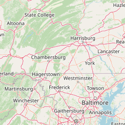


Leaflet | <a href="https://www.openstreetmap.org/copyright">© OpenStreetMap contributors</a>
Item
| Property | Value |
|---|---|
| id | 357711 |
| downstream_mainstem_id | https://geoconnex.us/ref/mainstems/314849 |
| encompassing_mainstem_basins | ['https://geoconnex.us/ref/mainstems/314849', 'https://geoconnex.us/ref/mainstems/312091'] |
| featuretype | ['https://www.opengis.net/def/schema/hy_features/hyf/HY_FlowPath', 'https://www.opengis.net/def/schema/hy_features/hyf/HY_WaterBody'] |
| fid | 7660 |
| head_2020huc12 | 050100060303 |
| head_nhdpv1_comid | 4737145 |
| head_nhdpv2_comid | https://geoconnex.us/nhdplusv2/comid/4737145 |
| head_nhdpv2huc12 | https://geoconnex.us/nhdplusv2/huc12/050100060303 |
| head_rf1id | 12042 |
| lengthkm | 146.4 |
| name_at_outlet | Redbank Creek |
| name_at_outlet_gnis_id | 1190990 |
| new_mainstemid | |
| outlet_2020huc12 | 050100060504 |
| outlet_drainagearea_sqkm | 1492.9 |
| outlet_nhdpv1_comid | 4745945 |
| outlet_nhdpv2_comid | https://geoconnex.us/nhdplusv2/comid/4745945 |
| outlet_nhdpv2huc12 | https://geoconnex.us/nhdplusv2/huc12/050100060504 |
| outlet_rf1id | 12040 |
| superseded | False |
| uri | https://geoconnex.us/ref/mainstems/357711 |
Graph Results
| monitoringLocation | https://geoconnex.us/iow/wqp/USGS-405945079233301 |
|---|---|
| siteName | USGS-405945079233301 |
| datasetDescription | Iron at USGS-405945079233301 |
| type | Well |
| url | https://www.waterqualitydata.us/provider/NWIS/USGS-PA/USGS-405945079233301/ |
| variableMeasured | Iron |
| variableUnit | % |
| measurementTechnique | observation |
| temporalCoverage | 1976-01-01T00:00:00Z/1976-12-31T00:00:00Z |
| distributionName | Water Quality Portal |
| distributionURL | https://www.waterqualitydata.us/data/Result/search?siteid=USGS-405945079233301&CharacteristicName=Iron&mimeType=csv |
| distributionFormat | text/comma-separated-values |
| wkt | POINT (-79.3922643 40.9958982) |
| monitoringLocation | https://geoconnex.us/iow/wqp/USGS-405945079233301 |
|---|---|
| siteName | USGS-405945079233301 |
| datasetDescription | Ferrous ion at USGS-405945079233301 |
| type | Well |
| url | https://www.waterqualitydata.us/provider/NWIS/USGS-PA/USGS-405945079233301/ |
| variableMeasured | Ferrous ion |
| variableUnit | ug/l |
| measurementTechnique | observation |
| temporalCoverage | 1976-01-01T00:00:00Z/1976-12-31T00:00:00Z |
| distributionName | Water Quality Portal |
| distributionURL | https://www.waterqualitydata.us/data/Result/search?siteid=USGS-405945079233301&CharacteristicName=Ferrous ion&mimeType=csv |
| distributionFormat | text/comma-separated-values |
| wkt | POINT (-79.3922643 40.9958982) |
| monitoringLocation | https://geoconnex.us/iow/wqp/USGS-405945079233301 |
|---|---|
| siteName | USGS-405945079233301 |
| datasetDescription | Chloride at USGS-405945079233301 |
| type | Well |
| url | https://www.waterqualitydata.us/provider/NWIS/USGS-PA/USGS-405945079233301/ |
| variableMeasured | Chloride |
| variableUnit | mg/l |
| measurementTechnique | observation |
| temporalCoverage | 1976-01-01T00:00:00Z/1976-12-31T00:00:00Z |
| distributionName | Water Quality Portal |
| distributionURL | https://www.waterqualitydata.us/data/Result/search?siteid=USGS-405945079233301&CharacteristicName=Chloride&mimeType=csv |
| distributionFormat | text/comma-separated-values |
| wkt | POINT (-79.3922643 40.9958982) |
| monitoringLocation | https://geoconnex.us/iow/wqp/USGS-405945079233301 |
|---|---|
| siteName | USGS-405945079233301 |
| datasetDescription | pH at USGS-405945079233301 |
| type | Well |
| url | https://www.waterqualitydata.us/provider/NWIS/USGS-PA/USGS-405945079233301/ |
| variableMeasured | pH |
| variableUnit | None |
| measurementTechnique | observation |
| temporalCoverage | 1976-01-01T00:00:00Z/1976-12-31T00:00:00Z |
| distributionName | Water Quality Portal |
| distributionURL | https://www.waterqualitydata.us/data/Result/search?siteid=USGS-405945079233301&CharacteristicName=pH&mimeType=csv |
| distributionFormat | text/comma-separated-values |
| wkt | POINT (-79.3922643 40.9958982) |
| monitoringLocation | https://geoconnex.us/iow/wqp/USGS-405945079233301 |
|---|---|
| siteName | USGS-405945079233301 |
| datasetDescription | Sulfate at USGS-405945079233301 |
| type | Well |
| url | https://www.waterqualitydata.us/provider/NWIS/USGS-PA/USGS-405945079233301/ |
| variableMeasured | Sulfate |
| variableUnit | mg/l |
| measurementTechnique | observation |
| temporalCoverage | 1976-01-01T00:00:00Z/1976-12-31T00:00:00Z |
| distributionName | Water Quality Portal |
| distributionURL | https://www.waterqualitydata.us/data/Result/search?siteid=USGS-405945079233301&CharacteristicName=Sulfate&mimeType=csv |
| distributionFormat | text/comma-separated-values |
| wkt | POINT (-79.3922643 40.9958982) |
| monitoringLocation | https://geoconnex.us/iow/wqp/USGS-405945079233301 |
|---|---|
| siteName | USGS-405945079233301 |
| datasetDescription | Hardness, Ca, Mg at USGS-405945079233301 |
| type | Well |
| url | https://www.waterqualitydata.us/provider/NWIS/USGS-PA/USGS-405945079233301/ |
| variableMeasured | Hardness, Ca, Mg |
| variableUnit | mg/l CaCO3 |
| measurementTechnique | observation |
| temporalCoverage | 1976-01-01T00:00:00Z/1976-12-31T00:00:00Z |
| distributionName | Water Quality Portal |
| distributionURL | https://www.waterqualitydata.us/data/Result/search?siteid=USGS-405945079233301&CharacteristicName=Hardness, Ca, Mg&mimeType=csv |
| distributionFormat | text/comma-separated-values |
| wkt | POINT (-79.3922643 40.9958982) |
| monitoringLocation | https://geoconnex.us/iow/wqp/USGS-405945079233301 |
|---|---|
| siteName | USGS-405945079233301 |
| datasetDescription | Depth to water level below land surface at USGS-405945079233301 |
| type | Well |
| url | https://www.waterqualitydata.us/provider/NWIS/USGS-PA/USGS-405945079233301/ |
| variableMeasured | Depth to water level below land surface |
| variableUnit | m |
| measurementTechnique | observation |
| temporalCoverage | 1976-01-01T00:00:00Z/1976-12-31T00:00:00Z |
| distributionName | Water Quality Portal |
| distributionURL | https://www.waterqualitydata.us/data/Result/search?siteid=USGS-405945079233301&CharacteristicName=Depth to water level below land surface&mimeType=csv |
| distributionFormat | text/comma-separated-values |
| wkt | POINT (-79.3922643 40.9958982) |
| monitoringLocation | https://geoconnex.us/iow/wqp/USGS-405945079233301 |
|---|---|
| siteName | USGS-405945079233301 |
| datasetDescription | Specific conductance at USGS-405945079233301 |
| type | Well |
| url | https://www.waterqualitydata.us/provider/NWIS/USGS-PA/USGS-405945079233301/ |
| variableMeasured | Specific conductance |
| variableUnit | umho/cm |
| measurementTechnique | observation |
| temporalCoverage | 1976-01-01T00:00:00Z/1976-12-31T00:00:00Z |
| distributionName | Water Quality Portal |
| distributionURL | https://www.waterqualitydata.us/data/Result/search?siteid=USGS-405945079233301&CharacteristicName=Specific conductance&mimeType=csv |
| distributionFormat | text/comma-separated-values |
| wkt | POINT (-79.3922643 40.9958982) |
| monitoringLocation | https://geoconnex.us/iow/wqp/USGS-405945079233301 |
|---|---|
| siteName | USGS-405945079233301 |
| datasetDescription | Manganese at USGS-405945079233301 |
| type | Well |
| url | https://www.waterqualitydata.us/provider/NWIS/USGS-PA/USGS-405945079233301/ |
| variableMeasured | Manganese |
| variableUnit | ug/l |
| measurementTechnique | observation |
| temporalCoverage | 1976-01-01T00:00:00Z/1976-12-31T00:00:00Z |
| distributionName | Water Quality Portal |
| distributionURL | https://www.waterqualitydata.us/data/Result/search?siteid=USGS-405945079233301&CharacteristicName=Manganese&mimeType=csv |
| distributionFormat | text/comma-separated-values |
| wkt | POINT (-79.3922643 40.9958982) |
| monitoringLocation | https://geoconnex.us/iow/wqp/USGS-405945079233301 |
|---|---|
| siteName | USGS-405945079233301 |
| datasetDescription | Temperature, water at USGS-405945079233301 |
| type | Well |
| url | https://www.waterqualitydata.us/provider/NWIS/USGS-PA/USGS-405945079233301/ |
| variableMeasured | Temperature, water |
| variableUnit | deg C |
| measurementTechnique | observation |
| temporalCoverage | 1976-01-01T00:00:00Z/1976-12-31T00:00:00Z |
| distributionName | Water Quality Portal |
| distributionURL | https://www.waterqualitydata.us/data/Result/search?siteid=USGS-405945079233301&CharacteristicName=Temperature, water&mimeType=csv |
| distributionFormat | text/comma-separated-values |
| wkt | POINT (-79.3922643 40.9958982) |
| monitoringLocation | https://geoconnex.us/iow/wqp/USGS-405945079233301 |
|---|---|
| siteName | USGS-405945079233301 |
| datasetDescription | Flow rate, instantaneous at USGS-405945079233301 |
| type | Well |
| url | https://www.waterqualitydata.us/provider/NWIS/USGS-PA/USGS-405945079233301/ |
| variableMeasured | Flow rate, instantaneous |
| variableUnit | gal/min |
| measurementTechnique | observation |
| temporalCoverage | 1976-01-01T00:00:00Z/1976-12-31T00:00:00Z |
| distributionName | Water Quality Portal |
| distributionURL | https://www.waterqualitydata.us/data/Result/search?siteid=USGS-405945079233301&CharacteristicName=Flow rate, instantaneous&mimeType=csv |
| distributionFormat | text/comma-separated-values |
| wkt | POINT (-79.3922643 40.9958982) |
| monitoringLocation | https://geoconnex.us/iow/wqp/USGS-410814078490301 |
|---|---|
| siteName | USGS-410814078490301 |
| datasetDescription | Bicarbonate at USGS-410814078490301 |
| type | Well |
| url | https://www.waterqualitydata.us/provider/NWIS/USGS-PA/USGS-410814078490301/ |
| variableMeasured | Bicarbonate |
| variableUnit | mg/l |
| measurementTechnique | observation |
| temporalCoverage | 1973-01-01T00:00:00Z/1973-12-31T00:00:00Z |
| distributionName | Water Quality Portal |
| distributionURL | https://www.waterqualitydata.us/data/Result/search?siteid=USGS-410814078490301&CharacteristicName=Bicarbonate&mimeType=csv |
| distributionFormat | text/comma-separated-values |
| wkt | POINT (-78.817253 41.13728408) |
| monitoringLocation | https://geoconnex.us/iow/wqp/USGS-410814078490301 |
|---|---|
| siteName | USGS-410814078490301 |
| datasetDescription | Iron at USGS-410814078490301 |
| type | Well |
| url | https://www.waterqualitydata.us/provider/NWIS/USGS-PA/USGS-410814078490301/ |
| variableMeasured | Iron |
| variableUnit | % |
| measurementTechnique | observation |
| temporalCoverage | 1973-01-01T00:00:00Z/1973-12-31T00:00:00Z |
| distributionName | Water Quality Portal |
| distributionURL | https://www.waterqualitydata.us/data/Result/search?siteid=USGS-410814078490301&CharacteristicName=Iron&mimeType=csv |
| distributionFormat | text/comma-separated-values |
| wkt | POINT (-78.817253 41.13728408) |
| monitoringLocation | https://geoconnex.us/iow/wqp/USGS-410814078490301 |
|---|---|
| siteName | USGS-410814078490301 |
| datasetDescription | Depth at USGS-410814078490301 |
| type | Well |
| url | https://www.waterqualitydata.us/provider/NWIS/USGS-PA/USGS-410814078490301/ |
| variableMeasured | Depth |
| variableUnit | ft |
| measurementTechnique | observation |
| temporalCoverage | 1973-01-01T00:00:00Z/1973-12-31T00:00:00Z |
| distributionName | Water Quality Portal |
| distributionURL | https://www.waterqualitydata.us/data/Result/search?siteid=USGS-410814078490301&CharacteristicName=Depth&mimeType=csv |
| distributionFormat | text/comma-separated-values |
| wkt | POINT (-78.817253 41.13728408) |
| monitoringLocation | https://geoconnex.us/iow/wqp/USGS-410814078490301 |
|---|---|
| siteName | USGS-410814078490301 |
| datasetDescription | Manganese at USGS-410814078490301 |
| type | Well |
| url | https://www.waterqualitydata.us/provider/NWIS/USGS-PA/USGS-410814078490301/ |
| variableMeasured | Manganese |
| variableUnit | ug/l |
| measurementTechnique | observation |
| temporalCoverage | 1973-01-01T00:00:00Z/1973-12-31T00:00:00Z |
| distributionName | Water Quality Portal |
| distributionURL | https://www.waterqualitydata.us/data/Result/search?siteid=USGS-410814078490301&CharacteristicName=Manganese&mimeType=csv |
| distributionFormat | text/comma-separated-values |
| wkt | POINT (-78.817253 41.13728408) |
| monitoringLocation | https://geoconnex.us/iow/wqp/USGS-410814078490301 |
|---|---|
| siteName | USGS-410814078490301 |
| datasetDescription | Hardness, Ca, Mg at USGS-410814078490301 |
| type | Well |
| url | https://www.waterqualitydata.us/provider/NWIS/USGS-PA/USGS-410814078490301/ |
| variableMeasured | Hardness, Ca, Mg |
| variableUnit | mg/l CaCO3 |
| measurementTechnique | observation |
| temporalCoverage | 1973-01-01T00:00:00Z/1973-12-31T00:00:00Z |
| distributionName | Water Quality Portal |
| distributionURL | https://www.waterqualitydata.us/data/Result/search?siteid=USGS-410814078490301&CharacteristicName=Hardness, Ca, Mg&mimeType=csv |
| distributionFormat | text/comma-separated-values |
| wkt | POINT (-78.817253 41.13728408) |
| monitoringLocation | https://geoconnex.us/iow/wqp/USGS-410814078490301 |
|---|---|
| siteName | USGS-410814078490301 |
| datasetDescription | Specific conductance at USGS-410814078490301 |
| type | Well |
| url | https://www.waterqualitydata.us/provider/NWIS/USGS-PA/USGS-410814078490301/ |
| variableMeasured | Specific conductance |
| variableUnit | umho/cm |
| measurementTechnique | observation |
| temporalCoverage | 1973-01-01T00:00:00Z/1973-12-31T00:00:00Z |
| distributionName | Water Quality Portal |
| distributionURL | https://www.waterqualitydata.us/data/Result/search?siteid=USGS-410814078490301&CharacteristicName=Specific conductance&mimeType=csv |
| distributionFormat | text/comma-separated-values |
| wkt | POINT (-78.817253 41.13728408) |
| monitoringLocation | https://geoconnex.us/iow/wqp/USGS-410814078490301 |
|---|---|
| siteName | USGS-410814078490301 |
| datasetDescription | Altitude at USGS-410814078490301 |
| type | Well |
| url | https://www.waterqualitydata.us/provider/NWIS/USGS-PA/USGS-410814078490301/ |
| variableMeasured | Altitude |
| variableUnit | ft |
| measurementTechnique | observation |
| temporalCoverage | 1973-01-01T00:00:00Z/1973-12-31T00:00:00Z |
| distributionName | Water Quality Portal |
| distributionURL | https://www.waterqualitydata.us/data/Result/search?siteid=USGS-410814078490301&CharacteristicName=Altitude&mimeType=csv |
| distributionFormat | text/comma-separated-values |
| wkt | POINT (-78.817253 41.13728408) |
| monitoringLocation | https://geoconnex.us/iow/wqp/USGS-410814078490301 |
|---|---|
| siteName | USGS-410814078490301 |
| datasetDescription | Carbon dioxide at USGS-410814078490301 |
| type | Well |
| url | https://www.waterqualitydata.us/provider/NWIS/USGS-PA/USGS-410814078490301/ |
| variableMeasured | Carbon dioxide |
| variableUnit | mg/l |
| measurementTechnique | observation |
| temporalCoverage | 1973-01-01T00:00:00Z/1973-12-31T00:00:00Z |
| distributionName | Water Quality Portal |
| distributionURL | https://www.waterqualitydata.us/data/Result/search?siteid=USGS-410814078490301&CharacteristicName=Carbon dioxide&mimeType=csv |
| distributionFormat | text/comma-separated-values |
| wkt | POINT (-78.817253 41.13728408) |
| monitoringLocation | https://geoconnex.us/iow/wqp/USGS-410814078490301 |
|---|---|
| siteName | USGS-410814078490301 |
| datasetDescription | Alkalinity at USGS-410814078490301 |
| type | Well |
| url | https://www.waterqualitydata.us/provider/NWIS/USGS-PA/USGS-410814078490301/ |
| variableMeasured | Alkalinity |
| variableUnit | mg/l CaCO3 |
| measurementTechnique | observation |
| temporalCoverage | 1973-01-01T00:00:00Z/1973-12-31T00:00:00Z |
| distributionName | Water Quality Portal |
| distributionURL | https://www.waterqualitydata.us/data/Result/search?siteid=USGS-410814078490301&CharacteristicName=Alkalinity&mimeType=csv |
| distributionFormat | text/comma-separated-values |
| wkt | POINT (-78.817253 41.13728408) |
| monitoringLocation | https://geoconnex.us/iow/wqp/USGS-410814078490301 |
|---|---|
| siteName | USGS-410814078490301 |
| datasetDescription | Hardness, non-carbonate at USGS-410814078490301 |
| type | Well |
| url | https://www.waterqualitydata.us/provider/NWIS/USGS-PA/USGS-410814078490301/ |
| variableMeasured | Hardness, non-carbonate |
| variableUnit | mg/l CaCO3 |
| measurementTechnique | observation |
| temporalCoverage | 1973-01-01T00:00:00Z/1973-12-31T00:00:00Z |
| distributionName | Water Quality Portal |
| distributionURL | https://www.waterqualitydata.us/data/Result/search?siteid=USGS-410814078490301&CharacteristicName=Hardness, non-carbonate&mimeType=csv |
| distributionFormat | text/comma-separated-values |
| wkt | POINT (-78.817253 41.13728408) |
| monitoringLocation | https://geoconnex.us/iow/wqp/USGS-410814078490301 |
|---|---|
| siteName | USGS-410814078490301 |
| datasetDescription | Flow rate at USGS-410814078490301 |
| type | Well |
| url | https://www.waterqualitydata.us/provider/NWIS/USGS-PA/USGS-410814078490301/ |
| variableMeasured | Flow rate |
| variableUnit | gal/min |
| measurementTechnique | observation |
| temporalCoverage | 1973-01-01T00:00:00Z/1973-12-31T00:00:00Z |
| distributionName | Water Quality Portal |
| distributionURL | https://www.waterqualitydata.us/data/Result/search?siteid=USGS-410814078490301&CharacteristicName=Flow rate&mimeType=csv |
| distributionFormat | text/comma-separated-values |
| wkt | POINT (-78.817253 41.13728408) |
| monitoringLocation | https://geoconnex.us/iow/wqp/USGS-410814078490301 |
|---|---|
| siteName | USGS-410814078490301 |
| datasetDescription | pH at USGS-410814078490301 |
| type | Well |
| url | https://www.waterqualitydata.us/provider/NWIS/USGS-PA/USGS-410814078490301/ |
| variableMeasured | pH |
| variableUnit | None |
| measurementTechnique | observation |
| temporalCoverage | 1973-01-01T00:00:00Z/1973-12-31T00:00:00Z |
| distributionName | Water Quality Portal |
| distributionURL | https://www.waterqualitydata.us/data/Result/search?siteid=USGS-410814078490301&CharacteristicName=pH&mimeType=csv |
| distributionFormat | text/comma-separated-values |
| wkt | POINT (-78.817253 41.13728408) |
| monitoringLocation | https://geoconnex.us/iow/wqp/USGS-410814078490301 |
|---|---|
| siteName | USGS-410814078490301 |
| datasetDescription | Depth to water level below land surface at USGS-410814078490301 |
| type | Well |
| url | https://www.waterqualitydata.us/provider/NWIS/USGS-PA/USGS-410814078490301/ |
| variableMeasured | Depth to water level below land surface |
| variableUnit | m |
| measurementTechnique | observation |
| temporalCoverage | 1973-01-01T00:00:00Z/1973-12-31T00:00:00Z |
| distributionName | Water Quality Portal |
| distributionURL | https://www.waterqualitydata.us/data/Result/search?siteid=USGS-410814078490301&CharacteristicName=Depth to water level below land surface&mimeType=csv |
| distributionFormat | text/comma-separated-values |
| wkt | POINT (-78.817253 41.13728408) |
| monitoringLocation | https://geoconnex.us/iow/wqp/USGS-410814078490301 |
|---|---|
| siteName | USGS-410814078490301 |
| datasetDescription | Flow rate, instantaneous at USGS-410814078490301 |
| type | Well |
| url | https://www.waterqualitydata.us/provider/NWIS/USGS-PA/USGS-410814078490301/ |
| variableMeasured | Flow rate, instantaneous |
| variableUnit | gal/min |
| measurementTechnique | observation |
| temporalCoverage | 1973-01-01T00:00:00Z/1973-12-31T00:00:00Z |
| distributionName | Water Quality Portal |
| distributionURL | https://www.waterqualitydata.us/data/Result/search?siteid=USGS-410814078490301&CharacteristicName=Flow rate, instantaneous&mimeType=csv |
| distributionFormat | text/comma-separated-values |
| wkt | POINT (-78.817253 41.13728408) |
| monitoringLocation | https://geoconnex.us/iow/wqp/21PA_WQX-WQN0820 |
|---|---|
| siteName | 21PA_WQX-WQN0820 |
| datasetDescription | DDT/DDD/DDE, sum of p,p' & o,p' isomers at 21PA_WQX-WQN0820 |
| type | River/Stream |
| url | https://www.waterqualitydata.us/provider/STORET/21PA_WQX/21PA_WQX-WQN0820/ |
| variableMeasured | DDT/DDD/DDE, sum of p,p' & o,p' isomers |
| variableUnit | ug/kg |
| measurementTechnique | observation |
| temporalCoverage | 2017-01-01T00:00:00Z/2017-12-31T00:00:00Z |
| distributionName | Water Quality Portal |
| distributionURL | https://www.waterqualitydata.us/data/Result/search?siteid=21PA_WQX-WQN0820&CharacteristicName=DDT/DDD/DDE, sum of p,p' & o,p' isomers&mimeType=csv |
| distributionFormat | text/comma-separated-values |
| wkt | POINT (-79.3928 40.9944) |
| monitoringLocation | https://geoconnex.us/iow/wqp/21PA_WQX-WQN0820 |
|---|---|
| siteName | 21PA_WQX-WQN0820 |
| datasetDescription | .alpha.-Hexachlorocyclohexane at 21PA_WQX-WQN0820 |
| type | River/Stream |
| url | https://www.waterqualitydata.us/provider/STORET/21PA_WQX/21PA_WQX-WQN0820/ |
| variableMeasured | .alpha.-Hexachlorocyclohexane |
| variableUnit | Unknown |
| measurementTechnique | observation |
| temporalCoverage | 2017-01-01T00:00:00Z/2017-12-31T00:00:00Z |
| distributionName | Water Quality Portal |
| distributionURL | https://www.waterqualitydata.us/data/Result/search?siteid=21PA_WQX-WQN0820&CharacteristicName=.alpha.-Hexachlorocyclohexane&mimeType=csv |
| distributionFormat | text/comma-separated-values |
| wkt | POINT (-79.3928 40.9944) |
| monitoringLocation | https://geoconnex.us/iow/wqp/21PA_WQX-WQN0820 |
|---|---|
| siteName | 21PA_WQX-WQN0820 |
| datasetDescription | Potassium at 21PA_WQX-WQN0820 |
| type | River/Stream |
| url | https://www.waterqualitydata.us/provider/STORET/21PA_WQX/21PA_WQX-WQN0820/ |
| variableMeasured | Potassium |
| variableUnit | mg/l |
| measurementTechnique | observation |
| temporalCoverage | 2015-01-01T00:00:00Z/2022-12-31T00:00:00Z |
| distributionName | Water Quality Portal |
| distributionURL | https://www.waterqualitydata.us/data/Result/search?siteid=21PA_WQX-WQN0820&CharacteristicName=Potassium&mimeType=csv |
| distributionFormat | text/comma-separated-values |
| wkt | POINT (-79.3928 40.9944) |
| monitoringLocation | https://geoconnex.us/iow/wqp/21PA_WQX-WQN0820 |
|---|---|
| siteName | 21PA_WQX-WQN0820 |
| datasetDescription | Cadmium at 21PA_WQX-WQN0820 |
| type | River/Stream |
| url | https://www.waterqualitydata.us/provider/STORET/21PA_WQX/21PA_WQX-WQN0820/ |
| variableMeasured | Cadmium |
| variableUnit | ug/L |
| measurementTechnique | observation |
| temporalCoverage | 2017-01-01T00:00:00Z/2017-12-31T00:00:00Z |
| distributionName | Water Quality Portal |
| distributionURL | https://www.waterqualitydata.us/data/Result/search?siteid=21PA_WQX-WQN0820&CharacteristicName=Cadmium&mimeType=csv |
| distributionFormat | text/comma-separated-values |
| wkt | POINT (-79.3928 40.9944) |
| monitoringLocation | https://geoconnex.us/iow/wqp/21PA_WQX-WQN0820 |
|---|---|
| siteName | 21PA_WQX-WQN0820 |
| datasetDescription | Phosphate-phosphorus at 21PA_WQX-WQN0820 |
| type | River/Stream |
| url | https://www.waterqualitydata.us/provider/STORET/21PA_WQX/21PA_WQX-WQN0820/ |
| variableMeasured | Phosphate-phosphorus |
| variableUnit | mg/L |
| measurementTechnique | observation |
| temporalCoverage | 2002-01-01T00:00:00Z/2008-12-31T00:00:00Z |
| distributionName | Water Quality Portal |
| distributionURL | https://www.waterqualitydata.us/data/Result/search?siteid=21PA_WQX-WQN0820&CharacteristicName=Phosphate-phosphorus&mimeType=csv |
| distributionFormat | text/comma-separated-values |
| wkt | POINT (-79.3928 40.9944) |
| monitoringLocation | https://geoconnex.us/iow/wqp/21PA_WQX-WQN0820 |
|---|---|
| siteName | 21PA_WQX-WQN0820 |
| datasetDescription | Nitrogen at 21PA_WQX-WQN0820 |
| type | River/Stream |
| url | https://www.waterqualitydata.us/provider/STORET/21PA_WQX/21PA_WQX-WQN0820/ |
| variableMeasured | Nitrogen |
| variableUnit | mg/L |
| measurementTechnique | observation |
| temporalCoverage | 2002-01-01T00:00:00Z/2022-12-31T00:00:00Z |
| distributionName | Water Quality Portal |
| distributionURL | https://www.waterqualitydata.us/data/Result/search?siteid=21PA_WQX-WQN0820&CharacteristicName=Nitrogen&mimeType=csv |
| distributionFormat | text/comma-separated-values |
| wkt | POINT (-79.3928 40.9944) |
| monitoringLocation | https://geoconnex.us/iow/wqp/21PA_WQX-WQN0820 |
|---|---|
| siteName | 21PA_WQX-WQN0820 |
| datasetDescription | cis-Nonachlor at 21PA_WQX-WQN0820 |
| type | River/Stream |
| url | https://www.waterqualitydata.us/provider/STORET/21PA_WQX/21PA_WQX-WQN0820/ |
| variableMeasured | cis-Nonachlor |
| variableUnit | ug/kg |
| measurementTechnique | observation |
| temporalCoverage | 2017-01-01T00:00:00Z/2017-12-31T00:00:00Z |
| distributionName | Water Quality Portal |
| distributionURL | https://www.waterqualitydata.us/data/Result/search?siteid=21PA_WQX-WQN0820&CharacteristicName=cis-Nonachlor&mimeType=csv |
| distributionFormat | text/comma-separated-values |
| wkt | POINT (-79.3928 40.9944) |
| monitoringLocation | https://geoconnex.us/iow/wqp/21PA_WQX-WQN0820 |
|---|---|
| siteName | 21PA_WQX-WQN0820 |
| datasetDescription | Sodium at 21PA_WQX-WQN0820 |
| type | River/Stream |
| url | https://www.waterqualitydata.us/provider/STORET/21PA_WQX/21PA_WQX-WQN0820/ |
| variableMeasured | Sodium |
| variableUnit | mg/l |
| measurementTechnique | observation |
| temporalCoverage | 2010-01-01T00:00:00Z/2022-12-31T00:00:00Z |
| distributionName | Water Quality Portal |
| distributionURL | https://www.waterqualitydata.us/data/Result/search?siteid=21PA_WQX-WQN0820&CharacteristicName=Sodium&mimeType=csv |
| distributionFormat | text/comma-separated-values |
| wkt | POINT (-79.3928 40.9944) |
| monitoringLocation | https://geoconnex.us/iow/wqp/21PA_WQX-WQN0820 |
|---|---|
| siteName | 21PA_WQX-WQN0820 |
| datasetDescription | Bromide at 21PA_WQX-WQN0820 |
| type | River/Stream |
| url | https://www.waterqualitydata.us/provider/STORET/21PA_WQX/21PA_WQX-WQN0820/ |
| variableMeasured | Bromide |
| variableUnit | mg/l |
| measurementTechnique | observation |
| temporalCoverage | 2010-01-01T00:00:00Z/2022-12-31T00:00:00Z |
| distributionName | Water Quality Portal |
| distributionURL | https://www.waterqualitydata.us/data/Result/search?siteid=21PA_WQX-WQN0820&CharacteristicName=Bromide&mimeType=csv |
| distributionFormat | text/comma-separated-values |
| wkt | POINT (-79.3928 40.9944) |
| monitoringLocation | https://geoconnex.us/iow/wqp/21PA_WQX-WQN0820 |
|---|---|
| siteName | 21PA_WQX-WQN0820 |
| datasetDescription | Heptachlor at 21PA_WQX-WQN0820 |
| type | River/Stream |
| url | https://www.waterqualitydata.us/provider/STORET/21PA_WQX/21PA_WQX-WQN0820/ |
| variableMeasured | Heptachlor |
| variableUnit | ug/kg |
| measurementTechnique | observation |
| temporalCoverage | 2017-01-01T00:00:00Z/2017-12-31T00:00:00Z |
| distributionName | Water Quality Portal |
| distributionURL | https://www.waterqualitydata.us/data/Result/search?siteid=21PA_WQX-WQN0820&CharacteristicName=Heptachlor&mimeType=csv |
| distributionFormat | text/comma-separated-values |
| wkt | POINT (-79.3928 40.9944) |
| monitoringLocation | https://geoconnex.us/iow/wqp/21PA_WQX-WQN0820 |
|---|---|
| siteName | 21PA_WQX-WQN0820 |
| datasetDescription | Total dissolved solids at 21PA_WQX-WQN0820 |
| type | River/Stream |
| url | https://www.waterqualitydata.us/provider/STORET/21PA_WQX/21PA_WQX-WQN0820/ |
| variableMeasured | Total dissolved solids |
| variableUnit | mg/l |
| measurementTechnique | observation |
| temporalCoverage | 1998-01-01T00:00:00Z/2022-12-31T00:00:00Z |
| distributionName | Water Quality Portal |
| distributionURL | https://www.waterqualitydata.us/data/Result/search?siteid=21PA_WQX-WQN0820&CharacteristicName=Total dissolved solids&mimeType=csv |
| distributionFormat | text/comma-separated-values |
| wkt | POINT (-79.3928 40.9944) |
| monitoringLocation | https://geoconnex.us/iow/wqp/21PA_WQX-WQN0820 |
|---|---|
| siteName | 21PA_WQX-WQN0820 |
| datasetDescription | Aroclor 1248 at 21PA_WQX-WQN0820 |
| type | River/Stream |
| url | https://www.waterqualitydata.us/provider/STORET/21PA_WQX/21PA_WQX-WQN0820/ |
| variableMeasured | Aroclor 1248 |
| variableUnit | Unknown |
| measurementTechnique | observation |
| temporalCoverage | 2017-01-01T00:00:00Z/2017-12-31T00:00:00Z |
| distributionName | Water Quality Portal |
| distributionURL | https://www.waterqualitydata.us/data/Result/search?siteid=21PA_WQX-WQN0820&CharacteristicName=Aroclor 1248&mimeType=csv |
| distributionFormat | text/comma-separated-values |
| wkt | POINT (-79.3928 40.9944) |
| monitoringLocation | https://geoconnex.us/iow/wqp/21PA_WQX-WQN0820 |
|---|---|
| siteName | 21PA_WQX-WQN0820 |
| datasetDescription | Lindane at 21PA_WQX-WQN0820 |
| type | River/Stream |
| url | https://www.waterqualitydata.us/provider/STORET/21PA_WQX/21PA_WQX-WQN0820/ |
| variableMeasured | Lindane |
| variableUnit | ug/L |
| measurementTechnique | observation |
| temporalCoverage | 2017-01-01T00:00:00Z/2017-12-31T00:00:00Z |
| distributionName | Water Quality Portal |
| distributionURL | https://www.waterqualitydata.us/data/Result/search?siteid=21PA_WQX-WQN0820&CharacteristicName=Lindane&mimeType=csv |
| distributionFormat | text/comma-separated-values |
| wkt | POINT (-79.3928 40.9944) |
| monitoringLocation | https://geoconnex.us/iow/wqp/21PA_WQX-WQN0820 |
|---|---|
| siteName | 21PA_WQX-WQN0820 |
| datasetDescription | Alkalinity, total at 21PA_WQX-WQN0820 |
| type | River/Stream |
| url | https://www.waterqualitydata.us/provider/STORET/21PA_WQX/21PA_WQX-WQN0820/ |
| variableMeasured | Alkalinity, total |
| variableUnit | mg/l |
| measurementTechnique | observation |
| temporalCoverage | 1998-01-01T00:00:00Z/2022-12-31T00:00:00Z |
| distributionName | Water Quality Portal |
| distributionURL | https://www.waterqualitydata.us/data/Result/search?siteid=21PA_WQX-WQN0820&CharacteristicName=Alkalinity, total&mimeType=csv |
| distributionFormat | text/comma-separated-values |
| wkt | POINT (-79.3928 40.9944) |
| monitoringLocation | https://geoconnex.us/iow/wqp/21PA_WQX-WQN0820 |
|---|---|
| siteName | 21PA_WQX-WQN0820 |
| datasetDescription | Count at 21PA_WQX-WQN0820 |
| type | River/Stream |
| url | https://www.waterqualitydata.us/provider/STORET/21PA_WQX/21PA_WQX-WQN0820/ |
| variableMeasured | Count |
| variableUnit | count |
| measurementTechnique | observation |
| temporalCoverage | 1991-01-01T00:00:00Z/2012-12-31T00:00:00Z |
| distributionName | Water Quality Portal |
| distributionURL | https://www.waterqualitydata.us/data/Result/search?siteid=21PA_WQX-WQN0820&CharacteristicName=Count&mimeType=csv |
| distributionFormat | text/comma-separated-values |
| wkt | POINT (-79.3928 40.9944) |
| monitoringLocation | https://geoconnex.us/iow/wqp/21PA_WQX-WQN0820 |
|---|---|
| siteName | 21PA_WQX-WQN0820 |
| datasetDescription | Height, gage at 21PA_WQX-WQN0820 |
| type | River/Stream |
| url | https://www.waterqualitydata.us/provider/STORET/21PA_WQX/21PA_WQX-WQN0820/ |
| variableMeasured | Height, gage |
| variableUnit | ft |
| measurementTechnique | observation |
| temporalCoverage | 1998-01-01T00:00:00Z/1999-12-31T00:00:00Z |
| distributionName | Water Quality Portal |
| distributionURL | https://www.waterqualitydata.us/data/Result/search?siteid=21PA_WQX-WQN0820&CharacteristicName=Height, gage&mimeType=csv |
| distributionFormat | text/comma-separated-values |
| wkt | POINT (-79.3928 40.9944) |
| monitoringLocation | https://geoconnex.us/iow/wqp/21PA_WQX-WQN0820 |
|---|---|
| siteName | 21PA_WQX-WQN0820 |
| datasetDescription | Hardness, Ca, Mg at 21PA_WQX-WQN0820 |
| type | River/Stream |
| url | https://www.waterqualitydata.us/provider/STORET/21PA_WQX/21PA_WQX-WQN0820/ |
| variableMeasured | Hardness, Ca, Mg |
| variableUnit | mg/l CaCO3 |
| measurementTechnique | observation |
| temporalCoverage | 1998-01-01T00:00:00Z/2022-12-31T00:00:00Z |
| distributionName | Water Quality Portal |
| distributionURL | https://www.waterqualitydata.us/data/Result/search?siteid=21PA_WQX-WQN0820&CharacteristicName=Hardness, Ca, Mg&mimeType=csv |
| distributionFormat | text/comma-separated-values |
| wkt | POINT (-79.3928 40.9944) |
| monitoringLocation | https://geoconnex.us/iow/wqp/21PA_WQX-WQN0820 |
|---|---|
| siteName | 21PA_WQX-WQN0820 |
| datasetDescription | Lithium at 21PA_WQX-WQN0820 |
| type | River/Stream |
| url | https://www.waterqualitydata.us/provider/STORET/21PA_WQX/21PA_WQX-WQN0820/ |
| variableMeasured | Lithium |
| variableUnit | ug/l |
| measurementTechnique | observation |
| temporalCoverage | 2016-01-01T00:00:00Z/2022-12-31T00:00:00Z |
| distributionName | Water Quality Portal |
| distributionURL | https://www.waterqualitydata.us/data/Result/search?siteid=21PA_WQX-WQN0820&CharacteristicName=Lithium&mimeType=csv |
| distributionFormat | text/comma-separated-values |
| wkt | POINT (-79.3928 40.9944) |
| monitoringLocation | https://geoconnex.us/iow/wqp/21PA_WQX-WQN0820 |
|---|---|
| siteName | 21PA_WQX-WQN0820 |
| datasetDescription | p,p'-DDE at 21PA_WQX-WQN0820 |
| type | River/Stream |
| url | https://www.waterqualitydata.us/provider/STORET/21PA_WQX/21PA_WQX-WQN0820/ |
| variableMeasured | p,p'-DDE |
| variableUnit | Unknown |
| measurementTechnique | observation |
| temporalCoverage | 2017-01-01T00:00:00Z/2017-12-31T00:00:00Z |
| distributionName | Water Quality Portal |
| distributionURL | https://www.waterqualitydata.us/data/Result/search?siteid=21PA_WQX-WQN0820&CharacteristicName=p,p'-DDE&mimeType=csv |
| distributionFormat | text/comma-separated-values |
| wkt | POINT (-79.3928 40.9944) |
| monitoringLocation | https://geoconnex.us/iow/wqp/21PA_WQX-WQN0820 |
|---|---|
| siteName | 21PA_WQX-WQN0820 |
| datasetDescription | Nitrate at 21PA_WQX-WQN0820 |
| type | River/Stream |
| url | https://www.waterqualitydata.us/provider/STORET/21PA_WQX/21PA_WQX-WQN0820/ |
| variableMeasured | Nitrate |
| variableUnit | mg/l as N |
| measurementTechnique | observation |
| temporalCoverage | 1998-01-01T00:00:00Z/2022-12-31T00:00:00Z |
| distributionName | Water Quality Portal |
| distributionURL | https://www.waterqualitydata.us/data/Result/search?siteid=21PA_WQX-WQN0820&CharacteristicName=Nitrate&mimeType=csv |
| distributionFormat | text/comma-separated-values |
| wkt | POINT (-79.3928 40.9944) |
| monitoringLocation | https://geoconnex.us/iow/wqp/21PA_WQX-WQN0820 |
|---|---|
| siteName | 21PA_WQX-WQN0820 |
| datasetDescription | Manganese at 21PA_WQX-WQN0820 |
| type | River/Stream |
| url | https://www.waterqualitydata.us/provider/STORET/21PA_WQX/21PA_WQX-WQN0820/ |
| variableMeasured | Manganese |
| variableUnit | ug/l |
| measurementTechnique | observation |
| temporalCoverage | 1998-01-01T00:00:00Z/2022-12-31T00:00:00Z |
| distributionName | Water Quality Portal |
| distributionURL | https://www.waterqualitydata.us/data/Result/search?siteid=21PA_WQX-WQN0820&CharacteristicName=Manganese&mimeType=csv |
| distributionFormat | text/comma-separated-values |
| wkt | POINT (-79.3928 40.9944) |
| monitoringLocation | https://geoconnex.us/iow/wqp/21PA_WQX-WQN0820 |
|---|---|
| siteName | 21PA_WQX-WQN0820 |
| datasetDescription | Sulfate at 21PA_WQX-WQN0820 |
| type | River/Stream |
| url | https://www.waterqualitydata.us/provider/STORET/21PA_WQX/21PA_WQX-WQN0820/ |
| variableMeasured | Sulfate |
| variableUnit | mg/l |
| measurementTechnique | observation |
| temporalCoverage | 1998-01-01T00:00:00Z/2022-12-31T00:00:00Z |
| distributionName | Water Quality Portal |
| distributionURL | https://www.waterqualitydata.us/data/Result/search?siteid=21PA_WQX-WQN0820&CharacteristicName=Sulfate&mimeType=csv |
| distributionFormat | text/comma-separated-values |
| wkt | POINT (-79.3928 40.9944) |
| monitoringLocation | https://geoconnex.us/iow/wqp/21PA_WQX-WQN0820 |
|---|---|
| siteName | 21PA_WQX-WQN0820 |
| datasetDescription | Aroclor 1260 at 21PA_WQX-WQN0820 |
| type | River/Stream |
| url | https://www.waterqualitydata.us/provider/STORET/21PA_WQX/21PA_WQX-WQN0820/ |
| variableMeasured | Aroclor 1260 |
| variableUnit | Unknown |
| measurementTechnique | observation |
| temporalCoverage | 2017-01-01T00:00:00Z/2017-12-31T00:00:00Z |
| distributionName | Water Quality Portal |
| distributionURL | https://www.waterqualitydata.us/data/Result/search?siteid=21PA_WQX-WQN0820&CharacteristicName=Aroclor 1260&mimeType=csv |
| distributionFormat | text/comma-separated-values |
| wkt | POINT (-79.3928 40.9944) |
| monitoringLocation | https://geoconnex.us/iow/wqp/21PA_WQX-WQN0820 |
|---|---|
| siteName | 21PA_WQX-WQN0820 |
| datasetDescription | Aroclor 1254 at 21PA_WQX-WQN0820 |
| type | River/Stream |
| url | https://www.waterqualitydata.us/provider/STORET/21PA_WQX/21PA_WQX-WQN0820/ |
| variableMeasured | Aroclor 1254 |
| variableUnit | Unknown |
| measurementTechnique | observation |
| temporalCoverage | 2017-01-01T00:00:00Z/2017-12-31T00:00:00Z |
| distributionName | Water Quality Portal |
| distributionURL | https://www.waterqualitydata.us/data/Result/search?siteid=21PA_WQX-WQN0820&CharacteristicName=Aroclor 1254&mimeType=csv |
| distributionFormat | text/comma-separated-values |
| wkt | POINT (-79.3928 40.9944) |
| monitoringLocation | https://geoconnex.us/iow/wqp/21PA_WQX-WQN0820 |
|---|---|
| siteName | 21PA_WQX-WQN0820 |
| datasetDescription | o,p'-DDT at 21PA_WQX-WQN0820 |
| type | River/Stream |
| url | https://www.waterqualitydata.us/provider/STORET/21PA_WQX/21PA_WQX-WQN0820/ |
| variableMeasured | o,p'-DDT |
| variableUnit | ng/g |
| measurementTechnique | observation |
| temporalCoverage | 2017-01-01T00:00:00Z/2017-12-31T00:00:00Z |
| distributionName | Water Quality Portal |
| distributionURL | https://www.waterqualitydata.us/data/Result/search?siteid=21PA_WQX-WQN0820&CharacteristicName=o,p'-DDT&mimeType=csv |
| distributionFormat | text/comma-separated-values |
| wkt | POINT (-79.3928 40.9944) |
| monitoringLocation | https://geoconnex.us/iow/wqp/21PA_WQX-WQN0820 |
|---|---|
| siteName | 21PA_WQX-WQN0820 |
| datasetDescription | Dissolved oxygen (DO) at 21PA_WQX-WQN0820 |
| type | River/Stream |
| url | https://www.waterqualitydata.us/provider/STORET/21PA_WQX/21PA_WQX-WQN0820/ |
| variableMeasured | Dissolved oxygen (DO) |
| variableUnit | mg/L |
| measurementTechnique | observation |
| temporalCoverage | 1998-01-01T00:00:00Z/2022-12-31T00:00:00Z |
| distributionName | Water Quality Portal |
| distributionURL | https://www.waterqualitydata.us/data/Result/search?siteid=21PA_WQX-WQN0820&CharacteristicName=Dissolved oxygen (DO)&mimeType=csv |
| distributionFormat | text/comma-separated-values |
| wkt | POINT (-79.3928 40.9944) |
| monitoringLocation | https://geoconnex.us/iow/wqp/21PA_WQX-WQN0820 |
|---|---|
| siteName | 21PA_WQX-WQN0820 |
| datasetDescription | Methoxychlor at 21PA_WQX-WQN0820 |
| type | River/Stream |
| url | https://www.waterqualitydata.us/provider/STORET/21PA_WQX/21PA_WQX-WQN0820/ |
| variableMeasured | Methoxychlor |
| variableUnit | Unknown |
| measurementTechnique | observation |
| temporalCoverage | 2017-01-01T00:00:00Z/2017-12-31T00:00:00Z |
| distributionName | Water Quality Portal |
| distributionURL | https://www.waterqualitydata.us/data/Result/search?siteid=21PA_WQX-WQN0820&CharacteristicName=Methoxychlor&mimeType=csv |
| distributionFormat | text/comma-separated-values |
| wkt | POINT (-79.3928 40.9944) |
| monitoringLocation | https://geoconnex.us/iow/wqp/21PA_WQX-WQN0820 |
|---|---|
| siteName | 21PA_WQX-WQN0820 |
| datasetDescription | Lead at 21PA_WQX-WQN0820 |
| type | River/Stream |
| url | https://www.waterqualitydata.us/provider/STORET/21PA_WQX/21PA_WQX-WQN0820/ |
| variableMeasured | Lead |
| variableUnit | ug/l |
| measurementTechnique | observation |
| temporalCoverage | 1998-01-01T00:00:00Z/2022-12-31T00:00:00Z |
| distributionName | Water Quality Portal |
| distributionURL | https://www.waterqualitydata.us/data/Result/search?siteid=21PA_WQX-WQN0820&CharacteristicName=Lead&mimeType=csv |
| distributionFormat | text/comma-separated-values |
| wkt | POINT (-79.3928 40.9944) |
| monitoringLocation | https://geoconnex.us/iow/wqp/21PA_WQX-WQN0820 |
|---|---|
| siteName | 21PA_WQX-WQN0820 |
| datasetDescription | o,p'-DDE at 21PA_WQX-WQN0820 |
| type | River/Stream |
| url | https://www.waterqualitydata.us/provider/STORET/21PA_WQX/21PA_WQX-WQN0820/ |
| variableMeasured | o,p'-DDE |
| variableUnit | Unknown |
| measurementTechnique | observation |
| temporalCoverage | 2017-01-01T00:00:00Z/2017-12-31T00:00:00Z |
| distributionName | Water Quality Portal |
| distributionURL | https://www.waterqualitydata.us/data/Result/search?siteid=21PA_WQX-WQN0820&CharacteristicName=o,p'-DDE&mimeType=csv |
| distributionFormat | text/comma-separated-values |
| wkt | POINT (-79.3928 40.9944) |
| monitoringLocation | https://geoconnex.us/iow/wqp/21PA_WQX-WQN0820 |
|---|---|
| siteName | 21PA_WQX-WQN0820 |
| datasetDescription | Endrin at 21PA_WQX-WQN0820 |
| type | River/Stream |
| url | https://www.waterqualitydata.us/provider/STORET/21PA_WQX/21PA_WQX-WQN0820/ |
| variableMeasured | Endrin |
| variableUnit | Unknown |
| measurementTechnique | observation |
| temporalCoverage | 2017-01-01T00:00:00Z/2017-12-31T00:00:00Z |
| distributionName | Water Quality Portal |
| distributionURL | https://www.waterqualitydata.us/data/Result/search?siteid=21PA_WQX-WQN0820&CharacteristicName=Endrin&mimeType=csv |
| distributionFormat | text/comma-separated-values |
| wkt | POINT (-79.3928 40.9944) |
| monitoringLocation | https://geoconnex.us/iow/wqp/21PA_WQX-WQN0820 |
|---|---|
| siteName | 21PA_WQX-WQN0820 |
| datasetDescription | Aroclor 1221 at 21PA_WQX-WQN0820 |
| type | River/Stream |
| url | https://www.waterqualitydata.us/provider/STORET/21PA_WQX/21PA_WQX-WQN0820/ |
| variableMeasured | Aroclor 1221 |
| variableUnit | ug/kg |
| measurementTechnique | observation |
| temporalCoverage | 2017-01-01T00:00:00Z/2017-12-31T00:00:00Z |
| distributionName | Water Quality Portal |
| distributionURL | https://www.waterqualitydata.us/data/Result/search?siteid=21PA_WQX-WQN0820&CharacteristicName=Aroclor 1221&mimeType=csv |
| distributionFormat | text/comma-separated-values |
| wkt | POINT (-79.3928 40.9944) |
| monitoringLocation | https://geoconnex.us/iow/wqp/21PA_WQX-WQN0820 |
|---|---|
| siteName | 21PA_WQX-WQN0820 |
| datasetDescription | Lipids at 21PA_WQX-WQN0820 |
| type | River/Stream |
| url | https://www.waterqualitydata.us/provider/STORET/21PA_WQX/21PA_WQX-WQN0820/ |
| variableMeasured | Lipids |
| variableUnit | % |
| measurementTechnique | observation |
| temporalCoverage | 2017-01-01T00:00:00Z/2017-12-31T00:00:00Z |
| distributionName | Water Quality Portal |
| distributionURL | https://www.waterqualitydata.us/data/Result/search?siteid=21PA_WQX-WQN0820&CharacteristicName=Lipids&mimeType=csv |
| distributionFormat | text/comma-separated-values |
| wkt | POINT (-79.3928 40.9944) |
| monitoringLocation | https://geoconnex.us/iow/wqp/21PA_WQX-WQN0820 |
|---|---|
| siteName | 21PA_WQX-WQN0820 |
| datasetDescription | p,p'-DDT at 21PA_WQX-WQN0820 |
| type | River/Stream |
| url | https://www.waterqualitydata.us/provider/STORET/21PA_WQX/21PA_WQX-WQN0820/ |
| variableMeasured | p,p'-DDT |
| variableUnit | Unknown |
| measurementTechnique | observation |
| temporalCoverage | 2017-01-01T00:00:00Z/2017-12-31T00:00:00Z |
| distributionName | Water Quality Portal |
| distributionURL | https://www.waterqualitydata.us/data/Result/search?siteid=21PA_WQX-WQN0820&CharacteristicName=p,p'-DDT&mimeType=csv |
| distributionFormat | text/comma-separated-values |
| wkt | POINT (-79.3928 40.9944) |
| monitoringLocation | https://geoconnex.us/iow/wqp/21PA_WQX-WQN0820 |
|---|---|
| siteName | 21PA_WQX-WQN0820 |
| datasetDescription | Total suspended solids at 21PA_WQX-WQN0820 |
| type | River/Stream |
| url | https://www.waterqualitydata.us/provider/STORET/21PA_WQX/21PA_WQX-WQN0820/ |
| variableMeasured | Total suspended solids |
| variableUnit | mg/L |
| measurementTechnique | observation |
| temporalCoverage | 1998-01-01T00:00:00Z/2022-12-31T00:00:00Z |
| distributionName | Water Quality Portal |
| distributionURL | https://www.waterqualitydata.us/data/Result/search?siteid=21PA_WQX-WQN0820&CharacteristicName=Total suspended solids&mimeType=csv |
| distributionFormat | text/comma-separated-values |
| wkt | POINT (-79.3928 40.9944) |
| monitoringLocation | https://geoconnex.us/iow/wqp/21PA_WQX-WQN0820 |
|---|---|
| siteName | 21PA_WQX-WQN0820 |
| datasetDescription | Ammonia-nitrogen at 21PA_WQX-WQN0820 |
| type | River/Stream |
| url | https://www.waterqualitydata.us/provider/STORET/21PA_WQX/21PA_WQX-WQN0820/ |
| variableMeasured | Ammonia-nitrogen |
| variableUnit | mg/L |
| measurementTechnique | observation |
| temporalCoverage | 2002-01-01T00:00:00Z/2008-12-31T00:00:00Z |
| distributionName | Water Quality Portal |
| distributionURL | https://www.waterqualitydata.us/data/Result/search?siteid=21PA_WQX-WQN0820&CharacteristicName=Ammonia-nitrogen&mimeType=csv |
| distributionFormat | text/comma-separated-values |
| wkt | POINT (-79.3928 40.9944) |
| monitoringLocation | https://geoconnex.us/iow/wqp/21PA_WQX-WQN0820 |
|---|---|
| siteName | 21PA_WQX-WQN0820 |
| datasetDescription | Chloride at 21PA_WQX-WQN0820 |
| type | River/Stream |
| url | https://www.waterqualitydata.us/provider/STORET/21PA_WQX/21PA_WQX-WQN0820/ |
| variableMeasured | Chloride |
| variableUnit | mg/l |
| measurementTechnique | observation |
| temporalCoverage | 2009-01-01T00:00:00Z/2022-12-31T00:00:00Z |
| distributionName | Water Quality Portal |
| distributionURL | https://www.waterqualitydata.us/data/Result/search?siteid=21PA_WQX-WQN0820&CharacteristicName=Chloride&mimeType=csv |
| distributionFormat | text/comma-separated-values |
| wkt | POINT (-79.3928 40.9944) |
| monitoringLocation | https://geoconnex.us/iow/wqp/21PA_WQX-WQN0820 |
|---|---|
| siteName | 21PA_WQX-WQN0820 |
| datasetDescription | Aluminum at 21PA_WQX-WQN0820 |
| type | River/Stream |
| url | https://www.waterqualitydata.us/provider/STORET/21PA_WQX/21PA_WQX-WQN0820/ |
| variableMeasured | Aluminum |
| variableUnit | Unknown |
| measurementTechnique | observation |
| temporalCoverage | 1998-01-01T00:00:00Z/2022-12-31T00:00:00Z |
| distributionName | Water Quality Portal |
| distributionURL | https://www.waterqualitydata.us/data/Result/search?siteid=21PA_WQX-WQN0820&CharacteristicName=Aluminum&mimeType=csv |
| distributionFormat | text/comma-separated-values |
| wkt | POINT (-79.3928 40.9944) |
| monitoringLocation | https://geoconnex.us/iow/wqp/21PA_WQX-WQN0820 |
|---|---|
| siteName | 21PA_WQX-WQN0820 |
| datasetDescription | Chlordene at 21PA_WQX-WQN0820 |
| type | River/Stream |
| url | https://www.waterqualitydata.us/provider/STORET/21PA_WQX/21PA_WQX-WQN0820/ |
| variableMeasured | Chlordene |
| variableUnit | Unknown |
| measurementTechnique | observation |
| temporalCoverage | 2017-01-01T00:00:00Z/2017-12-31T00:00:00Z |
| distributionName | Water Quality Portal |
| distributionURL | https://www.waterqualitydata.us/data/Result/search?siteid=21PA_WQX-WQN0820&CharacteristicName=Chlordene&mimeType=csv |
| distributionFormat | text/comma-separated-values |
| wkt | POINT (-79.3928 40.9944) |
| monitoringLocation | https://geoconnex.us/iow/wqp/21PA_WQX-WQN0820 |
|---|---|
| siteName | 21PA_WQX-WQN0820 |
| datasetDescription | Weight at 21PA_WQX-WQN0820 |
| type | River/Stream |
| url | https://www.waterqualitydata.us/provider/STORET/21PA_WQX/21PA_WQX-WQN0820/ |
| variableMeasured | Weight |
| variableUnit | g/m2 |
| measurementTechnique | observation |
| temporalCoverage | 2017-01-01T00:00:00Z/2017-12-31T00:00:00Z |
| distributionName | Water Quality Portal |
| distributionURL | https://www.waterqualitydata.us/data/Result/search?siteid=21PA_WQX-WQN0820&CharacteristicName=Weight&mimeType=csv |
| distributionFormat | text/comma-separated-values |
| wkt | POINT (-79.3928 40.9944) |
| monitoringLocation | https://geoconnex.us/iow/wqp/21PA_WQX-WQN0820 |
|---|---|
| siteName | 21PA_WQX-WQN0820 |
| datasetDescription | Iron at 21PA_WQX-WQN0820 |
| type | River/Stream |
| url | https://www.waterqualitydata.us/provider/STORET/21PA_WQX/21PA_WQX-WQN0820/ |
| variableMeasured | Iron |
| variableUnit | % |
| measurementTechnique | observation |
| temporalCoverage | 1998-01-01T00:00:00Z/2022-12-31T00:00:00Z |
| distributionName | Water Quality Portal |
| distributionURL | https://www.waterqualitydata.us/data/Result/search?siteid=21PA_WQX-WQN0820&CharacteristicName=Iron&mimeType=csv |
| distributionFormat | text/comma-separated-values |
| wkt | POINT (-79.3928 40.9944) |
| monitoringLocation | https://geoconnex.us/iow/wqp/21PA_WQX-WQN0820 |
|---|---|
| siteName | 21PA_WQX-WQN0820 |
| datasetDescription | Specific conductance at 21PA_WQX-WQN0820 |
| type | River/Stream |
| url | https://www.waterqualitydata.us/provider/STORET/21PA_WQX/21PA_WQX-WQN0820/ |
| variableMeasured | Specific conductance |
| variableUnit | umho/cm |
| measurementTechnique | observation |
| temporalCoverage | 1998-01-01T00:00:00Z/2022-12-31T00:00:00Z |
| distributionName | Water Quality Portal |
| distributionURL | https://www.waterqualitydata.us/data/Result/search?siteid=21PA_WQX-WQN0820&CharacteristicName=Specific conductance&mimeType=csv |
| distributionFormat | text/comma-separated-values |
| wkt | POINT (-79.3928 40.9944) |
| monitoringLocation | https://geoconnex.us/iow/wqp/21PA_WQX-WQN0820 |
|---|---|
| siteName | 21PA_WQX-WQN0820 |
| datasetDescription | Copper at 21PA_WQX-WQN0820 |
| type | River/Stream |
| url | https://www.waterqualitydata.us/provider/STORET/21PA_WQX/21PA_WQX-WQN0820/ |
| variableMeasured | Copper |
| variableUnit | Unknown |
| measurementTechnique | observation |
| temporalCoverage | 1998-01-01T00:00:00Z/2022-12-31T00:00:00Z |
| distributionName | Water Quality Portal |
| distributionURL | https://www.waterqualitydata.us/data/Result/search?siteid=21PA_WQX-WQN0820&CharacteristicName=Copper&mimeType=csv |
| distributionFormat | text/comma-separated-values |
| wkt | POINT (-79.3928 40.9944) |
| monitoringLocation | https://geoconnex.us/iow/wqp/21PA_WQX-WQN0820 |
|---|---|
| siteName | 21PA_WQX-WQN0820 |
| datasetDescription | Flow at 21PA_WQX-WQN0820 |
| type | River/Stream |
| url | https://www.waterqualitydata.us/provider/STORET/21PA_WQX/21PA_WQX-WQN0820/ |
| variableMeasured | Flow |
| variableUnit | ft3/sec |
| measurementTechnique | observation |
| temporalCoverage | 1998-01-01T00:00:00Z/2020-12-31T00:00:00Z |
| distributionName | Water Quality Portal |
| distributionURL | https://www.waterqualitydata.us/data/Result/search?siteid=21PA_WQX-WQN0820&CharacteristicName=Flow&mimeType=csv |
| distributionFormat | text/comma-separated-values |
| wkt | POINT (-79.3928 40.9944) |
| monitoringLocation | https://geoconnex.us/iow/wqp/21PA_WQX-WQN0820 |
|---|---|
| siteName | 21PA_WQX-WQN0820 |
| datasetDescription | Temperature, water at 21PA_WQX-WQN0820 |
| type | River/Stream |
| url | https://www.waterqualitydata.us/provider/STORET/21PA_WQX/21PA_WQX-WQN0820/ |
| variableMeasured | Temperature, water |
| variableUnit | deg C |
| measurementTechnique | observation |
| temporalCoverage | 1998-01-01T00:00:00Z/2022-12-31T00:00:00Z |
| distributionName | Water Quality Portal |
| distributionURL | https://www.waterqualitydata.us/data/Result/search?siteid=21PA_WQX-WQN0820&CharacteristicName=Temperature, water&mimeType=csv |
| distributionFormat | text/comma-separated-values |
| wkt | POINT (-79.3928 40.9944) |
| monitoringLocation | https://geoconnex.us/iow/wqp/21PA_WQX-WQN0820 |
|---|---|
| siteName | 21PA_WQX-WQN0820 |
| datasetDescription | Boron at 21PA_WQX-WQN0820 |
| type | River/Stream |
| url | https://www.waterqualitydata.us/provider/STORET/21PA_WQX/21PA_WQX-WQN0820/ |
| variableMeasured | Boron |
| variableUnit | Unknown |
| measurementTechnique | observation |
| temporalCoverage | 2010-01-01T00:00:00Z/2022-12-31T00:00:00Z |
| distributionName | Water Quality Portal |
| distributionURL | https://www.waterqualitydata.us/data/Result/search?siteid=21PA_WQX-WQN0820&CharacteristicName=Boron&mimeType=csv |
| distributionFormat | text/comma-separated-values |
| wkt | POINT (-79.3928 40.9944) |
| monitoringLocation | https://geoconnex.us/iow/wqp/21PA_WQX-WQN0820 |
|---|---|
| siteName | 21PA_WQX-WQN0820 |
| datasetDescription | Osmotic pressure at 21PA_WQX-WQN0820 |
| type | River/Stream |
| url | https://www.waterqualitydata.us/provider/STORET/21PA_WQX/21PA_WQX-WQN0820/ |
| variableMeasured | Osmotic pressure |
| variableUnit | mosm/kg |
| measurementTechnique | observation |
| temporalCoverage | 2010-01-01T00:00:00Z/2022-12-31T00:00:00Z |
| distributionName | Water Quality Portal |
| distributionURL | https://www.waterqualitydata.us/data/Result/search?siteid=21PA_WQX-WQN0820&CharacteristicName=Osmotic pressure&mimeType=csv |
| distributionFormat | text/comma-separated-values |
| wkt | POINT (-79.3928 40.9944) |
| monitoringLocation | https://geoconnex.us/iow/wqp/21PA_WQX-WQN0820 |
|---|---|
| siteName | 21PA_WQX-WQN0820 |
| datasetDescription | Oxychlordane at 21PA_WQX-WQN0820 |
| type | River/Stream |
| url | https://www.waterqualitydata.us/provider/STORET/21PA_WQX/21PA_WQX-WQN0820/ |
| variableMeasured | Oxychlordane |
| variableUnit | ug/kg |
| measurementTechnique | observation |
| temporalCoverage | 2017-01-01T00:00:00Z/2017-12-31T00:00:00Z |
| distributionName | Water Quality Portal |
| distributionURL | https://www.waterqualitydata.us/data/Result/search?siteid=21PA_WQX-WQN0820&CharacteristicName=Oxychlordane&mimeType=csv |
| distributionFormat | text/comma-separated-values |
| wkt | POINT (-79.3928 40.9944) |
| monitoringLocation | https://geoconnex.us/iow/wqp/21PA_WQX-WQN0820 |
|---|---|
| siteName | 21PA_WQX-WQN0820 |
| datasetDescription | o,p'-DDD at 21PA_WQX-WQN0820 |
| type | River/Stream |
| url | https://www.waterqualitydata.us/provider/STORET/21PA_WQX/21PA_WQX-WQN0820/ |
| variableMeasured | o,p'-DDD |
| variableUnit | Unknown |
| measurementTechnique | observation |
| temporalCoverage | 2017-01-01T00:00:00Z/2017-12-31T00:00:00Z |
| distributionName | Water Quality Portal |
| distributionURL | https://www.waterqualitydata.us/data/Result/search?siteid=21PA_WQX-WQN0820&CharacteristicName=o,p'-DDD&mimeType=csv |
| distributionFormat | text/comma-separated-values |
| wkt | POINT (-79.3928 40.9944) |
| monitoringLocation | https://geoconnex.us/iow/wqp/21PA_WQX-WQN0820 |
|---|---|
| siteName | 21PA_WQX-WQN0820 |
| datasetDescription | Calcium carbonate at 21PA_WQX-WQN0820 |
| type | River/Stream |
| url | https://www.waterqualitydata.us/provider/STORET/21PA_WQX/21PA_WQX-WQN0820/ |
| variableMeasured | Calcium carbonate |
| variableUnit | mg/L |
| measurementTechnique | observation |
| temporalCoverage | 2002-01-01T00:00:00Z/2008-12-31T00:00:00Z |
| distributionName | Water Quality Portal |
| distributionURL | https://www.waterqualitydata.us/data/Result/search?siteid=21PA_WQX-WQN0820&CharacteristicName=Calcium carbonate&mimeType=csv |
| distributionFormat | text/comma-separated-values |
| wkt | POINT (-79.3928 40.9944) |
| monitoringLocation | https://geoconnex.us/iow/wqp/21PA_WQX-WQN0820 |
|---|---|
| siteName | 21PA_WQX-WQN0820 |
| datasetDescription | Dieldrin at 21PA_WQX-WQN0820 |
| type | River/Stream |
| url | https://www.waterqualitydata.us/provider/STORET/21PA_WQX/21PA_WQX-WQN0820/ |
| variableMeasured | Dieldrin |
| variableUnit | Unknown |
| measurementTechnique | observation |
| temporalCoverage | 2017-01-01T00:00:00Z/2017-12-31T00:00:00Z |
| distributionName | Water Quality Portal |
| distributionURL | https://www.waterqualitydata.us/data/Result/search?siteid=21PA_WQX-WQN0820&CharacteristicName=Dieldrin&mimeType=csv |
| distributionFormat | text/comma-separated-values |
| wkt | POINT (-79.3928 40.9944) |
| monitoringLocation | https://geoconnex.us/iow/wqp/21PA_WQX-WQN0820 |
|---|---|
| siteName | 21PA_WQX-WQN0820 |
| datasetDescription | pH at 21PA_WQX-WQN0820 |
| type | River/Stream |
| url | https://www.waterqualitydata.us/provider/STORET/21PA_WQX/21PA_WQX-WQN0820/ |
| variableMeasured | pH |
| variableUnit | None |
| measurementTechnique | observation |
| temporalCoverage | 1998-01-01T00:00:00Z/2022-12-31T00:00:00Z |
| distributionName | Water Quality Portal |
| distributionURL | https://www.waterqualitydata.us/data/Result/search?siteid=21PA_WQX-WQN0820&CharacteristicName=pH&mimeType=csv |
| distributionFormat | text/comma-separated-values |
| wkt | POINT (-79.3928 40.9944) |
| monitoringLocation | https://geoconnex.us/iow/wqp/21PA_WQX-WQN0820 |
|---|---|
| siteName | 21PA_WQX-WQN0820 |
| datasetDescription | Mirex at 21PA_WQX-WQN0820 |
| type | River/Stream |
| url | https://www.waterqualitydata.us/provider/STORET/21PA_WQX/21PA_WQX-WQN0820/ |
| variableMeasured | Mirex |
| variableUnit | mg/kg |
| measurementTechnique | observation |
| temporalCoverage | 2017-01-01T00:00:00Z/2017-12-31T00:00:00Z |
| distributionName | Water Quality Portal |
| distributionURL | https://www.waterqualitydata.us/data/Result/search?siteid=21PA_WQX-WQN0820&CharacteristicName=Mirex&mimeType=csv |
| distributionFormat | text/comma-separated-values |
| wkt | POINT (-79.3928 40.9944) |
| monitoringLocation | https://geoconnex.us/iow/wqp/21PA_WQX-WQN0820 |
|---|---|
| siteName | 21PA_WQX-WQN0820 |
| datasetDescription | Strontium at 21PA_WQX-WQN0820 |
| type | River/Stream |
| url | https://www.waterqualitydata.us/provider/STORET/21PA_WQX/21PA_WQX-WQN0820/ |
| variableMeasured | Strontium |
| variableUnit | ug/L |
| measurementTechnique | observation |
| temporalCoverage | 2010-01-01T00:00:00Z/2022-12-31T00:00:00Z |
| distributionName | Water Quality Portal |
| distributionURL | https://www.waterqualitydata.us/data/Result/search?siteid=21PA_WQX-WQN0820&CharacteristicName=Strontium&mimeType=csv |
| distributionFormat | text/comma-separated-values |
| wkt | POINT (-79.3928 40.9944) |
| monitoringLocation | https://geoconnex.us/iow/wqp/21PA_WQX-WQN0820 |
|---|---|
| siteName | 21PA_WQX-WQN0820 |
| datasetDescription | Oxygen at 21PA_WQX-WQN0820 |
| type | River/Stream |
| url | https://www.waterqualitydata.us/provider/STORET/21PA_WQX/21PA_WQX-WQN0820/ |
| variableMeasured | Oxygen |
| variableUnit | mg/l |
| measurementTechnique | observation |
| temporalCoverage | 2002-01-01T00:00:00Z/2008-12-31T00:00:00Z |
| distributionName | Water Quality Portal |
| distributionURL | https://www.waterqualitydata.us/data/Result/search?siteid=21PA_WQX-WQN0820&CharacteristicName=Oxygen&mimeType=csv |
| distributionFormat | text/comma-separated-values |
| wkt | POINT (-79.3928 40.9944) |
| monitoringLocation | https://geoconnex.us/iow/wqp/21PA_WQX-WQN0820 |
|---|---|
| siteName | 21PA_WQX-WQN0820 |
| datasetDescription | Chlordane at 21PA_WQX-WQN0820 |
| type | River/Stream |
| url | https://www.waterqualitydata.us/provider/STORET/21PA_WQX/21PA_WQX-WQN0820/ |
| variableMeasured | Chlordane |
| variableUnit | ug/kg |
| measurementTechnique | observation |
| temporalCoverage | 2017-01-01T00:00:00Z/2017-12-31T00:00:00Z |
| distributionName | Water Quality Portal |
| distributionURL | https://www.waterqualitydata.us/data/Result/search?siteid=21PA_WQX-WQN0820&CharacteristicName=Chlordane&mimeType=csv |
| distributionFormat | text/comma-separated-values |
| wkt | POINT (-79.3928 40.9944) |
| monitoringLocation | https://geoconnex.us/iow/wqp/21PA_WQX-WQN0820 |
|---|---|
| siteName | 21PA_WQX-WQN0820 |
| datasetDescription | Barium at 21PA_WQX-WQN0820 |
| type | River/Stream |
| url | https://www.waterqualitydata.us/provider/STORET/21PA_WQX/21PA_WQX-WQN0820/ |
| variableMeasured | Barium |
| variableUnit | ug/L |
| measurementTechnique | observation |
| temporalCoverage | 2010-01-01T00:00:00Z/2022-12-31T00:00:00Z |
| distributionName | Water Quality Portal |
| distributionURL | https://www.waterqualitydata.us/data/Result/search?siteid=21PA_WQX-WQN0820&CharacteristicName=Barium&mimeType=csv |
| distributionFormat | text/comma-separated-values |
| wkt | POINT (-79.3928 40.9944) |
| monitoringLocation | https://geoconnex.us/iow/wqp/21PA_WQX-WQN0820 |
|---|---|
| siteName | 21PA_WQX-WQN0820 |
| datasetDescription | trans-Nonachlor at 21PA_WQX-WQN0820 |
| type | River/Stream |
| url | https://www.waterqualitydata.us/provider/STORET/21PA_WQX/21PA_WQX-WQN0820/ |
| variableMeasured | trans-Nonachlor |
| variableUnit | Unknown |
| measurementTechnique | observation |
| temporalCoverage | 2017-01-01T00:00:00Z/2017-12-31T00:00:00Z |
| distributionName | Water Quality Portal |
| distributionURL | https://www.waterqualitydata.us/data/Result/search?siteid=21PA_WQX-WQN0820&CharacteristicName=trans-Nonachlor&mimeType=csv |
| distributionFormat | text/comma-separated-values |
| wkt | POINT (-79.3928 40.9944) |
| monitoringLocation | https://geoconnex.us/iow/wqp/21PA_WQX-WQN0820 |
|---|---|
| siteName | 21PA_WQX-WQN0820 |
| datasetDescription | Phosphorus at 21PA_WQX-WQN0820 |
| type | River/Stream |
| url | https://www.waterqualitydata.us/provider/STORET/21PA_WQX/21PA_WQX-WQN0820/ |
| variableMeasured | Phosphorus |
| variableUnit | ppb |
| measurementTechnique | observation |
| temporalCoverage | 1998-01-01T00:00:00Z/2022-12-31T00:00:00Z |
| distributionName | Water Quality Portal |
| distributionURL | https://www.waterqualitydata.us/data/Result/search?siteid=21PA_WQX-WQN0820&CharacteristicName=Phosphorus&mimeType=csv |
| distributionFormat | text/comma-separated-values |
| wkt | POINT (-79.3928 40.9944) |
| monitoringLocation | https://geoconnex.us/iow/wqp/21PA_WQX-WQN0820 |
|---|---|
| siteName | 21PA_WQX-WQN0820 |
| datasetDescription | cis-Chlordane at 21PA_WQX-WQN0820 |
| type | River/Stream |
| url | https://www.waterqualitydata.us/provider/STORET/21PA_WQX/21PA_WQX-WQN0820/ |
| variableMeasured | cis-Chlordane |
| variableUnit | ng/g |
| measurementTechnique | observation |
| temporalCoverage | 2017-01-01T00:00:00Z/2017-12-31T00:00:00Z |
| distributionName | Water Quality Portal |
| distributionURL | https://www.waterqualitydata.us/data/Result/search?siteid=21PA_WQX-WQN0820&CharacteristicName=cis-Chlordane&mimeType=csv |
| distributionFormat | text/comma-separated-values |
| wkt | POINT (-79.3928 40.9944) |
| monitoringLocation | https://geoconnex.us/iow/wqp/21PA_WQX-WQN0820 |
|---|---|
| siteName | 21PA_WQX-WQN0820 |
| datasetDescription | Orthophosphate at 21PA_WQX-WQN0820 |
| type | River/Stream |
| url | https://www.waterqualitydata.us/provider/STORET/21PA_WQX/21PA_WQX-WQN0820/ |
| variableMeasured | Orthophosphate |
| variableUnit | mg/l asPO4 |
| measurementTechnique | observation |
| temporalCoverage | 2002-01-01T00:00:00Z/2022-12-31T00:00:00Z |
| distributionName | Water Quality Portal |
| distributionURL | https://www.waterqualitydata.us/data/Result/search?siteid=21PA_WQX-WQN0820&CharacteristicName=Orthophosphate&mimeType=csv |
| distributionFormat | text/comma-separated-values |
| wkt | POINT (-79.3928 40.9944) |
| monitoringLocation | https://geoconnex.us/iow/wqp/21PA_WQX-WQN0820 |
|---|---|
| siteName | 21PA_WQX-WQN0820 |
| datasetDescription | Ammonia at 21PA_WQX-WQN0820 |
| type | River/Stream |
| url | https://www.waterqualitydata.us/provider/STORET/21PA_WQX/21PA_WQX-WQN0820/ |
| variableMeasured | Ammonia |
| variableUnit | mg/L |
| measurementTechnique | observation |
| temporalCoverage | 1998-01-01T00:00:00Z/2022-12-31T00:00:00Z |
| distributionName | Water Quality Portal |
| distributionURL | https://www.waterqualitydata.us/data/Result/search?siteid=21PA_WQX-WQN0820&CharacteristicName=Ammonia&mimeType=csv |
| distributionFormat | text/comma-separated-values |
| wkt | POINT (-79.3928 40.9944) |
| monitoringLocation | https://geoconnex.us/iow/wqp/21PA_WQX-WQN0820 |
|---|---|
| siteName | 21PA_WQX-WQN0820 |
| datasetDescription | Heptachlor epoxide at 21PA_WQX-WQN0820 |
| type | River/Stream |
| url | https://www.waterqualitydata.us/provider/STORET/21PA_WQX/21PA_WQX-WQN0820/ |
| variableMeasured | Heptachlor epoxide |
| variableUnit | ng/g |
| measurementTechnique | observation |
| temporalCoverage | 2017-01-01T00:00:00Z/2017-12-31T00:00:00Z |
| distributionName | Water Quality Portal |
| distributionURL | https://www.waterqualitydata.us/data/Result/search?siteid=21PA_WQX-WQN0820&CharacteristicName=Heptachlor epoxide&mimeType=csv |
| distributionFormat | text/comma-separated-values |
| wkt | POINT (-79.3928 40.9944) |
| monitoringLocation | https://geoconnex.us/iow/wqp/21PA_WQX-WQN0820 |
|---|---|
| siteName | 21PA_WQX-WQN0820 |
| datasetDescription | Aroclor 1232 at 21PA_WQX-WQN0820 |
| type | River/Stream |
| url | https://www.waterqualitydata.us/provider/STORET/21PA_WQX/21PA_WQX-WQN0820/ |
| variableMeasured | Aroclor 1232 |
| variableUnit | ug/kg |
| measurementTechnique | observation |
| temporalCoverage | 2017-01-01T00:00:00Z/2017-12-31T00:00:00Z |
| distributionName | Water Quality Portal |
| distributionURL | https://www.waterqualitydata.us/data/Result/search?siteid=21PA_WQX-WQN0820&CharacteristicName=Aroclor 1232&mimeType=csv |
| distributionFormat | text/comma-separated-values |
| wkt | POINT (-79.3928 40.9944) |
| monitoringLocation | https://geoconnex.us/iow/wqp/21PA_WQX-WQN0820 |
|---|---|
| siteName | 21PA_WQX-WQN0820 |
| datasetDescription | Aldrin at 21PA_WQX-WQN0820 |
| type | River/Stream |
| url | https://www.waterqualitydata.us/provider/STORET/21PA_WQX/21PA_WQX-WQN0820/ |
| variableMeasured | Aldrin |
| variableUnit | ng/g |
| measurementTechnique | observation |
| temporalCoverage | 2017-01-01T00:00:00Z/2017-12-31T00:00:00Z |
| distributionName | Water Quality Portal |
| distributionURL | https://www.waterqualitydata.us/data/Result/search?siteid=21PA_WQX-WQN0820&CharacteristicName=Aldrin&mimeType=csv |
| distributionFormat | text/comma-separated-values |
| wkt | POINT (-79.3928 40.9944) |
| monitoringLocation | https://geoconnex.us/iow/wqp/21PA_WQX-WQN0820 |
|---|---|
| siteName | 21PA_WQX-WQN0820 |
| datasetDescription | Magnesium at 21PA_WQX-WQN0820 |
| type | River/Stream |
| url | https://www.waterqualitydata.us/provider/STORET/21PA_WQX/21PA_WQX-WQN0820/ |
| variableMeasured | Magnesium |
| variableUnit | % |
| measurementTechnique | observation |
| temporalCoverage | 1998-01-01T00:00:00Z/2022-12-31T00:00:00Z |
| distributionName | Water Quality Portal |
| distributionURL | https://www.waterqualitydata.us/data/Result/search?siteid=21PA_WQX-WQN0820&CharacteristicName=Magnesium&mimeType=csv |
| distributionFormat | text/comma-separated-values |
| wkt | POINT (-79.3928 40.9944) |
| monitoringLocation | https://geoconnex.us/iow/wqp/21PA_WQX-WQN0820 |
|---|---|
| siteName | 21PA_WQX-WQN0820 |
| datasetDescription | Aroclor 1242 at 21PA_WQX-WQN0820 |
| type | River/Stream |
| url | https://www.waterqualitydata.us/provider/STORET/21PA_WQX/21PA_WQX-WQN0820/ |
| variableMeasured | Aroclor 1242 |
| variableUnit | Unknown |
| measurementTechnique | observation |
| temporalCoverage | 2017-01-01T00:00:00Z/2017-12-31T00:00:00Z |
| distributionName | Water Quality Portal |
| distributionURL | https://www.waterqualitydata.us/data/Result/search?siteid=21PA_WQX-WQN0820&CharacteristicName=Aroclor 1242&mimeType=csv |
| distributionFormat | text/comma-separated-values |
| wkt | POINT (-79.3928 40.9944) |
| monitoringLocation | https://geoconnex.us/iow/wqp/21PA_WQX-WQN0820 |
|---|---|
| siteName | 21PA_WQX-WQN0820 |
| datasetDescription | trans-Chlordane at 21PA_WQX-WQN0820 |
| type | River/Stream |
| url | https://www.waterqualitydata.us/provider/STORET/21PA_WQX/21PA_WQX-WQN0820/ |
| variableMeasured | trans-Chlordane |
| variableUnit | ug/kg |
| measurementTechnique | observation |
| temporalCoverage | 2017-01-01T00:00:00Z/2017-12-31T00:00:00Z |
| distributionName | Water Quality Portal |
| distributionURL | https://www.waterqualitydata.us/data/Result/search?siteid=21PA_WQX-WQN0820&CharacteristicName=trans-Chlordane&mimeType=csv |
| distributionFormat | text/comma-separated-values |
| wkt | POINT (-79.3928 40.9944) |
| monitoringLocation | https://geoconnex.us/iow/wqp/21PA_WQX-WQN0820 |
|---|---|
| siteName | 21PA_WQX-WQN0820 |
| datasetDescription | Selenium at 21PA_WQX-WQN0820 |
| type | River/Stream |
| url | https://www.waterqualitydata.us/provider/STORET/21PA_WQX/21PA_WQX-WQN0820/ |
| variableMeasured | Selenium |
| variableUnit | ug/l |
| measurementTechnique | observation |
| temporalCoverage | 2010-01-01T00:00:00Z/2022-12-31T00:00:00Z |
| distributionName | Water Quality Portal |
| distributionURL | https://www.waterqualitydata.us/data/Result/search?siteid=21PA_WQX-WQN0820&CharacteristicName=Selenium&mimeType=csv |
| distributionFormat | text/comma-separated-values |
| wkt | POINT (-79.3928 40.9944) |
| monitoringLocation | https://geoconnex.us/iow/wqp/21PA_WQX-WQN0820 |
|---|---|
| siteName | 21PA_WQX-WQN0820 |
| datasetDescription | Chromium at 21PA_WQX-WQN0820 |
| type | River/Stream |
| url | https://www.waterqualitydata.us/provider/STORET/21PA_WQX/21PA_WQX-WQN0820/ |
| variableMeasured | Chromium |
| variableUnit | ppb |
| measurementTechnique | observation |
| temporalCoverage | 2017-01-01T00:00:00Z/2017-12-31T00:00:00Z |
| distributionName | Water Quality Portal |
| distributionURL | https://www.waterqualitydata.us/data/Result/search?siteid=21PA_WQX-WQN0820&CharacteristicName=Chromium&mimeType=csv |
| distributionFormat | text/comma-separated-values |
| wkt | POINT (-79.3928 40.9944) |
| monitoringLocation | https://geoconnex.us/iow/wqp/21PA_WQX-WQN0820 |
|---|---|
| siteName | 21PA_WQX-WQN0820 |
| datasetDescription | p,p'-DDD at 21PA_WQX-WQN0820 |
| type | River/Stream |
| url | https://www.waterqualitydata.us/provider/STORET/21PA_WQX/21PA_WQX-WQN0820/ |
| variableMeasured | p,p'-DDD |
| variableUnit | ug/kg |
| measurementTechnique | observation |
| temporalCoverage | 2017-01-01T00:00:00Z/2017-12-31T00:00:00Z |
| distributionName | Water Quality Portal |
| distributionURL | https://www.waterqualitydata.us/data/Result/search?siteid=21PA_WQX-WQN0820&CharacteristicName=p,p'-DDD&mimeType=csv |
| distributionFormat | text/comma-separated-values |
| wkt | POINT (-79.3928 40.9944) |
| monitoringLocation | https://geoconnex.us/iow/wqp/21PA_WQX-WQN0820 |
|---|---|
| siteName | 21PA_WQX-WQN0820 |
| datasetDescription | Polychlorinated biphenyls at 21PA_WQX-WQN0820 |
| type | River/Stream |
| url | https://www.waterqualitydata.us/provider/STORET/21PA_WQX/21PA_WQX-WQN0820/ |
| variableMeasured | Polychlorinated biphenyls |
| variableUnit | Unknown |
| measurementTechnique | observation |
| temporalCoverage | 2017-01-01T00:00:00Z/2017-12-31T00:00:00Z |
| distributionName | Water Quality Portal |
| distributionURL | https://www.waterqualitydata.us/data/Result/search?siteid=21PA_WQX-WQN0820&CharacteristicName=Polychlorinated biphenyls&mimeType=csv |
| distributionFormat | text/comma-separated-values |
| wkt | POINT (-79.3928 40.9944) |
| monitoringLocation | https://geoconnex.us/iow/wqp/21PA_WQX-WQN0820 |
|---|---|
| siteName | 21PA_WQX-WQN0820 |
| datasetDescription | Organic carbon at 21PA_WQX-WQN0820 |
| type | River/Stream |
| url | https://www.waterqualitydata.us/provider/STORET/21PA_WQX/21PA_WQX-WQN0820/ |
| variableMeasured | Organic carbon |
| variableUnit | mg/L |
| measurementTechnique | observation |
| temporalCoverage | 1998-01-01T00:00:00Z/2005-12-31T00:00:00Z |
| distributionName | Water Quality Portal |
| distributionURL | https://www.waterqualitydata.us/data/Result/search?siteid=21PA_WQX-WQN0820&CharacteristicName=Organic carbon&mimeType=csv |
| distributionFormat | text/comma-separated-values |
| wkt | POINT (-79.3928 40.9944) |
| monitoringLocation | https://geoconnex.us/iow/wqp/21PA_WQX-WQN0820 |
|---|---|
| siteName | 21PA_WQX-WQN0820 |
| datasetDescription | Zinc at 21PA_WQX-WQN0820 |
| type | River/Stream |
| url | https://www.waterqualitydata.us/provider/STORET/21PA_WQX/21PA_WQX-WQN0820/ |
| variableMeasured | Zinc |
| variableUnit | Unknown |
| measurementTechnique | observation |
| temporalCoverage | 1998-01-01T00:00:00Z/2022-12-31T00:00:00Z |
| distributionName | Water Quality Portal |
| distributionURL | https://www.waterqualitydata.us/data/Result/search?siteid=21PA_WQX-WQN0820&CharacteristicName=Zinc&mimeType=csv |
| distributionFormat | text/comma-separated-values |
| wkt | POINT (-79.3928 40.9944) |
| monitoringLocation | https://geoconnex.us/iow/wqp/21PA_WQX-WQN0820 |
|---|---|
| siteName | 21PA_WQX-WQN0820 |
| datasetDescription | Mercury at 21PA_WQX-WQN0820 |
| type | River/Stream |
| url | https://www.waterqualitydata.us/provider/STORET/21PA_WQX/21PA_WQX-WQN0820/ |
| variableMeasured | Mercury |
| variableUnit | Unknown |
| measurementTechnique | observation |
| temporalCoverage | 2017-01-01T00:00:00Z/2017-12-31T00:00:00Z |
| distributionName | Water Quality Portal |
| distributionURL | https://www.waterqualitydata.us/data/Result/search?siteid=21PA_WQX-WQN0820&CharacteristicName=Mercury&mimeType=csv |
| distributionFormat | text/comma-separated-values |
| wkt | POINT (-79.3928 40.9944) |
| monitoringLocation | https://geoconnex.us/iow/wqp/21PA_WQX-WQN0820 |
|---|---|
| siteName | 21PA_WQX-WQN0820 |
| datasetDescription | Nickel at 21PA_WQX-WQN0820 |
| type | River/Stream |
| url | https://www.waterqualitydata.us/provider/STORET/21PA_WQX/21PA_WQX-WQN0820/ |
| variableMeasured | Nickel |
| variableUnit | ppm |
| measurementTechnique | observation |
| temporalCoverage | 1998-01-01T00:00:00Z/2022-12-31T00:00:00Z |
| distributionName | Water Quality Portal |
| distributionURL | https://www.waterqualitydata.us/data/Result/search?siteid=21PA_WQX-WQN0820&CharacteristicName=Nickel&mimeType=csv |
| distributionFormat | text/comma-separated-values |
| wkt | POINT (-79.3928 40.9944) |