Fourche Maline
Map
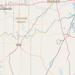
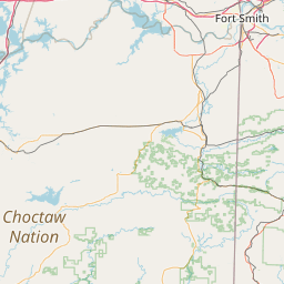
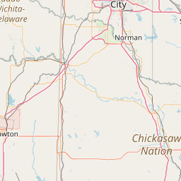
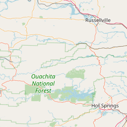
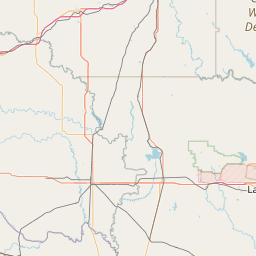
Leaflet | <a href="https://www.openstreetmap.org/copyright">© OpenStreetMap contributors</a>
Item
| Property | Value |
|---|---|
| id | 366084 |
| downstream_mainstem_id | https://geoconnex.us/ref/mainstems/338734 |
| encompassing_mainstem_basins | ['https://geoconnex.us/ref/mainstems/338734', 'https://geoconnex.us/ref/mainstems/314446', 'https://geoconnex.us/ref/mainstems/312091'] |
| featuretype | ['https://www.opengis.net/def/schema/hy_features/hyf/HY_FlowPath', 'https://www.opengis.net/def/schema/hy_features/hyf/HY_WaterBody'] |
| fid | 21589 |
| head_2020huc12 | 111101050401 |
| head_nhdpv1_comid | 6049028 |
| head_nhdpv2_comid | https://geoconnex.us/nhdplusv2/comid/6049028 |
| head_nhdpv2huc12 | https://geoconnex.us/nhdplusv2/huc12/111101050401 |
| head_rf1id | 35859 |
| lengthkm | 103.8 |
| name_at_outlet | Fourche Maline |
| name_at_outlet_gnis_id | 1101422 |
| new_mainstemid | |
| outlet_2020huc12 | 111101050507 |
| outlet_drainagearea_sqkm | 1049.0 |
| outlet_nhdpv1_comid | 6047720 |
| outlet_nhdpv2_comid | https://geoconnex.us/nhdplusv2/comid/6047720 |
| outlet_nhdpv2huc12 | https://geoconnex.us/nhdplusv2/huc12/111101050507 |
| outlet_rf1id | 37129 |
| superseded | False |
| uri | https://geoconnex.us/ref/mainstems/366084 |
Graph Results
| monitoringLocation | https://geoconnex.us/iow/wqp/USGS-07247650 |
|---|---|
| siteName | USGS-07247650 |
| datasetDescription | Magnesium at USGS-07247650 |
| type | Stream |
| url | https://www.waterqualitydata.us/provider/NWIS/USGS-OK/USGS-07247650/ |
| variableMeasured | Magnesium |
| variableUnit | % |
| measurementTechnique | observation |
| temporalCoverage | 1992-01-01T00:00:00Z/2003-12-31T00:00:00Z |
| distributionName | Water Quality Portal |
| distributionURL | https://www.waterqualitydata.us/data/Result/search?siteid=USGS-07247650&CharacteristicName=Magnesium&mimeType=csv |
| distributionFormat | text/comma-separated-values |
| wkt | POINT (-94.9455125 34.9198213) |
| monitoringLocation | https://geoconnex.us/iow/wqp/USGS-07247650 |
|---|---|
| siteName | USGS-07247650 |
| datasetDescription | Suspended Sediment Discharge at USGS-07247650 |
| type | Stream |
| url | https://www.waterqualitydata.us/provider/NWIS/USGS-OK/USGS-07247650/ |
| variableMeasured | Suspended Sediment Discharge |
| variableUnit | tons/day |
| measurementTechnique | observation |
| temporalCoverage | 1991-01-01T00:00:00Z/2023-12-31T00:00:00Z |
| distributionName | Water Quality Portal |
| distributionURL | https://www.waterqualitydata.us/data/Result/search?siteid=USGS-07247650&CharacteristicName=Suspended Sediment Discharge&mimeType=csv |
| distributionFormat | text/comma-separated-values |
| wkt | POINT (-94.9455125 34.9198213) |
| monitoringLocation | https://geoconnex.us/iow/wqp/USGS-07247650 |
|---|---|
| siteName | USGS-07247650 |
| datasetDescription | Zinc at USGS-07247650 |
| type | Stream |
| url | https://www.waterqualitydata.us/provider/NWIS/USGS-OK/USGS-07247650/ |
| variableMeasured | Zinc |
| variableUnit | Unknown |
| measurementTechnique | observation |
| temporalCoverage | 1992-01-01T00:00:00Z/1993-12-31T00:00:00Z |
| distributionName | Water Quality Portal |
| distributionURL | https://www.waterqualitydata.us/data/Result/search?siteid=USGS-07247650&CharacteristicName=Zinc&mimeType=csv |
| distributionFormat | text/comma-separated-values |
| wkt | POINT (-94.9455125 34.9198213) |
| monitoringLocation | https://geoconnex.us/iow/wqp/USGS-07247650 |
|---|---|
| siteName | USGS-07247650 |
| datasetDescription | Organic carbon at USGS-07247650 |
| type | Stream |
| url | https://www.waterqualitydata.us/provider/NWIS/USGS-OK/USGS-07247650/ |
| variableMeasured | Organic carbon |
| variableUnit | mg/L |
| measurementTechnique | observation |
| temporalCoverage | 2010-01-01T00:00:00Z/2024-12-31T00:00:00Z |
| distributionName | Water Quality Portal |
| distributionURL | https://www.waterqualitydata.us/data/Result/search?siteid=USGS-07247650&CharacteristicName=Organic carbon&mimeType=csv |
| distributionFormat | text/comma-separated-values |
| wkt | POINT (-94.9455125 34.9198213) |
| monitoringLocation | https://geoconnex.us/iow/wqp/USGS-07247650 |
|---|---|
| siteName | USGS-07247650 |
| datasetDescription | Temperature, water at USGS-07247650 |
| type | Stream |
| url | https://www.waterqualitydata.us/provider/NWIS/USGS-OK/USGS-07247650/ |
| variableMeasured | Temperature, water |
| variableUnit | deg C |
| measurementTechnique | observation |
| temporalCoverage | 1991-01-01T00:00:00Z/2024-12-31T00:00:00Z |
| distributionName | Water Quality Portal |
| distributionURL | https://www.waterqualitydata.us/data/Result/search?siteid=USGS-07247650&CharacteristicName=Temperature, water&mimeType=csv |
| distributionFormat | text/comma-separated-values |
| wkt | POINT (-94.9455125 34.9198213) |
| monitoringLocation | https://geoconnex.us/iow/wqp/USGS-07247650 |
|---|---|
| siteName | USGS-07247650 |
| datasetDescription | Oil and Grease at USGS-07247650 |
| type | Stream |
| url | https://www.waterqualitydata.us/provider/NWIS/USGS-OK/USGS-07247650/ |
| variableMeasured | Oil and Grease |
| variableUnit | code |
| measurementTechnique | observation |
| temporalCoverage | 2016-01-01T00:00:00Z/2016-12-31T00:00:00Z |
| distributionName | Water Quality Portal |
| distributionURL | https://www.waterqualitydata.us/data/Result/search?siteid=USGS-07247650&CharacteristicName=Oil and Grease&mimeType=csv |
| distributionFormat | text/comma-separated-values |
| wkt | POINT (-94.9455125 34.9198213) |
| monitoringLocation | https://geoconnex.us/iow/wqp/USGS-07247650 |
|---|---|
| siteName | USGS-07247650 |
| datasetDescription | Carbon dioxide at USGS-07247650 |
| type | Stream |
| url | https://www.waterqualitydata.us/provider/NWIS/USGS-OK/USGS-07247650/ |
| variableMeasured | Carbon dioxide |
| variableUnit | mg/l |
| measurementTechnique | observation |
| temporalCoverage | 1991-01-01T00:00:00Z/2003-12-31T00:00:00Z |
| distributionName | Water Quality Portal |
| distributionURL | https://www.waterqualitydata.us/data/Result/search?siteid=USGS-07247650&CharacteristicName=Carbon dioxide&mimeType=csv |
| distributionFormat | text/comma-separated-values |
| wkt | POINT (-94.9455125 34.9198213) |
| monitoringLocation | https://geoconnex.us/iow/wqp/USGS-07247650 |
|---|---|
| siteName | USGS-07247650 |
| datasetDescription | Chlorophyll c at USGS-07247650 |
| type | Stream |
| url | https://www.waterqualitydata.us/provider/NWIS/USGS-OK/USGS-07247650/ |
| variableMeasured | Chlorophyll c |
| variableUnit | Unknown |
| measurementTechnique | observation |
| temporalCoverage | 1996-01-01T00:00:00Z/2003-12-31T00:00:00Z |
| distributionName | Water Quality Portal |
| distributionURL | https://www.waterqualitydata.us/data/Result/search?siteid=USGS-07247650&CharacteristicName=Chlorophyll c&mimeType=csv |
| distributionFormat | text/comma-separated-values |
| wkt | POINT (-94.9455125 34.9198213) |
| monitoringLocation | https://geoconnex.us/iow/wqp/USGS-07247650 |
|---|---|
| siteName | USGS-07247650 |
| datasetDescription | Arsenic at USGS-07247650 |
| type | Stream |
| url | https://www.waterqualitydata.us/provider/NWIS/USGS-OK/USGS-07247650/ |
| variableMeasured | Arsenic |
| variableUnit | ppm |
| measurementTechnique | observation |
| temporalCoverage | 1991-01-01T00:00:00Z/1993-12-31T00:00:00Z |
| distributionName | Water Quality Portal |
| distributionURL | https://www.waterqualitydata.us/data/Result/search?siteid=USGS-07247650&CharacteristicName=Arsenic&mimeType=csv |
| distributionFormat | text/comma-separated-values |
| wkt | POINT (-94.9455125 34.9198213) |
| monitoringLocation | https://geoconnex.us/iow/wqp/USGS-07247650 |
|---|---|
| siteName | USGS-07247650 |
| datasetDescription | Hardness, non-carbonate at USGS-07247650 |
| type | Stream |
| url | https://www.waterqualitydata.us/provider/NWIS/USGS-OK/USGS-07247650/ |
| variableMeasured | Hardness, non-carbonate |
| variableUnit | mg/l CaCO3 |
| measurementTechnique | observation |
| temporalCoverage | 1992-01-01T00:00:00Z/2003-12-31T00:00:00Z |
| distributionName | Water Quality Portal |
| distributionURL | https://www.waterqualitydata.us/data/Result/search?siteid=USGS-07247650&CharacteristicName=Hardness, non-carbonate&mimeType=csv |
| distributionFormat | text/comma-separated-values |
| wkt | POINT (-94.9455125 34.9198213) |
| monitoringLocation | https://geoconnex.us/iow/wqp/USGS-07247650 |
|---|---|
| siteName | USGS-07247650 |
| datasetDescription | Total dissolved solids at USGS-07247650 |
| type | Stream |
| url | https://www.waterqualitydata.us/provider/NWIS/USGS-OK/USGS-07247650/ |
| variableMeasured | Total dissolved solids |
| variableUnit | mg/l |
| measurementTechnique | observation |
| temporalCoverage | 1996-01-01T00:00:00Z/2003-12-31T00:00:00Z |
| distributionName | Water Quality Portal |
| distributionURL | https://www.waterqualitydata.us/data/Result/search?siteid=USGS-07247650&CharacteristicName=Total dissolved solids&mimeType=csv |
| distributionFormat | text/comma-separated-values |
| wkt | POINT (-94.9455125 34.9198213) |
| monitoringLocation | https://geoconnex.us/iow/wqp/USGS-07247650 |
|---|---|
| siteName | USGS-07247650 |
| datasetDescription | Nickel at USGS-07247650 |
| type | Stream |
| url | https://www.waterqualitydata.us/provider/NWIS/USGS-OK/USGS-07247650/ |
| variableMeasured | Nickel |
| variableUnit | ppm |
| measurementTechnique | observation |
| temporalCoverage | 1992-01-01T00:00:00Z/1993-12-31T00:00:00Z |
| distributionName | Water Quality Portal |
| distributionURL | https://www.waterqualitydata.us/data/Result/search?siteid=USGS-07247650&CharacteristicName=Nickel&mimeType=csv |
| distributionFormat | text/comma-separated-values |
| wkt | POINT (-94.9455125 34.9198213) |
| monitoringLocation | https://geoconnex.us/iow/wqp/USGS-07247650 |
|---|---|
| siteName | USGS-07247650 |
| datasetDescription | Total suspended solids at USGS-07247650 |
| type | Stream |
| url | https://www.waterqualitydata.us/provider/NWIS/USGS-OK/USGS-07247650/ |
| variableMeasured | Total suspended solids |
| variableUnit | mg/L |
| measurementTechnique | observation |
| temporalCoverage | 1996-01-01T00:00:00Z/2003-12-31T00:00:00Z |
| distributionName | Water Quality Portal |
| distributionURL | https://www.waterqualitydata.us/data/Result/search?siteid=USGS-07247650&CharacteristicName=Total suspended solids&mimeType=csv |
| distributionFormat | text/comma-separated-values |
| wkt | POINT (-94.9455125 34.9198213) |
| monitoringLocation | https://geoconnex.us/iow/wqp/USGS-07247650 |
|---|---|
| siteName | USGS-07247650 |
| datasetDescription | Sodium, percent total cations at USGS-07247650 |
| type | Stream |
| url | https://www.waterqualitydata.us/provider/NWIS/USGS-OK/USGS-07247650/ |
| variableMeasured | Sodium, percent total cations |
| variableUnit | % |
| measurementTechnique | observation |
| temporalCoverage | 1996-01-01T00:00:00Z/2003-12-31T00:00:00Z |
| distributionName | Water Quality Portal |
| distributionURL | https://www.waterqualitydata.us/data/Result/search?siteid=USGS-07247650&CharacteristicName=Sodium, percent total cations&mimeType=csv |
| distributionFormat | text/comma-separated-values |
| wkt | POINT (-94.9455125 34.9198213) |
| monitoringLocation | https://geoconnex.us/iow/wqp/USGS-07247650 |
|---|---|
| siteName | USGS-07247650 |
| datasetDescription | Barometric pressure at USGS-07247650 |
| type | Stream |
| url | https://www.waterqualitydata.us/provider/NWIS/USGS-OK/USGS-07247650/ |
| variableMeasured | Barometric pressure |
| variableUnit | mm/Hg |
| measurementTechnique | observation |
| temporalCoverage | 1991-01-01T00:00:00Z/2024-12-31T00:00:00Z |
| distributionName | Water Quality Portal |
| distributionURL | https://www.waterqualitydata.us/data/Result/search?siteid=USGS-07247650&CharacteristicName=Barometric pressure&mimeType=csv |
| distributionFormat | text/comma-separated-values |
| wkt | POINT (-94.9455125 34.9198213) |
| monitoringLocation | https://geoconnex.us/iow/wqp/USGS-07247650 |
|---|---|
| siteName | USGS-07247650 |
| datasetDescription | Lead at USGS-07247650 |
| type | Stream |
| url | https://www.waterqualitydata.us/provider/NWIS/USGS-OK/USGS-07247650/ |
| variableMeasured | Lead |
| variableUnit | ug/l |
| measurementTechnique | observation |
| temporalCoverage | 1992-01-01T00:00:00Z/1993-12-31T00:00:00Z |
| distributionName | Water Quality Portal |
| distributionURL | https://www.waterqualitydata.us/data/Result/search?siteid=USGS-07247650&CharacteristicName=Lead&mimeType=csv |
| distributionFormat | text/comma-separated-values |
| wkt | POINT (-94.9455125 34.9198213) |
| monitoringLocation | https://geoconnex.us/iow/wqp/USGS-07247650 |
|---|---|
| siteName | USGS-07247650 |
| datasetDescription | Beryllium at USGS-07247650 |
| type | Stream |
| url | https://www.waterqualitydata.us/provider/NWIS/USGS-OK/USGS-07247650/ |
| variableMeasured | Beryllium |
| variableUnit | ppm |
| measurementTechnique | observation |
| temporalCoverage | 1992-01-01T00:00:00Z/1993-12-31T00:00:00Z |
| distributionName | Water Quality Portal |
| distributionURL | https://www.waterqualitydata.us/data/Result/search?siteid=USGS-07247650&CharacteristicName=Beryllium&mimeType=csv |
| distributionFormat | text/comma-separated-values |
| wkt | POINT (-94.9455125 34.9198213) |
| monitoringLocation | https://geoconnex.us/iow/wqp/USGS-07247650 |
|---|---|
| siteName | USGS-07247650 |
| datasetDescription | Nitrate at USGS-07247650 |
| type | Stream |
| url | https://www.waterqualitydata.us/provider/NWIS/USGS-OK/USGS-07247650/ |
| variableMeasured | Nitrate |
| variableUnit | mg/l as N |
| measurementTechnique | observation |
| temporalCoverage | 1991-01-01T00:00:00Z/2023-12-31T00:00:00Z |
| distributionName | Water Quality Portal |
| distributionURL | https://www.waterqualitydata.us/data/Result/search?siteid=USGS-07247650&CharacteristicName=Nitrate&mimeType=csv |
| distributionFormat | text/comma-separated-values |
| wkt | POINT (-94.9455125 34.9198213) |
| monitoringLocation | https://geoconnex.us/iow/wqp/USGS-07247650 |
|---|---|
| siteName | USGS-07247650 |
| datasetDescription | Fish Kill, Severity (choice list) at USGS-07247650 |
| type | Stream |
| url | https://www.waterqualitydata.us/provider/NWIS/USGS-OK/USGS-07247650/ |
| variableMeasured | Fish Kill, Severity (choice list) |
| variableUnit | code |
| measurementTechnique | observation |
| temporalCoverage | 2016-01-01T00:00:00Z/2016-12-31T00:00:00Z |
| distributionName | Water Quality Portal |
| distributionURL | https://www.waterqualitydata.us/data/Result/search?siteid=USGS-07247650&CharacteristicName=Fish Kill, Severity (choice list)&mimeType=csv |
| distributionFormat | text/comma-separated-values |
| wkt | POINT (-94.9455125 34.9198213) |
| monitoringLocation | https://geoconnex.us/iow/wqp/USGS-07247650 |
|---|---|
| siteName | USGS-07247650 |
| datasetDescription | Transit Rate, sampler at USGS-07247650 |
| type | Stream |
| url | https://www.waterqualitydata.us/provider/NWIS/USGS-OK/USGS-07247650/ |
| variableMeasured | Transit Rate, sampler |
| variableUnit | ft/sec |
| measurementTechnique | observation |
| temporalCoverage | 2013-01-01T00:00:00Z/2017-12-31T00:00:00Z |
| distributionName | Water Quality Portal |
| distributionURL | https://www.waterqualitydata.us/data/Result/search?siteid=USGS-07247650&CharacteristicName=Transit Rate, sampler&mimeType=csv |
| distributionFormat | text/comma-separated-values |
| wkt | POINT (-94.9455125 34.9198213) |
| monitoringLocation | https://geoconnex.us/iow/wqp/USGS-07247650 |
|---|---|
| siteName | USGS-07247650 |
| datasetDescription | Fecal Coliform at USGS-07247650 |
| type | Stream |
| url | https://www.waterqualitydata.us/provider/NWIS/USGS-OK/USGS-07247650/ |
| variableMeasured | Fecal Coliform |
| variableUnit | Unknown |
| measurementTechnique | observation |
| temporalCoverage | 1996-01-01T00:00:00Z/2003-12-31T00:00:00Z |
| distributionName | Water Quality Portal |
| distributionURL | https://www.waterqualitydata.us/data/Result/search?siteid=USGS-07247650&CharacteristicName=Fecal Coliform&mimeType=csv |
| distributionFormat | text/comma-separated-values |
| wkt | POINT (-94.9455125 34.9198213) |
| monitoringLocation | https://geoconnex.us/iow/wqp/USGS-07247650 |
|---|---|
| siteName | USGS-07247650 |
| datasetDescription | Mercury at USGS-07247650 |
| type | Stream |
| url | https://www.waterqualitydata.us/provider/NWIS/USGS-OK/USGS-07247650/ |
| variableMeasured | Mercury |
| variableUnit | Unknown |
| measurementTechnique | observation |
| temporalCoverage | 1992-01-01T00:00:00Z/1993-12-31T00:00:00Z |
| distributionName | Water Quality Portal |
| distributionURL | https://www.waterqualitydata.us/data/Result/search?siteid=USGS-07247650&CharacteristicName=Mercury&mimeType=csv |
| distributionFormat | text/comma-separated-values |
| wkt | POINT (-94.9455125 34.9198213) |
| monitoringLocation | https://geoconnex.us/iow/wqp/USGS-07247650 |
|---|---|
| siteName | USGS-07247650 |
| datasetDescription | Sediment at USGS-07247650 |
| type | Stream |
| url | https://www.waterqualitydata.us/provider/NWIS/USGS-OK/USGS-07247650/ |
| variableMeasured | Sediment |
| variableUnit | g |
| measurementTechnique | observation |
| temporalCoverage | 2018-01-01T00:00:00Z/2023-12-31T00:00:00Z |
| distributionName | Water Quality Portal |
| distributionURL | https://www.waterqualitydata.us/data/Result/search?siteid=USGS-07247650&CharacteristicName=Sediment&mimeType=csv |
| distributionFormat | text/comma-separated-values |
| wkt | POINT (-94.9455125 34.9198213) |
| monitoringLocation | https://geoconnex.us/iow/wqp/USGS-07247650 |
|---|---|
| siteName | USGS-07247650 |
| datasetDescription | Floating debris - severity (choice list) at USGS-07247650 |
| type | Stream |
| url | https://www.waterqualitydata.us/provider/NWIS/USGS-OK/USGS-07247650/ |
| variableMeasured | Floating debris - severity (choice list) |
| variableUnit | code |
| measurementTechnique | observation |
| temporalCoverage | 2016-01-01T00:00:00Z/2016-12-31T00:00:00Z |
| distributionName | Water Quality Portal |
| distributionURL | https://www.waterqualitydata.us/data/Result/search?siteid=USGS-07247650&CharacteristicName=Floating debris - severity (choice list)&mimeType=csv |
| distributionFormat | text/comma-separated-values |
| wkt | POINT (-94.9455125 34.9198213) |
| monitoringLocation | https://geoconnex.us/iow/wqp/USGS-07247650 |
|---|---|
| siteName | USGS-07247650 |
| datasetDescription | Stream flow, instantaneous at USGS-07247650 |
| type | Stream |
| url | https://www.waterqualitydata.us/provider/NWIS/USGS-OK/USGS-07247650/ |
| variableMeasured | Stream flow, instantaneous |
| variableUnit | ft3/s |
| measurementTechnique | observation |
| temporalCoverage | 1991-01-01T00:00:00Z/2024-12-31T00:00:00Z |
| distributionName | Water Quality Portal |
| distributionURL | https://www.waterqualitydata.us/data/Result/search?siteid=USGS-07247650&CharacteristicName=Stream flow, instantaneous&mimeType=csv |
| distributionFormat | text/comma-separated-values |
| wkt | POINT (-94.9455125 34.9198213) |
| monitoringLocation | https://geoconnex.us/iow/wqp/USGS-07247650 |
|---|---|
| siteName | USGS-07247650 |
| datasetDescription | Nitrite at USGS-07247650 |
| type | Stream |
| url | https://www.waterqualitydata.us/provider/NWIS/USGS-OK/USGS-07247650/ |
| variableMeasured | Nitrite |
| variableUnit | mg/L |
| measurementTechnique | observation |
| temporalCoverage | 1991-01-01T00:00:00Z/2023-12-31T00:00:00Z |
| distributionName | Water Quality Portal |
| distributionURL | https://www.waterqualitydata.us/data/Result/search?siteid=USGS-07247650&CharacteristicName=Nitrite&mimeType=csv |
| distributionFormat | text/comma-separated-values |
| wkt | POINT (-94.9455125 34.9198213) |
| monitoringLocation | https://geoconnex.us/iow/wqp/USGS-07247650 |
|---|---|
| siteName | USGS-07247650 |
| datasetDescription | Tin at USGS-07247650 |
| type | Stream |
| url | https://www.waterqualitydata.us/provider/NWIS/USGS-OK/USGS-07247650/ |
| variableMeasured | Tin |
| variableUnit | ug/g |
| measurementTechnique | observation |
| temporalCoverage | 1992-01-01T00:00:00Z/1993-12-31T00:00:00Z |
| distributionName | Water Quality Portal |
| distributionURL | https://www.waterqualitydata.us/data/Result/search?siteid=USGS-07247650&CharacteristicName=Tin&mimeType=csv |
| distributionFormat | text/comma-separated-values |
| wkt | POINT (-94.9455125 34.9198213) |
| monitoringLocation | https://geoconnex.us/iow/wqp/USGS-07247650 |
|---|---|
| siteName | USGS-07247650 |
| datasetDescription | Floating algae mat - severity (choice list) at USGS-07247650 |
| type | Stream |
| url | https://www.waterqualitydata.us/provider/NWIS/USGS-OK/USGS-07247650/ |
| variableMeasured | Floating algae mat - severity (choice list) |
| variableUnit | code |
| measurementTechnique | observation |
| temporalCoverage | 2016-01-01T00:00:00Z/2016-12-31T00:00:00Z |
| distributionName | Water Quality Portal |
| distributionURL | https://www.waterqualitydata.us/data/Result/search?siteid=USGS-07247650&CharacteristicName=Floating algae mat - severity (choice list)&mimeType=csv |
| distributionFormat | text/comma-separated-values |
| wkt | POINT (-94.9455125 34.9198213) |
| monitoringLocation | https://geoconnex.us/iow/wqp/USGS-07247650 |
|---|---|
| siteName | USGS-07247650 |
| datasetDescription | Hardness, Ca, Mg at USGS-07247650 |
| type | Stream |
| url | https://www.waterqualitydata.us/provider/NWIS/USGS-OK/USGS-07247650/ |
| variableMeasured | Hardness, Ca, Mg |
| variableUnit | mg/l CaCO3 |
| measurementTechnique | observation |
| temporalCoverage | 1996-01-01T00:00:00Z/2003-12-31T00:00:00Z |
| distributionName | Water Quality Portal |
| distributionURL | https://www.waterqualitydata.us/data/Result/search?siteid=USGS-07247650&CharacteristicName=Hardness, Ca, Mg&mimeType=csv |
| distributionFormat | text/comma-separated-values |
| wkt | POINT (-94.9455125 34.9198213) |
| monitoringLocation | https://geoconnex.us/iow/wqp/USGS-07247650 |
|---|---|
| siteName | USGS-07247650 |
| datasetDescription | Iron at USGS-07247650 |
| type | Stream |
| url | https://www.waterqualitydata.us/provider/NWIS/USGS-OK/USGS-07247650/ |
| variableMeasured | Iron |
| variableUnit | % |
| measurementTechnique | observation |
| temporalCoverage | 1992-01-01T00:00:00Z/1993-12-31T00:00:00Z |
| distributionName | Water Quality Portal |
| distributionURL | https://www.waterqualitydata.us/data/Result/search?siteid=USGS-07247650&CharacteristicName=Iron&mimeType=csv |
| distributionFormat | text/comma-separated-values |
| wkt | POINT (-94.9455125 34.9198213) |
| monitoringLocation | https://geoconnex.us/iow/wqp/USGS-07247650 |
|---|---|
| siteName | USGS-07247650 |
| datasetDescription | Chlorophyll a at USGS-07247650 |
| type | Stream |
| url | https://www.waterqualitydata.us/provider/NWIS/USGS-OK/USGS-07247650/ |
| variableMeasured | Chlorophyll a |
| variableUnit | ug/L |
| measurementTechnique | observation |
| temporalCoverage | 1996-01-01T00:00:00Z/2003-12-31T00:00:00Z |
| distributionName | Water Quality Portal |
| distributionURL | https://www.waterqualitydata.us/data/Result/search?siteid=USGS-07247650&CharacteristicName=Chlorophyll a&mimeType=csv |
| distributionFormat | text/comma-separated-values |
| wkt | POINT (-94.9455125 34.9198213) |
| monitoringLocation | https://geoconnex.us/iow/wqp/USGS-07247650 |
|---|---|
| siteName | USGS-07247650 |
| datasetDescription | Floating Garbage Severity (choice List) at USGS-07247650 |
| type | Stream |
| url | https://www.waterqualitydata.us/provider/NWIS/USGS-OK/USGS-07247650/ |
| variableMeasured | Floating Garbage Severity (choice List) |
| variableUnit | code |
| measurementTechnique | observation |
| temporalCoverage | 2016-01-01T00:00:00Z/2016-12-31T00:00:00Z |
| distributionName | Water Quality Portal |
| distributionURL | https://www.waterqualitydata.us/data/Result/search?siteid=USGS-07247650&CharacteristicName=Floating Garbage Severity (choice List)&mimeType=csv |
| distributionFormat | text/comma-separated-values |
| wkt | POINT (-94.9455125 34.9198213) |
| monitoringLocation | https://geoconnex.us/iow/wqp/USGS-07247650 |
|---|---|
| siteName | USGS-07247650 |
| datasetDescription | Inorganic nitrogen (nitrate and nitrite) at USGS-07247650 |
| type | Stream |
| url | https://www.waterqualitydata.us/provider/NWIS/USGS-OK/USGS-07247650/ |
| variableMeasured | Inorganic nitrogen (nitrate and nitrite) |
| variableUnit | mg/l as N |
| measurementTechnique | observation |
| temporalCoverage | 1991-01-01T00:00:00Z/2023-12-31T00:00:00Z |
| distributionName | Water Quality Portal |
| distributionURL | https://www.waterqualitydata.us/data/Result/search?siteid=USGS-07247650&CharacteristicName=Inorganic nitrogen (nitrate and nitrite)&mimeType=csv |
| distributionFormat | text/comma-separated-values |
| wkt | POINT (-94.9455125 34.9198213) |
| monitoringLocation | https://geoconnex.us/iow/wqp/USGS-07247650 |
|---|---|
| siteName | USGS-07247650 |
| datasetDescription | Kjeldahl nitrogen at USGS-07247650 |
| type | Stream |
| url | https://www.waterqualitydata.us/provider/NWIS/USGS-OK/USGS-07247650/ |
| variableMeasured | Kjeldahl nitrogen |
| variableUnit | mg/L |
| measurementTechnique | observation |
| temporalCoverage | 1991-01-01T00:00:00Z/2023-12-31T00:00:00Z |
| distributionName | Water Quality Portal |
| distributionURL | https://www.waterqualitydata.us/data/Result/search?siteid=USGS-07247650&CharacteristicName=Kjeldahl nitrogen&mimeType=csv |
| distributionFormat | text/comma-separated-values |
| wkt | POINT (-94.9455125 34.9198213) |
| monitoringLocation | https://geoconnex.us/iow/wqp/USGS-07247650 |
|---|---|
| siteName | USGS-07247650 |
| datasetDescription | Barium at USGS-07247650 |
| type | Stream |
| url | https://www.waterqualitydata.us/provider/NWIS/USGS-OK/USGS-07247650/ |
| variableMeasured | Barium |
| variableUnit | ug/L |
| measurementTechnique | observation |
| temporalCoverage | 1992-01-01T00:00:00Z/1993-12-31T00:00:00Z |
| distributionName | Water Quality Portal |
| distributionURL | https://www.waterqualitydata.us/data/Result/search?siteid=USGS-07247650&CharacteristicName=Barium&mimeType=csv |
| distributionFormat | text/comma-separated-values |
| wkt | POINT (-94.9455125 34.9198213) |
| monitoringLocation | https://geoconnex.us/iow/wqp/USGS-07247650 |
|---|---|
| siteName | USGS-07247650 |
| datasetDescription | Ammonia and ammonium at USGS-07247650 |
| type | Stream |
| url | https://www.waterqualitydata.us/provider/NWIS/USGS-OK/USGS-07247650/ |
| variableMeasured | Ammonia and ammonium |
| variableUnit | Unknown |
| measurementTechnique | observation |
| temporalCoverage | 1991-01-01T00:00:00Z/2023-12-31T00:00:00Z |
| distributionName | Water Quality Portal |
| distributionURL | https://www.waterqualitydata.us/data/Result/search?siteid=USGS-07247650&CharacteristicName=Ammonia and ammonium&mimeType=csv |
| distributionFormat | text/comma-separated-values |
| wkt | POINT (-94.9455125 34.9198213) |
| monitoringLocation | https://geoconnex.us/iow/wqp/USGS-07247650 |
|---|---|
| siteName | USGS-07247650 |
| datasetDescription | Organic Nitrogen at USGS-07247650 |
| type | Stream |
| url | https://www.waterqualitydata.us/provider/NWIS/USGS-OK/USGS-07247650/ |
| variableMeasured | Organic Nitrogen |
| variableUnit | mg/l |
| measurementTechnique | observation |
| temporalCoverage | 1991-01-01T00:00:00Z/2023-12-31T00:00:00Z |
| distributionName | Water Quality Portal |
| distributionURL | https://www.waterqualitydata.us/data/Result/search?siteid=USGS-07247650&CharacteristicName=Organic Nitrogen&mimeType=csv |
| distributionFormat | text/comma-separated-values |
| wkt | POINT (-94.9455125 34.9198213) |
| monitoringLocation | https://geoconnex.us/iow/wqp/USGS-07247650 |
|---|---|
| siteName | USGS-07247650 |
| datasetDescription | Aluminum at USGS-07247650 |
| type | Stream |
| url | https://www.waterqualitydata.us/provider/NWIS/USGS-OK/USGS-07247650/ |
| variableMeasured | Aluminum |
| variableUnit | Unknown |
| measurementTechnique | observation |
| temporalCoverage | 1992-01-01T00:00:00Z/1993-12-31T00:00:00Z |
| distributionName | Water Quality Portal |
| distributionURL | https://www.waterqualitydata.us/data/Result/search?siteid=USGS-07247650&CharacteristicName=Aluminum&mimeType=csv |
| distributionFormat | text/comma-separated-values |
| wkt | POINT (-94.9455125 34.9198213) |
| monitoringLocation | https://geoconnex.us/iow/wqp/USGS-07247650 |
|---|---|
| siteName | USGS-07247650 |
| datasetDescription | Chlorophyll b at USGS-07247650 |
| type | Stream |
| url | https://www.waterqualitydata.us/provider/NWIS/USGS-OK/USGS-07247650/ |
| variableMeasured | Chlorophyll b |
| variableUnit | ug/L |
| measurementTechnique | observation |
| temporalCoverage | 1996-01-01T00:00:00Z/2003-12-31T00:00:00Z |
| distributionName | Water Quality Portal |
| distributionURL | https://www.waterqualitydata.us/data/Result/search?siteid=USGS-07247650&CharacteristicName=Chlorophyll b&mimeType=csv |
| distributionFormat | text/comma-separated-values |
| wkt | POINT (-94.9455125 34.9198213) |
| monitoringLocation | https://geoconnex.us/iow/wqp/USGS-07247650 |
|---|---|
| siteName | USGS-07247650 |
| datasetDescription | Suspended Sediment Concentration (SSC) at USGS-07247650 |
| type | Stream |
| url | https://www.waterqualitydata.us/provider/NWIS/USGS-OK/USGS-07247650/ |
| variableMeasured | Suspended Sediment Concentration (SSC) |
| variableUnit | mg/l |
| measurementTechnique | observation |
| temporalCoverage | 1991-01-01T00:00:00Z/2023-12-31T00:00:00Z |
| distributionName | Water Quality Portal |
| distributionURL | https://www.waterqualitydata.us/data/Result/search?siteid=USGS-07247650&CharacteristicName=Suspended Sediment Concentration (SSC)&mimeType=csv |
| distributionFormat | text/comma-separated-values |
| wkt | POINT (-94.9455125 34.9198213) |
| monitoringLocation | https://geoconnex.us/iow/wqp/USGS-07247650 |
|---|---|
| siteName | USGS-07247650 |
| datasetDescription | Manganese at USGS-07247650 |
| type | Stream |
| url | https://www.waterqualitydata.us/provider/NWIS/USGS-OK/USGS-07247650/ |
| variableMeasured | Manganese |
| variableUnit | ug/l |
| measurementTechnique | observation |
| temporalCoverage | 1992-01-01T00:00:00Z/2003-12-31T00:00:00Z |
| distributionName | Water Quality Portal |
| distributionURL | https://www.waterqualitydata.us/data/Result/search?siteid=USGS-07247650&CharacteristicName=Manganese&mimeType=csv |
| distributionFormat | text/comma-separated-values |
| wkt | POINT (-94.9455125 34.9198213) |
| monitoringLocation | https://geoconnex.us/iow/wqp/USGS-07247650 |
|---|---|
| siteName | USGS-07247650 |
| datasetDescription | Nitrogen, mixed forms (NH3), (NH4), organic, (NO2) and (NO3) at USGS-07247650 |
| type | Stream |
| url | https://www.waterqualitydata.us/provider/NWIS/USGS-OK/USGS-07247650/ |
| variableMeasured | Nitrogen, mixed forms (NH3), (NH4), organic, (NO2) and (NO3) |
| variableUnit | mg/l |
| measurementTechnique | observation |
| temporalCoverage | 1991-01-01T00:00:00Z/2023-12-31T00:00:00Z |
| distributionName | Water Quality Portal |
| distributionURL | https://www.waterqualitydata.us/data/Result/search?siteid=USGS-07247650&CharacteristicName=Nitrogen, mixed forms (NH3), (NH4), organic, (NO2) and (NO3)&mimeType=csv |
| distributionFormat | text/comma-separated-values |
| wkt | POINT (-94.9455125 34.9198213) |
| monitoringLocation | https://geoconnex.us/iow/wqp/USGS-07247650 |
|---|---|
| siteName | USGS-07247650 |
| datasetDescription | Enterococcus at USGS-07247650 |
| type | Stream |
| url | https://www.waterqualitydata.us/provider/NWIS/USGS-OK/USGS-07247650/ |
| variableMeasured | Enterococcus |
| variableUnit | #/100mL |
| measurementTechnique | observation |
| temporalCoverage | 2010-01-01T00:00:00Z/2014-12-31T00:00:00Z |
| distributionName | Water Quality Portal |
| distributionURL | https://www.waterqualitydata.us/data/Result/search?siteid=USGS-07247650&CharacteristicName=Enterococcus&mimeType=csv |
| distributionFormat | text/comma-separated-values |
| wkt | POINT (-94.9455125 34.9198213) |
| monitoringLocation | https://geoconnex.us/iow/wqp/USGS-07247650 |
|---|---|
| siteName | USGS-07247650 |
| datasetDescription | Temperature, air at USGS-07247650 |
| type | Stream |
| url | https://www.waterqualitydata.us/provider/NWIS/USGS-OK/USGS-07247650/ |
| variableMeasured | Temperature, air |
| variableUnit | deg C |
| measurementTechnique | observation |
| temporalCoverage | 1991-01-01T00:00:00Z/2024-12-31T00:00:00Z |
| distributionName | Water Quality Portal |
| distributionURL | https://www.waterqualitydata.us/data/Result/search?siteid=USGS-07247650&CharacteristicName=Temperature, air&mimeType=csv |
| distributionFormat | text/comma-separated-values |
| wkt | POINT (-94.9455125 34.9198213) |
| monitoringLocation | https://geoconnex.us/iow/wqp/USGS-07247650 |
|---|---|
| siteName | USGS-07247650 |
| datasetDescription | Chromium at USGS-07247650 |
| type | Stream |
| url | https://www.waterqualitydata.us/provider/NWIS/USGS-OK/USGS-07247650/ |
| variableMeasured | Chromium |
| variableUnit | ppb |
| measurementTechnique | observation |
| temporalCoverage | 1992-01-01T00:00:00Z/1993-12-31T00:00:00Z |
| distributionName | Water Quality Portal |
| distributionURL | https://www.waterqualitydata.us/data/Result/search?siteid=USGS-07247650&CharacteristicName=Chromium&mimeType=csv |
| distributionFormat | text/comma-separated-values |
| wkt | POINT (-94.9455125 34.9198213) |
| monitoringLocation | https://geoconnex.us/iow/wqp/USGS-07247650 |
|---|---|
| siteName | USGS-07247650 |
| datasetDescription | Number of sampling points at USGS-07247650 |
| type | Stream |
| url | https://www.waterqualitydata.us/provider/NWIS/USGS-OK/USGS-07247650/ |
| variableMeasured | Number of sampling points |
| variableUnit | count |
| measurementTechnique | observation |
| temporalCoverage | 2016-01-01T00:00:00Z/2016-12-31T00:00:00Z |
| distributionName | Water Quality Portal |
| distributionURL | https://www.waterqualitydata.us/data/Result/search?siteid=USGS-07247650&CharacteristicName=Number of sampling points&mimeType=csv |
| distributionFormat | text/comma-separated-values |
| wkt | POINT (-94.9455125 34.9198213) |
| monitoringLocation | https://geoconnex.us/iow/wqp/USGS-07247650 |
|---|---|
| siteName | USGS-07247650 |
| datasetDescription | Height, gage at USGS-07247650 |
| type | Stream |
| url | https://www.waterqualitydata.us/provider/NWIS/USGS-OK/USGS-07247650/ |
| variableMeasured | Height, gage |
| variableUnit | ft |
| measurementTechnique | observation |
| temporalCoverage | 1991-01-01T00:00:00Z/2024-12-31T00:00:00Z |
| distributionName | Water Quality Portal |
| distributionURL | https://www.waterqualitydata.us/data/Result/search?siteid=USGS-07247650&CharacteristicName=Height, gage&mimeType=csv |
| distributionFormat | text/comma-separated-values |
| wkt | POINT (-94.9455125 34.9198213) |
| monitoringLocation | https://geoconnex.us/iow/wqp/USGS-07247650 |
|---|---|
| siteName | USGS-07247650 |
| datasetDescription | Chlorophyll a, uncorrected for pheophytin at USGS-07247650 |
| type | Stream |
| url | https://www.waterqualitydata.us/provider/NWIS/USGS-OK/USGS-07247650/ |
| variableMeasured | Chlorophyll a, uncorrected for pheophytin |
| variableUnit | ug/L |
| measurementTechnique | observation |
| temporalCoverage | 1996-01-01T00:00:00Z/2003-12-31T00:00:00Z |
| distributionName | Water Quality Portal |
| distributionURL | https://www.waterqualitydata.us/data/Result/search?siteid=USGS-07247650&CharacteristicName=Chlorophyll a, uncorrected for pheophytin&mimeType=csv |
| distributionFormat | text/comma-separated-values |
| wkt | POINT (-94.9455125 34.9198213) |
| monitoringLocation | https://geoconnex.us/iow/wqp/USGS-07247650 |
|---|---|
| siteName | USGS-07247650 |
| datasetDescription | Alkalinity at USGS-07247650 |
| type | Stream |
| url | https://www.waterqualitydata.us/provider/NWIS/USGS-OK/USGS-07247650/ |
| variableMeasured | Alkalinity |
| variableUnit | mg/l CaCO3 |
| measurementTechnique | observation |
| temporalCoverage | 1991-01-01T00:00:00Z/2003-12-31T00:00:00Z |
| distributionName | Water Quality Portal |
| distributionURL | https://www.waterqualitydata.us/data/Result/search?siteid=USGS-07247650&CharacteristicName=Alkalinity&mimeType=csv |
| distributionFormat | text/comma-separated-values |
| wkt | POINT (-94.9455125 34.9198213) |
| monitoringLocation | https://geoconnex.us/iow/wqp/USGS-07247650 |
|---|---|
| siteName | USGS-07247650 |
| datasetDescription | Phosphorus at USGS-07247650 |
| type | Stream |
| url | https://www.waterqualitydata.us/provider/NWIS/USGS-OK/USGS-07247650/ |
| variableMeasured | Phosphorus |
| variableUnit | ppb |
| measurementTechnique | observation |
| temporalCoverage | 1991-01-01T00:00:00Z/2023-12-31T00:00:00Z |
| distributionName | Water Quality Portal |
| distributionURL | https://www.waterqualitydata.us/data/Result/search?siteid=USGS-07247650&CharacteristicName=Phosphorus&mimeType=csv |
| distributionFormat | text/comma-separated-values |
| wkt | POINT (-94.9455125 34.9198213) |
| monitoringLocation | https://geoconnex.us/iow/wqp/USGS-07247650 |
|---|---|
| siteName | USGS-07247650 |
| datasetDescription | Antimony at USGS-07247650 |
| type | Stream |
| url | https://www.waterqualitydata.us/provider/NWIS/USGS-OK/USGS-07247650/ |
| variableMeasured | Antimony |
| variableUnit | ppm |
| measurementTechnique | observation |
| temporalCoverage | 1992-01-01T00:00:00Z/1993-12-31T00:00:00Z |
| distributionName | Water Quality Portal |
| distributionURL | https://www.waterqualitydata.us/data/Result/search?siteid=USGS-07247650&CharacteristicName=Antimony&mimeType=csv |
| distributionFormat | text/comma-separated-values |
| wkt | POINT (-94.9455125 34.9198213) |
| monitoringLocation | https://geoconnex.us/iow/wqp/USGS-07247650 |
|---|---|
| siteName | USGS-07247650 |
| datasetDescription | Stream width measure at USGS-07247650 |
| type | Stream |
| url | https://www.waterqualitydata.us/provider/NWIS/USGS-OK/USGS-07247650/ |
| variableMeasured | Stream width measure |
| variableUnit | m |
| measurementTechnique | observation |
| temporalCoverage | 2016-01-01T00:00:00Z/2017-12-31T00:00:00Z |
| distributionName | Water Quality Portal |
| distributionURL | https://www.waterqualitydata.us/data/Result/search?siteid=USGS-07247650&CharacteristicName=Stream width measure&mimeType=csv |
| distributionFormat | text/comma-separated-values |
| wkt | POINT (-94.9455125 34.9198213) |
| monitoringLocation | https://geoconnex.us/iow/wqp/USGS-07247650 |
|---|---|
| siteName | USGS-07247650 |
| datasetDescription | Orthophosphate at USGS-07247650 |
| type | Stream |
| url | https://www.waterqualitydata.us/provider/NWIS/USGS-OK/USGS-07247650/ |
| variableMeasured | Orthophosphate |
| variableUnit | mg/l asPO4 |
| measurementTechnique | observation |
| temporalCoverage | 1991-01-01T00:00:00Z/2023-12-31T00:00:00Z |
| distributionName | Water Quality Portal |
| distributionURL | https://www.waterqualitydata.us/data/Result/search?siteid=USGS-07247650&CharacteristicName=Orthophosphate&mimeType=csv |
| distributionFormat | text/comma-separated-values |
| wkt | POINT (-94.9455125 34.9198213) |
| monitoringLocation | https://geoconnex.us/iow/wqp/USGS-07247650 |
|---|---|
| siteName | USGS-07247650 |
| datasetDescription | Thallium at USGS-07247650 |
| type | Stream |
| url | https://www.waterqualitydata.us/provider/NWIS/USGS-OK/USGS-07247650/ |
| variableMeasured | Thallium |
| variableUnit | ppm |
| measurementTechnique | observation |
| temporalCoverage | 1992-01-01T00:00:00Z/1993-12-31T00:00:00Z |
| distributionName | Water Quality Portal |
| distributionURL | https://www.waterqualitydata.us/data/Result/search?siteid=USGS-07247650&CharacteristicName=Thallium&mimeType=csv |
| distributionFormat | text/comma-separated-values |
| wkt | POINT (-94.9455125 34.9198213) |
| monitoringLocation | https://geoconnex.us/iow/wqp/USGS-07247650 |
|---|---|
| siteName | USGS-07247650 |
| datasetDescription | Oxygen at USGS-07247650 |
| type | Stream |
| url | https://www.waterqualitydata.us/provider/NWIS/USGS-OK/USGS-07247650/ |
| variableMeasured | Oxygen |
| variableUnit | mg/l |
| measurementTechnique | observation |
| temporalCoverage | 1991-01-01T00:00:00Z/2024-12-31T00:00:00Z |
| distributionName | Water Quality Portal |
| distributionURL | https://www.waterqualitydata.us/data/Result/search?siteid=USGS-07247650&CharacteristicName=Oxygen&mimeType=csv |
| distributionFormat | text/comma-separated-values |
| wkt | POINT (-94.9455125 34.9198213) |
| monitoringLocation | https://geoconnex.us/iow/wqp/USGS-07247650 |
|---|---|
| siteName | USGS-07247650 |
| datasetDescription | Turbidity at USGS-07247650 |
| type | Stream |
| url | https://www.waterqualitydata.us/provider/NWIS/USGS-OK/USGS-07247650/ |
| variableMeasured | Turbidity |
| variableUnit | JTU |
| measurementTechnique | observation |
| temporalCoverage | 1996-01-01T00:00:00Z/2024-12-31T00:00:00Z |
| distributionName | Water Quality Portal |
| distributionURL | https://www.waterqualitydata.us/data/Result/search?siteid=USGS-07247650&CharacteristicName=Turbidity&mimeType=csv |
| distributionFormat | text/comma-separated-values |
| wkt | POINT (-94.9455125 34.9198213) |
| monitoringLocation | https://geoconnex.us/iow/wqp/USGS-07247650 |
|---|---|
| siteName | USGS-07247650 |
| datasetDescription | Selenium at USGS-07247650 |
| type | Stream |
| url | https://www.waterqualitydata.us/provider/NWIS/USGS-OK/USGS-07247650/ |
| variableMeasured | Selenium |
| variableUnit | ug/l |
| measurementTechnique | observation |
| temporalCoverage | 1991-01-01T00:00:00Z/1993-12-31T00:00:00Z |
| distributionName | Water Quality Portal |
| distributionURL | https://www.waterqualitydata.us/data/Result/search?siteid=USGS-07247650&CharacteristicName=Selenium&mimeType=csv |
| distributionFormat | text/comma-separated-values |
| wkt | POINT (-94.9455125 34.9198213) |
| monitoringLocation | https://geoconnex.us/iow/wqp/USGS-07247650 |
|---|---|
| siteName | USGS-07247650 |
| datasetDescription | Fecal Streptococcus Group Bacteria at USGS-07247650 |
| type | Stream |
| url | https://www.waterqualitydata.us/provider/NWIS/USGS-OK/USGS-07247650/ |
| variableMeasured | Fecal Streptococcus Group Bacteria |
| variableUnit | #/100mL |
| measurementTechnique | observation |
| temporalCoverage | 1996-01-01T00:00:00Z/2003-12-31T00:00:00Z |
| distributionName | Water Quality Portal |
| distributionURL | https://www.waterqualitydata.us/data/Result/search?siteid=USGS-07247650&CharacteristicName=Fecal Streptococcus Group Bacteria&mimeType=csv |
| distributionFormat | text/comma-separated-values |
| wkt | POINT (-94.9455125 34.9198213) |
| monitoringLocation | https://geoconnex.us/iow/wqp/USGS-07247650 |
|---|---|
| siteName | USGS-07247650 |
| datasetDescription | Calcium at USGS-07247650 |
| type | Stream |
| url | https://www.waterqualitydata.us/provider/NWIS/USGS-OK/USGS-07247650/ |
| variableMeasured | Calcium |
| variableUnit | mg/L |
| measurementTechnique | observation |
| temporalCoverage | 1992-01-01T00:00:00Z/2003-12-31T00:00:00Z |
| distributionName | Water Quality Portal |
| distributionURL | https://www.waterqualitydata.us/data/Result/search?siteid=USGS-07247650&CharacteristicName=Calcium&mimeType=csv |
| distributionFormat | text/comma-separated-values |
| wkt | POINT (-94.9455125 34.9198213) |
| monitoringLocation | https://geoconnex.us/iow/wqp/USGS-07247650 |
|---|---|
| siteName | USGS-07247650 |
| datasetDescription | Pheophytin a at USGS-07247650 |
| type | Stream |
| url | https://www.waterqualitydata.us/provider/NWIS/USGS-OK/USGS-07247650/ |
| variableMeasured | Pheophytin a |
| variableUnit | ug/L |
| measurementTechnique | observation |
| temporalCoverage | 1996-01-01T00:00:00Z/2003-12-31T00:00:00Z |
| distributionName | Water Quality Portal |
| distributionURL | https://www.waterqualitydata.us/data/Result/search?siteid=USGS-07247650&CharacteristicName=Pheophytin a&mimeType=csv |
| distributionFormat | text/comma-separated-values |
| wkt | POINT (-94.9455125 34.9198213) |
| monitoringLocation | https://geoconnex.us/iow/wqp/USGS-07247650 |
|---|---|
| siteName | USGS-07247650 |
| datasetDescription | Detergent, severity (choice list) at USGS-07247650 |
| type | Stream |
| url | https://www.waterqualitydata.us/provider/NWIS/USGS-OK/USGS-07247650/ |
| variableMeasured | Detergent, severity (choice list) |
| variableUnit | code |
| measurementTechnique | observation |
| temporalCoverage | 2016-01-01T00:00:00Z/2016-12-31T00:00:00Z |
| distributionName | Water Quality Portal |
| distributionURL | https://www.waterqualitydata.us/data/Result/search?siteid=USGS-07247650&CharacteristicName=Detergent, severity (choice list)&mimeType=csv |
| distributionFormat | text/comma-separated-values |
| wkt | POINT (-94.9455125 34.9198213) |
| monitoringLocation | https://geoconnex.us/iow/wqp/USGS-07247650 |
|---|---|
| siteName | USGS-07247650 |
| datasetDescription | Potassium at USGS-07247650 |
| type | Stream |
| url | https://www.waterqualitydata.us/provider/NWIS/USGS-OK/USGS-07247650/ |
| variableMeasured | Potassium |
| variableUnit | mg/l |
| measurementTechnique | observation |
| temporalCoverage | 1992-01-01T00:00:00Z/2003-12-31T00:00:00Z |
| distributionName | Water Quality Portal |
| distributionURL | https://www.waterqualitydata.us/data/Result/search?siteid=USGS-07247650&CharacteristicName=Potassium&mimeType=csv |
| distributionFormat | text/comma-separated-values |
| wkt | POINT (-94.9455125 34.9198213) |
| monitoringLocation | https://geoconnex.us/iow/wqp/USGS-07247650 |
|---|---|
| siteName | USGS-07247650 |
| datasetDescription | RBP High water mark at USGS-07247650 |
| type | Stream |
| url | https://www.waterqualitydata.us/provider/NWIS/USGS-OK/USGS-07247650/ |
| variableMeasured | RBP High water mark |
| variableUnit | ft |
| measurementTechnique | observation |
| temporalCoverage | 2012-01-01T00:00:00Z/2017-12-31T00:00:00Z |
| distributionName | Water Quality Portal |
| distributionURL | https://www.waterqualitydata.us/data/Result/search?siteid=USGS-07247650&CharacteristicName=RBP High water mark&mimeType=csv |
| distributionFormat | text/comma-separated-values |
| wkt | POINT (-94.9455125 34.9198213) |
| monitoringLocation | https://geoconnex.us/iow/wqp/USGS-07247650 |
|---|---|
| siteName | USGS-07247650 |
| datasetDescription | Cadmium at USGS-07247650 |
| type | Stream |
| url | https://www.waterqualitydata.us/provider/NWIS/USGS-OK/USGS-07247650/ |
| variableMeasured | Cadmium |
| variableUnit | ug/L |
| measurementTechnique | observation |
| temporalCoverage | 1992-01-01T00:00:00Z/1993-12-31T00:00:00Z |
| distributionName | Water Quality Portal |
| distributionURL | https://www.waterqualitydata.us/data/Result/search?siteid=USGS-07247650&CharacteristicName=Cadmium&mimeType=csv |
| distributionFormat | text/comma-separated-values |
| wkt | POINT (-94.9455125 34.9198213) |
| monitoringLocation | https://geoconnex.us/iow/wqp/USGS-07247650 |
|---|---|
| siteName | USGS-07247650 |
| datasetDescription | Copper at USGS-07247650 |
| type | Stream |
| url | https://www.waterqualitydata.us/provider/NWIS/USGS-OK/USGS-07247650/ |
| variableMeasured | Copper |
| variableUnit | Unknown |
| measurementTechnique | observation |
| temporalCoverage | 1992-01-01T00:00:00Z/1993-12-31T00:00:00Z |
| distributionName | Water Quality Portal |
| distributionURL | https://www.waterqualitydata.us/data/Result/search?siteid=USGS-07247650&CharacteristicName=Copper&mimeType=csv |
| distributionFormat | text/comma-separated-values |
| wkt | POINT (-94.9455125 34.9198213) |
| monitoringLocation | https://geoconnex.us/iow/wqp/USGS-07247650 |
|---|---|
| siteName | USGS-07247650 |
| datasetDescription | Wind velocity at USGS-07247650 |
| type | Stream |
| url | https://www.waterqualitydata.us/provider/NWIS/USGS-OK/USGS-07247650/ |
| variableMeasured | Wind velocity |
| variableUnit | m/sec |
| measurementTechnique | observation |
| temporalCoverage | 2014-01-01T00:00:00Z/2014-12-31T00:00:00Z |
| distributionName | Water Quality Portal |
| distributionURL | https://www.waterqualitydata.us/data/Result/search?siteid=USGS-07247650&CharacteristicName=Wind velocity&mimeType=csv |
| distributionFormat | text/comma-separated-values |
| wkt | POINT (-94.9455125 34.9198213) |
| monitoringLocation | https://geoconnex.us/iow/wqp/USGS-07247650 |
|---|---|
| siteName | USGS-07247650 |
| datasetDescription | pH at USGS-07247650 |
| type | Stream |
| url | https://www.waterqualitydata.us/provider/NWIS/USGS-OK/USGS-07247650/ |
| variableMeasured | pH |
| variableUnit | None |
| measurementTechnique | observation |
| temporalCoverage | 1991-01-01T00:00:00Z/2024-12-31T00:00:00Z |
| distributionName | Water Quality Portal |
| distributionURL | https://www.waterqualitydata.us/data/Result/search?siteid=USGS-07247650&CharacteristicName=pH&mimeType=csv |
| distributionFormat | text/comma-separated-values |
| wkt | POINT (-94.9455125 34.9198213) |
| monitoringLocation | https://geoconnex.us/iow/wqp/USGS-07247650 |
|---|---|
| siteName | USGS-07247650 |
| datasetDescription | Bicarbonate at USGS-07247650 |
| type | Stream |
| url | https://www.waterqualitydata.us/provider/NWIS/USGS-OK/USGS-07247650/ |
| variableMeasured | Bicarbonate |
| variableUnit | mg/l |
| measurementTechnique | observation |
| temporalCoverage | 1991-01-01T00:00:00Z/2003-12-31T00:00:00Z |
| distributionName | Water Quality Portal |
| distributionURL | https://www.waterqualitydata.us/data/Result/search?siteid=USGS-07247650&CharacteristicName=Bicarbonate&mimeType=csv |
| distributionFormat | text/comma-separated-values |
| wkt | POINT (-94.9455125 34.9198213) |
| monitoringLocation | https://geoconnex.us/iow/wqp/USGS-07247650 |
|---|---|
| siteName | USGS-07247650 |
| datasetDescription | Specific conductance at USGS-07247650 |
| type | Stream |
| url | https://www.waterqualitydata.us/provider/NWIS/USGS-OK/USGS-07247650/ |
| variableMeasured | Specific conductance |
| variableUnit | umho/cm |
| measurementTechnique | observation |
| temporalCoverage | 1991-01-01T00:00:00Z/2024-12-31T00:00:00Z |
| distributionName | Water Quality Portal |
| distributionURL | https://www.waterqualitydata.us/data/Result/search?siteid=USGS-07247650&CharacteristicName=Specific conductance&mimeType=csv |
| distributionFormat | text/comma-separated-values |
| wkt | POINT (-94.9455125 34.9198213) |
| monitoringLocation | https://geoconnex.us/iow/wqp/USGS-07247650 |
|---|---|
| siteName | USGS-07247650 |
| datasetDescription | Phosphate-phosphorus at USGS-07247650 |
| type | Stream |
| url | https://www.waterqualitydata.us/provider/NWIS/USGS-OK/USGS-07247650/ |
| variableMeasured | Phosphate-phosphorus |
| variableUnit | mg/L |
| measurementTechnique | observation |
| temporalCoverage | 1991-01-01T00:00:00Z/1992-12-31T00:00:00Z |
| distributionName | Water Quality Portal |
| distributionURL | https://www.waterqualitydata.us/data/Result/search?siteid=USGS-07247650&CharacteristicName=Phosphate-phosphorus&mimeType=csv |
| distributionFormat | text/comma-separated-values |
| wkt | POINT (-94.9455125 34.9198213) |
| monitoringLocation | https://geoconnex.us/iow/wqp/USGS-07247650 |
|---|---|
| siteName | USGS-07247650 |
| datasetDescription | Carbonate at USGS-07247650 |
| type | Stream |
| url | https://www.waterqualitydata.us/provider/NWIS/USGS-OK/USGS-07247650/ |
| variableMeasured | Carbonate |
| variableUnit | mg/l |
| measurementTechnique | observation |
| temporalCoverage | 1991-01-01T00:00:00Z/2003-12-31T00:00:00Z |
| distributionName | Water Quality Portal |
| distributionURL | https://www.waterqualitydata.us/data/Result/search?siteid=USGS-07247650&CharacteristicName=Carbonate&mimeType=csv |
| distributionFormat | text/comma-separated-values |
| wkt | POINT (-94.9455125 34.9198213) |
| monitoringLocation | https://geoconnex.us/iow/wqp/USGS-07247650 |
|---|---|
| siteName | USGS-07247650 |
| datasetDescription | Sulfate at USGS-07247650 |
| type | Stream |
| url | https://www.waterqualitydata.us/provider/NWIS/USGS-OK/USGS-07247650/ |
| variableMeasured | Sulfate |
| variableUnit | mg/l |
| measurementTechnique | observation |
| temporalCoverage | 1992-01-01T00:00:00Z/2003-12-31T00:00:00Z |
| distributionName | Water Quality Portal |
| distributionURL | https://www.waterqualitydata.us/data/Result/search?siteid=USGS-07247650&CharacteristicName=Sulfate&mimeType=csv |
| distributionFormat | text/comma-separated-values |
| wkt | POINT (-94.9455125 34.9198213) |
| monitoringLocation | https://geoconnex.us/iow/wqp/USGS-07247650 |
|---|---|
| siteName | USGS-07247650 |
| datasetDescription | Silver at USGS-07247650 |
| type | Stream |
| url | https://www.waterqualitydata.us/provider/NWIS/USGS-OK/USGS-07247650/ |
| variableMeasured | Silver |
| variableUnit | Unknown |
| measurementTechnique | observation |
| temporalCoverage | 1992-01-01T00:00:00Z/1993-12-31T00:00:00Z |
| distributionName | Water Quality Portal |
| distributionURL | https://www.waterqualitydata.us/data/Result/search?siteid=USGS-07247650&CharacteristicName=Silver&mimeType=csv |
| distributionFormat | text/comma-separated-values |
| wkt | POINT (-94.9455125 34.9198213) |
| monitoringLocation | https://geoconnex.us/iow/wqp/USGS-07247650 |
|---|---|
| siteName | USGS-07247650 |
| datasetDescription | Turbidity severity (choice list) at USGS-07247650 |
| type | Stream |
| url | https://www.waterqualitydata.us/provider/NWIS/USGS-OK/USGS-07247650/ |
| variableMeasured | Turbidity severity (choice list) |
| variableUnit | None |
| measurementTechnique | observation |
| temporalCoverage | 2016-01-01T00:00:00Z/2016-12-31T00:00:00Z |
| distributionName | Water Quality Portal |
| distributionURL | https://www.waterqualitydata.us/data/Result/search?siteid=USGS-07247650&CharacteristicName=Turbidity severity (choice list)&mimeType=csv |
| distributionFormat | text/comma-separated-values |
| wkt | POINT (-94.9455125 34.9198213) |
| monitoringLocation | https://geoconnex.us/iow/wqp/USGS-07247650 |
|---|---|
| siteName | USGS-07247650 |
| datasetDescription | Escherichia coli at USGS-07247650 |
| type | Stream |
| url | https://www.waterqualitydata.us/provider/NWIS/USGS-OK/USGS-07247650/ |
| variableMeasured | Escherichia coli |
| variableUnit | #/100mL |
| measurementTechnique | observation |
| temporalCoverage | 1996-01-01T00:00:00Z/2014-12-31T00:00:00Z |
| distributionName | Water Quality Portal |
| distributionURL | https://www.waterqualitydata.us/data/Result/search?siteid=USGS-07247650&CharacteristicName=Escherichia coli&mimeType=csv |
| distributionFormat | text/comma-separated-values |
| wkt | POINT (-94.9455125 34.9198213) |
| monitoringLocation | https://geoconnex.us/iow/wqp/USGS-07247650 |
|---|---|
| siteName | USGS-07247650 |
| datasetDescription | Depth at USGS-07247650 |
| type | Stream |
| url | https://www.waterqualitydata.us/provider/NWIS/USGS-OK/USGS-07247650/ |
| variableMeasured | Depth |
| variableUnit | ft |
| measurementTechnique | observation |
| temporalCoverage | 1994-01-01T00:00:00Z/2000-12-31T00:00:00Z |
| distributionName | Water Quality Portal |
| distributionURL | https://www.waterqualitydata.us/data/Result/search?siteid=USGS-07247650&CharacteristicName=Depth&mimeType=csv |
| distributionFormat | text/comma-separated-values |
| wkt | POINT (-94.9455125 34.9198213) |
| monitoringLocation | https://geoconnex.us/iow/wqp/USGS-07247650 |
|---|---|
| siteName | USGS-07247650 |
| datasetDescription | Odor, atmospheric at USGS-07247650 |
| type | Stream |
| url | https://www.waterqualitydata.us/provider/NWIS/USGS-OK/USGS-07247650/ |
| variableMeasured | Odor, atmospheric |
| variableUnit | code |
| measurementTechnique | observation |
| temporalCoverage | 2016-01-01T00:00:00Z/2016-12-31T00:00:00Z |
| distributionName | Water Quality Portal |
| distributionURL | https://www.waterqualitydata.us/data/Result/search?siteid=USGS-07247650&CharacteristicName=Odor, atmospheric&mimeType=csv |
| distributionFormat | text/comma-separated-values |
| wkt | POINT (-94.9455125 34.9198213) |
| monitoringLocation | https://geoconnex.us/iow/wqp/USGS-07247650 |
|---|---|
| siteName | USGS-07247650 |
| datasetDescription | Sodium at USGS-07247650 |
| type | Stream |
| url | https://www.waterqualitydata.us/provider/NWIS/USGS-OK/USGS-07247650/ |
| variableMeasured | Sodium |
| variableUnit | mg/l |
| measurementTechnique | observation |
| temporalCoverage | 1992-01-01T00:00:00Z/2003-12-31T00:00:00Z |
| distributionName | Water Quality Portal |
| distributionURL | https://www.waterqualitydata.us/data/Result/search?siteid=USGS-07247650&CharacteristicName=Sodium&mimeType=csv |
| distributionFormat | text/comma-separated-values |
| wkt | POINT (-94.9455125 34.9198213) |
| monitoringLocation | https://geoconnex.us/iow/wqp/USGS-07247650 |
|---|---|
| siteName | USGS-07247650 |
| datasetDescription | Cloud cover at USGS-07247650 |
| type | Stream |
| url | https://www.waterqualitydata.us/provider/NWIS/USGS-OK/USGS-07247650/ |
| variableMeasured | Cloud cover |
| variableUnit | % |
| measurementTechnique | observation |
| temporalCoverage | 2014-01-01T00:00:00Z/2016-12-31T00:00:00Z |
| distributionName | Water Quality Portal |
| distributionURL | https://www.waterqualitydata.us/data/Result/search?siteid=USGS-07247650&CharacteristicName=Cloud cover&mimeType=csv |
| distributionFormat | text/comma-separated-values |
| wkt | POINT (-94.9455125 34.9198213) |
| monitoringLocation | https://geoconnex.us/iow/wqp/USGS-07247650 |
|---|---|
| siteName | USGS-07247650 |
| datasetDescription | Total Coliform at USGS-07247650 |
| type | Stream |
| url | https://www.waterqualitydata.us/provider/NWIS/USGS-OK/USGS-07247650/ |
| variableMeasured | Total Coliform |
| variableUnit | Unknown |
| measurementTechnique | observation |
| temporalCoverage | 2010-01-01T00:00:00Z/2014-12-31T00:00:00Z |
| distributionName | Water Quality Portal |
| distributionURL | https://www.waterqualitydata.us/data/Result/search?siteid=USGS-07247650&CharacteristicName=Total Coliform&mimeType=csv |
| distributionFormat | text/comma-separated-values |
| wkt | POINT (-94.9455125 34.9198213) |
| monitoringLocation | https://geoconnex.us/iow/wqp/USGS-07247650 |
|---|---|
| siteName | USGS-07247650 |
| datasetDescription | Chloride at USGS-07247650 |
| type | Stream |
| url | https://www.waterqualitydata.us/provider/NWIS/USGS-OK/USGS-07247650/ |
| variableMeasured | Chloride |
| variableUnit | mg/l |
| measurementTechnique | observation |
| temporalCoverage | 1996-01-01T00:00:00Z/2003-12-31T00:00:00Z |
| distributionName | Water Quality Portal |
| distributionURL | https://www.waterqualitydata.us/data/Result/search?siteid=USGS-07247650&CharacteristicName=Chloride&mimeType=csv |
| distributionFormat | text/comma-separated-values |
| wkt | POINT (-94.9455125 34.9198213) |
| monitoringLocation | https://geoconnex.us/iow/wqp/USGS-07247450 |
|---|---|
| siteName | USGS-07247450 |
| datasetDescription | Chlorophyll a at USGS-07247450 |
| type | Stream |
| url | https://www.waterqualitydata.us/provider/NWIS/USGS-OK/USGS-07247450/ |
| variableMeasured | Chlorophyll a |
| variableUnit | ug/L |
| measurementTechnique | observation |
| temporalCoverage | 1980-01-01T00:00:00Z/1981-12-31T00:00:00Z |
| distributionName | Water Quality Portal |
| distributionURL | https://www.waterqualitydata.us/data/Result/search?siteid=USGS-07247450&CharacteristicName=Chlorophyll a&mimeType=csv |
| distributionFormat | text/comma-separated-values |
| wkt | POINT (-95.2530249 34.92371015) |
| monitoringLocation | https://geoconnex.us/iow/wqp/USGS-07247450 |
|---|---|
| siteName | USGS-07247450 |
| datasetDescription | Count at USGS-07247450 |
| type | Stream |
| url | https://www.waterqualitydata.us/provider/NWIS/USGS-OK/USGS-07247450/ |
| variableMeasured | Count |
| variableUnit | count |
| measurementTechnique | observation |
| temporalCoverage | 1980-01-01T00:00:00Z/1981-12-31T00:00:00Z |
| distributionName | Water Quality Portal |
| distributionURL | https://www.waterqualitydata.us/data/Result/search?siteid=USGS-07247450&CharacteristicName=Count&mimeType=csv |
| distributionFormat | text/comma-separated-values |
| wkt | POINT (-95.2530249 34.92371015) |
| monitoringLocation | https://geoconnex.us/iow/wqp/USGS-07247450 |
|---|---|
| siteName | USGS-07247450 |
| datasetDescription | Temperature, air at USGS-07247450 |
| type | Stream |
| url | https://www.waterqualitydata.us/provider/NWIS/USGS-OK/USGS-07247450/ |
| variableMeasured | Temperature, air |
| variableUnit | deg C |
| measurementTechnique | observation |
| temporalCoverage | 1980-01-01T00:00:00Z/1981-12-31T00:00:00Z |
| distributionName | Water Quality Portal |
| distributionURL | https://www.waterqualitydata.us/data/Result/search?siteid=USGS-07247450&CharacteristicName=Temperature, air&mimeType=csv |
| distributionFormat | text/comma-separated-values |
| wkt | POINT (-95.2530249 34.92371015) |
| monitoringLocation | https://geoconnex.us/iow/wqp/USGS-07247450 |
|---|---|
| siteName | USGS-07247450 |
| datasetDescription | Fluoride at USGS-07247450 |
| type | Stream |
| url | https://www.waterqualitydata.us/provider/NWIS/USGS-OK/USGS-07247450/ |
| variableMeasured | Fluoride |
| variableUnit | mg/l |
| measurementTechnique | observation |
| temporalCoverage | 1978-01-01T00:00:00Z/1981-12-31T00:00:00Z |
| distributionName | Water Quality Portal |
| distributionURL | https://www.waterqualitydata.us/data/Result/search?siteid=USGS-07247450&CharacteristicName=Fluoride&mimeType=csv |
| distributionFormat | text/comma-separated-values |
| wkt | POINT (-95.2530249 34.92371015) |
| monitoringLocation | https://geoconnex.us/iow/wqp/USGS-07247450 |
|---|---|
| siteName | USGS-07247450 |
| datasetDescription | Beryllium at USGS-07247450 |
| type | Stream |
| url | https://www.waterqualitydata.us/provider/NWIS/USGS-OK/USGS-07247450/ |
| variableMeasured | Beryllium |
| variableUnit | ppm |
| measurementTechnique | observation |
| temporalCoverage | 1980-01-01T00:00:00Z/1981-12-31T00:00:00Z |
| distributionName | Water Quality Portal |
| distributionURL | https://www.waterqualitydata.us/data/Result/search?siteid=USGS-07247450&CharacteristicName=Beryllium&mimeType=csv |
| distributionFormat | text/comma-separated-values |
| wkt | POINT (-95.2530249 34.92371015) |
| monitoringLocation | https://geoconnex.us/iow/wqp/USGS-07247450 |
|---|---|
| siteName | USGS-07247450 |
| datasetDescription | Organic Nitrogen at USGS-07247450 |
| type | Stream |
| url | https://www.waterqualitydata.us/provider/NWIS/USGS-OK/USGS-07247450/ |
| variableMeasured | Organic Nitrogen |
| variableUnit | mg/l |
| measurementTechnique | observation |
| temporalCoverage | 1980-01-01T00:00:00Z/1981-12-31T00:00:00Z |
| distributionName | Water Quality Portal |
| distributionURL | https://www.waterqualitydata.us/data/Result/search?siteid=USGS-07247450&CharacteristicName=Organic Nitrogen&mimeType=csv |
| distributionFormat | text/comma-separated-values |
| wkt | POINT (-95.2530249 34.92371015) |
| monitoringLocation | https://geoconnex.us/iow/wqp/USGS-07247450 |
|---|---|
| siteName | USGS-07247450 |
| datasetDescription | Sodium at USGS-07247450 |
| type | Stream |
| url | https://www.waterqualitydata.us/provider/NWIS/USGS-OK/USGS-07247450/ |
| variableMeasured | Sodium |
| variableUnit | mg/l |
| measurementTechnique | observation |
| temporalCoverage | 1978-01-01T00:00:00Z/1981-12-31T00:00:00Z |
| distributionName | Water Quality Portal |
| distributionURL | https://www.waterqualitydata.us/data/Result/search?siteid=USGS-07247450&CharacteristicName=Sodium&mimeType=csv |
| distributionFormat | text/comma-separated-values |
| wkt | POINT (-95.2530249 34.92371015) |
| monitoringLocation | https://geoconnex.us/iow/wqp/USGS-07247450 |
|---|---|
| siteName | USGS-07247450 |
| datasetDescription | Specific conductance at USGS-07247450 |
| type | Stream |
| url | https://www.waterqualitydata.us/provider/NWIS/USGS-OK/USGS-07247450/ |
| variableMeasured | Specific conductance |
| variableUnit | umho/cm |
| measurementTechnique | observation |
| temporalCoverage | 1978-01-01T00:00:00Z/1981-12-31T00:00:00Z |
| distributionName | Water Quality Portal |
| distributionURL | https://www.waterqualitydata.us/data/Result/search?siteid=USGS-07247450&CharacteristicName=Specific conductance&mimeType=csv |
| distributionFormat | text/comma-separated-values |
| wkt | POINT (-95.2530249 34.92371015) |
| monitoringLocation | https://geoconnex.us/iow/wqp/USGS-07247450 |
|---|---|
| siteName | USGS-07247450 |
| datasetDescription | Sodium, percent total cations at USGS-07247450 |
| type | Stream |
| url | https://www.waterqualitydata.us/provider/NWIS/USGS-OK/USGS-07247450/ |
| variableMeasured | Sodium, percent total cations |
| variableUnit | % |
| measurementTechnique | observation |
| temporalCoverage | 1978-01-01T00:00:00Z/1981-12-31T00:00:00Z |
| distributionName | Water Quality Portal |
| distributionURL | https://www.waterqualitydata.us/data/Result/search?siteid=USGS-07247450&CharacteristicName=Sodium, percent total cations&mimeType=csv |
| distributionFormat | text/comma-separated-values |
| wkt | POINT (-95.2530249 34.92371015) |
| monitoringLocation | https://geoconnex.us/iow/wqp/USGS-07247450 |
|---|---|
| siteName | USGS-07247450 |
| datasetDescription | Lithium at USGS-07247450 |
| type | Stream |
| url | https://www.waterqualitydata.us/provider/NWIS/USGS-OK/USGS-07247450/ |
| variableMeasured | Lithium |
| variableUnit | ug/l |
| measurementTechnique | observation |
| temporalCoverage | 1980-01-01T00:00:00Z/1981-12-31T00:00:00Z |
| distributionName | Water Quality Portal |
| distributionURL | https://www.waterqualitydata.us/data/Result/search?siteid=USGS-07247450&CharacteristicName=Lithium&mimeType=csv |
| distributionFormat | text/comma-separated-values |
| wkt | POINT (-95.2530249 34.92371015) |
| monitoringLocation | https://geoconnex.us/iow/wqp/USGS-07247450 |
|---|---|
| siteName | USGS-07247450 |
| datasetDescription | Nickel at USGS-07247450 |
| type | Stream |
| url | https://www.waterqualitydata.us/provider/NWIS/USGS-OK/USGS-07247450/ |
| variableMeasured | Nickel |
| variableUnit | ppm |
| measurementTechnique | observation |
| temporalCoverage | 1980-01-01T00:00:00Z/1981-12-31T00:00:00Z |
| distributionName | Water Quality Portal |
| distributionURL | https://www.waterqualitydata.us/data/Result/search?siteid=USGS-07247450&CharacteristicName=Nickel&mimeType=csv |
| distributionFormat | text/comma-separated-values |
| wkt | POINT (-95.2530249 34.92371015) |
| monitoringLocation | https://geoconnex.us/iow/wqp/USGS-07247450 |
|---|---|
| siteName | USGS-07247450 |
| datasetDescription | Selenium at USGS-07247450 |
| type | Stream |
| url | https://www.waterqualitydata.us/provider/NWIS/USGS-OK/USGS-07247450/ |
| variableMeasured | Selenium |
| variableUnit | ug/l |
| measurementTechnique | observation |
| temporalCoverage | 1980-01-01T00:00:00Z/1981-12-31T00:00:00Z |
| distributionName | Water Quality Portal |
| distributionURL | https://www.waterqualitydata.us/data/Result/search?siteid=USGS-07247450&CharacteristicName=Selenium&mimeType=csv |
| distributionFormat | text/comma-separated-values |
| wkt | POINT (-95.2530249 34.92371015) |
| monitoringLocation | https://geoconnex.us/iow/wqp/USGS-07247450 |
|---|---|
| siteName | USGS-07247450 |
| datasetDescription | Mercury at USGS-07247450 |
| type | Stream |
| url | https://www.waterqualitydata.us/provider/NWIS/USGS-OK/USGS-07247450/ |
| variableMeasured | Mercury |
| variableUnit | Unknown |
| measurementTechnique | observation |
| temporalCoverage | 1978-01-01T00:00:00Z/1981-12-31T00:00:00Z |
| distributionName | Water Quality Portal |
| distributionURL | https://www.waterqualitydata.us/data/Result/search?siteid=USGS-07247450&CharacteristicName=Mercury&mimeType=csv |
| distributionFormat | text/comma-separated-values |
| wkt | POINT (-95.2530249 34.92371015) |
| monitoringLocation | https://geoconnex.us/iow/wqp/USGS-07247450 |
|---|---|
| siteName | USGS-07247450 |
| datasetDescription | Chloride at USGS-07247450 |
| type | Stream |
| url | https://www.waterqualitydata.us/provider/NWIS/USGS-OK/USGS-07247450/ |
| variableMeasured | Chloride |
| variableUnit | mg/l |
| measurementTechnique | observation |
| temporalCoverage | 1978-01-01T00:00:00Z/1981-12-31T00:00:00Z |
| distributionName | Water Quality Portal |
| distributionURL | https://www.waterqualitydata.us/data/Result/search?siteid=USGS-07247450&CharacteristicName=Chloride&mimeType=csv |
| distributionFormat | text/comma-separated-values |
| wkt | POINT (-95.2530249 34.92371015) |
| monitoringLocation | https://geoconnex.us/iow/wqp/USGS-07247450 |
|---|---|
| siteName | USGS-07247450 |
| datasetDescription | Biomass/chlorophyll ratio at USGS-07247450 |
| type | Stream |
| url | https://www.waterqualitydata.us/provider/NWIS/USGS-OK/USGS-07247450/ |
| variableMeasured | Biomass/chlorophyll ratio |
| variableUnit | None |
| measurementTechnique | observation |
| temporalCoverage | 1980-01-01T00:00:00Z/1981-12-31T00:00:00Z |
| distributionName | Water Quality Portal |
| distributionURL | https://www.waterqualitydata.us/data/Result/search?siteid=USGS-07247450&CharacteristicName=Biomass/chlorophyll ratio&mimeType=csv |
| distributionFormat | text/comma-separated-values |
| wkt | POINT (-95.2530249 34.92371015) |
| monitoringLocation | https://geoconnex.us/iow/wqp/USGS-07247450 |
|---|---|
| siteName | USGS-07247450 |
| datasetDescription | Kjeldahl nitrogen at USGS-07247450 |
| type | Stream |
| url | https://www.waterqualitydata.us/provider/NWIS/USGS-OK/USGS-07247450/ |
| variableMeasured | Kjeldahl nitrogen |
| variableUnit | mg/L |
| measurementTechnique | observation |
| temporalCoverage | 1980-01-01T00:00:00Z/1981-12-31T00:00:00Z |
| distributionName | Water Quality Portal |
| distributionURL | https://www.waterqualitydata.us/data/Result/search?siteid=USGS-07247450&CharacteristicName=Kjeldahl nitrogen&mimeType=csv |
| distributionFormat | text/comma-separated-values |
| wkt | POINT (-95.2530249 34.92371015) |
| monitoringLocation | https://geoconnex.us/iow/wqp/USGS-07247450 |
|---|---|
| siteName | USGS-07247450 |
| datasetDescription | pH at USGS-07247450 |
| type | Stream |
| url | https://www.waterqualitydata.us/provider/NWIS/USGS-OK/USGS-07247450/ |
| variableMeasured | pH |
| variableUnit | None |
| measurementTechnique | observation |
| temporalCoverage | 1978-01-01T00:00:00Z/1981-12-31T00:00:00Z |
| distributionName | Water Quality Portal |
| distributionURL | https://www.waterqualitydata.us/data/Result/search?siteid=USGS-07247450&CharacteristicName=pH&mimeType=csv |
| distributionFormat | text/comma-separated-values |
| wkt | POINT (-95.2530249 34.92371015) |
| monitoringLocation | https://geoconnex.us/iow/wqp/USGS-07247450 |
|---|---|
| siteName | USGS-07247450 |
| datasetDescription | Nitrogen, mixed forms (NH3), (NH4), organic, (NO2) and (NO3) at USGS-07247450 |
| type | Stream |
| url | https://www.waterqualitydata.us/provider/NWIS/USGS-OK/USGS-07247450/ |
| variableMeasured | Nitrogen, mixed forms (NH3), (NH4), organic, (NO2) and (NO3) |
| variableUnit | mg/l |
| measurementTechnique | observation |
| temporalCoverage | 1980-01-01T00:00:00Z/1981-12-31T00:00:00Z |
| distributionName | Water Quality Portal |
| distributionURL | https://www.waterqualitydata.us/data/Result/search?siteid=USGS-07247450&CharacteristicName=Nitrogen, mixed forms (NH3), (NH4), organic, (NO2) and (NO3)&mimeType=csv |
| distributionFormat | text/comma-separated-values |
| wkt | POINT (-95.2530249 34.92371015) |
| monitoringLocation | https://geoconnex.us/iow/wqp/USGS-07247450 |
|---|---|
| siteName | USGS-07247450 |
| datasetDescription | Total dissolved solids at USGS-07247450 |
| type | Stream |
| url | https://www.waterqualitydata.us/provider/NWIS/USGS-OK/USGS-07247450/ |
| variableMeasured | Total dissolved solids |
| variableUnit | mg/l |
| measurementTechnique | observation |
| temporalCoverage | 1978-01-01T00:00:00Z/1981-12-31T00:00:00Z |
| distributionName | Water Quality Portal |
| distributionURL | https://www.waterqualitydata.us/data/Result/search?siteid=USGS-07247450&CharacteristicName=Total dissolved solids&mimeType=csv |
| distributionFormat | text/comma-separated-values |
| wkt | POINT (-95.2530249 34.92371015) |