Dolph Creek
Map
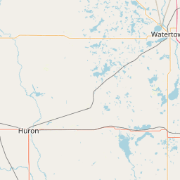
Leaflet | <a href="https://www.openstreetmap.org/copyright">© OpenStreetMap contributors</a>
Item
| Property | Value |
|---|---|
| id | 373391 |
| downstream_mainstem_id | https://geoconnex.us/ref/mainstems/333225 |
| encompassing_mainstem_basins | ['https://geoconnex.us/ref/mainstems/333225', 'https://geoconnex.us/ref/mainstems/312532', 'https://geoconnex.us/ref/mainstems/312091'] |
| featuretype | ['https://www.opengis.net/def/schema/hy_features/hyf/HY_FlowPath', 'https://www.opengis.net/def/schema/hy_features/hyf/HY_WaterBody'] |
| fid | 17587 |
| head_2020huc12 | 101702020303 |
| head_nhdpv1_comid | 2486092 |
| head_nhdpv2_comid | https://geoconnex.us/nhdplusv2/comid/2486092 |
| head_nhdpv2huc12 | https://geoconnex.us/nhdplusv2/huc12/101702020303 |
| head_rf1id | 27891 |
| lengthkm | 61.6 |
| name_at_outlet | Dolph Creek |
| name_at_outlet_gnis_id | 1266798 |
| new_mainstemid | |
| outlet_2020huc12 | 101702020308 |
| outlet_drainagearea_sqkm | 1273.7 |
| outlet_nhdpv1_comid | 9373666 |
| outlet_nhdpv2_comid | https://geoconnex.us/nhdplusv2/comid/9373666 |
| outlet_nhdpv2huc12 | https://geoconnex.us/nhdplusv2/huc12/101702020308 |
| outlet_rf1id | 27891 |
| superseded | False |
| uri | https://geoconnex.us/ref/mainstems/373391 |
Graph Results
| monitoringLocation | https://geoconnex.us/iow/wqp/USGS-443443097103701 |
|---|---|
| siteName | USGS-443443097103701 |
| datasetDescription | Calcium at USGS-443443097103701 |
| type | Well |
| url | https://www.waterqualitydata.us/provider/NWIS/USGS-SD/USGS-443443097103701/ |
| variableMeasured | Calcium |
| variableUnit | milligrams per liter |
| measurementTechnique | observation |
| temporalCoverage | 1964-01-01T00:00:00Z/1964-12-31T00:00:00Z |
| distributionName | Water Quality Portal |
| distributionURL | https://www.waterqualitydata.us/data/Result/search?siteid=USGS-443443097103701&CharacteristicName=Calcium&mimeType=csv |
| distributionFormat | text/comma-separated-values |
| wkt | POINT (-97.1772925 44.578577) |
| monitoringLocation | https://geoconnex.us/iow/wqp/USGS-443443097103701 |
|---|---|
| siteName | USGS-443443097103701 |
| datasetDescription | Hardness, Ca, Mg at USGS-443443097103701 |
| type | Well |
| url | https://www.waterqualitydata.us/provider/NWIS/USGS-SD/USGS-443443097103701/ |
| variableMeasured | Hardness, Ca, Mg |
| variableUnit | milligrams per liter as calcium carbonate |
| measurementTechnique | observation |
| temporalCoverage | 1964-01-01T00:00:00Z/1964-12-31T00:00:00Z |
| distributionName | Water Quality Portal |
| distributionURL | https://www.waterqualitydata.us/data/Result/search?siteid=USGS-443443097103701&CharacteristicName=Hardness, Ca, Mg&mimeType=csv |
| distributionFormat | text/comma-separated-values |
| wkt | POINT (-97.1772925 44.578577) |
| monitoringLocation | https://geoconnex.us/iow/wqp/USGS-443443097103701 |
|---|---|
| siteName | USGS-443443097103701 |
| datasetDescription | Sulfate at USGS-443443097103701 |
| type | Well |
| url | https://www.waterqualitydata.us/provider/NWIS/USGS-SD/USGS-443443097103701/ |
| variableMeasured | Sulfate |
| variableUnit | milligrams per liter |
| measurementTechnique | observation |
| temporalCoverage | 1964-01-01T00:00:00Z/1964-12-31T00:00:00Z |
| distributionName | Water Quality Portal |
| distributionURL | https://www.waterqualitydata.us/data/Result/search?siteid=USGS-443443097103701&CharacteristicName=Sulfate&mimeType=csv |
| distributionFormat | text/comma-separated-values |
| wkt | POINT (-97.1772925 44.578577) |
| monitoringLocation | https://geoconnex.us/iow/wqp/USGS-443443097103701 |
|---|---|
| siteName | USGS-443443097103701 |
| datasetDescription | Total dissolved solids at USGS-443443097103701 |
| type | Well |
| url | https://www.waterqualitydata.us/provider/NWIS/USGS-SD/USGS-443443097103701/ |
| variableMeasured | Total dissolved solids |
| variableUnit | milligrams per liter |
| measurementTechnique | observation |
| temporalCoverage | 1964-01-01T00:00:00Z/1964-12-31T00:00:00Z |
| distributionName | Water Quality Portal |
| distributionURL | https://www.waterqualitydata.us/data/Result/search?siteid=USGS-443443097103701&CharacteristicName=Total dissolved solids&mimeType=csv |
| distributionFormat | text/comma-separated-values |
| wkt | POINT (-97.1772925 44.578577) |
| monitoringLocation | https://geoconnex.us/iow/wqp/USGS-443443097103701 |
|---|---|
| siteName | USGS-443443097103701 |
| datasetDescription | Magnesium at USGS-443443097103701 |
| type | Well |
| url | https://www.waterqualitydata.us/provider/NWIS/USGS-SD/USGS-443443097103701/ |
| variableMeasured | Magnesium |
| variableUnit | percent |
| measurementTechnique | observation |
| temporalCoverage | 1964-01-01T00:00:00Z/1964-12-31T00:00:00Z |
| distributionName | Water Quality Portal |
| distributionURL | https://www.waterqualitydata.us/data/Result/search?siteid=USGS-443443097103701&CharacteristicName=Magnesium&mimeType=csv |
| distributionFormat | text/comma-separated-values |
| wkt | POINT (-97.1772925 44.578577) |
| monitoringLocation | https://geoconnex.us/iow/wqp/USGS-443443097103701 |
|---|---|
| siteName | USGS-443443097103701 |
| datasetDescription | Depth at USGS-443443097103701 |
| type | Well |
| url | https://www.waterqualitydata.us/provider/NWIS/USGS-SD/USGS-443443097103701/ |
| variableMeasured | Depth |
| variableUnit | feet |
| measurementTechnique | observation |
| temporalCoverage | 1964-01-01T00:00:00Z/1964-12-31T00:00:00Z |
| distributionName | Water Quality Portal |
| distributionURL | https://www.waterqualitydata.us/data/Result/search?siteid=USGS-443443097103701&CharacteristicName=Depth&mimeType=csv |
| distributionFormat | text/comma-separated-values |
| wkt | POINT (-97.1772925 44.578577) |
| monitoringLocation | https://geoconnex.us/iow/wqp/USGS-443443097103701 |
|---|---|
| siteName | USGS-443443097103701 |
| datasetDescription | Iron at USGS-443443097103701 |
| type | Well |
| url | https://www.waterqualitydata.us/provider/NWIS/USGS-SD/USGS-443443097103701/ |
| variableMeasured | Iron |
| variableUnit | percent |
| measurementTechnique | observation |
| temporalCoverage | 1964-01-01T00:00:00Z/1964-12-31T00:00:00Z |
| distributionName | Water Quality Portal |
| distributionURL | https://www.waterqualitydata.us/data/Result/search?siteid=USGS-443443097103701&CharacteristicName=Iron&mimeType=csv |
| distributionFormat | text/comma-separated-values |
| wkt | POINT (-97.1772925 44.578577) |
| monitoringLocation | https://geoconnex.us/iow/wqp/USGS-443443097103701 |
|---|---|
| siteName | USGS-443443097103701 |
| datasetDescription | pH at USGS-443443097103701 |
| type | Well |
| url | https://www.waterqualitydata.us/provider/NWIS/USGS-SD/USGS-443443097103701/ |
| variableMeasured | pH |
| variableUnit | Unknown |
| measurementTechnique | observation |
| temporalCoverage | 1964-01-01T00:00:00Z/1964-12-31T00:00:00Z |
| distributionName | Water Quality Portal |
| distributionURL | https://www.waterqualitydata.us/data/Result/search?siteid=USGS-443443097103701&CharacteristicName=pH&mimeType=csv |
| distributionFormat | text/comma-separated-values |
| wkt | POINT (-97.1772925 44.578577) |
| monitoringLocation | https://geoconnex.us/iow/wqp/USGS-443443097103701 |
|---|---|
| siteName | USGS-443443097103701 |
| datasetDescription | Chloride at USGS-443443097103701 |
| type | Well |
| url | https://www.waterqualitydata.us/provider/NWIS/USGS-SD/USGS-443443097103701/ |
| variableMeasured | Chloride |
| variableUnit | milligrams per liter |
| measurementTechnique | observation |
| temporalCoverage | 1964-01-01T00:00:00Z/1964-12-31T00:00:00Z |
| distributionName | Water Quality Portal |
| distributionURL | https://www.waterqualitydata.us/data/Result/search?siteid=USGS-443443097103701&CharacteristicName=Chloride&mimeType=csv |
| distributionFormat | text/comma-separated-values |
| wkt | POINT (-97.1772925 44.578577) |
| monitoringLocation | https://geoconnex.us/iow/wqp/SDDENR_WQX-SWLAZZZ3214 |
|---|---|
| siteName | SDDENR_WQX-SWLAZZZ3214 |
| datasetDescription | Alkalinity, total at SDDENR_WQX-SWLAZZZ3214 |
| type | Lake |
| url | https://www.waterqualitydata.us/provider/STORET/SDDENR_WQX/SDDENR_WQX-SWLAZZZ3214/ |
| variableMeasured | Alkalinity, total |
| variableUnit | milligrams per liter |
| measurementTechnique | observation |
| temporalCoverage | 1989-01-01T00:00:00Z/2021-12-31T00:00:00Z |
| distributionName | Water Quality Portal |
| distributionURL | https://www.waterqualitydata.us/data/Result/search?siteid=SDDENR_WQX-SWLAZZZ3214&CharacteristicName=Alkalinity, total&mimeType=csv |
| distributionFormat | text/comma-separated-values |
| wkt | POINT (-97.1975 44.595) |
| monitoringLocation | https://geoconnex.us/iow/wqp/SDDENR_WQX-SWLAZZZ3214 |
|---|---|
| siteName | SDDENR_WQX-SWLAZZZ3214 |
| datasetDescription | Chlorophyll/Pheophytin ratio at SDDENR_WQX-SWLAZZZ3214 |
| type | Lake |
| url | https://www.waterqualitydata.us/provider/STORET/SDDENR_WQX/SDDENR_WQX-SWLAZZZ3214/ |
| variableMeasured | Chlorophyll/Pheophytin ratio |
| variableUnit | Unknown |
| measurementTechnique | observation |
| temporalCoverage | 2000-01-01T00:00:00Z/2021-12-31T00:00:00Z |
| distributionName | Water Quality Portal |
| distributionURL | https://www.waterqualitydata.us/data/Result/search?siteid=SDDENR_WQX-SWLAZZZ3214&CharacteristicName=Chlorophyll/Pheophytin ratio&mimeType=csv |
| distributionFormat | text/comma-separated-values |
| wkt | POINT (-97.1975 44.595) |
| monitoringLocation | https://geoconnex.us/iow/wqp/SDDENR_WQX-SWLAZZZ3214 |
|---|---|
| siteName | SDDENR_WQX-SWLAZZZ3214 |
| datasetDescription | Total dissolved solids at SDDENR_WQX-SWLAZZZ3214 |
| type | Lake |
| url | https://www.waterqualitydata.us/provider/STORET/SDDENR_WQX/SDDENR_WQX-SWLAZZZ3214/ |
| variableMeasured | Total dissolved solids |
| variableUnit | milligrams per liter |
| measurementTechnique | observation |
| temporalCoverage | 1989-01-01T00:00:00Z/2021-12-31T00:00:00Z |
| distributionName | Water Quality Portal |
| distributionURL | https://www.waterqualitydata.us/data/Result/search?siteid=SDDENR_WQX-SWLAZZZ3214&CharacteristicName=Total dissolved solids&mimeType=csv |
| distributionFormat | text/comma-separated-values |
| wkt | POINT (-97.1975 44.595) |
| monitoringLocation | https://geoconnex.us/iow/wqp/SDDENR_WQX-SWLAZZZ3214 |
|---|---|
| siteName | SDDENR_WQX-SWLAZZZ3214 |
| datasetDescription | Ammonia at SDDENR_WQX-SWLAZZZ3214 |
| type | Lake |
| url | https://www.waterqualitydata.us/provider/STORET/SDDENR_WQX/SDDENR_WQX-SWLAZZZ3214/ |
| variableMeasured | Ammonia |
| variableUnit | milligrams per liter |
| measurementTechnique | observation |
| temporalCoverage | 2019-01-01T00:00:00Z/2021-12-31T00:00:00Z |
| distributionName | Water Quality Portal |
| distributionURL | https://www.waterqualitydata.us/data/Result/search?siteid=SDDENR_WQX-SWLAZZZ3214&CharacteristicName=Ammonia&mimeType=csv |
| distributionFormat | text/comma-separated-values |
| wkt | POINT (-97.1975 44.595) |
| monitoringLocation | https://geoconnex.us/iow/wqp/SDDENR_WQX-SWLAZZZ3214 |
|---|---|
| siteName | SDDENR_WQX-SWLAZZZ3214 |
| datasetDescription | Temperature, air at SDDENR_WQX-SWLAZZZ3214 |
| type | Lake |
| url | https://www.waterqualitydata.us/provider/STORET/SDDENR_WQX/SDDENR_WQX-SWLAZZZ3214/ |
| variableMeasured | Temperature, air |
| variableUnit | degrees Celsius |
| measurementTechnique | observation |
| temporalCoverage | 1989-01-01T00:00:00Z/2019-12-31T00:00:00Z |
| distributionName | Water Quality Portal |
| distributionURL | https://www.waterqualitydata.us/data/Result/search?siteid=SDDENR_WQX-SWLAZZZ3214&CharacteristicName=Temperature, air&mimeType=csv |
| distributionFormat | text/comma-separated-values |
| wkt | POINT (-97.1975 44.595) |
| monitoringLocation | https://geoconnex.us/iow/wqp/SDDENR_WQX-SWLAZZZ3214 |
|---|---|
| siteName | SDDENR_WQX-SWLAZZZ3214 |
| datasetDescription | Depth, bottom at SDDENR_WQX-SWLAZZZ3214 |
| type | Lake |
| url | https://www.waterqualitydata.us/provider/STORET/SDDENR_WQX/SDDENR_WQX-SWLAZZZ3214/ |
| variableMeasured | Depth, bottom |
| variableUnit | feet |
| measurementTechnique | observation |
| temporalCoverage | 2020-01-01T00:00:00Z/2021-12-31T00:00:00Z |
| distributionName | Water Quality Portal |
| distributionURL | https://www.waterqualitydata.us/data/Result/search?siteid=SDDENR_WQX-SWLAZZZ3214&CharacteristicName=Depth, bottom&mimeType=csv |
| distributionFormat | text/comma-separated-values |
| wkt | POINT (-97.1975 44.595) |
| monitoringLocation | https://geoconnex.us/iow/wqp/SDDENR_WQX-SWLAZZZ3214 |
|---|---|
| siteName | SDDENR_WQX-SWLAZZZ3214 |
| datasetDescription | pH at SDDENR_WQX-SWLAZZZ3214 |
| type | Lake |
| url | https://www.waterqualitydata.us/provider/STORET/SDDENR_WQX/SDDENR_WQX-SWLAZZZ3214/ |
| variableMeasured | pH |
| variableUnit | Unknown |
| measurementTechnique | observation |
| temporalCoverage | 1989-01-01T00:00:00Z/2021-12-31T00:00:00Z |
| distributionName | Water Quality Portal |
| distributionURL | https://www.waterqualitydata.us/data/Result/search?siteid=SDDENR_WQX-SWLAZZZ3214&CharacteristicName=pH&mimeType=csv |
| distributionFormat | text/comma-separated-values |
| wkt | POINT (-97.1975 44.595) |
| monitoringLocation | https://geoconnex.us/iow/wqp/SDDENR_WQX-SWLAZZZ3214 |
|---|---|
| siteName | SDDENR_WQX-SWLAZZZ3214 |
| datasetDescription | Escherichia coli at SDDENR_WQX-SWLAZZZ3214 |
| type | Lake |
| url | https://www.waterqualitydata.us/provider/STORET/SDDENR_WQX/SDDENR_WQX-SWLAZZZ3214/ |
| variableMeasured | Escherichia coli |
| variableUnit | number per 100 milliliters |
| measurementTechnique | observation |
| temporalCoverage | 2008-01-01T00:00:00Z/2019-12-31T00:00:00Z |
| distributionName | Water Quality Portal |
| distributionURL | https://www.waterqualitydata.us/data/Result/search?siteid=SDDENR_WQX-SWLAZZZ3214&CharacteristicName=Escherichia coli&mimeType=csv |
| distributionFormat | text/comma-separated-values |
| wkt | POINT (-97.1975 44.595) |
| monitoringLocation | https://geoconnex.us/iow/wqp/SDDENR_WQX-SWLAZZZ3214 |
|---|---|
| siteName | SDDENR_WQX-SWLAZZZ3214 |
| datasetDescription | Total suspended solids at SDDENR_WQX-SWLAZZZ3214 |
| type | Lake |
| url | https://www.waterqualitydata.us/provider/STORET/SDDENR_WQX/SDDENR_WQX-SWLAZZZ3214/ |
| variableMeasured | Total suspended solids |
| variableUnit | milligrams per liter |
| measurementTechnique | observation |
| temporalCoverage | 1989-01-01T00:00:00Z/2021-12-31T00:00:00Z |
| distributionName | Water Quality Portal |
| distributionURL | https://www.waterqualitydata.us/data/Result/search?siteid=SDDENR_WQX-SWLAZZZ3214&CharacteristicName=Total suspended solids&mimeType=csv |
| distributionFormat | text/comma-separated-values |
| wkt | POINT (-97.1975 44.595) |
| monitoringLocation | https://geoconnex.us/iow/wqp/SDDENR_WQX-SWLAZZZ3214 |
|---|---|
| siteName | SDDENR_WQX-SWLAZZZ3214 |
| datasetDescription | Chlorophyll a, corrected for pheophytin at SDDENR_WQX-SWLAZZZ3214 |
| type | Lake |
| url | https://www.waterqualitydata.us/provider/STORET/SDDENR_WQX/SDDENR_WQX-SWLAZZZ3214/ |
| variableMeasured | Chlorophyll a, corrected for pheophytin |
| variableUnit | micrograms per liter |
| measurementTechnique | observation |
| temporalCoverage | 1991-01-01T00:00:00Z/2021-12-31T00:00:00Z |
| distributionName | Water Quality Portal |
| distributionURL | https://www.waterqualitydata.us/data/Result/search?siteid=SDDENR_WQX-SWLAZZZ3214&CharacteristicName=Chlorophyll a, corrected for pheophytin&mimeType=csv |
| distributionFormat | text/comma-separated-values |
| wkt | POINT (-97.1975 44.595) |
| monitoringLocation | https://geoconnex.us/iow/wqp/SDDENR_WQX-SWLAZZZ3214 |
|---|---|
| siteName | SDDENR_WQX-SWLAZZZ3214 |
| datasetDescription | Total volatile solids at SDDENR_WQX-SWLAZZZ3214 |
| type | Lake |
| url | https://www.waterqualitydata.us/provider/STORET/SDDENR_WQX/SDDENR_WQX-SWLAZZZ3214/ |
| variableMeasured | Total volatile solids |
| variableUnit | milligrams per liter |
| measurementTechnique | observation |
| temporalCoverage | 1991-01-01T00:00:00Z/2008-12-31T00:00:00Z |
| distributionName | Water Quality Portal |
| distributionURL | https://www.waterqualitydata.us/data/Result/search?siteid=SDDENR_WQX-SWLAZZZ3214&CharacteristicName=Total volatile solids&mimeType=csv |
| distributionFormat | text/comma-separated-values |
| wkt | POINT (-97.1975 44.595) |
| monitoringLocation | https://geoconnex.us/iow/wqp/SDDENR_WQX-SWLAZZZ3214 |
|---|---|
| siteName | SDDENR_WQX-SWLAZZZ3214 |
| datasetDescription | Ammonia-nitrogen at SDDENR_WQX-SWLAZZZ3214 |
| type | Lake |
| url | https://www.waterqualitydata.us/provider/STORET/SDDENR_WQX/SDDENR_WQX-SWLAZZZ3214/ |
| variableMeasured | Ammonia-nitrogen |
| variableUnit | milligrams per liter |
| measurementTechnique | observation |
| temporalCoverage | 1989-01-01T00:00:00Z/2008-12-31T00:00:00Z |
| distributionName | Water Quality Portal |
| distributionURL | https://www.waterqualitydata.us/data/Result/search?siteid=SDDENR_WQX-SWLAZZZ3214&CharacteristicName=Ammonia-nitrogen&mimeType=csv |
| distributionFormat | text/comma-separated-values |
| wkt | POINT (-97.1975 44.595) |
| monitoringLocation | https://geoconnex.us/iow/wqp/SDDENR_WQX-SWLAZZZ3214 |
|---|---|
| siteName | SDDENR_WQX-SWLAZZZ3214 |
| datasetDescription | Kjeldahl nitrogen at SDDENR_WQX-SWLAZZZ3214 |
| type | Lake |
| url | https://www.waterqualitydata.us/provider/STORET/SDDENR_WQX/SDDENR_WQX-SWLAZZZ3214/ |
| variableMeasured | Kjeldahl nitrogen |
| variableUnit | milligrams per liter |
| measurementTechnique | observation |
| temporalCoverage | 1989-01-01T00:00:00Z/2021-12-31T00:00:00Z |
| distributionName | Water Quality Portal |
| distributionURL | https://www.waterqualitydata.us/data/Result/search?siteid=SDDENR_WQX-SWLAZZZ3214&CharacteristicName=Kjeldahl nitrogen&mimeType=csv |
| distributionFormat | text/comma-separated-values |
| wkt | POINT (-97.1975 44.595) |
| monitoringLocation | https://geoconnex.us/iow/wqp/SDDENR_WQX-SWLAZZZ3214 |
|---|---|
| siteName | SDDENR_WQX-SWLAZZZ3214 |
| datasetDescription | Orthophosphate at SDDENR_WQX-SWLAZZZ3214 |
| type | Lake |
| url | https://www.waterqualitydata.us/provider/STORET/SDDENR_WQX/SDDENR_WQX-SWLAZZZ3214/ |
| variableMeasured | Orthophosphate |
| variableUnit | milligrams per liter as phosphate |
| measurementTechnique | observation |
| temporalCoverage | 1989-01-01T00:00:00Z/1989-12-31T00:00:00Z |
| distributionName | Water Quality Portal |
| distributionURL | https://www.waterqualitydata.us/data/Result/search?siteid=SDDENR_WQX-SWLAZZZ3214&CharacteristicName=Orthophosphate&mimeType=csv |
| distributionFormat | text/comma-separated-values |
| wkt | POINT (-97.1975 44.595) |
| monitoringLocation | https://geoconnex.us/iow/wqp/SDDENR_WQX-SWLAZZZ3214 |
|---|---|
| siteName | SDDENR_WQX-SWLAZZZ3214 |
| datasetDescription | Total solids at SDDENR_WQX-SWLAZZZ3214 |
| type | Lake |
| url | https://www.waterqualitydata.us/provider/STORET/SDDENR_WQX/SDDENR_WQX-SWLAZZZ3214/ |
| variableMeasured | Total solids |
| variableUnit | milligrams per liter |
| measurementTechnique | observation |
| temporalCoverage | 1989-01-01T00:00:00Z/2004-12-31T00:00:00Z |
| distributionName | Water Quality Portal |
| distributionURL | https://www.waterqualitydata.us/data/Result/search?siteid=SDDENR_WQX-SWLAZZZ3214&CharacteristicName=Total solids&mimeType=csv |
| distributionFormat | text/comma-separated-values |
| wkt | POINT (-97.1975 44.595) |
| monitoringLocation | https://geoconnex.us/iow/wqp/SDDENR_WQX-SWLAZZZ3214 |
|---|---|
| siteName | SDDENR_WQX-SWLAZZZ3214 |
| datasetDescription | Chlorophyll a, free of pheophytin at SDDENR_WQX-SWLAZZZ3214 |
| type | Lake |
| url | https://www.waterqualitydata.us/provider/STORET/SDDENR_WQX/SDDENR_WQX-SWLAZZZ3214/ |
| variableMeasured | Chlorophyll a, free of pheophytin |
| variableUnit | micrograms per liter |
| measurementTechnique | observation |
| temporalCoverage | 2004-01-01T00:00:00Z/2021-12-31T00:00:00Z |
| distributionName | Water Quality Portal |
| distributionURL | https://www.waterqualitydata.us/data/Result/search?siteid=SDDENR_WQX-SWLAZZZ3214&CharacteristicName=Chlorophyll a, free of pheophytin&mimeType=csv |
| distributionFormat | text/comma-separated-values |
| wkt | POINT (-97.1975 44.595) |
| monitoringLocation | https://geoconnex.us/iow/wqp/SDDENR_WQX-SWLAZZZ3214 |
|---|---|
| siteName | SDDENR_WQX-SWLAZZZ3214 |
| datasetDescription | Water appearance (text) at SDDENR_WQX-SWLAZZZ3214 |
| type | Lake |
| url | https://www.waterqualitydata.us/provider/STORET/SDDENR_WQX/SDDENR_WQX-SWLAZZZ3214/ |
| variableMeasured | Water appearance (text) |
| variableUnit | Unknown |
| measurementTechnique | observation |
| temporalCoverage | 2004-01-01T00:00:00Z/2004-12-31T00:00:00Z |
| distributionName | Water Quality Portal |
| distributionURL | https://www.waterqualitydata.us/data/Result/search?siteid=SDDENR_WQX-SWLAZZZ3214&CharacteristicName=Water appearance (text)&mimeType=csv |
| distributionFormat | text/comma-separated-values |
| wkt | POINT (-97.1975 44.595) |
| monitoringLocation | https://geoconnex.us/iow/wqp/SDDENR_WQX-SWLAZZZ3214 |
|---|---|
| siteName | SDDENR_WQX-SWLAZZZ3214 |
| datasetDescription | Chlorophyll a at SDDENR_WQX-SWLAZZZ3214 |
| type | Lake |
| url | https://www.waterqualitydata.us/provider/STORET/SDDENR_WQX/SDDENR_WQX-SWLAZZZ3214/ |
| variableMeasured | Chlorophyll a |
| variableUnit | micrograms per liter |
| measurementTechnique | observation |
| temporalCoverage | 2004-01-01T00:00:00Z/2008-12-31T00:00:00Z |
| distributionName | Water Quality Portal |
| distributionURL | https://www.waterqualitydata.us/data/Result/search?siteid=SDDENR_WQX-SWLAZZZ3214&CharacteristicName=Chlorophyll a&mimeType=csv |
| distributionFormat | text/comma-separated-values |
| wkt | POINT (-97.1975 44.595) |
| monitoringLocation | https://geoconnex.us/iow/wqp/SDDENR_WQX-SWLAZZZ3214 |
|---|---|
| siteName | SDDENR_WQX-SWLAZZZ3214 |
| datasetDescription | Dissolved oxygen (DO) at SDDENR_WQX-SWLAZZZ3214 |
| type | Lake |
| url | https://www.waterqualitydata.us/provider/STORET/SDDENR_WQX/SDDENR_WQX-SWLAZZZ3214/ |
| variableMeasured | Dissolved oxygen (DO) |
| variableUnit | milligrams per liter |
| measurementTechnique | observation |
| temporalCoverage | 1989-01-01T00:00:00Z/2021-12-31T00:00:00Z |
| distributionName | Water Quality Portal |
| distributionURL | https://www.waterqualitydata.us/data/Result/search?siteid=SDDENR_WQX-SWLAZZZ3214&CharacteristicName=Dissolved oxygen (DO)&mimeType=csv |
| distributionFormat | text/comma-separated-values |
| wkt | POINT (-97.1975 44.595) |
| monitoringLocation | https://geoconnex.us/iow/wqp/SDDENR_WQX-SWLAZZZ3214 |
|---|---|
| siteName | SDDENR_WQX-SWLAZZZ3214 |
| datasetDescription | Temperature, water at SDDENR_WQX-SWLAZZZ3214 |
| type | Lake |
| url | https://www.waterqualitydata.us/provider/STORET/SDDENR_WQX/SDDENR_WQX-SWLAZZZ3214/ |
| variableMeasured | Temperature, water |
| variableUnit | degrees Celsius |
| measurementTechnique | observation |
| temporalCoverage | 1989-01-01T00:00:00Z/2021-12-31T00:00:00Z |
| distributionName | Water Quality Portal |
| distributionURL | https://www.waterqualitydata.us/data/Result/search?siteid=SDDENR_WQX-SWLAZZZ3214&CharacteristicName=Temperature, water&mimeType=csv |
| distributionFormat | text/comma-separated-values |
| wkt | POINT (-97.1975 44.595) |
| monitoringLocation | https://geoconnex.us/iow/wqp/SDDENR_WQX-SWLAZZZ3214 |
|---|---|
| siteName | SDDENR_WQX-SWLAZZZ3214 |
| datasetDescription | Fecal Coliform at SDDENR_WQX-SWLAZZZ3214 |
| type | Lake |
| url | https://www.waterqualitydata.us/provider/STORET/SDDENR_WQX/SDDENR_WQX-SWLAZZZ3214/ |
| variableMeasured | Fecal Coliform |
| variableUnit | Unknown |
| measurementTechnique | observation |
| temporalCoverage | 2008-01-01T00:00:00Z/2008-12-31T00:00:00Z |
| distributionName | Water Quality Portal |
| distributionURL | https://www.waterqualitydata.us/data/Result/search?siteid=SDDENR_WQX-SWLAZZZ3214&CharacteristicName=Fecal Coliform&mimeType=csv |
| distributionFormat | text/comma-separated-values |
| wkt | POINT (-97.1975 44.595) |
| monitoringLocation | https://geoconnex.us/iow/wqp/SDDENR_WQX-SWLAZZZ3214 |
|---|---|
| siteName | SDDENR_WQX-SWLAZZZ3214 |
| datasetDescription | Chlorophyll a, uncorrected for pheophytin at SDDENR_WQX-SWLAZZZ3214 |
| type | Lake |
| url | https://www.waterqualitydata.us/provider/STORET/SDDENR_WQX/SDDENR_WQX-SWLAZZZ3214/ |
| variableMeasured | Chlorophyll a, uncorrected for pheophytin |
| variableUnit | micrograms per liter |
| measurementTechnique | observation |
| temporalCoverage | 1991-01-01T00:00:00Z/2021-12-31T00:00:00Z |
| distributionName | Water Quality Portal |
| distributionURL | https://www.waterqualitydata.us/data/Result/search?siteid=SDDENR_WQX-SWLAZZZ3214&CharacteristicName=Chlorophyll a, uncorrected for pheophytin&mimeType=csv |
| distributionFormat | text/comma-separated-values |
| wkt | POINT (-97.1975 44.595) |
| monitoringLocation | https://geoconnex.us/iow/wqp/SDDENR_WQX-SWLAZZZ3214 |
|---|---|
| siteName | SDDENR_WQX-SWLAZZZ3214 |
| datasetDescription | Depth, Secchi disk depth at SDDENR_WQX-SWLAZZZ3214 |
| type | Lake |
| url | https://www.waterqualitydata.us/provider/STORET/SDDENR_WQX/SDDENR_WQX-SWLAZZZ3214/ |
| variableMeasured | Depth, Secchi disk depth |
| variableUnit | meters |
| measurementTechnique | observation |
| temporalCoverage | 1989-01-01T00:00:00Z/2008-12-31T00:00:00Z |
| distributionName | Water Quality Portal |
| distributionURL | https://www.waterqualitydata.us/data/Result/search?siteid=SDDENR_WQX-SWLAZZZ3214&CharacteristicName=Depth, Secchi disk depth&mimeType=csv |
| distributionFormat | text/comma-separated-values |
| wkt | POINT (-97.1975 44.595) |
| monitoringLocation | https://geoconnex.us/iow/wqp/SDDENR_WQX-SWLAZZZ3214 |
|---|---|
| siteName | SDDENR_WQX-SWLAZZZ3214 |
| datasetDescription | Chlorophyll c at SDDENR_WQX-SWLAZZZ3214 |
| type | Lake |
| url | https://www.waterqualitydata.us/provider/STORET/SDDENR_WQX/SDDENR_WQX-SWLAZZZ3214/ |
| variableMeasured | Chlorophyll c |
| variableUnit | Unknown |
| measurementTechnique | observation |
| temporalCoverage | 2004-01-01T00:00:00Z/2008-12-31T00:00:00Z |
| distributionName | Water Quality Portal |
| distributionURL | https://www.waterqualitydata.us/data/Result/search?siteid=SDDENR_WQX-SWLAZZZ3214&CharacteristicName=Chlorophyll c&mimeType=csv |
| distributionFormat | text/comma-separated-values |
| wkt | POINT (-97.1975 44.595) |
| monitoringLocation | https://geoconnex.us/iow/wqp/SDDENR_WQX-SWLAZZZ3214 |
|---|---|
| siteName | SDDENR_WQX-SWLAZZZ3214 |
| datasetDescription | Specific conductance at SDDENR_WQX-SWLAZZZ3214 |
| type | Lake |
| url | https://www.waterqualitydata.us/provider/STORET/SDDENR_WQX/SDDENR_WQX-SWLAZZZ3214/ |
| variableMeasured | Specific conductance |
| variableUnit | microsiemens per centimeter |
| measurementTechnique | observation |
| temporalCoverage | 1989-01-01T00:00:00Z/2021-12-31T00:00:00Z |
| distributionName | Water Quality Portal |
| distributionURL | https://www.waterqualitydata.us/data/Result/search?siteid=SDDENR_WQX-SWLAZZZ3214&CharacteristicName=Specific conductance&mimeType=csv |
| distributionFormat | text/comma-separated-values |
| wkt | POINT (-97.1975 44.595) |
| monitoringLocation | https://geoconnex.us/iow/wqp/SDDENR_WQX-SWLAZZZ3214 |
|---|---|
| siteName | SDDENR_WQX-SWLAZZZ3214 |
| datasetDescription | Chlorophyll b at SDDENR_WQX-SWLAZZZ3214 |
| type | Lake |
| url | https://www.waterqualitydata.us/provider/STORET/SDDENR_WQX/SDDENR_WQX-SWLAZZZ3214/ |
| variableMeasured | Chlorophyll b |
| variableUnit | micrograms per liter |
| measurementTechnique | observation |
| temporalCoverage | 2004-01-01T00:00:00Z/2008-12-31T00:00:00Z |
| distributionName | Water Quality Portal |
| distributionURL | https://www.waterqualitydata.us/data/Result/search?siteid=SDDENR_WQX-SWLAZZZ3214&CharacteristicName=Chlorophyll b&mimeType=csv |
| distributionFormat | text/comma-separated-values |
| wkt | POINT (-97.1975 44.595) |
| monitoringLocation | https://geoconnex.us/iow/wqp/SDDENR_WQX-SWLAZZZ3214 |
|---|---|
| siteName | SDDENR_WQX-SWLAZZZ3214 |
| datasetDescription | Phosphate-phosphorus at SDDENR_WQX-SWLAZZZ3214 |
| type | Lake |
| url | https://www.waterqualitydata.us/provider/STORET/SDDENR_WQX/SDDENR_WQX-SWLAZZZ3214/ |
| variableMeasured | Phosphate-phosphorus |
| variableUnit | milligrams per liter |
| measurementTechnique | observation |
| temporalCoverage | 1989-01-01T00:00:00Z/2008-12-31T00:00:00Z |
| distributionName | Water Quality Portal |
| distributionURL | https://www.waterqualitydata.us/data/Result/search?siteid=SDDENR_WQX-SWLAZZZ3214&CharacteristicName=Phosphate-phosphorus&mimeType=csv |
| distributionFormat | text/comma-separated-values |
| wkt | POINT (-97.1975 44.595) |
| monitoringLocation | https://geoconnex.us/iow/wqp/USGS-443605097134001 |
|---|---|
| siteName | USGS-443605097134001 |
| datasetDescription | Hardness, Ca, Mg at USGS-443605097134001 |
| type | Well |
| url | https://www.waterqualitydata.us/provider/NWIS/USGS-SD/USGS-443605097134001/ |
| variableMeasured | Hardness, Ca, Mg |
| variableUnit | milligrams per liter as calcium carbonate |
| measurementTechnique | observation |
| temporalCoverage | 1964-01-01T00:00:00Z/1964-12-31T00:00:00Z |
| distributionName | Water Quality Portal |
| distributionURL | https://www.waterqualitydata.us/data/Result/search?siteid=USGS-443605097134001&CharacteristicName=Hardness, Ca, Mg&mimeType=csv |
| distributionFormat | text/comma-separated-values |
| wkt | POINT (-97.228128 44.6013545) |
| monitoringLocation | https://geoconnex.us/iow/wqp/USGS-443605097134001 |
|---|---|
| siteName | USGS-443605097134001 |
| datasetDescription | Nitrate at USGS-443605097134001 |
| type | Well |
| url | https://www.waterqualitydata.us/provider/NWIS/USGS-SD/USGS-443605097134001/ |
| variableMeasured | Nitrate |
| variableUnit | milligrams per liter as nitrogen |
| measurementTechnique | observation |
| temporalCoverage | 1964-01-01T00:00:00Z/1964-12-31T00:00:00Z |
| distributionName | Water Quality Portal |
| distributionURL | https://www.waterqualitydata.us/data/Result/search?siteid=USGS-443605097134001&CharacteristicName=Nitrate&mimeType=csv |
| distributionFormat | text/comma-separated-values |
| wkt | POINT (-97.228128 44.6013545) |
| monitoringLocation | https://geoconnex.us/iow/wqp/USGS-443605097134001 |
|---|---|
| siteName | USGS-443605097134001 |
| datasetDescription | Chloride at USGS-443605097134001 |
| type | Well |
| url | https://www.waterqualitydata.us/provider/NWIS/USGS-SD/USGS-443605097134001/ |
| variableMeasured | Chloride |
| variableUnit | milligrams per liter |
| measurementTechnique | observation |
| temporalCoverage | 1964-01-01T00:00:00Z/1964-12-31T00:00:00Z |
| distributionName | Water Quality Portal |
| distributionURL | https://www.waterqualitydata.us/data/Result/search?siteid=USGS-443605097134001&CharacteristicName=Chloride&mimeType=csv |
| distributionFormat | text/comma-separated-values |
| wkt | POINT (-97.228128 44.6013545) |
| monitoringLocation | https://geoconnex.us/iow/wqp/USGS-443605097134001 |
|---|---|
| siteName | USGS-443605097134001 |
| datasetDescription | Depth at USGS-443605097134001 |
| type | Well |
| url | https://www.waterqualitydata.us/provider/NWIS/USGS-SD/USGS-443605097134001/ |
| variableMeasured | Depth |
| variableUnit | feet |
| measurementTechnique | observation |
| temporalCoverage | 1964-01-01T00:00:00Z/1964-12-31T00:00:00Z |
| distributionName | Water Quality Portal |
| distributionURL | https://www.waterqualitydata.us/data/Result/search?siteid=USGS-443605097134001&CharacteristicName=Depth&mimeType=csv |
| distributionFormat | text/comma-separated-values |
| wkt | POINT (-97.228128 44.6013545) |
| monitoringLocation | https://geoconnex.us/iow/wqp/USGS-443605097134001 |
|---|---|
| siteName | USGS-443605097134001 |
| datasetDescription | Fluoride at USGS-443605097134001 |
| type | Well |
| url | https://www.waterqualitydata.us/provider/NWIS/USGS-SD/USGS-443605097134001/ |
| variableMeasured | Fluoride |
| variableUnit | milligrams per liter |
| measurementTechnique | observation |
| temporalCoverage | 1964-01-01T00:00:00Z/1964-12-31T00:00:00Z |
| distributionName | Water Quality Portal |
| distributionURL | https://www.waterqualitydata.us/data/Result/search?siteid=USGS-443605097134001&CharacteristicName=Fluoride&mimeType=csv |
| distributionFormat | text/comma-separated-values |
| wkt | POINT (-97.228128 44.6013545) |
| monitoringLocation | https://geoconnex.us/iow/wqp/USGS-443605097134001 |
|---|---|
| siteName | USGS-443605097134001 |
| datasetDescription | Sulfate at USGS-443605097134001 |
| type | Well |
| url | https://www.waterqualitydata.us/provider/NWIS/USGS-SD/USGS-443605097134001/ |
| variableMeasured | Sulfate |
| variableUnit | milligrams per liter |
| measurementTechnique | observation |
| temporalCoverage | 1964-01-01T00:00:00Z/1964-12-31T00:00:00Z |
| distributionName | Water Quality Portal |
| distributionURL | https://www.waterqualitydata.us/data/Result/search?siteid=USGS-443605097134001&CharacteristicName=Sulfate&mimeType=csv |
| distributionFormat | text/comma-separated-values |
| wkt | POINT (-97.228128 44.6013545) |
| monitoringLocation | https://geoconnex.us/iow/wqp/USGS-443605097134001 |
|---|---|
| siteName | USGS-443605097134001 |
| datasetDescription | Sodium at USGS-443605097134001 |
| type | Well |
| url | https://www.waterqualitydata.us/provider/NWIS/USGS-SD/USGS-443605097134001/ |
| variableMeasured | Sodium |
| variableUnit | milligrams per liter |
| measurementTechnique | observation |
| temporalCoverage | 1964-01-01T00:00:00Z/1964-12-31T00:00:00Z |
| distributionName | Water Quality Portal |
| distributionURL | https://www.waterqualitydata.us/data/Result/search?siteid=USGS-443605097134001&CharacteristicName=Sodium&mimeType=csv |
| distributionFormat | text/comma-separated-values |
| wkt | POINT (-97.228128 44.6013545) |
| monitoringLocation | https://geoconnex.us/iow/wqp/USGS-443605097134001 |
|---|---|
| siteName | USGS-443605097134001 |
| datasetDescription | Magnesium at USGS-443605097134001 |
| type | Well |
| url | https://www.waterqualitydata.us/provider/NWIS/USGS-SD/USGS-443605097134001/ |
| variableMeasured | Magnesium |
| variableUnit | percent |
| measurementTechnique | observation |
| temporalCoverage | 1964-01-01T00:00:00Z/1964-12-31T00:00:00Z |
| distributionName | Water Quality Portal |
| distributionURL | https://www.waterqualitydata.us/data/Result/search?siteid=USGS-443605097134001&CharacteristicName=Magnesium&mimeType=csv |
| distributionFormat | text/comma-separated-values |
| wkt | POINT (-97.228128 44.6013545) |
| monitoringLocation | https://geoconnex.us/iow/wqp/USGS-443605097134001 |
|---|---|
| siteName | USGS-443605097134001 |
| datasetDescription | pH at USGS-443605097134001 |
| type | Well |
| url | https://www.waterqualitydata.us/provider/NWIS/USGS-SD/USGS-443605097134001/ |
| variableMeasured | pH |
| variableUnit | Unknown |
| measurementTechnique | observation |
| temporalCoverage | 1964-01-01T00:00:00Z/1964-12-31T00:00:00Z |
| distributionName | Water Quality Portal |
| distributionURL | https://www.waterqualitydata.us/data/Result/search?siteid=USGS-443605097134001&CharacteristicName=pH&mimeType=csv |
| distributionFormat | text/comma-separated-values |
| wkt | POINT (-97.228128 44.6013545) |
| monitoringLocation | https://geoconnex.us/iow/wqp/USGS-443605097134001 |
|---|---|
| siteName | USGS-443605097134001 |
| datasetDescription | Iron at USGS-443605097134001 |
| type | Well |
| url | https://www.waterqualitydata.us/provider/NWIS/USGS-SD/USGS-443605097134001/ |
| variableMeasured | Iron |
| variableUnit | percent |
| measurementTechnique | observation |
| temporalCoverage | 1964-01-01T00:00:00Z/1964-12-31T00:00:00Z |
| distributionName | Water Quality Portal |
| distributionURL | https://www.waterqualitydata.us/data/Result/search?siteid=USGS-443605097134001&CharacteristicName=Iron&mimeType=csv |
| distributionFormat | text/comma-separated-values |
| wkt | POINT (-97.228128 44.6013545) |
| monitoringLocation | https://geoconnex.us/iow/wqp/USGS-443605097134001 |
|---|---|
| siteName | USGS-443605097134001 |
| datasetDescription | Manganese at USGS-443605097134001 |
| type | Well |
| url | https://www.waterqualitydata.us/provider/NWIS/USGS-SD/USGS-443605097134001/ |
| variableMeasured | Manganese |
| variableUnit | micrograms per liter |
| measurementTechnique | observation |
| temporalCoverage | 1964-01-01T00:00:00Z/1964-12-31T00:00:00Z |
| distributionName | Water Quality Portal |
| distributionURL | https://www.waterqualitydata.us/data/Result/search?siteid=USGS-443605097134001&CharacteristicName=Manganese&mimeType=csv |
| distributionFormat | text/comma-separated-values |
| wkt | POINT (-97.228128 44.6013545) |
| monitoringLocation | https://geoconnex.us/iow/wqp/USGS-443605097134001 |
|---|---|
| siteName | USGS-443605097134001 |
| datasetDescription | Calcium at USGS-443605097134001 |
| type | Well |
| url | https://www.waterqualitydata.us/provider/NWIS/USGS-SD/USGS-443605097134001/ |
| variableMeasured | Calcium |
| variableUnit | milligrams per liter |
| measurementTechnique | observation |
| temporalCoverage | 1964-01-01T00:00:00Z/1964-12-31T00:00:00Z |
| distributionName | Water Quality Portal |
| distributionURL | https://www.waterqualitydata.us/data/Result/search?siteid=USGS-443605097134001&CharacteristicName=Calcium&mimeType=csv |
| distributionFormat | text/comma-separated-values |
| wkt | POINT (-97.228128 44.6013545) |
| monitoringLocation | https://geoconnex.us/iow/wqp/USGS-443605097134001 |
|---|---|
| siteName | USGS-443605097134001 |
| datasetDescription | Total dissolved solids at USGS-443605097134001 |
| type | Well |
| url | https://www.waterqualitydata.us/provider/NWIS/USGS-SD/USGS-443605097134001/ |
| variableMeasured | Total dissolved solids |
| variableUnit | milligrams per liter |
| measurementTechnique | observation |
| temporalCoverage | 1964-01-01T00:00:00Z/1964-12-31T00:00:00Z |
| distributionName | Water Quality Portal |
| distributionURL | https://www.waterqualitydata.us/data/Result/search?siteid=USGS-443605097134001&CharacteristicName=Total dissolved solids&mimeType=csv |
| distributionFormat | text/comma-separated-values |
| wkt | POINT (-97.228128 44.6013545) |
| monitoringLocation | https://geoconnex.us/iow/wqp/SDDENR_WQX-SPECPONLP03 |
|---|---|
| siteName | SDDENR_WQX-SPECPONLP03 |
| datasetDescription | Chlorophyll a, uncorrected for pheophytin at SDDENR_WQX-SPECPONLP03 |
| type | Lake |
| url | https://www.waterqualitydata.us/provider/STORET/SDDENR_WQX/SDDENR_WQX-SPECPONLP03/ |
| variableMeasured | Chlorophyll a, uncorrected for pheophytin |
| variableUnit | micrograms per liter |
| measurementTechnique | observation |
| temporalCoverage | 2008-01-01T00:00:00Z/2008-12-31T00:00:00Z |
| distributionName | Water Quality Portal |
| distributionURL | https://www.waterqualitydata.us/data/Result/search?siteid=SDDENR_WQX-SPECPONLP03&CharacteristicName=Chlorophyll a, uncorrected for pheophytin&mimeType=csv |
| distributionFormat | text/comma-separated-values |
| wkt | POINT (-97.060596 44.587423) |
| monitoringLocation | https://geoconnex.us/iow/wqp/SDDENR_WQX-SPECPONLP03 |
|---|---|
| siteName | SDDENR_WQX-SPECPONLP03 |
| datasetDescription | Phosphate-phosphorus at SDDENR_WQX-SPECPONLP03 |
| type | Lake |
| url | https://www.waterqualitydata.us/provider/STORET/SDDENR_WQX/SDDENR_WQX-SPECPONLP03/ |
| variableMeasured | Phosphate-phosphorus |
| variableUnit | milligrams per liter |
| measurementTechnique | observation |
| temporalCoverage | 2008-01-01T00:00:00Z/2008-12-31T00:00:00Z |
| distributionName | Water Quality Portal |
| distributionURL | https://www.waterqualitydata.us/data/Result/search?siteid=SDDENR_WQX-SPECPONLP03&CharacteristicName=Phosphate-phosphorus&mimeType=csv |
| distributionFormat | text/comma-separated-values |
| wkt | POINT (-97.060596 44.587423) |
| monitoringLocation | https://geoconnex.us/iow/wqp/SDDENR_WQX-SPECPONLP03 |
|---|---|
| siteName | SDDENR_WQX-SPECPONLP03 |
| datasetDescription | Chlorophyll a, free of pheophytin at SDDENR_WQX-SPECPONLP03 |
| type | Lake |
| url | https://www.waterqualitydata.us/provider/STORET/SDDENR_WQX/SDDENR_WQX-SPECPONLP03/ |
| variableMeasured | Chlorophyll a, free of pheophytin |
| variableUnit | micrograms per liter |
| measurementTechnique | observation |
| temporalCoverage | 2008-01-01T00:00:00Z/2008-12-31T00:00:00Z |
| distributionName | Water Quality Portal |
| distributionURL | https://www.waterqualitydata.us/data/Result/search?siteid=SDDENR_WQX-SPECPONLP03&CharacteristicName=Chlorophyll a, free of pheophytin&mimeType=csv |
| distributionFormat | text/comma-separated-values |
| wkt | POINT (-97.060596 44.587423) |
| monitoringLocation | https://geoconnex.us/iow/wqp/SDDENR_WQX-SPECPONLP03 |
|---|---|
| siteName | SDDENR_WQX-SPECPONLP03 |
| datasetDescription | Chlorophyll c at SDDENR_WQX-SPECPONLP03 |
| type | Lake |
| url | https://www.waterqualitydata.us/provider/STORET/SDDENR_WQX/SDDENR_WQX-SPECPONLP03/ |
| variableMeasured | Chlorophyll c |
| variableUnit | Unknown |
| measurementTechnique | observation |
| temporalCoverage | 2008-01-01T00:00:00Z/2008-12-31T00:00:00Z |
| distributionName | Water Quality Portal |
| distributionURL | https://www.waterqualitydata.us/data/Result/search?siteid=SDDENR_WQX-SPECPONLP03&CharacteristicName=Chlorophyll c&mimeType=csv |
| distributionFormat | text/comma-separated-values |
| wkt | POINT (-97.060596 44.587423) |
| monitoringLocation | https://geoconnex.us/iow/wqp/SDDENR_WQX-SPECPONLP03 |
|---|---|
| siteName | SDDENR_WQX-SPECPONLP03 |
| datasetDescription | Chlorophyll a at SDDENR_WQX-SPECPONLP03 |
| type | Lake |
| url | https://www.waterqualitydata.us/provider/STORET/SDDENR_WQX/SDDENR_WQX-SPECPONLP03/ |
| variableMeasured | Chlorophyll a |
| variableUnit | micrograms per liter |
| measurementTechnique | observation |
| temporalCoverage | 2008-01-01T00:00:00Z/2008-12-31T00:00:00Z |
| distributionName | Water Quality Portal |
| distributionURL | https://www.waterqualitydata.us/data/Result/search?siteid=SDDENR_WQX-SPECPONLP03&CharacteristicName=Chlorophyll a&mimeType=csv |
| distributionFormat | text/comma-separated-values |
| wkt | POINT (-97.060596 44.587423) |
| monitoringLocation | https://geoconnex.us/iow/wqp/SDDENR_WQX-SPECPONLP03 |
|---|---|
| siteName | SDDENR_WQX-SPECPONLP03 |
| datasetDescription | Chlorophyll b at SDDENR_WQX-SPECPONLP03 |
| type | Lake |
| url | https://www.waterqualitydata.us/provider/STORET/SDDENR_WQX/SDDENR_WQX-SPECPONLP03/ |
| variableMeasured | Chlorophyll b |
| variableUnit | micrograms per liter |
| measurementTechnique | observation |
| temporalCoverage | 2008-01-01T00:00:00Z/2008-12-31T00:00:00Z |
| distributionName | Water Quality Portal |
| distributionURL | https://www.waterqualitydata.us/data/Result/search?siteid=SDDENR_WQX-SPECPONLP03&CharacteristicName=Chlorophyll b&mimeType=csv |
| distributionFormat | text/comma-separated-values |
| wkt | POINT (-97.060596 44.587423) |
| monitoringLocation | https://geoconnex.us/iow/wqp/SDDENR_WQX-SPECPONLAO |
|---|---|
| siteName | SDDENR_WQX-SPECPONLAO |
| datasetDescription | Specific conductance at SDDENR_WQX-SPECPONLAO |
| type | River/Stream |
| url | https://www.waterqualitydata.us/provider/STORET/SDDENR_WQX/SDDENR_WQX-SPECPONLAO/ |
| variableMeasured | Specific conductance |
| variableUnit | microsiemens per centimeter |
| measurementTechnique | observation |
| temporalCoverage | 2007-01-01T00:00:00Z/2008-12-31T00:00:00Z |
| distributionName | Water Quality Portal |
| distributionURL | https://www.waterqualitydata.us/data/Result/search?siteid=SDDENR_WQX-SPECPONLAO&CharacteristicName=Specific conductance&mimeType=csv |
| distributionFormat | text/comma-separated-values |
| wkt | POINT (-97.128459 44.562986) |
| monitoringLocation | https://geoconnex.us/iow/wqp/SDDENR_WQX-SPECPONLAO |
|---|---|
| siteName | SDDENR_WQX-SPECPONLAO |
| datasetDescription | Total suspended solids at SDDENR_WQX-SPECPONLAO |
| type | River/Stream |
| url | https://www.waterqualitydata.us/provider/STORET/SDDENR_WQX/SDDENR_WQX-SPECPONLAO/ |
| variableMeasured | Total suspended solids |
| variableUnit | milligrams per liter |
| measurementTechnique | observation |
| temporalCoverage | 2009-01-01T00:00:00Z/2009-12-31T00:00:00Z |
| distributionName | Water Quality Portal |
| distributionURL | https://www.waterqualitydata.us/data/Result/search?siteid=SDDENR_WQX-SPECPONLAO&CharacteristicName=Total suspended solids&mimeType=csv |
| distributionFormat | text/comma-separated-values |
| wkt | POINT (-97.128459 44.562986) |
| monitoringLocation | https://geoconnex.us/iow/wqp/SDDENR_WQX-SPECPONLAO |
|---|---|
| siteName | SDDENR_WQX-SPECPONLAO |
| datasetDescription | pH at SDDENR_WQX-SPECPONLAO |
| type | River/Stream |
| url | https://www.waterqualitydata.us/provider/STORET/SDDENR_WQX/SDDENR_WQX-SPECPONLAO/ |
| variableMeasured | pH |
| variableUnit | Unknown |
| measurementTechnique | observation |
| temporalCoverage | 2007-01-01T00:00:00Z/2009-12-31T00:00:00Z |
| distributionName | Water Quality Portal |
| distributionURL | https://www.waterqualitydata.us/data/Result/search?siteid=SDDENR_WQX-SPECPONLAO&CharacteristicName=pH&mimeType=csv |
| distributionFormat | text/comma-separated-values |
| wkt | POINT (-97.128459 44.562986) |
| monitoringLocation | https://geoconnex.us/iow/wqp/SDDENR_WQX-SPECPONLAO |
|---|---|
| siteName | SDDENR_WQX-SPECPONLAO |
| datasetDescription | Temperature, water at SDDENR_WQX-SPECPONLAO |
| type | River/Stream |
| url | https://www.waterqualitydata.us/provider/STORET/SDDENR_WQX/SDDENR_WQX-SPECPONLAO/ |
| variableMeasured | Temperature, water |
| variableUnit | degrees Celsius |
| measurementTechnique | observation |
| temporalCoverage | 2007-01-01T00:00:00Z/2009-12-31T00:00:00Z |
| distributionName | Water Quality Portal |
| distributionURL | https://www.waterqualitydata.us/data/Result/search?siteid=SDDENR_WQX-SPECPONLAO&CharacteristicName=Temperature, water&mimeType=csv |
| distributionFormat | text/comma-separated-values |
| wkt | POINT (-97.128459 44.562986) |
| monitoringLocation | https://geoconnex.us/iow/wqp/SDDENR_WQX-SPECPONLAO |
|---|---|
| siteName | SDDENR_WQX-SPECPONLAO |
| datasetDescription | Dissolved oxygen (DO) at SDDENR_WQX-SPECPONLAO |
| type | River/Stream |
| url | https://www.waterqualitydata.us/provider/STORET/SDDENR_WQX/SDDENR_WQX-SPECPONLAO/ |
| variableMeasured | Dissolved oxygen (DO) |
| variableUnit | milligrams per liter |
| measurementTechnique | observation |
| temporalCoverage | 2007-01-01T00:00:00Z/2009-12-31T00:00:00Z |
| distributionName | Water Quality Portal |
| distributionURL | https://www.waterqualitydata.us/data/Result/search?siteid=SDDENR_WQX-SPECPONLAO&CharacteristicName=Dissolved oxygen (DO)&mimeType=csv |
| distributionFormat | text/comma-separated-values |
| wkt | POINT (-97.128459 44.562986) |
| monitoringLocation | https://geoconnex.us/iow/wqp/SDDENR_WQX-SPECPONLAO |
|---|---|
| siteName | SDDENR_WQX-SPECPONLAO |
| datasetDescription | Phosphate-phosphorus at SDDENR_WQX-SPECPONLAO |
| type | River/Stream |
| url | https://www.waterqualitydata.us/provider/STORET/SDDENR_WQX/SDDENR_WQX-SPECPONLAO/ |
| variableMeasured | Phosphate-phosphorus |
| variableUnit | milligrams per liter |
| measurementTechnique | observation |
| temporalCoverage | 2007-01-01T00:00:00Z/2009-12-31T00:00:00Z |
| distributionName | Water Quality Portal |
| distributionURL | https://www.waterqualitydata.us/data/Result/search?siteid=SDDENR_WQX-SPECPONLAO&CharacteristicName=Phosphate-phosphorus&mimeType=csv |
| distributionFormat | text/comma-separated-values |
| wkt | POINT (-97.128459 44.562986) |
| monitoringLocation | https://geoconnex.us/iow/wqp/SDDENR_WQX-SPECPONLAO |
|---|---|
| siteName | SDDENR_WQX-SPECPONLAO |
| datasetDescription | Temperature, air at SDDENR_WQX-SPECPONLAO |
| type | River/Stream |
| url | https://www.waterqualitydata.us/provider/STORET/SDDENR_WQX/SDDENR_WQX-SPECPONLAO/ |
| variableMeasured | Temperature, air |
| variableUnit | degrees Celsius |
| measurementTechnique | observation |
| temporalCoverage | 2007-01-01T00:00:00Z/2009-12-31T00:00:00Z |
| distributionName | Water Quality Portal |
| distributionURL | https://www.waterqualitydata.us/data/Result/search?siteid=SDDENR_WQX-SPECPONLAO&CharacteristicName=Temperature, air&mimeType=csv |
| distributionFormat | text/comma-separated-values |
| wkt | POINT (-97.128459 44.562986) |
| monitoringLocation | https://geoconnex.us/iow/wqp/SDDENR_WQX-SPECPONLAO |
|---|---|
| siteName | SDDENR_WQX-SPECPONLAO |
| datasetDescription | Turbidity at SDDENR_WQX-SPECPONLAO |
| type | River/Stream |
| url | https://www.waterqualitydata.us/provider/STORET/SDDENR_WQX/SDDENR_WQX-SPECPONLAO/ |
| variableMeasured | Turbidity |
| variableUnit | Jackson turbidity units |
| measurementTechnique | observation |
| temporalCoverage | 2007-01-01T00:00:00Z/2008-12-31T00:00:00Z |
| distributionName | Water Quality Portal |
| distributionURL | https://www.waterqualitydata.us/data/Result/search?siteid=SDDENR_WQX-SPECPONLAO&CharacteristicName=Turbidity&mimeType=csv |
| distributionFormat | text/comma-separated-values |
| wkt | POINT (-97.128459 44.562986) |
| monitoringLocation | https://geoconnex.us/iow/wqp/SDDENR_WQX-SPECPONLAO |
|---|---|
| siteName | SDDENR_WQX-SPECPONLAO |
| datasetDescription | Water appearance (text) at SDDENR_WQX-SPECPONLAO |
| type | River/Stream |
| url | https://www.waterqualitydata.us/provider/STORET/SDDENR_WQX/SDDENR_WQX-SPECPONLAO/ |
| variableMeasured | Water appearance (text) |
| variableUnit | Unknown |
| measurementTechnique | observation |
| temporalCoverage | 2007-01-01T00:00:00Z/2007-12-31T00:00:00Z |
| distributionName | Water Quality Portal |
| distributionURL | https://www.waterqualitydata.us/data/Result/search?siteid=SDDENR_WQX-SPECPONLAO&CharacteristicName=Water appearance (text)&mimeType=csv |
| distributionFormat | text/comma-separated-values |
| wkt | POINT (-97.128459 44.562986) |
| monitoringLocation | https://geoconnex.us/iow/wqp/USGS-443449097125201 |
|---|---|
| siteName | USGS-443449097125201 |
| datasetDescription | Manganese at USGS-443449097125201 |
| type | Well |
| url | https://www.waterqualitydata.us/provider/NWIS/USGS-SD/USGS-443449097125201/ |
| variableMeasured | Manganese |
| variableUnit | micrograms per liter |
| measurementTechnique | observation |
| temporalCoverage | 1964-01-01T00:00:00Z/1964-12-31T00:00:00Z |
| distributionName | Water Quality Portal |
| distributionURL | https://www.waterqualitydata.us/data/Result/search?siteid=USGS-443449097125201&CharacteristicName=Manganese&mimeType=csv |
| distributionFormat | text/comma-separated-values |
| wkt | POINT (-97.2147938 44.5802436) |
| monitoringLocation | https://geoconnex.us/iow/wqp/USGS-443449097125201 |
|---|---|
| siteName | USGS-443449097125201 |
| datasetDescription | Magnesium at USGS-443449097125201 |
| type | Well |
| url | https://www.waterqualitydata.us/provider/NWIS/USGS-SD/USGS-443449097125201/ |
| variableMeasured | Magnesium |
| variableUnit | percent |
| measurementTechnique | observation |
| temporalCoverage | 1964-01-01T00:00:00Z/1964-12-31T00:00:00Z |
| distributionName | Water Quality Portal |
| distributionURL | https://www.waterqualitydata.us/data/Result/search?siteid=USGS-443449097125201&CharacteristicName=Magnesium&mimeType=csv |
| distributionFormat | text/comma-separated-values |
| wkt | POINT (-97.2147938 44.5802436) |
| monitoringLocation | https://geoconnex.us/iow/wqp/USGS-443449097125201 |
|---|---|
| siteName | USGS-443449097125201 |
| datasetDescription | Fluoride at USGS-443449097125201 |
| type | Well |
| url | https://www.waterqualitydata.us/provider/NWIS/USGS-SD/USGS-443449097125201/ |
| variableMeasured | Fluoride |
| variableUnit | milligrams per liter |
| measurementTechnique | observation |
| temporalCoverage | 1964-01-01T00:00:00Z/1964-12-31T00:00:00Z |
| distributionName | Water Quality Portal |
| distributionURL | https://www.waterqualitydata.us/data/Result/search?siteid=USGS-443449097125201&CharacteristicName=Fluoride&mimeType=csv |
| distributionFormat | text/comma-separated-values |
| wkt | POINT (-97.2147938 44.5802436) |
| monitoringLocation | https://geoconnex.us/iow/wqp/USGS-443449097125201 |
|---|---|
| siteName | USGS-443449097125201 |
| datasetDescription | Chloride at USGS-443449097125201 |
| type | Well |
| url | https://www.waterqualitydata.us/provider/NWIS/USGS-SD/USGS-443449097125201/ |
| variableMeasured | Chloride |
| variableUnit | milligrams per liter |
| measurementTechnique | observation |
| temporalCoverage | 1964-01-01T00:00:00Z/1964-12-31T00:00:00Z |
| distributionName | Water Quality Portal |
| distributionURL | https://www.waterqualitydata.us/data/Result/search?siteid=USGS-443449097125201&CharacteristicName=Chloride&mimeType=csv |
| distributionFormat | text/comma-separated-values |
| wkt | POINT (-97.2147938 44.5802436) |
| monitoringLocation | https://geoconnex.us/iow/wqp/USGS-443449097125201 |
|---|---|
| siteName | USGS-443449097125201 |
| datasetDescription | Total dissolved solids at USGS-443449097125201 |
| type | Well |
| url | https://www.waterqualitydata.us/provider/NWIS/USGS-SD/USGS-443449097125201/ |
| variableMeasured | Total dissolved solids |
| variableUnit | milligrams per liter |
| measurementTechnique | observation |
| temporalCoverage | 1964-01-01T00:00:00Z/1964-12-31T00:00:00Z |
| distributionName | Water Quality Portal |
| distributionURL | https://www.waterqualitydata.us/data/Result/search?siteid=USGS-443449097125201&CharacteristicName=Total dissolved solids&mimeType=csv |
| distributionFormat | text/comma-separated-values |
| wkt | POINT (-97.2147938 44.5802436) |
| monitoringLocation | https://geoconnex.us/iow/wqp/USGS-443449097125201 |
|---|---|
| siteName | USGS-443449097125201 |
| datasetDescription | Sodium at USGS-443449097125201 |
| type | Well |
| url | https://www.waterqualitydata.us/provider/NWIS/USGS-SD/USGS-443449097125201/ |
| variableMeasured | Sodium |
| variableUnit | milligrams per liter |
| measurementTechnique | observation |
| temporalCoverage | 1964-01-01T00:00:00Z/1964-12-31T00:00:00Z |
| distributionName | Water Quality Portal |
| distributionURL | https://www.waterqualitydata.us/data/Result/search?siteid=USGS-443449097125201&CharacteristicName=Sodium&mimeType=csv |
| distributionFormat | text/comma-separated-values |
| wkt | POINT (-97.2147938 44.5802436) |
| monitoringLocation | https://geoconnex.us/iow/wqp/USGS-443449097125201 |
|---|---|
| siteName | USGS-443449097125201 |
| datasetDescription | Nitrate at USGS-443449097125201 |
| type | Well |
| url | https://www.waterqualitydata.us/provider/NWIS/USGS-SD/USGS-443449097125201/ |
| variableMeasured | Nitrate |
| variableUnit | milligrams per liter as nitrogen |
| measurementTechnique | observation |
| temporalCoverage | 1964-01-01T00:00:00Z/1964-12-31T00:00:00Z |
| distributionName | Water Quality Portal |
| distributionURL | https://www.waterqualitydata.us/data/Result/search?siteid=USGS-443449097125201&CharacteristicName=Nitrate&mimeType=csv |
| distributionFormat | text/comma-separated-values |
| wkt | POINT (-97.2147938 44.5802436) |
| monitoringLocation | https://geoconnex.us/iow/wqp/USGS-443449097125201 |
|---|---|
| siteName | USGS-443449097125201 |
| datasetDescription | pH at USGS-443449097125201 |
| type | Well |
| url | https://www.waterqualitydata.us/provider/NWIS/USGS-SD/USGS-443449097125201/ |
| variableMeasured | pH |
| variableUnit | Unknown |
| measurementTechnique | observation |
| temporalCoverage | 1964-01-01T00:00:00Z/1964-12-31T00:00:00Z |
| distributionName | Water Quality Portal |
| distributionURL | https://www.waterqualitydata.us/data/Result/search?siteid=USGS-443449097125201&CharacteristicName=pH&mimeType=csv |
| distributionFormat | text/comma-separated-values |
| wkt | POINT (-97.2147938 44.5802436) |
| monitoringLocation | https://geoconnex.us/iow/wqp/USGS-443449097125201 |
|---|---|
| siteName | USGS-443449097125201 |
| datasetDescription | Calcium at USGS-443449097125201 |
| type | Well |
| url | https://www.waterqualitydata.us/provider/NWIS/USGS-SD/USGS-443449097125201/ |
| variableMeasured | Calcium |
| variableUnit | milligrams per liter |
| measurementTechnique | observation |
| temporalCoverage | 1964-01-01T00:00:00Z/1964-12-31T00:00:00Z |
| distributionName | Water Quality Portal |
| distributionURL | https://www.waterqualitydata.us/data/Result/search?siteid=USGS-443449097125201&CharacteristicName=Calcium&mimeType=csv |
| distributionFormat | text/comma-separated-values |
| wkt | POINT (-97.2147938 44.5802436) |
| monitoringLocation | https://geoconnex.us/iow/wqp/USGS-443449097125201 |
|---|---|
| siteName | USGS-443449097125201 |
| datasetDescription | Hardness, Ca, Mg at USGS-443449097125201 |
| type | Well |
| url | https://www.waterqualitydata.us/provider/NWIS/USGS-SD/USGS-443449097125201/ |
| variableMeasured | Hardness, Ca, Mg |
| variableUnit | milligrams per liter as calcium carbonate |
| measurementTechnique | observation |
| temporalCoverage | 1964-01-01T00:00:00Z/1964-12-31T00:00:00Z |
| distributionName | Water Quality Portal |
| distributionURL | https://www.waterqualitydata.us/data/Result/search?siteid=USGS-443449097125201&CharacteristicName=Hardness, Ca, Mg&mimeType=csv |
| distributionFormat | text/comma-separated-values |
| wkt | POINT (-97.2147938 44.5802436) |
| monitoringLocation | https://geoconnex.us/iow/wqp/USGS-443449097125201 |
|---|---|
| siteName | USGS-443449097125201 |
| datasetDescription | Sulfate at USGS-443449097125201 |
| type | Well |
| url | https://www.waterqualitydata.us/provider/NWIS/USGS-SD/USGS-443449097125201/ |
| variableMeasured | Sulfate |
| variableUnit | milligrams per liter |
| measurementTechnique | observation |
| temporalCoverage | 1964-01-01T00:00:00Z/1964-12-31T00:00:00Z |
| distributionName | Water Quality Portal |
| distributionURL | https://www.waterqualitydata.us/data/Result/search?siteid=USGS-443449097125201&CharacteristicName=Sulfate&mimeType=csv |
| distributionFormat | text/comma-separated-values |
| wkt | POINT (-97.2147938 44.5802436) |
| monitoringLocation | https://geoconnex.us/iow/wqp/USGS-443449097125201 |
|---|---|
| siteName | USGS-443449097125201 |
| datasetDescription | Iron at USGS-443449097125201 |
| type | Well |
| url | https://www.waterqualitydata.us/provider/NWIS/USGS-SD/USGS-443449097125201/ |
| variableMeasured | Iron |
| variableUnit | percent |
| measurementTechnique | observation |
| temporalCoverage | 1964-01-01T00:00:00Z/1964-12-31T00:00:00Z |
| distributionName | Water Quality Portal |
| distributionURL | https://www.waterqualitydata.us/data/Result/search?siteid=USGS-443449097125201&CharacteristicName=Iron&mimeType=csv |
| distributionFormat | text/comma-separated-values |
| wkt | POINT (-97.2147938 44.5802436) |
| monitoringLocation | https://geoconnex.us/iow/wqp/USGS-443449097125201 |
|---|---|
| siteName | USGS-443449097125201 |
| datasetDescription | Depth at USGS-443449097125201 |
| type | Well |
| url | https://www.waterqualitydata.us/provider/NWIS/USGS-SD/USGS-443449097125201/ |
| variableMeasured | Depth |
| variableUnit | feet |
| measurementTechnique | observation |
| temporalCoverage | 1964-01-01T00:00:00Z/1964-12-31T00:00:00Z |
| distributionName | Water Quality Portal |
| distributionURL | https://www.waterqualitydata.us/data/Result/search?siteid=USGS-443449097125201&CharacteristicName=Depth&mimeType=csv |
| distributionFormat | text/comma-separated-values |
| wkt | POINT (-97.2147938 44.5802436) |
| monitoringLocation | https://geoconnex.us/iow/wqp/SDDENR_WQX-SWLAZZZ3211B |
|---|---|
| siteName | SDDENR_WQX-SWLAZZZ3211B |
| datasetDescription | pH at SDDENR_WQX-SWLAZZZ3211B |
| type | Lake |
| url | https://www.waterqualitydata.us/provider/STORET/SDDENR_WQX/SDDENR_WQX-SWLAZZZ3211B/ |
| variableMeasured | pH |
| variableUnit | Unknown |
| measurementTechnique | observation |
| temporalCoverage | 2003-01-01T00:00:00Z/2021-12-31T00:00:00Z |
| distributionName | Water Quality Portal |
| distributionURL | https://www.waterqualitydata.us/data/Result/search?siteid=SDDENR_WQX-SWLAZZZ3211B&CharacteristicName=pH&mimeType=csv |
| distributionFormat | text/comma-separated-values |
| wkt | POINT (-97.1878 44.565) |
| monitoringLocation | https://geoconnex.us/iow/wqp/SDDENR_WQX-SWLAZZZ3211B |
|---|---|
| siteName | SDDENR_WQX-SWLAZZZ3211B |
| datasetDescription | Specific conductance at SDDENR_WQX-SWLAZZZ3211B |
| type | Lake |
| url | https://www.waterqualitydata.us/provider/STORET/SDDENR_WQX/SDDENR_WQX-SWLAZZZ3211B/ |
| variableMeasured | Specific conductance |
| variableUnit | microsiemens per centimeter |
| measurementTechnique | observation |
| temporalCoverage | 2003-01-01T00:00:00Z/2021-12-31T00:00:00Z |
| distributionName | Water Quality Portal |
| distributionURL | https://www.waterqualitydata.us/data/Result/search?siteid=SDDENR_WQX-SWLAZZZ3211B&CharacteristicName=Specific conductance&mimeType=csv |
| distributionFormat | text/comma-separated-values |
| wkt | POINT (-97.1878 44.565) |
| monitoringLocation | https://geoconnex.us/iow/wqp/SDDENR_WQX-SWLAZZZ3211B |
|---|---|
| siteName | SDDENR_WQX-SWLAZZZ3211B |
| datasetDescription | Chlorophyll a (probe) at SDDENR_WQX-SWLAZZZ3211B |
| type | Lake |
| url | https://www.waterqualitydata.us/provider/STORET/SDDENR_WQX/SDDENR_WQX-SWLAZZZ3211B/ |
| variableMeasured | Chlorophyll a (probe) |
| variableUnit | micrograms per liter |
| measurementTechnique | observation |
| temporalCoverage | 2003-01-01T00:00:00Z/2007-12-31T00:00:00Z |
| distributionName | Water Quality Portal |
| distributionURL | https://www.waterqualitydata.us/data/Result/search?siteid=SDDENR_WQX-SWLAZZZ3211B&CharacteristicName=Chlorophyll a (probe)&mimeType=csv |
| distributionFormat | text/comma-separated-values |
| wkt | POINT (-97.1878 44.565) |
| monitoringLocation | https://geoconnex.us/iow/wqp/SDDENR_WQX-SWLAZZZ3211B |
|---|---|
| siteName | SDDENR_WQX-SWLAZZZ3211B |
| datasetDescription | Depth at SDDENR_WQX-SWLAZZZ3211B |
| type | Lake |
| url | https://www.waterqualitydata.us/provider/STORET/SDDENR_WQX/SDDENR_WQX-SWLAZZZ3211B/ |
| variableMeasured | Depth |
| variableUnit | feet |
| measurementTechnique | observation |
| temporalCoverage | 2003-01-01T00:00:00Z/2007-12-31T00:00:00Z |
| distributionName | Water Quality Portal |
| distributionURL | https://www.waterqualitydata.us/data/Result/search?siteid=SDDENR_WQX-SWLAZZZ3211B&CharacteristicName=Depth&mimeType=csv |
| distributionFormat | text/comma-separated-values |
| wkt | POINT (-97.1878 44.565) |
| monitoringLocation | https://geoconnex.us/iow/wqp/SDDENR_WQX-SWLAZZZ3211B |
|---|---|
| siteName | SDDENR_WQX-SWLAZZZ3211B |
| datasetDescription | Temperature, water at SDDENR_WQX-SWLAZZZ3211B |
| type | Lake |
| url | https://www.waterqualitydata.us/provider/STORET/SDDENR_WQX/SDDENR_WQX-SWLAZZZ3211B/ |
| variableMeasured | Temperature, water |
| variableUnit | degrees Celsius |
| measurementTechnique | observation |
| temporalCoverage | 2003-01-01T00:00:00Z/2021-12-31T00:00:00Z |
| distributionName | Water Quality Portal |
| distributionURL | https://www.waterqualitydata.us/data/Result/search?siteid=SDDENR_WQX-SWLAZZZ3211B&CharacteristicName=Temperature, water&mimeType=csv |
| distributionFormat | text/comma-separated-values |
| wkt | POINT (-97.1878 44.565) |
| monitoringLocation | https://geoconnex.us/iow/wqp/SDDENR_WQX-SWLAZZZ3211B |
|---|---|
| siteName | SDDENR_WQX-SWLAZZZ3211B |
| datasetDescription | Dissolved oxygen saturation at SDDENR_WQX-SWLAZZZ3211B |
| type | Lake |
| url | https://www.waterqualitydata.us/provider/STORET/SDDENR_WQX/SDDENR_WQX-SWLAZZZ3211B/ |
| variableMeasured | Dissolved oxygen saturation |
| variableUnit | percent |
| measurementTechnique | observation |
| temporalCoverage | 2007-01-01T00:00:00Z/2014-12-31T00:00:00Z |
| distributionName | Water Quality Portal |
| distributionURL | https://www.waterqualitydata.us/data/Result/search?siteid=SDDENR_WQX-SWLAZZZ3211B&CharacteristicName=Dissolved oxygen saturation&mimeType=csv |
| distributionFormat | text/comma-separated-values |
| wkt | POINT (-97.1878 44.565) |
| monitoringLocation | https://geoconnex.us/iow/wqp/SDDENR_WQX-SWLAZZZ3211B |
|---|---|
| siteName | SDDENR_WQX-SWLAZZZ3211B |
| datasetDescription | Depth, Secchi disk depth at SDDENR_WQX-SWLAZZZ3211B |
| type | Lake |
| url | https://www.waterqualitydata.us/provider/STORET/SDDENR_WQX/SDDENR_WQX-SWLAZZZ3211B/ |
| variableMeasured | Depth, Secchi disk depth |
| variableUnit | meters |
| measurementTechnique | observation |
| temporalCoverage | 2003-01-01T00:00:00Z/2014-12-31T00:00:00Z |
| distributionName | Water Quality Portal |
| distributionURL | https://www.waterqualitydata.us/data/Result/search?siteid=SDDENR_WQX-SWLAZZZ3211B&CharacteristicName=Depth, Secchi disk depth&mimeType=csv |
| distributionFormat | text/comma-separated-values |
| wkt | POINT (-97.1878 44.565) |
| monitoringLocation | https://geoconnex.us/iow/wqp/SDDENR_WQX-SWLAZZZ3211B |
|---|---|
| siteName | SDDENR_WQX-SWLAZZZ3211B |
| datasetDescription | Dissolved oxygen (DO) at SDDENR_WQX-SWLAZZZ3211B |
| type | Lake |
| url | https://www.waterqualitydata.us/provider/STORET/SDDENR_WQX/SDDENR_WQX-SWLAZZZ3211B/ |
| variableMeasured | Dissolved oxygen (DO) |
| variableUnit | milligrams per liter |
| measurementTechnique | observation |
| temporalCoverage | 2003-01-01T00:00:00Z/2021-12-31T00:00:00Z |
| distributionName | Water Quality Portal |
| distributionURL | https://www.waterqualitydata.us/data/Result/search?siteid=SDDENR_WQX-SWLAZZZ3211B&CharacteristicName=Dissolved oxygen (DO)&mimeType=csv |
| distributionFormat | text/comma-separated-values |
| wkt | POINT (-97.1878 44.565) |
| monitoringLocation | https://geoconnex.us/iow/wqp/SDDENR_WQX-SWLAZZZ3211B |
|---|---|
| siteName | SDDENR_WQX-SWLAZZZ3211B |
| datasetDescription | Turbidity at SDDENR_WQX-SWLAZZZ3211B |
| type | Lake |
| url | https://www.waterqualitydata.us/provider/STORET/SDDENR_WQX/SDDENR_WQX-SWLAZZZ3211B/ |
| variableMeasured | Turbidity |
| variableUnit | Jackson turbidity units |
| measurementTechnique | observation |
| temporalCoverage | 2003-01-01T00:00:00Z/2007-12-31T00:00:00Z |
| distributionName | Water Quality Portal |
| distributionURL | https://www.waterqualitydata.us/data/Result/search?siteid=SDDENR_WQX-SWLAZZZ3211B&CharacteristicName=Turbidity&mimeType=csv |
| distributionFormat | text/comma-separated-values |
| wkt | POINT (-97.1878 44.565) |
| monitoringLocation | https://geoconnex.us/iow/wqp/SDDENR_WQX-SWLAZZZ3211B |
|---|---|
| siteName | SDDENR_WQX-SWLAZZZ3211B |
| datasetDescription | Barometric pressure at SDDENR_WQX-SWLAZZZ3211B |
| type | Lake |
| url | https://www.waterqualitydata.us/provider/STORET/SDDENR_WQX/SDDENR_WQX-SWLAZZZ3211B/ |
| variableMeasured | Barometric pressure |
| variableUnit | millimeters of mercury |
| measurementTechnique | observation |
| temporalCoverage | 2007-01-01T00:00:00Z/2007-12-31T00:00:00Z |
| distributionName | Water Quality Portal |
| distributionURL | https://www.waterqualitydata.us/data/Result/search?siteid=SDDENR_WQX-SWLAZZZ3211B&CharacteristicName=Barometric pressure&mimeType=csv |
| distributionFormat | text/comma-separated-values |
| wkt | POINT (-97.1878 44.565) |
| monitoringLocation | https://geoconnex.us/iow/wqp/USGS-443447097105301 |
|---|---|
| siteName | USGS-443447097105301 |
| datasetDescription | Sodium, percent total cations at USGS-443447097105301 |
| type | Lake, Reservoir, Impoundment |
| url | https://www.waterqualitydata.us/provider/NWIS/USGS-SD/USGS-443447097105301/ |
| variableMeasured | Sodium, percent total cations |
| variableUnit | percent |
| measurementTechnique | observation |
| temporalCoverage | 1974-01-01T00:00:00Z/1974-12-31T00:00:00Z |
| distributionName | Water Quality Portal |
| distributionURL | https://www.waterqualitydata.us/data/Result/search?siteid=USGS-443447097105301&CharacteristicName=Sodium, percent total cations&mimeType=csv |
| distributionFormat | text/comma-separated-values |
| wkt | POINT (-97.1817372 44.5796881) |
| monitoringLocation | https://geoconnex.us/iow/wqp/USGS-443447097105301 |
|---|---|
| siteName | USGS-443447097105301 |
| datasetDescription | Sodium at USGS-443447097105301 |
| type | Lake, Reservoir, Impoundment |
| url | https://www.waterqualitydata.us/provider/NWIS/USGS-SD/USGS-443447097105301/ |
| variableMeasured | Sodium |
| variableUnit | milligrams per liter |
| measurementTechnique | observation |
| temporalCoverage | 1974-01-01T00:00:00Z/1974-12-31T00:00:00Z |
| distributionName | Water Quality Portal |
| distributionURL | https://www.waterqualitydata.us/data/Result/search?siteid=USGS-443447097105301&CharacteristicName=Sodium&mimeType=csv |
| distributionFormat | text/comma-separated-values |
| wkt | POINT (-97.1817372 44.5796881) |
| monitoringLocation | https://geoconnex.us/iow/wqp/USGS-443447097105301 |
|---|---|
| siteName | USGS-443447097105301 |
| datasetDescription | Boron at USGS-443447097105301 |
| type | Lake, Reservoir, Impoundment |
| url | https://www.waterqualitydata.us/provider/NWIS/USGS-SD/USGS-443447097105301/ |
| variableMeasured | Boron |
| variableUnit | Unknown |
| measurementTechnique | observation |
| temporalCoverage | 1974-01-01T00:00:00Z/1974-12-31T00:00:00Z |
| distributionName | Water Quality Portal |
| distributionURL | https://www.waterqualitydata.us/data/Result/search?siteid=USGS-443447097105301&CharacteristicName=Boron&mimeType=csv |
| distributionFormat | text/comma-separated-values |
| wkt | POINT (-97.1817372 44.5796881) |
| monitoringLocation | https://geoconnex.us/iow/wqp/USGS-443447097105301 |
|---|---|
| siteName | USGS-443447097105301 |
| datasetDescription | Calcium at USGS-443447097105301 |
| type | Lake, Reservoir, Impoundment |
| url | https://www.waterqualitydata.us/provider/NWIS/USGS-SD/USGS-443447097105301/ |
| variableMeasured | Calcium |
| variableUnit | milligrams per liter |
| measurementTechnique | observation |
| temporalCoverage | 1974-01-01T00:00:00Z/1974-12-31T00:00:00Z |
| distributionName | Water Quality Portal |
| distributionURL | https://www.waterqualitydata.us/data/Result/search?siteid=USGS-443447097105301&CharacteristicName=Calcium&mimeType=csv |
| distributionFormat | text/comma-separated-values |
| wkt | POINT (-97.1817372 44.5796881) |
| monitoringLocation | https://geoconnex.us/iow/wqp/USGS-443447097105301 |
|---|---|
| siteName | USGS-443447097105301 |
| datasetDescription | Sulfate at USGS-443447097105301 |
| type | Lake, Reservoir, Impoundment |
| url | https://www.waterqualitydata.us/provider/NWIS/USGS-SD/USGS-443447097105301/ |
| variableMeasured | Sulfate |
| variableUnit | milligrams per liter |
| measurementTechnique | observation |
| temporalCoverage | 1974-01-01T00:00:00Z/1974-12-31T00:00:00Z |
| distributionName | Water Quality Portal |
| distributionURL | https://www.waterqualitydata.us/data/Result/search?siteid=USGS-443447097105301&CharacteristicName=Sulfate&mimeType=csv |
| distributionFormat | text/comma-separated-values |
| wkt | POINT (-97.1817372 44.5796881) |
| monitoringLocation | https://geoconnex.us/iow/wqp/USGS-443447097105301 |
|---|---|
| siteName | USGS-443447097105301 |
| datasetDescription | Chloride at USGS-443447097105301 |
| type | Lake, Reservoir, Impoundment |
| url | https://www.waterqualitydata.us/provider/NWIS/USGS-SD/USGS-443447097105301/ |
| variableMeasured | Chloride |
| variableUnit | milligrams per liter |
| measurementTechnique | observation |
| temporalCoverage | 1974-01-01T00:00:00Z/1974-12-31T00:00:00Z |
| distributionName | Water Quality Portal |
| distributionURL | https://www.waterqualitydata.us/data/Result/search?siteid=USGS-443447097105301&CharacteristicName=Chloride&mimeType=csv |
| distributionFormat | text/comma-separated-values |
| wkt | POINT (-97.1817372 44.5796881) |
| monitoringLocation | https://geoconnex.us/iow/wqp/USGS-443447097105301 |
|---|---|
| siteName | USGS-443447097105301 |
| datasetDescription | Temperature, water at USGS-443447097105301 |
| type | Lake, Reservoir, Impoundment |
| url | https://www.waterqualitydata.us/provider/NWIS/USGS-SD/USGS-443447097105301/ |
| variableMeasured | Temperature, water |
| variableUnit | degrees Celsius |
| measurementTechnique | observation |
| temporalCoverage | 1974-01-01T00:00:00Z/1974-12-31T00:00:00Z |
| distributionName | Water Quality Portal |
| distributionURL | https://www.waterqualitydata.us/data/Result/search?siteid=USGS-443447097105301&CharacteristicName=Temperature, water&mimeType=csv |
| distributionFormat | text/comma-separated-values |
| wkt | POINT (-97.1817372 44.5796881) |
| monitoringLocation | https://geoconnex.us/iow/wqp/USGS-443447097105301 |
|---|---|
| siteName | USGS-443447097105301 |
| datasetDescription | Hardness, non-carbonate at USGS-443447097105301 |
| type | Lake, Reservoir, Impoundment |
| url | https://www.waterqualitydata.us/provider/NWIS/USGS-SD/USGS-443447097105301/ |
| variableMeasured | Hardness, non-carbonate |
| variableUnit | milligrams per liter as calcium carbonate |
| measurementTechnique | observation |
| temporalCoverage | 1974-01-01T00:00:00Z/1974-12-31T00:00:00Z |
| distributionName | Water Quality Portal |
| distributionURL | https://www.waterqualitydata.us/data/Result/search?siteid=USGS-443447097105301&CharacteristicName=Hardness, non-carbonate&mimeType=csv |
| distributionFormat | text/comma-separated-values |
| wkt | POINT (-97.1817372 44.5796881) |
| monitoringLocation | https://geoconnex.us/iow/wqp/USGS-443447097105301 |
|---|---|
| siteName | USGS-443447097105301 |
| datasetDescription | Carbonate at USGS-443447097105301 |
| type | Lake, Reservoir, Impoundment |
| url | https://www.waterqualitydata.us/provider/NWIS/USGS-SD/USGS-443447097105301/ |
| variableMeasured | Carbonate |
| variableUnit | milligrams per liter |
| measurementTechnique | observation |
| temporalCoverage | 1974-01-01T00:00:00Z/1974-12-31T00:00:00Z |
| distributionName | Water Quality Portal |
| distributionURL | https://www.waterqualitydata.us/data/Result/search?siteid=USGS-443447097105301&CharacteristicName=Carbonate&mimeType=csv |
| distributionFormat | text/comma-separated-values |
| wkt | POINT (-97.1817372 44.5796881) |
| monitoringLocation | https://geoconnex.us/iow/wqp/USGS-443447097105301 |
|---|---|
| siteName | USGS-443447097105301 |
| datasetDescription | Fluoride at USGS-443447097105301 |
| type | Lake, Reservoir, Impoundment |
| url | https://www.waterqualitydata.us/provider/NWIS/USGS-SD/USGS-443447097105301/ |
| variableMeasured | Fluoride |
| variableUnit | milligrams per liter |
| measurementTechnique | observation |
| temporalCoverage | 1974-01-01T00:00:00Z/1974-12-31T00:00:00Z |
| distributionName | Water Quality Portal |
| distributionURL | https://www.waterqualitydata.us/data/Result/search?siteid=USGS-443447097105301&CharacteristicName=Fluoride&mimeType=csv |
| distributionFormat | text/comma-separated-values |
| wkt | POINT (-97.1817372 44.5796881) |
| monitoringLocation | https://geoconnex.us/iow/wqp/USGS-443447097105301 |
|---|---|
| siteName | USGS-443447097105301 |
| datasetDescription | pH at USGS-443447097105301 |
| type | Lake, Reservoir, Impoundment |
| url | https://www.waterqualitydata.us/provider/NWIS/USGS-SD/USGS-443447097105301/ |
| variableMeasured | pH |
| variableUnit | Unknown |
| measurementTechnique | observation |
| temporalCoverage | 1974-01-01T00:00:00Z/1974-12-31T00:00:00Z |
| distributionName | Water Quality Portal |
| distributionURL | https://www.waterqualitydata.us/data/Result/search?siteid=USGS-443447097105301&CharacteristicName=pH&mimeType=csv |
| distributionFormat | text/comma-separated-values |
| wkt | POINT (-97.1817372 44.5796881) |
| monitoringLocation | https://geoconnex.us/iow/wqp/USGS-443447097105301 |
|---|---|
| siteName | USGS-443447097105301 |
| datasetDescription | Alkalinity at USGS-443447097105301 |
| type | Lake, Reservoir, Impoundment |
| url | https://www.waterqualitydata.us/provider/NWIS/USGS-SD/USGS-443447097105301/ |
| variableMeasured | Alkalinity |
| variableUnit | milligrams per liter as calcium carbonate |
| measurementTechnique | observation |
| temporalCoverage | 1974-01-01T00:00:00Z/1974-12-31T00:00:00Z |
| distributionName | Water Quality Portal |
| distributionURL | https://www.waterqualitydata.us/data/Result/search?siteid=USGS-443447097105301&CharacteristicName=Alkalinity&mimeType=csv |
| distributionFormat | text/comma-separated-values |
| wkt | POINT (-97.1817372 44.5796881) |
| monitoringLocation | https://geoconnex.us/iow/wqp/USGS-443447097105301 |
|---|---|
| siteName | USGS-443447097105301 |
| datasetDescription | Hardness, Ca, Mg at USGS-443447097105301 |
| type | Lake, Reservoir, Impoundment |
| url | https://www.waterqualitydata.us/provider/NWIS/USGS-SD/USGS-443447097105301/ |
| variableMeasured | Hardness, Ca, Mg |
| variableUnit | milligrams per liter as calcium carbonate |
| measurementTechnique | observation |
| temporalCoverage | 1974-01-01T00:00:00Z/1974-12-31T00:00:00Z |
| distributionName | Water Quality Portal |
| distributionURL | https://www.waterqualitydata.us/data/Result/search?siteid=USGS-443447097105301&CharacteristicName=Hardness, Ca, Mg&mimeType=csv |
| distributionFormat | text/comma-separated-values |
| wkt | POINT (-97.1817372 44.5796881) |