Dutch Creek
Map


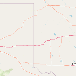

Leaflet | <a href="https://www.openstreetmap.org/copyright">© OpenStreetMap contributors</a>
Item
| Property | Value |
|---|---|
| id | 373918 |
| downstream_mainstem_id | https://geoconnex.us/ref/mainstems/353521 |
| encompassing_mainstem_basins | ['https://geoconnex.us/ref/mainstems/353521', 'https://geoconnex.us/ref/mainstems/314446', 'https://geoconnex.us/ref/mainstems/312091'] |
| featuretype | ['https://www.opengis.net/def/schema/hy_features/hyf/HY_FlowPath', 'https://www.opengis.net/def/schema/hy_features/hyf/HY_WaterBody'] |
| fid | 21676 |
| head_2020huc12 | 111102040301 |
| head_nhdpv1_comid | 7805857 |
| head_nhdpv2_comid | https://geoconnex.us/nhdplusv2/comid/7805857 |
| head_nhdpv2huc12 | https://geoconnex.us/nhdplusv2/huc12/111102040301 |
| head_rf1id | 35960 |
| lengthkm | 80.8 |
| name_at_outlet | Dutch Creek |
| name_at_outlet_gnis_id | 81856 |
| new_mainstemid | |
| outlet_2020huc12 | 111102040304 |
| outlet_drainagearea_sqkm | 370.8 |
| outlet_nhdpv1_comid | 7803471 |
| outlet_nhdpv2_comid | https://geoconnex.us/nhdplusv2/comid/7803471 |
| outlet_nhdpv2huc12 | https://geoconnex.us/nhdplusv2/huc12/111102040304 |
| outlet_rf1id | 35960 |
| superseded | False |
| uri | https://geoconnex.us/ref/mainstems/373918 |
Graph Results
| monitoringLocation | https://sta.geoconnex.dev/collections/USGS/Things/items/'USGS-07259950' |
|---|---|
| siteName | USGS-07259950 |
| datasetDescription | Discharge cubic feet per second / USGS-07259950-6dfd4499d4084c19a53679f43f95c6f9 |
| type | Stream |
| url | https://waterdata.usgs.gov/monitoring-location/07259950/#parameterCode=00060 |
| variableMeasured | Discharge |
| variableUnit | ft^3/s |
| measurementTechnique | observation |
| temporalCoverage | 2024-08-30T09:15:00Z/2024-09-09T17:45:00Z |
| distributionName | USGS Instantaneous Values Service |
| distributionURL | https://waterservices.usgs.gov/nwis/iv/?sites=USGS:07259950¶meterCd=00060&format=rdb |
| distributionFormat | text/tab-separated-values |
| wkt | POINT (-93.72059166666666 34.95666111111112) |
| monitoringLocation | https://sta.geoconnex.dev/collections/USGS/Things/items/'USGS-07259950' |
|---|---|
| siteName | USGS-07259950 |
| datasetDescription | Discharge cubic feet per second / USGS-07259950-6dfd4499d4084c19a53679f43f95c6f9 |
| type | Stream |
| url | https://waterdata.usgs.gov/monitoring-location/07259950/#parameterCode=00060 |
| variableMeasured | Discharge |
| variableUnit | ft^3/s |
| measurementTechnique | observation |
| temporalCoverage | 2024-08-30T09:15:00Z/2024-09-09T17:45:00Z |
| distributionName | USGS SensorThings API |
| distributionURL | https://labs.waterdata.usgs.gov/sta/v1.1/Datastreams('6dfd4499d4084c19a53679f43f95c6f9')?$expand=Thing,Observations |
| distributionFormat | application/json |
| wkt | POINT (-93.72059166666666 34.95666111111112) |
| monitoringLocation | https://sta.geoconnex.dev/collections/USGS/Things/items/'USGS-07259950' |
|---|---|
| siteName | USGS-07259950 |
| datasetDescription | Gage height feet / USGS-07259950-935a7e1b13fb4ce4949e361a51da9421 |
| type | Stream |
| url | https://waterdata.usgs.gov/monitoring-location/07259950/#parameterCode=00065 |
| variableMeasured | Gage height |
| variableUnit | ft |
| measurementTechnique | observation |
| temporalCoverage | 2024-08-30T09:15:00Z/2024-09-09T17:45:00Z |
| distributionName | USGS Instantaneous Values Service |
| distributionURL | https://waterservices.usgs.gov/nwis/iv/?sites=USGS:07259950¶meterCd=00065&format=rdb |
| distributionFormat | text/tab-separated-values |
| wkt | POINT (-93.72059166666666 34.95666111111112) |
| monitoringLocation | https://sta.geoconnex.dev/collections/USGS/Things/items/'USGS-07259950' |
|---|---|
| siteName | USGS-07259950 |
| datasetDescription | Gage height feet / USGS-07259950-935a7e1b13fb4ce4949e361a51da9421 |
| type | Stream |
| url | https://waterdata.usgs.gov/monitoring-location/07259950/#parameterCode=00065 |
| variableMeasured | Gage height |
| variableUnit | ft |
| measurementTechnique | observation |
| temporalCoverage | 2024-08-30T09:15:00Z/2024-09-09T17:45:00Z |
| distributionName | USGS SensorThings API |
| distributionURL | https://labs.waterdata.usgs.gov/sta/v1.1/Datastreams('935a7e1b13fb4ce4949e361a51da9421')?$expand=Thing,Observations |
| distributionFormat | application/json |
| wkt | POINT (-93.72059166666666 34.95666111111112) |