Red Rock Creek
Map
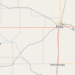
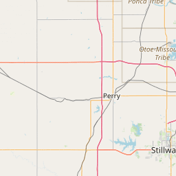
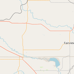
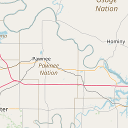
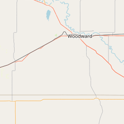
Leaflet | <a href="https://www.openstreetmap.org/copyright">© OpenStreetMap contributors</a>
Item
| Property | Value |
|---|---|
| id | 376559 |
| downstream_mainstem_id | https://geoconnex.us/ref/mainstems/314446 |
| encompassing_mainstem_basins | ['https://geoconnex.us/ref/mainstems/314446', 'https://geoconnex.us/ref/mainstems/312091'] |
| featuretype | ['https://www.opengis.net/def/schema/hy_features/hyf/HY_FlowPath', 'https://www.opengis.net/def/schema/hy_features/hyf/HY_WaterBody'] |
| fid | 20705 |
| head_2020huc12 | 110600060101 |
| head_nhdpv1_comid | 20970034 |
| head_nhdpv2_comid | https://geoconnex.us/nhdplusv2/comid/20970034 |
| head_nhdpv2huc12 | https://geoconnex.us/nhdplusv2/huc12/110600060101 |
| head_rf1id | 35019 |
| lengthkm | 137.6 |
| name_at_outlet | Red Rock Creek |
| name_at_outlet_gnis_id | 1097126 |
| new_mainstemid | |
| outlet_2020huc12 | 110600060204 |
| outlet_drainagearea_sqkm | 1260.4 |
| outlet_nhdpv1_comid | 20973118 |
| outlet_nhdpv2_comid | https://geoconnex.us/nhdplusv2/comid/20973118 |
| outlet_nhdpv2huc12 | https://geoconnex.us/nhdplusv2/huc12/110600060204 |
| outlet_rf1id | 35012 |
| superseded | False |
| uri | https://geoconnex.us/ref/mainstems/376559 |
Graph Results
| monitoringLocation | https://geoconnex.us/iow/wqp/USGS-362737097105301 |
|---|---|
| siteName | USGS-362737097105301 |
| datasetDescription | Total dissolved solids at USGS-362737097105301 |
| type | Well |
| url | https://www.waterqualitydata.us/provider/NWIS/USGS-OK/USGS-362737097105301/ |
| variableMeasured | Total dissolved solids |
| variableUnit | mg/l |
| measurementTechnique | observation |
| temporalCoverage | 1952-01-01T00:00:00Z/1952-12-31T00:00:00Z |
| distributionName | Water Quality Portal |
| distributionURL | https://www.waterqualitydata.us/data/Result/search?siteid=USGS-362737097105301&CharacteristicName=Total dissolved solids&mimeType=csv |
| distributionFormat | text/comma-separated-values |
| wkt | POINT (-97.18171 36.46031928) |
| monitoringLocation | https://geoconnex.us/iow/wqp/USGS-362737097105301 |
|---|---|
| siteName | USGS-362737097105301 |
| datasetDescription | Sulfate at USGS-362737097105301 |
| type | Well |
| url | https://www.waterqualitydata.us/provider/NWIS/USGS-OK/USGS-362737097105301/ |
| variableMeasured | Sulfate |
| variableUnit | mg/l |
| measurementTechnique | observation |
| temporalCoverage | 1952-01-01T00:00:00Z/1952-12-31T00:00:00Z |
| distributionName | Water Quality Portal |
| distributionURL | https://www.waterqualitydata.us/data/Result/search?siteid=USGS-362737097105301&CharacteristicName=Sulfate&mimeType=csv |
| distributionFormat | text/comma-separated-values |
| wkt | POINT (-97.18171 36.46031928) |
| monitoringLocation | https://geoconnex.us/iow/wqp/USGS-362737097105301 |
|---|---|
| siteName | USGS-362737097105301 |
| datasetDescription | Hardness, Ca, Mg at USGS-362737097105301 |
| type | Well |
| url | https://www.waterqualitydata.us/provider/NWIS/USGS-OK/USGS-362737097105301/ |
| variableMeasured | Hardness, Ca, Mg |
| variableUnit | mg/l CaCO3 |
| measurementTechnique | observation |
| temporalCoverage | 1952-01-01T00:00:00Z/1952-12-31T00:00:00Z |
| distributionName | Water Quality Portal |
| distributionURL | https://www.waterqualitydata.us/data/Result/search?siteid=USGS-362737097105301&CharacteristicName=Hardness, Ca, Mg&mimeType=csv |
| distributionFormat | text/comma-separated-values |
| wkt | POINT (-97.18171 36.46031928) |
| monitoringLocation | https://geoconnex.us/iow/wqp/USGS-362737097105301 |
|---|---|
| siteName | USGS-362737097105301 |
| datasetDescription | Carbonate at USGS-362737097105301 |
| type | Well |
| url | https://www.waterqualitydata.us/provider/NWIS/USGS-OK/USGS-362737097105301/ |
| variableMeasured | Carbonate |
| variableUnit | mg/l |
| measurementTechnique | observation |
| temporalCoverage | 1952-01-01T00:00:00Z/1952-12-31T00:00:00Z |
| distributionName | Water Quality Portal |
| distributionURL | https://www.waterqualitydata.us/data/Result/search?siteid=USGS-362737097105301&CharacteristicName=Carbonate&mimeType=csv |
| distributionFormat | text/comma-separated-values |
| wkt | POINT (-97.18171 36.46031928) |
| monitoringLocation | https://geoconnex.us/iow/wqp/USGS-362737097105301 |
|---|---|
| siteName | USGS-362737097105301 |
| datasetDescription | Fluoride at USGS-362737097105301 |
| type | Well |
| url | https://www.waterqualitydata.us/provider/NWIS/USGS-OK/USGS-362737097105301/ |
| variableMeasured | Fluoride |
| variableUnit | mg/l |
| measurementTechnique | observation |
| temporalCoverage | 1952-01-01T00:00:00Z/1952-12-31T00:00:00Z |
| distributionName | Water Quality Portal |
| distributionURL | https://www.waterqualitydata.us/data/Result/search?siteid=USGS-362737097105301&CharacteristicName=Fluoride&mimeType=csv |
| distributionFormat | text/comma-separated-values |
| wkt | POINT (-97.18171 36.46031928) |
| monitoringLocation | https://geoconnex.us/iow/wqp/USGS-362737097105301 |
|---|---|
| siteName | USGS-362737097105301 |
| datasetDescription | Iron at USGS-362737097105301 |
| type | Well |
| url | https://www.waterqualitydata.us/provider/NWIS/USGS-OK/USGS-362737097105301/ |
| variableMeasured | Iron |
| variableUnit | % |
| measurementTechnique | observation |
| temporalCoverage | 1952-01-01T00:00:00Z/1952-12-31T00:00:00Z |
| distributionName | Water Quality Portal |
| distributionURL | https://www.waterqualitydata.us/data/Result/search?siteid=USGS-362737097105301&CharacteristicName=Iron&mimeType=csv |
| distributionFormat | text/comma-separated-values |
| wkt | POINT (-97.18171 36.46031928) |
| monitoringLocation | https://geoconnex.us/iow/wqp/USGS-362737097105301 |
|---|---|
| siteName | USGS-362737097105301 |
| datasetDescription | Specific conductance at USGS-362737097105301 |
| type | Well |
| url | https://www.waterqualitydata.us/provider/NWIS/USGS-OK/USGS-362737097105301/ |
| variableMeasured | Specific conductance |
| variableUnit | umho/cm |
| measurementTechnique | observation |
| temporalCoverage | 1952-01-01T00:00:00Z/1952-12-31T00:00:00Z |
| distributionName | Water Quality Portal |
| distributionURL | https://www.waterqualitydata.us/data/Result/search?siteid=USGS-362737097105301&CharacteristicName=Specific conductance&mimeType=csv |
| distributionFormat | text/comma-separated-values |
| wkt | POINT (-97.18171 36.46031928) |
| monitoringLocation | https://geoconnex.us/iow/wqp/USGS-362737097105301 |
|---|---|
| siteName | USGS-362737097105301 |
| datasetDescription | Sodium plus potassium at USGS-362737097105301 |
| type | Well |
| url | https://www.waterqualitydata.us/provider/NWIS/USGS-OK/USGS-362737097105301/ |
| variableMeasured | Sodium plus potassium |
| variableUnit | mg/l as Na |
| measurementTechnique | observation |
| temporalCoverage | 1952-01-01T00:00:00Z/1952-12-31T00:00:00Z |
| distributionName | Water Quality Portal |
| distributionURL | https://www.waterqualitydata.us/data/Result/search?siteid=USGS-362737097105301&CharacteristicName=Sodium plus potassium&mimeType=csv |
| distributionFormat | text/comma-separated-values |
| wkt | POINT (-97.18171 36.46031928) |
| monitoringLocation | https://geoconnex.us/iow/wqp/USGS-362737097105301 |
|---|---|
| siteName | USGS-362737097105301 |
| datasetDescription | Calcium at USGS-362737097105301 |
| type | Well |
| url | https://www.waterqualitydata.us/provider/NWIS/USGS-OK/USGS-362737097105301/ |
| variableMeasured | Calcium |
| variableUnit | mg/L |
| measurementTechnique | observation |
| temporalCoverage | 1952-01-01T00:00:00Z/1952-12-31T00:00:00Z |
| distributionName | Water Quality Portal |
| distributionURL | https://www.waterqualitydata.us/data/Result/search?siteid=USGS-362737097105301&CharacteristicName=Calcium&mimeType=csv |
| distributionFormat | text/comma-separated-values |
| wkt | POINT (-97.18171 36.46031928) |
| monitoringLocation | https://geoconnex.us/iow/wqp/USGS-362737097105301 |
|---|---|
| siteName | USGS-362737097105301 |
| datasetDescription | Magnesium at USGS-362737097105301 |
| type | Well |
| url | https://www.waterqualitydata.us/provider/NWIS/USGS-OK/USGS-362737097105301/ |
| variableMeasured | Magnesium |
| variableUnit | % |
| measurementTechnique | observation |
| temporalCoverage | 1952-01-01T00:00:00Z/1952-12-31T00:00:00Z |
| distributionName | Water Quality Portal |
| distributionURL | https://www.waterqualitydata.us/data/Result/search?siteid=USGS-362737097105301&CharacteristicName=Magnesium&mimeType=csv |
| distributionFormat | text/comma-separated-values |
| wkt | POINT (-97.18171 36.46031928) |
| monitoringLocation | https://geoconnex.us/iow/wqp/USGS-362737097105301 |
|---|---|
| siteName | USGS-362737097105301 |
| datasetDescription | Silica at USGS-362737097105301 |
| type | Well |
| url | https://www.waterqualitydata.us/provider/NWIS/USGS-OK/USGS-362737097105301/ |
| variableMeasured | Silica |
| variableUnit | mg/l |
| measurementTechnique | observation |
| temporalCoverage | 1952-01-01T00:00:00Z/1952-12-31T00:00:00Z |
| distributionName | Water Quality Portal |
| distributionURL | https://www.waterqualitydata.us/data/Result/search?siteid=USGS-362737097105301&CharacteristicName=Silica&mimeType=csv |
| distributionFormat | text/comma-separated-values |
| wkt | POINT (-97.18171 36.46031928) |
| monitoringLocation | https://geoconnex.us/iow/wqp/USGS-362737097105301 |
|---|---|
| siteName | USGS-362737097105301 |
| datasetDescription | Chloride at USGS-362737097105301 |
| type | Well |
| url | https://www.waterqualitydata.us/provider/NWIS/USGS-OK/USGS-362737097105301/ |
| variableMeasured | Chloride |
| variableUnit | mg/l |
| measurementTechnique | observation |
| temporalCoverage | 1952-01-01T00:00:00Z/1952-12-31T00:00:00Z |
| distributionName | Water Quality Portal |
| distributionURL | https://www.waterqualitydata.us/data/Result/search?siteid=USGS-362737097105301&CharacteristicName=Chloride&mimeType=csv |
| distributionFormat | text/comma-separated-values |
| wkt | POINT (-97.18171 36.46031928) |
| monitoringLocation | https://geoconnex.us/iow/wqp/USGS-362737097105301 |
|---|---|
| siteName | USGS-362737097105301 |
| datasetDescription | Nitrate at USGS-362737097105301 |
| type | Well |
| url | https://www.waterqualitydata.us/provider/NWIS/USGS-OK/USGS-362737097105301/ |
| variableMeasured | Nitrate |
| variableUnit | mg/l as N |
| measurementTechnique | observation |
| temporalCoverage | 1952-01-01T00:00:00Z/1952-12-31T00:00:00Z |
| distributionName | Water Quality Portal |
| distributionURL | https://www.waterqualitydata.us/data/Result/search?siteid=USGS-362737097105301&CharacteristicName=Nitrate&mimeType=csv |
| distributionFormat | text/comma-separated-values |
| wkt | POINT (-97.18171 36.46031928) |
| monitoringLocation | https://geoconnex.us/iow/wqp/USGS-362737097105301 |
|---|---|
| siteName | USGS-362737097105301 |
| datasetDescription | Bicarbonate at USGS-362737097105301 |
| type | Well |
| url | https://www.waterqualitydata.us/provider/NWIS/USGS-OK/USGS-362737097105301/ |
| variableMeasured | Bicarbonate |
| variableUnit | mg/l |
| measurementTechnique | observation |
| temporalCoverage | 1952-01-01T00:00:00Z/1952-12-31T00:00:00Z |
| distributionName | Water Quality Portal |
| distributionURL | https://www.waterqualitydata.us/data/Result/search?siteid=USGS-362737097105301&CharacteristicName=Bicarbonate&mimeType=csv |
| distributionFormat | text/comma-separated-values |
| wkt | POINT (-97.18171 36.46031928) |
| monitoringLocation | https://geoconnex.us/iow/wqp/USGS-07152350 |
|---|---|
| siteName | USGS-07152350 |
| datasetDescription | Sulfate at USGS-07152350 |
| type | Stream |
| url | https://www.waterqualitydata.us/provider/NWIS/USGS-OK/USGS-07152350/ |
| variableMeasured | Sulfate |
| variableUnit | mg/l |
| measurementTechnique | observation |
| temporalCoverage | 1951-01-01T00:00:00Z/1963-12-31T00:00:00Z |
| distributionName | Water Quality Portal |
| distributionURL | https://www.waterqualitydata.us/data/Result/search?siteid=USGS-07152350&CharacteristicName=Sulfate&mimeType=csv |
| distributionFormat | text/comma-separated-values |
| wkt | POINT (-97.0711519 36.49170995) |
| monitoringLocation | https://geoconnex.us/iow/wqp/USGS-07152350 |
|---|---|
| siteName | USGS-07152350 |
| datasetDescription | Total dissolved solids at USGS-07152350 |
| type | Stream |
| url | https://www.waterqualitydata.us/provider/NWIS/USGS-OK/USGS-07152350/ |
| variableMeasured | Total dissolved solids |
| variableUnit | mg/l |
| measurementTechnique | observation |
| temporalCoverage | 1951-01-01T00:00:00Z/1963-12-31T00:00:00Z |
| distributionName | Water Quality Portal |
| distributionURL | https://www.waterqualitydata.us/data/Result/search?siteid=USGS-07152350&CharacteristicName=Total dissolved solids&mimeType=csv |
| distributionFormat | text/comma-separated-values |
| wkt | POINT (-97.0711519 36.49170995) |
| monitoringLocation | https://geoconnex.us/iow/wqp/USGS-07152350 |
|---|---|
| siteName | USGS-07152350 |
| datasetDescription | Sodium at USGS-07152350 |
| type | Stream |
| url | https://www.waterqualitydata.us/provider/NWIS/USGS-OK/USGS-07152350/ |
| variableMeasured | Sodium |
| variableUnit | mg/l |
| measurementTechnique | observation |
| temporalCoverage | 1952-01-01T00:00:00Z/1963-12-31T00:00:00Z |
| distributionName | Water Quality Portal |
| distributionURL | https://www.waterqualitydata.us/data/Result/search?siteid=USGS-07152350&CharacteristicName=Sodium&mimeType=csv |
| distributionFormat | text/comma-separated-values |
| wkt | POINT (-97.0711519 36.49170995) |
| monitoringLocation | https://geoconnex.us/iow/wqp/USGS-07152350 |
|---|---|
| siteName | USGS-07152350 |
| datasetDescription | Bicarbonate at USGS-07152350 |
| type | Stream |
| url | https://www.waterqualitydata.us/provider/NWIS/USGS-OK/USGS-07152350/ |
| variableMeasured | Bicarbonate |
| variableUnit | mg/l |
| measurementTechnique | observation |
| temporalCoverage | 1951-01-01T00:00:00Z/1963-12-31T00:00:00Z |
| distributionName | Water Quality Portal |
| distributionURL | https://www.waterqualitydata.us/data/Result/search?siteid=USGS-07152350&CharacteristicName=Bicarbonate&mimeType=csv |
| distributionFormat | text/comma-separated-values |
| wkt | POINT (-97.0711519 36.49170995) |
| monitoringLocation | https://geoconnex.us/iow/wqp/USGS-07152350 |
|---|---|
| siteName | USGS-07152350 |
| datasetDescription | Temperature, water at USGS-07152350 |
| type | Stream |
| url | https://www.waterqualitydata.us/provider/NWIS/USGS-OK/USGS-07152350/ |
| variableMeasured | Temperature, water |
| variableUnit | deg C |
| measurementTechnique | observation |
| temporalCoverage | 1951-01-01T00:00:00Z/1957-12-31T00:00:00Z |
| distributionName | Water Quality Portal |
| distributionURL | https://www.waterqualitydata.us/data/Result/search?siteid=USGS-07152350&CharacteristicName=Temperature, water&mimeType=csv |
| distributionFormat | text/comma-separated-values |
| wkt | POINT (-97.0711519 36.49170995) |
| monitoringLocation | https://geoconnex.us/iow/wqp/USGS-07152350 |
|---|---|
| siteName | USGS-07152350 |
| datasetDescription | Carbon dioxide at USGS-07152350 |
| type | Stream |
| url | https://www.waterqualitydata.us/provider/NWIS/USGS-OK/USGS-07152350/ |
| variableMeasured | Carbon dioxide |
| variableUnit | mg/l |
| measurementTechnique | observation |
| temporalCoverage | 1951-01-01T00:00:00Z/1963-12-31T00:00:00Z |
| distributionName | Water Quality Portal |
| distributionURL | https://www.waterqualitydata.us/data/Result/search?siteid=USGS-07152350&CharacteristicName=Carbon dioxide&mimeType=csv |
| distributionFormat | text/comma-separated-values |
| wkt | POINT (-97.0711519 36.49170995) |
| monitoringLocation | https://geoconnex.us/iow/wqp/USGS-07152350 |
|---|---|
| siteName | USGS-07152350 |
| datasetDescription | Chloride at USGS-07152350 |
| type | Stream |
| url | https://www.waterqualitydata.us/provider/NWIS/USGS-OK/USGS-07152350/ |
| variableMeasured | Chloride |
| variableUnit | mg/l |
| measurementTechnique | observation |
| temporalCoverage | 1951-01-01T00:00:00Z/1963-12-31T00:00:00Z |
| distributionName | Water Quality Portal |
| distributionURL | https://www.waterqualitydata.us/data/Result/search?siteid=USGS-07152350&CharacteristicName=Chloride&mimeType=csv |
| distributionFormat | text/comma-separated-values |
| wkt | POINT (-97.0711519 36.49170995) |
| monitoringLocation | https://geoconnex.us/iow/wqp/USGS-07152350 |
|---|---|
| siteName | USGS-07152350 |
| datasetDescription | Stream flow at USGS-07152350 |
| type | Stream |
| url | https://www.waterqualitydata.us/provider/NWIS/USGS-OK/USGS-07152350/ |
| variableMeasured | Stream flow |
| variableUnit | ft3/s |
| measurementTechnique | observation |
| temporalCoverage | 1951-01-01T00:00:00Z/1957-12-31T00:00:00Z |
| distributionName | Water Quality Portal |
| distributionURL | https://www.waterqualitydata.us/data/Result/search?siteid=USGS-07152350&CharacteristicName=Stream flow&mimeType=csv |
| distributionFormat | text/comma-separated-values |
| wkt | POINT (-97.0711519 36.49170995) |
| monitoringLocation | https://geoconnex.us/iow/wqp/USGS-07152350 |
|---|---|
| siteName | USGS-07152350 |
| datasetDescription | pH at USGS-07152350 |
| type | Stream |
| url | https://www.waterqualitydata.us/provider/NWIS/USGS-OK/USGS-07152350/ |
| variableMeasured | pH |
| variableUnit | None |
| measurementTechnique | observation |
| temporalCoverage | 1951-01-01T00:00:00Z/1963-12-31T00:00:00Z |
| distributionName | Water Quality Portal |
| distributionURL | https://www.waterqualitydata.us/data/Result/search?siteid=USGS-07152350&CharacteristicName=pH&mimeType=csv |
| distributionFormat | text/comma-separated-values |
| wkt | POINT (-97.0711519 36.49170995) |
| monitoringLocation | https://geoconnex.us/iow/wqp/USGS-07152350 |
|---|---|
| siteName | USGS-07152350 |
| datasetDescription | Hardness, non-carbonate at USGS-07152350 |
| type | Stream |
| url | https://www.waterqualitydata.us/provider/NWIS/USGS-OK/USGS-07152350/ |
| variableMeasured | Hardness, non-carbonate |
| variableUnit | mg/l CaCO3 |
| measurementTechnique | observation |
| temporalCoverage | 1951-01-01T00:00:00Z/1963-12-31T00:00:00Z |
| distributionName | Water Quality Portal |
| distributionURL | https://www.waterqualitydata.us/data/Result/search?siteid=USGS-07152350&CharacteristicName=Hardness, non-carbonate&mimeType=csv |
| distributionFormat | text/comma-separated-values |
| wkt | POINT (-97.0711519 36.49170995) |
| monitoringLocation | https://geoconnex.us/iow/wqp/USGS-07152350 |
|---|---|
| siteName | USGS-07152350 |
| datasetDescription | Sodium plus potassium at USGS-07152350 |
| type | Stream |
| url | https://www.waterqualitydata.us/provider/NWIS/USGS-OK/USGS-07152350/ |
| variableMeasured | Sodium plus potassium |
| variableUnit | mg/l as Na |
| measurementTechnique | observation |
| temporalCoverage | 1951-01-01T00:00:00Z/1958-12-31T00:00:00Z |
| distributionName | Water Quality Portal |
| distributionURL | https://www.waterqualitydata.us/data/Result/search?siteid=USGS-07152350&CharacteristicName=Sodium plus potassium&mimeType=csv |
| distributionFormat | text/comma-separated-values |
| wkt | POINT (-97.0711519 36.49170995) |
| monitoringLocation | https://geoconnex.us/iow/wqp/USGS-07152350 |
|---|---|
| siteName | USGS-07152350 |
| datasetDescription | Magnesium at USGS-07152350 |
| type | Stream |
| url | https://www.waterqualitydata.us/provider/NWIS/USGS-OK/USGS-07152350/ |
| variableMeasured | Magnesium |
| variableUnit | % |
| measurementTechnique | observation |
| temporalCoverage | 1951-01-01T00:00:00Z/1958-12-31T00:00:00Z |
| distributionName | Water Quality Portal |
| distributionURL | https://www.waterqualitydata.us/data/Result/search?siteid=USGS-07152350&CharacteristicName=Magnesium&mimeType=csv |
| distributionFormat | text/comma-separated-values |
| wkt | POINT (-97.0711519 36.49170995) |
| monitoringLocation | https://geoconnex.us/iow/wqp/USGS-07152350 |
|---|---|
| siteName | USGS-07152350 |
| datasetDescription | Alkalinity at USGS-07152350 |
| type | Stream |
| url | https://www.waterqualitydata.us/provider/NWIS/USGS-OK/USGS-07152350/ |
| variableMeasured | Alkalinity |
| variableUnit | mg/l CaCO3 |
| measurementTechnique | observation |
| temporalCoverage | 1951-01-01T00:00:00Z/1958-12-31T00:00:00Z |
| distributionName | Water Quality Portal |
| distributionURL | https://www.waterqualitydata.us/data/Result/search?siteid=USGS-07152350&CharacteristicName=Alkalinity&mimeType=csv |
| distributionFormat | text/comma-separated-values |
| wkt | POINT (-97.0711519 36.49170995) |
| monitoringLocation | https://geoconnex.us/iow/wqp/USGS-07152350 |
|---|---|
| siteName | USGS-07152350 |
| datasetDescription | Carbonate at USGS-07152350 |
| type | Stream |
| url | https://www.waterqualitydata.us/provider/NWIS/USGS-OK/USGS-07152350/ |
| variableMeasured | Carbonate |
| variableUnit | mg/l |
| measurementTechnique | observation |
| temporalCoverage | 1951-01-01T00:00:00Z/1963-12-31T00:00:00Z |
| distributionName | Water Quality Portal |
| distributionURL | https://www.waterqualitydata.us/data/Result/search?siteid=USGS-07152350&CharacteristicName=Carbonate&mimeType=csv |
| distributionFormat | text/comma-separated-values |
| wkt | POINT (-97.0711519 36.49170995) |
| monitoringLocation | https://geoconnex.us/iow/wqp/USGS-07152350 |
|---|---|
| siteName | USGS-07152350 |
| datasetDescription | Nitrate at USGS-07152350 |
| type | Stream |
| url | https://www.waterqualitydata.us/provider/NWIS/USGS-OK/USGS-07152350/ |
| variableMeasured | Nitrate |
| variableUnit | mg/l as N |
| measurementTechnique | observation |
| temporalCoverage | 1951-01-01T00:00:00Z/1962-12-31T00:00:00Z |
| distributionName | Water Quality Portal |
| distributionURL | https://www.waterqualitydata.us/data/Result/search?siteid=USGS-07152350&CharacteristicName=Nitrate&mimeType=csv |
| distributionFormat | text/comma-separated-values |
| wkt | POINT (-97.0711519 36.49170995) |
| monitoringLocation | https://geoconnex.us/iow/wqp/USGS-07152350 |
|---|---|
| siteName | USGS-07152350 |
| datasetDescription | Specific conductance at USGS-07152350 |
| type | Stream |
| url | https://www.waterqualitydata.us/provider/NWIS/USGS-OK/USGS-07152350/ |
| variableMeasured | Specific conductance |
| variableUnit | umho/cm |
| measurementTechnique | observation |
| temporalCoverage | 1951-01-01T00:00:00Z/1963-12-31T00:00:00Z |
| distributionName | Water Quality Portal |
| distributionURL | https://www.waterqualitydata.us/data/Result/search?siteid=USGS-07152350&CharacteristicName=Specific conductance&mimeType=csv |
| distributionFormat | text/comma-separated-values |
| wkt | POINT (-97.0711519 36.49170995) |
| monitoringLocation | https://geoconnex.us/iow/wqp/USGS-07152350 |
|---|---|
| siteName | USGS-07152350 |
| datasetDescription | Calcium at USGS-07152350 |
| type | Stream |
| url | https://www.waterqualitydata.us/provider/NWIS/USGS-OK/USGS-07152350/ |
| variableMeasured | Calcium |
| variableUnit | mg/L |
| measurementTechnique | observation |
| temporalCoverage | 1951-01-01T00:00:00Z/1958-12-31T00:00:00Z |
| distributionName | Water Quality Portal |
| distributionURL | https://www.waterqualitydata.us/data/Result/search?siteid=USGS-07152350&CharacteristicName=Calcium&mimeType=csv |
| distributionFormat | text/comma-separated-values |
| wkt | POINT (-97.0711519 36.49170995) |
| monitoringLocation | https://geoconnex.us/iow/wqp/USGS-07152350 |
|---|---|
| siteName | USGS-07152350 |
| datasetDescription | Hardness, Ca, Mg at USGS-07152350 |
| type | Stream |
| url | https://www.waterqualitydata.us/provider/NWIS/USGS-OK/USGS-07152350/ |
| variableMeasured | Hardness, Ca, Mg |
| variableUnit | mg/l CaCO3 |
| measurementTechnique | observation |
| temporalCoverage | 1951-01-01T00:00:00Z/1963-12-31T00:00:00Z |
| distributionName | Water Quality Portal |
| distributionURL | https://www.waterqualitydata.us/data/Result/search?siteid=USGS-07152350&CharacteristicName=Hardness, Ca, Mg&mimeType=csv |
| distributionFormat | text/comma-separated-values |
| wkt | POINT (-97.0711519 36.49170995) |
| monitoringLocation | https://geoconnex.us/iow/wqp/USGS-362800097111501 |
|---|---|
| siteName | USGS-362800097111501 |
| datasetDescription | Bicarbonate at USGS-362800097111501 |
| type | Well |
| url | https://www.waterqualitydata.us/provider/NWIS/USGS-OK/USGS-362800097111501/ |
| variableMeasured | Bicarbonate |
| variableUnit | mg/l |
| measurementTechnique | observation |
| temporalCoverage | 1973-01-01T00:00:00Z/1973-12-31T00:00:00Z |
| distributionName | Water Quality Portal |
| distributionURL | https://www.waterqualitydata.us/data/Result/search?siteid=USGS-362800097111501&CharacteristicName=Bicarbonate&mimeType=csv |
| distributionFormat | text/comma-separated-values |
| wkt | POINT (-97.1878214 36.46670796) |
| monitoringLocation | https://geoconnex.us/iow/wqp/USGS-362800097111501 |
|---|---|
| siteName | USGS-362800097111501 |
| datasetDescription | Sodium at USGS-362800097111501 |
| type | Well |
| url | https://www.waterqualitydata.us/provider/NWIS/USGS-OK/USGS-362800097111501/ |
| variableMeasured | Sodium |
| variableUnit | mg/l |
| measurementTechnique | observation |
| temporalCoverage | 1973-01-01T00:00:00Z/1973-12-31T00:00:00Z |
| distributionName | Water Quality Portal |
| distributionURL | https://www.waterqualitydata.us/data/Result/search?siteid=USGS-362800097111501&CharacteristicName=Sodium&mimeType=csv |
| distributionFormat | text/comma-separated-values |
| wkt | POINT (-97.1878214 36.46670796) |
| monitoringLocation | https://geoconnex.us/iow/wqp/USGS-362800097111501 |
|---|---|
| siteName | USGS-362800097111501 |
| datasetDescription | Carbon dioxide at USGS-362800097111501 |
| type | Well |
| url | https://www.waterqualitydata.us/provider/NWIS/USGS-OK/USGS-362800097111501/ |
| variableMeasured | Carbon dioxide |
| variableUnit | mg/l |
| measurementTechnique | observation |
| temporalCoverage | 1973-01-01T00:00:00Z/1973-12-31T00:00:00Z |
| distributionName | Water Quality Portal |
| distributionURL | https://www.waterqualitydata.us/data/Result/search?siteid=USGS-362800097111501&CharacteristicName=Carbon dioxide&mimeType=csv |
| distributionFormat | text/comma-separated-values |
| wkt | POINT (-97.1878214 36.46670796) |
| monitoringLocation | https://geoconnex.us/iow/wqp/USGS-362800097111501 |
|---|---|
| siteName | USGS-362800097111501 |
| datasetDescription | Chloride at USGS-362800097111501 |
| type | Well |
| url | https://www.waterqualitydata.us/provider/NWIS/USGS-OK/USGS-362800097111501/ |
| variableMeasured | Chloride |
| variableUnit | mg/l |
| measurementTechnique | observation |
| temporalCoverage | 1973-01-01T00:00:00Z/1973-12-31T00:00:00Z |
| distributionName | Water Quality Portal |
| distributionURL | https://www.waterqualitydata.us/data/Result/search?siteid=USGS-362800097111501&CharacteristicName=Chloride&mimeType=csv |
| distributionFormat | text/comma-separated-values |
| wkt | POINT (-97.1878214 36.46670796) |
| monitoringLocation | https://geoconnex.us/iow/wqp/USGS-362800097111501 |
|---|---|
| siteName | USGS-362800097111501 |
| datasetDescription | Sulfate at USGS-362800097111501 |
| type | Well |
| url | https://www.waterqualitydata.us/provider/NWIS/USGS-OK/USGS-362800097111501/ |
| variableMeasured | Sulfate |
| variableUnit | mg/l |
| measurementTechnique | observation |
| temporalCoverage | 1973-01-01T00:00:00Z/1973-12-31T00:00:00Z |
| distributionName | Water Quality Portal |
| distributionURL | https://www.waterqualitydata.us/data/Result/search?siteid=USGS-362800097111501&CharacteristicName=Sulfate&mimeType=csv |
| distributionFormat | text/comma-separated-values |
| wkt | POINT (-97.1878214 36.46670796) |
| monitoringLocation | https://geoconnex.us/iow/wqp/USGS-362800097111501 |
|---|---|
| siteName | USGS-362800097111501 |
| datasetDescription | pH at USGS-362800097111501 |
| type | Well |
| url | https://www.waterqualitydata.us/provider/NWIS/USGS-OK/USGS-362800097111501/ |
| variableMeasured | pH |
| variableUnit | None |
| measurementTechnique | observation |
| temporalCoverage | 1973-01-01T00:00:00Z/1973-12-31T00:00:00Z |
| distributionName | Water Quality Portal |
| distributionURL | https://www.waterqualitydata.us/data/Result/search?siteid=USGS-362800097111501&CharacteristicName=pH&mimeType=csv |
| distributionFormat | text/comma-separated-values |
| wkt | POINT (-97.1878214 36.46670796) |
| monitoringLocation | https://geoconnex.us/iow/wqp/USGS-362800097111501 |
|---|---|
| siteName | USGS-362800097111501 |
| datasetDescription | Total dissolved solids at USGS-362800097111501 |
| type | Well |
| url | https://www.waterqualitydata.us/provider/NWIS/USGS-OK/USGS-362800097111501/ |
| variableMeasured | Total dissolved solids |
| variableUnit | mg/l |
| measurementTechnique | observation |
| temporalCoverage | 1973-01-01T00:00:00Z/1973-12-31T00:00:00Z |
| distributionName | Water Quality Portal |
| distributionURL | https://www.waterqualitydata.us/data/Result/search?siteid=USGS-362800097111501&CharacteristicName=Total dissolved solids&mimeType=csv |
| distributionFormat | text/comma-separated-values |
| wkt | POINT (-97.1878214 36.46670796) |
| monitoringLocation | https://geoconnex.us/iow/wqp/USGS-362800097111501 |
|---|---|
| siteName | USGS-362800097111501 |
| datasetDescription | Carbonate at USGS-362800097111501 |
| type | Well |
| url | https://www.waterqualitydata.us/provider/NWIS/USGS-OK/USGS-362800097111501/ |
| variableMeasured | Carbonate |
| variableUnit | mg/l |
| measurementTechnique | observation |
| temporalCoverage | 1973-01-01T00:00:00Z/1973-12-31T00:00:00Z |
| distributionName | Water Quality Portal |
| distributionURL | https://www.waterqualitydata.us/data/Result/search?siteid=USGS-362800097111501&CharacteristicName=Carbonate&mimeType=csv |
| distributionFormat | text/comma-separated-values |
| wkt | POINT (-97.1878214 36.46670796) |
| monitoringLocation | https://geoconnex.us/iow/wqp/USGS-362800097111501 |
|---|---|
| siteName | USGS-362800097111501 |
| datasetDescription | Calcium at USGS-362800097111501 |
| type | Well |
| url | https://www.waterqualitydata.us/provider/NWIS/USGS-OK/USGS-362800097111501/ |
| variableMeasured | Calcium |
| variableUnit | mg/L |
| measurementTechnique | observation |
| temporalCoverage | 1973-01-01T00:00:00Z/1973-12-31T00:00:00Z |
| distributionName | Water Quality Portal |
| distributionURL | https://www.waterqualitydata.us/data/Result/search?siteid=USGS-362800097111501&CharacteristicName=Calcium&mimeType=csv |
| distributionFormat | text/comma-separated-values |
| wkt | POINT (-97.1878214 36.46670796) |
| monitoringLocation | https://geoconnex.us/iow/wqp/USGS-362800097111501 |
|---|---|
| siteName | USGS-362800097111501 |
| datasetDescription | Specific conductance at USGS-362800097111501 |
| type | Well |
| url | https://www.waterqualitydata.us/provider/NWIS/USGS-OK/USGS-362800097111501/ |
| variableMeasured | Specific conductance |
| variableUnit | umho/cm |
| measurementTechnique | observation |
| temporalCoverage | 1973-01-01T00:00:00Z/1973-12-31T00:00:00Z |
| distributionName | Water Quality Portal |
| distributionURL | https://www.waterqualitydata.us/data/Result/search?siteid=USGS-362800097111501&CharacteristicName=Specific conductance&mimeType=csv |
| distributionFormat | text/comma-separated-values |
| wkt | POINT (-97.1878214 36.46670796) |
| monitoringLocation | https://geoconnex.us/iow/wqp/USGS-362800097111501 |
|---|---|
| siteName | USGS-362800097111501 |
| datasetDescription | Hardness, Ca, Mg at USGS-362800097111501 |
| type | Well |
| url | https://www.waterqualitydata.us/provider/NWIS/USGS-OK/USGS-362800097111501/ |
| variableMeasured | Hardness, Ca, Mg |
| variableUnit | mg/l CaCO3 |
| measurementTechnique | observation |
| temporalCoverage | 1973-01-01T00:00:00Z/1973-12-31T00:00:00Z |
| distributionName | Water Quality Portal |
| distributionURL | https://www.waterqualitydata.us/data/Result/search?siteid=USGS-362800097111501&CharacteristicName=Hardness, Ca, Mg&mimeType=csv |
| distributionFormat | text/comma-separated-values |
| wkt | POINT (-97.1878214 36.46670796) |
| monitoringLocation | https://geoconnex.us/iow/wqp/USGS-362800097111501 |
|---|---|
| siteName | USGS-362800097111501 |
| datasetDescription | Inorganic nitrogen (nitrate and nitrite) at USGS-362800097111501 |
| type | Well |
| url | https://www.waterqualitydata.us/provider/NWIS/USGS-OK/USGS-362800097111501/ |
| variableMeasured | Inorganic nitrogen (nitrate and nitrite) |
| variableUnit | mg/l as N |
| measurementTechnique | observation |
| temporalCoverage | 1973-01-01T00:00:00Z/1973-12-31T00:00:00Z |
| distributionName | Water Quality Portal |
| distributionURL | https://www.waterqualitydata.us/data/Result/search?siteid=USGS-362800097111501&CharacteristicName=Inorganic nitrogen (nitrate and nitrite)&mimeType=csv |
| distributionFormat | text/comma-separated-values |
| wkt | POINT (-97.1878214 36.46670796) |
| monitoringLocation | https://geoconnex.us/iow/wqp/USGS-362800097111501 |
|---|---|
| siteName | USGS-362800097111501 |
| datasetDescription | Hardness, non-carbonate at USGS-362800097111501 |
| type | Well |
| url | https://www.waterqualitydata.us/provider/NWIS/USGS-OK/USGS-362800097111501/ |
| variableMeasured | Hardness, non-carbonate |
| variableUnit | mg/l CaCO3 |
| measurementTechnique | observation |
| temporalCoverage | 1973-01-01T00:00:00Z/1973-12-31T00:00:00Z |
| distributionName | Water Quality Portal |
| distributionURL | https://www.waterqualitydata.us/data/Result/search?siteid=USGS-362800097111501&CharacteristicName=Hardness, non-carbonate&mimeType=csv |
| distributionFormat | text/comma-separated-values |
| wkt | POINT (-97.1878214 36.46670796) |
| monitoringLocation | https://geoconnex.us/iow/wqp/USGS-362800097111501 |
|---|---|
| siteName | USGS-362800097111501 |
| datasetDescription | Alkalinity at USGS-362800097111501 |
| type | Well |
| url | https://www.waterqualitydata.us/provider/NWIS/USGS-OK/USGS-362800097111501/ |
| variableMeasured | Alkalinity |
| variableUnit | mg/l CaCO3 |
| measurementTechnique | observation |
| temporalCoverage | 1973-01-01T00:00:00Z/1973-12-31T00:00:00Z |
| distributionName | Water Quality Portal |
| distributionURL | https://www.waterqualitydata.us/data/Result/search?siteid=USGS-362800097111501&CharacteristicName=Alkalinity&mimeType=csv |
| distributionFormat | text/comma-separated-values |
| wkt | POINT (-97.1878214 36.46670796) |
| monitoringLocation | https://geoconnex.us/iow/wqp/USGS-362800097111501 |
|---|---|
| siteName | USGS-362800097111501 |
| datasetDescription | Magnesium at USGS-362800097111501 |
| type | Well |
| url | https://www.waterqualitydata.us/provider/NWIS/USGS-OK/USGS-362800097111501/ |
| variableMeasured | Magnesium |
| variableUnit | % |
| measurementTechnique | observation |
| temporalCoverage | 1973-01-01T00:00:00Z/1973-12-31T00:00:00Z |
| distributionName | Water Quality Portal |
| distributionURL | https://www.waterqualitydata.us/data/Result/search?siteid=USGS-362800097111501&CharacteristicName=Magnesium&mimeType=csv |
| distributionFormat | text/comma-separated-values |
| wkt | POINT (-97.1878214 36.46670796) |
| monitoringLocation | https://geoconnex.us/iow/wqp/USGS-362800097111501 |
|---|---|
| siteName | USGS-362800097111501 |
| datasetDescription | Temperature, water at USGS-362800097111501 |
| type | Well |
| url | https://www.waterqualitydata.us/provider/NWIS/USGS-OK/USGS-362800097111501/ |
| variableMeasured | Temperature, water |
| variableUnit | deg C |
| measurementTechnique | observation |
| temporalCoverage | 1973-01-01T00:00:00Z/1973-12-31T00:00:00Z |
| distributionName | Water Quality Portal |
| distributionURL | https://www.waterqualitydata.us/data/Result/search?siteid=USGS-362800097111501&CharacteristicName=Temperature, water&mimeType=csv |
| distributionFormat | text/comma-separated-values |
| wkt | POINT (-97.1878214 36.46670796) |