Square Butte Creek
Map
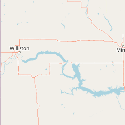
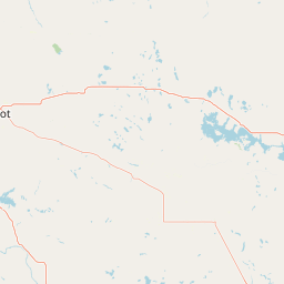
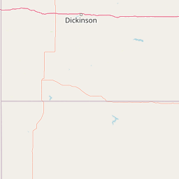
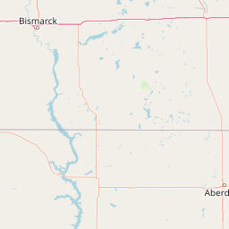
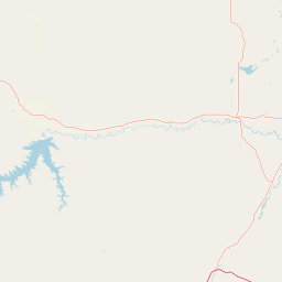
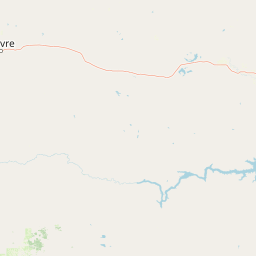
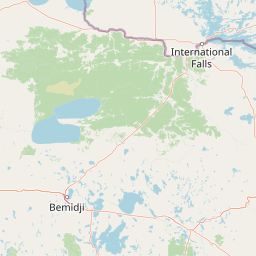

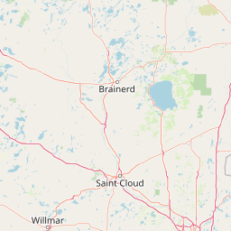
Leaflet | <a href="https://www.openstreetmap.org/copyright">© OpenStreetMap contributors</a>
Item
| Property | Value |
|---|---|
| id | 376664 |
| downstream_mainstem_id | https://geoconnex.us/ref/mainstems/312532 |
| encompassing_mainstem_basins | ['https://geoconnex.us/ref/mainstems/312532', 'https://geoconnex.us/ref/mainstems/312091'] |
| featuretype | ['https://www.opengis.net/def/schema/hy_features/hyf/HY_FlowPath', 'https://www.opengis.net/def/schema/hy_features/hyf/HY_WaterBody'] |
| fid | 16806 |
| head_2020huc12 | 101301010801 |
| head_nhdpv1_comid | 14519101 |
| head_nhdpv2_comid | https://geoconnex.us/nhdplusv2/comid/14519101 |
| head_nhdpv2huc12 | https://geoconnex.us/nhdplusv2/huc12/101301010801 |
| head_rf1id | 26481 |
| lengthkm | 112.8 |
| name_at_outlet | Square Butte Creek |
| name_at_outlet_gnis_id | 1032261 |
| new_mainstemid | |
| outlet_2020huc12 | 101301010806 |
| outlet_drainagearea_sqkm | 777.2 |
| outlet_nhdpv1_comid | 14523595 |
| outlet_nhdpv2_comid | https://geoconnex.us/nhdplusv2/comid/14523595 |
| outlet_nhdpv2huc12 | https://geoconnex.us/nhdplusv2/huc12/101301010806 |
| outlet_rf1id | 26479 |
| superseded | False |
| uri | https://geoconnex.us/ref/mainstems/376664 |
Graph Results
| monitoringLocation | https://geoconnex.us/iow/wqp/21NDHDWQ_WQX-380103 |
|---|---|
| siteName | 21NDHDWQ_WQX-380103 |
| datasetDescription | Conductivity at 21NDHDWQ_WQX-380103 |
| type | River/Stream |
| url | https://www.waterqualitydata.us/provider/STORET/21NDHDWQ_WQX/21NDHDWQ_WQX-380103/ |
| variableMeasured | Conductivity |
| variableUnit | uS/cm |
| measurementTechnique | observation |
| temporalCoverage | 1993-01-01T00:00:00Z/1993-12-31T00:00:00Z |
| distributionName | Water Quality Portal |
| distributionURL | https://www.waterqualitydata.us/data/Result/search?siteid=21NDHDWQ_WQX-380103&CharacteristicName=Conductivity&mimeType=csv |
| distributionFormat | text/comma-separated-values |
| wkt | POINT (-101.19417 47.06033) |
| monitoringLocation | https://geoconnex.us/iow/wqp/21NDHDWQ_WQX-380103 |
|---|---|
| siteName | 21NDHDWQ_WQX-380103 |
| datasetDescription | Selenium at 21NDHDWQ_WQX-380103 |
| type | River/Stream |
| url | https://www.waterqualitydata.us/provider/STORET/21NDHDWQ_WQX/21NDHDWQ_WQX-380103/ |
| variableMeasured | Selenium |
| variableUnit | ug/l |
| measurementTechnique | observation |
| temporalCoverage | 1993-01-01T00:00:00Z/1993-12-31T00:00:00Z |
| distributionName | Water Quality Portal |
| distributionURL | https://www.waterqualitydata.us/data/Result/search?siteid=21NDHDWQ_WQX-380103&CharacteristicName=Selenium&mimeType=csv |
| distributionFormat | text/comma-separated-values |
| wkt | POINT (-101.19417 47.06033) |
| monitoringLocation | https://geoconnex.us/iow/wqp/21NDHDWQ_WQX-380103 |
|---|---|
| siteName | 21NDHDWQ_WQX-380103 |
| datasetDescription | Hydroxide at 21NDHDWQ_WQX-380103 |
| type | River/Stream |
| url | https://www.waterqualitydata.us/provider/STORET/21NDHDWQ_WQX/21NDHDWQ_WQX-380103/ |
| variableMeasured | Hydroxide |
| variableUnit | mg/L |
| measurementTechnique | observation |
| temporalCoverage | 1993-01-01T00:00:00Z/1993-12-31T00:00:00Z |
| distributionName | Water Quality Portal |
| distributionURL | https://www.waterqualitydata.us/data/Result/search?siteid=21NDHDWQ_WQX-380103&CharacteristicName=Hydroxide&mimeType=csv |
| distributionFormat | text/comma-separated-values |
| wkt | POINT (-101.19417 47.06033) |
| monitoringLocation | https://geoconnex.us/iow/wqp/21NDHDWQ_WQX-380103 |
|---|---|
| siteName | 21NDHDWQ_WQX-380103 |
| datasetDescription | Dichlorprop at 21NDHDWQ_WQX-380103 |
| type | River/Stream |
| url | https://www.waterqualitydata.us/provider/STORET/21NDHDWQ_WQX/21NDHDWQ_WQX-380103/ |
| variableMeasured | Dichlorprop |
| variableUnit | Unknown |
| measurementTechnique | observation |
| temporalCoverage | 1999-01-01T00:00:00Z/1999-12-31T00:00:00Z |
| distributionName | Water Quality Portal |
| distributionURL | https://www.waterqualitydata.us/data/Result/search?siteid=21NDHDWQ_WQX-380103&CharacteristicName=Dichlorprop&mimeType=csv |
| distributionFormat | text/comma-separated-values |
| wkt | POINT (-101.19417 47.06033) |
| monitoringLocation | https://geoconnex.us/iow/wqp/21NDHDWQ_WQX-380103 |
|---|---|
| siteName | 21NDHDWQ_WQX-380103 |
| datasetDescription | MCPA at 21NDHDWQ_WQX-380103 |
| type | River/Stream |
| url | https://www.waterqualitydata.us/provider/STORET/21NDHDWQ_WQX/21NDHDWQ_WQX-380103/ |
| variableMeasured | MCPA |
| variableUnit | ug/L |
| measurementTechnique | observation |
| temporalCoverage | 1999-01-01T00:00:00Z/1999-12-31T00:00:00Z |
| distributionName | Water Quality Portal |
| distributionURL | https://www.waterqualitydata.us/data/Result/search?siteid=21NDHDWQ_WQX-380103&CharacteristicName=MCPA&mimeType=csv |
| distributionFormat | text/comma-separated-values |
| wkt | POINT (-101.19417 47.06033) |
| monitoringLocation | https://geoconnex.us/iow/wqp/21NDHDWQ_WQX-380103 |
|---|---|
| siteName | 21NDHDWQ_WQX-380103 |
| datasetDescription | Hardness, carbonate at 21NDHDWQ_WQX-380103 |
| type | River/Stream |
| url | https://www.waterqualitydata.us/provider/STORET/21NDHDWQ_WQX/21NDHDWQ_WQX-380103/ |
| variableMeasured | Hardness, carbonate |
| variableUnit | mg/L |
| measurementTechnique | observation |
| temporalCoverage | 1993-01-01T00:00:00Z/1993-12-31T00:00:00Z |
| distributionName | Water Quality Portal |
| distributionURL | https://www.waterqualitydata.us/data/Result/search?siteid=21NDHDWQ_WQX-380103&CharacteristicName=Hardness, carbonate&mimeType=csv |
| distributionFormat | text/comma-separated-values |
| wkt | POINT (-101.19417 47.06033) |
| monitoringLocation | https://geoconnex.us/iow/wqp/21NDHDWQ_WQX-380103 |
|---|---|
| siteName | 21NDHDWQ_WQX-380103 |
| datasetDescription | Manganese at 21NDHDWQ_WQX-380103 |
| type | River/Stream |
| url | https://www.waterqualitydata.us/provider/STORET/21NDHDWQ_WQX/21NDHDWQ_WQX-380103/ |
| variableMeasured | Manganese |
| variableUnit | ug/l |
| measurementTechnique | observation |
| temporalCoverage | 1993-01-01T00:00:00Z/1993-12-31T00:00:00Z |
| distributionName | Water Quality Portal |
| distributionURL | https://www.waterqualitydata.us/data/Result/search?siteid=21NDHDWQ_WQX-380103&CharacteristicName=Manganese&mimeType=csv |
| distributionFormat | text/comma-separated-values |
| wkt | POINT (-101.19417 47.06033) |
| monitoringLocation | https://geoconnex.us/iow/wqp/21NDHDWQ_WQX-380103 |
|---|---|
| siteName | 21NDHDWQ_WQX-380103 |
| datasetDescription | Chloride at 21NDHDWQ_WQX-380103 |
| type | River/Stream |
| url | https://www.waterqualitydata.us/provider/STORET/21NDHDWQ_WQX/21NDHDWQ_WQX-380103/ |
| variableMeasured | Chloride |
| variableUnit | mg/l |
| measurementTechnique | observation |
| temporalCoverage | 1993-01-01T00:00:00Z/1993-12-31T00:00:00Z |
| distributionName | Water Quality Portal |
| distributionURL | https://www.waterqualitydata.us/data/Result/search?siteid=21NDHDWQ_WQX-380103&CharacteristicName=Chloride&mimeType=csv |
| distributionFormat | text/comma-separated-values |
| wkt | POINT (-101.19417 47.06033) |
| monitoringLocation | https://geoconnex.us/iow/wqp/21NDHDWQ_WQX-380103 |
|---|---|
| siteName | 21NDHDWQ_WQX-380103 |
| datasetDescription | Cations-Anions at 21NDHDWQ_WQX-380103 |
| type | River/Stream |
| url | https://www.waterqualitydata.us/provider/STORET/21NDHDWQ_WQX/21NDHDWQ_WQX-380103/ |
| variableMeasured | Cations-Anions |
| variableUnit | % |
| measurementTechnique | observation |
| temporalCoverage | 1993-01-01T00:00:00Z/1993-12-31T00:00:00Z |
| distributionName | Water Quality Portal |
| distributionURL | https://www.waterqualitydata.us/data/Result/search?siteid=21NDHDWQ_WQX-380103&CharacteristicName=Cations-Anions&mimeType=csv |
| distributionFormat | text/comma-separated-values |
| wkt | POINT (-101.19417 47.06033) |
| monitoringLocation | https://geoconnex.us/iow/wqp/21NDHDWQ_WQX-380103 |
|---|---|
| siteName | 21NDHDWQ_WQX-380103 |
| datasetDescription | 2,4-D at 21NDHDWQ_WQX-380103 |
| type | River/Stream |
| url | https://www.waterqualitydata.us/provider/STORET/21NDHDWQ_WQX/21NDHDWQ_WQX-380103/ |
| variableMeasured | 2,4-D |
| variableUnit | ug/L |
| measurementTechnique | observation |
| temporalCoverage | 1999-01-01T00:00:00Z/1999-12-31T00:00:00Z |
| distributionName | Water Quality Portal |
| distributionURL | https://www.waterqualitydata.us/data/Result/search?siteid=21NDHDWQ_WQX-380103&CharacteristicName=2,4-D&mimeType=csv |
| distributionFormat | text/comma-separated-values |
| wkt | POINT (-101.19417 47.06033) |
| monitoringLocation | https://geoconnex.us/iow/wqp/21NDHDWQ_WQX-380103 |
|---|---|
| siteName | 21NDHDWQ_WQX-380103 |
| datasetDescription | Sodium at 21NDHDWQ_WQX-380103 |
| type | River/Stream |
| url | https://www.waterqualitydata.us/provider/STORET/21NDHDWQ_WQX/21NDHDWQ_WQX-380103/ |
| variableMeasured | Sodium |
| variableUnit | mg/l |
| measurementTechnique | observation |
| temporalCoverage | 1993-01-01T00:00:00Z/1993-12-31T00:00:00Z |
| distributionName | Water Quality Portal |
| distributionURL | https://www.waterqualitydata.us/data/Result/search?siteid=21NDHDWQ_WQX-380103&CharacteristicName=Sodium&mimeType=csv |
| distributionFormat | text/comma-separated-values |
| wkt | POINT (-101.19417 47.06033) |
| monitoringLocation | https://geoconnex.us/iow/wqp/21NDHDWQ_WQX-380103 |
|---|---|
| siteName | 21NDHDWQ_WQX-380103 |
| datasetDescription | Dissolved oxygen (DO) at 21NDHDWQ_WQX-380103 |
| type | River/Stream |
| url | https://www.waterqualitydata.us/provider/STORET/21NDHDWQ_WQX/21NDHDWQ_WQX-380103/ |
| variableMeasured | Dissolved oxygen (DO) |
| variableUnit | mg/L |
| measurementTechnique | observation |
| temporalCoverage | 1993-01-01T00:00:00Z/1993-12-31T00:00:00Z |
| distributionName | Water Quality Portal |
| distributionURL | https://www.waterqualitydata.us/data/Result/search?siteid=21NDHDWQ_WQX-380103&CharacteristicName=Dissolved oxygen (DO)&mimeType=csv |
| distributionFormat | text/comma-separated-values |
| wkt | POINT (-101.19417 47.06033) |
| monitoringLocation | https://geoconnex.us/iow/wqp/21NDHDWQ_WQX-380103 |
|---|---|
| siteName | 21NDHDWQ_WQX-380103 |
| datasetDescription | Carbonate at 21NDHDWQ_WQX-380103 |
| type | River/Stream |
| url | https://www.waterqualitydata.us/provider/STORET/21NDHDWQ_WQX/21NDHDWQ_WQX-380103/ |
| variableMeasured | Carbonate |
| variableUnit | mg/l |
| measurementTechnique | observation |
| temporalCoverage | 1993-01-01T00:00:00Z/1993-12-31T00:00:00Z |
| distributionName | Water Quality Portal |
| distributionURL | https://www.waterqualitydata.us/data/Result/search?siteid=21NDHDWQ_WQX-380103&CharacteristicName=Carbonate&mimeType=csv |
| distributionFormat | text/comma-separated-values |
| wkt | POINT (-101.19417 47.06033) |
| monitoringLocation | https://geoconnex.us/iow/wqp/21NDHDWQ_WQX-380103 |
|---|---|
| siteName | 21NDHDWQ_WQX-380103 |
| datasetDescription | Kjeldahl nitrogen at 21NDHDWQ_WQX-380103 |
| type | River/Stream |
| url | https://www.waterqualitydata.us/provider/STORET/21NDHDWQ_WQX/21NDHDWQ_WQX-380103/ |
| variableMeasured | Kjeldahl nitrogen |
| variableUnit | mg/L |
| measurementTechnique | observation |
| temporalCoverage | 1999-01-01T00:00:00Z/1999-12-31T00:00:00Z |
| distributionName | Water Quality Portal |
| distributionURL | https://www.waterqualitydata.us/data/Result/search?siteid=21NDHDWQ_WQX-380103&CharacteristicName=Kjeldahl nitrogen&mimeType=csv |
| distributionFormat | text/comma-separated-values |
| wkt | POINT (-101.19417 47.06033) |
| monitoringLocation | https://geoconnex.us/iow/wqp/21NDHDWQ_WQX-380103 |
|---|---|
| siteName | 21NDHDWQ_WQX-380103 |
| datasetDescription | Sum of cations at 21NDHDWQ_WQX-380103 |
| type | River/Stream |
| url | https://www.waterqualitydata.us/provider/STORET/21NDHDWQ_WQX/21NDHDWQ_WQX-380103/ |
| variableMeasured | Sum of cations |
| variableUnit | mg/L |
| measurementTechnique | observation |
| temporalCoverage | 1993-01-01T00:00:00Z/1993-12-31T00:00:00Z |
| distributionName | Water Quality Portal |
| distributionURL | https://www.waterqualitydata.us/data/Result/search?siteid=21NDHDWQ_WQX-380103&CharacteristicName=Sum of cations&mimeType=csv |
| distributionFormat | text/comma-separated-values |
| wkt | POINT (-101.19417 47.06033) |
| monitoringLocation | https://geoconnex.us/iow/wqp/21NDHDWQ_WQX-380103 |
|---|---|
| siteName | 21NDHDWQ_WQX-380103 |
| datasetDescription | 3,5-Dichlorobenzoic acid at 21NDHDWQ_WQX-380103 |
| type | River/Stream |
| url | https://www.waterqualitydata.us/provider/STORET/21NDHDWQ_WQX/21NDHDWQ_WQX-380103/ |
| variableMeasured | 3,5-Dichlorobenzoic acid |
| variableUnit | ug/kg |
| measurementTechnique | observation |
| temporalCoverage | 1999-01-01T00:00:00Z/1999-12-31T00:00:00Z |
| distributionName | Water Quality Portal |
| distributionURL | https://www.waterqualitydata.us/data/Result/search?siteid=21NDHDWQ_WQX-380103&CharacteristicName=3,5-Dichlorobenzoic acid&mimeType=csv |
| distributionFormat | text/comma-separated-values |
| wkt | POINT (-101.19417 47.06033) |
| monitoringLocation | https://geoconnex.us/iow/wqp/21NDHDWQ_WQX-380103 |
|---|---|
| siteName | 21NDHDWQ_WQX-380103 |
| datasetDescription | Diclofop methyl at 21NDHDWQ_WQX-380103 |
| type | River/Stream |
| url | https://www.waterqualitydata.us/provider/STORET/21NDHDWQ_WQX/21NDHDWQ_WQX-380103/ |
| variableMeasured | Diclofop methyl |
| variableUnit | Unknown |
| measurementTechnique | observation |
| temporalCoverage | 1999-01-01T00:00:00Z/1999-12-31T00:00:00Z |
| distributionName | Water Quality Portal |
| distributionURL | https://www.waterqualitydata.us/data/Result/search?siteid=21NDHDWQ_WQX-380103&CharacteristicName=Diclofop methyl&mimeType=csv |
| distributionFormat | text/comma-separated-values |
| wkt | POINT (-101.19417 47.06033) |
| monitoringLocation | https://geoconnex.us/iow/wqp/21NDHDWQ_WQX-380103 |
|---|---|
| siteName | 21NDHDWQ_WQX-380103 |
| datasetDescription | Chromium at 21NDHDWQ_WQX-380103 |
| type | River/Stream |
| url | https://www.waterqualitydata.us/provider/STORET/21NDHDWQ_WQX/21NDHDWQ_WQX-380103/ |
| variableMeasured | Chromium |
| variableUnit | ppb |
| measurementTechnique | observation |
| temporalCoverage | 1993-01-01T00:00:00Z/1993-12-31T00:00:00Z |
| distributionName | Water Quality Portal |
| distributionURL | https://www.waterqualitydata.us/data/Result/search?siteid=21NDHDWQ_WQX-380103&CharacteristicName=Chromium&mimeType=csv |
| distributionFormat | text/comma-separated-values |
| wkt | POINT (-101.19417 47.06033) |
| monitoringLocation | https://geoconnex.us/iow/wqp/21NDHDWQ_WQX-380103 |
|---|---|
| siteName | 21NDHDWQ_WQX-380103 |
| datasetDescription | Bicarbonate at 21NDHDWQ_WQX-380103 |
| type | River/Stream |
| url | https://www.waterqualitydata.us/provider/STORET/21NDHDWQ_WQX/21NDHDWQ_WQX-380103/ |
| variableMeasured | Bicarbonate |
| variableUnit | mg/l |
| measurementTechnique | observation |
| temporalCoverage | 1993-01-01T00:00:00Z/1993-12-31T00:00:00Z |
| distributionName | Water Quality Portal |
| distributionURL | https://www.waterqualitydata.us/data/Result/search?siteid=21NDHDWQ_WQX-380103&CharacteristicName=Bicarbonate&mimeType=csv |
| distributionFormat | text/comma-separated-values |
| wkt | POINT (-101.19417 47.06033) |
| monitoringLocation | https://geoconnex.us/iow/wqp/21NDHDWQ_WQX-380103 |
|---|---|
| siteName | 21NDHDWQ_WQX-380103 |
| datasetDescription | 2,4,5-T at 21NDHDWQ_WQX-380103 |
| type | River/Stream |
| url | https://www.waterqualitydata.us/provider/STORET/21NDHDWQ_WQX/21NDHDWQ_WQX-380103/ |
| variableMeasured | 2,4,5-T |
| variableUnit | Unknown |
| measurementTechnique | observation |
| temporalCoverage | 1999-01-01T00:00:00Z/1999-12-31T00:00:00Z |
| distributionName | Water Quality Portal |
| distributionURL | https://www.waterqualitydata.us/data/Result/search?siteid=21NDHDWQ_WQX-380103&CharacteristicName=2,4,5-T&mimeType=csv |
| distributionFormat | text/comma-separated-values |
| wkt | POINT (-101.19417 47.06033) |
| monitoringLocation | https://geoconnex.us/iow/wqp/21NDHDWQ_WQX-380103 |
|---|---|
| siteName | 21NDHDWQ_WQX-380103 |
| datasetDescription | Lead at 21NDHDWQ_WQX-380103 |
| type | River/Stream |
| url | https://www.waterqualitydata.us/provider/STORET/21NDHDWQ_WQX/21NDHDWQ_WQX-380103/ |
| variableMeasured | Lead |
| variableUnit | ug/l |
| measurementTechnique | observation |
| temporalCoverage | 1993-01-01T00:00:00Z/1993-12-31T00:00:00Z |
| distributionName | Water Quality Portal |
| distributionURL | https://www.waterqualitydata.us/data/Result/search?siteid=21NDHDWQ_WQX-380103&CharacteristicName=Lead&mimeType=csv |
| distributionFormat | text/comma-separated-values |
| wkt | POINT (-101.19417 47.06033) |
| monitoringLocation | https://geoconnex.us/iow/wqp/21NDHDWQ_WQX-380103 |
|---|---|
| siteName | 21NDHDWQ_WQX-380103 |
| datasetDescription | Total suspended solids at 21NDHDWQ_WQX-380103 |
| type | River/Stream |
| url | https://www.waterqualitydata.us/provider/STORET/21NDHDWQ_WQX/21NDHDWQ_WQX-380103/ |
| variableMeasured | Total suspended solids |
| variableUnit | mg/L |
| measurementTechnique | observation |
| temporalCoverage | 1999-01-01T00:00:00Z/1999-12-31T00:00:00Z |
| distributionName | Water Quality Portal |
| distributionURL | https://www.waterqualitydata.us/data/Result/search?siteid=21NDHDWQ_WQX-380103&CharacteristicName=Total suspended solids&mimeType=csv |
| distributionFormat | text/comma-separated-values |
| wkt | POINT (-101.19417 47.06033) |
| monitoringLocation | https://geoconnex.us/iow/wqp/21NDHDWQ_WQX-380103 |
|---|---|
| siteName | 21NDHDWQ_WQX-380103 |
| datasetDescription | Alkalinity, total at 21NDHDWQ_WQX-380103 |
| type | River/Stream |
| url | https://www.waterqualitydata.us/provider/STORET/21NDHDWQ_WQX/21NDHDWQ_WQX-380103/ |
| variableMeasured | Alkalinity, total |
| variableUnit | mg/l |
| measurementTechnique | observation |
| temporalCoverage | 1993-01-01T00:00:00Z/1993-12-31T00:00:00Z |
| distributionName | Water Quality Portal |
| distributionURL | https://www.waterqualitydata.us/data/Result/search?siteid=21NDHDWQ_WQX-380103&CharacteristicName=Alkalinity, total&mimeType=csv |
| distributionFormat | text/comma-separated-values |
| wkt | POINT (-101.19417 47.06033) |
| monitoringLocation | https://geoconnex.us/iow/wqp/21NDHDWQ_WQX-380103 |
|---|---|
| siteName | 21NDHDWQ_WQX-380103 |
| datasetDescription | Magnesium at 21NDHDWQ_WQX-380103 |
| type | River/Stream |
| url | https://www.waterqualitydata.us/provider/STORET/21NDHDWQ_WQX/21NDHDWQ_WQX-380103/ |
| variableMeasured | Magnesium |
| variableUnit | % |
| measurementTechnique | observation |
| temporalCoverage | 1993-01-01T00:00:00Z/1993-12-31T00:00:00Z |
| distributionName | Water Quality Portal |
| distributionURL | https://www.waterqualitydata.us/data/Result/search?siteid=21NDHDWQ_WQX-380103&CharacteristicName=Magnesium&mimeType=csv |
| distributionFormat | text/comma-separated-values |
| wkt | POINT (-101.19417 47.06033) |
| monitoringLocation | https://geoconnex.us/iow/wqp/21NDHDWQ_WQX-380103 |
|---|---|
| siteName | 21NDHDWQ_WQX-380103 |
| datasetDescription | Acifluorfen at 21NDHDWQ_WQX-380103 |
| type | River/Stream |
| url | https://www.waterqualitydata.us/provider/STORET/21NDHDWQ_WQX/21NDHDWQ_WQX-380103/ |
| variableMeasured | Acifluorfen |
| variableUnit | ug/L |
| measurementTechnique | observation |
| temporalCoverage | 1999-01-01T00:00:00Z/1999-12-31T00:00:00Z |
| distributionName | Water Quality Portal |
| distributionURL | https://www.waterqualitydata.us/data/Result/search?siteid=21NDHDWQ_WQX-380103&CharacteristicName=Acifluorfen&mimeType=csv |
| distributionFormat | text/comma-separated-values |
| wkt | POINT (-101.19417 47.06033) |
| monitoringLocation | https://geoconnex.us/iow/wqp/21NDHDWQ_WQX-380103 |
|---|---|
| siteName | 21NDHDWQ_WQX-380103 |
| datasetDescription | Phosphate-phosphorus at 21NDHDWQ_WQX-380103 |
| type | River/Stream |
| url | https://www.waterqualitydata.us/provider/STORET/21NDHDWQ_WQX/21NDHDWQ_WQX-380103/ |
| variableMeasured | Phosphate-phosphorus |
| variableUnit | mg/L |
| measurementTechnique | observation |
| temporalCoverage | 1993-01-01T00:00:00Z/1999-12-31T00:00:00Z |
| distributionName | Water Quality Portal |
| distributionURL | https://www.waterqualitydata.us/data/Result/search?siteid=21NDHDWQ_WQX-380103&CharacteristicName=Phosphate-phosphorus&mimeType=csv |
| distributionFormat | text/comma-separated-values |
| wkt | POINT (-101.19417 47.06033) |
| monitoringLocation | https://geoconnex.us/iow/wqp/21NDHDWQ_WQX-380103 |
|---|---|
| siteName | 21NDHDWQ_WQX-380103 |
| datasetDescription | pH at 21NDHDWQ_WQX-380103 |
| type | River/Stream |
| url | https://www.waterqualitydata.us/provider/STORET/21NDHDWQ_WQX/21NDHDWQ_WQX-380103/ |
| variableMeasured | pH |
| variableUnit | None |
| measurementTechnique | observation |
| temporalCoverage | 1993-01-01T00:00:00Z/1993-12-31T00:00:00Z |
| distributionName | Water Quality Portal |
| distributionURL | https://www.waterqualitydata.us/data/Result/search?siteid=21NDHDWQ_WQX-380103&CharacteristicName=pH&mimeType=csv |
| distributionFormat | text/comma-separated-values |
| wkt | POINT (-101.19417 47.06033) |
| monitoringLocation | https://geoconnex.us/iow/wqp/21NDHDWQ_WQX-380103 |
|---|---|
| siteName | 21NDHDWQ_WQX-380103 |
| datasetDescription | Sum of anions at 21NDHDWQ_WQX-380103 |
| type | River/Stream |
| url | https://www.waterqualitydata.us/provider/STORET/21NDHDWQ_WQX/21NDHDWQ_WQX-380103/ |
| variableMeasured | Sum of anions |
| variableUnit | meq/L |
| measurementTechnique | observation |
| temporalCoverage | 1993-01-01T00:00:00Z/1993-12-31T00:00:00Z |
| distributionName | Water Quality Portal |
| distributionURL | https://www.waterqualitydata.us/data/Result/search?siteid=21NDHDWQ_WQX-380103&CharacteristicName=Sum of anions&mimeType=csv |
| distributionFormat | text/comma-separated-values |
| wkt | POINT (-101.19417 47.06033) |
| monitoringLocation | https://geoconnex.us/iow/wqp/21NDHDWQ_WQX-380103 |
|---|---|
| siteName | 21NDHDWQ_WQX-380103 |
| datasetDescription | Sulfate at 21NDHDWQ_WQX-380103 |
| type | River/Stream |
| url | https://www.waterqualitydata.us/provider/STORET/21NDHDWQ_WQX/21NDHDWQ_WQX-380103/ |
| variableMeasured | Sulfate |
| variableUnit | mg/l |
| measurementTechnique | observation |
| temporalCoverage | 1993-01-01T00:00:00Z/1993-12-31T00:00:00Z |
| distributionName | Water Quality Portal |
| distributionURL | https://www.waterqualitydata.us/data/Result/search?siteid=21NDHDWQ_WQX-380103&CharacteristicName=Sulfate&mimeType=csv |
| distributionFormat | text/comma-separated-values |
| wkt | POINT (-101.19417 47.06033) |
| monitoringLocation | https://geoconnex.us/iow/wqp/21NDHDWQ_WQX-380103 |
|---|---|
| siteName | 21NDHDWQ_WQX-380103 |
| datasetDescription | Barium at 21NDHDWQ_WQX-380103 |
| type | River/Stream |
| url | https://www.waterqualitydata.us/provider/STORET/21NDHDWQ_WQX/21NDHDWQ_WQX-380103/ |
| variableMeasured | Barium |
| variableUnit | ug/L |
| measurementTechnique | observation |
| temporalCoverage | 1993-01-01T00:00:00Z/1993-12-31T00:00:00Z |
| distributionName | Water Quality Portal |
| distributionURL | https://www.waterqualitydata.us/data/Result/search?siteid=21NDHDWQ_WQX-380103&CharacteristicName=Barium&mimeType=csv |
| distributionFormat | text/comma-separated-values |
| wkt | POINT (-101.19417 47.06033) |
| monitoringLocation | https://geoconnex.us/iow/wqp/21NDHDWQ_WQX-380103 |
|---|---|
| siteName | 21NDHDWQ_WQX-380103 |
| datasetDescription | Pentachlorophenol at 21NDHDWQ_WQX-380103 |
| type | River/Stream |
| url | https://www.waterqualitydata.us/provider/STORET/21NDHDWQ_WQX/21NDHDWQ_WQX-380103/ |
| variableMeasured | Pentachlorophenol |
| variableUnit | ug/L |
| measurementTechnique | observation |
| temporalCoverage | 1999-01-01T00:00:00Z/1999-12-31T00:00:00Z |
| distributionName | Water Quality Portal |
| distributionURL | https://www.waterqualitydata.us/data/Result/search?siteid=21NDHDWQ_WQX-380103&CharacteristicName=Pentachlorophenol&mimeType=csv |
| distributionFormat | text/comma-separated-values |
| wkt | POINT (-101.19417 47.06033) |
| monitoringLocation | https://geoconnex.us/iow/wqp/21NDHDWQ_WQX-380103 |
|---|---|
| siteName | 21NDHDWQ_WQX-380103 |
| datasetDescription | Dinoseb at 21NDHDWQ_WQX-380103 |
| type | River/Stream |
| url | https://www.waterqualitydata.us/provider/STORET/21NDHDWQ_WQX/21NDHDWQ_WQX-380103/ |
| variableMeasured | Dinoseb |
| variableUnit | Unknown |
| measurementTechnique | observation |
| temporalCoverage | 1999-01-01T00:00:00Z/1999-12-31T00:00:00Z |
| distributionName | Water Quality Portal |
| distributionURL | https://www.waterqualitydata.us/data/Result/search?siteid=21NDHDWQ_WQX-380103&CharacteristicName=Dinoseb&mimeType=csv |
| distributionFormat | text/comma-separated-values |
| wkt | POINT (-101.19417 47.06033) |
| monitoringLocation | https://geoconnex.us/iow/wqp/21NDHDWQ_WQX-380103 |
|---|---|
| siteName | 21NDHDWQ_WQX-380103 |
| datasetDescription | Total dissolved solids at 21NDHDWQ_WQX-380103 |
| type | River/Stream |
| url | https://www.waterqualitydata.us/provider/STORET/21NDHDWQ_WQX/21NDHDWQ_WQX-380103/ |
| variableMeasured | Total dissolved solids |
| variableUnit | mg/l |
| measurementTechnique | observation |
| temporalCoverage | 1993-01-01T00:00:00Z/1993-12-31T00:00:00Z |
| distributionName | Water Quality Portal |
| distributionURL | https://www.waterqualitydata.us/data/Result/search?siteid=21NDHDWQ_WQX-380103&CharacteristicName=Total dissolved solids&mimeType=csv |
| distributionFormat | text/comma-separated-values |
| wkt | POINT (-101.19417 47.06033) |
| monitoringLocation | https://geoconnex.us/iow/wqp/21NDHDWQ_WQX-380103 |
|---|---|
| siteName | 21NDHDWQ_WQX-380103 |
| datasetDescription | Ammonia-nitrogen at 21NDHDWQ_WQX-380103 |
| type | River/Stream |
| url | https://www.waterqualitydata.us/provider/STORET/21NDHDWQ_WQX/21NDHDWQ_WQX-380103/ |
| variableMeasured | Ammonia-nitrogen |
| variableUnit | mg/L |
| measurementTechnique | observation |
| temporalCoverage | 1993-01-01T00:00:00Z/1999-12-31T00:00:00Z |
| distributionName | Water Quality Portal |
| distributionURL | https://www.waterqualitydata.us/data/Result/search?siteid=21NDHDWQ_WQX-380103&CharacteristicName=Ammonia-nitrogen&mimeType=csv |
| distributionFormat | text/comma-separated-values |
| wkt | POINT (-101.19417 47.06033) |
| monitoringLocation | https://geoconnex.us/iow/wqp/21NDHDWQ_WQX-380103 |
|---|---|
| siteName | 21NDHDWQ_WQX-380103 |
| datasetDescription | Bentazon at 21NDHDWQ_WQX-380103 |
| type | River/Stream |
| url | https://www.waterqualitydata.us/provider/STORET/21NDHDWQ_WQX/21NDHDWQ_WQX-380103/ |
| variableMeasured | Bentazon |
| variableUnit | ng/L |
| measurementTechnique | observation |
| temporalCoverage | 1999-01-01T00:00:00Z/1999-12-31T00:00:00Z |
| distributionName | Water Quality Portal |
| distributionURL | https://www.waterqualitydata.us/data/Result/search?siteid=21NDHDWQ_WQX-380103&CharacteristicName=Bentazon&mimeType=csv |
| distributionFormat | text/comma-separated-values |
| wkt | POINT (-101.19417 47.06033) |
| monitoringLocation | https://geoconnex.us/iow/wqp/21NDHDWQ_WQX-380103 |
|---|---|
| siteName | 21NDHDWQ_WQX-380103 |
| datasetDescription | Arsenic at 21NDHDWQ_WQX-380103 |
| type | River/Stream |
| url | https://www.waterqualitydata.us/provider/STORET/21NDHDWQ_WQX/21NDHDWQ_WQX-380103/ |
| variableMeasured | Arsenic |
| variableUnit | ppm |
| measurementTechnique | observation |
| temporalCoverage | 1993-01-01T00:00:00Z/1993-12-31T00:00:00Z |
| distributionName | Water Quality Portal |
| distributionURL | https://www.waterqualitydata.us/data/Result/search?siteid=21NDHDWQ_WQX-380103&CharacteristicName=Arsenic&mimeType=csv |
| distributionFormat | text/comma-separated-values |
| wkt | POINT (-101.19417 47.06033) |
| monitoringLocation | https://geoconnex.us/iow/wqp/21NDHDWQ_WQX-380103 |
|---|---|
| siteName | 21NDHDWQ_WQX-380103 |
| datasetDescription | Bromoxynil at 21NDHDWQ_WQX-380103 |
| type | River/Stream |
| url | https://www.waterqualitydata.us/provider/STORET/21NDHDWQ_WQX/21NDHDWQ_WQX-380103/ |
| variableMeasured | Bromoxynil |
| variableUnit | Unknown |
| measurementTechnique | observation |
| temporalCoverage | 1999-01-01T00:00:00Z/1999-12-31T00:00:00Z |
| distributionName | Water Quality Portal |
| distributionURL | https://www.waterqualitydata.us/data/Result/search?siteid=21NDHDWQ_WQX-380103&CharacteristicName=Bromoxynil&mimeType=csv |
| distributionFormat | text/comma-separated-values |
| wkt | POINT (-101.19417 47.06033) |
| monitoringLocation | https://geoconnex.us/iow/wqp/21NDHDWQ_WQX-380103 |
|---|---|
| siteName | 21NDHDWQ_WQX-380103 |
| datasetDescription | Iron at 21NDHDWQ_WQX-380103 |
| type | River/Stream |
| url | https://www.waterqualitydata.us/provider/STORET/21NDHDWQ_WQX/21NDHDWQ_WQX-380103/ |
| variableMeasured | Iron |
| variableUnit | % |
| measurementTechnique | observation |
| temporalCoverage | 1993-01-01T00:00:00Z/1993-12-31T00:00:00Z |
| distributionName | Water Quality Portal |
| distributionURL | https://www.waterqualitydata.us/data/Result/search?siteid=21NDHDWQ_WQX-380103&CharacteristicName=Iron&mimeType=csv |
| distributionFormat | text/comma-separated-values |
| wkt | POINT (-101.19417 47.06033) |
| monitoringLocation | https://geoconnex.us/iow/wqp/21NDHDWQ_WQX-380103 |
|---|---|
| siteName | 21NDHDWQ_WQX-380103 |
| datasetDescription | Cadmium at 21NDHDWQ_WQX-380103 |
| type | River/Stream |
| url | https://www.waterqualitydata.us/provider/STORET/21NDHDWQ_WQX/21NDHDWQ_WQX-380103/ |
| variableMeasured | Cadmium |
| variableUnit | ug/L |
| measurementTechnique | observation |
| temporalCoverage | 1993-01-01T00:00:00Z/1993-12-31T00:00:00Z |
| distributionName | Water Quality Portal |
| distributionURL | https://www.waterqualitydata.us/data/Result/search?siteid=21NDHDWQ_WQX-380103&CharacteristicName=Cadmium&mimeType=csv |
| distributionFormat | text/comma-separated-values |
| wkt | POINT (-101.19417 47.06033) |
| monitoringLocation | https://geoconnex.us/iow/wqp/21NDHDWQ_WQX-380103 |
|---|---|
| siteName | 21NDHDWQ_WQX-380103 |
| datasetDescription | Nutrient-nitrogen***retired***use TOTAL NITROGEN, MIXED FORMS with speciation AS N at 21NDHDWQ_WQX-380103 |
| type | River/Stream |
| url | https://www.waterqualitydata.us/provider/STORET/21NDHDWQ_WQX/21NDHDWQ_WQX-380103/ |
| variableMeasured | Nutrient-nitrogen***retired***use TOTAL NITROGEN, MIXED FORMS with speciation AS N |
| variableUnit | mg/L |
| measurementTechnique | observation |
| temporalCoverage | 1999-01-01T00:00:00Z/1999-12-31T00:00:00Z |
| distributionName | Water Quality Portal |
| distributionURL | https://www.waterqualitydata.us/data/Result/search?siteid=21NDHDWQ_WQX-380103&CharacteristicName=Nutrient-nitrogen***retired***use TOTAL NITROGEN, MIXED FORMS with speciation AS N&mimeType=csv |
| distributionFormat | text/comma-separated-values |
| wkt | POINT (-101.19417 47.06033) |
| monitoringLocation | https://geoconnex.us/iow/wqp/21NDHDWQ_WQX-380103 |
|---|---|
| siteName | 21NDHDWQ_WQX-380103 |
| datasetDescription | Calcium at 21NDHDWQ_WQX-380103 |
| type | River/Stream |
| url | https://www.waterqualitydata.us/provider/STORET/21NDHDWQ_WQX/21NDHDWQ_WQX-380103/ |
| variableMeasured | Calcium |
| variableUnit | mg/L |
| measurementTechnique | observation |
| temporalCoverage | 1993-01-01T00:00:00Z/1993-12-31T00:00:00Z |
| distributionName | Water Quality Portal |
| distributionURL | https://www.waterqualitydata.us/data/Result/search?siteid=21NDHDWQ_WQX-380103&CharacteristicName=Calcium&mimeType=csv |
| distributionFormat | text/comma-separated-values |
| wkt | POINT (-101.19417 47.06033) |
| monitoringLocation | https://geoconnex.us/iow/wqp/21NDHDWQ_WQX-380103 |
|---|---|
| siteName | 21NDHDWQ_WQX-380103 |
| datasetDescription | Zinc at 21NDHDWQ_WQX-380103 |
| type | River/Stream |
| url | https://www.waterqualitydata.us/provider/STORET/21NDHDWQ_WQX/21NDHDWQ_WQX-380103/ |
| variableMeasured | Zinc |
| variableUnit | Unknown |
| measurementTechnique | observation |
| temporalCoverage | 1993-01-01T00:00:00Z/1993-12-31T00:00:00Z |
| distributionName | Water Quality Portal |
| distributionURL | https://www.waterqualitydata.us/data/Result/search?siteid=21NDHDWQ_WQX-380103&CharacteristicName=Zinc&mimeType=csv |
| distributionFormat | text/comma-separated-values |
| wkt | POINT (-101.19417 47.06033) |
| monitoringLocation | https://geoconnex.us/iow/wqp/21NDHDWQ_WQX-380103 |
|---|---|
| siteName | 21NDHDWQ_WQX-380103 |
| datasetDescription | Potassium at 21NDHDWQ_WQX-380103 |
| type | River/Stream |
| url | https://www.waterqualitydata.us/provider/STORET/21NDHDWQ_WQX/21NDHDWQ_WQX-380103/ |
| variableMeasured | Potassium |
| variableUnit | mg/l |
| measurementTechnique | observation |
| temporalCoverage | 1993-01-01T00:00:00Z/1993-12-31T00:00:00Z |
| distributionName | Water Quality Portal |
| distributionURL | https://www.waterqualitydata.us/data/Result/search?siteid=21NDHDWQ_WQX-380103&CharacteristicName=Potassium&mimeType=csv |
| distributionFormat | text/comma-separated-values |
| wkt | POINT (-101.19417 47.06033) |
| monitoringLocation | https://geoconnex.us/iow/wqp/21NDHDWQ_WQX-380103 |
|---|---|
| siteName | 21NDHDWQ_WQX-380103 |
| datasetDescription | Temperature, water at 21NDHDWQ_WQX-380103 |
| type | River/Stream |
| url | https://www.waterqualitydata.us/provider/STORET/21NDHDWQ_WQX/21NDHDWQ_WQX-380103/ |
| variableMeasured | Temperature, water |
| variableUnit | deg C |
| measurementTechnique | observation |
| temporalCoverage | 1993-01-01T00:00:00Z/1993-12-31T00:00:00Z |
| distributionName | Water Quality Portal |
| distributionURL | https://www.waterqualitydata.us/data/Result/search?siteid=21NDHDWQ_WQX-380103&CharacteristicName=Temperature, water&mimeType=csv |
| distributionFormat | text/comma-separated-values |
| wkt | POINT (-101.19417 47.06033) |
| monitoringLocation | https://geoconnex.us/iow/wqp/21NDHDWQ_WQX-380103 |
|---|---|
| siteName | 21NDHDWQ_WQX-380103 |
| datasetDescription | Fecal Coliform at 21NDHDWQ_WQX-380103 |
| type | River/Stream |
| url | https://www.waterqualitydata.us/provider/STORET/21NDHDWQ_WQX/21NDHDWQ_WQX-380103/ |
| variableMeasured | Fecal Coliform |
| variableUnit | Unknown |
| measurementTechnique | observation |
| temporalCoverage | 1993-01-01T00:00:00Z/1999-12-31T00:00:00Z |
| distributionName | Water Quality Portal |
| distributionURL | https://www.waterqualitydata.us/data/Result/search?siteid=21NDHDWQ_WQX-380103&CharacteristicName=Fecal Coliform&mimeType=csv |
| distributionFormat | text/comma-separated-values |
| wkt | POINT (-101.19417 47.06033) |
| monitoringLocation | https://geoconnex.us/iow/wqp/21NDHDWQ_WQX-380103 |
|---|---|
| siteName | 21NDHDWQ_WQX-380103 |
| datasetDescription | Dicamba at 21NDHDWQ_WQX-380103 |
| type | River/Stream |
| url | https://www.waterqualitydata.us/provider/STORET/21NDHDWQ_WQX/21NDHDWQ_WQX-380103/ |
| variableMeasured | Dicamba |
| variableUnit | Unknown |
| measurementTechnique | observation |
| temporalCoverage | 1999-01-01T00:00:00Z/1999-12-31T00:00:00Z |
| distributionName | Water Quality Portal |
| distributionURL | https://www.waterqualitydata.us/data/Result/search?siteid=21NDHDWQ_WQX-380103&CharacteristicName=Dicamba&mimeType=csv |
| distributionFormat | text/comma-separated-values |
| wkt | POINT (-101.19417 47.06033) |
| monitoringLocation | https://geoconnex.us/iow/wqp/21NDHDWQ_WQX-380103 |
|---|---|
| siteName | 21NDHDWQ_WQX-380103 |
| datasetDescription | Copper at 21NDHDWQ_WQX-380103 |
| type | River/Stream |
| url | https://www.waterqualitydata.us/provider/STORET/21NDHDWQ_WQX/21NDHDWQ_WQX-380103/ |
| variableMeasured | Copper |
| variableUnit | Unknown |
| measurementTechnique | observation |
| temporalCoverage | 1993-01-01T00:00:00Z/1993-12-31T00:00:00Z |
| distributionName | Water Quality Portal |
| distributionURL | https://www.waterqualitydata.us/data/Result/search?siteid=21NDHDWQ_WQX-380103&CharacteristicName=Copper&mimeType=csv |
| distributionFormat | text/comma-separated-values |
| wkt | POINT (-101.19417 47.06033) |
| monitoringLocation | https://geoconnex.us/iow/wqp/21NDHDWQ_WQX-384185 |
|---|---|
| siteName | 21NDHDWQ_WQX-384185 |
| datasetDescription | Ammonia-nitrogen at 21NDHDWQ_WQX-384185 |
| type | River/Stream |
| url | https://www.waterqualitydata.us/provider/STORET/21NDHDWQ_WQX/21NDHDWQ_WQX-384185/ |
| variableMeasured | Ammonia-nitrogen |
| variableUnit | mg/L |
| measurementTechnique | observation |
| temporalCoverage | 1998-01-01T00:00:00Z/1998-12-31T00:00:00Z |
| distributionName | Water Quality Portal |
| distributionURL | https://www.waterqualitydata.us/data/Result/search?siteid=21NDHDWQ_WQX-384185&CharacteristicName=Ammonia-nitrogen&mimeType=csv |
| distributionFormat | text/comma-separated-values |
| wkt | POINT (-101.34152 47.12557) |
| monitoringLocation | https://geoconnex.us/iow/wqp/21NDHDWQ_WQX-384185 |
|---|---|
| siteName | 21NDHDWQ_WQX-384185 |
| datasetDescription | Kjeldahl nitrogen at 21NDHDWQ_WQX-384185 |
| type | River/Stream |
| url | https://www.waterqualitydata.us/provider/STORET/21NDHDWQ_WQX/21NDHDWQ_WQX-384185/ |
| variableMeasured | Kjeldahl nitrogen |
| variableUnit | mg/L |
| measurementTechnique | observation |
| temporalCoverage | 1998-01-01T00:00:00Z/1998-12-31T00:00:00Z |
| distributionName | Water Quality Portal |
| distributionURL | https://www.waterqualitydata.us/data/Result/search?siteid=21NDHDWQ_WQX-384185&CharacteristicName=Kjeldahl nitrogen&mimeType=csv |
| distributionFormat | text/comma-separated-values |
| wkt | POINT (-101.34152 47.12557) |
| monitoringLocation | https://geoconnex.us/iow/wqp/21NDHDWQ_WQX-384185 |
|---|---|
| siteName | 21NDHDWQ_WQX-384185 |
| datasetDescription | Total suspended solids at 21NDHDWQ_WQX-384185 |
| type | River/Stream |
| url | https://www.waterqualitydata.us/provider/STORET/21NDHDWQ_WQX/21NDHDWQ_WQX-384185/ |
| variableMeasured | Total suspended solids |
| variableUnit | mg/L |
| measurementTechnique | observation |
| temporalCoverage | 1998-01-01T00:00:00Z/1998-12-31T00:00:00Z |
| distributionName | Water Quality Portal |
| distributionURL | https://www.waterqualitydata.us/data/Result/search?siteid=21NDHDWQ_WQX-384185&CharacteristicName=Total suspended solids&mimeType=csv |
| distributionFormat | text/comma-separated-values |
| wkt | POINT (-101.34152 47.12557) |
| monitoringLocation | https://geoconnex.us/iow/wqp/21NDHDWQ_WQX-384185 |
|---|---|
| siteName | 21NDHDWQ_WQX-384185 |
| datasetDescription | Phosphate-phosphorus at 21NDHDWQ_WQX-384185 |
| type | River/Stream |
| url | https://www.waterqualitydata.us/provider/STORET/21NDHDWQ_WQX/21NDHDWQ_WQX-384185/ |
| variableMeasured | Phosphate-phosphorus |
| variableUnit | mg/L |
| measurementTechnique | observation |
| temporalCoverage | 1998-01-01T00:00:00Z/1998-12-31T00:00:00Z |
| distributionName | Water Quality Portal |
| distributionURL | https://www.waterqualitydata.us/data/Result/search?siteid=21NDHDWQ_WQX-384185&CharacteristicName=Phosphate-phosphorus&mimeType=csv |
| distributionFormat | text/comma-separated-values |
| wkt | POINT (-101.34152 47.12557) |
| monitoringLocation | https://geoconnex.us/iow/wqp/21NDHDWQ_WQX-384185 |
|---|---|
| siteName | 21NDHDWQ_WQX-384185 |
| datasetDescription | Nutrient-nitrogen***retired***use TOTAL NITROGEN, MIXED FORMS with speciation AS N at 21NDHDWQ_WQX-384185 |
| type | River/Stream |
| url | https://www.waterqualitydata.us/provider/STORET/21NDHDWQ_WQX/21NDHDWQ_WQX-384185/ |
| variableMeasured | Nutrient-nitrogen***retired***use TOTAL NITROGEN, MIXED FORMS with speciation AS N |
| variableUnit | mg/L |
| measurementTechnique | observation |
| temporalCoverage | 1998-01-01T00:00:00Z/1998-12-31T00:00:00Z |
| distributionName | Water Quality Portal |
| distributionURL | https://www.waterqualitydata.us/data/Result/search?siteid=21NDHDWQ_WQX-384185&CharacteristicName=Nutrient-nitrogen***retired***use TOTAL NITROGEN, MIXED FORMS with speciation AS N&mimeType=csv |
| distributionFormat | text/comma-separated-values |
| wkt | POINT (-101.34152 47.12557) |
| monitoringLocation | https://geoconnex.us/iow/wqp/21NDHDWQ_WQX-384185 |
|---|---|
| siteName | 21NDHDWQ_WQX-384185 |
| datasetDescription | Fecal Coliform at 21NDHDWQ_WQX-384185 |
| type | River/Stream |
| url | https://www.waterqualitydata.us/provider/STORET/21NDHDWQ_WQX/21NDHDWQ_WQX-384185/ |
| variableMeasured | Fecal Coliform |
| variableUnit | Unknown |
| measurementTechnique | observation |
| temporalCoverage | 1998-01-01T00:00:00Z/1998-12-31T00:00:00Z |
| distributionName | Water Quality Portal |
| distributionURL | https://www.waterqualitydata.us/data/Result/search?siteid=21NDHDWQ_WQX-384185&CharacteristicName=Fecal Coliform&mimeType=csv |
| distributionFormat | text/comma-separated-values |
| wkt | POINT (-101.34152 47.12557) |
| monitoringLocation | https://geoconnex.us/iow/wqp/21NDHDWQ-380128 |
|---|---|
| siteName | 21NDHDWQ-380128 |
| datasetDescription | Nutrient-nitrogen at 21NDHDWQ-380128 |
| type | River/Stream |
| url | https://www.waterqualitydata.us/provider/STORET/21NDHDWQ/21NDHDWQ-380128/ |
| variableMeasured | Nutrient-nitrogen |
| variableUnit | mg/l |
| measurementTechnique | observation |
| temporalCoverage | 1999-01-01T00:00:00Z/1999-12-31T00:00:00Z |
| distributionName | Water Quality Portal |
| distributionURL | https://www.waterqualitydata.us/data/Result/search?siteid=21NDHDWQ-380128&CharacteristicName=Nutrient-nitrogen&mimeType=csv |
| distributionFormat | text/comma-separated-values |
| wkt | POINT (-101.13361 47.0520111) |
| monitoringLocation | https://geoconnex.us/iow/wqp/21NDHDWQ-380128 |
|---|---|
| siteName | 21NDHDWQ-380128 |
| datasetDescription | 3,5-Dichlorobenzoic acid at 21NDHDWQ-380128 |
| type | River/Stream |
| url | https://www.waterqualitydata.us/provider/STORET/21NDHDWQ/21NDHDWQ-380128/ |
| variableMeasured | 3,5-Dichlorobenzoic acid |
| variableUnit | ug/kg |
| measurementTechnique | observation |
| temporalCoverage | 1999-01-01T00:00:00Z/1999-12-31T00:00:00Z |
| distributionName | Water Quality Portal |
| distributionURL | https://www.waterqualitydata.us/data/Result/search?siteid=21NDHDWQ-380128&CharacteristicName=3,5-Dichlorobenzoic acid&mimeType=csv |
| distributionFormat | text/comma-separated-values |
| wkt | POINT (-101.13361 47.0520111) |
| monitoringLocation | https://geoconnex.us/iow/wqp/21NDHDWQ-380128 |
|---|---|
| siteName | 21NDHDWQ-380128 |
| datasetDescription | 2,4-D at 21NDHDWQ-380128 |
| type | River/Stream |
| url | https://www.waterqualitydata.us/provider/STORET/21NDHDWQ/21NDHDWQ-380128/ |
| variableMeasured | 2,4-D |
| variableUnit | ug/L |
| measurementTechnique | observation |
| temporalCoverage | 1999-01-01T00:00:00Z/1999-12-31T00:00:00Z |
| distributionName | Water Quality Portal |
| distributionURL | https://www.waterqualitydata.us/data/Result/search?siteid=21NDHDWQ-380128&CharacteristicName=2,4-D&mimeType=csv |
| distributionFormat | text/comma-separated-values |
| wkt | POINT (-101.13361 47.0520111) |
| monitoringLocation | https://geoconnex.us/iow/wqp/21NDHDWQ-380128 |
|---|---|
| siteName | 21NDHDWQ-380128 |
| datasetDescription | Dicamba at 21NDHDWQ-380128 |
| type | River/Stream |
| url | https://www.waterqualitydata.us/provider/STORET/21NDHDWQ/21NDHDWQ-380128/ |
| variableMeasured | Dicamba |
| variableUnit | Unknown |
| measurementTechnique | observation |
| temporalCoverage | 1999-01-01T00:00:00Z/1999-12-31T00:00:00Z |
| distributionName | Water Quality Portal |
| distributionURL | https://www.waterqualitydata.us/data/Result/search?siteid=21NDHDWQ-380128&CharacteristicName=Dicamba&mimeType=csv |
| distributionFormat | text/comma-separated-values |
| wkt | POINT (-101.13361 47.0520111) |
| monitoringLocation | https://geoconnex.us/iow/wqp/21NDHDWQ-380128 |
|---|---|
| siteName | 21NDHDWQ-380128 |
| datasetDescription | Bromoxynil at 21NDHDWQ-380128 |
| type | River/Stream |
| url | https://www.waterqualitydata.us/provider/STORET/21NDHDWQ/21NDHDWQ-380128/ |
| variableMeasured | Bromoxynil |
| variableUnit | Unknown |
| measurementTechnique | observation |
| temporalCoverage | 1999-01-01T00:00:00Z/1999-12-31T00:00:00Z |
| distributionName | Water Quality Portal |
| distributionURL | https://www.waterqualitydata.us/data/Result/search?siteid=21NDHDWQ-380128&CharacteristicName=Bromoxynil&mimeType=csv |
| distributionFormat | text/comma-separated-values |
| wkt | POINT (-101.13361 47.0520111) |
| monitoringLocation | https://geoconnex.us/iow/wqp/21NDHDWQ-380128 |
|---|---|
| siteName | 21NDHDWQ-380128 |
| datasetDescription | 2,4,5-Trichlorophenoxypropanoic acid at 21NDHDWQ-380128 |
| type | River/Stream |
| url | https://www.waterqualitydata.us/provider/STORET/21NDHDWQ/21NDHDWQ-380128/ |
| variableMeasured | 2,4,5-Trichlorophenoxypropanoic acid |
| variableUnit | Unknown |
| measurementTechnique | observation |
| temporalCoverage | 1999-01-01T00:00:00Z/1999-12-31T00:00:00Z |
| distributionName | Water Quality Portal |
| distributionURL | https://www.waterqualitydata.us/data/Result/search?siteid=21NDHDWQ-380128&CharacteristicName=2,4,5-Trichlorophenoxypropanoic acid&mimeType=csv |
| distributionFormat | text/comma-separated-values |
| wkt | POINT (-101.13361 47.0520111) |
| monitoringLocation | https://geoconnex.us/iow/wqp/21NDHDWQ-380128 |
|---|---|
| siteName | 21NDHDWQ-380128 |
| datasetDescription | Dinoseb at 21NDHDWQ-380128 |
| type | River/Stream |
| url | https://www.waterqualitydata.us/provider/STORET/21NDHDWQ/21NDHDWQ-380128/ |
| variableMeasured | Dinoseb |
| variableUnit | Unknown |
| measurementTechnique | observation |
| temporalCoverage | 1999-01-01T00:00:00Z/1999-12-31T00:00:00Z |
| distributionName | Water Quality Portal |
| distributionURL | https://www.waterqualitydata.us/data/Result/search?siteid=21NDHDWQ-380128&CharacteristicName=Dinoseb&mimeType=csv |
| distributionFormat | text/comma-separated-values |
| wkt | POINT (-101.13361 47.0520111) |
| monitoringLocation | https://geoconnex.us/iow/wqp/21NDHDWQ-380128 |
|---|---|
| siteName | 21NDHDWQ-380128 |
| datasetDescription | Picloram at 21NDHDWQ-380128 |
| type | River/Stream |
| url | https://www.waterqualitydata.us/provider/STORET/21NDHDWQ/21NDHDWQ-380128/ |
| variableMeasured | Picloram |
| variableUnit | ug/L |
| measurementTechnique | observation |
| temporalCoverage | 1999-01-01T00:00:00Z/1999-12-31T00:00:00Z |
| distributionName | Water Quality Portal |
| distributionURL | https://www.waterqualitydata.us/data/Result/search?siteid=21NDHDWQ-380128&CharacteristicName=Picloram&mimeType=csv |
| distributionFormat | text/comma-separated-values |
| wkt | POINT (-101.13361 47.0520111) |
| monitoringLocation | https://geoconnex.us/iow/wqp/21NDHDWQ-380128 |
|---|---|
| siteName | 21NDHDWQ-380128 |
| datasetDescription | Dichlorprop at 21NDHDWQ-380128 |
| type | River/Stream |
| url | https://www.waterqualitydata.us/provider/STORET/21NDHDWQ/21NDHDWQ-380128/ |
| variableMeasured | Dichlorprop |
| variableUnit | Unknown |
| measurementTechnique | observation |
| temporalCoverage | 1999-01-01T00:00:00Z/1999-12-31T00:00:00Z |
| distributionName | Water Quality Portal |
| distributionURL | https://www.waterqualitydata.us/data/Result/search?siteid=21NDHDWQ-380128&CharacteristicName=Dichlorprop&mimeType=csv |
| distributionFormat | text/comma-separated-values |
| wkt | POINT (-101.13361 47.0520111) |
| monitoringLocation | https://geoconnex.us/iow/wqp/21NDHDWQ-380128 |
|---|---|
| siteName | 21NDHDWQ-380128 |
| datasetDescription | MCPA at 21NDHDWQ-380128 |
| type | River/Stream |
| url | https://www.waterqualitydata.us/provider/STORET/21NDHDWQ/21NDHDWQ-380128/ |
| variableMeasured | MCPA |
| variableUnit | ug/L |
| measurementTechnique | observation |
| temporalCoverage | 1999-01-01T00:00:00Z/1999-12-31T00:00:00Z |
| distributionName | Water Quality Portal |
| distributionURL | https://www.waterqualitydata.us/data/Result/search?siteid=21NDHDWQ-380128&CharacteristicName=MCPA&mimeType=csv |
| distributionFormat | text/comma-separated-values |
| wkt | POINT (-101.13361 47.0520111) |
| monitoringLocation | https://geoconnex.us/iow/wqp/21NDHDWQ-380128 |
|---|---|
| siteName | 21NDHDWQ-380128 |
| datasetDescription | Bentazon at 21NDHDWQ-380128 |
| type | River/Stream |
| url | https://www.waterqualitydata.us/provider/STORET/21NDHDWQ/21NDHDWQ-380128/ |
| variableMeasured | Bentazon |
| variableUnit | ng/L |
| measurementTechnique | observation |
| temporalCoverage | 1999-01-01T00:00:00Z/1999-12-31T00:00:00Z |
| distributionName | Water Quality Portal |
| distributionURL | https://www.waterqualitydata.us/data/Result/search?siteid=21NDHDWQ-380128&CharacteristicName=Bentazon&mimeType=csv |
| distributionFormat | text/comma-separated-values |
| wkt | POINT (-101.13361 47.0520111) |
| monitoringLocation | https://geoconnex.us/iow/wqp/21NDHDWQ-380128 |
|---|---|
| siteName | 21NDHDWQ-380128 |
| datasetDescription | Ammonia-nitrogen as N at 21NDHDWQ-380128 |
| type | River/Stream |
| url | https://www.waterqualitydata.us/provider/STORET/21NDHDWQ/21NDHDWQ-380128/ |
| variableMeasured | Ammonia-nitrogen as N |
| variableUnit | ueq/L |
| measurementTechnique | observation |
| temporalCoverage | 1999-01-01T00:00:00Z/1999-12-31T00:00:00Z |
| distributionName | Water Quality Portal |
| distributionURL | https://www.waterqualitydata.us/data/Result/search?siteid=21NDHDWQ-380128&CharacteristicName=Ammonia-nitrogen as N&mimeType=csv |
| distributionFormat | text/comma-separated-values |
| wkt | POINT (-101.13361 47.0520111) |
| monitoringLocation | https://geoconnex.us/iow/wqp/21NDHDWQ-380128 |
|---|---|
| siteName | 21NDHDWQ-380128 |
| datasetDescription | Total suspended solids at 21NDHDWQ-380128 |
| type | River/Stream |
| url | https://www.waterqualitydata.us/provider/STORET/21NDHDWQ/21NDHDWQ-380128/ |
| variableMeasured | Total suspended solids |
| variableUnit | mg/L |
| measurementTechnique | observation |
| temporalCoverage | 1999-01-01T00:00:00Z/1999-12-31T00:00:00Z |
| distributionName | Water Quality Portal |
| distributionURL | https://www.waterqualitydata.us/data/Result/search?siteid=21NDHDWQ-380128&CharacteristicName=Total suspended solids&mimeType=csv |
| distributionFormat | text/comma-separated-values |
| wkt | POINT (-101.13361 47.0520111) |
| monitoringLocation | https://geoconnex.us/iow/wqp/21NDHDWQ-380128 |
|---|---|
| siteName | 21NDHDWQ-380128 |
| datasetDescription | Acifluorfen at 21NDHDWQ-380128 |
| type | River/Stream |
| url | https://www.waterqualitydata.us/provider/STORET/21NDHDWQ/21NDHDWQ-380128/ |
| variableMeasured | Acifluorfen |
| variableUnit | ug/L |
| measurementTechnique | observation |
| temporalCoverage | 1999-01-01T00:00:00Z/1999-12-31T00:00:00Z |
| distributionName | Water Quality Portal |
| distributionURL | https://www.waterqualitydata.us/data/Result/search?siteid=21NDHDWQ-380128&CharacteristicName=Acifluorfen&mimeType=csv |
| distributionFormat | text/comma-separated-values |
| wkt | POINT (-101.13361 47.0520111) |
| monitoringLocation | https://geoconnex.us/iow/wqp/21NDHDWQ-380128 |
|---|---|
| siteName | 21NDHDWQ-380128 |
| datasetDescription | Fecal Coliform at 21NDHDWQ-380128 |
| type | River/Stream |
| url | https://www.waterqualitydata.us/provider/STORET/21NDHDWQ/21NDHDWQ-380128/ |
| variableMeasured | Fecal Coliform |
| variableUnit | Unknown |
| measurementTechnique | observation |
| temporalCoverage | 1999-01-01T00:00:00Z/1999-12-31T00:00:00Z |
| distributionName | Water Quality Portal |
| distributionURL | https://www.waterqualitydata.us/data/Result/search?siteid=21NDHDWQ-380128&CharacteristicName=Fecal Coliform&mimeType=csv |
| distributionFormat | text/comma-separated-values |
| wkt | POINT (-101.13361 47.0520111) |
| monitoringLocation | https://geoconnex.us/iow/wqp/21NDHDWQ-380128 |
|---|---|
| siteName | 21NDHDWQ-380128 |
| datasetDescription | Kjeldahl nitrogen at 21NDHDWQ-380128 |
| type | River/Stream |
| url | https://www.waterqualitydata.us/provider/STORET/21NDHDWQ/21NDHDWQ-380128/ |
| variableMeasured | Kjeldahl nitrogen |
| variableUnit | mg/L |
| measurementTechnique | observation |
| temporalCoverage | 1999-01-01T00:00:00Z/1999-12-31T00:00:00Z |
| distributionName | Water Quality Portal |
| distributionURL | https://www.waterqualitydata.us/data/Result/search?siteid=21NDHDWQ-380128&CharacteristicName=Kjeldahl nitrogen&mimeType=csv |
| distributionFormat | text/comma-separated-values |
| wkt | POINT (-101.13361 47.0520111) |
| monitoringLocation | https://geoconnex.us/iow/wqp/21NDHDWQ-380128 |
|---|---|
| siteName | 21NDHDWQ-380128 |
| datasetDescription | Diclofop methyl at 21NDHDWQ-380128 |
| type | River/Stream |
| url | https://www.waterqualitydata.us/provider/STORET/21NDHDWQ/21NDHDWQ-380128/ |
| variableMeasured | Diclofop methyl |
| variableUnit | Unknown |
| measurementTechnique | observation |
| temporalCoverage | 1999-01-01T00:00:00Z/1999-12-31T00:00:00Z |
| distributionName | Water Quality Portal |
| distributionURL | https://www.waterqualitydata.us/data/Result/search?siteid=21NDHDWQ-380128&CharacteristicName=Diclofop methyl&mimeType=csv |
| distributionFormat | text/comma-separated-values |
| wkt | POINT (-101.13361 47.0520111) |
| monitoringLocation | https://geoconnex.us/iow/wqp/21NDHDWQ-380128 |
|---|---|
| siteName | 21NDHDWQ-380128 |
| datasetDescription | Pentachlorophenol at 21NDHDWQ-380128 |
| type | River/Stream |
| url | https://www.waterqualitydata.us/provider/STORET/21NDHDWQ/21NDHDWQ-380128/ |
| variableMeasured | Pentachlorophenol |
| variableUnit | ug/L |
| measurementTechnique | observation |
| temporalCoverage | 1999-01-01T00:00:00Z/1999-12-31T00:00:00Z |
| distributionName | Water Quality Portal |
| distributionURL | https://www.waterqualitydata.us/data/Result/search?siteid=21NDHDWQ-380128&CharacteristicName=Pentachlorophenol&mimeType=csv |
| distributionFormat | text/comma-separated-values |
| wkt | POINT (-101.13361 47.0520111) |
| monitoringLocation | https://geoconnex.us/iow/wqp/21NDHDWQ-380128 |
|---|---|
| siteName | 21NDHDWQ-380128 |
| datasetDescription | 2,4,5-T at 21NDHDWQ-380128 |
| type | River/Stream |
| url | https://www.waterqualitydata.us/provider/STORET/21NDHDWQ/21NDHDWQ-380128/ |
| variableMeasured | 2,4,5-T |
| variableUnit | Unknown |
| measurementTechnique | observation |
| temporalCoverage | 1999-01-01T00:00:00Z/1999-12-31T00:00:00Z |
| distributionName | Water Quality Portal |
| distributionURL | https://www.waterqualitydata.us/data/Result/search?siteid=21NDHDWQ-380128&CharacteristicName=2,4,5-T&mimeType=csv |
| distributionFormat | text/comma-separated-values |
| wkt | POINT (-101.13361 47.0520111) |
| monitoringLocation | https://geoconnex.us/iow/wqp/21NDHDWQ-380844 |
|---|---|
| siteName | 21NDHDWQ-380844 |
| datasetDescription | Selenium at 21NDHDWQ-380844 |
| type | Lake |
| url | https://www.waterqualitydata.us/provider/STORET/21NDHDWQ/21NDHDWQ-380844/ |
| variableMeasured | Selenium |
| variableUnit | ug/l |
| measurementTechnique | observation |
| temporalCoverage | 1993-01-01T00:00:00Z/1993-12-31T00:00:00Z |
| distributionName | Water Quality Portal |
| distributionURL | https://www.waterqualitydata.us/data/Result/search?siteid=21NDHDWQ-380844&CharacteristicName=Selenium&mimeType=csv |
| distributionFormat | text/comma-separated-values |
| wkt | POINT (-101.23455 47.08395) |
| monitoringLocation | https://geoconnex.us/iow/wqp/21NDHDWQ-380844 |
|---|---|
| siteName | 21NDHDWQ-380844 |
| datasetDescription | Mercury at 21NDHDWQ-380844 |
| type | Lake |
| url | https://www.waterqualitydata.us/provider/STORET/21NDHDWQ/21NDHDWQ-380844/ |
| variableMeasured | Mercury |
| variableUnit | Unknown |
| measurementTechnique | observation |
| temporalCoverage | 1993-01-01T00:00:00Z/1993-12-31T00:00:00Z |
| distributionName | Water Quality Portal |
| distributionURL | https://www.waterqualitydata.us/data/Result/search?siteid=21NDHDWQ-380844&CharacteristicName=Mercury&mimeType=csv |
| distributionFormat | text/comma-separated-values |
| wkt | POINT (-101.23455 47.08395) |
| monitoringLocation | https://geoconnex.us/iow/wqp/21NDHDWQ-380844 |
|---|---|
| siteName | 21NDHDWQ-380844 |
| datasetDescription | Arsenic at 21NDHDWQ-380844 |
| type | Lake |
| url | https://www.waterqualitydata.us/provider/STORET/21NDHDWQ/21NDHDWQ-380844/ |
| variableMeasured | Arsenic |
| variableUnit | ppm |
| measurementTechnique | observation |
| temporalCoverage | 1993-01-01T00:00:00Z/1993-12-31T00:00:00Z |
| distributionName | Water Quality Portal |
| distributionURL | https://www.waterqualitydata.us/data/Result/search?siteid=21NDHDWQ-380844&CharacteristicName=Arsenic&mimeType=csv |
| distributionFormat | text/comma-separated-values |
| wkt | POINT (-101.23455 47.08395) |
| monitoringLocation | https://geoconnex.us/iow/wqp/21NDHDWQ-380844 |
|---|---|
| siteName | 21NDHDWQ-380844 |
| datasetDescription | Copper at 21NDHDWQ-380844 |
| type | Lake |
| url | https://www.waterqualitydata.us/provider/STORET/21NDHDWQ/21NDHDWQ-380844/ |
| variableMeasured | Copper |
| variableUnit | Unknown |
| measurementTechnique | observation |
| temporalCoverage | 1993-01-01T00:00:00Z/1993-12-31T00:00:00Z |
| distributionName | Water Quality Portal |
| distributionURL | https://www.waterqualitydata.us/data/Result/search?siteid=21NDHDWQ-380844&CharacteristicName=Copper&mimeType=csv |
| distributionFormat | text/comma-separated-values |
| wkt | POINT (-101.23455 47.08395) |
| monitoringLocation | https://geoconnex.us/iow/wqp/21NDHDWQ-380844 |
|---|---|
| siteName | 21NDHDWQ-380844 |
| datasetDescription | Cadmium at 21NDHDWQ-380844 |
| type | Lake |
| url | https://www.waterqualitydata.us/provider/STORET/21NDHDWQ/21NDHDWQ-380844/ |
| variableMeasured | Cadmium |
| variableUnit | ug/L |
| measurementTechnique | observation |
| temporalCoverage | 1993-01-01T00:00:00Z/1993-12-31T00:00:00Z |
| distributionName | Water Quality Portal |
| distributionURL | https://www.waterqualitydata.us/data/Result/search?siteid=21NDHDWQ-380844&CharacteristicName=Cadmium&mimeType=csv |
| distributionFormat | text/comma-separated-values |
| wkt | POINT (-101.23455 47.08395) |
| monitoringLocation | https://geoconnex.us/iow/wqp/21NDHDWQ-380844 |
|---|---|
| siteName | 21NDHDWQ-380844 |
| datasetDescription | Chromium at 21NDHDWQ-380844 |
| type | Lake |
| url | https://www.waterqualitydata.us/provider/STORET/21NDHDWQ/21NDHDWQ-380844/ |
| variableMeasured | Chromium |
| variableUnit | ppb |
| measurementTechnique | observation |
| temporalCoverage | 1993-01-01T00:00:00Z/1993-12-31T00:00:00Z |
| distributionName | Water Quality Portal |
| distributionURL | https://www.waterqualitydata.us/data/Result/search?siteid=21NDHDWQ-380844&CharacteristicName=Chromium&mimeType=csv |
| distributionFormat | text/comma-separated-values |
| wkt | POINT (-101.23455 47.08395) |
| monitoringLocation | https://geoconnex.us/iow/wqp/21NDHDWQ-380844 |
|---|---|
| siteName | 21NDHDWQ-380844 |
| datasetDescription | Barium at 21NDHDWQ-380844 |
| type | Lake |
| url | https://www.waterqualitydata.us/provider/STORET/21NDHDWQ/21NDHDWQ-380844/ |
| variableMeasured | Barium |
| variableUnit | ug/L |
| measurementTechnique | observation |
| temporalCoverage | 1993-01-01T00:00:00Z/1993-12-31T00:00:00Z |
| distributionName | Water Quality Portal |
| distributionURL | https://www.waterqualitydata.us/data/Result/search?siteid=21NDHDWQ-380844&CharacteristicName=Barium&mimeType=csv |
| distributionFormat | text/comma-separated-values |
| wkt | POINT (-101.23455 47.08395) |
| monitoringLocation | https://geoconnex.us/iow/wqp/21NDHDWQ-380844 |
|---|---|
| siteName | 21NDHDWQ-380844 |
| datasetDescription | Lead at 21NDHDWQ-380844 |
| type | Lake |
| url | https://www.waterqualitydata.us/provider/STORET/21NDHDWQ/21NDHDWQ-380844/ |
| variableMeasured | Lead |
| variableUnit | ug/l |
| measurementTechnique | observation |
| temporalCoverage | 1993-01-01T00:00:00Z/1993-12-31T00:00:00Z |
| distributionName | Water Quality Portal |
| distributionURL | https://www.waterqualitydata.us/data/Result/search?siteid=21NDHDWQ-380844&CharacteristicName=Lead&mimeType=csv |
| distributionFormat | text/comma-separated-values |
| wkt | POINT (-101.23455 47.08395) |
| monitoringLocation | https://geoconnex.us/iow/wqp/21NDHDWQ-380844 |
|---|---|
| siteName | 21NDHDWQ-380844 |
| datasetDescription | Zinc at 21NDHDWQ-380844 |
| type | Lake |
| url | https://www.waterqualitydata.us/provider/STORET/21NDHDWQ/21NDHDWQ-380844/ |
| variableMeasured | Zinc |
| variableUnit | Unknown |
| measurementTechnique | observation |
| temporalCoverage | 1993-01-01T00:00:00Z/1993-12-31T00:00:00Z |
| distributionName | Water Quality Portal |
| distributionURL | https://www.waterqualitydata.us/data/Result/search?siteid=21NDHDWQ-380844&CharacteristicName=Zinc&mimeType=csv |
| distributionFormat | text/comma-separated-values |
| wkt | POINT (-101.23455 47.08395) |
| monitoringLocation | https://geoconnex.us/iow/wqp/USGS-470827101204501 |
|---|---|
| siteName | USGS-470827101204501 |
| datasetDescription | Sodium at USGS-470827101204501 |
| type | Well |
| url | https://www.waterqualitydata.us/provider/NWIS/USGS-ND/USGS-470827101204501/ |
| variableMeasured | Sodium |
| variableUnit | mg/l |
| measurementTechnique | observation |
| temporalCoverage | 1969-01-01T00:00:00Z/1969-12-31T00:00:00Z |
| distributionName | Water Quality Portal |
| distributionURL | https://www.waterqualitydata.us/data/Result/search?siteid=USGS-470827101204501&CharacteristicName=Sodium&mimeType=csv |
| distributionFormat | text/comma-separated-values |
| wkt | POINT (-101.3462627 47.1408305) |
| monitoringLocation | https://geoconnex.us/iow/wqp/USGS-470827101204501 |
|---|---|
| siteName | USGS-470827101204501 |
| datasetDescription | Boron at USGS-470827101204501 |
| type | Well |
| url | https://www.waterqualitydata.us/provider/NWIS/USGS-ND/USGS-470827101204501/ |
| variableMeasured | Boron |
| variableUnit | Unknown |
| measurementTechnique | observation |
| temporalCoverage | 1969-01-01T00:00:00Z/1969-12-31T00:00:00Z |
| distributionName | Water Quality Portal |
| distributionURL | https://www.waterqualitydata.us/data/Result/search?siteid=USGS-470827101204501&CharacteristicName=Boron&mimeType=csv |
| distributionFormat | text/comma-separated-values |
| wkt | POINT (-101.3462627 47.1408305) |
| monitoringLocation | https://geoconnex.us/iow/wqp/USGS-470827101204501 |
|---|---|
| siteName | USGS-470827101204501 |
| datasetDescription | Nitrate at USGS-470827101204501 |
| type | Well |
| url | https://www.waterqualitydata.us/provider/NWIS/USGS-ND/USGS-470827101204501/ |
| variableMeasured | Nitrate |
| variableUnit | mg/l as N |
| measurementTechnique | observation |
| temporalCoverage | 1969-01-01T00:00:00Z/1969-12-31T00:00:00Z |
| distributionName | Water Quality Portal |
| distributionURL | https://www.waterqualitydata.us/data/Result/search?siteid=USGS-470827101204501&CharacteristicName=Nitrate&mimeType=csv |
| distributionFormat | text/comma-separated-values |
| wkt | POINT (-101.3462627 47.1408305) |
| monitoringLocation | https://geoconnex.us/iow/wqp/USGS-470827101204501 |
|---|---|
| siteName | USGS-470827101204501 |
| datasetDescription | Carbon dioxide at USGS-470827101204501 |
| type | Well |
| url | https://www.waterqualitydata.us/provider/NWIS/USGS-ND/USGS-470827101204501/ |
| variableMeasured | Carbon dioxide |
| variableUnit | mg/l |
| measurementTechnique | observation |
| temporalCoverage | 1969-01-01T00:00:00Z/1969-12-31T00:00:00Z |
| distributionName | Water Quality Portal |
| distributionURL | https://www.waterqualitydata.us/data/Result/search?siteid=USGS-470827101204501&CharacteristicName=Carbon dioxide&mimeType=csv |
| distributionFormat | text/comma-separated-values |
| wkt | POINT (-101.3462627 47.1408305) |
| monitoringLocation | https://geoconnex.us/iow/wqp/USGS-470827101204501 |
|---|---|
| siteName | USGS-470827101204501 |
| datasetDescription | Fluoride at USGS-470827101204501 |
| type | Well |
| url | https://www.waterqualitydata.us/provider/NWIS/USGS-ND/USGS-470827101204501/ |
| variableMeasured | Fluoride |
| variableUnit | mg/l |
| measurementTechnique | observation |
| temporalCoverage | 1969-01-01T00:00:00Z/1969-12-31T00:00:00Z |
| distributionName | Water Quality Portal |
| distributionURL | https://www.waterqualitydata.us/data/Result/search?siteid=USGS-470827101204501&CharacteristicName=Fluoride&mimeType=csv |
| distributionFormat | text/comma-separated-values |
| wkt | POINT (-101.3462627 47.1408305) |
| monitoringLocation | https://geoconnex.us/iow/wqp/USGS-470827101204501 |
|---|---|
| siteName | USGS-470827101204501 |
| datasetDescription | Chloride at USGS-470827101204501 |
| type | Well |
| url | https://www.waterqualitydata.us/provider/NWIS/USGS-ND/USGS-470827101204501/ |
| variableMeasured | Chloride |
| variableUnit | mg/l |
| measurementTechnique | observation |
| temporalCoverage | 1969-01-01T00:00:00Z/1969-12-31T00:00:00Z |
| distributionName | Water Quality Portal |
| distributionURL | https://www.waterqualitydata.us/data/Result/search?siteid=USGS-470827101204501&CharacteristicName=Chloride&mimeType=csv |
| distributionFormat | text/comma-separated-values |
| wkt | POINT (-101.3462627 47.1408305) |
| monitoringLocation | https://geoconnex.us/iow/wqp/USGS-470827101204501 |
|---|---|
| siteName | USGS-470827101204501 |
| datasetDescription | Hardness, Ca, Mg at USGS-470827101204501 |
| type | Well |
| url | https://www.waterqualitydata.us/provider/NWIS/USGS-ND/USGS-470827101204501/ |
| variableMeasured | Hardness, Ca, Mg |
| variableUnit | mg/l CaCO3 |
| measurementTechnique | observation |
| temporalCoverage | 1969-01-01T00:00:00Z/1969-12-31T00:00:00Z |
| distributionName | Water Quality Portal |
| distributionURL | https://www.waterqualitydata.us/data/Result/search?siteid=USGS-470827101204501&CharacteristicName=Hardness, Ca, Mg&mimeType=csv |
| distributionFormat | text/comma-separated-values |
| wkt | POINT (-101.3462627 47.1408305) |
| monitoringLocation | https://geoconnex.us/iow/wqp/USGS-470827101204501 |
|---|---|
| siteName | USGS-470827101204501 |
| datasetDescription | Sodium, percent total cations at USGS-470827101204501 |
| type | Well |
| url | https://www.waterqualitydata.us/provider/NWIS/USGS-ND/USGS-470827101204501/ |
| variableMeasured | Sodium, percent total cations |
| variableUnit | % |
| measurementTechnique | observation |
| temporalCoverage | 1969-01-01T00:00:00Z/1969-12-31T00:00:00Z |
| distributionName | Water Quality Portal |
| distributionURL | https://www.waterqualitydata.us/data/Result/search?siteid=USGS-470827101204501&CharacteristicName=Sodium, percent total cations&mimeType=csv |
| distributionFormat | text/comma-separated-values |
| wkt | POINT (-101.3462627 47.1408305) |
| monitoringLocation | https://geoconnex.us/iow/wqp/USGS-470827101204501 |
|---|---|
| siteName | USGS-470827101204501 |
| datasetDescription | Silica at USGS-470827101204501 |
| type | Well |
| url | https://www.waterqualitydata.us/provider/NWIS/USGS-ND/USGS-470827101204501/ |
| variableMeasured | Silica |
| variableUnit | mg/l |
| measurementTechnique | observation |
| temporalCoverage | 1969-01-01T00:00:00Z/1969-12-31T00:00:00Z |
| distributionName | Water Quality Portal |
| distributionURL | https://www.waterqualitydata.us/data/Result/search?siteid=USGS-470827101204501&CharacteristicName=Silica&mimeType=csv |
| distributionFormat | text/comma-separated-values |
| wkt | POINT (-101.3462627 47.1408305) |
| monitoringLocation | https://geoconnex.us/iow/wqp/USGS-470827101204501 |
|---|---|
| siteName | USGS-470827101204501 |
| datasetDescription | pH at USGS-470827101204501 |
| type | Well |
| url | https://www.waterqualitydata.us/provider/NWIS/USGS-ND/USGS-470827101204501/ |
| variableMeasured | pH |
| variableUnit | None |
| measurementTechnique | observation |
| temporalCoverage | 1969-01-01T00:00:00Z/1969-12-31T00:00:00Z |
| distributionName | Water Quality Portal |
| distributionURL | https://www.waterqualitydata.us/data/Result/search?siteid=USGS-470827101204501&CharacteristicName=pH&mimeType=csv |
| distributionFormat | text/comma-separated-values |
| wkt | POINT (-101.3462627 47.1408305) |
| monitoringLocation | https://geoconnex.us/iow/wqp/USGS-470827101204501 |
|---|---|
| siteName | USGS-470827101204501 |
| datasetDescription | Total dissolved solids at USGS-470827101204501 |
| type | Well |
| url | https://www.waterqualitydata.us/provider/NWIS/USGS-ND/USGS-470827101204501/ |
| variableMeasured | Total dissolved solids |
| variableUnit | mg/l |
| measurementTechnique | observation |
| temporalCoverage | 1969-01-01T00:00:00Z/1969-12-31T00:00:00Z |
| distributionName | Water Quality Portal |
| distributionURL | https://www.waterqualitydata.us/data/Result/search?siteid=USGS-470827101204501&CharacteristicName=Total dissolved solids&mimeType=csv |
| distributionFormat | text/comma-separated-values |
| wkt | POINT (-101.3462627 47.1408305) |
| monitoringLocation | https://geoconnex.us/iow/wqp/USGS-470827101204501 |
|---|---|
| siteName | USGS-470827101204501 |
| datasetDescription | Iron at USGS-470827101204501 |
| type | Well |
| url | https://www.waterqualitydata.us/provider/NWIS/USGS-ND/USGS-470827101204501/ |
| variableMeasured | Iron |
| variableUnit | % |
| measurementTechnique | observation |
| temporalCoverage | 1969-01-01T00:00:00Z/1969-12-31T00:00:00Z |
| distributionName | Water Quality Portal |
| distributionURL | https://www.waterqualitydata.us/data/Result/search?siteid=USGS-470827101204501&CharacteristicName=Iron&mimeType=csv |
| distributionFormat | text/comma-separated-values |
| wkt | POINT (-101.3462627 47.1408305) |
| monitoringLocation | https://geoconnex.us/iow/wqp/USGS-470827101204501 |
|---|---|
| siteName | USGS-470827101204501 |
| datasetDescription | Hardness, non-carbonate at USGS-470827101204501 |
| type | Well |
| url | https://www.waterqualitydata.us/provider/NWIS/USGS-ND/USGS-470827101204501/ |
| variableMeasured | Hardness, non-carbonate |
| variableUnit | mg/l CaCO3 |
| measurementTechnique | observation |
| temporalCoverage | 1969-01-01T00:00:00Z/1969-12-31T00:00:00Z |
| distributionName | Water Quality Portal |
| distributionURL | https://www.waterqualitydata.us/data/Result/search?siteid=USGS-470827101204501&CharacteristicName=Hardness, non-carbonate&mimeType=csv |
| distributionFormat | text/comma-separated-values |
| wkt | POINT (-101.3462627 47.1408305) |
| monitoringLocation | https://geoconnex.us/iow/wqp/USGS-470827101204501 |
|---|---|
| siteName | USGS-470827101204501 |
| datasetDescription | Calcium at USGS-470827101204501 |
| type | Well |
| url | https://www.waterqualitydata.us/provider/NWIS/USGS-ND/USGS-470827101204501/ |
| variableMeasured | Calcium |
| variableUnit | mg/L |
| measurementTechnique | observation |
| temporalCoverage | 1969-01-01T00:00:00Z/1969-12-31T00:00:00Z |
| distributionName | Water Quality Portal |
| distributionURL | https://www.waterqualitydata.us/data/Result/search?siteid=USGS-470827101204501&CharacteristicName=Calcium&mimeType=csv |
| distributionFormat | text/comma-separated-values |
| wkt | POINT (-101.3462627 47.1408305) |
| monitoringLocation | https://geoconnex.us/iow/wqp/USGS-470827101204501 |
|---|---|
| siteName | USGS-470827101204501 |
| datasetDescription | Depth at USGS-470827101204501 |
| type | Well |
| url | https://www.waterqualitydata.us/provider/NWIS/USGS-ND/USGS-470827101204501/ |
| variableMeasured | Depth |
| variableUnit | ft |
| measurementTechnique | observation |
| temporalCoverage | 1969-01-01T00:00:00Z/1969-12-31T00:00:00Z |
| distributionName | Water Quality Portal |
| distributionURL | https://www.waterqualitydata.us/data/Result/search?siteid=USGS-470827101204501&CharacteristicName=Depth&mimeType=csv |
| distributionFormat | text/comma-separated-values |
| wkt | POINT (-101.3462627 47.1408305) |
| monitoringLocation | https://geoconnex.us/iow/wqp/USGS-470827101204501 |
|---|---|
| siteName | USGS-470827101204501 |
| datasetDescription | Sulfate at USGS-470827101204501 |
| type | Well |
| url | https://www.waterqualitydata.us/provider/NWIS/USGS-ND/USGS-470827101204501/ |
| variableMeasured | Sulfate |
| variableUnit | mg/l |
| measurementTechnique | observation |
| temporalCoverage | 1969-01-01T00:00:00Z/1969-12-31T00:00:00Z |
| distributionName | Water Quality Portal |
| distributionURL | https://www.waterqualitydata.us/data/Result/search?siteid=USGS-470827101204501&CharacteristicName=Sulfate&mimeType=csv |
| distributionFormat | text/comma-separated-values |
| wkt | POINT (-101.3462627 47.1408305) |
| monitoringLocation | https://geoconnex.us/iow/wqp/USGS-470827101204501 |
|---|---|
| siteName | USGS-470827101204501 |
| datasetDescription | Bicarbonate at USGS-470827101204501 |
| type | Well |
| url | https://www.waterqualitydata.us/provider/NWIS/USGS-ND/USGS-470827101204501/ |
| variableMeasured | Bicarbonate |
| variableUnit | mg/l |
| measurementTechnique | observation |
| temporalCoverage | 1969-01-01T00:00:00Z/1969-12-31T00:00:00Z |
| distributionName | Water Quality Portal |
| distributionURL | https://www.waterqualitydata.us/data/Result/search?siteid=USGS-470827101204501&CharacteristicName=Bicarbonate&mimeType=csv |
| distributionFormat | text/comma-separated-values |
| wkt | POINT (-101.3462627 47.1408305) |
| monitoringLocation | https://geoconnex.us/iow/wqp/USGS-470827101204501 |
|---|---|
| siteName | USGS-470827101204501 |
| datasetDescription | Carbonate at USGS-470827101204501 |
| type | Well |
| url | https://www.waterqualitydata.us/provider/NWIS/USGS-ND/USGS-470827101204501/ |
| variableMeasured | Carbonate |
| variableUnit | mg/l |
| measurementTechnique | observation |
| temporalCoverage | 1969-01-01T00:00:00Z/1969-12-31T00:00:00Z |
| distributionName | Water Quality Portal |
| distributionURL | https://www.waterqualitydata.us/data/Result/search?siteid=USGS-470827101204501&CharacteristicName=Carbonate&mimeType=csv |
| distributionFormat | text/comma-separated-values |
| wkt | POINT (-101.3462627 47.1408305) |
| monitoringLocation | https://geoconnex.us/iow/wqp/USGS-470827101204501 |
|---|---|
| siteName | USGS-470827101204501 |
| datasetDescription | Altitude at USGS-470827101204501 |
| type | Well |
| url | https://www.waterqualitydata.us/provider/NWIS/USGS-ND/USGS-470827101204501/ |
| variableMeasured | Altitude |
| variableUnit | ft |
| measurementTechnique | observation |
| temporalCoverage | 1969-01-01T00:00:00Z/1969-12-31T00:00:00Z |
| distributionName | Water Quality Portal |
| distributionURL | https://www.waterqualitydata.us/data/Result/search?siteid=USGS-470827101204501&CharacteristicName=Altitude&mimeType=csv |
| distributionFormat | text/comma-separated-values |
| wkt | POINT (-101.3462627 47.1408305) |