Elk Creek
Map

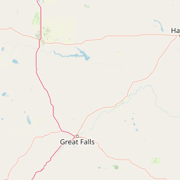


Leaflet | <a href="https://www.openstreetmap.org/copyright">© OpenStreetMap contributors</a>
Item
| Property | Value |
|---|---|
| id | 376744 |
| downstream_mainstem_id | https://geoconnex.us/ref/mainstems/346647 |
| encompassing_mainstem_basins | ['https://geoconnex.us/ref/mainstems/346647', 'https://geoconnex.us/ref/mainstems/312532', 'https://geoconnex.us/ref/mainstems/312091'] |
| featuretype | ['https://www.opengis.net/def/schema/hy_features/hyf/HY_FlowPath', 'https://www.opengis.net/def/schema/hy_features/hyf/HY_WaterBody'] |
| fid | 14792 |
| head_2020huc12 | 100301040504 |
| head_nhdpv1_comid | 12401536 |
| head_nhdpv2_comid | https://geoconnex.us/nhdplusv2/comid/12401536 |
| head_nhdpv2huc12 | https://geoconnex.us/nhdplusv2/huc12/100301040504 |
| head_rf1id | 29439 |
| lengthkm | 52.4 |
| name_at_outlet | Elk Creek |
| name_at_outlet_gnis_id | 800758 |
| new_mainstemid | |
| outlet_2020huc12 | 100301040506 |
| outlet_drainagearea_sqkm | 497.1 |
| outlet_nhdpv1_comid | 12395668 |
| outlet_nhdpv2_comid | https://geoconnex.us/nhdplusv2/comid/12395668 |
| outlet_nhdpv2huc12 | https://geoconnex.us/nhdplusv2/huc12/100301040506 |
| outlet_rf1id | 29435 |
| superseded | False |
| uri | https://geoconnex.us/ref/mainstems/376744 |
Graph Results
| monitoringLocation | https://geoconnex.us/iow/wqp/MTWTRSHD_WQX-SUN-ELKC02 |
|---|---|
| siteName | MTWTRSHD_WQX-SUN-ELKC02 |
| datasetDescription | Nutrient-nitrogen***retired***use TOTAL NITROGEN, MIXED FORMS with speciation AS N at MTWTRSHD_WQX-SUN-ELKC02 |
| type | River/Stream |
| url | https://www.waterqualitydata.us/provider/STORET/MTWTRSHD_WQX/MTWTRSHD_WQX-SUN-ELKC02/ |
| variableMeasured | Nutrient-nitrogen***retired***use TOTAL NITROGEN, MIXED FORMS with speciation AS N |
| variableUnit | mg/L |
| measurementTechnique | observation |
| temporalCoverage | 2002-01-01T00:00:00Z/2002-12-31T00:00:00Z |
| distributionName | Water Quality Portal |
| distributionURL | https://www.waterqualitydata.us/data/Result/search?siteid=MTWTRSHD_WQX-SUN-ELKC02&CharacteristicName=Nutrient-nitrogen***retired***use TOTAL NITROGEN, MIXED FORMS with speciation AS N&mimeType=csv |
| distributionFormat | text/comma-separated-values |
| wkt | POINT (-112.473056 47.416944) |
| monitoringLocation | https://geoconnex.us/iow/wqp/MTWTRSHD_WQX-SUN-ELKC02 |
|---|---|
| siteName | MTWTRSHD_WQX-SUN-ELKC02 |
| datasetDescription | Phosphate-phosphorus at MTWTRSHD_WQX-SUN-ELKC02 |
| type | River/Stream |
| url | https://www.waterqualitydata.us/provider/STORET/MTWTRSHD_WQX/MTWTRSHD_WQX-SUN-ELKC02/ |
| variableMeasured | Phosphate-phosphorus |
| variableUnit | mg/L |
| measurementTechnique | observation |
| temporalCoverage | 2002-01-01T00:00:00Z/2002-12-31T00:00:00Z |
| distributionName | Water Quality Portal |
| distributionURL | https://www.waterqualitydata.us/data/Result/search?siteid=MTWTRSHD_WQX-SUN-ELKC02&CharacteristicName=Phosphate-phosphorus&mimeType=csv |
| distributionFormat | text/comma-separated-values |
| wkt | POINT (-112.473056 47.416944) |
| monitoringLocation | https://geoconnex.us/iow/wqp/MTWTRSHD_WQX-SUN-ELKC02 |
|---|---|
| siteName | MTWTRSHD_WQX-SUN-ELKC02 |
| datasetDescription | Total dissolved solids at MTWTRSHD_WQX-SUN-ELKC02 |
| type | River/Stream |
| url | https://www.waterqualitydata.us/provider/STORET/MTWTRSHD_WQX/MTWTRSHD_WQX-SUN-ELKC02/ |
| variableMeasured | Total dissolved solids |
| variableUnit | mg/l |
| measurementTechnique | observation |
| temporalCoverage | 2002-01-01T00:00:00Z/2002-12-31T00:00:00Z |
| distributionName | Water Quality Portal |
| distributionURL | https://www.waterqualitydata.us/data/Result/search?siteid=MTWTRSHD_WQX-SUN-ELKC02&CharacteristicName=Total dissolved solids&mimeType=csv |
| distributionFormat | text/comma-separated-values |
| wkt | POINT (-112.473056 47.416944) |
| monitoringLocation | https://geoconnex.us/iow/wqp/MTWTRSHD_WQX-SUN-ELKC02 |
|---|---|
| siteName | MTWTRSHD_WQX-SUN-ELKC02 |
| datasetDescription | Kjeldahl nitrogen at MTWTRSHD_WQX-SUN-ELKC02 |
| type | River/Stream |
| url | https://www.waterqualitydata.us/provider/STORET/MTWTRSHD_WQX/MTWTRSHD_WQX-SUN-ELKC02/ |
| variableMeasured | Kjeldahl nitrogen |
| variableUnit | mg/L |
| measurementTechnique | observation |
| temporalCoverage | 2002-01-01T00:00:00Z/2002-12-31T00:00:00Z |
| distributionName | Water Quality Portal |
| distributionURL | https://www.waterqualitydata.us/data/Result/search?siteid=MTWTRSHD_WQX-SUN-ELKC02&CharacteristicName=Kjeldahl nitrogen&mimeType=csv |
| distributionFormat | text/comma-separated-values |
| wkt | POINT (-112.473056 47.416944) |
| monitoringLocation | https://geoconnex.us/iow/wqp/MTWTRSHD_WQX-SUN-ELKC02 |
|---|---|
| siteName | MTWTRSHD_WQX-SUN-ELKC02 |
| datasetDescription | Total suspended solids at MTWTRSHD_WQX-SUN-ELKC02 |
| type | River/Stream |
| url | https://www.waterqualitydata.us/provider/STORET/MTWTRSHD_WQX/MTWTRSHD_WQX-SUN-ELKC02/ |
| variableMeasured | Total suspended solids |
| variableUnit | mg/L |
| measurementTechnique | observation |
| temporalCoverage | 2002-01-01T00:00:00Z/2002-12-31T00:00:00Z |
| distributionName | Water Quality Portal |
| distributionURL | https://www.waterqualitydata.us/data/Result/search?siteid=MTWTRSHD_WQX-SUN-ELKC02&CharacteristicName=Total suspended solids&mimeType=csv |
| distributionFormat | text/comma-separated-values |
| wkt | POINT (-112.473056 47.416944) |
| monitoringLocation | https://geoconnex.us/iow/wqp/MTWTRSHD_WQX-SUN-ELKC01 |
|---|---|
| siteName | MTWTRSHD_WQX-SUN-ELKC01 |
| datasetDescription | Total dissolved solids at MTWTRSHD_WQX-SUN-ELKC01 |
| type | River/Stream |
| url | https://www.waterqualitydata.us/provider/STORET/MTWTRSHD_WQX/MTWTRSHD_WQX-SUN-ELKC01/ |
| variableMeasured | Total dissolved solids |
| variableUnit | mg/l |
| measurementTechnique | observation |
| temporalCoverage | 2002-01-01T00:00:00Z/2003-12-31T00:00:00Z |
| distributionName | Water Quality Portal |
| distributionURL | https://www.waterqualitydata.us/data/Result/search?siteid=MTWTRSHD_WQX-SUN-ELKC01&CharacteristicName=Total dissolved solids&mimeType=csv |
| distributionFormat | text/comma-separated-values |
| wkt | POINT (-112.341667 47.506389) |
| monitoringLocation | https://geoconnex.us/iow/wqp/MTWTRSHD_WQX-SUN-ELKC01 |
|---|---|
| siteName | MTWTRSHD_WQX-SUN-ELKC01 |
| datasetDescription | Potassium at MTWTRSHD_WQX-SUN-ELKC01 |
| type | River/Stream |
| url | https://www.waterqualitydata.us/provider/STORET/MTWTRSHD_WQX/MTWTRSHD_WQX-SUN-ELKC01/ |
| variableMeasured | Potassium |
| variableUnit | mg/l |
| measurementTechnique | observation |
| temporalCoverage | 2003-01-01T00:00:00Z/2003-12-31T00:00:00Z |
| distributionName | Water Quality Portal |
| distributionURL | https://www.waterqualitydata.us/data/Result/search?siteid=MTWTRSHD_WQX-SUN-ELKC01&CharacteristicName=Potassium&mimeType=csv |
| distributionFormat | text/comma-separated-values |
| wkt | POINT (-112.341667 47.506389) |
| monitoringLocation | https://geoconnex.us/iow/wqp/MTWTRSHD_WQX-SUN-ELKC01 |
|---|---|
| siteName | MTWTRSHD_WQX-SUN-ELKC01 |
| datasetDescription | Temperature, water at MTWTRSHD_WQX-SUN-ELKC01 |
| type | River/Stream |
| url | https://www.waterqualitydata.us/provider/STORET/MTWTRSHD_WQX/MTWTRSHD_WQX-SUN-ELKC01/ |
| variableMeasured | Temperature, water |
| variableUnit | deg C |
| measurementTechnique | observation |
| temporalCoverage | 2004-01-01T00:00:00Z/2004-12-31T00:00:00Z |
| distributionName | Water Quality Portal |
| distributionURL | https://www.waterqualitydata.us/data/Result/search?siteid=MTWTRSHD_WQX-SUN-ELKC01&CharacteristicName=Temperature, water&mimeType=csv |
| distributionFormat | text/comma-separated-values |
| wkt | POINT (-112.341667 47.506389) |
| monitoringLocation | https://geoconnex.us/iow/wqp/MTWTRSHD_WQX-SUN-ELKC01 |
|---|---|
| siteName | MTWTRSHD_WQX-SUN-ELKC01 |
| datasetDescription | Total suspended solids at MTWTRSHD_WQX-SUN-ELKC01 |
| type | River/Stream |
| url | https://www.waterqualitydata.us/provider/STORET/MTWTRSHD_WQX/MTWTRSHD_WQX-SUN-ELKC01/ |
| variableMeasured | Total suspended solids |
| variableUnit | mg/L |
| measurementTechnique | observation |
| temporalCoverage | 2001-01-01T00:00:00Z/2004-12-31T00:00:00Z |
| distributionName | Water Quality Portal |
| distributionURL | https://www.waterqualitydata.us/data/Result/search?siteid=MTWTRSHD_WQX-SUN-ELKC01&CharacteristicName=Total suspended solids&mimeType=csv |
| distributionFormat | text/comma-separated-values |
| wkt | POINT (-112.341667 47.506389) |
| monitoringLocation | https://geoconnex.us/iow/wqp/MTWTRSHD_WQX-SUN-ELKC01 |
|---|---|
| siteName | MTWTRSHD_WQX-SUN-ELKC01 |
| datasetDescription | Sum of cations at MTWTRSHD_WQX-SUN-ELKC01 |
| type | River/Stream |
| url | https://www.waterqualitydata.us/provider/STORET/MTWTRSHD_WQX/MTWTRSHD_WQX-SUN-ELKC01/ |
| variableMeasured | Sum of cations |
| variableUnit | mg/L |
| measurementTechnique | observation |
| temporalCoverage | 2003-01-01T00:00:00Z/2003-12-31T00:00:00Z |
| distributionName | Water Quality Portal |
| distributionURL | https://www.waterqualitydata.us/data/Result/search?siteid=MTWTRSHD_WQX-SUN-ELKC01&CharacteristicName=Sum of cations&mimeType=csv |
| distributionFormat | text/comma-separated-values |
| wkt | POINT (-112.341667 47.506389) |
| monitoringLocation | https://geoconnex.us/iow/wqp/MTWTRSHD_WQX-SUN-ELKC01 |
|---|---|
| siteName | MTWTRSHD_WQX-SUN-ELKC01 |
| datasetDescription | Phosphorus at MTWTRSHD_WQX-SUN-ELKC01 |
| type | River/Stream |
| url | https://www.waterqualitydata.us/provider/STORET/MTWTRSHD_WQX/MTWTRSHD_WQX-SUN-ELKC01/ |
| variableMeasured | Phosphorus |
| variableUnit | ppb |
| measurementTechnique | observation |
| temporalCoverage | 2001-01-01T00:00:00Z/2001-12-31T00:00:00Z |
| distributionName | Water Quality Portal |
| distributionURL | https://www.waterqualitydata.us/data/Result/search?siteid=MTWTRSHD_WQX-SUN-ELKC01&CharacteristicName=Phosphorus&mimeType=csv |
| distributionFormat | text/comma-separated-values |
| wkt | POINT (-112.341667 47.506389) |
| monitoringLocation | https://geoconnex.us/iow/wqp/MTWTRSHD_WQX-SUN-ELKC01 |
|---|---|
| siteName | MTWTRSHD_WQX-SUN-ELKC01 |
| datasetDescription | Phosphate-phosphorus at MTWTRSHD_WQX-SUN-ELKC01 |
| type | River/Stream |
| url | https://www.waterqualitydata.us/provider/STORET/MTWTRSHD_WQX/MTWTRSHD_WQX-SUN-ELKC01/ |
| variableMeasured | Phosphate-phosphorus |
| variableUnit | mg/L |
| measurementTechnique | observation |
| temporalCoverage | 2002-01-01T00:00:00Z/2004-12-31T00:00:00Z |
| distributionName | Water Quality Portal |
| distributionURL | https://www.waterqualitydata.us/data/Result/search?siteid=MTWTRSHD_WQX-SUN-ELKC01&CharacteristicName=Phosphate-phosphorus&mimeType=csv |
| distributionFormat | text/comma-separated-values |
| wkt | POINT (-112.341667 47.506389) |
| monitoringLocation | https://geoconnex.us/iow/wqp/MTWTRSHD_WQX-SUN-ELKC01 |
|---|---|
| siteName | MTWTRSHD_WQX-SUN-ELKC01 |
| datasetDescription | pH at MTWTRSHD_WQX-SUN-ELKC01 |
| type | River/Stream |
| url | https://www.waterqualitydata.us/provider/STORET/MTWTRSHD_WQX/MTWTRSHD_WQX-SUN-ELKC01/ |
| variableMeasured | pH |
| variableUnit | None |
| measurementTechnique | observation |
| temporalCoverage | 2004-01-01T00:00:00Z/2004-12-31T00:00:00Z |
| distributionName | Water Quality Portal |
| distributionURL | https://www.waterqualitydata.us/data/Result/search?siteid=MTWTRSHD_WQX-SUN-ELKC01&CharacteristicName=pH&mimeType=csv |
| distributionFormat | text/comma-separated-values |
| wkt | POINT (-112.341667 47.506389) |
| monitoringLocation | https://geoconnex.us/iow/wqp/MTWTRSHD_WQX-SUN-ELKC01 |
|---|---|
| siteName | MTWTRSHD_WQX-SUN-ELKC01 |
| datasetDescription | Calcium at MTWTRSHD_WQX-SUN-ELKC01 |
| type | River/Stream |
| url | https://www.waterqualitydata.us/provider/STORET/MTWTRSHD_WQX/MTWTRSHD_WQX-SUN-ELKC01/ |
| variableMeasured | Calcium |
| variableUnit | mg/L |
| measurementTechnique | observation |
| temporalCoverage | 2003-01-01T00:00:00Z/2003-12-31T00:00:00Z |
| distributionName | Water Quality Portal |
| distributionURL | https://www.waterqualitydata.us/data/Result/search?siteid=MTWTRSHD_WQX-SUN-ELKC01&CharacteristicName=Calcium&mimeType=csv |
| distributionFormat | text/comma-separated-values |
| wkt | POINT (-112.341667 47.506389) |
| monitoringLocation | https://geoconnex.us/iow/wqp/MTWTRSHD_WQX-SUN-ELKC01 |
|---|---|
| siteName | MTWTRSHD_WQX-SUN-ELKC01 |
| datasetDescription | Temperature, air at MTWTRSHD_WQX-SUN-ELKC01 |
| type | River/Stream |
| url | https://www.waterqualitydata.us/provider/STORET/MTWTRSHD_WQX/MTWTRSHD_WQX-SUN-ELKC01/ |
| variableMeasured | Temperature, air |
| variableUnit | deg C |
| measurementTechnique | observation |
| temporalCoverage | 2004-01-01T00:00:00Z/2004-12-31T00:00:00Z |
| distributionName | Water Quality Portal |
| distributionURL | https://www.waterqualitydata.us/data/Result/search?siteid=MTWTRSHD_WQX-SUN-ELKC01&CharacteristicName=Temperature, air&mimeType=csv |
| distributionFormat | text/comma-separated-values |
| wkt | POINT (-112.341667 47.506389) |
| monitoringLocation | https://geoconnex.us/iow/wqp/MTWTRSHD_WQX-SUN-ELKC01 |
|---|---|
| siteName | MTWTRSHD_WQX-SUN-ELKC01 |
| datasetDescription | Nutrient-nitrogen***retired***use TOTAL NITROGEN, MIXED FORMS with speciation AS N at MTWTRSHD_WQX-SUN-ELKC01 |
| type | River/Stream |
| url | https://www.waterqualitydata.us/provider/STORET/MTWTRSHD_WQX/MTWTRSHD_WQX-SUN-ELKC01/ |
| variableMeasured | Nutrient-nitrogen***retired***use TOTAL NITROGEN, MIXED FORMS with speciation AS N |
| variableUnit | mg/L |
| measurementTechnique | observation |
| temporalCoverage | 2002-01-01T00:00:00Z/2002-12-31T00:00:00Z |
| distributionName | Water Quality Portal |
| distributionURL | https://www.waterqualitydata.us/data/Result/search?siteid=MTWTRSHD_WQX-SUN-ELKC01&CharacteristicName=Nutrient-nitrogen***retired***use TOTAL NITROGEN, MIXED FORMS with speciation AS N&mimeType=csv |
| distributionFormat | text/comma-separated-values |
| wkt | POINT (-112.341667 47.506389) |
| monitoringLocation | https://geoconnex.us/iow/wqp/MTWTRSHD_WQX-SUN-ELKC01 |
|---|---|
| siteName | MTWTRSHD_WQX-SUN-ELKC01 |
| datasetDescription | Sodium at MTWTRSHD_WQX-SUN-ELKC01 |
| type | River/Stream |
| url | https://www.waterqualitydata.us/provider/STORET/MTWTRSHD_WQX/MTWTRSHD_WQX-SUN-ELKC01/ |
| variableMeasured | Sodium |
| variableUnit | mg/l |
| measurementTechnique | observation |
| temporalCoverage | 2003-01-01T00:00:00Z/2003-12-31T00:00:00Z |
| distributionName | Water Quality Portal |
| distributionURL | https://www.waterqualitydata.us/data/Result/search?siteid=MTWTRSHD_WQX-SUN-ELKC01&CharacteristicName=Sodium&mimeType=csv |
| distributionFormat | text/comma-separated-values |
| wkt | POINT (-112.341667 47.506389) |
| monitoringLocation | https://geoconnex.us/iow/wqp/MTWTRSHD_WQX-SUN-ELKC01 |
|---|---|
| siteName | MTWTRSHD_WQX-SUN-ELKC01 |
| datasetDescription | Sulfate at MTWTRSHD_WQX-SUN-ELKC01 |
| type | River/Stream |
| url | https://www.waterqualitydata.us/provider/STORET/MTWTRSHD_WQX/MTWTRSHD_WQX-SUN-ELKC01/ |
| variableMeasured | Sulfate |
| variableUnit | mg/l |
| measurementTechnique | observation |
| temporalCoverage | 2003-01-01T00:00:00Z/2003-12-31T00:00:00Z |
| distributionName | Water Quality Portal |
| distributionURL | https://www.waterqualitydata.us/data/Result/search?siteid=MTWTRSHD_WQX-SUN-ELKC01&CharacteristicName=Sulfate&mimeType=csv |
| distributionFormat | text/comma-separated-values |
| wkt | POINT (-112.341667 47.506389) |
| monitoringLocation | https://geoconnex.us/iow/wqp/MTWTRSHD_WQX-SUN-ELKC01 |
|---|---|
| siteName | MTWTRSHD_WQX-SUN-ELKC01 |
| datasetDescription | Sum of anions at MTWTRSHD_WQX-SUN-ELKC01 |
| type | River/Stream |
| url | https://www.waterqualitydata.us/provider/STORET/MTWTRSHD_WQX/MTWTRSHD_WQX-SUN-ELKC01/ |
| variableMeasured | Sum of anions |
| variableUnit | meq/L |
| measurementTechnique | observation |
| temporalCoverage | 2003-01-01T00:00:00Z/2003-12-31T00:00:00Z |
| distributionName | Water Quality Portal |
| distributionURL | https://www.waterqualitydata.us/data/Result/search?siteid=MTWTRSHD_WQX-SUN-ELKC01&CharacteristicName=Sum of anions&mimeType=csv |
| distributionFormat | text/comma-separated-values |
| wkt | POINT (-112.341667 47.506389) |
| monitoringLocation | https://geoconnex.us/iow/wqp/MTWTRSHD_WQX-SUN-ELKC01 |
|---|---|
| siteName | MTWTRSHD_WQX-SUN-ELKC01 |
| datasetDescription | Specific conductance at MTWTRSHD_WQX-SUN-ELKC01 |
| type | River/Stream |
| url | https://www.waterqualitydata.us/provider/STORET/MTWTRSHD_WQX/MTWTRSHD_WQX-SUN-ELKC01/ |
| variableMeasured | Specific conductance |
| variableUnit | umho/cm |
| measurementTechnique | observation |
| temporalCoverage | 2004-01-01T00:00:00Z/2004-12-31T00:00:00Z |
| distributionName | Water Quality Portal |
| distributionURL | https://www.waterqualitydata.us/data/Result/search?siteid=MTWTRSHD_WQX-SUN-ELKC01&CharacteristicName=Specific conductance&mimeType=csv |
| distributionFormat | text/comma-separated-values |
| wkt | POINT (-112.341667 47.506389) |
| monitoringLocation | https://geoconnex.us/iow/wqp/MTWTRSHD_WQX-SUN-ELKC01 |
|---|---|
| siteName | MTWTRSHD_WQX-SUN-ELKC01 |
| datasetDescription | Bicarbonate at MTWTRSHD_WQX-SUN-ELKC01 |
| type | River/Stream |
| url | https://www.waterqualitydata.us/provider/STORET/MTWTRSHD_WQX/MTWTRSHD_WQX-SUN-ELKC01/ |
| variableMeasured | Bicarbonate |
| variableUnit | mg/l |
| measurementTechnique | observation |
| temporalCoverage | 2003-01-01T00:00:00Z/2003-12-31T00:00:00Z |
| distributionName | Water Quality Portal |
| distributionURL | https://www.waterqualitydata.us/data/Result/search?siteid=MTWTRSHD_WQX-SUN-ELKC01&CharacteristicName=Bicarbonate&mimeType=csv |
| distributionFormat | text/comma-separated-values |
| wkt | POINT (-112.341667 47.506389) |
| monitoringLocation | https://geoconnex.us/iow/wqp/MTWTRSHD_WQX-SUN-ELKC01 |
|---|---|
| siteName | MTWTRSHD_WQX-SUN-ELKC01 |
| datasetDescription | Magnesium at MTWTRSHD_WQX-SUN-ELKC01 |
| type | River/Stream |
| url | https://www.waterqualitydata.us/provider/STORET/MTWTRSHD_WQX/MTWTRSHD_WQX-SUN-ELKC01/ |
| variableMeasured | Magnesium |
| variableUnit | % |
| measurementTechnique | observation |
| temporalCoverage | 2003-01-01T00:00:00Z/2003-12-31T00:00:00Z |
| distributionName | Water Quality Portal |
| distributionURL | https://www.waterqualitydata.us/data/Result/search?siteid=MTWTRSHD_WQX-SUN-ELKC01&CharacteristicName=Magnesium&mimeType=csv |
| distributionFormat | text/comma-separated-values |
| wkt | POINT (-112.341667 47.506389) |
| monitoringLocation | https://geoconnex.us/iow/wqp/MTWTRSHD_WQX-SUN-ELKC01 |
|---|---|
| siteName | MTWTRSHD_WQX-SUN-ELKC01 |
| datasetDescription | Chloride at MTWTRSHD_WQX-SUN-ELKC01 |
| type | River/Stream |
| url | https://www.waterqualitydata.us/provider/STORET/MTWTRSHD_WQX/MTWTRSHD_WQX-SUN-ELKC01/ |
| variableMeasured | Chloride |
| variableUnit | mg/l |
| measurementTechnique | observation |
| temporalCoverage | 2003-01-01T00:00:00Z/2003-12-31T00:00:00Z |
| distributionName | Water Quality Portal |
| distributionURL | https://www.waterqualitydata.us/data/Result/search?siteid=MTWTRSHD_WQX-SUN-ELKC01&CharacteristicName=Chloride&mimeType=csv |
| distributionFormat | text/comma-separated-values |
| wkt | POINT (-112.341667 47.506389) |
| monitoringLocation | https://geoconnex.us/iow/wqp/MTWTRSHD_WQX-SUN-ELKC01 |
|---|---|
| siteName | MTWTRSHD_WQX-SUN-ELKC01 |
| datasetDescription | Calcium carbonate at MTWTRSHD_WQX-SUN-ELKC01 |
| type | River/Stream |
| url | https://www.waterqualitydata.us/provider/STORET/MTWTRSHD_WQX/MTWTRSHD_WQX-SUN-ELKC01/ |
| variableMeasured | Calcium carbonate |
| variableUnit | mg/L |
| measurementTechnique | observation |
| temporalCoverage | 2003-01-01T00:00:00Z/2003-12-31T00:00:00Z |
| distributionName | Water Quality Portal |
| distributionURL | https://www.waterqualitydata.us/data/Result/search?siteid=MTWTRSHD_WQX-SUN-ELKC01&CharacteristicName=Calcium carbonate&mimeType=csv |
| distributionFormat | text/comma-separated-values |
| wkt | POINT (-112.341667 47.506389) |
| monitoringLocation | https://geoconnex.us/iow/wqp/MTWTRSHD_WQX-SUN-ELKC01 |
|---|---|
| siteName | MTWTRSHD_WQX-SUN-ELKC01 |
| datasetDescription | Alkalinity, total at MTWTRSHD_WQX-SUN-ELKC01 |
| type | River/Stream |
| url | https://www.waterqualitydata.us/provider/STORET/MTWTRSHD_WQX/MTWTRSHD_WQX-SUN-ELKC01/ |
| variableMeasured | Alkalinity, total |
| variableUnit | mg/l |
| measurementTechnique | observation |
| temporalCoverage | 2003-01-01T00:00:00Z/2003-12-31T00:00:00Z |
| distributionName | Water Quality Portal |
| distributionURL | https://www.waterqualitydata.us/data/Result/search?siteid=MTWTRSHD_WQX-SUN-ELKC01&CharacteristicName=Alkalinity, total&mimeType=csv |
| distributionFormat | text/comma-separated-values |
| wkt | POINT (-112.341667 47.506389) |
| monitoringLocation | https://geoconnex.us/iow/wqp/MTWTRSHD_WQX-SUN-ELKC01 |
|---|---|
| siteName | MTWTRSHD_WQX-SUN-ELKC01 |
| datasetDescription | Kjeldahl nitrogen at MTWTRSHD_WQX-SUN-ELKC01 |
| type | River/Stream |
| url | https://www.waterqualitydata.us/provider/STORET/MTWTRSHD_WQX/MTWTRSHD_WQX-SUN-ELKC01/ |
| variableMeasured | Kjeldahl nitrogen |
| variableUnit | mg/L |
| measurementTechnique | observation |
| temporalCoverage | 2001-01-01T00:00:00Z/2004-12-31T00:00:00Z |
| distributionName | Water Quality Portal |
| distributionURL | https://www.waterqualitydata.us/data/Result/search?siteid=MTWTRSHD_WQX-SUN-ELKC01&CharacteristicName=Kjeldahl nitrogen&mimeType=csv |
| distributionFormat | text/comma-separated-values |
| wkt | POINT (-112.341667 47.506389) |
| monitoringLocation | https://geoconnex.us/iow/wqp/MTWTRSHD_WQX-SUN-ELKC01 |
|---|---|
| siteName | MTWTRSHD_WQX-SUN-ELKC01 |
| datasetDescription | Dissolved oxygen (DO) at MTWTRSHD_WQX-SUN-ELKC01 |
| type | River/Stream |
| url | https://www.waterqualitydata.us/provider/STORET/MTWTRSHD_WQX/MTWTRSHD_WQX-SUN-ELKC01/ |
| variableMeasured | Dissolved oxygen (DO) |
| variableUnit | mg/L |
| measurementTechnique | observation |
| temporalCoverage | 2004-01-01T00:00:00Z/2004-12-31T00:00:00Z |
| distributionName | Water Quality Portal |
| distributionURL | https://www.waterqualitydata.us/data/Result/search?siteid=MTWTRSHD_WQX-SUN-ELKC01&CharacteristicName=Dissolved oxygen (DO)&mimeType=csv |
| distributionFormat | text/comma-separated-values |
| wkt | POINT (-112.341667 47.506389) |
| monitoringLocation | https://geoconnex.us/iow/wqp/MTWTRSHD_WQX-SUN-SMTHC01 |
|---|---|
| siteName | MTWTRSHD_WQX-SUN-SMTHC01 |
| datasetDescription | Total suspended solids at MTWTRSHD_WQX-SUN-SMTHC01 |
| type | River/Stream |
| url | https://www.waterqualitydata.us/provider/STORET/MTWTRSHD_WQX/MTWTRSHD_WQX-SUN-SMTHC01/ |
| variableMeasured | Total suspended solids |
| variableUnit | mg/L |
| measurementTechnique | observation |
| temporalCoverage | 2002-01-01T00:00:00Z/2002-12-31T00:00:00Z |
| distributionName | Water Quality Portal |
| distributionURL | https://www.waterqualitydata.us/data/Result/search?siteid=MTWTRSHD_WQX-SUN-SMTHC01&CharacteristicName=Total suspended solids&mimeType=csv |
| distributionFormat | text/comma-separated-values |
| wkt | POINT (-112.446667 47.444167) |
| monitoringLocation | https://geoconnex.us/iow/wqp/MTWTRSHD_WQX-SUN-SMTHC01 |
|---|---|
| siteName | MTWTRSHD_WQX-SUN-SMTHC01 |
| datasetDescription | Nutrient-nitrogen***retired***use TOTAL NITROGEN, MIXED FORMS with speciation AS N at MTWTRSHD_WQX-SUN-SMTHC01 |
| type | River/Stream |
| url | https://www.waterqualitydata.us/provider/STORET/MTWTRSHD_WQX/MTWTRSHD_WQX-SUN-SMTHC01/ |
| variableMeasured | Nutrient-nitrogen***retired***use TOTAL NITROGEN, MIXED FORMS with speciation AS N |
| variableUnit | mg/L |
| measurementTechnique | observation |
| temporalCoverage | 2002-01-01T00:00:00Z/2002-12-31T00:00:00Z |
| distributionName | Water Quality Portal |
| distributionURL | https://www.waterqualitydata.us/data/Result/search?siteid=MTWTRSHD_WQX-SUN-SMTHC01&CharacteristicName=Nutrient-nitrogen***retired***use TOTAL NITROGEN, MIXED FORMS with speciation AS N&mimeType=csv |
| distributionFormat | text/comma-separated-values |
| wkt | POINT (-112.446667 47.444167) |
| monitoringLocation | https://geoconnex.us/iow/wqp/MTWTRSHD_WQX-SUN-SMTHC01 |
|---|---|
| siteName | MTWTRSHD_WQX-SUN-SMTHC01 |
| datasetDescription | Kjeldahl nitrogen at MTWTRSHD_WQX-SUN-SMTHC01 |
| type | River/Stream |
| url | https://www.waterqualitydata.us/provider/STORET/MTWTRSHD_WQX/MTWTRSHD_WQX-SUN-SMTHC01/ |
| variableMeasured | Kjeldahl nitrogen |
| variableUnit | mg/L |
| measurementTechnique | observation |
| temporalCoverage | 2002-01-01T00:00:00Z/2002-12-31T00:00:00Z |
| distributionName | Water Quality Portal |
| distributionURL | https://www.waterqualitydata.us/data/Result/search?siteid=MTWTRSHD_WQX-SUN-SMTHC01&CharacteristicName=Kjeldahl nitrogen&mimeType=csv |
| distributionFormat | text/comma-separated-values |
| wkt | POINT (-112.446667 47.444167) |
| monitoringLocation | https://geoconnex.us/iow/wqp/MTWTRSHD_WQX-SUN-SMTHC01 |
|---|---|
| siteName | MTWTRSHD_WQX-SUN-SMTHC01 |
| datasetDescription | Total dissolved solids at MTWTRSHD_WQX-SUN-SMTHC01 |
| type | River/Stream |
| url | https://www.waterqualitydata.us/provider/STORET/MTWTRSHD_WQX/MTWTRSHD_WQX-SUN-SMTHC01/ |
| variableMeasured | Total dissolved solids |
| variableUnit | mg/l |
| measurementTechnique | observation |
| temporalCoverage | 2002-01-01T00:00:00Z/2002-12-31T00:00:00Z |
| distributionName | Water Quality Portal |
| distributionURL | https://www.waterqualitydata.us/data/Result/search?siteid=MTWTRSHD_WQX-SUN-SMTHC01&CharacteristicName=Total dissolved solids&mimeType=csv |
| distributionFormat | text/comma-separated-values |
| wkt | POINT (-112.446667 47.444167) |
| monitoringLocation | https://geoconnex.us/iow/wqp/MTWTRSHD_WQX-SUN-SMTHC01 |
|---|---|
| siteName | MTWTRSHD_WQX-SUN-SMTHC01 |
| datasetDescription | Phosphate-phosphorus at MTWTRSHD_WQX-SUN-SMTHC01 |
| type | River/Stream |
| url | https://www.waterqualitydata.us/provider/STORET/MTWTRSHD_WQX/MTWTRSHD_WQX-SUN-SMTHC01/ |
| variableMeasured | Phosphate-phosphorus |
| variableUnit | mg/L |
| measurementTechnique | observation |
| temporalCoverage | 2002-01-01T00:00:00Z/2002-12-31T00:00:00Z |
| distributionName | Water Quality Portal |
| distributionURL | https://www.waterqualitydata.us/data/Result/search?siteid=MTWTRSHD_WQX-SUN-SMTHC01&CharacteristicName=Phosphate-phosphorus&mimeType=csv |
| distributionFormat | text/comma-separated-values |
| wkt | POINT (-112.446667 47.444167) |