Maumelle River
Map
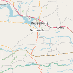
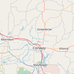
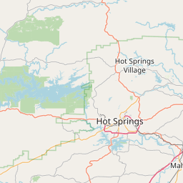
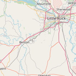
Leaflet | <a href="https://www.openstreetmap.org/copyright">© OpenStreetMap contributors</a>
Item
| Property | Value |
|---|---|
| id | 380181 |
| downstream_mainstem_id | https://geoconnex.us/ref/mainstems/314446 |
| encompassing_mainstem_basins | ['https://geoconnex.us/ref/mainstems/314446', 'https://geoconnex.us/ref/mainstems/312091'] |
| featuretype | ['https://www.opengis.net/def/schema/hy_features/hyf/HY_FlowPath', 'https://www.opengis.net/def/schema/hy_features/hyf/HY_WaterBody'] |
| fid | 21708 |
| head_2020huc12 | 111102070101 |
| head_nhdpv1_comid | 22846035 |
| head_nhdpv2_comid | https://geoconnex.us/nhdplusv2/comid/22846035 |
| head_nhdpv2huc12 | https://geoconnex.us/nhdplusv2/huc12/111102070101 |
| head_rf1id | 37087 |
| lengthkm | 71.1 |
| name_at_outlet | Maumelle River |
| name_at_outlet_gnis_id | 77617 |
| new_mainstemid | |
| outlet_2020huc12 | 111102070106 |
| outlet_drainagearea_sqkm | 363.2 |
| outlet_nhdpv1_comid | 22848051 |
| outlet_nhdpv2_comid | https://geoconnex.us/nhdplusv2/comid/22848051 |
| outlet_nhdpv2huc12 | https://geoconnex.us/nhdplusv2/huc12/111102070106 |
| outlet_rf1id | 36003 |
| superseded | False |
| uri | https://geoconnex.us/ref/mainstems/380181 |
Graph Results
| monitoringLocation | https://geoconnex.us/iow/wqp/USGS-072632965 |
|---|---|
| siteName | USGS-072632965 |
| datasetDescription | Chloride at USGS-072632965 |
| type | Lake, Reservoir, Impoundment |
| url | https://www.waterqualitydata.us/provider/NWIS/USGS-AR/USGS-072632965/ |
| variableMeasured | Chloride |
| variableUnit | milligrams per liter |
| measurementTechnique | observation |
| temporalCoverage | 2003-01-01T00:00:00Z/2009-12-31T00:00:00Z |
| distributionName | Water Quality Portal |
| distributionURL | https://www.waterqualitydata.us/data/Result/search?siteid=USGS-072632965&CharacteristicName=Chloride&mimeType=csv |
| distributionFormat | text/comma-separated-values |
| wkt | POINT (-92.6573856 34.87342287) |
| monitoringLocation | https://geoconnex.us/iow/wqp/USGS-072632965 |
|---|---|
| siteName | USGS-072632965 |
| datasetDescription | Fecal Streptococcus Group Bacteria at USGS-072632965 |
| type | Lake, Reservoir, Impoundment |
| url | https://www.waterqualitydata.us/provider/NWIS/USGS-AR/USGS-072632965/ |
| variableMeasured | Fecal Streptococcus Group Bacteria |
| variableUnit | number per 100 milliliters |
| measurementTechnique | observation |
| temporalCoverage | 2000-01-01T00:00:00Z/2005-12-31T00:00:00Z |
| distributionName | Water Quality Portal |
| distributionURL | https://www.waterqualitydata.us/data/Result/search?siteid=USGS-072632965&CharacteristicName=Fecal Streptococcus Group Bacteria&mimeType=csv |
| distributionFormat | text/comma-separated-values |
| wkt | POINT (-92.6573856 34.87342287) |
| monitoringLocation | https://geoconnex.us/iow/wqp/USGS-072632965 |
|---|---|
| siteName | USGS-072632965 |
| datasetDescription | Pheophytin a at USGS-072632965 |
| type | Lake, Reservoir, Impoundment |
| url | https://www.waterqualitydata.us/provider/NWIS/USGS-AR/USGS-072632965/ |
| variableMeasured | Pheophytin a |
| variableUnit | micrograms per liter |
| measurementTechnique | observation |
| temporalCoverage | 2004-01-01T00:00:00Z/2009-12-31T00:00:00Z |
| distributionName | Water Quality Portal |
| distributionURL | https://www.waterqualitydata.us/data/Result/search?siteid=USGS-072632965&CharacteristicName=Pheophytin a&mimeType=csv |
| distributionFormat | text/comma-separated-values |
| wkt | POINT (-92.6573856 34.87342287) |
| monitoringLocation | https://geoconnex.us/iow/wqp/USGS-072632965 |
|---|---|
| siteName | USGS-072632965 |
| datasetDescription | Hardness, non-carbonate at USGS-072632965 |
| type | Lake, Reservoir, Impoundment |
| url | https://www.waterqualitydata.us/provider/NWIS/USGS-AR/USGS-072632965/ |
| variableMeasured | Hardness, non-carbonate |
| variableUnit | milligrams per liter as calcium carbonate |
| measurementTechnique | observation |
| temporalCoverage | 2006-01-01T00:00:00Z/2009-12-31T00:00:00Z |
| distributionName | Water Quality Portal |
| distributionURL | https://www.waterqualitydata.us/data/Result/search?siteid=USGS-072632965&CharacteristicName=Hardness, non-carbonate&mimeType=csv |
| distributionFormat | text/comma-separated-values |
| wkt | POINT (-92.6573856 34.87342287) |
| monitoringLocation | https://geoconnex.us/iow/wqp/USGS-072632965 |
|---|---|
| siteName | USGS-072632965 |
| datasetDescription | Turbidity at USGS-072632965 |
| type | Lake, Reservoir, Impoundment |
| url | https://www.waterqualitydata.us/provider/NWIS/USGS-AR/USGS-072632965/ |
| variableMeasured | Turbidity |
| variableUnit | Jackson turbidity units |
| measurementTechnique | observation |
| temporalCoverage | 2000-01-01T00:00:00Z/2009-12-31T00:00:00Z |
| distributionName | Water Quality Portal |
| distributionURL | https://www.waterqualitydata.us/data/Result/search?siteid=USGS-072632965&CharacteristicName=Turbidity&mimeType=csv |
| distributionFormat | text/comma-separated-values |
| wkt | POINT (-92.6573856 34.87342287) |
| monitoringLocation | https://geoconnex.us/iow/wqp/USGS-072632965 |
|---|---|
| siteName | USGS-072632965 |
| datasetDescription | Fluoride at USGS-072632965 |
| type | Lake, Reservoir, Impoundment |
| url | https://www.waterqualitydata.us/provider/NWIS/USGS-AR/USGS-072632965/ |
| variableMeasured | Fluoride |
| variableUnit | milligrams per liter |
| measurementTechnique | observation |
| temporalCoverage | 2003-01-01T00:00:00Z/2009-12-31T00:00:00Z |
| distributionName | Water Quality Portal |
| distributionURL | https://www.waterqualitydata.us/data/Result/search?siteid=USGS-072632965&CharacteristicName=Fluoride&mimeType=csv |
| distributionFormat | text/comma-separated-values |
| wkt | POINT (-92.6573856 34.87342287) |
| monitoringLocation | https://geoconnex.us/iow/wqp/USGS-072632965 |
|---|---|
| siteName | USGS-072632965 |
| datasetDescription | Specific conductance at USGS-072632965 |
| type | Lake, Reservoir, Impoundment |
| url | https://www.waterqualitydata.us/provider/NWIS/USGS-AR/USGS-072632965/ |
| variableMeasured | Specific conductance |
| variableUnit | microsiemens per centimeter |
| measurementTechnique | observation |
| temporalCoverage | 1991-01-01T00:00:00Z/2009-12-31T00:00:00Z |
| distributionName | Water Quality Portal |
| distributionURL | https://www.waterqualitydata.us/data/Result/search?siteid=USGS-072632965&CharacteristicName=Specific conductance&mimeType=csv |
| distributionFormat | text/comma-separated-values |
| wkt | POINT (-92.6573856 34.87342287) |
| monitoringLocation | https://geoconnex.us/iow/wqp/USGS-072632965 |
|---|---|
| siteName | USGS-072632965 |
| datasetDescription | Color at USGS-072632965 |
| type | Lake, Reservoir, Impoundment |
| url | https://www.waterqualitydata.us/provider/NWIS/USGS-AR/USGS-072632965/ |
| variableMeasured | Color |
| variableUnit | platinum-cobalt units |
| measurementTechnique | observation |
| temporalCoverage | 2000-01-01T00:00:00Z/2009-12-31T00:00:00Z |
| distributionName | Water Quality Portal |
| distributionURL | https://www.waterqualitydata.us/data/Result/search?siteid=USGS-072632965&CharacteristicName=Color&mimeType=csv |
| distributionFormat | text/comma-separated-values |
| wkt | POINT (-92.6573856 34.87342287) |
| monitoringLocation | https://geoconnex.us/iow/wqp/USGS-072632965 |
|---|---|
| siteName | USGS-072632965 |
| datasetDescription | Carbonate at USGS-072632965 |
| type | Lake, Reservoir, Impoundment |
| url | https://www.waterqualitydata.us/provider/NWIS/USGS-AR/USGS-072632965/ |
| variableMeasured | Carbonate |
| variableUnit | milligrams per liter |
| measurementTechnique | observation |
| temporalCoverage | 2006-01-01T00:00:00Z/2009-12-31T00:00:00Z |
| distributionName | Water Quality Portal |
| distributionURL | https://www.waterqualitydata.us/data/Result/search?siteid=USGS-072632965&CharacteristicName=Carbonate&mimeType=csv |
| distributionFormat | text/comma-separated-values |
| wkt | POINT (-92.6573856 34.87342287) |
| monitoringLocation | https://geoconnex.us/iow/wqp/USGS-072632965 |
|---|---|
| siteName | USGS-072632965 |
| datasetDescription | Moisture content at USGS-072632965 |
| type | Lake, Reservoir, Impoundment |
| url | https://www.waterqualitydata.us/provider/NWIS/USGS-AR/USGS-072632965/ |
| variableMeasured | Moisture content |
| variableUnit | percent |
| measurementTechnique | observation |
| temporalCoverage | 2004-01-01T00:00:00Z/2004-12-31T00:00:00Z |
| distributionName | Water Quality Portal |
| distributionURL | https://www.waterqualitydata.us/data/Result/search?siteid=USGS-072632965&CharacteristicName=Moisture content&mimeType=csv |
| distributionFormat | text/comma-separated-values |
| wkt | POINT (-92.6573856 34.87342287) |
| monitoringLocation | https://geoconnex.us/iow/wqp/USGS-072632965 |
|---|---|
| siteName | USGS-072632965 |
| datasetDescription | Hardness, Ca, Mg at USGS-072632965 |
| type | Lake, Reservoir, Impoundment |
| url | https://www.waterqualitydata.us/provider/NWIS/USGS-AR/USGS-072632965/ |
| variableMeasured | Hardness, Ca, Mg |
| variableUnit | milligrams per liter as calcium carbonate |
| measurementTechnique | observation |
| temporalCoverage | 2003-01-01T00:00:00Z/2009-12-31T00:00:00Z |
| distributionName | Water Quality Portal |
| distributionURL | https://www.waterqualitydata.us/data/Result/search?siteid=USGS-072632965&CharacteristicName=Hardness, Ca, Mg&mimeType=csv |
| distributionFormat | text/comma-separated-values |
| wkt | POINT (-92.6573856 34.87342287) |
| monitoringLocation | https://geoconnex.us/iow/wqp/USGS-072632965 |
|---|---|
| siteName | USGS-072632965 |
| datasetDescription | Escherichia coli at USGS-072632965 |
| type | Lake, Reservoir, Impoundment |
| url | https://www.waterqualitydata.us/provider/NWIS/USGS-AR/USGS-072632965/ |
| variableMeasured | Escherichia coli |
| variableUnit | number per 100 milliliters |
| measurementTechnique | observation |
| temporalCoverage | 2005-01-01T00:00:00Z/2009-12-31T00:00:00Z |
| distributionName | Water Quality Portal |
| distributionURL | https://www.waterqualitydata.us/data/Result/search?siteid=USGS-072632965&CharacteristicName=Escherichia coli&mimeType=csv |
| distributionFormat | text/comma-separated-values |
| wkt | POINT (-92.6573856 34.87342287) |
| monitoringLocation | https://geoconnex.us/iow/wqp/USGS-072632965 |
|---|---|
| siteName | USGS-072632965 |
| datasetDescription | Organic carbon at USGS-072632965 |
| type | Lake, Reservoir, Impoundment |
| url | https://www.waterqualitydata.us/provider/NWIS/USGS-AR/USGS-072632965/ |
| variableMeasured | Organic carbon |
| variableUnit | milligrams per liter |
| measurementTechnique | observation |
| temporalCoverage | 2000-01-01T00:00:00Z/2009-12-31T00:00:00Z |
| distributionName | Water Quality Portal |
| distributionURL | https://www.waterqualitydata.us/data/Result/search?siteid=USGS-072632965&CharacteristicName=Organic carbon&mimeType=csv |
| distributionFormat | text/comma-separated-values |
| wkt | POINT (-92.6573856 34.87342287) |
| monitoringLocation | https://geoconnex.us/iow/wqp/USGS-072632965 |
|---|---|
| siteName | USGS-072632965 |
| datasetDescription | Iron at USGS-072632965 |
| type | Lake, Reservoir, Impoundment |
| url | https://www.waterqualitydata.us/provider/NWIS/USGS-AR/USGS-072632965/ |
| variableMeasured | Iron |
| variableUnit | percent |
| measurementTechnique | observation |
| temporalCoverage | 2000-01-01T00:00:00Z/2009-12-31T00:00:00Z |
| distributionName | Water Quality Portal |
| distributionURL | https://www.waterqualitydata.us/data/Result/search?siteid=USGS-072632965&CharacteristicName=Iron&mimeType=csv |
| distributionFormat | text/comma-separated-values |
| wkt | POINT (-92.6573856 34.87342287) |
| monitoringLocation | https://geoconnex.us/iow/wqp/USGS-072632965 |
|---|---|
| siteName | USGS-072632965 |
| datasetDescription | Nitrite at USGS-072632965 |
| type | Lake, Reservoir, Impoundment |
| url | https://www.waterqualitydata.us/provider/NWIS/USGS-AR/USGS-072632965/ |
| variableMeasured | Nitrite |
| variableUnit | milligrams per liter |
| measurementTechnique | observation |
| temporalCoverage | 2000-01-01T00:00:00Z/2009-12-31T00:00:00Z |
| distributionName | Water Quality Portal |
| distributionURL | https://www.waterqualitydata.us/data/Result/search?siteid=USGS-072632965&CharacteristicName=Nitrite&mimeType=csv |
| distributionFormat | text/comma-separated-values |
| wkt | POINT (-92.6573856 34.87342287) |
| monitoringLocation | https://geoconnex.us/iow/wqp/USGS-072632965 |
|---|---|
| siteName | USGS-072632965 |
| datasetDescription | Oxygen at USGS-072632965 |
| type | Lake, Reservoir, Impoundment |
| url | https://www.waterqualitydata.us/provider/NWIS/USGS-AR/USGS-072632965/ |
| variableMeasured | Oxygen |
| variableUnit | milligrams per liter |
| measurementTechnique | observation |
| temporalCoverage | 1991-01-01T00:00:00Z/2009-12-31T00:00:00Z |
| distributionName | Water Quality Portal |
| distributionURL | https://www.waterqualitydata.us/data/Result/search?siteid=USGS-072632965&CharacteristicName=Oxygen&mimeType=csv |
| distributionFormat | text/comma-separated-values |
| wkt | POINT (-92.6573856 34.87342287) |
| monitoringLocation | https://geoconnex.us/iow/wqp/USGS-072632965 |
|---|---|
| siteName | USGS-072632965 |
| datasetDescription | Bicarbonate at USGS-072632965 |
| type | Lake, Reservoir, Impoundment |
| url | https://www.waterqualitydata.us/provider/NWIS/USGS-AR/USGS-072632965/ |
| variableMeasured | Bicarbonate |
| variableUnit | milligrams per liter |
| measurementTechnique | observation |
| temporalCoverage | 2006-01-01T00:00:00Z/2009-12-31T00:00:00Z |
| distributionName | Water Quality Portal |
| distributionURL | https://www.waterqualitydata.us/data/Result/search?siteid=USGS-072632965&CharacteristicName=Bicarbonate&mimeType=csv |
| distributionFormat | text/comma-separated-values |
| wkt | POINT (-92.6573856 34.87342287) |
| monitoringLocation | https://geoconnex.us/iow/wqp/USGS-072632965 |
|---|---|
| siteName | USGS-072632965 |
| datasetDescription | Sodium at USGS-072632965 |
| type | Lake, Reservoir, Impoundment |
| url | https://www.waterqualitydata.us/provider/NWIS/USGS-AR/USGS-072632965/ |
| variableMeasured | Sodium |
| variableUnit | milligrams per liter |
| measurementTechnique | observation |
| temporalCoverage | 2003-01-01T00:00:00Z/2009-12-31T00:00:00Z |
| distributionName | Water Quality Portal |
| distributionURL | https://www.waterqualitydata.us/data/Result/search?siteid=USGS-072632965&CharacteristicName=Sodium&mimeType=csv |
| distributionFormat | text/comma-separated-values |
| wkt | POINT (-92.6573856 34.87342287) |
| monitoringLocation | https://geoconnex.us/iow/wqp/USGS-072632965 |
|---|---|
| siteName | USGS-072632965 |
| datasetDescription | Nitrogen, mixed forms (NH3), (NH4), organic, (NO2) and (NO3) at USGS-072632965 |
| type | Lake, Reservoir, Impoundment |
| url | https://www.waterqualitydata.us/provider/NWIS/USGS-AR/USGS-072632965/ |
| variableMeasured | Nitrogen, mixed forms (NH3), (NH4), organic, (NO2) and (NO3) |
| variableUnit | milligrams per liter |
| measurementTechnique | observation |
| temporalCoverage | 1991-01-01T00:00:00Z/2009-12-31T00:00:00Z |
| distributionName | Water Quality Portal |
| distributionURL | https://www.waterqualitydata.us/data/Result/search?siteid=USGS-072632965&CharacteristicName=Nitrogen, mixed forms (NH3), (NH4), organic, (NO2) and (NO3)&mimeType=csv |
| distributionFormat | text/comma-separated-values |
| wkt | POINT (-92.6573856 34.87342287) |
| monitoringLocation | https://geoconnex.us/iow/wqp/USGS-072632965 |
|---|---|
| siteName | USGS-072632965 |
| datasetDescription | Alkalinity at USGS-072632965 |
| type | Lake, Reservoir, Impoundment |
| url | https://www.waterqualitydata.us/provider/NWIS/USGS-AR/USGS-072632965/ |
| variableMeasured | Alkalinity |
| variableUnit | milligrams per liter as calcium carbonate |
| measurementTechnique | observation |
| temporalCoverage | 2000-01-01T00:00:00Z/2009-12-31T00:00:00Z |
| distributionName | Water Quality Portal |
| distributionURL | https://www.waterqualitydata.us/data/Result/search?siteid=USGS-072632965&CharacteristicName=Alkalinity&mimeType=csv |
| distributionFormat | text/comma-separated-values |
| wkt | POINT (-92.6573856 34.87342287) |
| monitoringLocation | https://geoconnex.us/iow/wqp/USGS-072632965 |
|---|---|
| siteName | USGS-072632965 |
| datasetDescription | Chlorophyll a at USGS-072632965 |
| type | Lake, Reservoir, Impoundment |
| url | https://www.waterqualitydata.us/provider/NWIS/USGS-AR/USGS-072632965/ |
| variableMeasured | Chlorophyll a |
| variableUnit | micrograms per liter |
| measurementTechnique | observation |
| temporalCoverage | 2000-01-01T00:00:00Z/2009-12-31T00:00:00Z |
| distributionName | Water Quality Portal |
| distributionURL | https://www.waterqualitydata.us/data/Result/search?siteid=USGS-072632965&CharacteristicName=Chlorophyll a&mimeType=csv |
| distributionFormat | text/comma-separated-values |
| wkt | POINT (-92.6573856 34.87342287) |
| monitoringLocation | https://geoconnex.us/iow/wqp/USGS-072632965 |
|---|---|
| siteName | USGS-072632965 |
| datasetDescription | Nitrate at USGS-072632965 |
| type | Lake, Reservoir, Impoundment |
| url | https://www.waterqualitydata.us/provider/NWIS/USGS-AR/USGS-072632965/ |
| variableMeasured | Nitrate |
| variableUnit | milligrams per liter as nitrogen |
| measurementTechnique | observation |
| temporalCoverage | 2000-01-01T00:00:00Z/2009-12-31T00:00:00Z |
| distributionName | Water Quality Portal |
| distributionURL | https://www.waterqualitydata.us/data/Result/search?siteid=USGS-072632965&CharacteristicName=Nitrate&mimeType=csv |
| distributionFormat | text/comma-separated-values |
| wkt | POINT (-92.6573856 34.87342287) |
| monitoringLocation | https://geoconnex.us/iow/wqp/USGS-072632965 |
|---|---|
| siteName | USGS-072632965 |
| datasetDescription | pH at USGS-072632965 |
| type | Lake, Reservoir, Impoundment |
| url | https://www.waterqualitydata.us/provider/NWIS/USGS-AR/USGS-072632965/ |
| variableMeasured | pH |
| variableUnit | Unknown |
| measurementTechnique | observation |
| temporalCoverage | 1991-01-01T00:00:00Z/2009-12-31T00:00:00Z |
| distributionName | Water Quality Portal |
| distributionURL | https://www.waterqualitydata.us/data/Result/search?siteid=USGS-072632965&CharacteristicName=pH&mimeType=csv |
| distributionFormat | text/comma-separated-values |
| wkt | POINT (-92.6573856 34.87342287) |
| monitoringLocation | https://geoconnex.us/iow/wqp/USGS-072632965 |
|---|---|
| siteName | USGS-072632965 |
| datasetDescription | Inorganic nitrogen (nitrate and nitrite) at USGS-072632965 |
| type | Lake, Reservoir, Impoundment |
| url | https://www.waterqualitydata.us/provider/NWIS/USGS-AR/USGS-072632965/ |
| variableMeasured | Inorganic nitrogen (nitrate and nitrite) |
| variableUnit | milligrams per liter as nitrogen |
| measurementTechnique | observation |
| temporalCoverage | 1991-01-01T00:00:00Z/2009-12-31T00:00:00Z |
| distributionName | Water Quality Portal |
| distributionURL | https://www.waterqualitydata.us/data/Result/search?siteid=USGS-072632965&CharacteristicName=Inorganic nitrogen (nitrate and nitrite)&mimeType=csv |
| distributionFormat | text/comma-separated-values |
| wkt | POINT (-92.6573856 34.87342287) |
| monitoringLocation | https://geoconnex.us/iow/wqp/USGS-072632965 |
|---|---|
| siteName | USGS-072632965 |
| datasetDescription | Carbon dioxide at USGS-072632965 |
| type | Lake, Reservoir, Impoundment |
| url | https://www.waterqualitydata.us/provider/NWIS/USGS-AR/USGS-072632965/ |
| variableMeasured | Carbon dioxide |
| variableUnit | milligrams per liter |
| measurementTechnique | observation |
| temporalCoverage | 2003-01-01T00:00:00Z/2009-12-31T00:00:00Z |
| distributionName | Water Quality Portal |
| distributionURL | https://www.waterqualitydata.us/data/Result/search?siteid=USGS-072632965&CharacteristicName=Carbon dioxide&mimeType=csv |
| distributionFormat | text/comma-separated-values |
| wkt | POINT (-92.6573856 34.87342287) |
| monitoringLocation | https://geoconnex.us/iow/wqp/USGS-072632965 |
|---|---|
| siteName | USGS-072632965 |
| datasetDescription | Silica at USGS-072632965 |
| type | Lake, Reservoir, Impoundment |
| url | https://www.waterqualitydata.us/provider/NWIS/USGS-AR/USGS-072632965/ |
| variableMeasured | Silica |
| variableUnit | milligrams per liter |
| measurementTechnique | observation |
| temporalCoverage | 2003-01-01T00:00:00Z/2009-12-31T00:00:00Z |
| distributionName | Water Quality Portal |
| distributionURL | https://www.waterqualitydata.us/data/Result/search?siteid=USGS-072632965&CharacteristicName=Silica&mimeType=csv |
| distributionFormat | text/comma-separated-values |
| wkt | POINT (-92.6573856 34.87342287) |
| monitoringLocation | https://geoconnex.us/iow/wqp/USGS-072632965 |
|---|---|
| siteName | USGS-072632965 |
| datasetDescription | Mercury at USGS-072632965 |
| type | Lake, Reservoir, Impoundment |
| url | https://www.waterqualitydata.us/provider/NWIS/USGS-AR/USGS-072632965/ |
| variableMeasured | Mercury |
| variableUnit | Unknown |
| measurementTechnique | observation |
| temporalCoverage | 2003-01-01T00:00:00Z/2009-12-31T00:00:00Z |
| distributionName | Water Quality Portal |
| distributionURL | https://www.waterqualitydata.us/data/Result/search?siteid=USGS-072632965&CharacteristicName=Mercury&mimeType=csv |
| distributionFormat | text/comma-separated-values |
| wkt | POINT (-92.6573856 34.87342287) |
| monitoringLocation | https://geoconnex.us/iow/wqp/USGS-072632965 |
|---|---|
| siteName | USGS-072632965 |
| datasetDescription | Barometric pressure at USGS-072632965 |
| type | Lake, Reservoir, Impoundment |
| url | https://www.waterqualitydata.us/provider/NWIS/USGS-AR/USGS-072632965/ |
| variableMeasured | Barometric pressure |
| variableUnit | millimeters of mercury |
| measurementTechnique | observation |
| temporalCoverage | 1991-01-01T00:00:00Z/2009-12-31T00:00:00Z |
| distributionName | Water Quality Portal |
| distributionURL | https://www.waterqualitydata.us/data/Result/search?siteid=USGS-072632965&CharacteristicName=Barometric pressure&mimeType=csv |
| distributionFormat | text/comma-separated-values |
| wkt | POINT (-92.6573856 34.87342287) |
| monitoringLocation | https://geoconnex.us/iow/wqp/USGS-072632965 |
|---|---|
| siteName | USGS-072632965 |
| datasetDescription | Sulfate at USGS-072632965 |
| type | Lake, Reservoir, Impoundment |
| url | https://www.waterqualitydata.us/provider/NWIS/USGS-AR/USGS-072632965/ |
| variableMeasured | Sulfate |
| variableUnit | milligrams per liter |
| measurementTechnique | observation |
| temporalCoverage | 2003-01-01T00:00:00Z/2009-12-31T00:00:00Z |
| distributionName | Water Quality Portal |
| distributionURL | https://www.waterqualitydata.us/data/Result/search?siteid=USGS-072632965&CharacteristicName=Sulfate&mimeType=csv |
| distributionFormat | text/comma-separated-values |
| wkt | POINT (-92.6573856 34.87342287) |
| monitoringLocation | https://geoconnex.us/iow/wqp/USGS-072632965 |
|---|---|
| siteName | USGS-072632965 |
| datasetDescription | Magnesium at USGS-072632965 |
| type | Lake, Reservoir, Impoundment |
| url | https://www.waterqualitydata.us/provider/NWIS/USGS-AR/USGS-072632965/ |
| variableMeasured | Magnesium |
| variableUnit | percent |
| measurementTechnique | observation |
| temporalCoverage | 2003-01-01T00:00:00Z/2009-12-31T00:00:00Z |
| distributionName | Water Quality Portal |
| distributionURL | https://www.waterqualitydata.us/data/Result/search?siteid=USGS-072632965&CharacteristicName=Magnesium&mimeType=csv |
| distributionFormat | text/comma-separated-values |
| wkt | POINT (-92.6573856 34.87342287) |
| monitoringLocation | https://geoconnex.us/iow/wqp/USGS-072632965 |
|---|---|
| siteName | USGS-072632965 |
| datasetDescription | Manganese at USGS-072632965 |
| type | Lake, Reservoir, Impoundment |
| url | https://www.waterqualitydata.us/provider/NWIS/USGS-AR/USGS-072632965/ |
| variableMeasured | Manganese |
| variableUnit | micrograms per liter |
| measurementTechnique | observation |
| temporalCoverage | 2000-01-01T00:00:00Z/2009-12-31T00:00:00Z |
| distributionName | Water Quality Portal |
| distributionURL | https://www.waterqualitydata.us/data/Result/search?siteid=USGS-072632965&CharacteristicName=Manganese&mimeType=csv |
| distributionFormat | text/comma-separated-values |
| wkt | POINT (-92.6573856 34.87342287) |
| monitoringLocation | https://geoconnex.us/iow/wqp/USGS-072632965 |
|---|---|
| siteName | USGS-072632965 |
| datasetDescription | Phosphorus at USGS-072632965 |
| type | Lake, Reservoir, Impoundment |
| url | https://www.waterqualitydata.us/provider/NWIS/USGS-AR/USGS-072632965/ |
| variableMeasured | Phosphorus |
| variableUnit | parts per billion |
| measurementTechnique | observation |
| temporalCoverage | 1991-01-01T00:00:00Z/2009-12-31T00:00:00Z |
| distributionName | Water Quality Portal |
| distributionURL | https://www.waterqualitydata.us/data/Result/search?siteid=USGS-072632965&CharacteristicName=Phosphorus&mimeType=csv |
| distributionFormat | text/comma-separated-values |
| wkt | POINT (-92.6573856 34.87342287) |
| monitoringLocation | https://geoconnex.us/iow/wqp/USGS-072632965 |
|---|---|
| siteName | USGS-072632965 |
| datasetDescription | Temperature, water at USGS-072632965 |
| type | Lake, Reservoir, Impoundment |
| url | https://www.waterqualitydata.us/provider/NWIS/USGS-AR/USGS-072632965/ |
| variableMeasured | Temperature, water |
| variableUnit | degrees Celsius |
| measurementTechnique | observation |
| temporalCoverage | 1991-01-01T00:00:00Z/2009-12-31T00:00:00Z |
| distributionName | Water Quality Portal |
| distributionURL | https://www.waterqualitydata.us/data/Result/search?siteid=USGS-072632965&CharacteristicName=Temperature, water&mimeType=csv |
| distributionFormat | text/comma-separated-values |
| wkt | POINT (-92.6573856 34.87342287) |
| monitoringLocation | https://geoconnex.us/iow/wqp/USGS-072632965 |
|---|---|
| siteName | USGS-072632965 |
| datasetDescription | Depth, Secchi disk depth at USGS-072632965 |
| type | Lake, Reservoir, Impoundment |
| url | https://www.waterqualitydata.us/provider/NWIS/USGS-AR/USGS-072632965/ |
| variableMeasured | Depth, Secchi disk depth |
| variableUnit | meters |
| measurementTechnique | observation |
| temporalCoverage | 1991-01-01T00:00:00Z/2009-12-31T00:00:00Z |
| distributionName | Water Quality Portal |
| distributionURL | https://www.waterqualitydata.us/data/Result/search?siteid=USGS-072632965&CharacteristicName=Depth, Secchi disk depth&mimeType=csv |
| distributionFormat | text/comma-separated-values |
| wkt | POINT (-92.6573856 34.87342287) |
| monitoringLocation | https://geoconnex.us/iow/wqp/USGS-072632965 |
|---|---|
| siteName | USGS-072632965 |
| datasetDescription | Organic Nitrogen at USGS-072632965 |
| type | Lake, Reservoir, Impoundment |
| url | https://www.waterqualitydata.us/provider/NWIS/USGS-AR/USGS-072632965/ |
| variableMeasured | Organic Nitrogen |
| variableUnit | milligrams per liter |
| measurementTechnique | observation |
| temporalCoverage | 1991-01-01T00:00:00Z/2009-12-31T00:00:00Z |
| distributionName | Water Quality Portal |
| distributionURL | https://www.waterqualitydata.us/data/Result/search?siteid=USGS-072632965&CharacteristicName=Organic Nitrogen&mimeType=csv |
| distributionFormat | text/comma-separated-values |
| wkt | POINT (-92.6573856 34.87342287) |
| monitoringLocation | https://geoconnex.us/iow/wqp/USGS-072632965 |
|---|---|
| siteName | USGS-072632965 |
| datasetDescription | Calcium at USGS-072632965 |
| type | Lake, Reservoir, Impoundment |
| url | https://www.waterqualitydata.us/provider/NWIS/USGS-AR/USGS-072632965/ |
| variableMeasured | Calcium |
| variableUnit | milligrams per liter |
| measurementTechnique | observation |
| temporalCoverage | 2003-01-01T00:00:00Z/2009-12-31T00:00:00Z |
| distributionName | Water Quality Portal |
| distributionURL | https://www.waterqualitydata.us/data/Result/search?siteid=USGS-072632965&CharacteristicName=Calcium&mimeType=csv |
| distributionFormat | text/comma-separated-values |
| wkt | POINT (-92.6573856 34.87342287) |
| monitoringLocation | https://geoconnex.us/iow/wqp/USGS-072632965 |
|---|---|
| siteName | USGS-072632965 |
| datasetDescription | Kjeldahl nitrogen at USGS-072632965 |
| type | Lake, Reservoir, Impoundment |
| url | https://www.waterqualitydata.us/provider/NWIS/USGS-AR/USGS-072632965/ |
| variableMeasured | Kjeldahl nitrogen |
| variableUnit | milligrams per liter |
| measurementTechnique | observation |
| temporalCoverage | 1991-01-01T00:00:00Z/2009-12-31T00:00:00Z |
| distributionName | Water Quality Portal |
| distributionURL | https://www.waterqualitydata.us/data/Result/search?siteid=USGS-072632965&CharacteristicName=Kjeldahl nitrogen&mimeType=csv |
| distributionFormat | text/comma-separated-values |
| wkt | POINT (-92.6573856 34.87342287) |
| monitoringLocation | https://geoconnex.us/iow/wqp/USGS-072632965 |
|---|---|
| siteName | USGS-072632965 |
| datasetDescription | Fecal Coliform at USGS-072632965 |
| type | Lake, Reservoir, Impoundment |
| url | https://www.waterqualitydata.us/provider/NWIS/USGS-AR/USGS-072632965/ |
| variableMeasured | Fecal Coliform |
| variableUnit | Unknown |
| measurementTechnique | observation |
| temporalCoverage | 2000-01-01T00:00:00Z/2009-12-31T00:00:00Z |
| distributionName | Water Quality Portal |
| distributionURL | https://www.waterqualitydata.us/data/Result/search?siteid=USGS-072632965&CharacteristicName=Fecal Coliform&mimeType=csv |
| distributionFormat | text/comma-separated-values |
| wkt | POINT (-92.6573856 34.87342287) |
| monitoringLocation | https://geoconnex.us/iow/wqp/USGS-072632965 |
|---|---|
| siteName | USGS-072632965 |
| datasetDescription | Ammonia and ammonium at USGS-072632965 |
| type | Lake, Reservoir, Impoundment |
| url | https://www.waterqualitydata.us/provider/NWIS/USGS-AR/USGS-072632965/ |
| variableMeasured | Ammonia and ammonium |
| variableUnit | Unknown |
| measurementTechnique | observation |
| temporalCoverage | 1991-01-01T00:00:00Z/2009-12-31T00:00:00Z |
| distributionName | Water Quality Portal |
| distributionURL | https://www.waterqualitydata.us/data/Result/search?siteid=USGS-072632965&CharacteristicName=Ammonia and ammonium&mimeType=csv |
| distributionFormat | text/comma-separated-values |
| wkt | POINT (-92.6573856 34.87342287) |
| monitoringLocation | https://geoconnex.us/iow/wqp/USGS-072632965 |
|---|---|
| siteName | USGS-072632965 |
| datasetDescription | Orthophosphate at USGS-072632965 |
| type | Lake, Reservoir, Impoundment |
| url | https://www.waterqualitydata.us/provider/NWIS/USGS-AR/USGS-072632965/ |
| variableMeasured | Orthophosphate |
| variableUnit | milligrams per liter as phosphate |
| measurementTechnique | observation |
| temporalCoverage | 2000-01-01T00:00:00Z/2009-12-31T00:00:00Z |
| distributionName | Water Quality Portal |
| distributionURL | https://www.waterqualitydata.us/data/Result/search?siteid=USGS-072632965&CharacteristicName=Orthophosphate&mimeType=csv |
| distributionFormat | text/comma-separated-values |
| wkt | POINT (-92.6573856 34.87342287) |
| monitoringLocation | https://geoconnex.us/iow/wqp/USGS-072632965 |
|---|---|
| siteName | USGS-072632965 |
| datasetDescription | Potassium at USGS-072632965 |
| type | Lake, Reservoir, Impoundment |
| url | https://www.waterqualitydata.us/provider/NWIS/USGS-AR/USGS-072632965/ |
| variableMeasured | Potassium |
| variableUnit | milligrams per liter |
| measurementTechnique | observation |
| temporalCoverage | 2003-01-01T00:00:00Z/2009-12-31T00:00:00Z |
| distributionName | Water Quality Portal |
| distributionURL | https://www.waterqualitydata.us/data/Result/search?siteid=USGS-072632965&CharacteristicName=Potassium&mimeType=csv |
| distributionFormat | text/comma-separated-values |
| wkt | POINT (-92.6573856 34.87342287) |
| monitoringLocation | https://geoconnex.us/iow/wqp/USGS-072632965 |
|---|---|
| siteName | USGS-072632965 |
| datasetDescription | Depth of water column at USGS-072632965 |
| type | Lake, Reservoir, Impoundment |
| url | https://www.waterqualitydata.us/provider/NWIS/USGS-AR/USGS-072632965/ |
| variableMeasured | Depth of water column |
| variableUnit | meters |
| measurementTechnique | observation |
| temporalCoverage | 1991-01-01T00:00:00Z/2009-12-31T00:00:00Z |
| distributionName | Water Quality Portal |
| distributionURL | https://www.waterqualitydata.us/data/Result/search?siteid=USGS-072632965&CharacteristicName=Depth of water column&mimeType=csv |
| distributionFormat | text/comma-separated-values |
| wkt | POINT (-92.6573856 34.87342287) |
| monitoringLocation | https://geoconnex.us/iow/wqp/USGS-072632965 |
|---|---|
| siteName | USGS-072632965 |
| datasetDescription | Total dissolved solids at USGS-072632965 |
| type | Lake, Reservoir, Impoundment |
| url | https://www.waterqualitydata.us/provider/NWIS/USGS-AR/USGS-072632965/ |
| variableMeasured | Total dissolved solids |
| variableUnit | milligrams per liter |
| measurementTechnique | observation |
| temporalCoverage | 2000-01-01T00:00:00Z/2009-12-31T00:00:00Z |
| distributionName | Water Quality Portal |
| distributionURL | https://www.waterqualitydata.us/data/Result/search?siteid=USGS-072632965&CharacteristicName=Total dissolved solids&mimeType=csv |
| distributionFormat | text/comma-separated-values |
| wkt | POINT (-92.6573856 34.87342287) |
| monitoringLocation | https://geoconnex.us/iow/wqp/USGS-072632965 |
|---|---|
| siteName | USGS-072632965 |
| datasetDescription | Sodium, percent total cations at USGS-072632965 |
| type | Lake, Reservoir, Impoundment |
| url | https://www.waterqualitydata.us/provider/NWIS/USGS-AR/USGS-072632965/ |
| variableMeasured | Sodium, percent total cations |
| variableUnit | percent |
| measurementTechnique | observation |
| temporalCoverage | 2003-01-01T00:00:00Z/2009-12-31T00:00:00Z |
| distributionName | Water Quality Portal |
| distributionURL | https://www.waterqualitydata.us/data/Result/search?siteid=USGS-072632965&CharacteristicName=Sodium, percent total cations&mimeType=csv |
| distributionFormat | text/comma-separated-values |
| wkt | POINT (-92.6573856 34.87342287) |
| monitoringLocation | https://geoconnex.us/iow/wqp/USGS-345213092295202 |
|---|---|
| siteName | USGS-345213092295202 |
| datasetDescription | Temperature, water at USGS-345213092295202 |
| type | Lake, Reservoir, Impoundment |
| url | https://www.waterqualitydata.us/provider/NWIS/USGS-AR/USGS-345213092295202/ |
| variableMeasured | Temperature, water |
| variableUnit | degrees Celsius |
| measurementTechnique | observation |
| temporalCoverage | 2007-01-01T00:00:00Z/2007-12-31T00:00:00Z |
| distributionName | Water Quality Portal |
| distributionURL | https://www.waterqualitydata.us/data/Result/search?siteid=USGS-345213092295202&CharacteristicName=Temperature, water&mimeType=csv |
| distributionFormat | text/comma-separated-values |
| wkt | POINT (-92.4977778 34.87027778) |
| monitoringLocation | https://geoconnex.us/iow/wqp/USGS-345213092295202 |
|---|---|
| siteName | USGS-345213092295202 |
| datasetDescription | Ammonia and ammonium at USGS-345213092295202 |
| type | Lake, Reservoir, Impoundment |
| url | https://www.waterqualitydata.us/provider/NWIS/USGS-AR/USGS-345213092295202/ |
| variableMeasured | Ammonia and ammonium |
| variableUnit | Unknown |
| measurementTechnique | observation |
| temporalCoverage | 2007-01-01T00:00:00Z/2007-12-31T00:00:00Z |
| distributionName | Water Quality Portal |
| distributionURL | https://www.waterqualitydata.us/data/Result/search?siteid=USGS-345213092295202&CharacteristicName=Ammonia and ammonium&mimeType=csv |
| distributionFormat | text/comma-separated-values |
| wkt | POINT (-92.4977778 34.87027778) |
| monitoringLocation | https://geoconnex.us/iow/wqp/USGS-345213092295202 |
|---|---|
| siteName | USGS-345213092295202 |
| datasetDescription | Inorganic nitrogen (nitrate and nitrite) at USGS-345213092295202 |
| type | Lake, Reservoir, Impoundment |
| url | https://www.waterqualitydata.us/provider/NWIS/USGS-AR/USGS-345213092295202/ |
| variableMeasured | Inorganic nitrogen (nitrate and nitrite) |
| variableUnit | milligrams per liter as nitrogen |
| measurementTechnique | observation |
| temporalCoverage | 2007-01-01T00:00:00Z/2007-12-31T00:00:00Z |
| distributionName | Water Quality Portal |
| distributionURL | https://www.waterqualitydata.us/data/Result/search?siteid=USGS-345213092295202&CharacteristicName=Inorganic nitrogen (nitrate and nitrite)&mimeType=csv |
| distributionFormat | text/comma-separated-values |
| wkt | POINT (-92.4977778 34.87027778) |
| monitoringLocation | https://geoconnex.us/iow/wqp/USGS-345213092295202 |
|---|---|
| siteName | USGS-345213092295202 |
| datasetDescription | Turbidity at USGS-345213092295202 |
| type | Lake, Reservoir, Impoundment |
| url | https://www.waterqualitydata.us/provider/NWIS/USGS-AR/USGS-345213092295202/ |
| variableMeasured | Turbidity |
| variableUnit | Jackson turbidity units |
| measurementTechnique | observation |
| temporalCoverage | 2007-01-01T00:00:00Z/2007-12-31T00:00:00Z |
| distributionName | Water Quality Portal |
| distributionURL | https://www.waterqualitydata.us/data/Result/search?siteid=USGS-345213092295202&CharacteristicName=Turbidity&mimeType=csv |
| distributionFormat | text/comma-separated-values |
| wkt | POINT (-92.4977778 34.87027778) |
| monitoringLocation | https://geoconnex.us/iow/wqp/USGS-345213092295202 |
|---|---|
| siteName | USGS-345213092295202 |
| datasetDescription | Organic Nitrogen at USGS-345213092295202 |
| type | Lake, Reservoir, Impoundment |
| url | https://www.waterqualitydata.us/provider/NWIS/USGS-AR/USGS-345213092295202/ |
| variableMeasured | Organic Nitrogen |
| variableUnit | milligrams per liter |
| measurementTechnique | observation |
| temporalCoverage | 2007-01-01T00:00:00Z/2007-12-31T00:00:00Z |
| distributionName | Water Quality Portal |
| distributionURL | https://www.waterqualitydata.us/data/Result/search?siteid=USGS-345213092295202&CharacteristicName=Organic Nitrogen&mimeType=csv |
| distributionFormat | text/comma-separated-values |
| wkt | POINT (-92.4977778 34.87027778) |
| monitoringLocation | https://geoconnex.us/iow/wqp/USGS-345213092295202 |
|---|---|
| siteName | USGS-345213092295202 |
| datasetDescription | Kjeldahl nitrogen at USGS-345213092295202 |
| type | Lake, Reservoir, Impoundment |
| url | https://www.waterqualitydata.us/provider/NWIS/USGS-AR/USGS-345213092295202/ |
| variableMeasured | Kjeldahl nitrogen |
| variableUnit | milligrams per liter |
| measurementTechnique | observation |
| temporalCoverage | 2007-01-01T00:00:00Z/2007-12-31T00:00:00Z |
| distributionName | Water Quality Portal |
| distributionURL | https://www.waterqualitydata.us/data/Result/search?siteid=USGS-345213092295202&CharacteristicName=Kjeldahl nitrogen&mimeType=csv |
| distributionFormat | text/comma-separated-values |
| wkt | POINT (-92.4977778 34.87027778) |
| monitoringLocation | https://geoconnex.us/iow/wqp/USGS-345213092295202 |
|---|---|
| siteName | USGS-345213092295202 |
| datasetDescription | Oxygen at USGS-345213092295202 |
| type | Lake, Reservoir, Impoundment |
| url | https://www.waterqualitydata.us/provider/NWIS/USGS-AR/USGS-345213092295202/ |
| variableMeasured | Oxygen |
| variableUnit | milligrams per liter |
| measurementTechnique | observation |
| temporalCoverage | 2007-01-01T00:00:00Z/2007-12-31T00:00:00Z |
| distributionName | Water Quality Portal |
| distributionURL | https://www.waterqualitydata.us/data/Result/search?siteid=USGS-345213092295202&CharacteristicName=Oxygen&mimeType=csv |
| distributionFormat | text/comma-separated-values |
| wkt | POINT (-92.4977778 34.87027778) |
| monitoringLocation | https://geoconnex.us/iow/wqp/USGS-345213092295202 |
|---|---|
| siteName | USGS-345213092295202 |
| datasetDescription | Nitrate at USGS-345213092295202 |
| type | Lake, Reservoir, Impoundment |
| url | https://www.waterqualitydata.us/provider/NWIS/USGS-AR/USGS-345213092295202/ |
| variableMeasured | Nitrate |
| variableUnit | milligrams per liter as nitrogen |
| measurementTechnique | observation |
| temporalCoverage | 2007-01-01T00:00:00Z/2007-12-31T00:00:00Z |
| distributionName | Water Quality Portal |
| distributionURL | https://www.waterqualitydata.us/data/Result/search?siteid=USGS-345213092295202&CharacteristicName=Nitrate&mimeType=csv |
| distributionFormat | text/comma-separated-values |
| wkt | POINT (-92.4977778 34.87027778) |
| monitoringLocation | https://geoconnex.us/iow/wqp/USGS-345213092295202 |
|---|---|
| siteName | USGS-345213092295202 |
| datasetDescription | Organic carbon at USGS-345213092295202 |
| type | Lake, Reservoir, Impoundment |
| url | https://www.waterqualitydata.us/provider/NWIS/USGS-AR/USGS-345213092295202/ |
| variableMeasured | Organic carbon |
| variableUnit | milligrams per liter |
| measurementTechnique | observation |
| temporalCoverage | 2007-01-01T00:00:00Z/2007-12-31T00:00:00Z |
| distributionName | Water Quality Portal |
| distributionURL | https://www.waterqualitydata.us/data/Result/search?siteid=USGS-345213092295202&CharacteristicName=Organic carbon&mimeType=csv |
| distributionFormat | text/comma-separated-values |
| wkt | POINT (-92.4977778 34.87027778) |
| monitoringLocation | https://geoconnex.us/iow/wqp/USGS-345213092295202 |
|---|---|
| siteName | USGS-345213092295202 |
| datasetDescription | Nitrite at USGS-345213092295202 |
| type | Lake, Reservoir, Impoundment |
| url | https://www.waterqualitydata.us/provider/NWIS/USGS-AR/USGS-345213092295202/ |
| variableMeasured | Nitrite |
| variableUnit | milligrams per liter |
| measurementTechnique | observation |
| temporalCoverage | 2007-01-01T00:00:00Z/2007-12-31T00:00:00Z |
| distributionName | Water Quality Portal |
| distributionURL | https://www.waterqualitydata.us/data/Result/search?siteid=USGS-345213092295202&CharacteristicName=Nitrite&mimeType=csv |
| distributionFormat | text/comma-separated-values |
| wkt | POINT (-92.4977778 34.87027778) |
| monitoringLocation | https://geoconnex.us/iow/wqp/USGS-345213092295202 |
|---|---|
| siteName | USGS-345213092295202 |
| datasetDescription | Phosphorus at USGS-345213092295202 |
| type | Lake, Reservoir, Impoundment |
| url | https://www.waterqualitydata.us/provider/NWIS/USGS-AR/USGS-345213092295202/ |
| variableMeasured | Phosphorus |
| variableUnit | parts per billion |
| measurementTechnique | observation |
| temporalCoverage | 2007-01-01T00:00:00Z/2007-12-31T00:00:00Z |
| distributionName | Water Quality Portal |
| distributionURL | https://www.waterqualitydata.us/data/Result/search?siteid=USGS-345213092295202&CharacteristicName=Phosphorus&mimeType=csv |
| distributionFormat | text/comma-separated-values |
| wkt | POINT (-92.4977778 34.87027778) |
| monitoringLocation | https://geoconnex.us/iow/wqp/USGS-345213092295202 |
|---|---|
| siteName | USGS-345213092295202 |
| datasetDescription | Specific conductance at USGS-345213092295202 |
| type | Lake, Reservoir, Impoundment |
| url | https://www.waterqualitydata.us/provider/NWIS/USGS-AR/USGS-345213092295202/ |
| variableMeasured | Specific conductance |
| variableUnit | microsiemens per centimeter |
| measurementTechnique | observation |
| temporalCoverage | 2007-01-01T00:00:00Z/2007-12-31T00:00:00Z |
| distributionName | Water Quality Portal |
| distributionURL | https://www.waterqualitydata.us/data/Result/search?siteid=USGS-345213092295202&CharacteristicName=Specific conductance&mimeType=csv |
| distributionFormat | text/comma-separated-values |
| wkt | POINT (-92.4977778 34.87027778) |
| monitoringLocation | https://geoconnex.us/iow/wqp/USGS-345213092295202 |
|---|---|
| siteName | USGS-345213092295202 |
| datasetDescription | Barometric pressure at USGS-345213092295202 |
| type | Lake, Reservoir, Impoundment |
| url | https://www.waterqualitydata.us/provider/NWIS/USGS-AR/USGS-345213092295202/ |
| variableMeasured | Barometric pressure |
| variableUnit | millimeters of mercury |
| measurementTechnique | observation |
| temporalCoverage | 2007-01-01T00:00:00Z/2007-12-31T00:00:00Z |
| distributionName | Water Quality Portal |
| distributionURL | https://www.waterqualitydata.us/data/Result/search?siteid=USGS-345213092295202&CharacteristicName=Barometric pressure&mimeType=csv |
| distributionFormat | text/comma-separated-values |
| wkt | POINT (-92.4977778 34.87027778) |
| monitoringLocation | https://geoconnex.us/iow/wqp/USGS-345213092295202 |
|---|---|
| siteName | USGS-345213092295202 |
| datasetDescription | Nitrogen, mixed forms (NH3), (NH4), organic, (NO2) and (NO3) at USGS-345213092295202 |
| type | Lake, Reservoir, Impoundment |
| url | https://www.waterqualitydata.us/provider/NWIS/USGS-AR/USGS-345213092295202/ |
| variableMeasured | Nitrogen, mixed forms (NH3), (NH4), organic, (NO2) and (NO3) |
| variableUnit | milligrams per liter |
| measurementTechnique | observation |
| temporalCoverage | 2007-01-01T00:00:00Z/2007-12-31T00:00:00Z |
| distributionName | Water Quality Portal |
| distributionURL | https://www.waterqualitydata.us/data/Result/search?siteid=USGS-345213092295202&CharacteristicName=Nitrogen, mixed forms (NH3), (NH4), organic, (NO2) and (NO3)&mimeType=csv |
| distributionFormat | text/comma-separated-values |
| wkt | POINT (-92.4977778 34.87027778) |
| monitoringLocation | https://geoconnex.us/iow/wqp/USGS-345213092295202 |
|---|---|
| siteName | USGS-345213092295202 |
| datasetDescription | Orthophosphate at USGS-345213092295202 |
| type | Lake, Reservoir, Impoundment |
| url | https://www.waterqualitydata.us/provider/NWIS/USGS-AR/USGS-345213092295202/ |
| variableMeasured | Orthophosphate |
| variableUnit | milligrams per liter as phosphate |
| measurementTechnique | observation |
| temporalCoverage | 2007-01-01T00:00:00Z/2007-12-31T00:00:00Z |
| distributionName | Water Quality Portal |
| distributionURL | https://www.waterqualitydata.us/data/Result/search?siteid=USGS-345213092295202&CharacteristicName=Orthophosphate&mimeType=csv |
| distributionFormat | text/comma-separated-values |
| wkt | POINT (-92.4977778 34.87027778) |
| monitoringLocation | https://geoconnex.us/iow/wqp/USGS-345213092295202 |
|---|---|
| siteName | USGS-345213092295202 |
| datasetDescription | pH at USGS-345213092295202 |
| type | Lake, Reservoir, Impoundment |
| url | https://www.waterqualitydata.us/provider/NWIS/USGS-AR/USGS-345213092295202/ |
| variableMeasured | pH |
| variableUnit | Unknown |
| measurementTechnique | observation |
| temporalCoverage | 2007-01-01T00:00:00Z/2007-12-31T00:00:00Z |
| distributionName | Water Quality Portal |
| distributionURL | https://www.waterqualitydata.us/data/Result/search?siteid=USGS-345213092295202&CharacteristicName=pH&mimeType=csv |
| distributionFormat | text/comma-separated-values |
| wkt | POINT (-92.4977778 34.87027778) |
| monitoringLocation | https://geoconnex.us/iow/wqp/USGS-345213092295202 |
|---|---|
| siteName | USGS-345213092295202 |
| datasetDescription | Suspended Sediment Concentration (SSC) at USGS-345213092295202 |
| type | Lake, Reservoir, Impoundment |
| url | https://www.waterqualitydata.us/provider/NWIS/USGS-AR/USGS-345213092295202/ |
| variableMeasured | Suspended Sediment Concentration (SSC) |
| variableUnit | milligrams per liter |
| measurementTechnique | observation |
| temporalCoverage | 2007-01-01T00:00:00Z/2007-12-31T00:00:00Z |
| distributionName | Water Quality Portal |
| distributionURL | https://www.waterqualitydata.us/data/Result/search?siteid=USGS-345213092295202&CharacteristicName=Suspended Sediment Concentration (SSC)&mimeType=csv |
| distributionFormat | text/comma-separated-values |
| wkt | POINT (-92.4977778 34.87027778) |
| monitoringLocation | https://geoconnex.us/iow/wqp/USGS-345213092295201 |
|---|---|
| siteName | USGS-345213092295201 |
| datasetDescription | Nitrogen, mixed forms (NH3), (NH4), organic, (NO2) and (NO3) at USGS-345213092295201 |
| type | Stream |
| url | https://www.waterqualitydata.us/provider/NWIS/USGS-AR/USGS-345213092295201/ |
| variableMeasured | Nitrogen, mixed forms (NH3), (NH4), organic, (NO2) and (NO3) |
| variableUnit | milligrams per liter |
| measurementTechnique | observation |
| temporalCoverage | 2007-01-01T00:00:00Z/2007-12-31T00:00:00Z |
| distributionName | Water Quality Portal |
| distributionURL | https://www.waterqualitydata.us/data/Result/search?siteid=USGS-345213092295201&CharacteristicName=Nitrogen, mixed forms (NH3), (NH4), organic, (NO2) and (NO3)&mimeType=csv |
| distributionFormat | text/comma-separated-values |
| wkt | POINT (-92.4977778 34.87027778) |
| monitoringLocation | https://geoconnex.us/iow/wqp/USGS-345213092295201 |
|---|---|
| siteName | USGS-345213092295201 |
| datasetDescription | Turbidity at USGS-345213092295201 |
| type | Stream |
| url | https://www.waterqualitydata.us/provider/NWIS/USGS-AR/USGS-345213092295201/ |
| variableMeasured | Turbidity |
| variableUnit | Jackson turbidity units |
| measurementTechnique | observation |
| temporalCoverage | 2007-01-01T00:00:00Z/2007-12-31T00:00:00Z |
| distributionName | Water Quality Portal |
| distributionURL | https://www.waterqualitydata.us/data/Result/search?siteid=USGS-345213092295201&CharacteristicName=Turbidity&mimeType=csv |
| distributionFormat | text/comma-separated-values |
| wkt | POINT (-92.4977778 34.87027778) |
| monitoringLocation | https://geoconnex.us/iow/wqp/USGS-345213092295201 |
|---|---|
| siteName | USGS-345213092295201 |
| datasetDescription | Nitrate at USGS-345213092295201 |
| type | Stream |
| url | https://www.waterqualitydata.us/provider/NWIS/USGS-AR/USGS-345213092295201/ |
| variableMeasured | Nitrate |
| variableUnit | milligrams per liter as nitrogen |
| measurementTechnique | observation |
| temporalCoverage | 2007-01-01T00:00:00Z/2007-12-31T00:00:00Z |
| distributionName | Water Quality Portal |
| distributionURL | https://www.waterqualitydata.us/data/Result/search?siteid=USGS-345213092295201&CharacteristicName=Nitrate&mimeType=csv |
| distributionFormat | text/comma-separated-values |
| wkt | POINT (-92.4977778 34.87027778) |
| monitoringLocation | https://geoconnex.us/iow/wqp/USGS-345213092295201 |
|---|---|
| siteName | USGS-345213092295201 |
| datasetDescription | Kjeldahl nitrogen at USGS-345213092295201 |
| type | Stream |
| url | https://www.waterqualitydata.us/provider/NWIS/USGS-AR/USGS-345213092295201/ |
| variableMeasured | Kjeldahl nitrogen |
| variableUnit | milligrams per liter |
| measurementTechnique | observation |
| temporalCoverage | 2007-01-01T00:00:00Z/2007-12-31T00:00:00Z |
| distributionName | Water Quality Portal |
| distributionURL | https://www.waterqualitydata.us/data/Result/search?siteid=USGS-345213092295201&CharacteristicName=Kjeldahl nitrogen&mimeType=csv |
| distributionFormat | text/comma-separated-values |
| wkt | POINT (-92.4977778 34.87027778) |
| monitoringLocation | https://geoconnex.us/iow/wqp/USGS-345213092295201 |
|---|---|
| siteName | USGS-345213092295201 |
| datasetDescription | Inorganic nitrogen (nitrate and nitrite) at USGS-345213092295201 |
| type | Stream |
| url | https://www.waterqualitydata.us/provider/NWIS/USGS-AR/USGS-345213092295201/ |
| variableMeasured | Inorganic nitrogen (nitrate and nitrite) |
| variableUnit | milligrams per liter as nitrogen |
| measurementTechnique | observation |
| temporalCoverage | 2007-01-01T00:00:00Z/2007-12-31T00:00:00Z |
| distributionName | Water Quality Portal |
| distributionURL | https://www.waterqualitydata.us/data/Result/search?siteid=USGS-345213092295201&CharacteristicName=Inorganic nitrogen (nitrate and nitrite)&mimeType=csv |
| distributionFormat | text/comma-separated-values |
| wkt | POINT (-92.4977778 34.87027778) |
| monitoringLocation | https://geoconnex.us/iow/wqp/USGS-345213092295201 |
|---|---|
| siteName | USGS-345213092295201 |
| datasetDescription | Temperature, water at USGS-345213092295201 |
| type | Stream |
| url | https://www.waterqualitydata.us/provider/NWIS/USGS-AR/USGS-345213092295201/ |
| variableMeasured | Temperature, water |
| variableUnit | degrees Celsius |
| measurementTechnique | observation |
| temporalCoverage | 2007-01-01T00:00:00Z/2007-12-31T00:00:00Z |
| distributionName | Water Quality Portal |
| distributionURL | https://www.waterqualitydata.us/data/Result/search?siteid=USGS-345213092295201&CharacteristicName=Temperature, water&mimeType=csv |
| distributionFormat | text/comma-separated-values |
| wkt | POINT (-92.4977778 34.87027778) |
| monitoringLocation | https://geoconnex.us/iow/wqp/USGS-345213092295201 |
|---|---|
| siteName | USGS-345213092295201 |
| datasetDescription | Specific conductance at USGS-345213092295201 |
| type | Stream |
| url | https://www.waterqualitydata.us/provider/NWIS/USGS-AR/USGS-345213092295201/ |
| variableMeasured | Specific conductance |
| variableUnit | microsiemens per centimeter |
| measurementTechnique | observation |
| temporalCoverage | 2007-01-01T00:00:00Z/2007-12-31T00:00:00Z |
| distributionName | Water Quality Portal |
| distributionURL | https://www.waterqualitydata.us/data/Result/search?siteid=USGS-345213092295201&CharacteristicName=Specific conductance&mimeType=csv |
| distributionFormat | text/comma-separated-values |
| wkt | POINT (-92.4977778 34.87027778) |
| monitoringLocation | https://geoconnex.us/iow/wqp/USGS-345213092295201 |
|---|---|
| siteName | USGS-345213092295201 |
| datasetDescription | Phosphorus at USGS-345213092295201 |
| type | Stream |
| url | https://www.waterqualitydata.us/provider/NWIS/USGS-AR/USGS-345213092295201/ |
| variableMeasured | Phosphorus |
| variableUnit | parts per billion |
| measurementTechnique | observation |
| temporalCoverage | 2007-01-01T00:00:00Z/2007-12-31T00:00:00Z |
| distributionName | Water Quality Portal |
| distributionURL | https://www.waterqualitydata.us/data/Result/search?siteid=USGS-345213092295201&CharacteristicName=Phosphorus&mimeType=csv |
| distributionFormat | text/comma-separated-values |
| wkt | POINT (-92.4977778 34.87027778) |
| monitoringLocation | https://geoconnex.us/iow/wqp/USGS-345213092295201 |
|---|---|
| siteName | USGS-345213092295201 |
| datasetDescription | pH at USGS-345213092295201 |
| type | Stream |
| url | https://www.waterqualitydata.us/provider/NWIS/USGS-AR/USGS-345213092295201/ |
| variableMeasured | pH |
| variableUnit | Unknown |
| measurementTechnique | observation |
| temporalCoverage | 2007-01-01T00:00:00Z/2007-12-31T00:00:00Z |
| distributionName | Water Quality Portal |
| distributionURL | https://www.waterqualitydata.us/data/Result/search?siteid=USGS-345213092295201&CharacteristicName=pH&mimeType=csv |
| distributionFormat | text/comma-separated-values |
| wkt | POINT (-92.4977778 34.87027778) |
| monitoringLocation | https://geoconnex.us/iow/wqp/USGS-345213092295201 |
|---|---|
| siteName | USGS-345213092295201 |
| datasetDescription | Nitrite at USGS-345213092295201 |
| type | Stream |
| url | https://www.waterqualitydata.us/provider/NWIS/USGS-AR/USGS-345213092295201/ |
| variableMeasured | Nitrite |
| variableUnit | milligrams per liter |
| measurementTechnique | observation |
| temporalCoverage | 2007-01-01T00:00:00Z/2007-12-31T00:00:00Z |
| distributionName | Water Quality Portal |
| distributionURL | https://www.waterqualitydata.us/data/Result/search?siteid=USGS-345213092295201&CharacteristicName=Nitrite&mimeType=csv |
| distributionFormat | text/comma-separated-values |
| wkt | POINT (-92.4977778 34.87027778) |
| monitoringLocation | https://geoconnex.us/iow/wqp/USGS-345213092295201 |
|---|---|
| siteName | USGS-345213092295201 |
| datasetDescription | Orthophosphate at USGS-345213092295201 |
| type | Stream |
| url | https://www.waterqualitydata.us/provider/NWIS/USGS-AR/USGS-345213092295201/ |
| variableMeasured | Orthophosphate |
| variableUnit | milligrams per liter as phosphate |
| measurementTechnique | observation |
| temporalCoverage | 2007-01-01T00:00:00Z/2007-12-31T00:00:00Z |
| distributionName | Water Quality Portal |
| distributionURL | https://www.waterqualitydata.us/data/Result/search?siteid=USGS-345213092295201&CharacteristicName=Orthophosphate&mimeType=csv |
| distributionFormat | text/comma-separated-values |
| wkt | POINT (-92.4977778 34.87027778) |
| monitoringLocation | https://geoconnex.us/iow/wqp/USGS-345213092295201 |
|---|---|
| siteName | USGS-345213092295201 |
| datasetDescription | Barometric pressure at USGS-345213092295201 |
| type | Stream |
| url | https://www.waterqualitydata.us/provider/NWIS/USGS-AR/USGS-345213092295201/ |
| variableMeasured | Barometric pressure |
| variableUnit | millimeters of mercury |
| measurementTechnique | observation |
| temporalCoverage | 2007-01-01T00:00:00Z/2007-12-31T00:00:00Z |
| distributionName | Water Quality Portal |
| distributionURL | https://www.waterqualitydata.us/data/Result/search?siteid=USGS-345213092295201&CharacteristicName=Barometric pressure&mimeType=csv |
| distributionFormat | text/comma-separated-values |
| wkt | POINT (-92.4977778 34.87027778) |
| monitoringLocation | https://geoconnex.us/iow/wqp/USGS-345213092295201 |
|---|---|
| siteName | USGS-345213092295201 |
| datasetDescription | Organic Nitrogen at USGS-345213092295201 |
| type | Stream |
| url | https://www.waterqualitydata.us/provider/NWIS/USGS-AR/USGS-345213092295201/ |
| variableMeasured | Organic Nitrogen |
| variableUnit | milligrams per liter |
| measurementTechnique | observation |
| temporalCoverage | 2007-01-01T00:00:00Z/2007-12-31T00:00:00Z |
| distributionName | Water Quality Portal |
| distributionURL | https://www.waterqualitydata.us/data/Result/search?siteid=USGS-345213092295201&CharacteristicName=Organic Nitrogen&mimeType=csv |
| distributionFormat | text/comma-separated-values |
| wkt | POINT (-92.4977778 34.87027778) |
| monitoringLocation | https://geoconnex.us/iow/wqp/USGS-345213092295201 |
|---|---|
| siteName | USGS-345213092295201 |
| datasetDescription | Oxygen at USGS-345213092295201 |
| type | Stream |
| url | https://www.waterqualitydata.us/provider/NWIS/USGS-AR/USGS-345213092295201/ |
| variableMeasured | Oxygen |
| variableUnit | milligrams per liter |
| measurementTechnique | observation |
| temporalCoverage | 2007-01-01T00:00:00Z/2007-12-31T00:00:00Z |
| distributionName | Water Quality Portal |
| distributionURL | https://www.waterqualitydata.us/data/Result/search?siteid=USGS-345213092295201&CharacteristicName=Oxygen&mimeType=csv |
| distributionFormat | text/comma-separated-values |
| wkt | POINT (-92.4977778 34.87027778) |
| monitoringLocation | https://geoconnex.us/iow/wqp/USGS-345213092295201 |
|---|---|
| siteName | USGS-345213092295201 |
| datasetDescription | Ammonia and ammonium at USGS-345213092295201 |
| type | Stream |
| url | https://www.waterqualitydata.us/provider/NWIS/USGS-AR/USGS-345213092295201/ |
| variableMeasured | Ammonia and ammonium |
| variableUnit | Unknown |
| measurementTechnique | observation |
| temporalCoverage | 2007-01-01T00:00:00Z/2007-12-31T00:00:00Z |
| distributionName | Water Quality Portal |
| distributionURL | https://www.waterqualitydata.us/data/Result/search?siteid=USGS-345213092295201&CharacteristicName=Ammonia and ammonium&mimeType=csv |
| distributionFormat | text/comma-separated-values |
| wkt | POINT (-92.4977778 34.87027778) |
| monitoringLocation | https://geoconnex.us/iow/wqp/USGS-345213092295201 |
|---|---|
| siteName | USGS-345213092295201 |
| datasetDescription | Suspended Sediment Concentration (SSC) at USGS-345213092295201 |
| type | Stream |
| url | https://www.waterqualitydata.us/provider/NWIS/USGS-AR/USGS-345213092295201/ |
| variableMeasured | Suspended Sediment Concentration (SSC) |
| variableUnit | milligrams per liter |
| measurementTechnique | observation |
| temporalCoverage | 2007-01-01T00:00:00Z/2007-12-31T00:00:00Z |
| distributionName | Water Quality Portal |
| distributionURL | https://www.waterqualitydata.us/data/Result/search?siteid=USGS-345213092295201&CharacteristicName=Suspended Sediment Concentration (SSC)&mimeType=csv |
| distributionFormat | text/comma-separated-values |
| wkt | POINT (-92.4977778 34.87027778) |
| monitoringLocation | https://geoconnex.us/iow/wqp/USGS-345213092295201 |
|---|---|
| siteName | USGS-345213092295201 |
| datasetDescription | Organic carbon at USGS-345213092295201 |
| type | Stream |
| url | https://www.waterqualitydata.us/provider/NWIS/USGS-AR/USGS-345213092295201/ |
| variableMeasured | Organic carbon |
| variableUnit | milligrams per liter |
| measurementTechnique | observation |
| temporalCoverage | 2007-01-01T00:00:00Z/2007-12-31T00:00:00Z |
| distributionName | Water Quality Portal |
| distributionURL | https://www.waterqualitydata.us/data/Result/search?siteid=USGS-345213092295201&CharacteristicName=Organic carbon&mimeType=csv |
| distributionFormat | text/comma-separated-values |
| wkt | POINT (-92.4977778 34.87027778) |
| monitoringLocation | https://geoconnex.us/iow/wqp/USGS-072632964 |
|---|---|
| siteName | USGS-072632964 |
| datasetDescription | Methomyl at USGS-072632964 |
| type | Lake, Reservoir, Impoundment |
| url | https://www.waterqualitydata.us/provider/NWIS/USGS-AR/USGS-072632964/ |
| variableMeasured | Methomyl |
| variableUnit | nanograms per liter |
| measurementTechnique | observation |
| temporalCoverage | 1998-01-01T00:00:00Z/1998-12-31T00:00:00Z |
| distributionName | Water Quality Portal |
| distributionURL | https://www.waterqualitydata.us/data/Result/search?siteid=USGS-072632964&CharacteristicName=Methomyl&mimeType=csv |
| distributionFormat | text/comma-separated-values |
| wkt | POINT (-92.6674833 34.87921944) |
| monitoringLocation | https://geoconnex.us/iow/wqp/USGS-072632964 |
|---|---|
| siteName | USGS-072632964 |
| datasetDescription | Neburon at USGS-072632964 |
| type | Lake, Reservoir, Impoundment |
| url | https://www.waterqualitydata.us/provider/NWIS/USGS-AR/USGS-072632964/ |
| variableMeasured | Neburon |
| variableUnit | Unknown |
| measurementTechnique | observation |
| temporalCoverage | 1998-01-01T00:00:00Z/1998-12-31T00:00:00Z |
| distributionName | Water Quality Portal |
| distributionURL | https://www.waterqualitydata.us/data/Result/search?siteid=USGS-072632964&CharacteristicName=Neburon&mimeType=csv |
| distributionFormat | text/comma-separated-values |
| wkt | POINT (-92.6674833 34.87921944) |
| monitoringLocation | https://geoconnex.us/iow/wqp/USGS-072632964 |
|---|---|
| siteName | USGS-072632964 |
| datasetDescription | Chlorothalonil at USGS-072632964 |
| type | Lake, Reservoir, Impoundment |
| url | https://www.waterqualitydata.us/provider/NWIS/USGS-AR/USGS-072632964/ |
| variableMeasured | Chlorothalonil |
| variableUnit | Unknown |
| measurementTechnique | observation |
| temporalCoverage | 1998-01-01T00:00:00Z/1998-12-31T00:00:00Z |
| distributionName | Water Quality Portal |
| distributionURL | https://www.waterqualitydata.us/data/Result/search?siteid=USGS-072632964&CharacteristicName=Chlorothalonil&mimeType=csv |
| distributionFormat | text/comma-separated-values |
| wkt | POINT (-92.6674833 34.87921944) |
| monitoringLocation | https://geoconnex.us/iow/wqp/USGS-072632964 |
|---|---|
| siteName | USGS-072632964 |
| datasetDescription | Triallate at USGS-072632964 |
| type | Lake, Reservoir, Impoundment |
| url | https://www.waterqualitydata.us/provider/NWIS/USGS-AR/USGS-072632964/ |
| variableMeasured | Triallate |
| variableUnit | Unknown |
| measurementTechnique | observation |
| temporalCoverage | 1998-01-01T00:00:00Z/1998-12-31T00:00:00Z |
| distributionName | Water Quality Portal |
| distributionURL | https://www.waterqualitydata.us/data/Result/search?siteid=USGS-072632964&CharacteristicName=Triallate&mimeType=csv |
| distributionFormat | text/comma-separated-values |
| wkt | POINT (-92.6674833 34.87921944) |
| monitoringLocation | https://geoconnex.us/iow/wqp/USGS-072632964 |
|---|---|
| siteName | USGS-072632964 |
| datasetDescription | 2,4-D at USGS-072632964 |
| type | Lake, Reservoir, Impoundment |
| url | https://www.waterqualitydata.us/provider/NWIS/USGS-AR/USGS-072632964/ |
| variableMeasured | 2,4-D |
| variableUnit | micrograms per liter |
| measurementTechnique | observation |
| temporalCoverage | 1998-01-01T00:00:00Z/1998-12-31T00:00:00Z |
| distributionName | Water Quality Portal |
| distributionURL | https://www.waterqualitydata.us/data/Result/search?siteid=USGS-072632964&CharacteristicName=2,4-D&mimeType=csv |
| distributionFormat | text/comma-separated-values |
| wkt | POINT (-92.6674833 34.87921944) |
| monitoringLocation | https://geoconnex.us/iow/wqp/USGS-072632964 |
|---|---|
| siteName | USGS-072632964 |
| datasetDescription | Metribuzin at USGS-072632964 |
| type | Lake, Reservoir, Impoundment |
| url | https://www.waterqualitydata.us/provider/NWIS/USGS-AR/USGS-072632964/ |
| variableMeasured | Metribuzin |
| variableUnit | Unknown |
| measurementTechnique | observation |
| temporalCoverage | 1998-01-01T00:00:00Z/1998-12-31T00:00:00Z |
| distributionName | Water Quality Portal |
| distributionURL | https://www.waterqualitydata.us/data/Result/search?siteid=USGS-072632964&CharacteristicName=Metribuzin&mimeType=csv |
| distributionFormat | text/comma-separated-values |
| wkt | POINT (-92.6674833 34.87921944) |
| monitoringLocation | https://geoconnex.us/iow/wqp/USGS-072632964 |
|---|---|
| siteName | USGS-072632964 |
| datasetDescription | Total dissolved solids at USGS-072632964 |
| type | Lake, Reservoir, Impoundment |
| url | https://www.waterqualitydata.us/provider/NWIS/USGS-AR/USGS-072632964/ |
| variableMeasured | Total dissolved solids |
| variableUnit | milligrams per liter |
| measurementTechnique | observation |
| temporalCoverage | 1998-01-01T00:00:00Z/1998-12-31T00:00:00Z |
| distributionName | Water Quality Portal |
| distributionURL | https://www.waterqualitydata.us/data/Result/search?siteid=USGS-072632964&CharacteristicName=Total dissolved solids&mimeType=csv |
| distributionFormat | text/comma-separated-values |
| wkt | POINT (-92.6674833 34.87921944) |
| monitoringLocation | https://geoconnex.us/iow/wqp/USGS-072632964 |
|---|---|
| siteName | USGS-072632964 |
| datasetDescription | Picloram at USGS-072632964 |
| type | Lake, Reservoir, Impoundment |
| url | https://www.waterqualitydata.us/provider/NWIS/USGS-AR/USGS-072632964/ |
| variableMeasured | Picloram |
| variableUnit | micrograms per liter |
| measurementTechnique | observation |
| temporalCoverage | 1998-01-01T00:00:00Z/1998-12-31T00:00:00Z |
| distributionName | Water Quality Portal |
| distributionURL | https://www.waterqualitydata.us/data/Result/search?siteid=USGS-072632964&CharacteristicName=Picloram&mimeType=csv |
| distributionFormat | text/comma-separated-values |
| wkt | POINT (-92.6674833 34.87921944) |
| monitoringLocation | https://geoconnex.us/iow/wqp/USGS-072632964 |
|---|---|
| siteName | USGS-072632964 |
| datasetDescription | Ethoprop at USGS-072632964 |
| type | Lake, Reservoir, Impoundment |
| url | https://www.waterqualitydata.us/provider/NWIS/USGS-AR/USGS-072632964/ |
| variableMeasured | Ethoprop |
| variableUnit | Unknown |
| measurementTechnique | observation |
| temporalCoverage | 1998-01-01T00:00:00Z/1998-12-31T00:00:00Z |
| distributionName | Water Quality Portal |
| distributionURL | https://www.waterqualitydata.us/data/Result/search?siteid=USGS-072632964&CharacteristicName=Ethoprop&mimeType=csv |
| distributionFormat | text/comma-separated-values |
| wkt | POINT (-92.6674833 34.87921944) |
| monitoringLocation | https://geoconnex.us/iow/wqp/USGS-072632964 |
|---|---|
| siteName | USGS-072632964 |
| datasetDescription | Benfluralin at USGS-072632964 |
| type | Lake, Reservoir, Impoundment |
| url | https://www.waterqualitydata.us/provider/NWIS/USGS-AR/USGS-072632964/ |
| variableMeasured | Benfluralin |
| variableUnit | Unknown |
| measurementTechnique | observation |
| temporalCoverage | 1998-01-01T00:00:00Z/1998-12-31T00:00:00Z |
| distributionName | Water Quality Portal |
| distributionURL | https://www.waterqualitydata.us/data/Result/search?siteid=USGS-072632964&CharacteristicName=Benfluralin&mimeType=csv |
| distributionFormat | text/comma-separated-values |
| wkt | POINT (-92.6674833 34.87921944) |
| monitoringLocation | https://geoconnex.us/iow/wqp/USGS-072632964 |
|---|---|
| siteName | USGS-072632964 |
| datasetDescription | Carbofuran at USGS-072632964 |
| type | Lake, Reservoir, Impoundment |
| url | https://www.waterqualitydata.us/provider/NWIS/USGS-AR/USGS-072632964/ |
| variableMeasured | Carbofuran |
| variableUnit | micrograms per liter |
| measurementTechnique | observation |
| temporalCoverage | 1998-01-01T00:00:00Z/1998-12-31T00:00:00Z |
| distributionName | Water Quality Portal |
| distributionURL | https://www.waterqualitydata.us/data/Result/search?siteid=USGS-072632964&CharacteristicName=Carbofuran&mimeType=csv |
| distributionFormat | text/comma-separated-values |
| wkt | POINT (-92.6674833 34.87921944) |
| monitoringLocation | https://geoconnex.us/iow/wqp/USGS-072632964 |
|---|---|
| siteName | USGS-072632964 |
| datasetDescription | 2,6-Diethylaniline at USGS-072632964 |
| type | Lake, Reservoir, Impoundment |
| url | https://www.waterqualitydata.us/provider/NWIS/USGS-AR/USGS-072632964/ |
| variableMeasured | 2,6-Diethylaniline |
| variableUnit | Unknown |
| measurementTechnique | observation |
| temporalCoverage | 1998-01-01T00:00:00Z/1998-12-31T00:00:00Z |
| distributionName | Water Quality Portal |
| distributionURL | https://www.waterqualitydata.us/data/Result/search?siteid=USGS-072632964&CharacteristicName=2,6-Diethylaniline&mimeType=csv |
| distributionFormat | text/comma-separated-values |
| wkt | POINT (-92.6674833 34.87921944) |
| monitoringLocation | https://geoconnex.us/iow/wqp/USGS-072632964 |
|---|---|
| siteName | USGS-072632964 |
| datasetDescription | Orthophosphate at USGS-072632964 |
| type | Lake, Reservoir, Impoundment |
| url | https://www.waterqualitydata.us/provider/NWIS/USGS-AR/USGS-072632964/ |
| variableMeasured | Orthophosphate |
| variableUnit | milligrams per liter as phosphate |
| measurementTechnique | observation |
| temporalCoverage | 1998-01-01T00:00:00Z/1998-12-31T00:00:00Z |
| distributionName | Water Quality Portal |
| distributionURL | https://www.waterqualitydata.us/data/Result/search?siteid=USGS-072632964&CharacteristicName=Orthophosphate&mimeType=csv |
| distributionFormat | text/comma-separated-values |
| wkt | POINT (-92.6674833 34.87921944) |
| monitoringLocation | https://geoconnex.us/iow/wqp/USGS-072632964 |
|---|---|
| siteName | USGS-072632964 |
| datasetDescription | 2,4,5-T at USGS-072632964 |
| type | Lake, Reservoir, Impoundment |
| url | https://www.waterqualitydata.us/provider/NWIS/USGS-AR/USGS-072632964/ |
| variableMeasured | 2,4,5-T |
| variableUnit | Unknown |
| measurementTechnique | observation |
| temporalCoverage | 1998-01-01T00:00:00Z/1998-12-31T00:00:00Z |
| distributionName | Water Quality Portal |
| distributionURL | https://www.waterqualitydata.us/data/Result/search?siteid=USGS-072632964&CharacteristicName=2,4,5-T&mimeType=csv |
| distributionFormat | text/comma-separated-values |
| wkt | POINT (-92.6674833 34.87921944) |
| monitoringLocation | https://geoconnex.us/iow/wqp/USGS-072632964 |
|---|---|
| siteName | USGS-072632964 |
| datasetDescription | Bromacil at USGS-072632964 |
| type | Lake, Reservoir, Impoundment |
| url | https://www.waterqualitydata.us/provider/NWIS/USGS-AR/USGS-072632964/ |
| variableMeasured | Bromacil |
| variableUnit | nanograms per liter |
| measurementTechnique | observation |
| temporalCoverage | 1998-01-01T00:00:00Z/1998-12-31T00:00:00Z |
| distributionName | Water Quality Portal |
| distributionURL | https://www.waterqualitydata.us/data/Result/search?siteid=USGS-072632964&CharacteristicName=Bromacil&mimeType=csv |
| distributionFormat | text/comma-separated-values |
| wkt | POINT (-92.6674833 34.87921944) |
| monitoringLocation | https://geoconnex.us/iow/wqp/USGS-072632964 |
|---|---|
| siteName | USGS-072632964 |
| datasetDescription | Dichlobenil at USGS-072632964 |
| type | Lake, Reservoir, Impoundment |
| url | https://www.waterqualitydata.us/provider/NWIS/USGS-AR/USGS-072632964/ |
| variableMeasured | Dichlobenil |
| variableUnit | Unknown |
| measurementTechnique | observation |
| temporalCoverage | 1998-01-01T00:00:00Z/1998-12-31T00:00:00Z |
| distributionName | Water Quality Portal |
| distributionURL | https://www.waterqualitydata.us/data/Result/search?siteid=USGS-072632964&CharacteristicName=Dichlobenil&mimeType=csv |
| distributionFormat | text/comma-separated-values |
| wkt | POINT (-92.6674833 34.87921944) |
| monitoringLocation | https://geoconnex.us/iow/wqp/USGS-072632964 |
|---|---|
| siteName | USGS-072632964 |
| datasetDescription | Oryzalin at USGS-072632964 |
| type | Lake, Reservoir, Impoundment |
| url | https://www.waterqualitydata.us/provider/NWIS/USGS-AR/USGS-072632964/ |
| variableMeasured | Oryzalin |
| variableUnit | Unknown |
| measurementTechnique | observation |
| temporalCoverage | 1998-01-01T00:00:00Z/1998-12-31T00:00:00Z |
| distributionName | Water Quality Portal |
| distributionURL | https://www.waterqualitydata.us/data/Result/search?siteid=USGS-072632964&CharacteristicName=Oryzalin&mimeType=csv |
| distributionFormat | text/comma-separated-values |
| wkt | POINT (-92.6674833 34.87921944) |
| monitoringLocation | https://geoconnex.us/iow/wqp/USGS-072632964 |
|---|---|
| siteName | USGS-072632964 |
| datasetDescription | MCPA at USGS-072632964 |
| type | Lake, Reservoir, Impoundment |
| url | https://www.waterqualitydata.us/provider/NWIS/USGS-AR/USGS-072632964/ |
| variableMeasured | MCPA |
| variableUnit | micrograms per liter |
| measurementTechnique | observation |
| temporalCoverage | 1998-01-01T00:00:00Z/1998-12-31T00:00:00Z |
| distributionName | Water Quality Portal |
| distributionURL | https://www.waterqualitydata.us/data/Result/search?siteid=USGS-072632964&CharacteristicName=MCPA&mimeType=csv |
| distributionFormat | text/comma-separated-values |
| wkt | POINT (-92.6674833 34.87921944) |
| monitoringLocation | https://geoconnex.us/iow/wqp/USGS-072632964 |
|---|---|
| siteName | USGS-072632964 |
| datasetDescription | Chlorthal-Monomethyl at USGS-072632964 |
| type | Lake, Reservoir, Impoundment |
| url | https://www.waterqualitydata.us/provider/NWIS/USGS-AR/USGS-072632964/ |
| variableMeasured | Chlorthal-Monomethyl |
| variableUnit | Unknown |
| measurementTechnique | observation |
| temporalCoverage | 1998-01-01T00:00:00Z/1998-12-31T00:00:00Z |
| distributionName | Water Quality Portal |
| distributionURL | https://www.waterqualitydata.us/data/Result/search?siteid=USGS-072632964&CharacteristicName=Chlorthal-Monomethyl&mimeType=csv |
| distributionFormat | text/comma-separated-values |
| wkt | POINT (-92.6674833 34.87921944) |
| monitoringLocation | https://geoconnex.us/iow/wqp/USGS-072632964 |
|---|---|
| siteName | USGS-072632964 |
| datasetDescription | Thiobencarb at USGS-072632964 |
| type | Lake, Reservoir, Impoundment |
| url | https://www.waterqualitydata.us/provider/NWIS/USGS-AR/USGS-072632964/ |
| variableMeasured | Thiobencarb |
| variableUnit | Unknown |
| measurementTechnique | observation |
| temporalCoverage | 1998-01-01T00:00:00Z/1998-12-31T00:00:00Z |
| distributionName | Water Quality Portal |
| distributionURL | https://www.waterqualitydata.us/data/Result/search?siteid=USGS-072632964&CharacteristicName=Thiobencarb&mimeType=csv |
| distributionFormat | text/comma-separated-values |
| wkt | POINT (-92.6674833 34.87921944) |
| monitoringLocation | https://geoconnex.us/iow/wqp/USGS-072632964 |
|---|---|
| siteName | USGS-072632964 |
| datasetDescription | Aldicarb sulfone at USGS-072632964 |
| type | Lake, Reservoir, Impoundment |
| url | https://www.waterqualitydata.us/provider/NWIS/USGS-AR/USGS-072632964/ |
| variableMeasured | Aldicarb sulfone |
| variableUnit | Unknown |
| measurementTechnique | observation |
| temporalCoverage | 1998-01-01T00:00:00Z/1998-12-31T00:00:00Z |
| distributionName | Water Quality Portal |
| distributionURL | https://www.waterqualitydata.us/data/Result/search?siteid=USGS-072632964&CharacteristicName=Aldicarb sulfone&mimeType=csv |
| distributionFormat | text/comma-separated-values |
| wkt | POINT (-92.6674833 34.87921944) |
| monitoringLocation | https://geoconnex.us/iow/wqp/USGS-072632964 |
|---|---|
| siteName | USGS-072632964 |
| datasetDescription | .alpha.-Hexachlorocyclohexane at USGS-072632964 |
| type | Lake, Reservoir, Impoundment |
| url | https://www.waterqualitydata.us/provider/NWIS/USGS-AR/USGS-072632964/ |
| variableMeasured | .alpha.-Hexachlorocyclohexane |
| variableUnit | Unknown |
| measurementTechnique | observation |
| temporalCoverage | 1998-01-01T00:00:00Z/1998-12-31T00:00:00Z |
| distributionName | Water Quality Portal |
| distributionURL | https://www.waterqualitydata.us/data/Result/search?siteid=USGS-072632964&CharacteristicName=.alpha.-Hexachlorocyclohexane&mimeType=csv |
| distributionFormat | text/comma-separated-values |
| wkt | POINT (-92.6674833 34.87921944) |