Kishwaukee River
Map
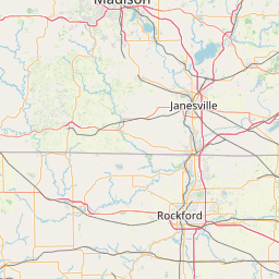
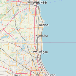
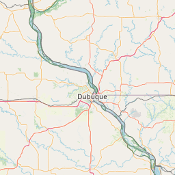
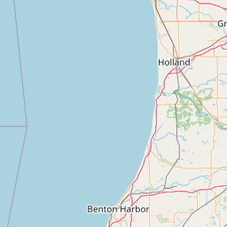
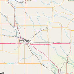
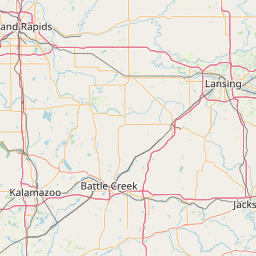
Leaflet | <a href="https://www.openstreetmap.org/copyright">© OpenStreetMap contributors</a>
Item
| Property | Value |
|---|---|
| id | 380734 |
| downstream_mainstem_id | https://geoconnex.us/ref/mainstems/327078 |
| encompassing_mainstem_basins | ['https://geoconnex.us/ref/mainstems/327078', 'https://geoconnex.us/ref/mainstems/312091'] |
| featuretype | ['https://www.opengis.net/def/schema/hy_features/hyf/HY_FlowPath', 'https://www.opengis.net/def/schema/hy_features/hyf/HY_WaterBody'] |
| fid | 11808 |
| head_2020huc12 | 070900060205 |
| head_nhdpv1_comid | 19286719 |
| head_nhdpv2_comid | https://geoconnex.us/nhdplusv2/comid/19286719 |
| head_nhdpv2huc12 | https://geoconnex.us/nhdplusv2/huc12/070900060205 |
| head_rf1id | 19289 |
| lengthkm | 95.5 |
| name_at_outlet | Kishwaukee River |
| name_at_outlet_gnis_id | 411555 |
| new_mainstemid | |
| outlet_2020huc12 | 070900060803 |
| outlet_drainagearea_sqkm | 3250.1 |
| outlet_nhdpv1_comid | 19287125 |
| outlet_nhdpv2_comid | https://geoconnex.us/nhdplusv2/comid/19287125 |
| outlet_nhdpv2huc12 | https://geoconnex.us/nhdplusv2/huc12/070900060803 |
| outlet_rf1id | 19277 |
| superseded | False |
| uri | https://geoconnex.us/ref/mainstems/380734 |
Graph Results
| monitoringLocation | https://sta.geoconnex.dev/collections/USGS/Things/items/'USGS-05438170' |
|---|---|
| siteName | USGS-05438170 |
| datasetDescription | Discharge cubic feet per second / USGS-05438170-29fe4563ec5a4e339fecd44ab083e8ce |
| type | Stream |
| url | https://waterdata.usgs.gov/monitoring-location/05438170/#parameterCode=00060 |
| variableMeasured | Discharge |
| variableUnit | ft^3/s |
| measurementTechnique | observation |
| temporalCoverage | 2024-08-30T09:15:00Z/2024-09-09T18:15:00Z |
| distributionName | USGS Instantaneous Values Service |
| distributionURL | https://waterservices.usgs.gov/nwis/iv/?sites=USGS:05438170¶meterCd=00060&format=rdb |
| distributionFormat | text/tab-separated-values |
| wkt | POINT (-88.6084888888889 42.26535) |
| monitoringLocation | https://sta.geoconnex.dev/collections/USGS/Things/items/'USGS-05438170' |
|---|---|
| siteName | USGS-05438170 |
| datasetDescription | Discharge cubic feet per second / USGS-05438170-29fe4563ec5a4e339fecd44ab083e8ce |
| type | Stream |
| url | https://waterdata.usgs.gov/monitoring-location/05438170/#parameterCode=00060 |
| variableMeasured | Discharge |
| variableUnit | ft^3/s |
| measurementTechnique | observation |
| temporalCoverage | 2024-08-30T09:15:00Z/2024-09-09T18:15:00Z |
| distributionName | USGS SensorThings API |
| distributionURL | https://labs.waterdata.usgs.gov/sta/v1.1/Datastreams('29fe4563ec5a4e339fecd44ab083e8ce')?$expand=Thing,Observations |
| distributionFormat | application/json |
| wkt | POINT (-88.6084888888889 42.26535) |
| monitoringLocation | https://sta.geoconnex.dev/collections/USGS/Things/items/'USGS-05438170' |
|---|---|
| siteName | USGS-05438170 |
| datasetDescription | Gage height / USGS-05438170-5168a455f04d46d2af8bc17c72d8d5b8 |
| type | Stream |
| url | https://waterdata.usgs.gov/monitoring-location/05438170/#parameterCode=00065 |
| variableMeasured | Gage height / USGS-05438170-5168a455f04d46d2af8bc17c72d8d5b8 |
| variableUnit | ft |
| measurementTechnique | observation |
| temporalCoverage | 2024-08-30T09:15:00Z/2024-09-09T18:15:00Z |
| distributionName | USGS SensorThings API |
| distributionURL | https://labs.waterdata.usgs.gov/sta/v1.1/Datastreams('5168a455f04d46d2af8bc17c72d8d5b8')?$expand=Thing,Observations |
| distributionFormat | application/json |
| wkt | POINT (-88.6084888888889 42.26535) |
| monitoringLocation | https://sta.geoconnex.dev/collections/USGS/Things/items/'USGS-05438170' |
|---|---|
| siteName | USGS-05438170 |
| datasetDescription | Gage height / USGS-05438170-5168a455f04d46d2af8bc17c72d8d5b8 |
| type | Stream |
| url | https://waterdata.usgs.gov/monitoring-location/05438170/#parameterCode=00065 |
| variableMeasured | Gage height / USGS-05438170-5168a455f04d46d2af8bc17c72d8d5b8 |
| variableUnit | ft |
| measurementTechnique | observation |
| temporalCoverage | 2024-08-30T09:15:00Z/2024-09-09T18:15:00Z |
| distributionName | USGS Instantaneous Values Service |
| distributionURL | https://waterservices.usgs.gov/nwis/iv/?sites=USGS:05438170¶meterCd=00065&format=rdb |
| distributionFormat | text/tab-separated-values |
| wkt | POINT (-88.6084888888889 42.26535) |
| monitoringLocation | https://sta.geoconnex.dev/collections/USGS/Things/items/'USGS-05438500' |
|---|---|
| siteName | USGS-05438500 |
| datasetDescription | Discharge / USGS-05438500-15da2e26eeb143f29c64e00dbbd7e99a |
| type | Stream |
| url | https://waterdata.usgs.gov/monitoring-location/05438500/#parameterCode=00060 |
| variableMeasured | Discharge / USGS-05438500-15da2e26eeb143f29c64e00dbbd7e99a |
| variableUnit | ft^3/s |
| measurementTechnique | observation |
| temporalCoverage | 2024-08-30T09:15:00Z/2024-09-09T18:30:00Z |
| distributionName | USGS SensorThings API |
| distributionURL | https://labs.waterdata.usgs.gov/sta/v1.1/Datastreams('15da2e26eeb143f29c64e00dbbd7e99a')?$expand=Thing,Observations |
| distributionFormat | application/json |
| wkt | POINT (-88.8631564848154 42.2561320777989) |
| monitoringLocation | https://sta.geoconnex.dev/collections/USGS/Things/items/'USGS-05438500' |
|---|---|
| siteName | USGS-05438500 |
| datasetDescription | Discharge / USGS-05438500-15da2e26eeb143f29c64e00dbbd7e99a |
| type | Stream |
| url | https://waterdata.usgs.gov/monitoring-location/05438500/#parameterCode=00060 |
| variableMeasured | Discharge / USGS-05438500-15da2e26eeb143f29c64e00dbbd7e99a |
| variableUnit | ft^3/s |
| measurementTechnique | observation |
| temporalCoverage | 2024-08-30T09:15:00Z/2024-09-09T18:30:00Z |
| distributionName | USGS Instantaneous Values Service |
| distributionURL | https://waterservices.usgs.gov/nwis/iv/?sites=USGS:05438500¶meterCd=00060&format=rdb |
| distributionFormat | text/tab-separated-values |
| wkt | POINT (-88.8631564848154 42.2561320777989) |
| monitoringLocation | https://sta.geoconnex.dev/collections/USGS/Things/items/'USGS-05438500' |
|---|---|
| siteName | USGS-05438500 |
| datasetDescription | Gage height / USGS-05438500-8c4a079c63e644f4a4e1c07e9f134156 |
| type | Stream |
| url | https://waterdata.usgs.gov/monitoring-location/05438500/#parameterCode=00065 |
| variableMeasured | Gage height / USGS-05438500-8c4a079c63e644f4a4e1c07e9f134156 |
| variableUnit | ft |
| measurementTechnique | observation |
| temporalCoverage | 2024-08-30T09:15:00Z/2024-09-09T18:30:00Z |
| distributionName | USGS SensorThings API |
| distributionURL | https://labs.waterdata.usgs.gov/sta/v1.1/Datastreams('8c4a079c63e644f4a4e1c07e9f134156')?$expand=Thing,Observations |
| distributionFormat | application/json |
| wkt | POINT (-88.8631564848154 42.2561320777989) |
| monitoringLocation | https://sta.geoconnex.dev/collections/USGS/Things/items/'USGS-05438500' |
|---|---|
| siteName | USGS-05438500 |
| datasetDescription | Gage height / USGS-05438500-8c4a079c63e644f4a4e1c07e9f134156 |
| type | Stream |
| url | https://waterdata.usgs.gov/monitoring-location/05438500/#parameterCode=00065 |
| variableMeasured | Gage height / USGS-05438500-8c4a079c63e644f4a4e1c07e9f134156 |
| variableUnit | ft |
| measurementTechnique | observation |
| temporalCoverage | 2024-08-30T09:15:00Z/2024-09-09T18:30:00Z |
| distributionName | USGS Instantaneous Values Service |
| distributionURL | https://waterservices.usgs.gov/nwis/iv/?sites=USGS:05438500¶meterCd=00065&format=rdb |
| distributionFormat | text/tab-separated-values |
| wkt | POINT (-88.8631564848154 42.2561320777989) |
| monitoringLocation | https://sta.geoconnex.dev/collections/USGS/Things/items/'USGS-05440000' |
|---|---|
| siteName | USGS-05440000 |
| datasetDescription | Gage height / USGS-05440000-25376fd9a6f04f3bbae0c22428ea2cf8 |
| type | Stream |
| url | https://waterdata.usgs.gov/monitoring-location/05440000/#parameterCode=00065 |
| variableMeasured | Gage height / USGS-05440000-25376fd9a6f04f3bbae0c22428ea2cf8 |
| variableUnit | ft |
| measurementTechnique | observation |
| temporalCoverage | 2024-08-30T09:15:00Z/2024-09-09T18:30:00Z |
| distributionName | USGS Instantaneous Values Service |
| distributionURL | https://waterservices.usgs.gov/nwis/iv/?sites=USGS:05440000¶meterCd=00065&format=rdb |
| distributionFormat | text/tab-separated-values |
| wkt | POINT (-88.9988888888889 42.1944444444444) |
| monitoringLocation | https://sta.geoconnex.dev/collections/USGS/Things/items/'USGS-05440000' |
|---|---|
| siteName | USGS-05440000 |
| datasetDescription | Gage height / USGS-05440000-25376fd9a6f04f3bbae0c22428ea2cf8 |
| type | Stream |
| url | https://waterdata.usgs.gov/monitoring-location/05440000/#parameterCode=00065 |
| variableMeasured | Gage height / USGS-05440000-25376fd9a6f04f3bbae0c22428ea2cf8 |
| variableUnit | ft |
| measurementTechnique | observation |
| temporalCoverage | 2024-08-30T09:15:00Z/2024-09-09T18:30:00Z |
| distributionName | USGS SensorThings API |
| distributionURL | https://labs.waterdata.usgs.gov/sta/v1.1/Datastreams('25376fd9a6f04f3bbae0c22428ea2cf8')?$expand=Thing,Observations |
| distributionFormat | application/json |
| wkt | POINT (-88.9988888888889 42.1944444444444) |
| monitoringLocation | https://sta.geoconnex.dev/collections/USGS/Things/items/'USGS-05440000' |
|---|---|
| siteName | USGS-05440000 |
| datasetDescription | Discharge cubic feet per second / USGS-05440000-d494da9bbb2e4f5f874649da88c94c32 |
| type | Stream |
| url | https://waterdata.usgs.gov/monitoring-location/05440000/#parameterCode=00060 |
| variableMeasured | Discharge |
| variableUnit | ft^3/s |
| measurementTechnique | observation |
| temporalCoverage | 2024-08-30T09:15:00Z/2024-09-09T18:30:00Z |
| distributionName | USGS Instantaneous Values Service |
| distributionURL | https://waterservices.usgs.gov/nwis/iv/?sites=USGS:05440000¶meterCd=00060&format=rdb |
| distributionFormat | text/tab-separated-values |
| wkt | POINT (-88.9988888888889 42.1944444444444) |
| monitoringLocation | https://sta.geoconnex.dev/collections/USGS/Things/items/'USGS-05440000' |
|---|---|
| siteName | USGS-05440000 |
| datasetDescription | Discharge cubic feet per second / USGS-05440000-d494da9bbb2e4f5f874649da88c94c32 |
| type | Stream |
| url | https://waterdata.usgs.gov/monitoring-location/05440000/#parameterCode=00060 |
| variableMeasured | Discharge |
| variableUnit | ft^3/s |
| measurementTechnique | observation |
| temporalCoverage | 2024-08-30T09:15:00Z/2024-09-09T18:30:00Z |
| distributionName | USGS SensorThings API |
| distributionURL | https://labs.waterdata.usgs.gov/sta/v1.1/Datastreams('d494da9bbb2e4f5f874649da88c94c32')?$expand=Thing,Observations |
| distributionFormat | application/json |
| wkt | POINT (-88.9988888888889 42.1944444444444) |