Minnehaha Creek
Map
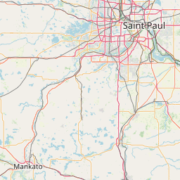
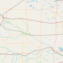
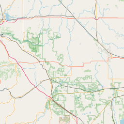
Leaflet | <a href="https://www.openstreetmap.org/copyright">© OpenStreetMap contributors</a>
Item
| Property | Value |
|---|---|
| id | 382449 |
| downstream_mainstem_id | https://geoconnex.us/ref/mainstems/312091 |
| encompassing_mainstem_basins | ['https://geoconnex.us/ref/mainstems/312091'] |
| featuretype | ['https://www.opengis.net/def/schema/hy_features/hyf/HY_FlowPath', 'https://www.opengis.net/def/schema/hy_features/hyf/HY_WaterBody'] |
| fid | 10569 |
| head_2020huc12 | 070102060601 |
| head_nhdpv1_comid | 1104320 |
| head_nhdpv2_comid | https://geoconnex.us/nhdplusv2/comid/1104320 |
| head_nhdpv2huc12 | https://geoconnex.us/nhdplusv2/huc12/070102060601 |
| head_rf1id | None |
| lengthkm | 76.6 |
| name_at_outlet | Minnehaha Creek |
| name_at_outlet_gnis_id | 647923 |
| new_mainstemid | |
| outlet_2020huc12 | 070102060605 |
| outlet_drainagearea_sqkm | 441.5 |
| outlet_nhdpv1_comid | 1104208 |
| outlet_nhdpv2_comid | https://geoconnex.us/nhdplusv2/comid/1104208 |
| outlet_nhdpv2huc12 | https://geoconnex.us/nhdplusv2/huc12/070102060605 |
| outlet_rf1id | None |
| superseded | False |
| uri | https://geoconnex.us/ref/mainstems/382449 |
Graph Results
| monitoringLocation | https://sta.geoconnex.dev/collections/USGS/Things/items/'USGS-05289100' |
|---|---|
| siteName | USGS-05289100 |
| datasetDescription | None / USGS-05289100-dd1a0b3802eb4b6ea73c15957320d3a9 |
| type | Stream |
| url | https://waterdata.usgs.gov/monitoring-location/05289100/#parameterCode=00065 |
| variableMeasured | None / USGS-05289100-dd1a0b3802eb4b6ea73c15957320d3a9 |
| variableUnit | ft |
| measurementTechnique | observation |
| temporalCoverage | 2024-08-30T09:15:00Z/2024-09-09T18:00:00Z |
| distributionName | USGS SensorThings API |
| distributionURL | https://labs.waterdata.usgs.gov/sta/v1.1/Datastreams('dd1a0b3802eb4b6ea73c15957320d3a9')?$expand=Thing,Observations |
| distributionFormat | application/json |
| wkt | POINT (-93.4872222222222 44.9533333333333) |
| monitoringLocation | https://sta.geoconnex.dev/collections/USGS/Things/items/'USGS-05289100' |
|---|---|
| siteName | USGS-05289100 |
| datasetDescription | None / USGS-05289100-dd1a0b3802eb4b6ea73c15957320d3a9 |
| type | Stream |
| url | https://waterdata.usgs.gov/monitoring-location/05289100/#parameterCode=00065 |
| variableMeasured | None / USGS-05289100-dd1a0b3802eb4b6ea73c15957320d3a9 |
| variableUnit | ft |
| measurementTechnique | observation |
| temporalCoverage | 2024-08-30T09:15:00Z/2024-09-09T18:00:00Z |
| distributionName | USGS Instantaneous Values Service |
| distributionURL | https://waterservices.usgs.gov/nwis/iv/?sites=USGS:05289100¶meterCd=00065&format=rdb |
| distributionFormat | text/tab-separated-values |
| wkt | POINT (-93.4872222222222 44.9533333333333) |
| monitoringLocation | https://sta.geoconnex.dev/collections/USGS/Things/items/'USGS-05289800' |
|---|---|
| siteName | USGS-05289800 |
| datasetDescription | None / USGS-05289800-f07d44442e204039a64422e32d6313ff |
| type | Stream |
| url | https://waterdata.usgs.gov/monitoring-location/05289800/#parameterCode=00045 |
| variableMeasured | None / USGS-05289800-f07d44442e204039a64422e32d6313ff |
| variableUnit | in |
| measurementTechnique | observation |
| temporalCoverage | 2024-08-30T09:05:00Z/2024-09-09T18:00:00Z |
| distributionName | USGS Instantaneous Values Service |
| distributionURL | https://waterservices.usgs.gov/nwis/iv/?sites=USGS:05289800¶meterCd=00045&format=rdb |
| distributionFormat | text/tab-separated-values |
| wkt | POINT (-93.2127223630236 44.9155209735311) |
| monitoringLocation | https://sta.geoconnex.dev/collections/USGS/Things/items/'USGS-05289800' |
|---|---|
| siteName | USGS-05289800 |
| datasetDescription | None / USGS-05289800-f07d44442e204039a64422e32d6313ff |
| type | Stream |
| url | https://waterdata.usgs.gov/monitoring-location/05289800/#parameterCode=00045 |
| variableMeasured | None / USGS-05289800-f07d44442e204039a64422e32d6313ff |
| variableUnit | in |
| measurementTechnique | observation |
| temporalCoverage | 2024-08-30T09:05:00Z/2024-09-09T18:00:00Z |
| distributionName | USGS SensorThings API |
| distributionURL | https://labs.waterdata.usgs.gov/sta/v1.1/Datastreams('f07d44442e204039a64422e32d6313ff')?$expand=Thing,Observations |
| distributionFormat | application/json |
| wkt | POINT (-93.2127223630236 44.9155209735311) |
| monitoringLocation | https://sta.geoconnex.dev/collections/USGS/Things/items/'USGS-05289800' |
|---|---|
| siteName | USGS-05289800 |
| datasetDescription | Temperature water / USGS-05289800-cc48d206203747fab7954457a26b45cc |
| type | Stream |
| url | https://waterdata.usgs.gov/monitoring-location/05289800/#parameterCode=00010 |
| variableMeasured | Temperature |
| variableUnit | degC |
| measurementTechnique | observation |
| temporalCoverage | 2024-08-30T09:05:00Z/2024-09-09T18:00:00Z |
| distributionName | USGS Instantaneous Values Service |
| distributionURL | https://waterservices.usgs.gov/nwis/iv/?sites=USGS:05289800¶meterCd=00010&format=rdb |
| distributionFormat | text/tab-separated-values |
| wkt | POINT (-93.2127223630236 44.9155209735311) |
| monitoringLocation | https://sta.geoconnex.dev/collections/USGS/Things/items/'USGS-05289800' |
|---|---|
| siteName | USGS-05289800 |
| datasetDescription | Temperature water / USGS-05289800-cc48d206203747fab7954457a26b45cc |
| type | Stream |
| url | https://waterdata.usgs.gov/monitoring-location/05289800/#parameterCode=00010 |
| variableMeasured | Temperature |
| variableUnit | degC |
| measurementTechnique | observation |
| temporalCoverage | 2024-08-30T09:05:00Z/2024-09-09T18:00:00Z |
| distributionName | USGS SensorThings API |
| distributionURL | https://labs.waterdata.usgs.gov/sta/v1.1/Datastreams('cc48d206203747fab7954457a26b45cc')?$expand=Thing,Observations |
| distributionFormat | application/json |
| wkt | POINT (-93.2127223630236 44.9155209735311) |
| monitoringLocation | https://sta.geoconnex.dev/collections/USGS/Things/items/'USGS-05289800' |
|---|---|
| siteName | USGS-05289800 |
| datasetDescription | Stream water level elevation above NAVD 1988 in feet / USGS-05289800-a58ff9824d4d4912ac40116f3bf33105 |
| type | Stream |
| url | https://waterdata.usgs.gov/monitoring-location/05289800/#parameterCode=63160 |
| variableMeasured | Stream water level elevation above NAVD 1988 |
| variableUnit | ft |
| measurementTechnique | observation |
| temporalCoverage | 2024-08-30T09:05:00Z/2024-09-09T18:00:00Z |
| distributionName | USGS Instantaneous Values Service |
| distributionURL | https://waterservices.usgs.gov/nwis/iv/?sites=USGS:05289800¶meterCd=63160&format=rdb |
| distributionFormat | text/tab-separated-values |
| wkt | POINT (-93.2127223630236 44.9155209735311) |
| monitoringLocation | https://sta.geoconnex.dev/collections/USGS/Things/items/'USGS-05289800' |
|---|---|
| siteName | USGS-05289800 |
| datasetDescription | Stream water level elevation above NAVD 1988 in feet / USGS-05289800-a58ff9824d4d4912ac40116f3bf33105 |
| type | Stream |
| url | https://waterdata.usgs.gov/monitoring-location/05289800/#parameterCode=63160 |
| variableMeasured | Stream water level elevation above NAVD 1988 |
| variableUnit | ft |
| measurementTechnique | observation |
| temporalCoverage | 2024-08-30T09:05:00Z/2024-09-09T18:00:00Z |
| distributionName | USGS SensorThings API |
| distributionURL | https://labs.waterdata.usgs.gov/sta/v1.1/Datastreams('a58ff9824d4d4912ac40116f3bf33105')?$expand=Thing,Observations |
| distributionFormat | application/json |
| wkt | POINT (-93.2127223630236 44.9155209735311) |
| monitoringLocation | https://sta.geoconnex.dev/collections/USGS/Things/items/'USGS-05289800' |
|---|---|
| siteName | USGS-05289800 |
| datasetDescription | Specific conductance water unfiltered microsiemens per centimeter at 25 degrees Celsius / USGS-05289800-ec7a22fd327d4a459c91054bd7e7d9f5 |
| type | Stream |
| url | https://waterdata.usgs.gov/monitoring-location/05289800/#parameterCode=00095 |
| variableMeasured | Specific conductance |
| variableUnit | uS/cm |
| measurementTechnique | observation |
| temporalCoverage | 2024-08-30T09:05:00Z/2024-09-09T18:00:00Z |
| distributionName | USGS Instantaneous Values Service |
| distributionURL | https://waterservices.usgs.gov/nwis/iv/?sites=USGS:05289800¶meterCd=00095&format=rdb |
| distributionFormat | text/tab-separated-values |
| wkt | POINT (-93.2127223630236 44.9155209735311) |
| monitoringLocation | https://sta.geoconnex.dev/collections/USGS/Things/items/'USGS-05289800' |
|---|---|
| siteName | USGS-05289800 |
| datasetDescription | Specific conductance water unfiltered microsiemens per centimeter at 25 degrees Celsius / USGS-05289800-ec7a22fd327d4a459c91054bd7e7d9f5 |
| type | Stream |
| url | https://waterdata.usgs.gov/monitoring-location/05289800/#parameterCode=00095 |
| variableMeasured | Specific conductance |
| variableUnit | uS/cm |
| measurementTechnique | observation |
| temporalCoverage | 2024-08-30T09:05:00Z/2024-09-09T18:00:00Z |
| distributionName | USGS SensorThings API |
| distributionURL | https://labs.waterdata.usgs.gov/sta/v1.1/Datastreams('ec7a22fd327d4a459c91054bd7e7d9f5')?$expand=Thing,Observations |
| distributionFormat | application/json |
| wkt | POINT (-93.2127223630236 44.9155209735311) |
| monitoringLocation | https://sta.geoconnex.dev/collections/USGS/Things/items/'USGS-05289800' |
|---|---|
| siteName | USGS-05289800 |
| datasetDescription | Gage height / USGS-05289800-5724ee8ed47e4391883466c18bf1445a |
| type | Stream |
| url | https://waterdata.usgs.gov/monitoring-location/05289800/#parameterCode=00065 |
| variableMeasured | Gage height / USGS-05289800-5724ee8ed47e4391883466c18bf1445a |
| variableUnit | ft |
| measurementTechnique | observation |
| temporalCoverage | 2024-08-30T09:05:00Z/2024-09-09T18:00:00Z |
| distributionName | USGS Instantaneous Values Service |
| distributionURL | https://waterservices.usgs.gov/nwis/iv/?sites=USGS:05289800¶meterCd=00065&format=rdb |
| distributionFormat | text/tab-separated-values |
| wkt | POINT (-93.2127223630236 44.9155209735311) |
| monitoringLocation | https://sta.geoconnex.dev/collections/USGS/Things/items/'USGS-05289800' |
|---|---|
| siteName | USGS-05289800 |
| datasetDescription | Gage height / USGS-05289800-5724ee8ed47e4391883466c18bf1445a |
| type | Stream |
| url | https://waterdata.usgs.gov/monitoring-location/05289800/#parameterCode=00065 |
| variableMeasured | Gage height / USGS-05289800-5724ee8ed47e4391883466c18bf1445a |
| variableUnit | ft |
| measurementTechnique | observation |
| temporalCoverage | 2024-08-30T09:05:00Z/2024-09-09T18:00:00Z |
| distributionName | USGS SensorThings API |
| distributionURL | https://labs.waterdata.usgs.gov/sta/v1.1/Datastreams('5724ee8ed47e4391883466c18bf1445a')?$expand=Thing,Observations |
| distributionFormat | application/json |
| wkt | POINT (-93.2127223630236 44.9155209735311) |
| monitoringLocation | https://sta.geoconnex.dev/collections/USGS/Things/items/'USGS-05289800' |
|---|---|
| siteName | USGS-05289800 |
| datasetDescription | Discharge cubic feet per second / USGS-05289800-64897e1d1a664c90b3852e404a888fb6 |
| type | Stream |
| url | https://waterdata.usgs.gov/monitoring-location/05289800/#parameterCode=00060 |
| variableMeasured | Discharge |
| variableUnit | ft^3/s |
| measurementTechnique | observation |
| temporalCoverage | 2024-08-30T09:05:00Z/2024-09-09T18:00:00Z |
| distributionName | USGS SensorThings API |
| distributionURL | https://labs.waterdata.usgs.gov/sta/v1.1/Datastreams('64897e1d1a664c90b3852e404a888fb6')?$expand=Thing,Observations |
| distributionFormat | application/json |
| wkt | POINT (-93.2127223630236 44.9155209735311) |
| monitoringLocation | https://sta.geoconnex.dev/collections/USGS/Things/items/'USGS-05289800' |
|---|---|
| siteName | USGS-05289800 |
| datasetDescription | Discharge cubic feet per second / USGS-05289800-64897e1d1a664c90b3852e404a888fb6 |
| type | Stream |
| url | https://waterdata.usgs.gov/monitoring-location/05289800/#parameterCode=00060 |
| variableMeasured | Discharge |
| variableUnit | ft^3/s |
| measurementTechnique | observation |
| temporalCoverage | 2024-08-30T09:05:00Z/2024-09-09T18:00:00Z |
| distributionName | USGS Instantaneous Values Service |
| distributionURL | https://waterservices.usgs.gov/nwis/iv/?sites=USGS:05289800¶meterCd=00060&format=rdb |
| distributionFormat | text/tab-separated-values |
| wkt | POINT (-93.2127223630236 44.9155209735311) |