Elm Creek
Map


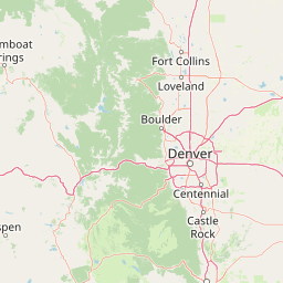

Leaflet | <a href="https://www.openstreetmap.org/copyright">© OpenStreetMap contributors</a>
Item
| Property | Value |
|---|---|
| id | 387672 |
| downstream_mainstem_id | https://geoconnex.us/ref/mainstems/313255 |
| encompassing_mainstem_basins | ['https://geoconnex.us/ref/mainstems/313255', 'https://geoconnex.us/ref/mainstems/312532', 'https://geoconnex.us/ref/mainstems/312091'] |
| featuretype | ['https://www.opengis.net/def/schema/hy_features/hyf/HY_FlowPath', 'https://www.opengis.net/def/schema/hy_features/hyf/HY_WaterBody'] |
| fid | 18146 |
| head_2020huc12 | 102001010805 |
| head_nhdpv1_comid | 7259671 |
| head_nhdpv2_comid | https://geoconnex.us/nhdplusv2/comid/7259671 |
| head_nhdpv2huc12 | https://geoconnex.us/nhdplusv2/huc12/102001010805 |
| head_rf1id | 23097 |
| lengthkm | 60.9 |
| name_at_outlet | Elm Creek |
| name_at_outlet_gnis_id | 829076 |
| new_mainstemid | |
| outlet_2020huc12 | 102001010808 |
| outlet_drainagearea_sqkm | 1221.7 |
| outlet_nhdpv1_comid | 7264437 |
| outlet_nhdpv2_comid | https://geoconnex.us/nhdplusv2/comid/7264437 |
| outlet_nhdpv2huc12 | https://geoconnex.us/nhdplusv2/huc12/102001010808 |
| outlet_rf1id | 23096 |
| superseded | False |
| uri | https://geoconnex.us/ref/mainstems/387672 |
Graph Results
| monitoringLocation | https://sta.geoconnex.dev/collections/USGS/Things/items/'USGS-06769525' |
|---|---|
| siteName | USGS-06769525 |
| datasetDescription | Gage height / USGS-06769525-d30e466ee4544931a4d50b1eddf5561c |
| type | Stream |
| url | https://waterdata.usgs.gov/monitoring-location/06769525/#parameterCode=00065 |
| variableMeasured | Gage height / USGS-06769525-d30e466ee4544931a4d50b1eddf5561c |
| variableUnit | ft |
| measurementTechnique | observation |
| temporalCoverage | 2024-08-30T09:15:00Z/2024-09-09T17:45:00Z |
| distributionName | USGS Instantaneous Values Service |
| distributionURL | https://waterservices.usgs.gov/nwis/iv/?sites=USGS:06769525¶meterCd=00065&format=rdb |
| distributionFormat | text/tab-separated-values |
| wkt | POINT (-99.3989884924351 40.7288987981634) |
| monitoringLocation | https://sta.geoconnex.dev/collections/USGS/Things/items/'USGS-06769525' |
|---|---|
| siteName | USGS-06769525 |
| datasetDescription | Gage height / USGS-06769525-d30e466ee4544931a4d50b1eddf5561c |
| type | Stream |
| url | https://waterdata.usgs.gov/monitoring-location/06769525/#parameterCode=00065 |
| variableMeasured | Gage height / USGS-06769525-d30e466ee4544931a4d50b1eddf5561c |
| variableUnit | ft |
| measurementTechnique | observation |
| temporalCoverage | 2024-08-30T09:15:00Z/2024-09-09T17:45:00Z |
| distributionName | USGS SensorThings API |
| distributionURL | https://labs.waterdata.usgs.gov/sta/v1.1/Datastreams('d30e466ee4544931a4d50b1eddf5561c')?$expand=Thing,Observations |
| distributionFormat | application/json |
| wkt | POINT (-99.3989884924351 40.7288987981634) |
| monitoringLocation | https://sta.geoconnex.dev/collections/USGS/Things/items/'USGS-06769525' |
|---|---|
| siteName | USGS-06769525 |
| datasetDescription | Discharge / USGS-06769525-e453d1b5628c4521b211d717917e0758 |
| type | Stream |
| url | https://waterdata.usgs.gov/monitoring-location/06769525/#parameterCode=00060 |
| variableMeasured | Discharge / USGS-06769525-e453d1b5628c4521b211d717917e0758 |
| variableUnit | ft^3/s |
| measurementTechnique | observation |
| temporalCoverage | 2024-08-30T09:15:00Z/2024-09-09T17:45:00Z |
| distributionName | USGS Instantaneous Values Service |
| distributionURL | https://waterservices.usgs.gov/nwis/iv/?sites=USGS:06769525¶meterCd=00060&format=rdb |
| distributionFormat | text/tab-separated-values |
| wkt | POINT (-99.3989884924351 40.7288987981634) |
| monitoringLocation | https://sta.geoconnex.dev/collections/USGS/Things/items/'USGS-06769525' |
|---|---|
| siteName | USGS-06769525 |
| datasetDescription | Discharge / USGS-06769525-e453d1b5628c4521b211d717917e0758 |
| type | Stream |
| url | https://waterdata.usgs.gov/monitoring-location/06769525/#parameterCode=00060 |
| variableMeasured | Discharge / USGS-06769525-e453d1b5628c4521b211d717917e0758 |
| variableUnit | ft^3/s |
| measurementTechnique | observation |
| temporalCoverage | 2024-08-30T09:15:00Z/2024-09-09T17:45:00Z |
| distributionName | USGS SensorThings API |
| distributionURL | https://labs.waterdata.usgs.gov/sta/v1.1/Datastreams('e453d1b5628c4521b211d717917e0758')?$expand=Thing,Observations |
| distributionFormat | application/json |
| wkt | POINT (-99.3989884924351 40.7288987981634) |