Turtle River
Map
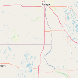
Leaflet | <a href="https://www.openstreetmap.org/copyright">© OpenStreetMap contributors</a>
Item
| Property | Value |
|---|---|
| id | 388940 |
| downstream_mainstem_id | https://geoconnex.us/ref/mainstems/348803 |
| encompassing_mainstem_basins | ['https://geoconnex.us/ref/mainstems/348803', 'https://geoconnex.us/ref/mainstems/333963', 'https://geoconnex.us/ref/mainstems/312091'] |
| featuretype | ['https://www.opengis.net/def/schema/hy_features/hyf/HY_FlowPath', 'https://www.opengis.net/def/schema/hy_features/hyf/HY_WaterBody'] |
| fid | 11007 |
| head_2020huc12 | 070500020302 |
| head_nhdpv1_comid | 13345120 |
| head_nhdpv2_comid | https://geoconnex.us/nhdplusv2/comid/13345120 |
| head_nhdpv2huc12 | https://geoconnex.us/nhdplusv2/huc12/070500020302 |
| head_rf1id | 20486 |
| lengthkm | 65.6 |
| name_at_outlet | Turtle River |
| name_at_outlet_gnis_id | 1575746 |
| new_mainstemid | |
| outlet_2020huc12 | 070500020306 |
| outlet_drainagearea_sqkm | 411.9 |
| outlet_nhdpv1_comid | 13346284 |
| outlet_nhdpv2_comid | https://geoconnex.us/nhdplusv2/comid/13346284 |
| outlet_nhdpv2huc12 | https://geoconnex.us/nhdplusv2/huc12/070500020306 |
| outlet_rf1id | 20489 |
| superseded | False |
| uri | https://geoconnex.us/ref/mainstems/388940 |
Graph Results
| monitoringLocation | https://geoconnex.us/iow/wqp/NALMS-F1564427 |
|---|---|
| siteName | NALMS-F1564427 |
| datasetDescription | Weather condition (WMO code 4501) (choice list) at NALMS-F1564427 |
| type | Lake |
| url | https://www.waterqualitydata.us/provider/STORET/NALMS/NALMS-F1564427/ |
| variableMeasured | Weather condition (WMO code 4501) (choice list) |
| variableUnit | None |
| measurementTechnique | observation |
| temporalCoverage | 1994-01-01T00:00:00Z/2001-12-31T00:00:00Z |
| distributionName | Water Quality Portal |
| distributionURL | https://www.waterqualitydata.us/data/Result/search?siteid=NALMS-F1564427&CharacteristicName=Weather condition (WMO code 4501) (choice list)&mimeType=csv |
| distributionFormat | text/comma-separated-values |
| wkt | POINT (-90.061 46.182) |
| monitoringLocation | https://geoconnex.us/iow/wqp/NALMS-F1564427 |
|---|---|
| siteName | NALMS-F1564427 |
| datasetDescription | Depth, Secchi disk depth at NALMS-F1564427 |
| type | Lake |
| url | https://www.waterqualitydata.us/provider/STORET/NALMS/NALMS-F1564427/ |
| variableMeasured | Depth, Secchi disk depth |
| variableUnit | m |
| measurementTechnique | observation |
| temporalCoverage | 1994-01-01T00:00:00Z/2001-12-31T00:00:00Z |
| distributionName | Water Quality Portal |
| distributionURL | https://www.waterqualitydata.us/data/Result/search?siteid=NALMS-F1564427&CharacteristicName=Depth, Secchi disk depth&mimeType=csv |
| distributionFormat | text/comma-separated-values |
| wkt | POINT (-90.061 46.182) |
| monitoringLocation | https://geoconnex.us/iow/wqp/USGS-461351089541101 |
|---|---|
| siteName | USGS-461351089541101 |
| datasetDescription | Hardness, non-carbonate at USGS-461351089541101 |
| type | Well |
| url | https://www.waterqualitydata.us/provider/NWIS/USGS-WI/USGS-461351089541101/ |
| variableMeasured | Hardness, non-carbonate |
| variableUnit | mg/l CaCO3 |
| measurementTechnique | observation |
| temporalCoverage | 1973-01-01T00:00:00Z/1975-12-31T00:00:00Z |
| distributionName | Water Quality Portal |
| distributionURL | https://www.waterqualitydata.us/data/Result/search?siteid=USGS-461351089541101&CharacteristicName=Hardness, non-carbonate&mimeType=csv |
| distributionFormat | text/comma-separated-values |
| wkt | POINT (-89.9032166 46.2307822) |
| monitoringLocation | https://geoconnex.us/iow/wqp/USGS-461351089541101 |
|---|---|
| siteName | USGS-461351089541101 |
| datasetDescription | Sodium, percent total cations at USGS-461351089541101 |
| type | Well |
| url | https://www.waterqualitydata.us/provider/NWIS/USGS-WI/USGS-461351089541101/ |
| variableMeasured | Sodium, percent total cations |
| variableUnit | % |
| measurementTechnique | observation |
| temporalCoverage | 1973-01-01T00:00:00Z/1975-12-31T00:00:00Z |
| distributionName | Water Quality Portal |
| distributionURL | https://www.waterqualitydata.us/data/Result/search?siteid=USGS-461351089541101&CharacteristicName=Sodium, percent total cations&mimeType=csv |
| distributionFormat | text/comma-separated-values |
| wkt | POINT (-89.9032166 46.2307822) |
| monitoringLocation | https://geoconnex.us/iow/wqp/USGS-461351089541101 |
|---|---|
| siteName | USGS-461351089541101 |
| datasetDescription | Color at USGS-461351089541101 |
| type | Well |
| url | https://www.waterqualitydata.us/provider/NWIS/USGS-WI/USGS-461351089541101/ |
| variableMeasured | Color |
| variableUnit | PCU |
| measurementTechnique | observation |
| temporalCoverage | 1973-01-01T00:00:00Z/1975-12-31T00:00:00Z |
| distributionName | Water Quality Portal |
| distributionURL | https://www.waterqualitydata.us/data/Result/search?siteid=USGS-461351089541101&CharacteristicName=Color&mimeType=csv |
| distributionFormat | text/comma-separated-values |
| wkt | POINT (-89.9032166 46.2307822) |
| monitoringLocation | https://geoconnex.us/iow/wqp/USGS-461351089541101 |
|---|---|
| siteName | USGS-461351089541101 |
| datasetDescription | Depth to water level below land surface at USGS-461351089541101 |
| type | Well |
| url | https://www.waterqualitydata.us/provider/NWIS/USGS-WI/USGS-461351089541101/ |
| variableMeasured | Depth to water level below land surface |
| variableUnit | m |
| measurementTechnique | observation |
| temporalCoverage | 1973-01-01T00:00:00Z/1973-12-31T00:00:00Z |
| distributionName | Water Quality Portal |
| distributionURL | https://www.waterqualitydata.us/data/Result/search?siteid=USGS-461351089541101&CharacteristicName=Depth to water level below land surface&mimeType=csv |
| distributionFormat | text/comma-separated-values |
| wkt | POINT (-89.9032166 46.2307822) |
| monitoringLocation | https://geoconnex.us/iow/wqp/USGS-461351089541101 |
|---|---|
| siteName | USGS-461351089541101 |
| datasetDescription | Magnesium at USGS-461351089541101 |
| type | Well |
| url | https://www.waterqualitydata.us/provider/NWIS/USGS-WI/USGS-461351089541101/ |
| variableMeasured | Magnesium |
| variableUnit | % |
| measurementTechnique | observation |
| temporalCoverage | 1973-01-01T00:00:00Z/1975-12-31T00:00:00Z |
| distributionName | Water Quality Portal |
| distributionURL | https://www.waterqualitydata.us/data/Result/search?siteid=USGS-461351089541101&CharacteristicName=Magnesium&mimeType=csv |
| distributionFormat | text/comma-separated-values |
| wkt | POINT (-89.9032166 46.2307822) |
| monitoringLocation | https://geoconnex.us/iow/wqp/USGS-461351089541101 |
|---|---|
| siteName | USGS-461351089541101 |
| datasetDescription | Silica at USGS-461351089541101 |
| type | Well |
| url | https://www.waterqualitydata.us/provider/NWIS/USGS-WI/USGS-461351089541101/ |
| variableMeasured | Silica |
| variableUnit | mg/l |
| measurementTechnique | observation |
| temporalCoverage | 1973-01-01T00:00:00Z/1975-12-31T00:00:00Z |
| distributionName | Water Quality Portal |
| distributionURL | https://www.waterqualitydata.us/data/Result/search?siteid=USGS-461351089541101&CharacteristicName=Silica&mimeType=csv |
| distributionFormat | text/comma-separated-values |
| wkt | POINT (-89.9032166 46.2307822) |
| monitoringLocation | https://geoconnex.us/iow/wqp/USGS-461351089541101 |
|---|---|
| siteName | USGS-461351089541101 |
| datasetDescription | Total dissolved solids at USGS-461351089541101 |
| type | Well |
| url | https://www.waterqualitydata.us/provider/NWIS/USGS-WI/USGS-461351089541101/ |
| variableMeasured | Total dissolved solids |
| variableUnit | mg/l |
| measurementTechnique | observation |
| temporalCoverage | 1973-01-01T00:00:00Z/1975-12-31T00:00:00Z |
| distributionName | Water Quality Portal |
| distributionURL | https://www.waterqualitydata.us/data/Result/search?siteid=USGS-461351089541101&CharacteristicName=Total dissolved solids&mimeType=csv |
| distributionFormat | text/comma-separated-values |
| wkt | POINT (-89.9032166 46.2307822) |
| monitoringLocation | https://geoconnex.us/iow/wqp/USGS-461351089541101 |
|---|---|
| siteName | USGS-461351089541101 |
| datasetDescription | Manganese at USGS-461351089541101 |
| type | Well |
| url | https://www.waterqualitydata.us/provider/NWIS/USGS-WI/USGS-461351089541101/ |
| variableMeasured | Manganese |
| variableUnit | ug/l |
| measurementTechnique | observation |
| temporalCoverage | 1973-01-01T00:00:00Z/1975-12-31T00:00:00Z |
| distributionName | Water Quality Portal |
| distributionURL | https://www.waterqualitydata.us/data/Result/search?siteid=USGS-461351089541101&CharacteristicName=Manganese&mimeType=csv |
| distributionFormat | text/comma-separated-values |
| wkt | POINT (-89.9032166 46.2307822) |
| monitoringLocation | https://geoconnex.us/iow/wqp/USGS-461351089541101 |
|---|---|
| siteName | USGS-461351089541101 |
| datasetDescription | Bicarbonate at USGS-461351089541101 |
| type | Well |
| url | https://www.waterqualitydata.us/provider/NWIS/USGS-WI/USGS-461351089541101/ |
| variableMeasured | Bicarbonate |
| variableUnit | mg/l |
| measurementTechnique | observation |
| temporalCoverage | 1973-01-01T00:00:00Z/1975-12-31T00:00:00Z |
| distributionName | Water Quality Portal |
| distributionURL | https://www.waterqualitydata.us/data/Result/search?siteid=USGS-461351089541101&CharacteristicName=Bicarbonate&mimeType=csv |
| distributionFormat | text/comma-separated-values |
| wkt | POINT (-89.9032166 46.2307822) |
| monitoringLocation | https://geoconnex.us/iow/wqp/USGS-461351089541101 |
|---|---|
| siteName | USGS-461351089541101 |
| datasetDescription | Sodium at USGS-461351089541101 |
| type | Well |
| url | https://www.waterqualitydata.us/provider/NWIS/USGS-WI/USGS-461351089541101/ |
| variableMeasured | Sodium |
| variableUnit | mg/l |
| measurementTechnique | observation |
| temporalCoverage | 1973-01-01T00:00:00Z/1975-12-31T00:00:00Z |
| distributionName | Water Quality Portal |
| distributionURL | https://www.waterqualitydata.us/data/Result/search?siteid=USGS-461351089541101&CharacteristicName=Sodium&mimeType=csv |
| distributionFormat | text/comma-separated-values |
| wkt | POINT (-89.9032166 46.2307822) |
| monitoringLocation | https://geoconnex.us/iow/wqp/USGS-461351089541101 |
|---|---|
| siteName | USGS-461351089541101 |
| datasetDescription | Inorganic nitrogen (nitrate and nitrite) at USGS-461351089541101 |
| type | Well |
| url | https://www.waterqualitydata.us/provider/NWIS/USGS-WI/USGS-461351089541101/ |
| variableMeasured | Inorganic nitrogen (nitrate and nitrite) |
| variableUnit | mg/l as N |
| measurementTechnique | observation |
| temporalCoverage | 1975-01-01T00:00:00Z/1975-12-31T00:00:00Z |
| distributionName | Water Quality Portal |
| distributionURL | https://www.waterqualitydata.us/data/Result/search?siteid=USGS-461351089541101&CharacteristicName=Inorganic nitrogen (nitrate and nitrite)&mimeType=csv |
| distributionFormat | text/comma-separated-values |
| wkt | POINT (-89.9032166 46.2307822) |
| monitoringLocation | https://geoconnex.us/iow/wqp/USGS-461351089541101 |
|---|---|
| siteName | USGS-461351089541101 |
| datasetDescription | Depth at USGS-461351089541101 |
| type | Well |
| url | https://www.waterqualitydata.us/provider/NWIS/USGS-WI/USGS-461351089541101/ |
| variableMeasured | Depth |
| variableUnit | ft |
| measurementTechnique | observation |
| temporalCoverage | 1973-01-01T00:00:00Z/1973-12-31T00:00:00Z |
| distributionName | Water Quality Portal |
| distributionURL | https://www.waterqualitydata.us/data/Result/search?siteid=USGS-461351089541101&CharacteristicName=Depth&mimeType=csv |
| distributionFormat | text/comma-separated-values |
| wkt | POINT (-89.9032166 46.2307822) |
| monitoringLocation | https://geoconnex.us/iow/wqp/USGS-461351089541101 |
|---|---|
| siteName | USGS-461351089541101 |
| datasetDescription | Potassium at USGS-461351089541101 |
| type | Well |
| url | https://www.waterqualitydata.us/provider/NWIS/USGS-WI/USGS-461351089541101/ |
| variableMeasured | Potassium |
| variableUnit | mg/l |
| measurementTechnique | observation |
| temporalCoverage | 1973-01-01T00:00:00Z/1975-12-31T00:00:00Z |
| distributionName | Water Quality Portal |
| distributionURL | https://www.waterqualitydata.us/data/Result/search?siteid=USGS-461351089541101&CharacteristicName=Potassium&mimeType=csv |
| distributionFormat | text/comma-separated-values |
| wkt | POINT (-89.9032166 46.2307822) |
| monitoringLocation | https://geoconnex.us/iow/wqp/USGS-461351089541101 |
|---|---|
| siteName | USGS-461351089541101 |
| datasetDescription | Carbonate at USGS-461351089541101 |
| type | Well |
| url | https://www.waterqualitydata.us/provider/NWIS/USGS-WI/USGS-461351089541101/ |
| variableMeasured | Carbonate |
| variableUnit | mg/l |
| measurementTechnique | observation |
| temporalCoverage | 1973-01-01T00:00:00Z/1975-12-31T00:00:00Z |
| distributionName | Water Quality Portal |
| distributionURL | https://www.waterqualitydata.us/data/Result/search?siteid=USGS-461351089541101&CharacteristicName=Carbonate&mimeType=csv |
| distributionFormat | text/comma-separated-values |
| wkt | POINT (-89.9032166 46.2307822) |
| monitoringLocation | https://geoconnex.us/iow/wqp/USGS-461351089541101 |
|---|---|
| siteName | USGS-461351089541101 |
| datasetDescription | Alkalinity at USGS-461351089541101 |
| type | Well |
| url | https://www.waterqualitydata.us/provider/NWIS/USGS-WI/USGS-461351089541101/ |
| variableMeasured | Alkalinity |
| variableUnit | mg/l CaCO3 |
| measurementTechnique | observation |
| temporalCoverage | 1973-01-01T00:00:00Z/1975-12-31T00:00:00Z |
| distributionName | Water Quality Portal |
| distributionURL | https://www.waterqualitydata.us/data/Result/search?siteid=USGS-461351089541101&CharacteristicName=Alkalinity&mimeType=csv |
| distributionFormat | text/comma-separated-values |
| wkt | POINT (-89.9032166 46.2307822) |
| monitoringLocation | https://geoconnex.us/iow/wqp/USGS-461351089541101 |
|---|---|
| siteName | USGS-461351089541101 |
| datasetDescription | Sulfate at USGS-461351089541101 |
| type | Well |
| url | https://www.waterqualitydata.us/provider/NWIS/USGS-WI/USGS-461351089541101/ |
| variableMeasured | Sulfate |
| variableUnit | mg/l |
| measurementTechnique | observation |
| temporalCoverage | 1973-01-01T00:00:00Z/1975-12-31T00:00:00Z |
| distributionName | Water Quality Portal |
| distributionURL | https://www.waterqualitydata.us/data/Result/search?siteid=USGS-461351089541101&CharacteristicName=Sulfate&mimeType=csv |
| distributionFormat | text/comma-separated-values |
| wkt | POINT (-89.9032166 46.2307822) |
| monitoringLocation | https://geoconnex.us/iow/wqp/USGS-461351089541101 |
|---|---|
| siteName | USGS-461351089541101 |
| datasetDescription | Chloride at USGS-461351089541101 |
| type | Well |
| url | https://www.waterqualitydata.us/provider/NWIS/USGS-WI/USGS-461351089541101/ |
| variableMeasured | Chloride |
| variableUnit | mg/l |
| measurementTechnique | observation |
| temporalCoverage | 1973-01-01T00:00:00Z/1975-12-31T00:00:00Z |
| distributionName | Water Quality Portal |
| distributionURL | https://www.waterqualitydata.us/data/Result/search?siteid=USGS-461351089541101&CharacteristicName=Chloride&mimeType=csv |
| distributionFormat | text/comma-separated-values |
| wkt | POINT (-89.9032166 46.2307822) |
| monitoringLocation | https://geoconnex.us/iow/wqp/USGS-461351089541101 |
|---|---|
| siteName | USGS-461351089541101 |
| datasetDescription | Fluoride at USGS-461351089541101 |
| type | Well |
| url | https://www.waterqualitydata.us/provider/NWIS/USGS-WI/USGS-461351089541101/ |
| variableMeasured | Fluoride |
| variableUnit | mg/l |
| measurementTechnique | observation |
| temporalCoverage | 1973-01-01T00:00:00Z/1975-12-31T00:00:00Z |
| distributionName | Water Quality Portal |
| distributionURL | https://www.waterqualitydata.us/data/Result/search?siteid=USGS-461351089541101&CharacteristicName=Fluoride&mimeType=csv |
| distributionFormat | text/comma-separated-values |
| wkt | POINT (-89.9032166 46.2307822) |
| monitoringLocation | https://geoconnex.us/iow/wqp/USGS-461351089541101 |
|---|---|
| siteName | USGS-461351089541101 |
| datasetDescription | Flow rate at USGS-461351089541101 |
| type | Well |
| url | https://www.waterqualitydata.us/provider/NWIS/USGS-WI/USGS-461351089541101/ |
| variableMeasured | Flow rate |
| variableUnit | gal/min |
| measurementTechnique | observation |
| temporalCoverage | 1973-01-01T00:00:00Z/1973-12-31T00:00:00Z |
| distributionName | Water Quality Portal |
| distributionURL | https://www.waterqualitydata.us/data/Result/search?siteid=USGS-461351089541101&CharacteristicName=Flow rate&mimeType=csv |
| distributionFormat | text/comma-separated-values |
| wkt | POINT (-89.9032166 46.2307822) |
| monitoringLocation | https://geoconnex.us/iow/wqp/USGS-461351089541101 |
|---|---|
| siteName | USGS-461351089541101 |
| datasetDescription | Calcium at USGS-461351089541101 |
| type | Well |
| url | https://www.waterqualitydata.us/provider/NWIS/USGS-WI/USGS-461351089541101/ |
| variableMeasured | Calcium |
| variableUnit | mg/L |
| measurementTechnique | observation |
| temporalCoverage | 1973-01-01T00:00:00Z/1975-12-31T00:00:00Z |
| distributionName | Water Quality Portal |
| distributionURL | https://www.waterqualitydata.us/data/Result/search?siteid=USGS-461351089541101&CharacteristicName=Calcium&mimeType=csv |
| distributionFormat | text/comma-separated-values |
| wkt | POINT (-89.9032166 46.2307822) |
| monitoringLocation | https://geoconnex.us/iow/wqp/USGS-461351089541101 |
|---|---|
| siteName | USGS-461351089541101 |
| datasetDescription | Nitrate at USGS-461351089541101 |
| type | Well |
| url | https://www.waterqualitydata.us/provider/NWIS/USGS-WI/USGS-461351089541101/ |
| variableMeasured | Nitrate |
| variableUnit | mg/l as N |
| measurementTechnique | observation |
| temporalCoverage | 1973-01-01T00:00:00Z/1975-12-31T00:00:00Z |
| distributionName | Water Quality Portal |
| distributionURL | https://www.waterqualitydata.us/data/Result/search?siteid=USGS-461351089541101&CharacteristicName=Nitrate&mimeType=csv |
| distributionFormat | text/comma-separated-values |
| wkt | POINT (-89.9032166 46.2307822) |
| monitoringLocation | https://geoconnex.us/iow/wqp/USGS-461351089541101 |
|---|---|
| siteName | USGS-461351089541101 |
| datasetDescription | pH at USGS-461351089541101 |
| type | Well |
| url | https://www.waterqualitydata.us/provider/NWIS/USGS-WI/USGS-461351089541101/ |
| variableMeasured | pH |
| variableUnit | None |
| measurementTechnique | observation |
| temporalCoverage | 1973-01-01T00:00:00Z/1975-12-31T00:00:00Z |
| distributionName | Water Quality Portal |
| distributionURL | https://www.waterqualitydata.us/data/Result/search?siteid=USGS-461351089541101&CharacteristicName=pH&mimeType=csv |
| distributionFormat | text/comma-separated-values |
| wkt | POINT (-89.9032166 46.2307822) |
| monitoringLocation | https://geoconnex.us/iow/wqp/USGS-461351089541101 |
|---|---|
| siteName | USGS-461351089541101 |
| datasetDescription | Nitrite at USGS-461351089541101 |
| type | Well |
| url | https://www.waterqualitydata.us/provider/NWIS/USGS-WI/USGS-461351089541101/ |
| variableMeasured | Nitrite |
| variableUnit | mg/L |
| measurementTechnique | observation |
| temporalCoverage | 1975-01-01T00:00:00Z/1975-12-31T00:00:00Z |
| distributionName | Water Quality Portal |
| distributionURL | https://www.waterqualitydata.us/data/Result/search?siteid=USGS-461351089541101&CharacteristicName=Nitrite&mimeType=csv |
| distributionFormat | text/comma-separated-values |
| wkt | POINT (-89.9032166 46.2307822) |
| monitoringLocation | https://geoconnex.us/iow/wqp/USGS-461351089541101 |
|---|---|
| siteName | USGS-461351089541101 |
| datasetDescription | Specific conductance at USGS-461351089541101 |
| type | Well |
| url | https://www.waterqualitydata.us/provider/NWIS/USGS-WI/USGS-461351089541101/ |
| variableMeasured | Specific conductance |
| variableUnit | umho/cm |
| measurementTechnique | observation |
| temporalCoverage | 1973-01-01T00:00:00Z/1975-12-31T00:00:00Z |
| distributionName | Water Quality Portal |
| distributionURL | https://www.waterqualitydata.us/data/Result/search?siteid=USGS-461351089541101&CharacteristicName=Specific conductance&mimeType=csv |
| distributionFormat | text/comma-separated-values |
| wkt | POINT (-89.9032166 46.2307822) |
| monitoringLocation | https://geoconnex.us/iow/wqp/USGS-461351089541101 |
|---|---|
| siteName | USGS-461351089541101 |
| datasetDescription | Temperature, water at USGS-461351089541101 |
| type | Well |
| url | https://www.waterqualitydata.us/provider/NWIS/USGS-WI/USGS-461351089541101/ |
| variableMeasured | Temperature, water |
| variableUnit | deg C |
| measurementTechnique | observation |
| temporalCoverage | 1973-01-01T00:00:00Z/1975-12-31T00:00:00Z |
| distributionName | Water Quality Portal |
| distributionURL | https://www.waterqualitydata.us/data/Result/search?siteid=USGS-461351089541101&CharacteristicName=Temperature, water&mimeType=csv |
| distributionFormat | text/comma-separated-values |
| wkt | POINT (-89.9032166 46.2307822) |
| monitoringLocation | https://geoconnex.us/iow/wqp/USGS-461351089541101 |
|---|---|
| siteName | USGS-461351089541101 |
| datasetDescription | Iron at USGS-461351089541101 |
| type | Well |
| url | https://www.waterqualitydata.us/provider/NWIS/USGS-WI/USGS-461351089541101/ |
| variableMeasured | Iron |
| variableUnit | % |
| measurementTechnique | observation |
| temporalCoverage | 1973-01-01T00:00:00Z/1975-12-31T00:00:00Z |
| distributionName | Water Quality Portal |
| distributionURL | https://www.waterqualitydata.us/data/Result/search?siteid=USGS-461351089541101&CharacteristicName=Iron&mimeType=csv |
| distributionFormat | text/comma-separated-values |
| wkt | POINT (-89.9032166 46.2307822) |
| monitoringLocation | https://geoconnex.us/iow/wqp/USGS-461351089541101 |
|---|---|
| siteName | USGS-461351089541101 |
| datasetDescription | Kjeldahl nitrogen at USGS-461351089541101 |
| type | Well |
| url | https://www.waterqualitydata.us/provider/NWIS/USGS-WI/USGS-461351089541101/ |
| variableMeasured | Kjeldahl nitrogen |
| variableUnit | mg/L |
| measurementTechnique | observation |
| temporalCoverage | 1975-01-01T00:00:00Z/1975-12-31T00:00:00Z |
| distributionName | Water Quality Portal |
| distributionURL | https://www.waterqualitydata.us/data/Result/search?siteid=USGS-461351089541101&CharacteristicName=Kjeldahl nitrogen&mimeType=csv |
| distributionFormat | text/comma-separated-values |
| wkt | POINT (-89.9032166 46.2307822) |
| monitoringLocation | https://geoconnex.us/iow/wqp/USGS-461351089541101 |
|---|---|
| siteName | USGS-461351089541101 |
| datasetDescription | Hardness, Ca, Mg at USGS-461351089541101 |
| type | Well |
| url | https://www.waterqualitydata.us/provider/NWIS/USGS-WI/USGS-461351089541101/ |
| variableMeasured | Hardness, Ca, Mg |
| variableUnit | mg/l CaCO3 |
| measurementTechnique | observation |
| temporalCoverage | 1973-01-01T00:00:00Z/1975-12-31T00:00:00Z |
| distributionName | Water Quality Portal |
| distributionURL | https://www.waterqualitydata.us/data/Result/search?siteid=USGS-461351089541101&CharacteristicName=Hardness, Ca, Mg&mimeType=csv |
| distributionFormat | text/comma-separated-values |
| wkt | POINT (-89.9032166 46.2307822) |
| monitoringLocation | https://geoconnex.us/iow/wqp/USGS-461351089541101 |
|---|---|
| siteName | USGS-461351089541101 |
| datasetDescription | Phosphorus at USGS-461351089541101 |
| type | Well |
| url | https://www.waterqualitydata.us/provider/NWIS/USGS-WI/USGS-461351089541101/ |
| variableMeasured | Phosphorus |
| variableUnit | ppb |
| measurementTechnique | observation |
| temporalCoverage | 1975-01-01T00:00:00Z/1975-12-31T00:00:00Z |
| distributionName | Water Quality Portal |
| distributionURL | https://www.waterqualitydata.us/data/Result/search?siteid=USGS-461351089541101&CharacteristicName=Phosphorus&mimeType=csv |
| distributionFormat | text/comma-separated-values |
| wkt | POINT (-89.9032166 46.2307822) |
| monitoringLocation | https://geoconnex.us/iow/wqp/USGS-461351089541101 |
|---|---|
| siteName | USGS-461351089541101 |
| datasetDescription | Nitrogen, mixed forms (NH3), (NH4), organic, (NO2) and (NO3) at USGS-461351089541101 |
| type | Well |
| url | https://www.waterqualitydata.us/provider/NWIS/USGS-WI/USGS-461351089541101/ |
| variableMeasured | Nitrogen, mixed forms (NH3), (NH4), organic, (NO2) and (NO3) |
| variableUnit | mg/l |
| measurementTechnique | observation |
| temporalCoverage | 1975-01-01T00:00:00Z/1975-12-31T00:00:00Z |
| distributionName | Water Quality Portal |
| distributionURL | https://www.waterqualitydata.us/data/Result/search?siteid=USGS-461351089541101&CharacteristicName=Nitrogen, mixed forms (NH3), (NH4), organic, (NO2) and (NO3)&mimeType=csv |
| distributionFormat | text/comma-separated-values |
| wkt | POINT (-89.9032166 46.2307822) |
| monitoringLocation | https://geoconnex.us/iow/wqp/USGS-461351089541101 |
|---|---|
| siteName | USGS-461351089541101 |
| datasetDescription | Carbon dioxide at USGS-461351089541101 |
| type | Well |
| url | https://www.waterqualitydata.us/provider/NWIS/USGS-WI/USGS-461351089541101/ |
| variableMeasured | Carbon dioxide |
| variableUnit | mg/l |
| measurementTechnique | observation |
| temporalCoverage | 1973-01-01T00:00:00Z/1975-12-31T00:00:00Z |
| distributionName | Water Quality Portal |
| distributionURL | https://www.waterqualitydata.us/data/Result/search?siteid=USGS-461351089541101&CharacteristicName=Carbon dioxide&mimeType=csv |
| distributionFormat | text/comma-separated-values |
| wkt | POINT (-89.9032166 46.2307822) |
| monitoringLocation | https://geoconnex.us/iow/wqp/WIDNR_WQX-10051476 |
|---|---|
| siteName | WIDNR_WQX-10051476 |
| datasetDescription | Water level (probe) at WIDNR_WQX-10051476 |
| type | Lake |
| url | https://www.waterqualitydata.us/provider/STORET/WIDNR_WQX/WIDNR_WQX-10051476/ |
| variableMeasured | Water level (probe) |
| variableUnit | ft |
| measurementTechnique | observation |
| temporalCoverage | 2019-01-01T00:00:00Z/2019-12-31T00:00:00Z |
| distributionName | Water Quality Portal |
| distributionURL | https://www.waterqualitydata.us/data/Result/search?siteid=WIDNR_WQX-10051476&CharacteristicName=Water level (probe)&mimeType=csv |
| distributionFormat | text/comma-separated-values |
| wkt | POINT (-89.974715 46.245478) |
| monitoringLocation | https://geoconnex.us/iow/wqp/WIDNR_WQX-10051476 |
|---|---|
| siteName | WIDNR_WQX-10051476 |
| datasetDescription | Depth, Secchi disk depth at WIDNR_WQX-10051476 |
| type | Lake |
| url | https://www.waterqualitydata.us/provider/STORET/WIDNR_WQX/WIDNR_WQX-10051476/ |
| variableMeasured | Depth, Secchi disk depth |
| variableUnit | m |
| measurementTechnique | observation |
| temporalCoverage | 2018-01-01T00:00:00Z/2024-12-31T00:00:00Z |
| distributionName | Water Quality Portal |
| distributionURL | https://www.waterqualitydata.us/data/Result/search?siteid=WIDNR_WQX-10051476&CharacteristicName=Depth, Secchi disk depth&mimeType=csv |
| distributionFormat | text/comma-separated-values |
| wkt | POINT (-89.974715 46.245478) |
| monitoringLocation | https://geoconnex.us/iow/wqp/WIDNR_WQX-10051476 |
|---|---|
| siteName | WIDNR_WQX-10051476 |
| datasetDescription | Water appearance (text) at WIDNR_WQX-10051476 |
| type | Lake |
| url | https://www.waterqualitydata.us/provider/STORET/WIDNR_WQX/WIDNR_WQX-10051476/ |
| variableMeasured | Water appearance (text) |
| variableUnit | Unknown |
| measurementTechnique | observation |
| temporalCoverage | 2018-01-01T00:00:00Z/2024-12-31T00:00:00Z |
| distributionName | Water Quality Portal |
| distributionURL | https://www.waterqualitydata.us/data/Result/search?siteid=WIDNR_WQX-10051476&CharacteristicName=Water appearance (text)&mimeType=csv |
| distributionFormat | text/comma-separated-values |
| wkt | POINT (-89.974715 46.245478) |
| monitoringLocation | https://geoconnex.us/iow/wqp/WIDNR_WQX-10051476 |
|---|---|
| siteName | WIDNR_WQX-10051476 |
| datasetDescription | Temperature, water at WIDNR_WQX-10051476 |
| type | Lake |
| url | https://www.waterqualitydata.us/provider/STORET/WIDNR_WQX/WIDNR_WQX-10051476/ |
| variableMeasured | Temperature, water |
| variableUnit | deg C |
| measurementTechnique | observation |
| temporalCoverage | 2018-01-01T00:00:00Z/2024-12-31T00:00:00Z |
| distributionName | Water Quality Portal |
| distributionURL | https://www.waterqualitydata.us/data/Result/search?siteid=WIDNR_WQX-10051476&CharacteristicName=Temperature, water&mimeType=csv |
| distributionFormat | text/comma-separated-values |
| wkt | POINT (-89.974715 46.245478) |
| monitoringLocation | https://geoconnex.us/iow/wqp/WIDNR_WQX-10051476 |
|---|---|
| siteName | WIDNR_WQX-10051476 |
| datasetDescription | Dissolved oxygen (DO) at WIDNR_WQX-10051476 |
| type | Lake |
| url | https://www.waterqualitydata.us/provider/STORET/WIDNR_WQX/WIDNR_WQX-10051476/ |
| variableMeasured | Dissolved oxygen (DO) |
| variableUnit | mg/L |
| measurementTechnique | observation |
| temporalCoverage | 2018-01-01T00:00:00Z/2024-12-31T00:00:00Z |
| distributionName | Water Quality Portal |
| distributionURL | https://www.waterqualitydata.us/data/Result/search?siteid=WIDNR_WQX-10051476&CharacteristicName=Dissolved oxygen (DO)&mimeType=csv |
| distributionFormat | text/comma-separated-values |
| wkt | POINT (-89.974715 46.245478) |
| monitoringLocation | https://geoconnex.us/iow/wqp/USGS-461436089501302 |
|---|---|
| siteName | USGS-461436089501302 |
| datasetDescription | Depth at USGS-461436089501302 |
| type | Well |
| url | https://www.waterqualitydata.us/provider/NWIS/USGS-WI/USGS-461436089501302/ |
| variableMeasured | Depth |
| variableUnit | ft |
| measurementTechnique | observation |
| temporalCoverage | 1982-01-01T00:00:00Z/1982-12-31T00:00:00Z |
| distributionName | Water Quality Portal |
| distributionURL | https://www.waterqualitydata.us/data/Result/search?siteid=USGS-461436089501302&CharacteristicName=Depth&mimeType=csv |
| distributionFormat | text/comma-separated-values |
| wkt | POINT (-89.8371038 46.24328219) |
| monitoringLocation | https://geoconnex.us/iow/wqp/USGS-461436089501302 |
|---|---|
| siteName | USGS-461436089501302 |
| datasetDescription | Barium at USGS-461436089501302 |
| type | Well |
| url | https://www.waterqualitydata.us/provider/NWIS/USGS-WI/USGS-461436089501302/ |
| variableMeasured | Barium |
| variableUnit | ug/L |
| measurementTechnique | observation |
| temporalCoverage | 1982-01-01T00:00:00Z/1982-12-31T00:00:00Z |
| distributionName | Water Quality Portal |
| distributionURL | https://www.waterqualitydata.us/data/Result/search?siteid=USGS-461436089501302&CharacteristicName=Barium&mimeType=csv |
| distributionFormat | text/comma-separated-values |
| wkt | POINT (-89.8371038 46.24328219) |
| monitoringLocation | https://geoconnex.us/iow/wqp/USGS-461436089501302 |
|---|---|
| siteName | USGS-461436089501302 |
| datasetDescription | Chloride at USGS-461436089501302 |
| type | Well |
| url | https://www.waterqualitydata.us/provider/NWIS/USGS-WI/USGS-461436089501302/ |
| variableMeasured | Chloride |
| variableUnit | mg/l |
| measurementTechnique | observation |
| temporalCoverage | 1982-01-01T00:00:00Z/1982-12-31T00:00:00Z |
| distributionName | Water Quality Portal |
| distributionURL | https://www.waterqualitydata.us/data/Result/search?siteid=USGS-461436089501302&CharacteristicName=Chloride&mimeType=csv |
| distributionFormat | text/comma-separated-values |
| wkt | POINT (-89.8371038 46.24328219) |
| monitoringLocation | https://geoconnex.us/iow/wqp/USGS-461436089501302 |
|---|---|
| siteName | USGS-461436089501302 |
| datasetDescription | Hardness, Ca, Mg at USGS-461436089501302 |
| type | Well |
| url | https://www.waterqualitydata.us/provider/NWIS/USGS-WI/USGS-461436089501302/ |
| variableMeasured | Hardness, Ca, Mg |
| variableUnit | mg/l CaCO3 |
| measurementTechnique | observation |
| temporalCoverage | 1982-01-01T00:00:00Z/1982-12-31T00:00:00Z |
| distributionName | Water Quality Portal |
| distributionURL | https://www.waterqualitydata.us/data/Result/search?siteid=USGS-461436089501302&CharacteristicName=Hardness, Ca, Mg&mimeType=csv |
| distributionFormat | text/comma-separated-values |
| wkt | POINT (-89.8371038 46.24328219) |
| monitoringLocation | https://geoconnex.us/iow/wqp/USGS-461436089501302 |
|---|---|
| siteName | USGS-461436089501302 |
| datasetDescription | Magnesium at USGS-461436089501302 |
| type | Well |
| url | https://www.waterqualitydata.us/provider/NWIS/USGS-WI/USGS-461436089501302/ |
| variableMeasured | Magnesium |
| variableUnit | % |
| measurementTechnique | observation |
| temporalCoverage | 1982-01-01T00:00:00Z/1982-12-31T00:00:00Z |
| distributionName | Water Quality Portal |
| distributionURL | https://www.waterqualitydata.us/data/Result/search?siteid=USGS-461436089501302&CharacteristicName=Magnesium&mimeType=csv |
| distributionFormat | text/comma-separated-values |
| wkt | POINT (-89.8371038 46.24328219) |
| monitoringLocation | https://geoconnex.us/iow/wqp/USGS-461436089501302 |
|---|---|
| siteName | USGS-461436089501302 |
| datasetDescription | Arsenic at USGS-461436089501302 |
| type | Well |
| url | https://www.waterqualitydata.us/provider/NWIS/USGS-WI/USGS-461436089501302/ |
| variableMeasured | Arsenic |
| variableUnit | ppm |
| measurementTechnique | observation |
| temporalCoverage | 1982-01-01T00:00:00Z/1982-12-31T00:00:00Z |
| distributionName | Water Quality Portal |
| distributionURL | https://www.waterqualitydata.us/data/Result/search?siteid=USGS-461436089501302&CharacteristicName=Arsenic&mimeType=csv |
| distributionFormat | text/comma-separated-values |
| wkt | POINT (-89.8371038 46.24328219) |
| monitoringLocation | https://geoconnex.us/iow/wqp/USGS-461436089501302 |
|---|---|
| siteName | USGS-461436089501302 |
| datasetDescription | Temperature, water at USGS-461436089501302 |
| type | Well |
| url | https://www.waterqualitydata.us/provider/NWIS/USGS-WI/USGS-461436089501302/ |
| variableMeasured | Temperature, water |
| variableUnit | deg C |
| measurementTechnique | observation |
| temporalCoverage | 1982-01-01T00:00:00Z/1982-12-31T00:00:00Z |
| distributionName | Water Quality Portal |
| distributionURL | https://www.waterqualitydata.us/data/Result/search?siteid=USGS-461436089501302&CharacteristicName=Temperature, water&mimeType=csv |
| distributionFormat | text/comma-separated-values |
| wkt | POINT (-89.8371038 46.24328219) |
| monitoringLocation | https://geoconnex.us/iow/wqp/USGS-461436089501302 |
|---|---|
| siteName | USGS-461436089501302 |
| datasetDescription | Potassium at USGS-461436089501302 |
| type | Well |
| url | https://www.waterqualitydata.us/provider/NWIS/USGS-WI/USGS-461436089501302/ |
| variableMeasured | Potassium |
| variableUnit | mg/l |
| measurementTechnique | observation |
| temporalCoverage | 1982-01-01T00:00:00Z/1982-12-31T00:00:00Z |
| distributionName | Water Quality Portal |
| distributionURL | https://www.waterqualitydata.us/data/Result/search?siteid=USGS-461436089501302&CharacteristicName=Potassium&mimeType=csv |
| distributionFormat | text/comma-separated-values |
| wkt | POINT (-89.8371038 46.24328219) |
| monitoringLocation | https://geoconnex.us/iow/wqp/USGS-461436089501302 |
|---|---|
| siteName | USGS-461436089501302 |
| datasetDescription | Sodium at USGS-461436089501302 |
| type | Well |
| url | https://www.waterqualitydata.us/provider/NWIS/USGS-WI/USGS-461436089501302/ |
| variableMeasured | Sodium |
| variableUnit | mg/l |
| measurementTechnique | observation |
| temporalCoverage | 1982-01-01T00:00:00Z/1982-12-31T00:00:00Z |
| distributionName | Water Quality Portal |
| distributionURL | https://www.waterqualitydata.us/data/Result/search?siteid=USGS-461436089501302&CharacteristicName=Sodium&mimeType=csv |
| distributionFormat | text/comma-separated-values |
| wkt | POINT (-89.8371038 46.24328219) |
| monitoringLocation | https://geoconnex.us/iow/wqp/USGS-461436089501302 |
|---|---|
| siteName | USGS-461436089501302 |
| datasetDescription | Calcium at USGS-461436089501302 |
| type | Well |
| url | https://www.waterqualitydata.us/provider/NWIS/USGS-WI/USGS-461436089501302/ |
| variableMeasured | Calcium |
| variableUnit | mg/L |
| measurementTechnique | observation |
| temporalCoverage | 1982-01-01T00:00:00Z/1982-12-31T00:00:00Z |
| distributionName | Water Quality Portal |
| distributionURL | https://www.waterqualitydata.us/data/Result/search?siteid=USGS-461436089501302&CharacteristicName=Calcium&mimeType=csv |
| distributionFormat | text/comma-separated-values |
| wkt | POINT (-89.8371038 46.24328219) |
| monitoringLocation | https://geoconnex.us/iow/wqp/USGS-461436089501302 |
|---|---|
| siteName | USGS-461436089501302 |
| datasetDescription | Organic Nitrogen at USGS-461436089501302 |
| type | Well |
| url | https://www.waterqualitydata.us/provider/NWIS/USGS-WI/USGS-461436089501302/ |
| variableMeasured | Organic Nitrogen |
| variableUnit | mg/l |
| measurementTechnique | observation |
| temporalCoverage | 1982-01-01T00:00:00Z/1982-12-31T00:00:00Z |
| distributionName | Water Quality Portal |
| distributionURL | https://www.waterqualitydata.us/data/Result/search?siteid=USGS-461436089501302&CharacteristicName=Organic Nitrogen&mimeType=csv |
| distributionFormat | text/comma-separated-values |
| wkt | POINT (-89.8371038 46.24328219) |
| monitoringLocation | https://geoconnex.us/iow/wqp/USGS-461436089501302 |
|---|---|
| siteName | USGS-461436089501302 |
| datasetDescription | Sulfate at USGS-461436089501302 |
| type | Well |
| url | https://www.waterqualitydata.us/provider/NWIS/USGS-WI/USGS-461436089501302/ |
| variableMeasured | Sulfate |
| variableUnit | mg/l |
| measurementTechnique | observation |
| temporalCoverage | 1982-01-01T00:00:00Z/1982-12-31T00:00:00Z |
| distributionName | Water Quality Portal |
| distributionURL | https://www.waterqualitydata.us/data/Result/search?siteid=USGS-461436089501302&CharacteristicName=Sulfate&mimeType=csv |
| distributionFormat | text/comma-separated-values |
| wkt | POINT (-89.8371038 46.24328219) |
| monitoringLocation | https://geoconnex.us/iow/wqp/USGS-461436089501302 |
|---|---|
| siteName | USGS-461436089501302 |
| datasetDescription | Specific conductance at USGS-461436089501302 |
| type | Well |
| url | https://www.waterqualitydata.us/provider/NWIS/USGS-WI/USGS-461436089501302/ |
| variableMeasured | Specific conductance |
| variableUnit | umho/cm |
| measurementTechnique | observation |
| temporalCoverage | 1982-01-01T00:00:00Z/1982-12-31T00:00:00Z |
| distributionName | Water Quality Portal |
| distributionURL | https://www.waterqualitydata.us/data/Result/search?siteid=USGS-461436089501302&CharacteristicName=Specific conductance&mimeType=csv |
| distributionFormat | text/comma-separated-values |
| wkt | POINT (-89.8371038 46.24328219) |
| monitoringLocation | https://geoconnex.us/iow/wqp/USGS-461436089501302 |
|---|---|
| siteName | USGS-461436089501302 |
| datasetDescription | Nitrogen, mixed forms (NH3), (NH4), organic, (NO2) and (NO3) at USGS-461436089501302 |
| type | Well |
| url | https://www.waterqualitydata.us/provider/NWIS/USGS-WI/USGS-461436089501302/ |
| variableMeasured | Nitrogen, mixed forms (NH3), (NH4), organic, (NO2) and (NO3) |
| variableUnit | mg/l |
| measurementTechnique | observation |
| temporalCoverage | 1982-01-01T00:00:00Z/1982-12-31T00:00:00Z |
| distributionName | Water Quality Portal |
| distributionURL | https://www.waterqualitydata.us/data/Result/search?siteid=USGS-461436089501302&CharacteristicName=Nitrogen, mixed forms (NH3), (NH4), organic, (NO2) and (NO3)&mimeType=csv |
| distributionFormat | text/comma-separated-values |
| wkt | POINT (-89.8371038 46.24328219) |
| monitoringLocation | https://geoconnex.us/iow/wqp/USGS-461436089501302 |
|---|---|
| siteName | USGS-461436089501302 |
| datasetDescription | Fluoride at USGS-461436089501302 |
| type | Well |
| url | https://www.waterqualitydata.us/provider/NWIS/USGS-WI/USGS-461436089501302/ |
| variableMeasured | Fluoride |
| variableUnit | mg/l |
| measurementTechnique | observation |
| temporalCoverage | 1982-01-01T00:00:00Z/1982-12-31T00:00:00Z |
| distributionName | Water Quality Portal |
| distributionURL | https://www.waterqualitydata.us/data/Result/search?siteid=USGS-461436089501302&CharacteristicName=Fluoride&mimeType=csv |
| distributionFormat | text/comma-separated-values |
| wkt | POINT (-89.8371038 46.24328219) |
| monitoringLocation | https://geoconnex.us/iow/wqp/USGS-461436089501302 |
|---|---|
| siteName | USGS-461436089501302 |
| datasetDescription | Total dissolved solids at USGS-461436089501302 |
| type | Well |
| url | https://www.waterqualitydata.us/provider/NWIS/USGS-WI/USGS-461436089501302/ |
| variableMeasured | Total dissolved solids |
| variableUnit | mg/l |
| measurementTechnique | observation |
| temporalCoverage | 1982-01-01T00:00:00Z/1982-12-31T00:00:00Z |
| distributionName | Water Quality Portal |
| distributionURL | https://www.waterqualitydata.us/data/Result/search?siteid=USGS-461436089501302&CharacteristicName=Total dissolved solids&mimeType=csv |
| distributionFormat | text/comma-separated-values |
| wkt | POINT (-89.8371038 46.24328219) |
| monitoringLocation | https://geoconnex.us/iow/wqp/USGS-461436089501302 |
|---|---|
| siteName | USGS-461436089501302 |
| datasetDescription | Iron at USGS-461436089501302 |
| type | Well |
| url | https://www.waterqualitydata.us/provider/NWIS/USGS-WI/USGS-461436089501302/ |
| variableMeasured | Iron |
| variableUnit | % |
| measurementTechnique | observation |
| temporalCoverage | 1982-01-01T00:00:00Z/1982-12-31T00:00:00Z |
| distributionName | Water Quality Portal |
| distributionURL | https://www.waterqualitydata.us/data/Result/search?siteid=USGS-461436089501302&CharacteristicName=Iron&mimeType=csv |
| distributionFormat | text/comma-separated-values |
| wkt | POINT (-89.8371038 46.24328219) |
| monitoringLocation | https://geoconnex.us/iow/wqp/USGS-461436089501302 |
|---|---|
| siteName | USGS-461436089501302 |
| datasetDescription | Alkalinity at USGS-461436089501302 |
| type | Well |
| url | https://www.waterqualitydata.us/provider/NWIS/USGS-WI/USGS-461436089501302/ |
| variableMeasured | Alkalinity |
| variableUnit | mg/l CaCO3 |
| measurementTechnique | observation |
| temporalCoverage | 1982-01-01T00:00:00Z/1982-12-31T00:00:00Z |
| distributionName | Water Quality Portal |
| distributionURL | https://www.waterqualitydata.us/data/Result/search?siteid=USGS-461436089501302&CharacteristicName=Alkalinity&mimeType=csv |
| distributionFormat | text/comma-separated-values |
| wkt | POINT (-89.8371038 46.24328219) |
| monitoringLocation | https://geoconnex.us/iow/wqp/USGS-461436089501302 |
|---|---|
| siteName | USGS-461436089501302 |
| datasetDescription | Nitrite at USGS-461436089501302 |
| type | Well |
| url | https://www.waterqualitydata.us/provider/NWIS/USGS-WI/USGS-461436089501302/ |
| variableMeasured | Nitrite |
| variableUnit | mg/L |
| measurementTechnique | observation |
| temporalCoverage | 1982-01-01T00:00:00Z/1982-12-31T00:00:00Z |
| distributionName | Water Quality Portal |
| distributionURL | https://www.waterqualitydata.us/data/Result/search?siteid=USGS-461436089501302&CharacteristicName=Nitrite&mimeType=csv |
| distributionFormat | text/comma-separated-values |
| wkt | POINT (-89.8371038 46.24328219) |
| monitoringLocation | https://geoconnex.us/iow/wqp/USGS-461436089501302 |
|---|---|
| siteName | USGS-461436089501302 |
| datasetDescription | Strontium at USGS-461436089501302 |
| type | Well |
| url | https://www.waterqualitydata.us/provider/NWIS/USGS-WI/USGS-461436089501302/ |
| variableMeasured | Strontium |
| variableUnit | ug/L |
| measurementTechnique | observation |
| temporalCoverage | 1982-01-01T00:00:00Z/1982-12-31T00:00:00Z |
| distributionName | Water Quality Portal |
| distributionURL | https://www.waterqualitydata.us/data/Result/search?siteid=USGS-461436089501302&CharacteristicName=Strontium&mimeType=csv |
| distributionFormat | text/comma-separated-values |
| wkt | POINT (-89.8371038 46.24328219) |
| monitoringLocation | https://geoconnex.us/iow/wqp/USGS-461436089501302 |
|---|---|
| siteName | USGS-461436089501302 |
| datasetDescription | Phosphorus at USGS-461436089501302 |
| type | Well |
| url | https://www.waterqualitydata.us/provider/NWIS/USGS-WI/USGS-461436089501302/ |
| variableMeasured | Phosphorus |
| variableUnit | ppb |
| measurementTechnique | observation |
| temporalCoverage | 1982-01-01T00:00:00Z/1982-12-31T00:00:00Z |
| distributionName | Water Quality Portal |
| distributionURL | https://www.waterqualitydata.us/data/Result/search?siteid=USGS-461436089501302&CharacteristicName=Phosphorus&mimeType=csv |
| distributionFormat | text/comma-separated-values |
| wkt | POINT (-89.8371038 46.24328219) |
| monitoringLocation | https://geoconnex.us/iow/wqp/USGS-461436089501302 |
|---|---|
| siteName | USGS-461436089501302 |
| datasetDescription | Sodium, percent total cations at USGS-461436089501302 |
| type | Well |
| url | https://www.waterqualitydata.us/provider/NWIS/USGS-WI/USGS-461436089501302/ |
| variableMeasured | Sodium, percent total cations |
| variableUnit | % |
| measurementTechnique | observation |
| temporalCoverage | 1982-01-01T00:00:00Z/1982-12-31T00:00:00Z |
| distributionName | Water Quality Portal |
| distributionURL | https://www.waterqualitydata.us/data/Result/search?siteid=USGS-461436089501302&CharacteristicName=Sodium, percent total cations&mimeType=csv |
| distributionFormat | text/comma-separated-values |
| wkt | POINT (-89.8371038 46.24328219) |
| monitoringLocation | https://geoconnex.us/iow/wqp/USGS-461436089501302 |
|---|---|
| siteName | USGS-461436089501302 |
| datasetDescription | Ammonia and ammonium at USGS-461436089501302 |
| type | Well |
| url | https://www.waterqualitydata.us/provider/NWIS/USGS-WI/USGS-461436089501302/ |
| variableMeasured | Ammonia and ammonium |
| variableUnit | Unknown |
| measurementTechnique | observation |
| temporalCoverage | 1982-01-01T00:00:00Z/1982-12-31T00:00:00Z |
| distributionName | Water Quality Portal |
| distributionURL | https://www.waterqualitydata.us/data/Result/search?siteid=USGS-461436089501302&CharacteristicName=Ammonia and ammonium&mimeType=csv |
| distributionFormat | text/comma-separated-values |
| wkt | POINT (-89.8371038 46.24328219) |
| monitoringLocation | https://geoconnex.us/iow/wqp/USGS-461436089501302 |
|---|---|
| siteName | USGS-461436089501302 |
| datasetDescription | Organic carbon at USGS-461436089501302 |
| type | Well |
| url | https://www.waterqualitydata.us/provider/NWIS/USGS-WI/USGS-461436089501302/ |
| variableMeasured | Organic carbon |
| variableUnit | mg/L |
| measurementTechnique | observation |
| temporalCoverage | 1982-01-01T00:00:00Z/1982-12-31T00:00:00Z |
| distributionName | Water Quality Portal |
| distributionURL | https://www.waterqualitydata.us/data/Result/search?siteid=USGS-461436089501302&CharacteristicName=Organic carbon&mimeType=csv |
| distributionFormat | text/comma-separated-values |
| wkt | POINT (-89.8371038 46.24328219) |
| monitoringLocation | https://geoconnex.us/iow/wqp/USGS-461436089501302 |
|---|---|
| siteName | USGS-461436089501302 |
| datasetDescription | Silica at USGS-461436089501302 |
| type | Well |
| url | https://www.waterqualitydata.us/provider/NWIS/USGS-WI/USGS-461436089501302/ |
| variableMeasured | Silica |
| variableUnit | mg/l |
| measurementTechnique | observation |
| temporalCoverage | 1982-01-01T00:00:00Z/1982-12-31T00:00:00Z |
| distributionName | Water Quality Portal |
| distributionURL | https://www.waterqualitydata.us/data/Result/search?siteid=USGS-461436089501302&CharacteristicName=Silica&mimeType=csv |
| distributionFormat | text/comma-separated-values |
| wkt | POINT (-89.8371038 46.24328219) |
| monitoringLocation | https://geoconnex.us/iow/wqp/USGS-461436089501302 |
|---|---|
| siteName | USGS-461436089501302 |
| datasetDescription | Zinc at USGS-461436089501302 |
| type | Well |
| url | https://www.waterqualitydata.us/provider/NWIS/USGS-WI/USGS-461436089501302/ |
| variableMeasured | Zinc |
| variableUnit | Unknown |
| measurementTechnique | observation |
| temporalCoverage | 1982-01-01T00:00:00Z/1982-12-31T00:00:00Z |
| distributionName | Water Quality Portal |
| distributionURL | https://www.waterqualitydata.us/data/Result/search?siteid=USGS-461436089501302&CharacteristicName=Zinc&mimeType=csv |
| distributionFormat | text/comma-separated-values |
| wkt | POINT (-89.8371038 46.24328219) |
| monitoringLocation | https://geoconnex.us/iow/wqp/USGS-461436089501302 |
|---|---|
| siteName | USGS-461436089501302 |
| datasetDescription | Inorganic nitrogen (nitrate and nitrite) at USGS-461436089501302 |
| type | Well |
| url | https://www.waterqualitydata.us/provider/NWIS/USGS-WI/USGS-461436089501302/ |
| variableMeasured | Inorganic nitrogen (nitrate and nitrite) |
| variableUnit | mg/l as N |
| measurementTechnique | observation |
| temporalCoverage | 1982-01-01T00:00:00Z/1982-12-31T00:00:00Z |
| distributionName | Water Quality Portal |
| distributionURL | https://www.waterqualitydata.us/data/Result/search?siteid=USGS-461436089501302&CharacteristicName=Inorganic nitrogen (nitrate and nitrite)&mimeType=csv |
| distributionFormat | text/comma-separated-values |
| wkt | POINT (-89.8371038 46.24328219) |
| monitoringLocation | https://geoconnex.us/iow/wqp/USGS-461436089501302 |
|---|---|
| siteName | USGS-461436089501302 |
| datasetDescription | Chromium at USGS-461436089501302 |
| type | Well |
| url | https://www.waterqualitydata.us/provider/NWIS/USGS-WI/USGS-461436089501302/ |
| variableMeasured | Chromium |
| variableUnit | ppb |
| measurementTechnique | observation |
| temporalCoverage | 1982-01-01T00:00:00Z/1982-12-31T00:00:00Z |
| distributionName | Water Quality Portal |
| distributionURL | https://www.waterqualitydata.us/data/Result/search?siteid=USGS-461436089501302&CharacteristicName=Chromium&mimeType=csv |
| distributionFormat | text/comma-separated-values |
| wkt | POINT (-89.8371038 46.24328219) |
| monitoringLocation | https://geoconnex.us/iow/wqp/USGS-461436089501302 |
|---|---|
| siteName | USGS-461436089501302 |
| datasetDescription | pH at USGS-461436089501302 |
| type | Well |
| url | https://www.waterqualitydata.us/provider/NWIS/USGS-WI/USGS-461436089501302/ |
| variableMeasured | pH |
| variableUnit | None |
| measurementTechnique | observation |
| temporalCoverage | 1982-01-01T00:00:00Z/1982-12-31T00:00:00Z |
| distributionName | Water Quality Portal |
| distributionURL | https://www.waterqualitydata.us/data/Result/search?siteid=USGS-461436089501302&CharacteristicName=pH&mimeType=csv |
| distributionFormat | text/comma-separated-values |
| wkt | POINT (-89.8371038 46.24328219) |
| monitoringLocation | https://geoconnex.us/iow/wqp/USGS-461436089501302 |
|---|---|
| siteName | USGS-461436089501302 |
| datasetDescription | Manganese at USGS-461436089501302 |
| type | Well |
| url | https://www.waterqualitydata.us/provider/NWIS/USGS-WI/USGS-461436089501302/ |
| variableMeasured | Manganese |
| variableUnit | ug/l |
| measurementTechnique | observation |
| temporalCoverage | 1982-01-01T00:00:00Z/1982-12-31T00:00:00Z |
| distributionName | Water Quality Portal |
| distributionURL | https://www.waterqualitydata.us/data/Result/search?siteid=USGS-461436089501302&CharacteristicName=Manganese&mimeType=csv |
| distributionFormat | text/comma-separated-values |
| wkt | POINT (-89.8371038 46.24328219) |
| monitoringLocation | https://geoconnex.us/iow/wqp/USGS-461436089501302 |
|---|---|
| siteName | USGS-461436089501302 |
| datasetDescription | Hardness, non-carbonate at USGS-461436089501302 |
| type | Well |
| url | https://www.waterqualitydata.us/provider/NWIS/USGS-WI/USGS-461436089501302/ |
| variableMeasured | Hardness, non-carbonate |
| variableUnit | mg/l CaCO3 |
| measurementTechnique | observation |
| temporalCoverage | 1982-01-01T00:00:00Z/1982-12-31T00:00:00Z |
| distributionName | Water Quality Portal |
| distributionURL | https://www.waterqualitydata.us/data/Result/search?siteid=USGS-461436089501302&CharacteristicName=Hardness, non-carbonate&mimeType=csv |
| distributionFormat | text/comma-separated-values |
| wkt | POINT (-89.8371038 46.24328219) |
| monitoringLocation | https://geoconnex.us/iow/wqp/USGS-461436089501302 |
|---|---|
| siteName | USGS-461436089501302 |
| datasetDescription | Carbon dioxide at USGS-461436089501302 |
| type | Well |
| url | https://www.waterqualitydata.us/provider/NWIS/USGS-WI/USGS-461436089501302/ |
| variableMeasured | Carbon dioxide |
| variableUnit | mg/l |
| measurementTechnique | observation |
| temporalCoverage | 1982-01-01T00:00:00Z/1982-12-31T00:00:00Z |
| distributionName | Water Quality Portal |
| distributionURL | https://www.waterqualitydata.us/data/Result/search?siteid=USGS-461436089501302&CharacteristicName=Carbon dioxide&mimeType=csv |
| distributionFormat | text/comma-separated-values |
| wkt | POINT (-89.8371038 46.24328219) |
| monitoringLocation | https://geoconnex.us/iow/wqp/USGS-461436089501302 |
|---|---|
| siteName | USGS-461436089501302 |
| datasetDescription | Lead at USGS-461436089501302 |
| type | Well |
| url | https://www.waterqualitydata.us/provider/NWIS/USGS-WI/USGS-461436089501302/ |
| variableMeasured | Lead |
| variableUnit | ug/l |
| measurementTechnique | observation |
| temporalCoverage | 1982-01-01T00:00:00Z/1982-12-31T00:00:00Z |
| distributionName | Water Quality Portal |
| distributionURL | https://www.waterqualitydata.us/data/Result/search?siteid=USGS-461436089501302&CharacteristicName=Lead&mimeType=csv |
| distributionFormat | text/comma-separated-values |
| wkt | POINT (-89.8371038 46.24328219) |
| monitoringLocation | https://geoconnex.us/iow/wqp/USGS-461436089501302 |
|---|---|
| siteName | USGS-461436089501302 |
| datasetDescription | Copper at USGS-461436089501302 |
| type | Well |
| url | https://www.waterqualitydata.us/provider/NWIS/USGS-WI/USGS-461436089501302/ |
| variableMeasured | Copper |
| variableUnit | Unknown |
| measurementTechnique | observation |
| temporalCoverage | 1982-01-01T00:00:00Z/1982-12-31T00:00:00Z |
| distributionName | Water Quality Portal |
| distributionURL | https://www.waterqualitydata.us/data/Result/search?siteid=USGS-461436089501302&CharacteristicName=Copper&mimeType=csv |
| distributionFormat | text/comma-separated-values |
| wkt | POINT (-89.8371038 46.24328219) |
| monitoringLocation | https://geoconnex.us/iow/wqp/USGS-461436089501302 |
|---|---|
| siteName | USGS-461436089501302 |
| datasetDescription | Kjeldahl nitrogen at USGS-461436089501302 |
| type | Well |
| url | https://www.waterqualitydata.us/provider/NWIS/USGS-WI/USGS-461436089501302/ |
| variableMeasured | Kjeldahl nitrogen |
| variableUnit | mg/L |
| measurementTechnique | observation |
| temporalCoverage | 1982-01-01T00:00:00Z/1982-12-31T00:00:00Z |
| distributionName | Water Quality Portal |
| distributionURL | https://www.waterqualitydata.us/data/Result/search?siteid=USGS-461436089501302&CharacteristicName=Kjeldahl nitrogen&mimeType=csv |
| distributionFormat | text/comma-separated-values |
| wkt | POINT (-89.8371038 46.24328219) |
| monitoringLocation | https://geoconnex.us/iow/wqp/USGS-461436089501302 |
|---|---|
| siteName | USGS-461436089501302 |
| datasetDescription | Nitrate at USGS-461436089501302 |
| type | Well |
| url | https://www.waterqualitydata.us/provider/NWIS/USGS-WI/USGS-461436089501302/ |
| variableMeasured | Nitrate |
| variableUnit | mg/l as N |
| measurementTechnique | observation |
| temporalCoverage | 1982-01-01T00:00:00Z/1982-12-31T00:00:00Z |
| distributionName | Water Quality Portal |
| distributionURL | https://www.waterqualitydata.us/data/Result/search?siteid=USGS-461436089501302&CharacteristicName=Nitrate&mimeType=csv |
| distributionFormat | text/comma-separated-values |
| wkt | POINT (-89.8371038 46.24328219) |
| monitoringLocation | https://geoconnex.us/iow/wqp/USGS-461436089501302 |
|---|---|
| siteName | USGS-461436089501302 |
| datasetDescription | Cadmium at USGS-461436089501302 |
| type | Well |
| url | https://www.waterqualitydata.us/provider/NWIS/USGS-WI/USGS-461436089501302/ |
| variableMeasured | Cadmium |
| variableUnit | ug/L |
| measurementTechnique | observation |
| temporalCoverage | 1982-01-01T00:00:00Z/1982-12-31T00:00:00Z |
| distributionName | Water Quality Portal |
| distributionURL | https://www.waterqualitydata.us/data/Result/search?siteid=USGS-461436089501302&CharacteristicName=Cadmium&mimeType=csv |
| distributionFormat | text/comma-separated-values |
| wkt | POINT (-89.8371038 46.24328219) |
| monitoringLocation | https://geoconnex.us/iow/wqp/WIDNR_WQX-643027 |
|---|---|
| siteName | WIDNR_WQX-643027 |
| datasetDescription | Depth, Secchi disk depth (choice list) at WIDNR_WQX-643027 |
| type | Lake |
| url | https://www.waterqualitydata.us/provider/STORET/WIDNR_WQX/WIDNR_WQX-643027/ |
| variableMeasured | Depth, Secchi disk depth (choice list) |
| variableUnit | Unknown |
| measurementTechnique | observation |
| temporalCoverage | 1990-01-01T00:00:00Z/1990-12-31T00:00:00Z |
| distributionName | Water Quality Portal |
| distributionURL | https://www.waterqualitydata.us/data/Result/search?siteid=WIDNR_WQX-643027&CharacteristicName=Depth, Secchi disk depth (choice list)&mimeType=csv |
| distributionFormat | text/comma-separated-values |
| wkt | POINT (-89.89945 46.247772) |
| monitoringLocation | https://geoconnex.us/iow/wqp/WIDNR_WQX-643027 |
|---|---|
| siteName | WIDNR_WQX-643027 |
| datasetDescription | Depth, Secchi disk depth at WIDNR_WQX-643027 |
| type | Lake |
| url | https://www.waterqualitydata.us/provider/STORET/WIDNR_WQX/WIDNR_WQX-643027/ |
| variableMeasured | Depth, Secchi disk depth |
| variableUnit | m |
| measurementTechnique | observation |
| temporalCoverage | 1990-01-01T00:00:00Z/2015-12-31T00:00:00Z |
| distributionName | Water Quality Portal |
| distributionURL | https://www.waterqualitydata.us/data/Result/search?siteid=WIDNR_WQX-643027&CharacteristicName=Depth, Secchi disk depth&mimeType=csv |
| distributionFormat | text/comma-separated-values |
| wkt | POINT (-89.89945 46.247772) |
| monitoringLocation | https://geoconnex.us/iow/wqp/WIDNR_WQX-643027 |
|---|---|
| siteName | WIDNR_WQX-643027 |
| datasetDescription | Dissolved oxygen (DO) at WIDNR_WQX-643027 |
| type | Lake |
| url | https://www.waterqualitydata.us/provider/STORET/WIDNR_WQX/WIDNR_WQX-643027/ |
| variableMeasured | Dissolved oxygen (DO) |
| variableUnit | mg/L |
| measurementTechnique | observation |
| temporalCoverage | 1997-01-01T00:00:00Z/2011-12-31T00:00:00Z |
| distributionName | Water Quality Portal |
| distributionURL | https://www.waterqualitydata.us/data/Result/search?siteid=WIDNR_WQX-643027&CharacteristicName=Dissolved oxygen (DO)&mimeType=csv |
| distributionFormat | text/comma-separated-values |
| wkt | POINT (-89.89945 46.247772) |
| monitoringLocation | https://geoconnex.us/iow/wqp/WIDNR_WQX-643027 |
|---|---|
| siteName | WIDNR_WQX-643027 |
| datasetDescription | Water appearance (text) at WIDNR_WQX-643027 |
| type | Lake |
| url | https://www.waterqualitydata.us/provider/STORET/WIDNR_WQX/WIDNR_WQX-643027/ |
| variableMeasured | Water appearance (text) |
| variableUnit | Unknown |
| measurementTechnique | observation |
| temporalCoverage | 1990-01-01T00:00:00Z/2015-12-31T00:00:00Z |
| distributionName | Water Quality Portal |
| distributionURL | https://www.waterqualitydata.us/data/Result/search?siteid=WIDNR_WQX-643027&CharacteristicName=Water appearance (text)&mimeType=csv |
| distributionFormat | text/comma-separated-values |
| wkt | POINT (-89.89945 46.247772) |
| monitoringLocation | https://geoconnex.us/iow/wqp/WIDNR_WQX-643027 |
|---|---|
| siteName | WIDNR_WQX-643027 |
| datasetDescription | Temperature, water at WIDNR_WQX-643027 |
| type | Lake |
| url | https://www.waterqualitydata.us/provider/STORET/WIDNR_WQX/WIDNR_WQX-643027/ |
| variableMeasured | Temperature, water |
| variableUnit | deg C |
| measurementTechnique | observation |
| temporalCoverage | 1997-01-01T00:00:00Z/2007-12-31T00:00:00Z |
| distributionName | Water Quality Portal |
| distributionURL | https://www.waterqualitydata.us/data/Result/search?siteid=WIDNR_WQX-643027&CharacteristicName=Temperature, water&mimeType=csv |
| distributionFormat | text/comma-separated-values |
| wkt | POINT (-89.89945 46.247772) |
| monitoringLocation | https://geoconnex.us/iow/wqp/NARS_WQX-NLA12_WI-174 |
|---|---|
| siteName | NARS_WQX-NLA12_WI-174 |
| datasetDescription | Nitrate at NARS_WQX-NLA12_WI-174 |
| type | Lake |
| url | https://www.waterqualitydata.us/provider/STORET/NARS_WQX/NARS_WQX-NLA12_WI-174/ |
| variableMeasured | Nitrate |
| variableUnit | mg/l as N |
| measurementTechnique | observation |
| temporalCoverage | 2012-01-01T00:00:00Z/2012-12-31T00:00:00Z |
| distributionName | Water Quality Portal |
| distributionURL | https://www.waterqualitydata.us/data/Result/search?siteid=NARS_WQX-NLA12_WI-174&CharacteristicName=Nitrate&mimeType=csv |
| distributionFormat | text/comma-separated-values |
| wkt | POINT (-89.84834363 46.25445969) |
| monitoringLocation | https://geoconnex.us/iow/wqp/NARS_WQX-NLA12_WI-174 |
|---|---|
| siteName | NARS_WQX-NLA12_WI-174 |
| datasetDescription | Volume, total at NARS_WQX-NLA12_WI-174 |
| type | Lake |
| url | https://www.waterqualitydata.us/provider/STORET/NARS_WQX/NARS_WQX-NLA12_WI-174/ |
| variableMeasured | Volume, total |
| variableUnit | L |
| measurementTechnique | observation |
| temporalCoverage | 2012-01-01T00:00:00Z/2012-12-31T00:00:00Z |
| distributionName | Water Quality Portal |
| distributionURL | https://www.waterqualitydata.us/data/Result/search?siteid=NARS_WQX-NLA12_WI-174&CharacteristicName=Volume, total&mimeType=csv |
| distributionFormat | text/comma-separated-values |
| wkt | POINT (-89.84834363 46.25445969) |
| monitoringLocation | https://geoconnex.us/iow/wqp/NARS_WQX-NLA12_WI-174 |
|---|---|
| siteName | NARS_WQX-NLA12_WI-174 |
| datasetDescription | Temperature, water at NARS_WQX-NLA12_WI-174 |
| type | Lake |
| url | https://www.waterqualitydata.us/provider/STORET/NARS_WQX/NARS_WQX-NLA12_WI-174/ |
| variableMeasured | Temperature, water |
| variableUnit | deg C |
| measurementTechnique | observation |
| temporalCoverage | 2012-01-01T00:00:00Z/2012-12-31T00:00:00Z |
| distributionName | Water Quality Portal |
| distributionURL | https://www.waterqualitydata.us/data/Result/search?siteid=NARS_WQX-NLA12_WI-174&CharacteristicName=Temperature, water&mimeType=csv |
| distributionFormat | text/comma-separated-values |
| wkt | POINT (-89.84834363 46.25445969) |
| monitoringLocation | https://geoconnex.us/iow/wqp/NARS_WQX-NLA12_WI-174 |
|---|---|
| siteName | NARS_WQX-NLA12_WI-174 |
| datasetDescription | Depth, Secchi disk depth at NARS_WQX-NLA12_WI-174 |
| type | Lake |
| url | https://www.waterqualitydata.us/provider/STORET/NARS_WQX/NARS_WQX-NLA12_WI-174/ |
| variableMeasured | Depth, Secchi disk depth |
| variableUnit | m |
| measurementTechnique | observation |
| temporalCoverage | 2012-01-01T00:00:00Z/2012-12-31T00:00:00Z |
| distributionName | Water Quality Portal |
| distributionURL | https://www.waterqualitydata.us/data/Result/search?siteid=NARS_WQX-NLA12_WI-174&CharacteristicName=Depth, Secchi disk depth&mimeType=csv |
| distributionFormat | text/comma-separated-values |
| wkt | POINT (-89.84834363 46.25445969) |
| monitoringLocation | https://geoconnex.us/iow/wqp/NARS_WQX-NLA12_WI-174 |
|---|---|
| siteName | NARS_WQX-NLA12_WI-174 |
| datasetDescription | Chlorophyll a at NARS_WQX-NLA12_WI-174 |
| type | Lake |
| url | https://www.waterqualitydata.us/provider/STORET/NARS_WQX/NARS_WQX-NLA12_WI-174/ |
| variableMeasured | Chlorophyll a |
| variableUnit | ug/L |
| measurementTechnique | observation |
| temporalCoverage | 2012-01-01T00:00:00Z/2012-12-31T00:00:00Z |
| distributionName | Water Quality Portal |
| distributionURL | https://www.waterqualitydata.us/data/Result/search?siteid=NARS_WQX-NLA12_WI-174&CharacteristicName=Chlorophyll a&mimeType=csv |
| distributionFormat | text/comma-separated-values |
| wkt | POINT (-89.84834363 46.25445969) |
| monitoringLocation | https://geoconnex.us/iow/wqp/NARS_WQX-NLA12_WI-174 |
|---|---|
| siteName | NARS_WQX-NLA12_WI-174 |
| datasetDescription | Nitrite at NARS_WQX-NLA12_WI-174 |
| type | Lake |
| url | https://www.waterqualitydata.us/provider/STORET/NARS_WQX/NARS_WQX-NLA12_WI-174/ |
| variableMeasured | Nitrite |
| variableUnit | mg/L |
| measurementTechnique | observation |
| temporalCoverage | 2012-01-01T00:00:00Z/2012-12-31T00:00:00Z |
| distributionName | Water Quality Portal |
| distributionURL | https://www.waterqualitydata.us/data/Result/search?siteid=NARS_WQX-NLA12_WI-174&CharacteristicName=Nitrite&mimeType=csv |
| distributionFormat | text/comma-separated-values |
| wkt | POINT (-89.84834363 46.25445969) |
| monitoringLocation | https://geoconnex.us/iow/wqp/NARS_WQX-NLA12_WI-174 |
|---|---|
| siteName | NARS_WQX-NLA12_WI-174 |
| datasetDescription | Mercury at NARS_WQX-NLA12_WI-174 |
| type | Lake |
| url | https://www.waterqualitydata.us/provider/STORET/NARS_WQX/NARS_WQX-NLA12_WI-174/ |
| variableMeasured | Mercury |
| variableUnit | Unknown |
| measurementTechnique | observation |
| temporalCoverage | 2012-01-01T00:00:00Z/2012-12-31T00:00:00Z |
| distributionName | Water Quality Portal |
| distributionURL | https://www.waterqualitydata.us/data/Result/search?siteid=NARS_WQX-NLA12_WI-174&CharacteristicName=Mercury&mimeType=csv |
| distributionFormat | text/comma-separated-values |
| wkt | POINT (-89.84834363 46.25445969) |
| monitoringLocation | https://geoconnex.us/iow/wqp/NARS_WQX-NLA12_WI-174 |
|---|---|
| siteName | NARS_WQX-NLA12_WI-174 |
| datasetDescription | Dissolved oxygen (DO) at NARS_WQX-NLA12_WI-174 |
| type | Lake |
| url | https://www.waterqualitydata.us/provider/STORET/NARS_WQX/NARS_WQX-NLA12_WI-174/ |
| variableMeasured | Dissolved oxygen (DO) |
| variableUnit | mg/L |
| measurementTechnique | observation |
| temporalCoverage | 2012-01-01T00:00:00Z/2012-12-31T00:00:00Z |
| distributionName | Water Quality Portal |
| distributionURL | https://www.waterqualitydata.us/data/Result/search?siteid=NARS_WQX-NLA12_WI-174&CharacteristicName=Dissolved oxygen (DO)&mimeType=csv |
| distributionFormat | text/comma-separated-values |
| wkt | POINT (-89.84834363 46.25445969) |
| monitoringLocation | https://geoconnex.us/iow/wqp/NARS_WQX-NLA12_WI-174 |
|---|---|
| siteName | NARS_WQX-NLA12_WI-174 |
| datasetDescription | Chloride at NARS_WQX-NLA12_WI-174 |
| type | Lake |
| url | https://www.waterqualitydata.us/provider/STORET/NARS_WQX/NARS_WQX-NLA12_WI-174/ |
| variableMeasured | Chloride |
| variableUnit | mg/l |
| measurementTechnique | observation |
| temporalCoverage | 2012-01-01T00:00:00Z/2012-12-31T00:00:00Z |
| distributionName | Water Quality Portal |
| distributionURL | https://www.waterqualitydata.us/data/Result/search?siteid=NARS_WQX-NLA12_WI-174&CharacteristicName=Chloride&mimeType=csv |
| distributionFormat | text/comma-separated-values |
| wkt | POINT (-89.84834363 46.25445969) |
| monitoringLocation | https://geoconnex.us/iow/wqp/NARS_WQX-NLA12_WI-174 |
|---|---|
| siteName | NARS_WQX-NLA12_WI-174 |
| datasetDescription | Phytoplankton Density at NARS_WQX-NLA12_WI-174 |
| type | Lake |
| url | https://www.waterqualitydata.us/provider/STORET/NARS_WQX/NARS_WQX-NLA12_WI-174/ |
| variableMeasured | Phytoplankton Density |
| variableUnit | #/mL |
| measurementTechnique | observation |
| temporalCoverage | 2012-01-01T00:00:00Z/2012-12-31T00:00:00Z |
| distributionName | Water Quality Portal |
| distributionURL | https://www.waterqualitydata.us/data/Result/search?siteid=NARS_WQX-NLA12_WI-174&CharacteristicName=Phytoplankton Density&mimeType=csv |
| distributionFormat | text/comma-separated-values |
| wkt | POINT (-89.84834363 46.25445969) |
| monitoringLocation | https://geoconnex.us/iow/wqp/NARS_WQX-NLA12_WI-174 |
|---|---|
| siteName | NARS_WQX-NLA12_WI-174 |
| datasetDescription | Organic carbon at NARS_WQX-NLA12_WI-174 |
| type | Lake |
| url | https://www.waterqualitydata.us/provider/STORET/NARS_WQX/NARS_WQX-NLA12_WI-174/ |
| variableMeasured | Organic carbon |
| variableUnit | mg/L |
| measurementTechnique | observation |
| temporalCoverage | 2012-01-01T00:00:00Z/2012-12-31T00:00:00Z |
| distributionName | Water Quality Portal |
| distributionURL | https://www.waterqualitydata.us/data/Result/search?siteid=NARS_WQX-NLA12_WI-174&CharacteristicName=Organic carbon&mimeType=csv |
| distributionFormat | text/comma-separated-values |
| wkt | POINT (-89.84834363 46.25445969) |
| monitoringLocation | https://geoconnex.us/iow/wqp/NARS_WQX-NLA12_WI-174 |
|---|---|
| siteName | NARS_WQX-NLA12_WI-174 |
| datasetDescription | Gran acid neutralizing capacity at NARS_WQX-NLA12_WI-174 |
| type | Lake |
| url | https://www.waterqualitydata.us/provider/STORET/NARS_WQX/NARS_WQX-NLA12_WI-174/ |
| variableMeasured | Gran acid neutralizing capacity |
| variableUnit | ueq/L |
| measurementTechnique | observation |
| temporalCoverage | 2012-01-01T00:00:00Z/2012-12-31T00:00:00Z |
| distributionName | Water Quality Portal |
| distributionURL | https://www.waterqualitydata.us/data/Result/search?siteid=NARS_WQX-NLA12_WI-174&CharacteristicName=Gran acid neutralizing capacity&mimeType=csv |
| distributionFormat | text/comma-separated-values |
| wkt | POINT (-89.84834363 46.25445969) |
| monitoringLocation | https://geoconnex.us/iow/wqp/NARS_WQX-NLA12_WI-174 |
|---|---|
| siteName | NARS_WQX-NLA12_WI-174 |
| datasetDescription | Aluminum at NARS_WQX-NLA12_WI-174 |
| type | Lake |
| url | https://www.waterqualitydata.us/provider/STORET/NARS_WQX/NARS_WQX-NLA12_WI-174/ |
| variableMeasured | Aluminum |
| variableUnit | Unknown |
| measurementTechnique | observation |
| temporalCoverage | 2012-01-01T00:00:00Z/2012-12-31T00:00:00Z |
| distributionName | Water Quality Portal |
| distributionURL | https://www.waterqualitydata.us/data/Result/search?siteid=NARS_WQX-NLA12_WI-174&CharacteristicName=Aluminum&mimeType=csv |
| distributionFormat | text/comma-separated-values |
| wkt | POINT (-89.84834363 46.25445969) |
| monitoringLocation | https://geoconnex.us/iow/wqp/NARS_WQX-NLA12_WI-174 |
|---|---|
| siteName | NARS_WQX-NLA12_WI-174 |
| datasetDescription | Sodium at NARS_WQX-NLA12_WI-174 |
| type | Lake |
| url | https://www.waterqualitydata.us/provider/STORET/NARS_WQX/NARS_WQX-NLA12_WI-174/ |
| variableMeasured | Sodium |
| variableUnit | mg/l |
| measurementTechnique | observation |
| temporalCoverage | 2012-01-01T00:00:00Z/2012-12-31T00:00:00Z |
| distributionName | Water Quality Portal |
| distributionURL | https://www.waterqualitydata.us/data/Result/search?siteid=NARS_WQX-NLA12_WI-174&CharacteristicName=Sodium&mimeType=csv |
| distributionFormat | text/comma-separated-values |
| wkt | POINT (-89.84834363 46.25445969) |
| monitoringLocation | https://geoconnex.us/iow/wqp/NARS_WQX-NLA12_WI-174 |
|---|---|
| siteName | NARS_WQX-NLA12_WI-174 |
| datasetDescription | Silica at NARS_WQX-NLA12_WI-174 |
| type | Lake |
| url | https://www.waterqualitydata.us/provider/STORET/NARS_WQX/NARS_WQX-NLA12_WI-174/ |
| variableMeasured | Silica |
| variableUnit | mg/l |
| measurementTechnique | observation |
| temporalCoverage | 2012-01-01T00:00:00Z/2012-12-31T00:00:00Z |
| distributionName | Water Quality Portal |
| distributionURL | https://www.waterqualitydata.us/data/Result/search?siteid=NARS_WQX-NLA12_WI-174&CharacteristicName=Silica&mimeType=csv |
| distributionFormat | text/comma-separated-values |
| wkt | POINT (-89.84834363 46.25445969) |
| monitoringLocation | https://geoconnex.us/iow/wqp/NARS_WQX-NLA12_WI-174 |
|---|---|
| siteName | NARS_WQX-NLA12_WI-174 |
| datasetDescription | Ammonia at NARS_WQX-NLA12_WI-174 |
| type | Lake |
| url | https://www.waterqualitydata.us/provider/STORET/NARS_WQX/NARS_WQX-NLA12_WI-174/ |
| variableMeasured | Ammonia |
| variableUnit | mg/L |
| measurementTechnique | observation |
| temporalCoverage | 2012-01-01T00:00:00Z/2012-12-31T00:00:00Z |
| distributionName | Water Quality Portal |
| distributionURL | https://www.waterqualitydata.us/data/Result/search?siteid=NARS_WQX-NLA12_WI-174&CharacteristicName=Ammonia&mimeType=csv |
| distributionFormat | text/comma-separated-values |
| wkt | POINT (-89.84834363 46.25445969) |
| monitoringLocation | https://geoconnex.us/iow/wqp/NARS_WQX-NLA12_WI-174 |
|---|---|
| siteName | NARS_WQX-NLA12_WI-174 |
| datasetDescription | Potassium at NARS_WQX-NLA12_WI-174 |
| type | Lake |
| url | https://www.waterqualitydata.us/provider/STORET/NARS_WQX/NARS_WQX-NLA12_WI-174/ |
| variableMeasured | Potassium |
| variableUnit | mg/l |
| measurementTechnique | observation |
| temporalCoverage | 2012-01-01T00:00:00Z/2012-12-31T00:00:00Z |
| distributionName | Water Quality Portal |
| distributionURL | https://www.waterqualitydata.us/data/Result/search?siteid=NARS_WQX-NLA12_WI-174&CharacteristicName=Potassium&mimeType=csv |
| distributionFormat | text/comma-separated-values |
| wkt | POINT (-89.84834363 46.25445969) |
| monitoringLocation | https://geoconnex.us/iow/wqp/NARS_WQX-NLA12_WI-174 |
|---|---|
| siteName | NARS_WQX-NLA12_WI-174 |
| datasetDescription | Total suspended solids at NARS_WQX-NLA12_WI-174 |
| type | Lake |
| url | https://www.waterqualitydata.us/provider/STORET/NARS_WQX/NARS_WQX-NLA12_WI-174/ |
| variableMeasured | Total suspended solids |
| variableUnit | mg/L |
| measurementTechnique | observation |
| temporalCoverage | 2012-01-01T00:00:00Z/2012-12-31T00:00:00Z |
| distributionName | Water Quality Portal |
| distributionURL | https://www.waterqualitydata.us/data/Result/search?siteid=NARS_WQX-NLA12_WI-174&CharacteristicName=Total suspended solids&mimeType=csv |
| distributionFormat | text/comma-separated-values |
| wkt | POINT (-89.84834363 46.25445969) |
| monitoringLocation | https://geoconnex.us/iow/wqp/NARS_WQX-NLA12_WI-174 |
|---|---|
| siteName | NARS_WQX-NLA12_WI-174 |
| datasetDescription | Methylmercury(1+) at NARS_WQX-NLA12_WI-174 |
| type | Lake |
| url | https://www.waterqualitydata.us/provider/STORET/NARS_WQX/NARS_WQX-NLA12_WI-174/ |
| variableMeasured | Methylmercury(1+) |
| variableUnit | Unknown |
| measurementTechnique | observation |
| temporalCoverage | 2012-01-01T00:00:00Z/2012-12-31T00:00:00Z |
| distributionName | Water Quality Portal |
| distributionURL | https://www.waterqualitydata.us/data/Result/search?siteid=NARS_WQX-NLA12_WI-174&CharacteristicName=Methylmercury(1+)&mimeType=csv |
| distributionFormat | text/comma-separated-values |
| wkt | POINT (-89.84834363 46.25445969) |
| monitoringLocation | https://geoconnex.us/iow/wqp/NARS_WQX-NLA12_WI-174 |
|---|---|
| siteName | NARS_WQX-NLA12_WI-174 |
| datasetDescription | Phytoplankton biovolume at NARS_WQX-NLA12_WI-174 |
| type | Lake |
| url | https://www.waterqualitydata.us/provider/STORET/NARS_WQX/NARS_WQX-NLA12_WI-174/ |
| variableMeasured | Phytoplankton biovolume |
| variableUnit | um3/mL |
| measurementTechnique | observation |
| temporalCoverage | 2012-01-01T00:00:00Z/2012-12-31T00:00:00Z |
| distributionName | Water Quality Portal |
| distributionURL | https://www.waterqualitydata.us/data/Result/search?siteid=NARS_WQX-NLA12_WI-174&CharacteristicName=Phytoplankton biovolume&mimeType=csv |
| distributionFormat | text/comma-separated-values |
| wkt | POINT (-89.84834363 46.25445969) |