Clear Fork Mohican River
Map


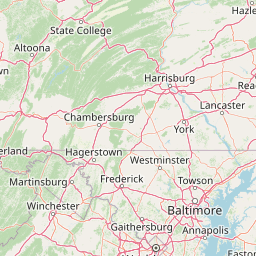

Leaflet | <a href="https://www.openstreetmap.org/copyright">© OpenStreetMap contributors</a>
Item
| Property | Value |
|---|---|
| id | 390214 |
| downstream_mainstem_id | https://geoconnex.us/ref/mainstems/333361 |
| encompassing_mainstem_basins | ['https://geoconnex.us/ref/mainstems/333361', 'https://geoconnex.us/ref/mainstems/314849', 'https://geoconnex.us/ref/mainstems/312091'] |
| featuretype | ['https://www.opengis.net/def/schema/hy_features/hyf/HY_FlowPath', 'https://www.opengis.net/def/schema/hy_features/hyf/HY_WaterBody'] |
| fid | 8050 |
| head_2020huc12 | 050400020301 |
| head_nhdpv1_comid | 15410005 |
| head_nhdpv2_comid | https://geoconnex.us/nhdplusv2/comid/15410005 |
| head_nhdpv2huc12 | https://geoconnex.us/nhdplusv2/huc12/050400020301 |
| head_rf1id | 12725 |
| lengthkm | 61.5 |
| name_at_outlet | Clear Fork Mohican River |
| name_at_outlet_gnis_id | 1065962 |
| new_mainstemid | |
| outlet_2020huc12 | 050400020405 |
| outlet_drainagearea_sqkm | 563.8 |
| outlet_nhdpv1_comid | 15410821 |
| outlet_nhdpv2_comid | https://geoconnex.us/nhdplusv2/comid/15410821 |
| outlet_nhdpv2huc12 | https://geoconnex.us/nhdplusv2/huc12/050400020405 |
| outlet_rf1id | 12725 |
| superseded | False |
| uri | https://geoconnex.us/ref/mainstems/390214 |
Graph Results
| monitoringLocation | https://sta.geoconnex.dev/collections/USGS/Things/items/'USGS-03133500' |
|---|---|
| siteName | USGS-03133500 |
| datasetDescription | Gage height / USGS-03133500-c7ced7a326c848a8999e6f42cf9d0d1b |
| type | Stream |
| url | https://waterdata.usgs.gov/monitoring-location/03133500/#parameterCode=00065 |
| variableMeasured | Gage height / USGS-03133500-c7ced7a326c848a8999e6f42cf9d0d1b |
| variableUnit | ft |
| measurementTechnique | observation |
| temporalCoverage | 2024-08-30T09:15:00Z/2024-09-09T18:15:00Z |
| distributionName | USGS SensorThings API |
| distributionURL | https://labs.waterdata.usgs.gov/sta/v1.1/Datastreams('c7ced7a326c848a8999e6f42cf9d0d1b')?$expand=Thing,Observations |
| distributionFormat | application/json |
| wkt | POINT (-82.3243284081728 40.6203379154383) |
| monitoringLocation | https://sta.geoconnex.dev/collections/USGS/Things/items/'USGS-03133500' |
|---|---|
| siteName | USGS-03133500 |
| datasetDescription | Gage height / USGS-03133500-c7ced7a326c848a8999e6f42cf9d0d1b |
| type | Stream |
| url | https://waterdata.usgs.gov/monitoring-location/03133500/#parameterCode=00065 |
| variableMeasured | Gage height / USGS-03133500-c7ced7a326c848a8999e6f42cf9d0d1b |
| variableUnit | ft |
| measurementTechnique | observation |
| temporalCoverage | 2024-08-30T09:15:00Z/2024-09-09T18:15:00Z |
| distributionName | USGS Instantaneous Values Service |
| distributionURL | https://waterservices.usgs.gov/nwis/iv/?sites=USGS:03133500¶meterCd=00065&format=rdb |
| distributionFormat | text/tab-separated-values |
| wkt | POINT (-82.3243284081728 40.6203379154383) |