Item 391743
Map

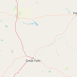


Leaflet | <a href="https://www.openstreetmap.org/copyright">© OpenStreetMap contributors</a>
Item
| Property | Value |
|---|---|
| id | 391743 |
| downstream_mainstem_id | https://geoconnex.us/ref/mainstems/336132 |
| encompassing_mainstem_basins | ['https://geoconnex.us/ref/mainstems/336132', 'https://geoconnex.us/ref/mainstems/312532', 'https://geoconnex.us/ref/mainstems/312091'] |
| featuretype | ['https://www.opengis.net/def/schema/hy_features/hyf/HY_FlowPath', 'https://www.opengis.net/def/schema/hy_features/hyf/HY_WaterBody'] |
| fid | 14848 |
| head_2020huc12 | 100302030901 |
| head_nhdpv1_comid | 12641723 |
| head_nhdpv2_comid | https://geoconnex.us/nhdplusv2/comid/12641723 |
| head_nhdpv2huc12 | https://geoconnex.us/nhdplusv2/huc12/100302030904 |
| head_rf1id | 29681 |
| lengthkm | 188.4 |
| name_at_outlet | |
| name_at_outlet_gnis_id | None |
| new_mainstemid | |
| outlet_2020huc12 | 100302031306 |
| outlet_drainagearea_sqkm | 1717.3 |
| outlet_nhdpv1_comid | 12644049 |
| outlet_nhdpv2_comid | https://geoconnex.us/nhdplusv2/comid/12644049 |
| outlet_nhdpv2huc12 | https://geoconnex.us/nhdplusv2/huc12/100302031306 |
| outlet_rf1id | 29673 |
| superseded | False |
| uri | https://geoconnex.us/ref/mainstems/391743 |
Graph Results
| monitoringLocation | https://geoconnex.us/iow/wqp/MONT_DEQ_WQX-5634PO01 |
|---|---|
| siteName | MONT_DEQ_WQX-5634PO01 |
| datasetDescription | Specific conductance at MONT_DEQ_WQX-5634PO01 |
| type | River/Stream |
| url | https://www.waterqualitydata.us/provider/STORET/MONT_DEQ_WQX/MONT_DEQ_WQX-5634PO01/ |
| variableMeasured | Specific conductance |
| variableUnit | umho/cm |
| measurementTechnique | observation |
| temporalCoverage | 1978-01-01T00:00:00Z/1980-12-31T00:00:00Z |
| distributionName | Water Quality Portal |
| distributionURL | https://www.waterqualitydata.us/data/Result/search?siteid=MONT_DEQ_WQX-5634PO01&CharacteristicName=Specific conductance&mimeType=csv |
| distributionFormat | text/comma-separated-values |
| wkt | POINT (-111.713611 48.175556) |
| monitoringLocation | https://geoconnex.us/iow/wqp/MONT_DEQ_WQX-5634PO01 |
|---|---|
| siteName | MONT_DEQ_WQX-5634PO01 |
| datasetDescription | Flow at MONT_DEQ_WQX-5634PO01 |
| type | River/Stream |
| url | https://www.waterqualitydata.us/provider/STORET/MONT_DEQ_WQX/MONT_DEQ_WQX-5634PO01/ |
| variableMeasured | Flow |
| variableUnit | ft3/sec |
| measurementTechnique | observation |
| temporalCoverage | 1978-01-01T00:00:00Z/1978-12-31T00:00:00Z |
| distributionName | Water Quality Portal |
| distributionURL | https://www.waterqualitydata.us/data/Result/search?siteid=MONT_DEQ_WQX-5634PO01&CharacteristicName=Flow&mimeType=csv |
| distributionFormat | text/comma-separated-values |
| wkt | POINT (-111.713611 48.175556) |
| monitoringLocation | https://geoconnex.us/iow/wqp/MONT_DEQ_WQX-5634PO01 |
|---|---|
| siteName | MONT_DEQ_WQX-5634PO01 |
| datasetDescription | Hardness, Ca, Mg at MONT_DEQ_WQX-5634PO01 |
| type | River/Stream |
| url | https://www.waterqualitydata.us/provider/STORET/MONT_DEQ_WQX/MONT_DEQ_WQX-5634PO01/ |
| variableMeasured | Hardness, Ca, Mg |
| variableUnit | mg/l CaCO3 |
| measurementTechnique | observation |
| temporalCoverage | 1978-01-01T00:00:00Z/1980-12-31T00:00:00Z |
| distributionName | Water Quality Portal |
| distributionURL | https://www.waterqualitydata.us/data/Result/search?siteid=MONT_DEQ_WQX-5634PO01&CharacteristicName=Hardness, Ca, Mg&mimeType=csv |
| distributionFormat | text/comma-separated-values |
| wkt | POINT (-111.713611 48.175556) |
| monitoringLocation | https://geoconnex.us/iow/wqp/MONT_DEQ_WQX-5634PO01 |
|---|---|
| siteName | MONT_DEQ_WQX-5634PO01 |
| datasetDescription | Chloride at MONT_DEQ_WQX-5634PO01 |
| type | River/Stream |
| url | https://www.waterqualitydata.us/provider/STORET/MONT_DEQ_WQX/MONT_DEQ_WQX-5634PO01/ |
| variableMeasured | Chloride |
| variableUnit | mg/l |
| measurementTechnique | observation |
| temporalCoverage | 1980-01-01T00:00:00Z/1980-12-31T00:00:00Z |
| distributionName | Water Quality Portal |
| distributionURL | https://www.waterqualitydata.us/data/Result/search?siteid=MONT_DEQ_WQX-5634PO01&CharacteristicName=Chloride&mimeType=csv |
| distributionFormat | text/comma-separated-values |
| wkt | POINT (-111.713611 48.175556) |
| monitoringLocation | https://geoconnex.us/iow/wqp/MONT_DEQ_WQX-5634PO01 |
|---|---|
| siteName | MONT_DEQ_WQX-5634PO01 |
| datasetDescription | Alkalinity, total at MONT_DEQ_WQX-5634PO01 |
| type | River/Stream |
| url | https://www.waterqualitydata.us/provider/STORET/MONT_DEQ_WQX/MONT_DEQ_WQX-5634PO01/ |
| variableMeasured | Alkalinity, total |
| variableUnit | mg/l |
| measurementTechnique | observation |
| temporalCoverage | 1980-01-01T00:00:00Z/1980-12-31T00:00:00Z |
| distributionName | Water Quality Portal |
| distributionURL | https://www.waterqualitydata.us/data/Result/search?siteid=MONT_DEQ_WQX-5634PO01&CharacteristicName=Alkalinity, total&mimeType=csv |
| distributionFormat | text/comma-separated-values |
| wkt | POINT (-111.713611 48.175556) |
| monitoringLocation | https://geoconnex.us/iow/wqp/MONT_DEQ_WQX-5634PO01 |
|---|---|
| siteName | MONT_DEQ_WQX-5634PO01 |
| datasetDescription | Carbonate at MONT_DEQ_WQX-5634PO01 |
| type | River/Stream |
| url | https://www.waterqualitydata.us/provider/STORET/MONT_DEQ_WQX/MONT_DEQ_WQX-5634PO01/ |
| variableMeasured | Carbonate |
| variableUnit | mg/l |
| measurementTechnique | observation |
| temporalCoverage | 1980-01-01T00:00:00Z/1980-12-31T00:00:00Z |
| distributionName | Water Quality Portal |
| distributionURL | https://www.waterqualitydata.us/data/Result/search?siteid=MONT_DEQ_WQX-5634PO01&CharacteristicName=Carbonate&mimeType=csv |
| distributionFormat | text/comma-separated-values |
| wkt | POINT (-111.713611 48.175556) |
| monitoringLocation | https://geoconnex.us/iow/wqp/MONT_DEQ_WQX-5634PO01 |
|---|---|
| siteName | MONT_DEQ_WQX-5634PO01 |
| datasetDescription | Calcium at MONT_DEQ_WQX-5634PO01 |
| type | River/Stream |
| url | https://www.waterqualitydata.us/provider/STORET/MONT_DEQ_WQX/MONT_DEQ_WQX-5634PO01/ |
| variableMeasured | Calcium |
| variableUnit | mg/L |
| measurementTechnique | observation |
| temporalCoverage | 1978-01-01T00:00:00Z/1980-12-31T00:00:00Z |
| distributionName | Water Quality Portal |
| distributionURL | https://www.waterqualitydata.us/data/Result/search?siteid=MONT_DEQ_WQX-5634PO01&CharacteristicName=Calcium&mimeType=csv |
| distributionFormat | text/comma-separated-values |
| wkt | POINT (-111.713611 48.175556) |
| monitoringLocation | https://geoconnex.us/iow/wqp/MONT_DEQ_WQX-5634PO01 |
|---|---|
| siteName | MONT_DEQ_WQX-5634PO01 |
| datasetDescription | Sulfate at MONT_DEQ_WQX-5634PO01 |
| type | River/Stream |
| url | https://www.waterqualitydata.us/provider/STORET/MONT_DEQ_WQX/MONT_DEQ_WQX-5634PO01/ |
| variableMeasured | Sulfate |
| variableUnit | mg/l |
| measurementTechnique | observation |
| temporalCoverage | 1978-01-01T00:00:00Z/1980-12-31T00:00:00Z |
| distributionName | Water Quality Portal |
| distributionURL | https://www.waterqualitydata.us/data/Result/search?siteid=MONT_DEQ_WQX-5634PO01&CharacteristicName=Sulfate&mimeType=csv |
| distributionFormat | text/comma-separated-values |
| wkt | POINT (-111.713611 48.175556) |
| monitoringLocation | https://geoconnex.us/iow/wqp/MONT_DEQ_WQX-5634PO01 |
|---|---|
| siteName | MONT_DEQ_WQX-5634PO01 |
| datasetDescription | Magnesium at MONT_DEQ_WQX-5634PO01 |
| type | River/Stream |
| url | https://www.waterqualitydata.us/provider/STORET/MONT_DEQ_WQX/MONT_DEQ_WQX-5634PO01/ |
| variableMeasured | Magnesium |
| variableUnit | % |
| measurementTechnique | observation |
| temporalCoverage | 1978-01-01T00:00:00Z/1980-12-31T00:00:00Z |
| distributionName | Water Quality Portal |
| distributionURL | https://www.waterqualitydata.us/data/Result/search?siteid=MONT_DEQ_WQX-5634PO01&CharacteristicName=Magnesium&mimeType=csv |
| distributionFormat | text/comma-separated-values |
| wkt | POINT (-111.713611 48.175556) |
| monitoringLocation | https://geoconnex.us/iow/wqp/MONT_DEQ_WQX-5634PO01 |
|---|---|
| siteName | MONT_DEQ_WQX-5634PO01 |
| datasetDescription | Bicarbonate at MONT_DEQ_WQX-5634PO01 |
| type | River/Stream |
| url | https://www.waterqualitydata.us/provider/STORET/MONT_DEQ_WQX/MONT_DEQ_WQX-5634PO01/ |
| variableMeasured | Bicarbonate |
| variableUnit | mg/l |
| measurementTechnique | observation |
| temporalCoverage | 1980-01-01T00:00:00Z/1980-12-31T00:00:00Z |
| distributionName | Water Quality Portal |
| distributionURL | https://www.waterqualitydata.us/data/Result/search?siteid=MONT_DEQ_WQX-5634PO01&CharacteristicName=Bicarbonate&mimeType=csv |
| distributionFormat | text/comma-separated-values |
| wkt | POINT (-111.713611 48.175556) |
| monitoringLocation | https://geoconnex.us/iow/wqp/MONT_DEQ_WQX-5634PO01 |
|---|---|
| siteName | MONT_DEQ_WQX-5634PO01 |
| datasetDescription | pH at MONT_DEQ_WQX-5634PO01 |
| type | River/Stream |
| url | https://www.waterqualitydata.us/provider/STORET/MONT_DEQ_WQX/MONT_DEQ_WQX-5634PO01/ |
| variableMeasured | pH |
| variableUnit | None |
| measurementTechnique | observation |
| temporalCoverage | 1980-01-01T00:00:00Z/1980-12-31T00:00:00Z |
| distributionName | Water Quality Portal |
| distributionURL | https://www.waterqualitydata.us/data/Result/search?siteid=MONT_DEQ_WQX-5634PO01&CharacteristicName=pH&mimeType=csv |
| distributionFormat | text/comma-separated-values |
| wkt | POINT (-111.713611 48.175556) |
| monitoringLocation | https://geoconnex.us/iow/wqp/MONT_DEQ_WQX-5634PO01 |
|---|---|
| siteName | MONT_DEQ_WQX-5634PO01 |
| datasetDescription | Sodium at MONT_DEQ_WQX-5634PO01 |
| type | River/Stream |
| url | https://www.waterqualitydata.us/provider/STORET/MONT_DEQ_WQX/MONT_DEQ_WQX-5634PO01/ |
| variableMeasured | Sodium |
| variableUnit | mg/l |
| measurementTechnique | observation |
| temporalCoverage | 1978-01-01T00:00:00Z/1980-12-31T00:00:00Z |
| distributionName | Water Quality Portal |
| distributionURL | https://www.waterqualitydata.us/data/Result/search?siteid=MONT_DEQ_WQX-5634PO01&CharacteristicName=Sodium&mimeType=csv |
| distributionFormat | text/comma-separated-values |
| wkt | POINT (-111.713611 48.175556) |
| monitoringLocation | https://geoconnex.us/iow/wqp/MONT_DEQ_WQX-5634PO01 |
|---|---|
| siteName | MONT_DEQ_WQX-5634PO01 |
| datasetDescription | Temperature, water at MONT_DEQ_WQX-5634PO01 |
| type | River/Stream |
| url | https://www.waterqualitydata.us/provider/STORET/MONT_DEQ_WQX/MONT_DEQ_WQX-5634PO01/ |
| variableMeasured | Temperature, water |
| variableUnit | deg C |
| measurementTechnique | observation |
| temporalCoverage | 1978-01-01T00:00:00Z/1980-12-31T00:00:00Z |
| distributionName | Water Quality Portal |
| distributionURL | https://www.waterqualitydata.us/data/Result/search?siteid=MONT_DEQ_WQX-5634PO01&CharacteristicName=Temperature, water&mimeType=csv |
| distributionFormat | text/comma-separated-values |
| wkt | POINT (-111.713611 48.175556) |
| monitoringLocation | https://geoconnex.us/iow/wqp/MONT_DEQ_WQX-5634PO01 |
|---|---|
| siteName | MONT_DEQ_WQX-5634PO01 |
| datasetDescription | Total dissolved solids at MONT_DEQ_WQX-5634PO01 |
| type | River/Stream |
| url | https://www.waterqualitydata.us/provider/STORET/MONT_DEQ_WQX/MONT_DEQ_WQX-5634PO01/ |
| variableMeasured | Total dissolved solids |
| variableUnit | mg/l |
| measurementTechnique | observation |
| temporalCoverage | 1980-01-01T00:00:00Z/1980-12-31T00:00:00Z |
| distributionName | Water Quality Portal |
| distributionURL | https://www.waterqualitydata.us/data/Result/search?siteid=MONT_DEQ_WQX-5634PO01&CharacteristicName=Total dissolved solids&mimeType=csv |
| distributionFormat | text/comma-separated-values |
| wkt | POINT (-111.713611 48.175556) |
| monitoringLocation | https://geoconnex.us/iow/wqp/USGS-480926111503201 |
|---|---|
| siteName | USGS-480926111503201 |
| datasetDescription | Carbon dioxide at USGS-480926111503201 |
| type | Well |
| url | https://www.waterqualitydata.us/provider/NWIS/USGS-MT/USGS-480926111503201/ |
| variableMeasured | Carbon dioxide |
| variableUnit | mg/l |
| measurementTechnique | observation |
| temporalCoverage | 1976-01-01T00:00:00Z/1976-12-31T00:00:00Z |
| distributionName | Water Quality Portal |
| distributionURL | https://www.waterqualitydata.us/data/Result/search?siteid=USGS-480926111503201&CharacteristicName=Carbon dioxide&mimeType=csv |
| distributionFormat | text/comma-separated-values |
| wkt | POINT (-111.8430683 48.15719396) |
| monitoringLocation | https://geoconnex.us/iow/wqp/USGS-480926111503201 |
|---|---|
| siteName | USGS-480926111503201 |
| datasetDescription | Sulfate at USGS-480926111503201 |
| type | Well |
| url | https://www.waterqualitydata.us/provider/NWIS/USGS-MT/USGS-480926111503201/ |
| variableMeasured | Sulfate |
| variableUnit | mg/l |
| measurementTechnique | observation |
| temporalCoverage | 1976-01-01T00:00:00Z/1976-12-31T00:00:00Z |
| distributionName | Water Quality Portal |
| distributionURL | https://www.waterqualitydata.us/data/Result/search?siteid=USGS-480926111503201&CharacteristicName=Sulfate&mimeType=csv |
| distributionFormat | text/comma-separated-values |
| wkt | POINT (-111.8430683 48.15719396) |
| monitoringLocation | https://geoconnex.us/iow/wqp/USGS-480926111503201 |
|---|---|
| siteName | USGS-480926111503201 |
| datasetDescription | Manganese at USGS-480926111503201 |
| type | Well |
| url | https://www.waterqualitydata.us/provider/NWIS/USGS-MT/USGS-480926111503201/ |
| variableMeasured | Manganese |
| variableUnit | ug/l |
| measurementTechnique | observation |
| temporalCoverage | 1976-01-01T00:00:00Z/1976-12-31T00:00:00Z |
| distributionName | Water Quality Portal |
| distributionURL | https://www.waterqualitydata.us/data/Result/search?siteid=USGS-480926111503201&CharacteristicName=Manganese&mimeType=csv |
| distributionFormat | text/comma-separated-values |
| wkt | POINT (-111.8430683 48.15719396) |
| monitoringLocation | https://geoconnex.us/iow/wqp/USGS-480926111503201 |
|---|---|
| siteName | USGS-480926111503201 |
| datasetDescription | Nitrate at USGS-480926111503201 |
| type | Well |
| url | https://www.waterqualitydata.us/provider/NWIS/USGS-MT/USGS-480926111503201/ |
| variableMeasured | Nitrate |
| variableUnit | mg/l as N |
| measurementTechnique | observation |
| temporalCoverage | 1976-01-01T00:00:00Z/1976-12-31T00:00:00Z |
| distributionName | Water Quality Portal |
| distributionURL | https://www.waterqualitydata.us/data/Result/search?siteid=USGS-480926111503201&CharacteristicName=Nitrate&mimeType=csv |
| distributionFormat | text/comma-separated-values |
| wkt | POINT (-111.8430683 48.15719396) |
| monitoringLocation | https://geoconnex.us/iow/wqp/USGS-480926111503201 |
|---|---|
| siteName | USGS-480926111503201 |
| datasetDescription | Selenium at USGS-480926111503201 |
| type | Well |
| url | https://www.waterqualitydata.us/provider/NWIS/USGS-MT/USGS-480926111503201/ |
| variableMeasured | Selenium |
| variableUnit | ug/l |
| measurementTechnique | observation |
| temporalCoverage | 1976-01-01T00:00:00Z/1976-12-31T00:00:00Z |
| distributionName | Water Quality Portal |
| distributionURL | https://www.waterqualitydata.us/data/Result/search?siteid=USGS-480926111503201&CharacteristicName=Selenium&mimeType=csv |
| distributionFormat | text/comma-separated-values |
| wkt | POINT (-111.8430683 48.15719396) |
| monitoringLocation | https://geoconnex.us/iow/wqp/USGS-480926111503201 |
|---|---|
| siteName | USGS-480926111503201 |
| datasetDescription | Alkalinity at USGS-480926111503201 |
| type | Well |
| url | https://www.waterqualitydata.us/provider/NWIS/USGS-MT/USGS-480926111503201/ |
| variableMeasured | Alkalinity |
| variableUnit | mg/l CaCO3 |
| measurementTechnique | observation |
| temporalCoverage | 1976-01-01T00:00:00Z/1976-12-31T00:00:00Z |
| distributionName | Water Quality Portal |
| distributionURL | https://www.waterqualitydata.us/data/Result/search?siteid=USGS-480926111503201&CharacteristicName=Alkalinity&mimeType=csv |
| distributionFormat | text/comma-separated-values |
| wkt | POINT (-111.8430683 48.15719396) |
| monitoringLocation | https://geoconnex.us/iow/wqp/USGS-480926111503201 |
|---|---|
| siteName | USGS-480926111503201 |
| datasetDescription | pH at USGS-480926111503201 |
| type | Well |
| url | https://www.waterqualitydata.us/provider/NWIS/USGS-MT/USGS-480926111503201/ |
| variableMeasured | pH |
| variableUnit | None |
| measurementTechnique | observation |
| temporalCoverage | 1976-01-01T00:00:00Z/1976-12-31T00:00:00Z |
| distributionName | Water Quality Portal |
| distributionURL | https://www.waterqualitydata.us/data/Result/search?siteid=USGS-480926111503201&CharacteristicName=pH&mimeType=csv |
| distributionFormat | text/comma-separated-values |
| wkt | POINT (-111.8430683 48.15719396) |
| monitoringLocation | https://geoconnex.us/iow/wqp/USGS-480926111503201 |
|---|---|
| siteName | USGS-480926111503201 |
| datasetDescription | Calcium at USGS-480926111503201 |
| type | Well |
| url | https://www.waterqualitydata.us/provider/NWIS/USGS-MT/USGS-480926111503201/ |
| variableMeasured | Calcium |
| variableUnit | mg/L |
| measurementTechnique | observation |
| temporalCoverage | 1976-01-01T00:00:00Z/1976-12-31T00:00:00Z |
| distributionName | Water Quality Portal |
| distributionURL | https://www.waterqualitydata.us/data/Result/search?siteid=USGS-480926111503201&CharacteristicName=Calcium&mimeType=csv |
| distributionFormat | text/comma-separated-values |
| wkt | POINT (-111.8430683 48.15719396) |
| monitoringLocation | https://geoconnex.us/iow/wqp/USGS-480926111503201 |
|---|---|
| siteName | USGS-480926111503201 |
| datasetDescription | Silica at USGS-480926111503201 |
| type | Well |
| url | https://www.waterqualitydata.us/provider/NWIS/USGS-MT/USGS-480926111503201/ |
| variableMeasured | Silica |
| variableUnit | mg/l |
| measurementTechnique | observation |
| temporalCoverage | 1976-01-01T00:00:00Z/1976-12-31T00:00:00Z |
| distributionName | Water Quality Portal |
| distributionURL | https://www.waterqualitydata.us/data/Result/search?siteid=USGS-480926111503201&CharacteristicName=Silica&mimeType=csv |
| distributionFormat | text/comma-separated-values |
| wkt | POINT (-111.8430683 48.15719396) |
| monitoringLocation | https://geoconnex.us/iow/wqp/USGS-480926111503201 |
|---|---|
| siteName | USGS-480926111503201 |
| datasetDescription | Specific conductance at USGS-480926111503201 |
| type | Well |
| url | https://www.waterqualitydata.us/provider/NWIS/USGS-MT/USGS-480926111503201/ |
| variableMeasured | Specific conductance |
| variableUnit | umho/cm |
| measurementTechnique | observation |
| temporalCoverage | 1976-01-01T00:00:00Z/1976-12-31T00:00:00Z |
| distributionName | Water Quality Portal |
| distributionURL | https://www.waterqualitydata.us/data/Result/search?siteid=USGS-480926111503201&CharacteristicName=Specific conductance&mimeType=csv |
| distributionFormat | text/comma-separated-values |
| wkt | POINT (-111.8430683 48.15719396) |
| monitoringLocation | https://geoconnex.us/iow/wqp/USGS-480926111503201 |
|---|---|
| siteName | USGS-480926111503201 |
| datasetDescription | Hardness, Ca, Mg at USGS-480926111503201 |
| type | Well |
| url | https://www.waterqualitydata.us/provider/NWIS/USGS-MT/USGS-480926111503201/ |
| variableMeasured | Hardness, Ca, Mg |
| variableUnit | mg/l CaCO3 |
| measurementTechnique | observation |
| temporalCoverage | 1976-01-01T00:00:00Z/1976-12-31T00:00:00Z |
| distributionName | Water Quality Portal |
| distributionURL | https://www.waterqualitydata.us/data/Result/search?siteid=USGS-480926111503201&CharacteristicName=Hardness, Ca, Mg&mimeType=csv |
| distributionFormat | text/comma-separated-values |
| wkt | POINT (-111.8430683 48.15719396) |
| monitoringLocation | https://geoconnex.us/iow/wqp/USGS-480926111503201 |
|---|---|
| siteName | USGS-480926111503201 |
| datasetDescription | Hardness, non-carbonate at USGS-480926111503201 |
| type | Well |
| url | https://www.waterqualitydata.us/provider/NWIS/USGS-MT/USGS-480926111503201/ |
| variableMeasured | Hardness, non-carbonate |
| variableUnit | mg/l CaCO3 |
| measurementTechnique | observation |
| temporalCoverage | 1976-01-01T00:00:00Z/1976-12-31T00:00:00Z |
| distributionName | Water Quality Portal |
| distributionURL | https://www.waterqualitydata.us/data/Result/search?siteid=USGS-480926111503201&CharacteristicName=Hardness, non-carbonate&mimeType=csv |
| distributionFormat | text/comma-separated-values |
| wkt | POINT (-111.8430683 48.15719396) |
| monitoringLocation | https://geoconnex.us/iow/wqp/USGS-480926111503201 |
|---|---|
| siteName | USGS-480926111503201 |
| datasetDescription | Boron at USGS-480926111503201 |
| type | Well |
| url | https://www.waterqualitydata.us/provider/NWIS/USGS-MT/USGS-480926111503201/ |
| variableMeasured | Boron |
| variableUnit | Unknown |
| measurementTechnique | observation |
| temporalCoverage | 1976-01-01T00:00:00Z/1976-12-31T00:00:00Z |
| distributionName | Water Quality Portal |
| distributionURL | https://www.waterqualitydata.us/data/Result/search?siteid=USGS-480926111503201&CharacteristicName=Boron&mimeType=csv |
| distributionFormat | text/comma-separated-values |
| wkt | POINT (-111.8430683 48.15719396) |
| monitoringLocation | https://geoconnex.us/iow/wqp/USGS-480926111503201 |
|---|---|
| siteName | USGS-480926111503201 |
| datasetDescription | Magnesium at USGS-480926111503201 |
| type | Well |
| url | https://www.waterqualitydata.us/provider/NWIS/USGS-MT/USGS-480926111503201/ |
| variableMeasured | Magnesium |
| variableUnit | % |
| measurementTechnique | observation |
| temporalCoverage | 1976-01-01T00:00:00Z/1976-12-31T00:00:00Z |
| distributionName | Water Quality Portal |
| distributionURL | https://www.waterqualitydata.us/data/Result/search?siteid=USGS-480926111503201&CharacteristicName=Magnesium&mimeType=csv |
| distributionFormat | text/comma-separated-values |
| wkt | POINT (-111.8430683 48.15719396) |
| monitoringLocation | https://geoconnex.us/iow/wqp/USGS-480926111503201 |
|---|---|
| siteName | USGS-480926111503201 |
| datasetDescription | Fluoride at USGS-480926111503201 |
| type | Well |
| url | https://www.waterqualitydata.us/provider/NWIS/USGS-MT/USGS-480926111503201/ |
| variableMeasured | Fluoride |
| variableUnit | mg/l |
| measurementTechnique | observation |
| temporalCoverage | 1976-01-01T00:00:00Z/1976-12-31T00:00:00Z |
| distributionName | Water Quality Portal |
| distributionURL | https://www.waterqualitydata.us/data/Result/search?siteid=USGS-480926111503201&CharacteristicName=Fluoride&mimeType=csv |
| distributionFormat | text/comma-separated-values |
| wkt | POINT (-111.8430683 48.15719396) |
| monitoringLocation | https://geoconnex.us/iow/wqp/USGS-480926111503201 |
|---|---|
| siteName | USGS-480926111503201 |
| datasetDescription | Potassium at USGS-480926111503201 |
| type | Well |
| url | https://www.waterqualitydata.us/provider/NWIS/USGS-MT/USGS-480926111503201/ |
| variableMeasured | Potassium |
| variableUnit | mg/l |
| measurementTechnique | observation |
| temporalCoverage | 1976-01-01T00:00:00Z/1976-12-31T00:00:00Z |
| distributionName | Water Quality Portal |
| distributionURL | https://www.waterqualitydata.us/data/Result/search?siteid=USGS-480926111503201&CharacteristicName=Potassium&mimeType=csv |
| distributionFormat | text/comma-separated-values |
| wkt | POINT (-111.8430683 48.15719396) |
| monitoringLocation | https://geoconnex.us/iow/wqp/USGS-480926111503201 |
|---|---|
| siteName | USGS-480926111503201 |
| datasetDescription | Zinc at USGS-480926111503201 |
| type | Well |
| url | https://www.waterqualitydata.us/provider/NWIS/USGS-MT/USGS-480926111503201/ |
| variableMeasured | Zinc |
| variableUnit | Unknown |
| measurementTechnique | observation |
| temporalCoverage | 1976-01-01T00:00:00Z/1976-12-31T00:00:00Z |
| distributionName | Water Quality Portal |
| distributionURL | https://www.waterqualitydata.us/data/Result/search?siteid=USGS-480926111503201&CharacteristicName=Zinc&mimeType=csv |
| distributionFormat | text/comma-separated-values |
| wkt | POINT (-111.8430683 48.15719396) |
| monitoringLocation | https://geoconnex.us/iow/wqp/USGS-480926111503201 |
|---|---|
| siteName | USGS-480926111503201 |
| datasetDescription | Bicarbonate at USGS-480926111503201 |
| type | Well |
| url | https://www.waterqualitydata.us/provider/NWIS/USGS-MT/USGS-480926111503201/ |
| variableMeasured | Bicarbonate |
| variableUnit | mg/l |
| measurementTechnique | observation |
| temporalCoverage | 1976-01-01T00:00:00Z/1976-12-31T00:00:00Z |
| distributionName | Water Quality Portal |
| distributionURL | https://www.waterqualitydata.us/data/Result/search?siteid=USGS-480926111503201&CharacteristicName=Bicarbonate&mimeType=csv |
| distributionFormat | text/comma-separated-values |
| wkt | POINT (-111.8430683 48.15719396) |
| monitoringLocation | https://geoconnex.us/iow/wqp/USGS-480926111503201 |
|---|---|
| siteName | USGS-480926111503201 |
| datasetDescription | Sodium at USGS-480926111503201 |
| type | Well |
| url | https://www.waterqualitydata.us/provider/NWIS/USGS-MT/USGS-480926111503201/ |
| variableMeasured | Sodium |
| variableUnit | mg/l |
| measurementTechnique | observation |
| temporalCoverage | 1976-01-01T00:00:00Z/1976-12-31T00:00:00Z |
| distributionName | Water Quality Portal |
| distributionURL | https://www.waterqualitydata.us/data/Result/search?siteid=USGS-480926111503201&CharacteristicName=Sodium&mimeType=csv |
| distributionFormat | text/comma-separated-values |
| wkt | POINT (-111.8430683 48.15719396) |
| monitoringLocation | https://geoconnex.us/iow/wqp/USGS-480926111503201 |
|---|---|
| siteName | USGS-480926111503201 |
| datasetDescription | Strontium at USGS-480926111503201 |
| type | Well |
| url | https://www.waterqualitydata.us/provider/NWIS/USGS-MT/USGS-480926111503201/ |
| variableMeasured | Strontium |
| variableUnit | ug/L |
| measurementTechnique | observation |
| temporalCoverage | 1976-01-01T00:00:00Z/1976-12-31T00:00:00Z |
| distributionName | Water Quality Portal |
| distributionURL | https://www.waterqualitydata.us/data/Result/search?siteid=USGS-480926111503201&CharacteristicName=Strontium&mimeType=csv |
| distributionFormat | text/comma-separated-values |
| wkt | POINT (-111.8430683 48.15719396) |
| monitoringLocation | https://geoconnex.us/iow/wqp/USGS-480926111503201 |
|---|---|
| siteName | USGS-480926111503201 |
| datasetDescription | Chromium at USGS-480926111503201 |
| type | Well |
| url | https://www.waterqualitydata.us/provider/NWIS/USGS-MT/USGS-480926111503201/ |
| variableMeasured | Chromium |
| variableUnit | ppb |
| measurementTechnique | observation |
| temporalCoverage | 1976-01-01T00:00:00Z/1976-12-31T00:00:00Z |
| distributionName | Water Quality Portal |
| distributionURL | https://www.waterqualitydata.us/data/Result/search?siteid=USGS-480926111503201&CharacteristicName=Chromium&mimeType=csv |
| distributionFormat | text/comma-separated-values |
| wkt | POINT (-111.8430683 48.15719396) |
| monitoringLocation | https://geoconnex.us/iow/wqp/USGS-480926111503201 |
|---|---|
| siteName | USGS-480926111503201 |
| datasetDescription | Cadmium at USGS-480926111503201 |
| type | Well |
| url | https://www.waterqualitydata.us/provider/NWIS/USGS-MT/USGS-480926111503201/ |
| variableMeasured | Cadmium |
| variableUnit | ug/L |
| measurementTechnique | observation |
| temporalCoverage | 1976-01-01T00:00:00Z/1976-12-31T00:00:00Z |
| distributionName | Water Quality Portal |
| distributionURL | https://www.waterqualitydata.us/data/Result/search?siteid=USGS-480926111503201&CharacteristicName=Cadmium&mimeType=csv |
| distributionFormat | text/comma-separated-values |
| wkt | POINT (-111.8430683 48.15719396) |
| monitoringLocation | https://geoconnex.us/iow/wqp/USGS-480926111503201 |
|---|---|
| siteName | USGS-480926111503201 |
| datasetDescription | Lithium at USGS-480926111503201 |
| type | Well |
| url | https://www.waterqualitydata.us/provider/NWIS/USGS-MT/USGS-480926111503201/ |
| variableMeasured | Lithium |
| variableUnit | ug/l |
| measurementTechnique | observation |
| temporalCoverage | 1976-01-01T00:00:00Z/1976-12-31T00:00:00Z |
| distributionName | Water Quality Portal |
| distributionURL | https://www.waterqualitydata.us/data/Result/search?siteid=USGS-480926111503201&CharacteristicName=Lithium&mimeType=csv |
| distributionFormat | text/comma-separated-values |
| wkt | POINT (-111.8430683 48.15719396) |
| monitoringLocation | https://geoconnex.us/iow/wqp/USGS-480926111503201 |
|---|---|
| siteName | USGS-480926111503201 |
| datasetDescription | Lead at USGS-480926111503201 |
| type | Well |
| url | https://www.waterqualitydata.us/provider/NWIS/USGS-MT/USGS-480926111503201/ |
| variableMeasured | Lead |
| variableUnit | ug/l |
| measurementTechnique | observation |
| temporalCoverage | 1976-01-01T00:00:00Z/1976-12-31T00:00:00Z |
| distributionName | Water Quality Portal |
| distributionURL | https://www.waterqualitydata.us/data/Result/search?siteid=USGS-480926111503201&CharacteristicName=Lead&mimeType=csv |
| distributionFormat | text/comma-separated-values |
| wkt | POINT (-111.8430683 48.15719396) |
| monitoringLocation | https://geoconnex.us/iow/wqp/USGS-480926111503201 |
|---|---|
| siteName | USGS-480926111503201 |
| datasetDescription | Chloride at USGS-480926111503201 |
| type | Well |
| url | https://www.waterqualitydata.us/provider/NWIS/USGS-MT/USGS-480926111503201/ |
| variableMeasured | Chloride |
| variableUnit | mg/l |
| measurementTechnique | observation |
| temporalCoverage | 1976-01-01T00:00:00Z/1976-12-31T00:00:00Z |
| distributionName | Water Quality Portal |
| distributionURL | https://www.waterqualitydata.us/data/Result/search?siteid=USGS-480926111503201&CharacteristicName=Chloride&mimeType=csv |
| distributionFormat | text/comma-separated-values |
| wkt | POINT (-111.8430683 48.15719396) |
| monitoringLocation | https://geoconnex.us/iow/wqp/USGS-480926111503201 |
|---|---|
| siteName | USGS-480926111503201 |
| datasetDescription | Iron at USGS-480926111503201 |
| type | Well |
| url | https://www.waterqualitydata.us/provider/NWIS/USGS-MT/USGS-480926111503201/ |
| variableMeasured | Iron |
| variableUnit | % |
| measurementTechnique | observation |
| temporalCoverage | 1976-01-01T00:00:00Z/1976-12-31T00:00:00Z |
| distributionName | Water Quality Portal |
| distributionURL | https://www.waterqualitydata.us/data/Result/search?siteid=USGS-480926111503201&CharacteristicName=Iron&mimeType=csv |
| distributionFormat | text/comma-separated-values |
| wkt | POINT (-111.8430683 48.15719396) |
| monitoringLocation | https://geoconnex.us/iow/wqp/USGS-480926111503201 |
|---|---|
| siteName | USGS-480926111503201 |
| datasetDescription | Total dissolved solids at USGS-480926111503201 |
| type | Well |
| url | https://www.waterqualitydata.us/provider/NWIS/USGS-MT/USGS-480926111503201/ |
| variableMeasured | Total dissolved solids |
| variableUnit | mg/l |
| measurementTechnique | observation |
| temporalCoverage | 1976-01-01T00:00:00Z/1976-12-31T00:00:00Z |
| distributionName | Water Quality Portal |
| distributionURL | https://www.waterqualitydata.us/data/Result/search?siteid=USGS-480926111503201&CharacteristicName=Total dissolved solids&mimeType=csv |
| distributionFormat | text/comma-separated-values |
| wkt | POINT (-111.8430683 48.15719396) |
| monitoringLocation | https://geoconnex.us/iow/wqp/USGS-480926111503201 |
|---|---|
| siteName | USGS-480926111503201 |
| datasetDescription | Aluminum at USGS-480926111503201 |
| type | Well |
| url | https://www.waterqualitydata.us/provider/NWIS/USGS-MT/USGS-480926111503201/ |
| variableMeasured | Aluminum |
| variableUnit | Unknown |
| measurementTechnique | observation |
| temporalCoverage | 1976-01-01T00:00:00Z/1976-12-31T00:00:00Z |
| distributionName | Water Quality Portal |
| distributionURL | https://www.waterqualitydata.us/data/Result/search?siteid=USGS-480926111503201&CharacteristicName=Aluminum&mimeType=csv |
| distributionFormat | text/comma-separated-values |
| wkt | POINT (-111.8430683 48.15719396) |
| monitoringLocation | https://geoconnex.us/iow/wqp/USGS-480926111503201 |
|---|---|
| siteName | USGS-480926111503201 |
| datasetDescription | Copper at USGS-480926111503201 |
| type | Well |
| url | https://www.waterqualitydata.us/provider/NWIS/USGS-MT/USGS-480926111503201/ |
| variableMeasured | Copper |
| variableUnit | Unknown |
| measurementTechnique | observation |
| temporalCoverage | 1976-01-01T00:00:00Z/1976-12-31T00:00:00Z |
| distributionName | Water Quality Portal |
| distributionURL | https://www.waterqualitydata.us/data/Result/search?siteid=USGS-480926111503201&CharacteristicName=Copper&mimeType=csv |
| distributionFormat | text/comma-separated-values |
| wkt | POINT (-111.8430683 48.15719396) |
| monitoringLocation | https://geoconnex.us/iow/wqp/USGS-480926111503201 |
|---|---|
| siteName | USGS-480926111503201 |
| datasetDescription | Sodium, percent total cations at USGS-480926111503201 |
| type | Well |
| url | https://www.waterqualitydata.us/provider/NWIS/USGS-MT/USGS-480926111503201/ |
| variableMeasured | Sodium, percent total cations |
| variableUnit | % |
| measurementTechnique | observation |
| temporalCoverage | 1976-01-01T00:00:00Z/1976-12-31T00:00:00Z |
| distributionName | Water Quality Portal |
| distributionURL | https://www.waterqualitydata.us/data/Result/search?siteid=USGS-480926111503201&CharacteristicName=Sodium, percent total cations&mimeType=csv |
| distributionFormat | text/comma-separated-values |
| wkt | POINT (-111.8430683 48.15719396) |
| monitoringLocation | https://geoconnex.us/iow/wqp/USGS-480926111503201 |
|---|---|
| siteName | USGS-480926111503201 |
| datasetDescription | Temperature, water at USGS-480926111503201 |
| type | Well |
| url | https://www.waterqualitydata.us/provider/NWIS/USGS-MT/USGS-480926111503201/ |
| variableMeasured | Temperature, water |
| variableUnit | deg C |
| measurementTechnique | observation |
| temporalCoverage | 1976-01-01T00:00:00Z/1976-12-31T00:00:00Z |
| distributionName | Water Quality Portal |
| distributionURL | https://www.waterqualitydata.us/data/Result/search?siteid=USGS-480926111503201&CharacteristicName=Temperature, water&mimeType=csv |
| distributionFormat | text/comma-separated-values |
| wkt | POINT (-111.8430683 48.15719396) |
| monitoringLocation | https://geoconnex.us/iow/wqp/USGS-480926111503201 |
|---|---|
| siteName | USGS-480926111503201 |
| datasetDescription | Tin at USGS-480926111503201 |
| type | Well |
| url | https://www.waterqualitydata.us/provider/NWIS/USGS-MT/USGS-480926111503201/ |
| variableMeasured | Tin |
| variableUnit | ug/g |
| measurementTechnique | observation |
| temporalCoverage | 1976-01-01T00:00:00Z/1976-12-31T00:00:00Z |
| distributionName | Water Quality Portal |
| distributionURL | https://www.waterqualitydata.us/data/Result/search?siteid=USGS-480926111503201&CharacteristicName=Tin&mimeType=csv |
| distributionFormat | text/comma-separated-values |
| wkt | POINT (-111.8430683 48.15719396) |
| monitoringLocation | https://geoconnex.us/iow/wqp/USGS-480926111503201 |
|---|---|
| siteName | USGS-480926111503201 |
| datasetDescription | Arsenic at USGS-480926111503201 |
| type | Well |
| url | https://www.waterqualitydata.us/provider/NWIS/USGS-MT/USGS-480926111503201/ |
| variableMeasured | Arsenic |
| variableUnit | ppm |
| measurementTechnique | observation |
| temporalCoverage | 1976-01-01T00:00:00Z/1976-12-31T00:00:00Z |
| distributionName | Water Quality Portal |
| distributionURL | https://www.waterqualitydata.us/data/Result/search?siteid=USGS-480926111503201&CharacteristicName=Arsenic&mimeType=csv |
| distributionFormat | text/comma-separated-values |
| wkt | POINT (-111.8430683 48.15719396) |
| monitoringLocation | https://geoconnex.us/iow/wqp/USGS-480926111503201 |
|---|---|
| siteName | USGS-480926111503201 |
| datasetDescription | Nickel at USGS-480926111503201 |
| type | Well |
| url | https://www.waterqualitydata.us/provider/NWIS/USGS-MT/USGS-480926111503201/ |
| variableMeasured | Nickel |
| variableUnit | ppm |
| measurementTechnique | observation |
| temporalCoverage | 1976-01-01T00:00:00Z/1976-12-31T00:00:00Z |
| distributionName | Water Quality Portal |
| distributionURL | https://www.waterqualitydata.us/data/Result/search?siteid=USGS-480926111503201&CharacteristicName=Nickel&mimeType=csv |
| distributionFormat | text/comma-separated-values |
| wkt | POINT (-111.8430683 48.15719396) |
| monitoringLocation | https://geoconnex.us/iow/wqp/USGS-480926111503201 |
|---|---|
| siteName | USGS-480926111503201 |
| datasetDescription | Phosphorus at USGS-480926111503201 |
| type | Well |
| url | https://www.waterqualitydata.us/provider/NWIS/USGS-MT/USGS-480926111503201/ |
| variableMeasured | Phosphorus |
| variableUnit | ppb |
| measurementTechnique | observation |
| temporalCoverage | 1976-01-01T00:00:00Z/1976-12-31T00:00:00Z |
| distributionName | Water Quality Portal |
| distributionURL | https://www.waterqualitydata.us/data/Result/search?siteid=USGS-480926111503201&CharacteristicName=Phosphorus&mimeType=csv |
| distributionFormat | text/comma-separated-values |
| wkt | POINT (-111.8430683 48.15719396) |
| monitoringLocation | https://geoconnex.us/iow/wqp/USGS-480927111503501 |
|---|---|
| siteName | USGS-480927111503501 |
| datasetDescription | Chloride at USGS-480927111503501 |
| type | Well |
| url | https://www.waterqualitydata.us/provider/NWIS/USGS-MT/USGS-480927111503501/ |
| variableMeasured | Chloride |
| variableUnit | mg/l |
| measurementTechnique | observation |
| temporalCoverage | 1978-01-01T00:00:00Z/1978-12-31T00:00:00Z |
| distributionName | Water Quality Portal |
| distributionURL | https://www.waterqualitydata.us/data/Result/search?siteid=USGS-480927111503501&CharacteristicName=Chloride&mimeType=csv |
| distributionFormat | text/comma-separated-values |
| wkt | POINT (-111.8439017 48.15747176) |
| monitoringLocation | https://geoconnex.us/iow/wqp/USGS-480927111503501 |
|---|---|
| siteName | USGS-480927111503501 |
| datasetDescription | Magnesium at USGS-480927111503501 |
| type | Well |
| url | https://www.waterqualitydata.us/provider/NWIS/USGS-MT/USGS-480927111503501/ |
| variableMeasured | Magnesium |
| variableUnit | % |
| measurementTechnique | observation |
| temporalCoverage | 1978-01-01T00:00:00Z/1978-12-31T00:00:00Z |
| distributionName | Water Quality Portal |
| distributionURL | https://www.waterqualitydata.us/data/Result/search?siteid=USGS-480927111503501&CharacteristicName=Magnesium&mimeType=csv |
| distributionFormat | text/comma-separated-values |
| wkt | POINT (-111.8439017 48.15747176) |
| monitoringLocation | https://geoconnex.us/iow/wqp/USGS-480927111503501 |
|---|---|
| siteName | USGS-480927111503501 |
| datasetDescription | Nitrate at USGS-480927111503501 |
| type | Well |
| url | https://www.waterqualitydata.us/provider/NWIS/USGS-MT/USGS-480927111503501/ |
| variableMeasured | Nitrate |
| variableUnit | mg/l as N |
| measurementTechnique | observation |
| temporalCoverage | 1978-01-01T00:00:00Z/1978-12-31T00:00:00Z |
| distributionName | Water Quality Portal |
| distributionURL | https://www.waterqualitydata.us/data/Result/search?siteid=USGS-480927111503501&CharacteristicName=Nitrate&mimeType=csv |
| distributionFormat | text/comma-separated-values |
| wkt | POINT (-111.8439017 48.15747176) |
| monitoringLocation | https://geoconnex.us/iow/wqp/USGS-480927111503501 |
|---|---|
| siteName | USGS-480927111503501 |
| datasetDescription | Bicarbonate at USGS-480927111503501 |
| type | Well |
| url | https://www.waterqualitydata.us/provider/NWIS/USGS-MT/USGS-480927111503501/ |
| variableMeasured | Bicarbonate |
| variableUnit | mg/l |
| measurementTechnique | observation |
| temporalCoverage | 1978-01-01T00:00:00Z/1978-12-31T00:00:00Z |
| distributionName | Water Quality Portal |
| distributionURL | https://www.waterqualitydata.us/data/Result/search?siteid=USGS-480927111503501&CharacteristicName=Bicarbonate&mimeType=csv |
| distributionFormat | text/comma-separated-values |
| wkt | POINT (-111.8439017 48.15747176) |
| monitoringLocation | https://geoconnex.us/iow/wqp/USGS-480927111503501 |
|---|---|
| siteName | USGS-480927111503501 |
| datasetDescription | Alkalinity at USGS-480927111503501 |
| type | Well |
| url | https://www.waterqualitydata.us/provider/NWIS/USGS-MT/USGS-480927111503501/ |
| variableMeasured | Alkalinity |
| variableUnit | mg/l CaCO3 |
| measurementTechnique | observation |
| temporalCoverage | 1978-01-01T00:00:00Z/1978-12-31T00:00:00Z |
| distributionName | Water Quality Portal |
| distributionURL | https://www.waterqualitydata.us/data/Result/search?siteid=USGS-480927111503501&CharacteristicName=Alkalinity&mimeType=csv |
| distributionFormat | text/comma-separated-values |
| wkt | POINT (-111.8439017 48.15747176) |
| monitoringLocation | https://geoconnex.us/iow/wqp/USGS-480927111503501 |
|---|---|
| siteName | USGS-480927111503501 |
| datasetDescription | Calcium at USGS-480927111503501 |
| type | Well |
| url | https://www.waterqualitydata.us/provider/NWIS/USGS-MT/USGS-480927111503501/ |
| variableMeasured | Calcium |
| variableUnit | mg/L |
| measurementTechnique | observation |
| temporalCoverage | 1978-01-01T00:00:00Z/1978-12-31T00:00:00Z |
| distributionName | Water Quality Portal |
| distributionURL | https://www.waterqualitydata.us/data/Result/search?siteid=USGS-480927111503501&CharacteristicName=Calcium&mimeType=csv |
| distributionFormat | text/comma-separated-values |
| wkt | POINT (-111.8439017 48.15747176) |
| monitoringLocation | https://geoconnex.us/iow/wqp/USGS-480927111503501 |
|---|---|
| siteName | USGS-480927111503501 |
| datasetDescription | Potassium at USGS-480927111503501 |
| type | Well |
| url | https://www.waterqualitydata.us/provider/NWIS/USGS-MT/USGS-480927111503501/ |
| variableMeasured | Potassium |
| variableUnit | mg/l |
| measurementTechnique | observation |
| temporalCoverage | 1978-01-01T00:00:00Z/1978-12-31T00:00:00Z |
| distributionName | Water Quality Portal |
| distributionURL | https://www.waterqualitydata.us/data/Result/search?siteid=USGS-480927111503501&CharacteristicName=Potassium&mimeType=csv |
| distributionFormat | text/comma-separated-values |
| wkt | POINT (-111.8439017 48.15747176) |
| monitoringLocation | https://geoconnex.us/iow/wqp/USGS-480927111503501 |
|---|---|
| siteName | USGS-480927111503501 |
| datasetDescription | Manganese at USGS-480927111503501 |
| type | Well |
| url | https://www.waterqualitydata.us/provider/NWIS/USGS-MT/USGS-480927111503501/ |
| variableMeasured | Manganese |
| variableUnit | ug/l |
| measurementTechnique | observation |
| temporalCoverage | 1978-01-01T00:00:00Z/1978-12-31T00:00:00Z |
| distributionName | Water Quality Portal |
| distributionURL | https://www.waterqualitydata.us/data/Result/search?siteid=USGS-480927111503501&CharacteristicName=Manganese&mimeType=csv |
| distributionFormat | text/comma-separated-values |
| wkt | POINT (-111.8439017 48.15747176) |
| monitoringLocation | https://geoconnex.us/iow/wqp/USGS-480927111503501 |
|---|---|
| siteName | USGS-480927111503501 |
| datasetDescription | Lithium at USGS-480927111503501 |
| type | Well |
| url | https://www.waterqualitydata.us/provider/NWIS/USGS-MT/USGS-480927111503501/ |
| variableMeasured | Lithium |
| variableUnit | ug/l |
| measurementTechnique | observation |
| temporalCoverage | 1978-01-01T00:00:00Z/1978-12-31T00:00:00Z |
| distributionName | Water Quality Portal |
| distributionURL | https://www.waterqualitydata.us/data/Result/search?siteid=USGS-480927111503501&CharacteristicName=Lithium&mimeType=csv |
| distributionFormat | text/comma-separated-values |
| wkt | POINT (-111.8439017 48.15747176) |
| monitoringLocation | https://geoconnex.us/iow/wqp/USGS-480927111503501 |
|---|---|
| siteName | USGS-480927111503501 |
| datasetDescription | Strontium at USGS-480927111503501 |
| type | Well |
| url | https://www.waterqualitydata.us/provider/NWIS/USGS-MT/USGS-480927111503501/ |
| variableMeasured | Strontium |
| variableUnit | ug/L |
| measurementTechnique | observation |
| temporalCoverage | 1978-01-01T00:00:00Z/1978-12-31T00:00:00Z |
| distributionName | Water Quality Portal |
| distributionURL | https://www.waterqualitydata.us/data/Result/search?siteid=USGS-480927111503501&CharacteristicName=Strontium&mimeType=csv |
| distributionFormat | text/comma-separated-values |
| wkt | POINT (-111.8439017 48.15747176) |
| monitoringLocation | https://geoconnex.us/iow/wqp/USGS-480927111503501 |
|---|---|
| siteName | USGS-480927111503501 |
| datasetDescription | Selenium at USGS-480927111503501 |
| type | Well |
| url | https://www.waterqualitydata.us/provider/NWIS/USGS-MT/USGS-480927111503501/ |
| variableMeasured | Selenium |
| variableUnit | ug/l |
| measurementTechnique | observation |
| temporalCoverage | 1978-01-01T00:00:00Z/1978-12-31T00:00:00Z |
| distributionName | Water Quality Portal |
| distributionURL | https://www.waterqualitydata.us/data/Result/search?siteid=USGS-480927111503501&CharacteristicName=Selenium&mimeType=csv |
| distributionFormat | text/comma-separated-values |
| wkt | POINT (-111.8439017 48.15747176) |
| monitoringLocation | https://geoconnex.us/iow/wqp/USGS-480927111503501 |
|---|---|
| siteName | USGS-480927111503501 |
| datasetDescription | Iron at USGS-480927111503501 |
| type | Well |
| url | https://www.waterqualitydata.us/provider/NWIS/USGS-MT/USGS-480927111503501/ |
| variableMeasured | Iron |
| variableUnit | % |
| measurementTechnique | observation |
| temporalCoverage | 1978-01-01T00:00:00Z/1978-12-31T00:00:00Z |
| distributionName | Water Quality Portal |
| distributionURL | https://www.waterqualitydata.us/data/Result/search?siteid=USGS-480927111503501&CharacteristicName=Iron&mimeType=csv |
| distributionFormat | text/comma-separated-values |
| wkt | POINT (-111.8439017 48.15747176) |
| monitoringLocation | https://geoconnex.us/iow/wqp/USGS-480927111503501 |
|---|---|
| siteName | USGS-480927111503501 |
| datasetDescription | Fluoride at USGS-480927111503501 |
| type | Well |
| url | https://www.waterqualitydata.us/provider/NWIS/USGS-MT/USGS-480927111503501/ |
| variableMeasured | Fluoride |
| variableUnit | mg/l |
| measurementTechnique | observation |
| temporalCoverage | 1978-01-01T00:00:00Z/1978-12-31T00:00:00Z |
| distributionName | Water Quality Portal |
| distributionURL | https://www.waterqualitydata.us/data/Result/search?siteid=USGS-480927111503501&CharacteristicName=Fluoride&mimeType=csv |
| distributionFormat | text/comma-separated-values |
| wkt | POINT (-111.8439017 48.15747176) |
| monitoringLocation | https://geoconnex.us/iow/wqp/USGS-480927111503501 |
|---|---|
| siteName | USGS-480927111503501 |
| datasetDescription | Silica at USGS-480927111503501 |
| type | Well |
| url | https://www.waterqualitydata.us/provider/NWIS/USGS-MT/USGS-480927111503501/ |
| variableMeasured | Silica |
| variableUnit | mg/l |
| measurementTechnique | observation |
| temporalCoverage | 1978-01-01T00:00:00Z/1978-12-31T00:00:00Z |
| distributionName | Water Quality Portal |
| distributionURL | https://www.waterqualitydata.us/data/Result/search?siteid=USGS-480927111503501&CharacteristicName=Silica&mimeType=csv |
| distributionFormat | text/comma-separated-values |
| wkt | POINT (-111.8439017 48.15747176) |
| monitoringLocation | https://geoconnex.us/iow/wqp/USGS-480927111503501 |
|---|---|
| siteName | USGS-480927111503501 |
| datasetDescription | Sodium at USGS-480927111503501 |
| type | Well |
| url | https://www.waterqualitydata.us/provider/NWIS/USGS-MT/USGS-480927111503501/ |
| variableMeasured | Sodium |
| variableUnit | mg/l |
| measurementTechnique | observation |
| temporalCoverage | 1978-01-01T00:00:00Z/1978-12-31T00:00:00Z |
| distributionName | Water Quality Portal |
| distributionURL | https://www.waterqualitydata.us/data/Result/search?siteid=USGS-480927111503501&CharacteristicName=Sodium&mimeType=csv |
| distributionFormat | text/comma-separated-values |
| wkt | POINT (-111.8439017 48.15747176) |
| monitoringLocation | https://geoconnex.us/iow/wqp/USGS-480927111503501 |
|---|---|
| siteName | USGS-480927111503501 |
| datasetDescription | Specific conductance at USGS-480927111503501 |
| type | Well |
| url | https://www.waterqualitydata.us/provider/NWIS/USGS-MT/USGS-480927111503501/ |
| variableMeasured | Specific conductance |
| variableUnit | umho/cm |
| measurementTechnique | observation |
| temporalCoverage | 1978-01-01T00:00:00Z/1978-12-31T00:00:00Z |
| distributionName | Water Quality Portal |
| distributionURL | https://www.waterqualitydata.us/data/Result/search?siteid=USGS-480927111503501&CharacteristicName=Specific conductance&mimeType=csv |
| distributionFormat | text/comma-separated-values |
| wkt | POINT (-111.8439017 48.15747176) |
| monitoringLocation | https://geoconnex.us/iow/wqp/USGS-480927111503501 |
|---|---|
| siteName | USGS-480927111503501 |
| datasetDescription | Aluminum at USGS-480927111503501 |
| type | Well |
| url | https://www.waterqualitydata.us/provider/NWIS/USGS-MT/USGS-480927111503501/ |
| variableMeasured | Aluminum |
| variableUnit | Unknown |
| measurementTechnique | observation |
| temporalCoverage | 1978-01-01T00:00:00Z/1978-12-31T00:00:00Z |
| distributionName | Water Quality Portal |
| distributionURL | https://www.waterqualitydata.us/data/Result/search?siteid=USGS-480927111503501&CharacteristicName=Aluminum&mimeType=csv |
| distributionFormat | text/comma-separated-values |
| wkt | POINT (-111.8439017 48.15747176) |
| monitoringLocation | https://geoconnex.us/iow/wqp/USGS-480927111503501 |
|---|---|
| siteName | USGS-480927111503501 |
| datasetDescription | pH at USGS-480927111503501 |
| type | Well |
| url | https://www.waterqualitydata.us/provider/NWIS/USGS-MT/USGS-480927111503501/ |
| variableMeasured | pH |
| variableUnit | None |
| measurementTechnique | observation |
| temporalCoverage | 1978-01-01T00:00:00Z/1978-12-31T00:00:00Z |
| distributionName | Water Quality Portal |
| distributionURL | https://www.waterqualitydata.us/data/Result/search?siteid=USGS-480927111503501&CharacteristicName=pH&mimeType=csv |
| distributionFormat | text/comma-separated-values |
| wkt | POINT (-111.8439017 48.15747176) |
| monitoringLocation | https://geoconnex.us/iow/wqp/USGS-480927111503501 |
|---|---|
| siteName | USGS-480927111503501 |
| datasetDescription | Sulfate at USGS-480927111503501 |
| type | Well |
| url | https://www.waterqualitydata.us/provider/NWIS/USGS-MT/USGS-480927111503501/ |
| variableMeasured | Sulfate |
| variableUnit | mg/l |
| measurementTechnique | observation |
| temporalCoverage | 1978-01-01T00:00:00Z/1978-12-31T00:00:00Z |
| distributionName | Water Quality Portal |
| distributionURL | https://www.waterqualitydata.us/data/Result/search?siteid=USGS-480927111503501&CharacteristicName=Sulfate&mimeType=csv |
| distributionFormat | text/comma-separated-values |
| wkt | POINT (-111.8439017 48.15747176) |
| monitoringLocation | https://geoconnex.us/iow/wqp/USGS-480927111503501 |
|---|---|
| siteName | USGS-480927111503501 |
| datasetDescription | Hardness, Ca, Mg at USGS-480927111503501 |
| type | Well |
| url | https://www.waterqualitydata.us/provider/NWIS/USGS-MT/USGS-480927111503501/ |
| variableMeasured | Hardness, Ca, Mg |
| variableUnit | mg/l CaCO3 |
| measurementTechnique | observation |
| temporalCoverage | 1978-01-01T00:00:00Z/1978-12-31T00:00:00Z |
| distributionName | Water Quality Portal |
| distributionURL | https://www.waterqualitydata.us/data/Result/search?siteid=USGS-480927111503501&CharacteristicName=Hardness, Ca, Mg&mimeType=csv |
| distributionFormat | text/comma-separated-values |
| wkt | POINT (-111.8439017 48.15747176) |
| monitoringLocation | https://geoconnex.us/iow/wqp/USGS-480927111503501 |
|---|---|
| siteName | USGS-480927111503501 |
| datasetDescription | Temperature, water at USGS-480927111503501 |
| type | Well |
| url | https://www.waterqualitydata.us/provider/NWIS/USGS-MT/USGS-480927111503501/ |
| variableMeasured | Temperature, water |
| variableUnit | deg C |
| measurementTechnique | observation |
| temporalCoverage | 1978-01-01T00:00:00Z/1978-12-31T00:00:00Z |
| distributionName | Water Quality Portal |
| distributionURL | https://www.waterqualitydata.us/data/Result/search?siteid=USGS-480927111503501&CharacteristicName=Temperature, water&mimeType=csv |
| distributionFormat | text/comma-separated-values |
| wkt | POINT (-111.8439017 48.15747176) |
| monitoringLocation | https://geoconnex.us/iow/wqp/USGS-480927111503501 |
|---|---|
| siteName | USGS-480927111503501 |
| datasetDescription | Hardness, non-carbonate at USGS-480927111503501 |
| type | Well |
| url | https://www.waterqualitydata.us/provider/NWIS/USGS-MT/USGS-480927111503501/ |
| variableMeasured | Hardness, non-carbonate |
| variableUnit | mg/l CaCO3 |
| measurementTechnique | observation |
| temporalCoverage | 1978-01-01T00:00:00Z/1978-12-31T00:00:00Z |
| distributionName | Water Quality Portal |
| distributionURL | https://www.waterqualitydata.us/data/Result/search?siteid=USGS-480927111503501&CharacteristicName=Hardness, non-carbonate&mimeType=csv |
| distributionFormat | text/comma-separated-values |
| wkt | POINT (-111.8439017 48.15747176) |
| monitoringLocation | https://geoconnex.us/iow/wqp/USGS-480927111503501 |
|---|---|
| siteName | USGS-480927111503501 |
| datasetDescription | Total dissolved solids at USGS-480927111503501 |
| type | Well |
| url | https://www.waterqualitydata.us/provider/NWIS/USGS-MT/USGS-480927111503501/ |
| variableMeasured | Total dissolved solids |
| variableUnit | mg/l |
| measurementTechnique | observation |
| temporalCoverage | 1978-01-01T00:00:00Z/1978-12-31T00:00:00Z |
| distributionName | Water Quality Portal |
| distributionURL | https://www.waterqualitydata.us/data/Result/search?siteid=USGS-480927111503501&CharacteristicName=Total dissolved solids&mimeType=csv |
| distributionFormat | text/comma-separated-values |
| wkt | POINT (-111.8439017 48.15747176) |
| monitoringLocation | https://geoconnex.us/iow/wqp/USGS-480927111503501 |
|---|---|
| siteName | USGS-480927111503501 |
| datasetDescription | Sodium, percent total cations at USGS-480927111503501 |
| type | Well |
| url | https://www.waterqualitydata.us/provider/NWIS/USGS-MT/USGS-480927111503501/ |
| variableMeasured | Sodium, percent total cations |
| variableUnit | % |
| measurementTechnique | observation |
| temporalCoverage | 1978-01-01T00:00:00Z/1978-12-31T00:00:00Z |
| distributionName | Water Quality Portal |
| distributionURL | https://www.waterqualitydata.us/data/Result/search?siteid=USGS-480927111503501&CharacteristicName=Sodium, percent total cations&mimeType=csv |
| distributionFormat | text/comma-separated-values |
| wkt | POINT (-111.8439017 48.15747176) |
| monitoringLocation | https://geoconnex.us/iow/wqp/USGS-480927111503501 |
|---|---|
| siteName | USGS-480927111503501 |
| datasetDescription | Carbon dioxide at USGS-480927111503501 |
| type | Well |
| url | https://www.waterqualitydata.us/provider/NWIS/USGS-MT/USGS-480927111503501/ |
| variableMeasured | Carbon dioxide |
| variableUnit | mg/l |
| measurementTechnique | observation |
| temporalCoverage | 1978-01-01T00:00:00Z/1978-12-31T00:00:00Z |
| distributionName | Water Quality Portal |
| distributionURL | https://www.waterqualitydata.us/data/Result/search?siteid=USGS-480927111503501&CharacteristicName=Carbon dioxide&mimeType=csv |
| distributionFormat | text/comma-separated-values |
| wkt | POINT (-111.8439017 48.15747176) |
| monitoringLocation | https://geoconnex.us/iow/wqp/MTWTRSHD_WQX-MS-PONDC02 |
|---|---|
| siteName | MTWTRSHD_WQX-MS-PONDC02 |
| datasetDescription | Bicarbonate at MTWTRSHD_WQX-MS-PONDC02 |
| type | River/Stream |
| url | https://www.waterqualitydata.us/provider/STORET/MTWTRSHD_WQX/MTWTRSHD_WQX-MS-PONDC02/ |
| variableMeasured | Bicarbonate |
| variableUnit | mg/l |
| measurementTechnique | observation |
| temporalCoverage | 2005-01-01T00:00:00Z/2005-12-31T00:00:00Z |
| distributionName | Water Quality Portal |
| distributionURL | https://www.waterqualitydata.us/data/Result/search?siteid=MTWTRSHD_WQX-MS-PONDC02&CharacteristicName=Bicarbonate&mimeType=csv |
| distributionFormat | text/comma-separated-values |
| wkt | POINT (-111.42183 48.1177) |
| monitoringLocation | https://geoconnex.us/iow/wqp/MTWTRSHD_WQX-MS-PONDC02 |
|---|---|
| siteName | MTWTRSHD_WQX-MS-PONDC02 |
| datasetDescription | pH at MTWTRSHD_WQX-MS-PONDC02 |
| type | River/Stream |
| url | https://www.waterqualitydata.us/provider/STORET/MTWTRSHD_WQX/MTWTRSHD_WQX-MS-PONDC02/ |
| variableMeasured | pH |
| variableUnit | None |
| measurementTechnique | observation |
| temporalCoverage | 2005-01-01T00:00:00Z/2005-12-31T00:00:00Z |
| distributionName | Water Quality Portal |
| distributionURL | https://www.waterqualitydata.us/data/Result/search?siteid=MTWTRSHD_WQX-MS-PONDC02&CharacteristicName=pH&mimeType=csv |
| distributionFormat | text/comma-separated-values |
| wkt | POINT (-111.42183 48.1177) |
| monitoringLocation | https://geoconnex.us/iow/wqp/MTWTRSHD_WQX-MS-PONDC02 |
|---|---|
| siteName | MTWTRSHD_WQX-MS-PONDC02 |
| datasetDescription | Alkalinity, total at MTWTRSHD_WQX-MS-PONDC02 |
| type | River/Stream |
| url | https://www.waterqualitydata.us/provider/STORET/MTWTRSHD_WQX/MTWTRSHD_WQX-MS-PONDC02/ |
| variableMeasured | Alkalinity, total |
| variableUnit | mg/l |
| measurementTechnique | observation |
| temporalCoverage | 2005-01-01T00:00:00Z/2005-12-31T00:00:00Z |
| distributionName | Water Quality Portal |
| distributionURL | https://www.waterqualitydata.us/data/Result/search?siteid=MTWTRSHD_WQX-MS-PONDC02&CharacteristicName=Alkalinity, total&mimeType=csv |
| distributionFormat | text/comma-separated-values |
| wkt | POINT (-111.42183 48.1177) |
| monitoringLocation | https://geoconnex.us/iow/wqp/MTWTRSHD_WQX-MS-PONDC02 |
|---|---|
| siteName | MTWTRSHD_WQX-MS-PONDC02 |
| datasetDescription | Salinity at MTWTRSHD_WQX-MS-PONDC02 |
| type | River/Stream |
| url | https://www.waterqualitydata.us/provider/STORET/MTWTRSHD_WQX/MTWTRSHD_WQX-MS-PONDC02/ |
| variableMeasured | Salinity |
| variableUnit | ppt |
| measurementTechnique | observation |
| temporalCoverage | 2005-01-01T00:00:00Z/2005-12-31T00:00:00Z |
| distributionName | Water Quality Portal |
| distributionURL | https://www.waterqualitydata.us/data/Result/search?siteid=MTWTRSHD_WQX-MS-PONDC02&CharacteristicName=Salinity&mimeType=csv |
| distributionFormat | text/comma-separated-values |
| wkt | POINT (-111.42183 48.1177) |
| monitoringLocation | https://geoconnex.us/iow/wqp/MTWTRSHD_WQX-MS-PONDC02 |
|---|---|
| siteName | MTWTRSHD_WQX-MS-PONDC02 |
| datasetDescription | Kjeldahl nitrogen at MTWTRSHD_WQX-MS-PONDC02 |
| type | River/Stream |
| url | https://www.waterqualitydata.us/provider/STORET/MTWTRSHD_WQX/MTWTRSHD_WQX-MS-PONDC02/ |
| variableMeasured | Kjeldahl nitrogen |
| variableUnit | mg/L |
| measurementTechnique | observation |
| temporalCoverage | 2005-01-01T00:00:00Z/2005-12-31T00:00:00Z |
| distributionName | Water Quality Portal |
| distributionURL | https://www.waterqualitydata.us/data/Result/search?siteid=MTWTRSHD_WQX-MS-PONDC02&CharacteristicName=Kjeldahl nitrogen&mimeType=csv |
| distributionFormat | text/comma-separated-values |
| wkt | POINT (-111.42183 48.1177) |
| monitoringLocation | https://geoconnex.us/iow/wqp/MTWTRSHD_WQX-MS-PONDC02 |
|---|---|
| siteName | MTWTRSHD_WQX-MS-PONDC02 |
| datasetDescription | Specific conductance at MTWTRSHD_WQX-MS-PONDC02 |
| type | River/Stream |
| url | https://www.waterqualitydata.us/provider/STORET/MTWTRSHD_WQX/MTWTRSHD_WQX-MS-PONDC02/ |
| variableMeasured | Specific conductance |
| variableUnit | umho/cm |
| measurementTechnique | observation |
| temporalCoverage | 2005-01-01T00:00:00Z/2005-12-31T00:00:00Z |
| distributionName | Water Quality Portal |
| distributionURL | https://www.waterqualitydata.us/data/Result/search?siteid=MTWTRSHD_WQX-MS-PONDC02&CharacteristicName=Specific conductance&mimeType=csv |
| distributionFormat | text/comma-separated-values |
| wkt | POINT (-111.42183 48.1177) |
| monitoringLocation | https://geoconnex.us/iow/wqp/MTWTRSHD_WQX-MS-PONDC02 |
|---|---|
| siteName | MTWTRSHD_WQX-MS-PONDC02 |
| datasetDescription | Flow at MTWTRSHD_WQX-MS-PONDC02 |
| type | River/Stream |
| url | https://www.waterqualitydata.us/provider/STORET/MTWTRSHD_WQX/MTWTRSHD_WQX-MS-PONDC02/ |
| variableMeasured | Flow |
| variableUnit | ft3/sec |
| measurementTechnique | observation |
| temporalCoverage | 2005-01-01T00:00:00Z/2005-12-31T00:00:00Z |
| distributionName | Water Quality Portal |
| distributionURL | https://www.waterqualitydata.us/data/Result/search?siteid=MTWTRSHD_WQX-MS-PONDC02&CharacteristicName=Flow&mimeType=csv |
| distributionFormat | text/comma-separated-values |
| wkt | POINT (-111.42183 48.1177) |
| monitoringLocation | https://geoconnex.us/iow/wqp/MTWTRSHD_WQX-MS-PONDC02 |
|---|---|
| siteName | MTWTRSHD_WQX-MS-PONDC02 |
| datasetDescription | Total dissolved solids at MTWTRSHD_WQX-MS-PONDC02 |
| type | River/Stream |
| url | https://www.waterqualitydata.us/provider/STORET/MTWTRSHD_WQX/MTWTRSHD_WQX-MS-PONDC02/ |
| variableMeasured | Total dissolved solids |
| variableUnit | mg/l |
| measurementTechnique | observation |
| temporalCoverage | 2005-01-01T00:00:00Z/2005-12-31T00:00:00Z |
| distributionName | Water Quality Portal |
| distributionURL | https://www.waterqualitydata.us/data/Result/search?siteid=MTWTRSHD_WQX-MS-PONDC02&CharacteristicName=Total dissolved solids&mimeType=csv |
| distributionFormat | text/comma-separated-values |
| wkt | POINT (-111.42183 48.1177) |
| monitoringLocation | https://geoconnex.us/iow/wqp/MTWTRSHD_WQX-MS-PONDC02 |
|---|---|
| siteName | MTWTRSHD_WQX-MS-PONDC02 |
| datasetDescription | Phosphate-phosphorus at MTWTRSHD_WQX-MS-PONDC02 |
| type | River/Stream |
| url | https://www.waterqualitydata.us/provider/STORET/MTWTRSHD_WQX/MTWTRSHD_WQX-MS-PONDC02/ |
| variableMeasured | Phosphate-phosphorus |
| variableUnit | mg/L |
| measurementTechnique | observation |
| temporalCoverage | 2005-01-01T00:00:00Z/2005-12-31T00:00:00Z |
| distributionName | Water Quality Portal |
| distributionURL | https://www.waterqualitydata.us/data/Result/search?siteid=MTWTRSHD_WQX-MS-PONDC02&CharacteristicName=Phosphate-phosphorus&mimeType=csv |
| distributionFormat | text/comma-separated-values |
| wkt | POINT (-111.42183 48.1177) |
| monitoringLocation | https://geoconnex.us/iow/wqp/MTWTRSHD_WQX-MS-PONDC02 |
|---|---|
| siteName | MTWTRSHD_WQX-MS-PONDC02 |
| datasetDescription | Dissolved oxygen (DO) at MTWTRSHD_WQX-MS-PONDC02 |
| type | River/Stream |
| url | https://www.waterqualitydata.us/provider/STORET/MTWTRSHD_WQX/MTWTRSHD_WQX-MS-PONDC02/ |
| variableMeasured | Dissolved oxygen (DO) |
| variableUnit | mg/L |
| measurementTechnique | observation |
| temporalCoverage | 2005-01-01T00:00:00Z/2005-12-31T00:00:00Z |
| distributionName | Water Quality Portal |
| distributionURL | https://www.waterqualitydata.us/data/Result/search?siteid=MTWTRSHD_WQX-MS-PONDC02&CharacteristicName=Dissolved oxygen (DO)&mimeType=csv |
| distributionFormat | text/comma-separated-values |
| wkt | POINT (-111.42183 48.1177) |
| monitoringLocation | https://geoconnex.us/iow/wqp/MTWTRSHD_WQX-MS-PONDC02 |
|---|---|
| siteName | MTWTRSHD_WQX-MS-PONDC02 |
| datasetDescription | Carbonate at MTWTRSHD_WQX-MS-PONDC02 |
| type | River/Stream |
| url | https://www.waterqualitydata.us/provider/STORET/MTWTRSHD_WQX/MTWTRSHD_WQX-MS-PONDC02/ |
| variableMeasured | Carbonate |
| variableUnit | mg/l |
| measurementTechnique | observation |
| temporalCoverage | 2005-01-01T00:00:00Z/2005-12-31T00:00:00Z |
| distributionName | Water Quality Portal |
| distributionURL | https://www.waterqualitydata.us/data/Result/search?siteid=MTWTRSHD_WQX-MS-PONDC02&CharacteristicName=Carbonate&mimeType=csv |
| distributionFormat | text/comma-separated-values |
| wkt | POINT (-111.42183 48.1177) |
| monitoringLocation | https://geoconnex.us/iow/wqp/MTWTRSHD_WQX-MS-PONDC02 |
|---|---|
| siteName | MTWTRSHD_WQX-MS-PONDC02 |
| datasetDescription | Sulfate at MTWTRSHD_WQX-MS-PONDC02 |
| type | River/Stream |
| url | https://www.waterqualitydata.us/provider/STORET/MTWTRSHD_WQX/MTWTRSHD_WQX-MS-PONDC02/ |
| variableMeasured | Sulfate |
| variableUnit | mg/l |
| measurementTechnique | observation |
| temporalCoverage | 2005-01-01T00:00:00Z/2005-12-31T00:00:00Z |
| distributionName | Water Quality Portal |
| distributionURL | https://www.waterqualitydata.us/data/Result/search?siteid=MTWTRSHD_WQX-MS-PONDC02&CharacteristicName=Sulfate&mimeType=csv |
| distributionFormat | text/comma-separated-values |
| wkt | POINT (-111.42183 48.1177) |
| monitoringLocation | https://geoconnex.us/iow/wqp/MTWTRSHD_WQX-MS-PONDC02 |
|---|---|
| siteName | MTWTRSHD_WQX-MS-PONDC02 |
| datasetDescription | Nutrient-nitrogen***retired***use TOTAL NITROGEN, MIXED FORMS with speciation AS N at MTWTRSHD_WQX-MS-PONDC02 |
| type | River/Stream |
| url | https://www.waterqualitydata.us/provider/STORET/MTWTRSHD_WQX/MTWTRSHD_WQX-MS-PONDC02/ |
| variableMeasured | Nutrient-nitrogen***retired***use TOTAL NITROGEN, MIXED FORMS with speciation AS N |
| variableUnit | mg/L |
| measurementTechnique | observation |
| temporalCoverage | 2005-01-01T00:00:00Z/2005-12-31T00:00:00Z |
| distributionName | Water Quality Portal |
| distributionURL | https://www.waterqualitydata.us/data/Result/search?siteid=MTWTRSHD_WQX-MS-PONDC02&CharacteristicName=Nutrient-nitrogen***retired***use TOTAL NITROGEN, MIXED FORMS with speciation AS N&mimeType=csv |
| distributionFormat | text/comma-separated-values |
| wkt | POINT (-111.42183 48.1177) |
| monitoringLocation | https://geoconnex.us/iow/wqp/MTWTRSHD_WQX-MS-PONDC02 |
|---|---|
| siteName | MTWTRSHD_WQX-MS-PONDC02 |
| datasetDescription | Temperature, water at MTWTRSHD_WQX-MS-PONDC02 |
| type | River/Stream |
| url | https://www.waterqualitydata.us/provider/STORET/MTWTRSHD_WQX/MTWTRSHD_WQX-MS-PONDC02/ |
| variableMeasured | Temperature, water |
| variableUnit | deg C |
| measurementTechnique | observation |
| temporalCoverage | 2005-01-01T00:00:00Z/2005-12-31T00:00:00Z |
| distributionName | Water Quality Portal |
| distributionURL | https://www.waterqualitydata.us/data/Result/search?siteid=MTWTRSHD_WQX-MS-PONDC02&CharacteristicName=Temperature, water&mimeType=csv |
| distributionFormat | text/comma-separated-values |
| wkt | POINT (-111.42183 48.1177) |
| monitoringLocation | https://geoconnex.us/iow/wqp/MTWTRSHD_WQX-MS-PONDC02 |
|---|---|
| siteName | MTWTRSHD_WQX-MS-PONDC02 |
| datasetDescription | Chloride at MTWTRSHD_WQX-MS-PONDC02 |
| type | River/Stream |
| url | https://www.waterqualitydata.us/provider/STORET/MTWTRSHD_WQX/MTWTRSHD_WQX-MS-PONDC02/ |
| variableMeasured | Chloride |
| variableUnit | mg/l |
| measurementTechnique | observation |
| temporalCoverage | 2005-01-01T00:00:00Z/2005-12-31T00:00:00Z |
| distributionName | Water Quality Portal |
| distributionURL | https://www.waterqualitydata.us/data/Result/search?siteid=MTWTRSHD_WQX-MS-PONDC02&CharacteristicName=Chloride&mimeType=csv |
| distributionFormat | text/comma-separated-values |
| wkt | POINT (-111.42183 48.1177) |
| monitoringLocation | https://geoconnex.us/iow/wqp/NARS_WQX-FW08MT059 |
|---|---|
| siteName | NARS_WQX-FW08MT059 |
| datasetDescription | Silica at NARS_WQX-FW08MT059 |
| type | River/Stream |
| url | https://www.waterqualitydata.us/provider/STORET/NARS_WQX/NARS_WQX-FW08MT059/ |
| variableMeasured | Silica |
| variableUnit | mg/l |
| measurementTechnique | observation |
| temporalCoverage | 2009-01-01T00:00:00Z/2009-12-31T00:00:00Z |
| distributionName | Water Quality Portal |
| distributionURL | https://www.waterqualitydata.us/data/Result/search?siteid=NARS_WQX-FW08MT059&CharacteristicName=Silica&mimeType=csv |
| distributionFormat | text/comma-separated-values |
| wkt | POINT (-112.1246251 48.14320727) |
| monitoringLocation | https://geoconnex.us/iow/wqp/NARS_WQX-FW08MT059 |
|---|---|
| siteName | NARS_WQX-FW08MT059 |
| datasetDescription | Enterococcus at NARS_WQX-FW08MT059 |
| type | River/Stream |
| url | https://www.waterqualitydata.us/provider/STORET/NARS_WQX/NARS_WQX-FW08MT059/ |
| variableMeasured | Enterococcus |
| variableUnit | #/100mL |
| measurementTechnique | observation |
| temporalCoverage | 2009-01-01T00:00:00Z/2009-12-31T00:00:00Z |
| distributionName | Water Quality Portal |
| distributionURL | https://www.waterqualitydata.us/data/Result/search?siteid=NARS_WQX-FW08MT059&CharacteristicName=Enterococcus&mimeType=csv |
| distributionFormat | text/comma-separated-values |
| wkt | POINT (-112.1246251 48.14320727) |
| monitoringLocation | https://geoconnex.us/iow/wqp/NARS_WQX-FW08MT059 |
|---|---|
| siteName | NARS_WQX-FW08MT059 |
| datasetDescription | Nitrate at NARS_WQX-FW08MT059 |
| type | River/Stream |
| url | https://www.waterqualitydata.us/provider/STORET/NARS_WQX/NARS_WQX-FW08MT059/ |
| variableMeasured | Nitrate |
| variableUnit | mg/l as N |
| measurementTechnique | observation |
| temporalCoverage | 2009-01-01T00:00:00Z/2009-12-31T00:00:00Z |
| distributionName | Water Quality Portal |
| distributionURL | https://www.waterqualitydata.us/data/Result/search?siteid=NARS_WQX-FW08MT059&CharacteristicName=Nitrate&mimeType=csv |
| distributionFormat | text/comma-separated-values |
| wkt | POINT (-112.1246251 48.14320727) |
| monitoringLocation | https://geoconnex.us/iow/wqp/NARS_WQX-FW08MT059 |
|---|---|
| siteName | NARS_WQX-FW08MT059 |
| datasetDescription | Specific conductance at NARS_WQX-FW08MT059 |
| type | River/Stream |
| url | https://www.waterqualitydata.us/provider/STORET/NARS_WQX/NARS_WQX-FW08MT059/ |
| variableMeasured | Specific conductance |
| variableUnit | umho/cm |
| measurementTechnique | observation |
| temporalCoverage | 2009-01-01T00:00:00Z/2009-12-31T00:00:00Z |
| distributionName | Water Quality Portal |
| distributionURL | https://www.waterqualitydata.us/data/Result/search?siteid=NARS_WQX-FW08MT059&CharacteristicName=Specific conductance&mimeType=csv |
| distributionFormat | text/comma-separated-values |
| wkt | POINT (-112.1246251 48.14320727) |
| monitoringLocation | https://geoconnex.us/iow/wqp/NARS_WQX-FW08MT059 |
|---|---|
| siteName | NARS_WQX-FW08MT059 |
| datasetDescription | Count at NARS_WQX-FW08MT059 |
| type | River/Stream |
| url | https://www.waterqualitydata.us/provider/STORET/NARS_WQX/NARS_WQX-FW08MT059/ |
| variableMeasured | Count |
| variableUnit | count |
| measurementTechnique | observation |
| temporalCoverage | 2009-01-01T00:00:00Z/2009-12-31T00:00:00Z |
| distributionName | Water Quality Portal |
| distributionURL | https://www.waterqualitydata.us/data/Result/search?siteid=NARS_WQX-FW08MT059&CharacteristicName=Count&mimeType=csv |
| distributionFormat | text/comma-separated-values |
| wkt | POINT (-112.1246251 48.14320727) |
| monitoringLocation | https://geoconnex.us/iow/wqp/NARS_WQX-FW08MT059 |
|---|---|
| siteName | NARS_WQX-FW08MT059 |
| datasetDescription | Potassium at NARS_WQX-FW08MT059 |
| type | River/Stream |
| url | https://www.waterqualitydata.us/provider/STORET/NARS_WQX/NARS_WQX-FW08MT059/ |
| variableMeasured | Potassium |
| variableUnit | mg/l |
| measurementTechnique | observation |
| temporalCoverage | 2009-01-01T00:00:00Z/2009-12-31T00:00:00Z |
| distributionName | Water Quality Portal |
| distributionURL | https://www.waterqualitydata.us/data/Result/search?siteid=NARS_WQX-FW08MT059&CharacteristicName=Potassium&mimeType=csv |
| distributionFormat | text/comma-separated-values |
| wkt | POINT (-112.1246251 48.14320727) |
| monitoringLocation | https://geoconnex.us/iow/wqp/NARS_WQX-FW08MT059 |
|---|---|
| siteName | NARS_WQX-FW08MT059 |
| datasetDescription | Aluminum at NARS_WQX-FW08MT059 |
| type | River/Stream |
| url | https://www.waterqualitydata.us/provider/STORET/NARS_WQX/NARS_WQX-FW08MT059/ |
| variableMeasured | Aluminum |
| variableUnit | Unknown |
| measurementTechnique | observation |
| temporalCoverage | 2009-01-01T00:00:00Z/2009-12-31T00:00:00Z |
| distributionName | Water Quality Portal |
| distributionURL | https://www.waterqualitydata.us/data/Result/search?siteid=NARS_WQX-FW08MT059&CharacteristicName=Aluminum&mimeType=csv |
| distributionFormat | text/comma-separated-values |
| wkt | POINT (-112.1246251 48.14320727) |
| monitoringLocation | https://geoconnex.us/iow/wqp/NARS_WQX-FW08MT059 |
|---|---|
| siteName | NARS_WQX-FW08MT059 |
| datasetDescription | True color at NARS_WQX-FW08MT059 |
| type | River/Stream |
| url | https://www.waterqualitydata.us/provider/STORET/NARS_WQX/NARS_WQX-FW08MT059/ |
| variableMeasured | True color |
| variableUnit | PCU |
| measurementTechnique | observation |
| temporalCoverage | 2009-01-01T00:00:00Z/2009-12-31T00:00:00Z |
| distributionName | Water Quality Portal |
| distributionURL | https://www.waterqualitydata.us/data/Result/search?siteid=NARS_WQX-FW08MT059&CharacteristicName=True color&mimeType=csv |
| distributionFormat | text/comma-separated-values |
| wkt | POINT (-112.1246251 48.14320727) |
| monitoringLocation | https://geoconnex.us/iow/wqp/NARS_WQX-FW08MT059 |
|---|---|
| siteName | NARS_WQX-FW08MT059 |
| datasetDescription | pH at NARS_WQX-FW08MT059 |
| type | River/Stream |
| url | https://www.waterqualitydata.us/provider/STORET/NARS_WQX/NARS_WQX-FW08MT059/ |
| variableMeasured | pH |
| variableUnit | None |
| measurementTechnique | observation |
| temporalCoverage | 2009-01-01T00:00:00Z/2009-12-31T00:00:00Z |
| distributionName | Water Quality Portal |
| distributionURL | https://www.waterqualitydata.us/data/Result/search?siteid=NARS_WQX-FW08MT059&CharacteristicName=pH&mimeType=csv |
| distributionFormat | text/comma-separated-values |
| wkt | POINT (-112.1246251 48.14320727) |
| monitoringLocation | https://geoconnex.us/iow/wqp/NARS_WQX-FW08MT059 |
|---|---|
| siteName | NARS_WQX-FW08MT059 |
| datasetDescription | Total suspended solids at NARS_WQX-FW08MT059 |
| type | River/Stream |
| url | https://www.waterqualitydata.us/provider/STORET/NARS_WQX/NARS_WQX-FW08MT059/ |
| variableMeasured | Total suspended solids |
| variableUnit | mg/L |
| measurementTechnique | observation |
| temporalCoverage | 2009-01-01T00:00:00Z/2009-12-31T00:00:00Z |
| distributionName | Water Quality Portal |
| distributionURL | https://www.waterqualitydata.us/data/Result/search?siteid=NARS_WQX-FW08MT059&CharacteristicName=Total suspended solids&mimeType=csv |
| distributionFormat | text/comma-separated-values |
| wkt | POINT (-112.1246251 48.14320727) |
| monitoringLocation | https://geoconnex.us/iow/wqp/NARS_WQX-FW08MT059 |
|---|---|
| siteName | NARS_WQX-FW08MT059 |
| datasetDescription | Ammonia at NARS_WQX-FW08MT059 |
| type | River/Stream |
| url | https://www.waterqualitydata.us/provider/STORET/NARS_WQX/NARS_WQX-FW08MT059/ |
| variableMeasured | Ammonia |
| variableUnit | mg/L |
| measurementTechnique | observation |
| temporalCoverage | 2009-01-01T00:00:00Z/2009-12-31T00:00:00Z |
| distributionName | Water Quality Portal |
| distributionURL | https://www.waterqualitydata.us/data/Result/search?siteid=NARS_WQX-FW08MT059&CharacteristicName=Ammonia&mimeType=csv |
| distributionFormat | text/comma-separated-values |
| wkt | POINT (-112.1246251 48.14320727) |