Monument Creek
Map
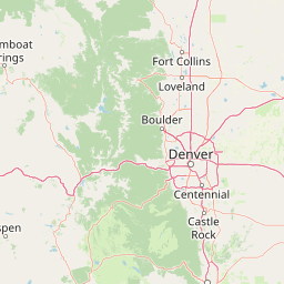


Leaflet | <a href="https://www.openstreetmap.org/copyright">© OpenStreetMap contributors</a>
Item
| Property | Value |
|---|---|
| id | 397657 |
| downstream_mainstem_id | https://geoconnex.us/ref/mainstems/332651 |
| encompassing_mainstem_basins | ['https://geoconnex.us/ref/mainstems/332651', 'https://geoconnex.us/ref/mainstems/314446', 'https://geoconnex.us/ref/mainstems/312091'] |
| featuretype | ['https://www.opengis.net/def/schema/hy_features/hyf/HY_FlowPath', 'https://www.opengis.net/def/schema/hy_features/hyf/HY_WaterBody'] |
| fid | 20109 |
| head_2020huc12 | 110200030102 |
| head_nhdpv1_comid | 1527779 |
| head_nhdpv2_comid | https://geoconnex.us/nhdplusv2/comid/1527779 |
| head_nhdpv2huc12 | https://geoconnex.us/nhdplusv2/huc12/110200030102 |
| head_rf1id | 34354 |
| lengthkm | 56.1 |
| name_at_outlet | Monument Creek |
| name_at_outlet_gnis_id | 193535 |
| new_mainstemid | |
| outlet_2020huc12 | 110200030107 |
| outlet_drainagearea_sqkm | 612.4 |
| outlet_nhdpv1_comid | 1529719 |
| outlet_nhdpv2_comid | https://geoconnex.us/nhdplusv2/comid/1529719 |
| outlet_nhdpv2huc12 | https://geoconnex.us/nhdplusv2/huc12/110200030107 |
| outlet_rf1id | 34350 |
| superseded | False |
| uri | https://geoconnex.us/ref/mainstems/397657 |
Graph Results
| monitoringLocation | https://sta.geoconnex.dev/collections/USGS/Things/items/'USGS-07104000' |
|---|---|
| siteName | USGS-07104000 |
| datasetDescription | Gage height / USGS-07104000-010b1dd793244513b2c441cdf6450cb8 |
| type | Stream |
| url | https://waterdata.usgs.gov/monitoring-location/07104000/#parameterCode=00065 |
| variableMeasured | Gage height / USGS-07104000-010b1dd793244513b2c441cdf6450cb8 |
| variableUnit | ft |
| measurementTechnique | observation |
| temporalCoverage | 2024-08-30T09:05:00Z/2024-09-09T18:30:00Z |
| distributionName | USGS SensorThings API |
| distributionURL | https://labs.waterdata.usgs.gov/sta/v1.1/Datastreams('010b1dd793244513b2c441cdf6450cb8')?$expand=Thing,Observations |
| distributionFormat | application/json |
| wkt | POINT (-104.818587676677 38.9177705744193) |
| monitoringLocation | https://sta.geoconnex.dev/collections/USGS/Things/items/'USGS-07104000' |
|---|---|
| siteName | USGS-07104000 |
| datasetDescription | Gage height / USGS-07104000-010b1dd793244513b2c441cdf6450cb8 |
| type | Stream |
| url | https://waterdata.usgs.gov/monitoring-location/07104000/#parameterCode=00065 |
| variableMeasured | Gage height / USGS-07104000-010b1dd793244513b2c441cdf6450cb8 |
| variableUnit | ft |
| measurementTechnique | observation |
| temporalCoverage | 2024-08-30T09:05:00Z/2024-09-09T18:30:00Z |
| distributionName | USGS Instantaneous Values Service |
| distributionURL | https://waterservices.usgs.gov/nwis/iv/?sites=USGS:07104000¶meterCd=00065&format=rdb |
| distributionFormat | text/tab-separated-values |
| wkt | POINT (-104.818587676677 38.9177705744193) |
| monitoringLocation | https://sta.geoconnex.dev/collections/USGS/Things/items/'USGS-07104000' |
|---|---|
| siteName | USGS-07104000 |
| datasetDescription | Discharge / USGS-07104000-a8724de3c01a41aab341120656c7f2c5 |
| type | Stream |
| url | https://waterdata.usgs.gov/monitoring-location/07104000/#parameterCode=00060 |
| variableMeasured | Discharge / USGS-07104000-a8724de3c01a41aab341120656c7f2c5 |
| variableUnit | ft^3/s |
| measurementTechnique | observation |
| temporalCoverage | 2024-08-30T09:05:00Z/2024-09-09T18:30:00Z |
| distributionName | USGS Instantaneous Values Service |
| distributionURL | https://waterservices.usgs.gov/nwis/iv/?sites=USGS:07104000¶meterCd=00060&format=rdb |
| distributionFormat | text/tab-separated-values |
| wkt | POINT (-104.818587676677 38.9177705744193) |
| monitoringLocation | https://sta.geoconnex.dev/collections/USGS/Things/items/'USGS-07104000' |
|---|---|
| siteName | USGS-07104000 |
| datasetDescription | Discharge / USGS-07104000-a8724de3c01a41aab341120656c7f2c5 |
| type | Stream |
| url | https://waterdata.usgs.gov/monitoring-location/07104000/#parameterCode=00060 |
| variableMeasured | Discharge / USGS-07104000-a8724de3c01a41aab341120656c7f2c5 |
| variableUnit | ft^3/s |
| measurementTechnique | observation |
| temporalCoverage | 2024-08-30T09:05:00Z/2024-09-09T18:30:00Z |
| distributionName | USGS SensorThings API |
| distributionURL | https://labs.waterdata.usgs.gov/sta/v1.1/Datastreams('a8724de3c01a41aab341120656c7f2c5')?$expand=Thing,Observations |
| distributionFormat | application/json |
| wkt | POINT (-104.818587676677 38.9177705744193) |
| monitoringLocation | https://sta.geoconnex.dev/collections/USGS/Things/items/'USGS-07103970' |
|---|---|
| siteName | USGS-07103970 |
| datasetDescription | None / USGS-07103970-60c30412728e43c4b02d6e6d5033d282 |
| type | Stream |
| url | https://waterdata.usgs.gov/monitoring-location/07103970/#parameterCode=00045 |
| variableMeasured | None / USGS-07103970-60c30412728e43c4b02d6e6d5033d282 |
| variableUnit | in |
| measurementTechnique | observation |
| temporalCoverage | 2024-08-30T09:05:00Z/2024-09-09T17:50:00Z |
| distributionName | USGS Instantaneous Values Service |
| distributionURL | https://waterservices.usgs.gov/nwis/iv/?sites=USGS:07103970¶meterCd=00045&format=rdb |
| distributionFormat | text/tab-separated-values |
| wkt | POINT (-104.81719915064 38.9338817003109) |
| monitoringLocation | https://sta.geoconnex.dev/collections/USGS/Things/items/'USGS-07103970' |
|---|---|
| siteName | USGS-07103970 |
| datasetDescription | None / USGS-07103970-60c30412728e43c4b02d6e6d5033d282 |
| type | Stream |
| url | https://waterdata.usgs.gov/monitoring-location/07103970/#parameterCode=00045 |
| variableMeasured | None / USGS-07103970-60c30412728e43c4b02d6e6d5033d282 |
| variableUnit | in |
| measurementTechnique | observation |
| temporalCoverage | 2024-08-30T09:05:00Z/2024-09-09T17:50:00Z |
| distributionName | USGS SensorThings API |
| distributionURL | https://labs.waterdata.usgs.gov/sta/v1.1/Datastreams('60c30412728e43c4b02d6e6d5033d282')?$expand=Thing,Observations |
| distributionFormat | application/json |
| wkt | POINT (-104.81719915064 38.9338817003109) |
| monitoringLocation | https://sta.geoconnex.dev/collections/USGS/Things/items/'USGS-07103970' |
|---|---|
| siteName | USGS-07103970 |
| datasetDescription | Discharge / USGS-07103970-837b2ee975994128a8dc5c455f91f3db |
| type | Stream |
| url | https://waterdata.usgs.gov/monitoring-location/07103970/#parameterCode=00060 |
| variableMeasured | Discharge / USGS-07103970-837b2ee975994128a8dc5c455f91f3db |
| variableUnit | ft^3/s |
| measurementTechnique | observation |
| temporalCoverage | 2024-08-30T09:05:00Z/2024-09-09T17:50:00Z |
| distributionName | USGS Instantaneous Values Service |
| distributionURL | https://waterservices.usgs.gov/nwis/iv/?sites=USGS:07103970¶meterCd=00060&format=rdb |
| distributionFormat | text/tab-separated-values |
| wkt | POINT (-104.81719915064 38.9338817003109) |
| monitoringLocation | https://sta.geoconnex.dev/collections/USGS/Things/items/'USGS-07103970' |
|---|---|
| siteName | USGS-07103970 |
| datasetDescription | Discharge / USGS-07103970-837b2ee975994128a8dc5c455f91f3db |
| type | Stream |
| url | https://waterdata.usgs.gov/monitoring-location/07103970/#parameterCode=00060 |
| variableMeasured | Discharge / USGS-07103970-837b2ee975994128a8dc5c455f91f3db |
| variableUnit | ft^3/s |
| measurementTechnique | observation |
| temporalCoverage | 2024-08-30T09:05:00Z/2024-09-09T17:50:00Z |
| distributionName | USGS SensorThings API |
| distributionURL | https://labs.waterdata.usgs.gov/sta/v1.1/Datastreams('837b2ee975994128a8dc5c455f91f3db')?$expand=Thing,Observations |
| distributionFormat | application/json |
| wkt | POINT (-104.81719915064 38.9338817003109) |
| monitoringLocation | https://sta.geoconnex.dev/collections/USGS/Things/items/'USGS-07103970' |
|---|---|
| siteName | USGS-07103970 |
| datasetDescription | Gage height, feet / USGS-07103970-eb45e10055fa4e4f8b264fcef0c83d9b |
| type | Stream |
| url | https://waterdata.usgs.gov/monitoring-location/07103970/#parameterCode=00065 |
| variableMeasured | Gage height |
| variableUnit | ft |
| measurementTechnique | observation |
| temporalCoverage | 2024-08-30T09:05:00Z/2024-09-09T17:50:00Z |
| distributionName | USGS Instantaneous Values Service |
| distributionURL | https://waterservices.usgs.gov/nwis/iv/?sites=USGS:07103970¶meterCd=00065&format=rdb |
| distributionFormat | text/tab-separated-values |
| wkt | POINT (-104.81719915064 38.9338817003109) |
| monitoringLocation | https://sta.geoconnex.dev/collections/USGS/Things/items/'USGS-07103970' |
|---|---|
| siteName | USGS-07103970 |
| datasetDescription | Gage height, feet / USGS-07103970-eb45e10055fa4e4f8b264fcef0c83d9b |
| type | Stream |
| url | https://waterdata.usgs.gov/monitoring-location/07103970/#parameterCode=00065 |
| variableMeasured | Gage height |
| variableUnit | ft |
| measurementTechnique | observation |
| temporalCoverage | 2024-08-30T09:05:00Z/2024-09-09T17:50:00Z |
| distributionName | USGS SensorThings API |
| distributionURL | https://labs.waterdata.usgs.gov/sta/v1.1/Datastreams('eb45e10055fa4e4f8b264fcef0c83d9b')?$expand=Thing,Observations |
| distributionFormat | application/json |
| wkt | POINT (-104.81719915064 38.9338817003109) |
| monitoringLocation | https://sta.geoconnex.dev/collections/USGS/Things/items/'USGS-07103970' |
|---|---|
| siteName | USGS-07103970 |
| datasetDescription | Temperature, water, degrees Celsius / USGS-07103970-f6228d81889b48459674225bbf5987bd |
| type | Stream |
| url | https://waterdata.usgs.gov/monitoring-location/07103970/#parameterCode=00010 |
| variableMeasured | Temperature |
| variableUnit | degC |
| measurementTechnique | observation |
| temporalCoverage | 2024-08-30T09:05:00Z/2024-09-09T17:50:00Z |
| distributionName | USGS Instantaneous Values Service |
| distributionURL | https://waterservices.usgs.gov/nwis/iv/?sites=USGS:07103970¶meterCd=00010&format=rdb |
| distributionFormat | text/tab-separated-values |
| wkt | POINT (-104.81719915064 38.9338817003109) |
| monitoringLocation | https://sta.geoconnex.dev/collections/USGS/Things/items/'USGS-07103970' |
|---|---|
| siteName | USGS-07103970 |
| datasetDescription | Temperature, water, degrees Celsius / USGS-07103970-f6228d81889b48459674225bbf5987bd |
| type | Stream |
| url | https://waterdata.usgs.gov/monitoring-location/07103970/#parameterCode=00010 |
| variableMeasured | Temperature |
| variableUnit | degC |
| measurementTechnique | observation |
| temporalCoverage | 2024-08-30T09:05:00Z/2024-09-09T17:50:00Z |
| distributionName | USGS SensorThings API |
| distributionURL | https://labs.waterdata.usgs.gov/sta/v1.1/Datastreams('f6228d81889b48459674225bbf5987bd')?$expand=Thing,Observations |
| distributionFormat | application/json |
| wkt | POINT (-104.81719915064 38.9338817003109) |