Thirtytwo Mile Creek
Map


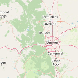

Leaflet | <a href="https://www.openstreetmap.org/copyright">© OpenStreetMap contributors</a>
Item
| Property | Value |
|---|---|
| id | 398228 |
| downstream_mainstem_id | https://geoconnex.us/ref/mainstems/332883 |
| encompassing_mainstem_basins | ['https://geoconnex.us/ref/mainstems/332883', 'https://geoconnex.us/ref/mainstems/328831', 'https://geoconnex.us/ref/mainstems/315152', 'https://geoconnex.us/ref/mainstems/312532', 'https://geoconnex.us/ref/mainstems/312091'] |
| featuretype | ['https://www.opengis.net/def/schema/hy_features/hyf/HY_FlowPath', 'https://www.opengis.net/def/schema/hy_features/hyf/HY_WaterBody'] |
| fid | 18158 |
| head_2020huc12 | 102702060404 |
| head_nhdpv1_comid | None |
| head_nhdpv2_comid | https://geoconnex.us/nhdplusv2/comid/7269383 |
| head_nhdpv2huc12 | https://geoconnex.us/nhdplusv2/huc12/102702060404 |
| head_rf1id | 24860 |
| lengthkm | 135.8 |
| name_at_outlet | Thirtytwo Mile Creek |
| name_at_outlet_gnis_id | 834084 |
| new_mainstemid | |
| outlet_2020huc12 | 102702060403 |
| outlet_drainagearea_sqkm | 444.2 |
| outlet_nhdpv1_comid | None |
| outlet_nhdpv2_comid | https://geoconnex.us/nhdplusv2/comid/18766780 |
| outlet_nhdpv2huc12 | https://geoconnex.us/nhdplusv2/huc12/102500160303 |
| outlet_rf1id | 24858 |
| superseded | False |
| uri | https://geoconnex.us/ref/mainstems/398228 |