Thompson Creek
Map

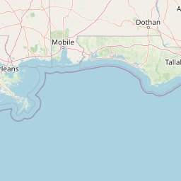


Leaflet | <a href="https://www.openstreetmap.org/copyright">© OpenStreetMap contributors</a>
Item
| Property | Value |
|---|---|
| id | 398276 |
| downstream_mainstem_id | https://geoconnex.us/ref/mainstems/312091 |
| encompassing_mainstem_basins | ['https://geoconnex.us/ref/mainstems/312091'] |
| featuretype | ['https://www.opengis.net/def/schema/hy_features/hyf/HY_FlowPath', 'https://www.opengis.net/def/schema/hy_features/hyf/HY_WaterBody'] |
| fid | 13773 |
| head_2020huc12 | 080702010301 |
| head_nhdpv1_comid | 19051586 |
| head_nhdpv2_comid | https://geoconnex.us/nhdplusv2/comid/19051586 |
| head_nhdpv2huc12 | https://geoconnex.us/nhdplusv2/huc12/080702010301 |
| head_rf1id | 21562 |
| lengthkm | 70.6 |
| name_at_outlet | Thompson Creek |
| name_at_outlet_gnis_id | 556235 |
| new_mainstemid | |
| outlet_2020huc12 | 080702010308 |
| outlet_drainagearea_sqkm | 848.9 |
| outlet_nhdpv1_comid | 19053734 |
| outlet_nhdpv2_comid | https://geoconnex.us/nhdplusv2/comid/19053734 |
| outlet_nhdpv2huc12 | https://geoconnex.us/nhdplusv2/huc12/080702010308 |
| outlet_rf1id | 21560 |
| superseded | False |
| uri | https://geoconnex.us/ref/mainstems/398276 |
Graph Results
| monitoringLocation | https://sta.geoconnex.dev/collections/USGS/Things/items/'USGS-07373700' |
|---|---|
| siteName | USGS-07373700 |
| datasetDescription | Gage height feet / USGS-07373700-8ea5af0bc9ca49d3a5b706baec0bba2c |
| type | Stream |
| url | https://waterdata.usgs.gov/monitoring-location/07373700/#parameterCode=00065 |
| variableMeasured | Gage height |
| variableUnit | ft |
| measurementTechnique | observation |
| temporalCoverage | 2024-08-30T09:15:00Z/2024-09-09T18:45:00Z |
| distributionName | USGS Instantaneous Values Service |
| distributionURL | https://waterservices.usgs.gov/nwis/iv/?sites=USGS:07373700¶meterCd=00065&format=rdb |
| distributionFormat | text/tab-separated-values |
| wkt | POINT (-91.28558333333334 30.74736111111111) |
| monitoringLocation | https://sta.geoconnex.dev/collections/USGS/Things/items/'USGS-07373700' |
|---|---|
| siteName | USGS-07373700 |
| datasetDescription | Gage height feet / USGS-07373700-8ea5af0bc9ca49d3a5b706baec0bba2c |
| type | Stream |
| url | https://waterdata.usgs.gov/monitoring-location/07373700/#parameterCode=00065 |
| variableMeasured | Gage height |
| variableUnit | ft |
| measurementTechnique | observation |
| temporalCoverage | 2024-08-30T09:15:00Z/2024-09-09T18:45:00Z |
| distributionName | USGS SensorThings API |
| distributionURL | https://labs.waterdata.usgs.gov/sta/v1.1/Datastreams('8ea5af0bc9ca49d3a5b706baec0bba2c')?$expand=Thing,Observations |
| distributionFormat | application/json |
| wkt | POINT (-91.28558333333334 30.74736111111111) |
| monitoringLocation | https://sta.geoconnex.dev/collections/USGS/Things/items/'USGS-07373700' |
|---|---|
| siteName | USGS-07373700 |
| datasetDescription | Stream water level elevation above NAVD 1988 in feet / USGS-07373700-688acc6008634dd6989caf45e5e18b81 |
| type | Stream |
| url | https://waterdata.usgs.gov/monitoring-location/07373700/#parameterCode=63160 |
| variableMeasured | Stream water level elevation above NAVD 1988 |
| variableUnit | ft |
| measurementTechnique | observation |
| temporalCoverage | 2024-08-30T09:15:00Z/2024-09-09T18:45:00Z |
| distributionName | USGS Instantaneous Values Service |
| distributionURL | https://waterservices.usgs.gov/nwis/iv/?sites=USGS:07373700¶meterCd=63160&format=rdb |
| distributionFormat | text/tab-separated-values |
| wkt | POINT (-91.28558333333334 30.74736111111111) |
| monitoringLocation | https://sta.geoconnex.dev/collections/USGS/Things/items/'USGS-07373700' |
|---|---|
| siteName | USGS-07373700 |
| datasetDescription | Stream water level elevation above NAVD 1988 in feet / USGS-07373700-688acc6008634dd6989caf45e5e18b81 |
| type | Stream |
| url | https://waterdata.usgs.gov/monitoring-location/07373700/#parameterCode=63160 |
| variableMeasured | Stream water level elevation above NAVD 1988 |
| variableUnit | ft |
| measurementTechnique | observation |
| temporalCoverage | 2024-08-30T09:15:00Z/2024-09-09T18:45:00Z |
| distributionName | USGS SensorThings API |
| distributionURL | https://labs.waterdata.usgs.gov/sta/v1.1/Datastreams('688acc6008634dd6989caf45e5e18b81')?$expand=Thing,Observations |
| distributionFormat | application/json |
| wkt | POINT (-91.28558333333334 30.74736111111111) |