Bear Creek
Map


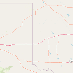

Leaflet | <a href="https://www.openstreetmap.org/copyright">© OpenStreetMap contributors</a>
Item
| Property | Value |
|---|---|
| id | 400518 |
| downstream_mainstem_id | https://geoconnex.us/ref/mainstems/320872 |
| encompassing_mainstem_basins | ['https://geoconnex.us/ref/mainstems/320872', 'https://geoconnex.us/ref/mainstems/312091'] |
| featuretype | ['https://www.opengis.net/def/schema/hy_features/hyf/HY_FlowPath', 'https://www.opengis.net/def/schema/hy_features/hyf/HY_WaterBody'] |
| fid | 19799 |
| head_2020huc12 | 110100030401 |
| head_nhdpv1_comid | 7630576 |
| head_nhdpv2_comid | https://geoconnex.us/nhdplusv2/comid/7630576 |
| head_nhdpv2huc12 | https://geoconnex.us/nhdplusv2/huc12/110100030401 |
| head_rf1id | 36930 |
| lengthkm | 56.5 |
| name_at_outlet | Bear Creek |
| name_at_outlet_gnis_id | 46214 |
| new_mainstemid | |
| outlet_2020huc12 | 110100030405 |
| outlet_drainagearea_sqkm | 393.6 |
| outlet_nhdpv1_comid | 7630614 |
| outlet_nhdpv2_comid | https://geoconnex.us/nhdplusv2/comid/7630614 |
| outlet_nhdpv2huc12 | https://geoconnex.us/nhdplusv2/huc12/110100030405 |
| outlet_rf1id | 36940 |
| superseded | False |
| uri | https://geoconnex.us/ref/mainstems/400518 |
Graph Results
| monitoringLocation | https://sta.geoconnex.dev/collections/USGS/Things/items/'USGS-07054410' |
|---|---|
| siteName | USGS-07054410 |
| datasetDescription | Gage height feet / USGS-07054410-ccffb7de8934411b92d4fa8d708958f4 |
| type | Stream |
| url | https://waterdata.usgs.gov/monitoring-location/07054410/#parameterCode=00065 |
| variableMeasured | Gage height |
| variableUnit | ft |
| measurementTechnique | observation |
| temporalCoverage | 2024-08-30T09:15:00Z/2024-09-09T18:30:00Z |
| distributionName | USGS Instantaneous Values Service |
| distributionURL | https://waterservices.usgs.gov/nwis/iv/?sites=USGS:07054410¶meterCd=00065&format=rdb |
| distributionFormat | text/tab-separated-values |
| wkt | POINT (-93.075 36.4494444444444) |
| monitoringLocation | https://sta.geoconnex.dev/collections/USGS/Things/items/'USGS-07054410' |
|---|---|
| siteName | USGS-07054410 |
| datasetDescription | Gage height feet / USGS-07054410-ccffb7de8934411b92d4fa8d708958f4 |
| type | Stream |
| url | https://waterdata.usgs.gov/monitoring-location/07054410/#parameterCode=00065 |
| variableMeasured | Gage height |
| variableUnit | ft |
| measurementTechnique | observation |
| temporalCoverage | 2024-08-30T09:15:00Z/2024-09-09T18:30:00Z |
| distributionName | USGS SensorThings API |
| distributionURL | https://labs.waterdata.usgs.gov/sta/v1.1/Datastreams('ccffb7de8934411b92d4fa8d708958f4')?$expand=Thing,Observations |
| distributionFormat | application/json |
| wkt | POINT (-93.075 36.4494444444444) |