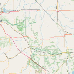
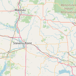
Morrison Creek
Map
Leaflet | <a href="https://www.openstreetmap.org/copyright">© OpenStreetMap contributors</a>
Item
| Property | Value |
|---|---|
| id | 404588 |
| downstream_mainstem_id | https://geoconnex.us/ref/mainstems/330354 |
| encompassing_mainstem_basins | ['https://geoconnex.us/ref/mainstems/330354', 'https://geoconnex.us/ref/mainstems/312091'] |
| featuretype | ['https://www.opengis.net/def/schema/hy_features/hyf/HY_FlowPath', 'https://www.opengis.net/def/schema/hy_features/hyf/HY_WaterBody'] |
| fid | 10912 |
| head_2020huc12 | 070400070701 |
| head_nhdpv1_comid | 13136463 |
| head_nhdpv2_comid | https://geoconnex.us/nhdplusv2/comid/13136463 |
| head_nhdpv2huc12 | https://geoconnex.us/nhdplusv2/huc12/070400070701 |
| head_rf1id | 18106 |
| lengthkm | 37.7 |
| name_at_outlet | Morrison Creek |
| name_at_outlet_gnis_id | 1569756 |
| new_mainstemid | |
| outlet_2020huc12 | 070400070703 |
| outlet_drainagearea_sqkm | 340.7 |
| outlet_nhdpv1_comid | 13137969 |
| outlet_nhdpv2_comid | https://geoconnex.us/nhdplusv2/comid/13137969 |
| outlet_nhdpv2huc12 | https://geoconnex.us/nhdplusv2/huc12/070400070703 |
| outlet_rf1id | 18106 |
| superseded | False |
| uri | https://geoconnex.us/ref/mainstems/404588 |
Graph Results
| monitoringLocation | https://geoconnex.us/iow/wqp/WIDNR_WQX-273027 |
|---|---|
| siteName | WIDNR_WQX-273027 |
| datasetDescription | Orthophosphate at WIDNR_WQX-273027 |
| type | Lake |
| url | https://www.waterqualitydata.us/provider/STORET/WIDNR_WQX/WIDNR_WQX-273027/ |
| variableMeasured | Orthophosphate |
| variableUnit | mg/l asPO4 |
| measurementTechnique | observation |
| temporalCoverage | 2006-01-01T00:00:00Z/2006-12-31T00:00:00Z |
| distributionName | Water Quality Portal |
| distributionURL | https://www.waterqualitydata.us/data/Result/search?siteid=WIDNR_WQX-273027&CharacteristicName=Orthophosphate&mimeType=csv |
| distributionFormat | text/comma-separated-values |
| wkt | POINT (-90.52296 44.304267) |
| monitoringLocation | https://geoconnex.us/iow/wqp/WIDNR_WQX-273027 |
|---|---|
| siteName | WIDNR_WQX-273027 |
| datasetDescription | Phosphate-phosphorus at WIDNR_WQX-273027 |
| type | Lake |
| url | https://www.waterqualitydata.us/provider/STORET/WIDNR_WQX/WIDNR_WQX-273027/ |
| variableMeasured | Phosphate-phosphorus |
| variableUnit | mg/L |
| measurementTechnique | observation |
| temporalCoverage | 1992-01-01T00:00:00Z/2006-12-31T00:00:00Z |
| distributionName | Water Quality Portal |
| distributionURL | https://www.waterqualitydata.us/data/Result/search?siteid=WIDNR_WQX-273027&CharacteristicName=Phosphate-phosphorus&mimeType=csv |
| distributionFormat | text/comma-separated-values |
| wkt | POINT (-90.52296 44.304267) |
| monitoringLocation | https://geoconnex.us/iow/wqp/WIDNR_WQX-273027 |
|---|---|
| siteName | WIDNR_WQX-273027 |
| datasetDescription | Chlorophyll a, uncorrected for pheophytin at WIDNR_WQX-273027 |
| type | Lake |
| url | https://www.waterqualitydata.us/provider/STORET/WIDNR_WQX/WIDNR_WQX-273027/ |
| variableMeasured | Chlorophyll a, uncorrected for pheophytin |
| variableUnit | ug/L |
| measurementTechnique | observation |
| temporalCoverage | 1992-01-01T00:00:00Z/1992-12-31T00:00:00Z |
| distributionName | Water Quality Portal |
| distributionURL | https://www.waterqualitydata.us/data/Result/search?siteid=WIDNR_WQX-273027&CharacteristicName=Chlorophyll a, uncorrected for pheophytin&mimeType=csv |
| distributionFormat | text/comma-separated-values |
| wkt | POINT (-90.52296 44.304267) |
| monitoringLocation | https://geoconnex.us/iow/wqp/WIDNR_WQX-273027 |
|---|---|
| siteName | WIDNR_WQX-273027 |
| datasetDescription | Copper at WIDNR_WQX-273027 |
| type | Lake |
| url | https://www.waterqualitydata.us/provider/STORET/WIDNR_WQX/WIDNR_WQX-273027/ |
| variableMeasured | Copper |
| variableUnit | Unknown |
| measurementTechnique | observation |
| temporalCoverage | 1992-01-01T00:00:00Z/1992-12-31T00:00:00Z |
| distributionName | Water Quality Portal |
| distributionURL | https://www.waterqualitydata.us/data/Result/search?siteid=WIDNR_WQX-273027&CharacteristicName=Copper&mimeType=csv |
| distributionFormat | text/comma-separated-values |
| wkt | POINT (-90.52296 44.304267) |
| monitoringLocation | https://geoconnex.us/iow/wqp/WIDNR_WQX-273027 |
|---|---|
| siteName | WIDNR_WQX-273027 |
| datasetDescription | Depth, Secchi disk depth at WIDNR_WQX-273027 |
| type | Lake |
| url | https://www.waterqualitydata.us/provider/STORET/WIDNR_WQX/WIDNR_WQX-273027/ |
| variableMeasured | Depth, Secchi disk depth |
| variableUnit | m |
| measurementTechnique | observation |
| temporalCoverage | 1992-01-01T00:00:00Z/1992-12-31T00:00:00Z |
| distributionName | Water Quality Portal |
| distributionURL | https://www.waterqualitydata.us/data/Result/search?siteid=WIDNR_WQX-273027&CharacteristicName=Depth, Secchi disk depth&mimeType=csv |
| distributionFormat | text/comma-separated-values |
| wkt | POINT (-90.52296 44.304267) |
| monitoringLocation | https://geoconnex.us/iow/wqp/WIDNR_WQX-273027 |
|---|---|
| siteName | WIDNR_WQX-273027 |
| datasetDescription | Arsenic at WIDNR_WQX-273027 |
| type | Lake |
| url | https://www.waterqualitydata.us/provider/STORET/WIDNR_WQX/WIDNR_WQX-273027/ |
| variableMeasured | Arsenic |
| variableUnit | ppm |
| measurementTechnique | observation |
| temporalCoverage | 1992-01-01T00:00:00Z/1992-12-31T00:00:00Z |
| distributionName | Water Quality Portal |
| distributionURL | https://www.waterqualitydata.us/data/Result/search?siteid=WIDNR_WQX-273027&CharacteristicName=Arsenic&mimeType=csv |
| distributionFormat | text/comma-separated-values |
| wkt | POINT (-90.52296 44.304267) |
| monitoringLocation | https://geoconnex.us/iow/wqp/WIDNR_WQX-273027 |
|---|---|
| siteName | WIDNR_WQX-273027 |
| datasetDescription | Calcium carbonate at WIDNR_WQX-273027 |
| type | Lake |
| url | https://www.waterqualitydata.us/provider/STORET/WIDNR_WQX/WIDNR_WQX-273027/ |
| variableMeasured | Calcium carbonate |
| variableUnit | mg/L |
| measurementTechnique | observation |
| temporalCoverage | 2006-01-01T00:00:00Z/2006-12-31T00:00:00Z |
| distributionName | Water Quality Portal |
| distributionURL | https://www.waterqualitydata.us/data/Result/search?siteid=WIDNR_WQX-273027&CharacteristicName=Calcium carbonate&mimeType=csv |
| distributionFormat | text/comma-separated-values |
| wkt | POINT (-90.52296 44.304267) |
| monitoringLocation | https://geoconnex.us/iow/wqp/WIDNR_WQX-273027 |
|---|---|
| siteName | WIDNR_WQX-273027 |
| datasetDescription | Cadmium at WIDNR_WQX-273027 |
| type | Lake |
| url | https://www.waterqualitydata.us/provider/STORET/WIDNR_WQX/WIDNR_WQX-273027/ |
| variableMeasured | Cadmium |
| variableUnit | ug/L |
| measurementTechnique | observation |
| temporalCoverage | 1992-01-01T00:00:00Z/1992-12-31T00:00:00Z |
| distributionName | Water Quality Portal |
| distributionURL | https://www.waterqualitydata.us/data/Result/search?siteid=WIDNR_WQX-273027&CharacteristicName=Cadmium&mimeType=csv |
| distributionFormat | text/comma-separated-values |
| wkt | POINT (-90.52296 44.304267) |
| monitoringLocation | https://geoconnex.us/iow/wqp/WIDNR_WQX-273027 |
|---|---|
| siteName | WIDNR_WQX-273027 |
| datasetDescription | Chromium at WIDNR_WQX-273027 |
| type | Lake |
| url | https://www.waterqualitydata.us/provider/STORET/WIDNR_WQX/WIDNR_WQX-273027/ |
| variableMeasured | Chromium |
| variableUnit | ppb |
| measurementTechnique | observation |
| temporalCoverage | 1992-01-01T00:00:00Z/1992-12-31T00:00:00Z |
| distributionName | Water Quality Portal |
| distributionURL | https://www.waterqualitydata.us/data/Result/search?siteid=WIDNR_WQX-273027&CharacteristicName=Chromium&mimeType=csv |
| distributionFormat | text/comma-separated-values |
| wkt | POINT (-90.52296 44.304267) |
| monitoringLocation | https://geoconnex.us/iow/wqp/WIDNR_WQX-273027 |
|---|---|
| siteName | WIDNR_WQX-273027 |
| datasetDescription | Lead at WIDNR_WQX-273027 |
| type | Lake |
| url | https://www.waterqualitydata.us/provider/STORET/WIDNR_WQX/WIDNR_WQX-273027/ |
| variableMeasured | Lead |
| variableUnit | ug/l |
| measurementTechnique | observation |
| temporalCoverage | 1992-01-01T00:00:00Z/1992-12-31T00:00:00Z |
| distributionName | Water Quality Portal |
| distributionURL | https://www.waterqualitydata.us/data/Result/search?siteid=WIDNR_WQX-273027&CharacteristicName=Lead&mimeType=csv |
| distributionFormat | text/comma-separated-values |
| wkt | POINT (-90.52296 44.304267) |
| monitoringLocation | https://geoconnex.us/iow/wqp/WIDNR_WQX-273027 |
|---|---|
| siteName | WIDNR_WQX-273027 |
| datasetDescription | Nickel at WIDNR_WQX-273027 |
| type | Lake |
| url | https://www.waterqualitydata.us/provider/STORET/WIDNR_WQX/WIDNR_WQX-273027/ |
| variableMeasured | Nickel |
| variableUnit | ppm |
| measurementTechnique | observation |
| temporalCoverage | 1992-01-01T00:00:00Z/1992-12-31T00:00:00Z |
| distributionName | Water Quality Portal |
| distributionURL | https://www.waterqualitydata.us/data/Result/search?siteid=WIDNR_WQX-273027&CharacteristicName=Nickel&mimeType=csv |
| distributionFormat | text/comma-separated-values |
| wkt | POINT (-90.52296 44.304267) |
| monitoringLocation | https://geoconnex.us/iow/wqp/WIDNR_WQX-273027 |
|---|---|
| siteName | WIDNR_WQX-273027 |
| datasetDescription | Zinc at WIDNR_WQX-273027 |
| type | Lake |
| url | https://www.waterqualitydata.us/provider/STORET/WIDNR_WQX/WIDNR_WQX-273027/ |
| variableMeasured | Zinc |
| variableUnit | Unknown |
| measurementTechnique | observation |
| temporalCoverage | 1992-01-01T00:00:00Z/1992-12-31T00:00:00Z |
| distributionName | Water Quality Portal |
| distributionURL | https://www.waterqualitydata.us/data/Result/search?siteid=WIDNR_WQX-273027&CharacteristicName=Zinc&mimeType=csv |
| distributionFormat | text/comma-separated-values |
| wkt | POINT (-90.52296 44.304267) |
| monitoringLocation | https://geoconnex.us/iow/wqp/WIDNR_WQX-273027 |
|---|---|
| siteName | WIDNR_WQX-273027 |
| datasetDescription | Ammonia at WIDNR_WQX-273027 |
| type | Lake |
| url | https://www.waterqualitydata.us/provider/STORET/WIDNR_WQX/WIDNR_WQX-273027/ |
| variableMeasured | Ammonia |
| variableUnit | mg/L |
| measurementTechnique | observation |
| temporalCoverage | 1992-01-01T00:00:00Z/2006-12-31T00:00:00Z |
| distributionName | Water Quality Portal |
| distributionURL | https://www.waterqualitydata.us/data/Result/search?siteid=WIDNR_WQX-273027&CharacteristicName=Ammonia&mimeType=csv |
| distributionFormat | text/comma-separated-values |
| wkt | POINT (-90.52296 44.304267) |
| monitoringLocation | https://geoconnex.us/iow/wqp/WIDNR_WQX-273027 |
|---|---|
| siteName | WIDNR_WQX-273027 |
| datasetDescription | Kjeldahl nitrogen at WIDNR_WQX-273027 |
| type | Lake |
| url | https://www.waterqualitydata.us/provider/STORET/WIDNR_WQX/WIDNR_WQX-273027/ |
| variableMeasured | Kjeldahl nitrogen |
| variableUnit | mg/L |
| measurementTechnique | observation |
| temporalCoverage | 1992-01-01T00:00:00Z/2006-12-31T00:00:00Z |
| distributionName | Water Quality Portal |
| distributionURL | https://www.waterqualitydata.us/data/Result/search?siteid=WIDNR_WQX-273027&CharacteristicName=Kjeldahl nitrogen&mimeType=csv |
| distributionFormat | text/comma-separated-values |
| wkt | POINT (-90.52296 44.304267) |
| monitoringLocation | https://geoconnex.us/iow/wqp/WIDNR_WQX-273027 |
|---|---|
| siteName | WIDNR_WQX-273027 |
| datasetDescription | Temperature, air at WIDNR_WQX-273027 |
| type | Lake |
| url | https://www.waterqualitydata.us/provider/STORET/WIDNR_WQX/WIDNR_WQX-273027/ |
| variableMeasured | Temperature, air |
| variableUnit | deg C |
| measurementTechnique | observation |
| temporalCoverage | 2006-01-01T00:00:00Z/2006-12-31T00:00:00Z |
| distributionName | Water Quality Portal |
| distributionURL | https://www.waterqualitydata.us/data/Result/search?siteid=WIDNR_WQX-273027&CharacteristicName=Temperature, air&mimeType=csv |
| distributionFormat | text/comma-separated-values |
| wkt | POINT (-90.52296 44.304267) |
| monitoringLocation | https://geoconnex.us/iow/wqp/WIDNR_WQX-273027 |
|---|---|
| siteName | WIDNR_WQX-273027 |
| datasetDescription | Carbon at WIDNR_WQX-273027 |
| type | Lake |
| url | https://www.waterqualitydata.us/provider/STORET/WIDNR_WQX/WIDNR_WQX-273027/ |
| variableMeasured | Carbon |
| variableUnit | mg/L |
| measurementTechnique | observation |
| temporalCoverage | 1992-01-01T00:00:00Z/1992-12-31T00:00:00Z |
| distributionName | Water Quality Portal |
| distributionURL | https://www.waterqualitydata.us/data/Result/search?siteid=WIDNR_WQX-273027&CharacteristicName=Carbon&mimeType=csv |
| distributionFormat | text/comma-separated-values |
| wkt | POINT (-90.52296 44.304267) |
| monitoringLocation | https://geoconnex.us/iow/wqp/WIDNR_WQX-273027 |
|---|---|
| siteName | WIDNR_WQX-273027 |
| datasetDescription | Selenium at WIDNR_WQX-273027 |
| type | Lake |
| url | https://www.waterqualitydata.us/provider/STORET/WIDNR_WQX/WIDNR_WQX-273027/ |
| variableMeasured | Selenium |
| variableUnit | ug/l |
| measurementTechnique | observation |
| temporalCoverage | 1992-01-01T00:00:00Z/1992-12-31T00:00:00Z |
| distributionName | Water Quality Portal |
| distributionURL | https://www.waterqualitydata.us/data/Result/search?siteid=WIDNR_WQX-273027&CharacteristicName=Selenium&mimeType=csv |
| distributionFormat | text/comma-separated-values |
| wkt | POINT (-90.52296 44.304267) |
| monitoringLocation | https://geoconnex.us/iow/wqp/WIDNR_WQX-273027 |
|---|---|
| siteName | WIDNR_WQX-273027 |
| datasetDescription | Specific conductance at WIDNR_WQX-273027 |
| type | Lake |
| url | https://www.waterqualitydata.us/provider/STORET/WIDNR_WQX/WIDNR_WQX-273027/ |
| variableMeasured | Specific conductance |
| variableUnit | umho/cm |
| measurementTechnique | observation |
| temporalCoverage | 2006-01-01T00:00:00Z/2006-12-31T00:00:00Z |
| distributionName | Water Quality Portal |
| distributionURL | https://www.waterqualitydata.us/data/Result/search?siteid=WIDNR_WQX-273027&CharacteristicName=Specific conductance&mimeType=csv |
| distributionFormat | text/comma-separated-values |
| wkt | POINT (-90.52296 44.304267) |
| monitoringLocation | https://geoconnex.us/iow/wqp/WIDNR_WQX-273027 |
|---|---|
| siteName | WIDNR_WQX-273027 |
| datasetDescription | Chlorophyll a (probe relative fluorescence) at WIDNR_WQX-273027 |
| type | Lake |
| url | https://www.waterqualitydata.us/provider/STORET/WIDNR_WQX/WIDNR_WQX-273027/ |
| variableMeasured | Chlorophyll a (probe relative fluorescence) |
| variableUnit | RFU |
| measurementTechnique | observation |
| temporalCoverage | 2006-01-01T00:00:00Z/2006-12-31T00:00:00Z |
| distributionName | Water Quality Portal |
| distributionURL | https://www.waterqualitydata.us/data/Result/search?siteid=WIDNR_WQX-273027&CharacteristicName=Chlorophyll a (probe relative fluorescence)&mimeType=csv |
| distributionFormat | text/comma-separated-values |
| wkt | POINT (-90.52296 44.304267) |
| monitoringLocation | https://geoconnex.us/iow/wqp/WIDNR_WQX-273027 |
|---|---|
| siteName | WIDNR_WQX-273027 |
| datasetDescription | pH at WIDNR_WQX-273027 |
| type | Lake |
| url | https://www.waterqualitydata.us/provider/STORET/WIDNR_WQX/WIDNR_WQX-273027/ |
| variableMeasured | pH |
| variableUnit | None |
| measurementTechnique | observation |
| temporalCoverage | 1992-01-01T00:00:00Z/2006-12-31T00:00:00Z |
| distributionName | Water Quality Portal |
| distributionURL | https://www.waterqualitydata.us/data/Result/search?siteid=WIDNR_WQX-273027&CharacteristicName=pH&mimeType=csv |
| distributionFormat | text/comma-separated-values |
| wkt | POINT (-90.52296 44.304267) |
| monitoringLocation | https://geoconnex.us/iow/wqp/WIDNR_WQX-273027 |
|---|---|
| siteName | WIDNR_WQX-273027 |
| datasetDescription | Dissolved oxygen (DO) at WIDNR_WQX-273027 |
| type | Lake |
| url | https://www.waterqualitydata.us/provider/STORET/WIDNR_WQX/WIDNR_WQX-273027/ |
| variableMeasured | Dissolved oxygen (DO) |
| variableUnit | mg/L |
| measurementTechnique | observation |
| temporalCoverage | 1992-01-01T00:00:00Z/2006-12-31T00:00:00Z |
| distributionName | Water Quality Portal |
| distributionURL | https://www.waterqualitydata.us/data/Result/search?siteid=WIDNR_WQX-273027&CharacteristicName=Dissolved oxygen (DO)&mimeType=csv |
| distributionFormat | text/comma-separated-values |
| wkt | POINT (-90.52296 44.304267) |
| monitoringLocation | https://geoconnex.us/iow/wqp/WIDNR_WQX-273027 |
|---|---|
| siteName | WIDNR_WQX-273027 |
| datasetDescription | Temperature, water at WIDNR_WQX-273027 |
| type | Lake |
| url | https://www.waterqualitydata.us/provider/STORET/WIDNR_WQX/WIDNR_WQX-273027/ |
| variableMeasured | Temperature, water |
| variableUnit | deg C |
| measurementTechnique | observation |
| temporalCoverage | 1992-01-01T00:00:00Z/2006-12-31T00:00:00Z |
| distributionName | Water Quality Portal |
| distributionURL | https://www.waterqualitydata.us/data/Result/search?siteid=WIDNR_WQX-273027&CharacteristicName=Temperature, water&mimeType=csv |
| distributionFormat | text/comma-separated-values |
| wkt | POINT (-90.52296 44.304267) |
| monitoringLocation | https://geoconnex.us/iow/wqp/WIDNR_WQX-273027 |
|---|---|
| siteName | WIDNR_WQX-273027 |
| datasetDescription | True color at WIDNR_WQX-273027 |
| type | Lake |
| url | https://www.waterqualitydata.us/provider/STORET/WIDNR_WQX/WIDNR_WQX-273027/ |
| variableMeasured | True color |
| variableUnit | PCU |
| measurementTechnique | observation |
| temporalCoverage | 2006-01-01T00:00:00Z/2006-12-31T00:00:00Z |
| distributionName | Water Quality Portal |
| distributionURL | https://www.waterqualitydata.us/data/Result/search?siteid=WIDNR_WQX-273027&CharacteristicName=True color&mimeType=csv |
| distributionFormat | text/comma-separated-values |
| wkt | POINT (-90.52296 44.304267) |
| monitoringLocation | https://geoconnex.us/iow/wqp/WIDNR_WQX-273027 |
|---|---|
| siteName | WIDNR_WQX-273027 |
| datasetDescription | Cloud cover at WIDNR_WQX-273027 |
| type | Lake |
| url | https://www.waterqualitydata.us/provider/STORET/WIDNR_WQX/WIDNR_WQX-273027/ |
| variableMeasured | Cloud cover |
| variableUnit | % |
| measurementTechnique | observation |
| temporalCoverage | 2006-01-01T00:00:00Z/2006-12-31T00:00:00Z |
| distributionName | Water Quality Portal |
| distributionURL | https://www.waterqualitydata.us/data/Result/search?siteid=WIDNR_WQX-273027&CharacteristicName=Cloud cover&mimeType=csv |
| distributionFormat | text/comma-separated-values |
| wkt | POINT (-90.52296 44.304267) |
| monitoringLocation | https://geoconnex.us/iow/wqp/WIDNR_WQX-273027 |
|---|---|
| siteName | WIDNR_WQX-273027 |
| datasetDescription | Mercury at WIDNR_WQX-273027 |
| type | Lake |
| url | https://www.waterqualitydata.us/provider/STORET/WIDNR_WQX/WIDNR_WQX-273027/ |
| variableMeasured | Mercury |
| variableUnit | Unknown |
| measurementTechnique | observation |
| temporalCoverage | 1992-01-01T00:00:00Z/1992-12-31T00:00:00Z |
| distributionName | Water Quality Portal |
| distributionURL | https://www.waterqualitydata.us/data/Result/search?siteid=WIDNR_WQX-273027&CharacteristicName=Mercury&mimeType=csv |
| distributionFormat | text/comma-separated-values |
| wkt | POINT (-90.52296 44.304267) |
| monitoringLocation | https://geoconnex.us/iow/wqp/USGS-05381240 |
|---|---|
| siteName | USGS-05381240 |
| datasetDescription | Stream flow, instantaneous at USGS-05381240 |
| type | Stream |
| url | https://www.waterqualitydata.us/provider/NWIS/USGS-WI/USGS-05381240/ |
| variableMeasured | Stream flow, instantaneous |
| variableUnit | ft3/s |
| measurementTechnique | observation |
| temporalCoverage | 2008-01-01T00:00:00Z/2008-12-31T00:00:00Z |
| distributionName | Water Quality Portal |
| distributionURL | https://www.waterqualitydata.us/data/Result/search?siteid=USGS-05381240&CharacteristicName=Stream flow, instantaneous&mimeType=csv |
| distributionFormat | text/comma-separated-values |
| wkt | POINT (-90.7218068 44.3780174) |
| monitoringLocation | https://geoconnex.us/iow/wqp/USGS-05381240 |
|---|---|
| siteName | USGS-05381240 |
| datasetDescription | Ammonia and ammonium at USGS-05381240 |
| type | Stream |
| url | https://www.waterqualitydata.us/provider/NWIS/USGS-WI/USGS-05381240/ |
| variableMeasured | Ammonia and ammonium |
| variableUnit | Unknown |
| measurementTechnique | observation |
| temporalCoverage | 2008-01-01T00:00:00Z/2008-12-31T00:00:00Z |
| distributionName | Water Quality Portal |
| distributionURL | https://www.waterqualitydata.us/data/Result/search?siteid=USGS-05381240&CharacteristicName=Ammonia and ammonium&mimeType=csv |
| distributionFormat | text/comma-separated-values |
| wkt | POINT (-90.7218068 44.3780174) |
| monitoringLocation | https://geoconnex.us/iow/wqp/USGS-05381240 |
|---|---|
| siteName | USGS-05381240 |
| datasetDescription | pH at USGS-05381240 |
| type | Stream |
| url | https://www.waterqualitydata.us/provider/NWIS/USGS-WI/USGS-05381240/ |
| variableMeasured | pH |
| variableUnit | None |
| measurementTechnique | observation |
| temporalCoverage | 2008-01-01T00:00:00Z/2008-12-31T00:00:00Z |
| distributionName | Water Quality Portal |
| distributionURL | https://www.waterqualitydata.us/data/Result/search?siteid=USGS-05381240&CharacteristicName=pH&mimeType=csv |
| distributionFormat | text/comma-separated-values |
| wkt | POINT (-90.7218068 44.3780174) |
| monitoringLocation | https://geoconnex.us/iow/wqp/USGS-05381240 |
|---|---|
| siteName | USGS-05381240 |
| datasetDescription | Organic Nitrogen at USGS-05381240 |
| type | Stream |
| url | https://www.waterqualitydata.us/provider/NWIS/USGS-WI/USGS-05381240/ |
| variableMeasured | Organic Nitrogen |
| variableUnit | mg/l |
| measurementTechnique | observation |
| temporalCoverage | 2008-01-01T00:00:00Z/2008-12-31T00:00:00Z |
| distributionName | Water Quality Portal |
| distributionURL | https://www.waterqualitydata.us/data/Result/search?siteid=USGS-05381240&CharacteristicName=Organic Nitrogen&mimeType=csv |
| distributionFormat | text/comma-separated-values |
| wkt | POINT (-90.7218068 44.3780174) |
| monitoringLocation | https://geoconnex.us/iow/wqp/USGS-05381240 |
|---|---|
| siteName | USGS-05381240 |
| datasetDescription | Oxygen at USGS-05381240 |
| type | Stream |
| url | https://www.waterqualitydata.us/provider/NWIS/USGS-WI/USGS-05381240/ |
| variableMeasured | Oxygen |
| variableUnit | mg/l |
| measurementTechnique | observation |
| temporalCoverage | 2008-01-01T00:00:00Z/2008-12-31T00:00:00Z |
| distributionName | Water Quality Portal |
| distributionURL | https://www.waterqualitydata.us/data/Result/search?siteid=USGS-05381240&CharacteristicName=Oxygen&mimeType=csv |
| distributionFormat | text/comma-separated-values |
| wkt | POINT (-90.7218068 44.3780174) |
| monitoringLocation | https://geoconnex.us/iow/wqp/USGS-05381240 |
|---|---|
| siteName | USGS-05381240 |
| datasetDescription | Nitrogen, mixed forms (NH3), (NH4), organic, (NO2) and (NO3) at USGS-05381240 |
| type | Stream |
| url | https://www.waterqualitydata.us/provider/NWIS/USGS-WI/USGS-05381240/ |
| variableMeasured | Nitrogen, mixed forms (NH3), (NH4), organic, (NO2) and (NO3) |
| variableUnit | mg/l |
| measurementTechnique | observation |
| temporalCoverage | 2008-01-01T00:00:00Z/2008-12-31T00:00:00Z |
| distributionName | Water Quality Portal |
| distributionURL | https://www.waterqualitydata.us/data/Result/search?siteid=USGS-05381240&CharacteristicName=Nitrogen, mixed forms (NH3), (NH4), organic, (NO2) and (NO3)&mimeType=csv |
| distributionFormat | text/comma-separated-values |
| wkt | POINT (-90.7218068 44.3780174) |
| monitoringLocation | https://geoconnex.us/iow/wqp/USGS-05381240 |
|---|---|
| siteName | USGS-05381240 |
| datasetDescription | Suspended Sediment Discharge at USGS-05381240 |
| type | Stream |
| url | https://www.waterqualitydata.us/provider/NWIS/USGS-WI/USGS-05381240/ |
| variableMeasured | Suspended Sediment Discharge |
| variableUnit | tons/day |
| measurementTechnique | observation |
| temporalCoverage | 2008-01-01T00:00:00Z/2008-12-31T00:00:00Z |
| distributionName | Water Quality Portal |
| distributionURL | https://www.waterqualitydata.us/data/Result/search?siteid=USGS-05381240&CharacteristicName=Suspended Sediment Discharge&mimeType=csv |
| distributionFormat | text/comma-separated-values |
| wkt | POINT (-90.7218068 44.3780174) |
| monitoringLocation | https://geoconnex.us/iow/wqp/USGS-05381240 |
|---|---|
| siteName | USGS-05381240 |
| datasetDescription | Temperature, water at USGS-05381240 |
| type | Stream |
| url | https://www.waterqualitydata.us/provider/NWIS/USGS-WI/USGS-05381240/ |
| variableMeasured | Temperature, water |
| variableUnit | deg C |
| measurementTechnique | observation |
| temporalCoverage | 2008-01-01T00:00:00Z/2008-12-31T00:00:00Z |
| distributionName | Water Quality Portal |
| distributionURL | https://www.waterqualitydata.us/data/Result/search?siteid=USGS-05381240&CharacteristicName=Temperature, water&mimeType=csv |
| distributionFormat | text/comma-separated-values |
| wkt | POINT (-90.7218068 44.3780174) |
| monitoringLocation | https://geoconnex.us/iow/wqp/USGS-05381240 |
|---|---|
| siteName | USGS-05381240 |
| datasetDescription | Suspended Sediment Concentration (SSC) at USGS-05381240 |
| type | Stream |
| url | https://www.waterqualitydata.us/provider/NWIS/USGS-WI/USGS-05381240/ |
| variableMeasured | Suspended Sediment Concentration (SSC) |
| variableUnit | mg/l |
| measurementTechnique | observation |
| temporalCoverage | 2008-01-01T00:00:00Z/2008-12-31T00:00:00Z |
| distributionName | Water Quality Portal |
| distributionURL | https://www.waterqualitydata.us/data/Result/search?siteid=USGS-05381240&CharacteristicName=Suspended Sediment Concentration (SSC)&mimeType=csv |
| distributionFormat | text/comma-separated-values |
| wkt | POINT (-90.7218068 44.3780174) |
| monitoringLocation | https://geoconnex.us/iow/wqp/USGS-05381240 |
|---|---|
| siteName | USGS-05381240 |
| datasetDescription | Specific conductance at USGS-05381240 |
| type | Stream |
| url | https://www.waterqualitydata.us/provider/NWIS/USGS-WI/USGS-05381240/ |
| variableMeasured | Specific conductance |
| variableUnit | umho/cm |
| measurementTechnique | observation |
| temporalCoverage | 2008-01-01T00:00:00Z/2008-12-31T00:00:00Z |
| distributionName | Water Quality Portal |
| distributionURL | https://www.waterqualitydata.us/data/Result/search?siteid=USGS-05381240&CharacteristicName=Specific conductance&mimeType=csv |
| distributionFormat | text/comma-separated-values |
| wkt | POINT (-90.7218068 44.3780174) |
| monitoringLocation | https://geoconnex.us/iow/wqp/USGS-05381240 |
|---|---|
| siteName | USGS-05381240 |
| datasetDescription | Chlorophyll a, uncorrected for pheophytin at USGS-05381240 |
| type | Stream |
| url | https://www.waterqualitydata.us/provider/NWIS/USGS-WI/USGS-05381240/ |
| variableMeasured | Chlorophyll a, uncorrected for pheophytin |
| variableUnit | ug/L |
| measurementTechnique | observation |
| temporalCoverage | 2008-01-01T00:00:00Z/2008-12-31T00:00:00Z |
| distributionName | Water Quality Portal |
| distributionURL | https://www.waterqualitydata.us/data/Result/search?siteid=USGS-05381240&CharacteristicName=Chlorophyll a, uncorrected for pheophytin&mimeType=csv |
| distributionFormat | text/comma-separated-values |
| wkt | POINT (-90.7218068 44.3780174) |
| monitoringLocation | https://geoconnex.us/iow/wqp/USGS-05381240 |
|---|---|
| siteName | USGS-05381240 |
| datasetDescription | Inorganic nitrogen (nitrate and nitrite) at USGS-05381240 |
| type | Stream |
| url | https://www.waterqualitydata.us/provider/NWIS/USGS-WI/USGS-05381240/ |
| variableMeasured | Inorganic nitrogen (nitrate and nitrite) |
| variableUnit | mg/l as N |
| measurementTechnique | observation |
| temporalCoverage | 2008-01-01T00:00:00Z/2008-12-31T00:00:00Z |
| distributionName | Water Quality Portal |
| distributionURL | https://www.waterqualitydata.us/data/Result/search?siteid=USGS-05381240&CharacteristicName=Inorganic nitrogen (nitrate and nitrite)&mimeType=csv |
| distributionFormat | text/comma-separated-values |
| wkt | POINT (-90.7218068 44.3780174) |
| monitoringLocation | https://geoconnex.us/iow/wqp/USGS-05381240 |
|---|---|
| siteName | USGS-05381240 |
| datasetDescription | Kjeldahl nitrogen at USGS-05381240 |
| type | Stream |
| url | https://www.waterqualitydata.us/provider/NWIS/USGS-WI/USGS-05381240/ |
| variableMeasured | Kjeldahl nitrogen |
| variableUnit | mg/L |
| measurementTechnique | observation |
| temporalCoverage | 2008-01-01T00:00:00Z/2008-12-31T00:00:00Z |
| distributionName | Water Quality Portal |
| distributionURL | https://www.waterqualitydata.us/data/Result/search?siteid=USGS-05381240&CharacteristicName=Kjeldahl nitrogen&mimeType=csv |
| distributionFormat | text/comma-separated-values |
| wkt | POINT (-90.7218068 44.3780174) |
| monitoringLocation | https://geoconnex.us/iow/wqp/USGS-05381240 |
|---|---|
| siteName | USGS-05381240 |
| datasetDescription | Phosphorus at USGS-05381240 |
| type | Stream |
| url | https://www.waterqualitydata.us/provider/NWIS/USGS-WI/USGS-05381240/ |
| variableMeasured | Phosphorus |
| variableUnit | ppb |
| measurementTechnique | observation |
| temporalCoverage | 2008-01-01T00:00:00Z/2008-12-31T00:00:00Z |
| distributionName | Water Quality Portal |
| distributionURL | https://www.waterqualitydata.us/data/Result/search?siteid=USGS-05381240&CharacteristicName=Phosphorus&mimeType=csv |
| distributionFormat | text/comma-separated-values |
| wkt | POINT (-90.7218068 44.3780174) |
| monitoringLocation | https://geoconnex.us/iow/wqp/USGS-05381265 |
|---|---|
| siteName | USGS-05381265 |
| datasetDescription | 2,6-Diethylaniline at USGS-05381265 |
| type | Stream |
| url | https://www.waterqualitydata.us/provider/NWIS/USGS-WI/USGS-05381265/ |
| variableMeasured | 2,6-Diethylaniline |
| variableUnit | Unknown |
| measurementTechnique | observation |
| temporalCoverage | 2002-01-01T00:00:00Z/2004-12-31T00:00:00Z |
| distributionName | Water Quality Portal |
| distributionURL | https://www.waterqualitydata.us/data/Result/search?siteid=USGS-05381265&CharacteristicName=2,6-Diethylaniline&mimeType=csv |
| distributionFormat | text/comma-separated-values |
| wkt | POINT (-90.7662522 44.3563506) |
| monitoringLocation | https://geoconnex.us/iow/wqp/USGS-05381265 |
|---|---|
| siteName | USGS-05381265 |
| datasetDescription | Alachlor at USGS-05381265 |
| type | Stream |
| url | https://www.waterqualitydata.us/provider/NWIS/USGS-WI/USGS-05381265/ |
| variableMeasured | Alachlor |
| variableUnit | Unknown |
| measurementTechnique | observation |
| temporalCoverage | 2002-01-01T00:00:00Z/2004-12-31T00:00:00Z |
| distributionName | Water Quality Portal |
| distributionURL | https://www.waterqualitydata.us/data/Result/search?siteid=USGS-05381265&CharacteristicName=Alachlor&mimeType=csv |
| distributionFormat | text/comma-separated-values |
| wkt | POINT (-90.7662522 44.3563506) |
| monitoringLocation | https://geoconnex.us/iow/wqp/USGS-05381265 |
|---|---|
| siteName | USGS-05381265 |
| datasetDescription | Methyl parathion at USGS-05381265 |
| type | Stream |
| url | https://www.waterqualitydata.us/provider/NWIS/USGS-WI/USGS-05381265/ |
| variableMeasured | Methyl parathion |
| variableUnit | ug/kg |
| measurementTechnique | observation |
| temporalCoverage | 2002-01-01T00:00:00Z/2004-12-31T00:00:00Z |
| distributionName | Water Quality Portal |
| distributionURL | https://www.waterqualitydata.us/data/Result/search?siteid=USGS-05381265&CharacteristicName=Methyl parathion&mimeType=csv |
| distributionFormat | text/comma-separated-values |
| wkt | POINT (-90.7662522 44.3563506) |
| monitoringLocation | https://geoconnex.us/iow/wqp/USGS-05381265 |
|---|---|
| siteName | USGS-05381265 |
| datasetDescription | Chlorpyrifos at USGS-05381265 |
| type | Stream |
| url | https://www.waterqualitydata.us/provider/NWIS/USGS-WI/USGS-05381265/ |
| variableMeasured | Chlorpyrifos |
| variableUnit | Unknown |
| measurementTechnique | observation |
| temporalCoverage | 2002-01-01T00:00:00Z/2004-12-31T00:00:00Z |
| distributionName | Water Quality Portal |
| distributionURL | https://www.waterqualitydata.us/data/Result/search?siteid=USGS-05381265&CharacteristicName=Chlorpyrifos&mimeType=csv |
| distributionFormat | text/comma-separated-values |
| wkt | POINT (-90.7662522 44.3563506) |
| monitoringLocation | https://geoconnex.us/iow/wqp/USGS-05381265 |
|---|---|
| siteName | USGS-05381265 |
| datasetDescription | .alpha.-Hexachlorocyclohexane at USGS-05381265 |
| type | Stream |
| url | https://www.waterqualitydata.us/provider/NWIS/USGS-WI/USGS-05381265/ |
| variableMeasured | .alpha.-Hexachlorocyclohexane |
| variableUnit | Unknown |
| measurementTechnique | observation |
| temporalCoverage | 2002-01-01T00:00:00Z/2004-12-31T00:00:00Z |
| distributionName | Water Quality Portal |
| distributionURL | https://www.waterqualitydata.us/data/Result/search?siteid=USGS-05381265&CharacteristicName=.alpha.-Hexachlorocyclohexane&mimeType=csv |
| distributionFormat | text/comma-separated-values |
| wkt | POINT (-90.7662522 44.3563506) |
| monitoringLocation | https://geoconnex.us/iow/wqp/USGS-05381265 |
|---|---|
| siteName | USGS-05381265 |
| datasetDescription | Prometon at USGS-05381265 |
| type | Stream |
| url | https://www.waterqualitydata.us/provider/NWIS/USGS-WI/USGS-05381265/ |
| variableMeasured | Prometon |
| variableUnit | Unknown |
| measurementTechnique | observation |
| temporalCoverage | 2002-01-01T00:00:00Z/2004-12-31T00:00:00Z |
| distributionName | Water Quality Portal |
| distributionURL | https://www.waterqualitydata.us/data/Result/search?siteid=USGS-05381265&CharacteristicName=Prometon&mimeType=csv |
| distributionFormat | text/comma-separated-values |
| wkt | POINT (-90.7662522 44.3563506) |
| monitoringLocation | https://geoconnex.us/iow/wqp/USGS-05381265 |
|---|---|
| siteName | USGS-05381265 |
| datasetDescription | pH at USGS-05381265 |
| type | Stream |
| url | https://www.waterqualitydata.us/provider/NWIS/USGS-WI/USGS-05381265/ |
| variableMeasured | pH |
| variableUnit | None |
| measurementTechnique | observation |
| temporalCoverage | 2002-01-01T00:00:00Z/2003-12-31T00:00:00Z |
| distributionName | Water Quality Portal |
| distributionURL | https://www.waterqualitydata.us/data/Result/search?siteid=USGS-05381265&CharacteristicName=pH&mimeType=csv |
| distributionFormat | text/comma-separated-values |
| wkt | POINT (-90.7662522 44.3563506) |
| monitoringLocation | https://geoconnex.us/iow/wqp/USGS-05381265 |
|---|---|
| siteName | USGS-05381265 |
| datasetDescription | Inorganic carbon at USGS-05381265 |
| type | Stream |
| url | https://www.waterqualitydata.us/provider/NWIS/USGS-WI/USGS-05381265/ |
| variableMeasured | Inorganic carbon |
| variableUnit | Unknown |
| measurementTechnique | observation |
| temporalCoverage | 2002-01-01T00:00:00Z/2003-12-31T00:00:00Z |
| distributionName | Water Quality Portal |
| distributionURL | https://www.waterqualitydata.us/data/Result/search?siteid=USGS-05381265&CharacteristicName=Inorganic carbon&mimeType=csv |
| distributionFormat | text/comma-separated-values |
| wkt | POINT (-90.7662522 44.3563506) |
| monitoringLocation | https://geoconnex.us/iow/wqp/USGS-05381265 |
|---|---|
| siteName | USGS-05381265 |
| datasetDescription | Diazinon-D10 at USGS-05381265 |
| type | Stream |
| url | https://www.waterqualitydata.us/provider/NWIS/USGS-WI/USGS-05381265/ |
| variableMeasured | Diazinon-D10 |
| variableUnit | % |
| measurementTechnique | observation |
| temporalCoverage | 2002-01-01T00:00:00Z/2004-12-31T00:00:00Z |
| distributionName | Water Quality Portal |
| distributionURL | https://www.waterqualitydata.us/data/Result/search?siteid=USGS-05381265&CharacteristicName=Diazinon-D10&mimeType=csv |
| distributionFormat | text/comma-separated-values |
| wkt | POINT (-90.7662522 44.3563506) |
| monitoringLocation | https://geoconnex.us/iow/wqp/USGS-05381265 |
|---|---|
| siteName | USGS-05381265 |
| datasetDescription | .alpha.-1,2,3,4,5,6-Hexachlorocyclohexane-D6 or alpha-HCH D6 at USGS-05381265 |
| type | Stream |
| url | https://www.waterqualitydata.us/provider/NWIS/USGS-WI/USGS-05381265/ |
| variableMeasured | .alpha.-1,2,3,4,5,6-Hexachlorocyclohexane-D6 or alpha-HCH D6 |
| variableUnit | % |
| measurementTechnique | observation |
| temporalCoverage | 2002-01-01T00:00:00Z/2004-12-31T00:00:00Z |
| distributionName | Water Quality Portal |
| distributionURL | https://www.waterqualitydata.us/data/Result/search?siteid=USGS-05381265&CharacteristicName=.alpha.-1,2,3,4,5,6-Hexachlorocyclohexane-D6 or alpha-HCH D6&mimeType=csv |
| distributionFormat | text/comma-separated-values |
| wkt | POINT (-90.7662522 44.3563506) |
| monitoringLocation | https://geoconnex.us/iow/wqp/USGS-05381265 |
|---|---|
| siteName | USGS-05381265 |
| datasetDescription | Acetochlor at USGS-05381265 |
| type | Stream |
| url | https://www.waterqualitydata.us/provider/NWIS/USGS-WI/USGS-05381265/ |
| variableMeasured | Acetochlor |
| variableUnit | Unknown |
| measurementTechnique | observation |
| temporalCoverage | 2002-01-01T00:00:00Z/2004-12-31T00:00:00Z |
| distributionName | Water Quality Portal |
| distributionURL | https://www.waterqualitydata.us/data/Result/search?siteid=USGS-05381265&CharacteristicName=Acetochlor&mimeType=csv |
| distributionFormat | text/comma-separated-values |
| wkt | POINT (-90.7662522 44.3563506) |
| monitoringLocation | https://geoconnex.us/iow/wqp/USGS-05381265 |
|---|---|
| siteName | USGS-05381265 |
| datasetDescription | Phorate at USGS-05381265 |
| type | Stream |
| url | https://www.waterqualitydata.us/provider/NWIS/USGS-WI/USGS-05381265/ |
| variableMeasured | Phorate |
| variableUnit | Unknown |
| measurementTechnique | observation |
| temporalCoverage | 2002-01-01T00:00:00Z/2004-12-31T00:00:00Z |
| distributionName | Water Quality Portal |
| distributionURL | https://www.waterqualitydata.us/data/Result/search?siteid=USGS-05381265&CharacteristicName=Phorate&mimeType=csv |
| distributionFormat | text/comma-separated-values |
| wkt | POINT (-90.7662522 44.3563506) |
| monitoringLocation | https://geoconnex.us/iow/wqp/USGS-05381265 |
|---|---|
| siteName | USGS-05381265 |
| datasetDescription | Stream width measure at USGS-05381265 |
| type | Stream |
| url | https://www.waterqualitydata.us/provider/NWIS/USGS-WI/USGS-05381265/ |
| variableMeasured | Stream width measure |
| variableUnit | m |
| measurementTechnique | observation |
| temporalCoverage | 2002-01-01T00:00:00Z/2003-12-31T00:00:00Z |
| distributionName | Water Quality Portal |
| distributionURL | https://www.waterqualitydata.us/data/Result/search?siteid=USGS-05381265&CharacteristicName=Stream width measure&mimeType=csv |
| distributionFormat | text/comma-separated-values |
| wkt | POINT (-90.7662522 44.3563506) |
| monitoringLocation | https://geoconnex.us/iow/wqp/USGS-05381265 |
|---|---|
| siteName | USGS-05381265 |
| datasetDescription | Butylate at USGS-05381265 |
| type | Stream |
| url | https://www.waterqualitydata.us/provider/NWIS/USGS-WI/USGS-05381265/ |
| variableMeasured | Butylate |
| variableUnit | ug/L |
| measurementTechnique | observation |
| temporalCoverage | 2002-01-01T00:00:00Z/2004-12-31T00:00:00Z |
| distributionName | Water Quality Portal |
| distributionURL | https://www.waterqualitydata.us/data/Result/search?siteid=USGS-05381265&CharacteristicName=Butylate&mimeType=csv |
| distributionFormat | text/comma-separated-values |
| wkt | POINT (-90.7662522 44.3563506) |
| monitoringLocation | https://geoconnex.us/iow/wqp/USGS-05381265 |
|---|---|
| siteName | USGS-05381265 |
| datasetDescription | Propanil at USGS-05381265 |
| type | Stream |
| url | https://www.waterqualitydata.us/provider/NWIS/USGS-WI/USGS-05381265/ |
| variableMeasured | Propanil |
| variableUnit | Unknown |
| measurementTechnique | observation |
| temporalCoverage | 2002-01-01T00:00:00Z/2004-12-31T00:00:00Z |
| distributionName | Water Quality Portal |
| distributionURL | https://www.waterqualitydata.us/data/Result/search?siteid=USGS-05381265&CharacteristicName=Propanil&mimeType=csv |
| distributionFormat | text/comma-separated-values |
| wkt | POINT (-90.7662522 44.3563506) |
| monitoringLocation | https://geoconnex.us/iow/wqp/USGS-05381265 |
|---|---|
| siteName | USGS-05381265 |
| datasetDescription | Suspended Sediment Discharge at USGS-05381265 |
| type | Stream |
| url | https://www.waterqualitydata.us/provider/NWIS/USGS-WI/USGS-05381265/ |
| variableMeasured | Suspended Sediment Discharge |
| variableUnit | tons/day |
| measurementTechnique | observation |
| temporalCoverage | 2002-01-01T00:00:00Z/2002-12-31T00:00:00Z |
| distributionName | Water Quality Portal |
| distributionURL | https://www.waterqualitydata.us/data/Result/search?siteid=USGS-05381265&CharacteristicName=Suspended Sediment Discharge&mimeType=csv |
| distributionFormat | text/comma-separated-values |
| wkt | POINT (-90.7662522 44.3563506) |
| monitoringLocation | https://geoconnex.us/iow/wqp/USGS-05381265 |
|---|---|
| siteName | USGS-05381265 |
| datasetDescription | Pendimethalin at USGS-05381265 |
| type | Stream |
| url | https://www.waterqualitydata.us/provider/NWIS/USGS-WI/USGS-05381265/ |
| variableMeasured | Pendimethalin |
| variableUnit | Unknown |
| measurementTechnique | observation |
| temporalCoverage | 2002-01-01T00:00:00Z/2004-12-31T00:00:00Z |
| distributionName | Water Quality Portal |
| distributionURL | https://www.waterqualitydata.us/data/Result/search?siteid=USGS-05381265&CharacteristicName=Pendimethalin&mimeType=csv |
| distributionFormat | text/comma-separated-values |
| wkt | POINT (-90.7662522 44.3563506) |
| monitoringLocation | https://geoconnex.us/iow/wqp/USGS-05381265 |
|---|---|
| siteName | USGS-05381265 |
| datasetDescription | Triallate at USGS-05381265 |
| type | Stream |
| url | https://www.waterqualitydata.us/provider/NWIS/USGS-WI/USGS-05381265/ |
| variableMeasured | Triallate |
| variableUnit | Unknown |
| measurementTechnique | observation |
| temporalCoverage | 2002-01-01T00:00:00Z/2004-12-31T00:00:00Z |
| distributionName | Water Quality Portal |
| distributionURL | https://www.waterqualitydata.us/data/Result/search?siteid=USGS-05381265&CharacteristicName=Triallate&mimeType=csv |
| distributionFormat | text/comma-separated-values |
| wkt | POINT (-90.7662522 44.3563506) |
| monitoringLocation | https://geoconnex.us/iow/wqp/USGS-05381265 |
|---|---|
| siteName | USGS-05381265 |
| datasetDescription | Organic Nitrogen at USGS-05381265 |
| type | Stream |
| url | https://www.waterqualitydata.us/provider/NWIS/USGS-WI/USGS-05381265/ |
| variableMeasured | Organic Nitrogen |
| variableUnit | mg/l |
| measurementTechnique | observation |
| temporalCoverage | 2002-01-01T00:00:00Z/2003-12-31T00:00:00Z |
| distributionName | Water Quality Portal |
| distributionURL | https://www.waterqualitydata.us/data/Result/search?siteid=USGS-05381265&CharacteristicName=Organic Nitrogen&mimeType=csv |
| distributionFormat | text/comma-separated-values |
| wkt | POINT (-90.7662522 44.3563506) |
| monitoringLocation | https://geoconnex.us/iow/wqp/USGS-05381265 |
|---|---|
| siteName | USGS-05381265 |
| datasetDescription | Napropamide at USGS-05381265 |
| type | Stream |
| url | https://www.waterqualitydata.us/provider/NWIS/USGS-WI/USGS-05381265/ |
| variableMeasured | Napropamide |
| variableUnit | Unknown |
| measurementTechnique | observation |
| temporalCoverage | 2002-01-01T00:00:00Z/2004-12-31T00:00:00Z |
| distributionName | Water Quality Portal |
| distributionURL | https://www.waterqualitydata.us/data/Result/search?siteid=USGS-05381265&CharacteristicName=Napropamide&mimeType=csv |
| distributionFormat | text/comma-separated-values |
| wkt | POINT (-90.7662522 44.3563506) |
| monitoringLocation | https://geoconnex.us/iow/wqp/USGS-05381265 |
|---|---|
| siteName | USGS-05381265 |
| datasetDescription | Pronamide at USGS-05381265 |
| type | Stream |
| url | https://www.waterqualitydata.us/provider/NWIS/USGS-WI/USGS-05381265/ |
| variableMeasured | Pronamide |
| variableUnit | Unknown |
| measurementTechnique | observation |
| temporalCoverage | 2002-01-01T00:00:00Z/2004-12-31T00:00:00Z |
| distributionName | Water Quality Portal |
| distributionURL | https://www.waterqualitydata.us/data/Result/search?siteid=USGS-05381265&CharacteristicName=Pronamide&mimeType=csv |
| distributionFormat | text/comma-separated-values |
| wkt | POINT (-90.7662522 44.3563506) |
| monitoringLocation | https://geoconnex.us/iow/wqp/USGS-05381265 |
|---|---|
| siteName | USGS-05381265 |
| datasetDescription | Metolachlor at USGS-05381265 |
| type | Stream |
| url | https://www.waterqualitydata.us/provider/NWIS/USGS-WI/USGS-05381265/ |
| variableMeasured | Metolachlor |
| variableUnit | ug/L |
| measurementTechnique | observation |
| temporalCoverage | 2002-01-01T00:00:00Z/2004-12-31T00:00:00Z |
| distributionName | Water Quality Portal |
| distributionURL | https://www.waterqualitydata.us/data/Result/search?siteid=USGS-05381265&CharacteristicName=Metolachlor&mimeType=csv |
| distributionFormat | text/comma-separated-values |
| wkt | POINT (-90.7662522 44.3563506) |
| monitoringLocation | https://geoconnex.us/iow/wqp/USGS-05381265 |
|---|---|
| siteName | USGS-05381265 |
| datasetDescription | Chlorthal-dimethyl at USGS-05381265 |
| type | Stream |
| url | https://www.waterqualitydata.us/provider/NWIS/USGS-WI/USGS-05381265/ |
| variableMeasured | Chlorthal-dimethyl |
| variableUnit | Unknown |
| measurementTechnique | observation |
| temporalCoverage | 2002-01-01T00:00:00Z/2004-12-31T00:00:00Z |
| distributionName | Water Quality Portal |
| distributionURL | https://www.waterqualitydata.us/data/Result/search?siteid=USGS-05381265&CharacteristicName=Chlorthal-dimethyl&mimeType=csv |
| distributionFormat | text/comma-separated-values |
| wkt | POINT (-90.7662522 44.3563506) |
| monitoringLocation | https://geoconnex.us/iow/wqp/USGS-05381265 |
|---|---|
| siteName | USGS-05381265 |
| datasetDescription | Nitrite at USGS-05381265 |
| type | Stream |
| url | https://www.waterqualitydata.us/provider/NWIS/USGS-WI/USGS-05381265/ |
| variableMeasured | Nitrite |
| variableUnit | mg/L |
| measurementTechnique | observation |
| temporalCoverage | 2002-01-01T00:00:00Z/2003-12-31T00:00:00Z |
| distributionName | Water Quality Portal |
| distributionURL | https://www.waterqualitydata.us/data/Result/search?siteid=USGS-05381265&CharacteristicName=Nitrite&mimeType=csv |
| distributionFormat | text/comma-separated-values |
| wkt | POINT (-90.7662522 44.3563506) |
| monitoringLocation | https://geoconnex.us/iow/wqp/USGS-05381265 |
|---|---|
| siteName | USGS-05381265 |
| datasetDescription | Terbufos at USGS-05381265 |
| type | Stream |
| url | https://www.waterqualitydata.us/provider/NWIS/USGS-WI/USGS-05381265/ |
| variableMeasured | Terbufos |
| variableUnit | Unknown |
| measurementTechnique | observation |
| temporalCoverage | 2002-01-01T00:00:00Z/2004-12-31T00:00:00Z |
| distributionName | Water Quality Portal |
| distributionURL | https://www.waterqualitydata.us/data/Result/search?siteid=USGS-05381265&CharacteristicName=Terbufos&mimeType=csv |
| distributionFormat | text/comma-separated-values |
| wkt | POINT (-90.7662522 44.3563506) |
| monitoringLocation | https://geoconnex.us/iow/wqp/USGS-05381265 |
|---|---|
| siteName | USGS-05381265 |
| datasetDescription | gamma-HCH (Lindane) at USGS-05381265 |
| type | Stream |
| url | https://www.waterqualitydata.us/provider/NWIS/USGS-WI/USGS-05381265/ |
| variableMeasured | gamma-HCH (Lindane) |
| variableUnit | Unknown |
| measurementTechnique | observation |
| temporalCoverage | 2002-01-01T00:00:00Z/2004-12-31T00:00:00Z |
| distributionName | Water Quality Portal |
| distributionURL | https://www.waterqualitydata.us/data/Result/search?siteid=USGS-05381265&CharacteristicName=gamma-HCH (Lindane)&mimeType=csv |
| distributionFormat | text/comma-separated-values |
| wkt | POINT (-90.7662522 44.3563506) |
| monitoringLocation | https://geoconnex.us/iow/wqp/USGS-05381265 |
|---|---|
| siteName | USGS-05381265 |
| datasetDescription | Chloride at USGS-05381265 |
| type | Stream |
| url | https://www.waterqualitydata.us/provider/NWIS/USGS-WI/USGS-05381265/ |
| variableMeasured | Chloride |
| variableUnit | mg/l |
| measurementTechnique | observation |
| temporalCoverage | 2002-01-01T00:00:00Z/2003-12-31T00:00:00Z |
| distributionName | Water Quality Portal |
| distributionURL | https://www.waterqualitydata.us/data/Result/search?siteid=USGS-05381265&CharacteristicName=Chloride&mimeType=csv |
| distributionFormat | text/comma-separated-values |
| wkt | POINT (-90.7662522 44.3563506) |
| monitoringLocation | https://geoconnex.us/iow/wqp/USGS-05381265 |
|---|---|
| siteName | USGS-05381265 |
| datasetDescription | Malathion at USGS-05381265 |
| type | Stream |
| url | https://www.waterqualitydata.us/provider/NWIS/USGS-WI/USGS-05381265/ |
| variableMeasured | Malathion |
| variableUnit | Unknown |
| measurementTechnique | observation |
| temporalCoverage | 2002-01-01T00:00:00Z/2004-12-31T00:00:00Z |
| distributionName | Water Quality Portal |
| distributionURL | https://www.waterqualitydata.us/data/Result/search?siteid=USGS-05381265&CharacteristicName=Malathion&mimeType=csv |
| distributionFormat | text/comma-separated-values |
| wkt | POINT (-90.7662522 44.3563506) |
| monitoringLocation | https://geoconnex.us/iow/wqp/USGS-05381265 |
|---|---|
| siteName | USGS-05381265 |
| datasetDescription | Temperature, air at USGS-05381265 |
| type | Stream |
| url | https://www.waterqualitydata.us/provider/NWIS/USGS-WI/USGS-05381265/ |
| variableMeasured | Temperature, air |
| variableUnit | deg C |
| measurementTechnique | observation |
| temporalCoverage | 2002-01-01T00:00:00Z/2003-12-31T00:00:00Z |
| distributionName | Water Quality Portal |
| distributionURL | https://www.waterqualitydata.us/data/Result/search?siteid=USGS-05381265&CharacteristicName=Temperature, air&mimeType=csv |
| distributionFormat | text/comma-separated-values |
| wkt | POINT (-90.7662522 44.3563506) |
| monitoringLocation | https://geoconnex.us/iow/wqp/USGS-05381265 |
|---|---|
| siteName | USGS-05381265 |
| datasetDescription | Terbacil at USGS-05381265 |
| type | Stream |
| url | https://www.waterqualitydata.us/provider/NWIS/USGS-WI/USGS-05381265/ |
| variableMeasured | Terbacil |
| variableUnit | Unknown |
| measurementTechnique | observation |
| temporalCoverage | 2002-01-01T00:00:00Z/2004-12-31T00:00:00Z |
| distributionName | Water Quality Portal |
| distributionURL | https://www.waterqualitydata.us/data/Result/search?siteid=USGS-05381265&CharacteristicName=Terbacil&mimeType=csv |
| distributionFormat | text/comma-separated-values |
| wkt | POINT (-90.7662522 44.3563506) |
| monitoringLocation | https://geoconnex.us/iow/wqp/USGS-05381265 |
|---|---|
| siteName | USGS-05381265 |
| datasetDescription | Disulfoton at USGS-05381265 |
| type | Stream |
| url | https://www.waterqualitydata.us/provider/NWIS/USGS-WI/USGS-05381265/ |
| variableMeasured | Disulfoton |
| variableUnit | Unknown |
| measurementTechnique | observation |
| temporalCoverage | 2002-01-01T00:00:00Z/2004-12-31T00:00:00Z |
| distributionName | Water Quality Portal |
| distributionURL | https://www.waterqualitydata.us/data/Result/search?siteid=USGS-05381265&CharacteristicName=Disulfoton&mimeType=csv |
| distributionFormat | text/comma-separated-values |
| wkt | POINT (-90.7662522 44.3563506) |
| monitoringLocation | https://geoconnex.us/iow/wqp/USGS-05381265 |
|---|---|
| siteName | USGS-05381265 |
| datasetDescription | Ethalfluralin at USGS-05381265 |
| type | Stream |
| url | https://www.waterqualitydata.us/provider/NWIS/USGS-WI/USGS-05381265/ |
| variableMeasured | Ethalfluralin |
| variableUnit | Unknown |
| measurementTechnique | observation |
| temporalCoverage | 2002-01-01T00:00:00Z/2004-12-31T00:00:00Z |
| distributionName | Water Quality Portal |
| distributionURL | https://www.waterqualitydata.us/data/Result/search?siteid=USGS-05381265&CharacteristicName=Ethalfluralin&mimeType=csv |
| distributionFormat | text/comma-separated-values |
| wkt | POINT (-90.7662522 44.3563506) |
| monitoringLocation | https://geoconnex.us/iow/wqp/USGS-05381265 |
|---|---|
| siteName | USGS-05381265 |
| datasetDescription | Organic carbon at USGS-05381265 |
| type | Stream |
| url | https://www.waterqualitydata.us/provider/NWIS/USGS-WI/USGS-05381265/ |
| variableMeasured | Organic carbon |
| variableUnit | mg/L |
| measurementTechnique | observation |
| temporalCoverage | 2002-01-01T00:00:00Z/2003-12-31T00:00:00Z |
| distributionName | Water Quality Portal |
| distributionURL | https://www.waterqualitydata.us/data/Result/search?siteid=USGS-05381265&CharacteristicName=Organic carbon&mimeType=csv |
| distributionFormat | text/comma-separated-values |
| wkt | POINT (-90.7662522 44.3563506) |
| monitoringLocation | https://geoconnex.us/iow/wqp/USGS-05381265 |
|---|---|
| siteName | USGS-05381265 |
| datasetDescription | S-Ethyl dipropylthiocarbamate at USGS-05381265 |
| type | Stream |
| url | https://www.waterqualitydata.us/provider/NWIS/USGS-WI/USGS-05381265/ |
| variableMeasured | S-Ethyl dipropylthiocarbamate |
| variableUnit | Unknown |
| measurementTechnique | observation |
| temporalCoverage | 2002-01-01T00:00:00Z/2004-12-31T00:00:00Z |
| distributionName | Water Quality Portal |
| distributionURL | https://www.waterqualitydata.us/data/Result/search?siteid=USGS-05381265&CharacteristicName=S-Ethyl dipropylthiocarbamate&mimeType=csv |
| distributionFormat | text/comma-separated-values |
| wkt | POINT (-90.7662522 44.3563506) |
| monitoringLocation | https://geoconnex.us/iow/wqp/USGS-05381265 |
|---|---|
| siteName | USGS-05381265 |
| datasetDescription | Diazinon at USGS-05381265 |
| type | Stream |
| url | https://www.waterqualitydata.us/provider/NWIS/USGS-WI/USGS-05381265/ |
| variableMeasured | Diazinon |
| variableUnit | Unknown |
| measurementTechnique | observation |
| temporalCoverage | 2002-01-01T00:00:00Z/2004-12-31T00:00:00Z |
| distributionName | Water Quality Portal |
| distributionURL | https://www.waterqualitydata.us/data/Result/search?siteid=USGS-05381265&CharacteristicName=Diazinon&mimeType=csv |
| distributionFormat | text/comma-separated-values |
| wkt | POINT (-90.7662522 44.3563506) |
| monitoringLocation | https://geoconnex.us/iow/wqp/USGS-05381265 |
|---|---|
| siteName | USGS-05381265 |
| datasetDescription | Propachlor at USGS-05381265 |
| type | Stream |
| url | https://www.waterqualitydata.us/provider/NWIS/USGS-WI/USGS-05381265/ |
| variableMeasured | Propachlor |
| variableUnit | ng/L |
| measurementTechnique | observation |
| temporalCoverage | 2002-01-01T00:00:00Z/2004-12-31T00:00:00Z |
| distributionName | Water Quality Portal |
| distributionURL | https://www.waterqualitydata.us/data/Result/search?siteid=USGS-05381265&CharacteristicName=Propachlor&mimeType=csv |
| distributionFormat | text/comma-separated-values |
| wkt | POINT (-90.7662522 44.3563506) |
| monitoringLocation | https://geoconnex.us/iow/wqp/USGS-05381265 |
|---|---|
| siteName | USGS-05381265 |
| datasetDescription | Linuron at USGS-05381265 |
| type | Stream |
| url | https://www.waterqualitydata.us/provider/NWIS/USGS-WI/USGS-05381265/ |
| variableMeasured | Linuron |
| variableUnit | % recovery |
| measurementTechnique | observation |
| temporalCoverage | 2002-01-01T00:00:00Z/2004-12-31T00:00:00Z |
| distributionName | Water Quality Portal |
| distributionURL | https://www.waterqualitydata.us/data/Result/search?siteid=USGS-05381265&CharacteristicName=Linuron&mimeType=csv |
| distributionFormat | text/comma-separated-values |
| wkt | POINT (-90.7662522 44.3563506) |
| monitoringLocation | https://geoconnex.us/iow/wqp/USGS-05381265 |
|---|---|
| siteName | USGS-05381265 |
| datasetDescription | Tebuthiuron at USGS-05381265 |
| type | Stream |
| url | https://www.waterqualitydata.us/provider/NWIS/USGS-WI/USGS-05381265/ |
| variableMeasured | Tebuthiuron |
| variableUnit | ug/L |
| measurementTechnique | observation |
| temporalCoverage | 2002-01-01T00:00:00Z/2004-12-31T00:00:00Z |
| distributionName | Water Quality Portal |
| distributionURL | https://www.waterqualitydata.us/data/Result/search?siteid=USGS-05381265&CharacteristicName=Tebuthiuron&mimeType=csv |
| distributionFormat | text/comma-separated-values |
| wkt | POINT (-90.7662522 44.3563506) |
| monitoringLocation | https://geoconnex.us/iow/wqp/USGS-05381265 |
|---|---|
| siteName | USGS-05381265 |
| datasetDescription | Simazine at USGS-05381265 |
| type | Stream |
| url | https://www.waterqualitydata.us/provider/NWIS/USGS-WI/USGS-05381265/ |
| variableMeasured | Simazine |
| variableUnit | Unknown |
| measurementTechnique | observation |
| temporalCoverage | 2002-01-01T00:00:00Z/2004-12-31T00:00:00Z |
| distributionName | Water Quality Portal |
| distributionURL | https://www.waterqualitydata.us/data/Result/search?siteid=USGS-05381265&CharacteristicName=Simazine&mimeType=csv |
| distributionFormat | text/comma-separated-values |
| wkt | POINT (-90.7662522 44.3563506) |
| monitoringLocation | https://geoconnex.us/iow/wqp/USGS-05381265 |
|---|---|
| siteName | USGS-05381265 |
| datasetDescription | Barometric pressure at USGS-05381265 |
| type | Stream |
| url | https://www.waterqualitydata.us/provider/NWIS/USGS-WI/USGS-05381265/ |
| variableMeasured | Barometric pressure |
| variableUnit | mm/Hg |
| measurementTechnique | observation |
| temporalCoverage | 2002-01-01T00:00:00Z/2003-12-31T00:00:00Z |
| distributionName | Water Quality Portal |
| distributionURL | https://www.waterqualitydata.us/data/Result/search?siteid=USGS-05381265&CharacteristicName=Barometric pressure&mimeType=csv |
| distributionFormat | text/comma-separated-values |
| wkt | POINT (-90.7662522 44.3563506) |
| monitoringLocation | https://geoconnex.us/iow/wqp/USGS-05381265 |
|---|---|
| siteName | USGS-05381265 |
| datasetDescription | Fipronil at USGS-05381265 |
| type | Stream |
| url | https://www.waterqualitydata.us/provider/NWIS/USGS-WI/USGS-05381265/ |
| variableMeasured | Fipronil |
| variableUnit | Unknown |
| measurementTechnique | observation |
| temporalCoverage | 2004-01-01T00:00:00Z/2004-12-31T00:00:00Z |
| distributionName | Water Quality Portal |
| distributionURL | https://www.waterqualitydata.us/data/Result/search?siteid=USGS-05381265&CharacteristicName=Fipronil&mimeType=csv |
| distributionFormat | text/comma-separated-values |
| wkt | POINT (-90.7662522 44.3563506) |
| monitoringLocation | https://geoconnex.us/iow/wqp/USGS-05381265 |
|---|---|
| siteName | USGS-05381265 |
| datasetDescription | Fipronil Sulfone at USGS-05381265 |
| type | Stream |
| url | https://www.waterqualitydata.us/provider/NWIS/USGS-WI/USGS-05381265/ |
| variableMeasured | Fipronil Sulfone |
| variableUnit | Unknown |
| measurementTechnique | observation |
| temporalCoverage | 2004-01-01T00:00:00Z/2004-12-31T00:00:00Z |
| distributionName | Water Quality Portal |
| distributionURL | https://www.waterqualitydata.us/data/Result/search?siteid=USGS-05381265&CharacteristicName=Fipronil Sulfone&mimeType=csv |
| distributionFormat | text/comma-separated-values |
| wkt | POINT (-90.7662522 44.3563506) |
| monitoringLocation | https://geoconnex.us/iow/wqp/USGS-05381265 |
|---|---|
| siteName | USGS-05381265 |
| datasetDescription | Metribuzin at USGS-05381265 |
| type | Stream |
| url | https://www.waterqualitydata.us/provider/NWIS/USGS-WI/USGS-05381265/ |
| variableMeasured | Metribuzin |
| variableUnit | Unknown |
| measurementTechnique | observation |
| temporalCoverage | 2002-01-01T00:00:00Z/2004-12-31T00:00:00Z |
| distributionName | Water Quality Portal |
| distributionURL | https://www.waterqualitydata.us/data/Result/search?siteid=USGS-05381265&CharacteristicName=Metribuzin&mimeType=csv |
| distributionFormat | text/comma-separated-values |
| wkt | POINT (-90.7662522 44.3563506) |
| monitoringLocation | https://geoconnex.us/iow/wqp/USGS-05381265 |
|---|---|
| siteName | USGS-05381265 |
| datasetDescription | Benfluralin at USGS-05381265 |
| type | Stream |
| url | https://www.waterqualitydata.us/provider/NWIS/USGS-WI/USGS-05381265/ |
| variableMeasured | Benfluralin |
| variableUnit | Unknown |
| measurementTechnique | observation |
| temporalCoverage | 2002-01-01T00:00:00Z/2004-12-31T00:00:00Z |
| distributionName | Water Quality Portal |
| distributionURL | https://www.waterqualitydata.us/data/Result/search?siteid=USGS-05381265&CharacteristicName=Benfluralin&mimeType=csv |
| distributionFormat | text/comma-separated-values |
| wkt | POINT (-90.7662522 44.3563506) |
| monitoringLocation | https://geoconnex.us/iow/wqp/USGS-05381265 |
|---|---|
| siteName | USGS-05381265 |
| datasetDescription | Fipronil Desulfinyl at USGS-05381265 |
| type | Stream |
| url | https://www.waterqualitydata.us/provider/NWIS/USGS-WI/USGS-05381265/ |
| variableMeasured | Fipronil Desulfinyl |
| variableUnit | Unknown |
| measurementTechnique | observation |
| temporalCoverage | 2004-01-01T00:00:00Z/2004-12-31T00:00:00Z |
| distributionName | Water Quality Portal |
| distributionURL | https://www.waterqualitydata.us/data/Result/search?siteid=USGS-05381265&CharacteristicName=Fipronil Desulfinyl&mimeType=csv |
| distributionFormat | text/comma-separated-values |
| wkt | POINT (-90.7662522 44.3563506) |
| monitoringLocation | https://geoconnex.us/iow/wqp/USGS-05381265 |
|---|---|
| siteName | USGS-05381265 |
| datasetDescription | Orthophosphate at USGS-05381265 |
| type | Stream |
| url | https://www.waterqualitydata.us/provider/NWIS/USGS-WI/USGS-05381265/ |
| variableMeasured | Orthophosphate |
| variableUnit | mg/l asPO4 |
| measurementTechnique | observation |
| temporalCoverage | 2002-01-01T00:00:00Z/2003-12-31T00:00:00Z |
| distributionName | Water Quality Portal |
| distributionURL | https://www.waterqualitydata.us/data/Result/search?siteid=USGS-05381265&CharacteristicName=Orthophosphate&mimeType=csv |
| distributionFormat | text/comma-separated-values |
| wkt | POINT (-90.7662522 44.3563506) |
| monitoringLocation | https://geoconnex.us/iow/wqp/USGS-05381265 |
|---|---|
| siteName | USGS-05381265 |
| datasetDescription | 2-Chloro-4-isopropylamino-6-amino-s-triazine at USGS-05381265 |
| type | Stream |
| url | https://www.waterqualitydata.us/provider/NWIS/USGS-WI/USGS-05381265/ |
| variableMeasured | 2-Chloro-4-isopropylamino-6-amino-s-triazine |
| variableUnit | Unknown |
| measurementTechnique | observation |
| temporalCoverage | 2002-01-01T00:00:00Z/2004-12-31T00:00:00Z |
| distributionName | Water Quality Portal |
| distributionURL | https://www.waterqualitydata.us/data/Result/search?siteid=USGS-05381265&CharacteristicName=2-Chloro-4-isopropylamino-6-amino-s-triazine&mimeType=csv |
| distributionFormat | text/comma-separated-values |
| wkt | POINT (-90.7662522 44.3563506) |
| monitoringLocation | https://geoconnex.us/iow/wqp/USGS-05381265 |
|---|---|
| siteName | USGS-05381265 |
| datasetDescription | Kjeldahl nitrogen at USGS-05381265 |
| type | Stream |
| url | https://www.waterqualitydata.us/provider/NWIS/USGS-WI/USGS-05381265/ |
| variableMeasured | Kjeldahl nitrogen |
| variableUnit | mg/L |
| measurementTechnique | observation |
| temporalCoverage | 2002-01-01T00:00:00Z/2003-12-31T00:00:00Z |
| distributionName | Water Quality Portal |
| distributionURL | https://www.waterqualitydata.us/data/Result/search?siteid=USGS-05381265&CharacteristicName=Kjeldahl nitrogen&mimeType=csv |
| distributionFormat | text/comma-separated-values |
| wkt | POINT (-90.7662522 44.3563506) |
| monitoringLocation | https://geoconnex.us/iow/wqp/USGS-05381265 |
|---|---|
| siteName | USGS-05381265 |
| datasetDescription | Propargite at USGS-05381265 |
| type | Stream |
| url | https://www.waterqualitydata.us/provider/NWIS/USGS-WI/USGS-05381265/ |
| variableMeasured | Propargite |
| variableUnit | Unknown |
| measurementTechnique | observation |
| temporalCoverage | 2002-01-01T00:00:00Z/2004-12-31T00:00:00Z |
| distributionName | Water Quality Portal |
| distributionURL | https://www.waterqualitydata.us/data/Result/search?siteid=USGS-05381265&CharacteristicName=Propargite&mimeType=csv |
| distributionFormat | text/comma-separated-values |
| wkt | POINT (-90.7662522 44.3563506) |
| monitoringLocation | https://geoconnex.us/iow/wqp/USGS-05381265 |
|---|---|
| siteName | USGS-05381265 |
| datasetDescription | p,p'-DDE at USGS-05381265 |
| type | Stream |
| url | https://www.waterqualitydata.us/provider/NWIS/USGS-WI/USGS-05381265/ |
| variableMeasured | p,p'-DDE |
| variableUnit | Unknown |
| measurementTechnique | observation |
| temporalCoverage | 2002-01-01T00:00:00Z/2004-12-31T00:00:00Z |
| distributionName | Water Quality Portal |
| distributionURL | https://www.waterqualitydata.us/data/Result/search?siteid=USGS-05381265&CharacteristicName=p,p'-DDE&mimeType=csv |
| distributionFormat | text/comma-separated-values |
| wkt | POINT (-90.7662522 44.3563506) |
| monitoringLocation | https://geoconnex.us/iow/wqp/USGS-05381265 |
|---|---|
| siteName | USGS-05381265 |
| datasetDescription | Suspended Sediment Concentration (SSC) at USGS-05381265 |
| type | Stream |
| url | https://www.waterqualitydata.us/provider/NWIS/USGS-WI/USGS-05381265/ |
| variableMeasured | Suspended Sediment Concentration (SSC) |
| variableUnit | mg/l |
| measurementTechnique | observation |
| temporalCoverage | 2002-01-01T00:00:00Z/2003-12-31T00:00:00Z |
| distributionName | Water Quality Portal |
| distributionURL | https://www.waterqualitydata.us/data/Result/search?siteid=USGS-05381265&CharacteristicName=Suspended Sediment Concentration (SSC)&mimeType=csv |
| distributionFormat | text/comma-separated-values |
| wkt | POINT (-90.7662522 44.3563506) |
| monitoringLocation | https://geoconnex.us/iow/wqp/USGS-05381265 |
|---|---|
| siteName | USGS-05381265 |
| datasetDescription | Carbaryl at USGS-05381265 |
| type | Stream |
| url | https://www.waterqualitydata.us/provider/NWIS/USGS-WI/USGS-05381265/ |
| variableMeasured | Carbaryl |
| variableUnit | Unknown |
| measurementTechnique | observation |
| temporalCoverage | 2002-01-01T00:00:00Z/2004-12-31T00:00:00Z |
| distributionName | Water Quality Portal |
| distributionURL | https://www.waterqualitydata.us/data/Result/search?siteid=USGS-05381265&CharacteristicName=Carbaryl&mimeType=csv |
| distributionFormat | text/comma-separated-values |
| wkt | POINT (-90.7662522 44.3563506) |
| monitoringLocation | https://geoconnex.us/iow/wqp/USGS-05381265 |
|---|---|
| siteName | USGS-05381265 |
| datasetDescription | Carbon at USGS-05381265 |
| type | Stream |
| url | https://www.waterqualitydata.us/provider/NWIS/USGS-WI/USGS-05381265/ |
| variableMeasured | Carbon |
| variableUnit | mg/L |
| measurementTechnique | observation |
| temporalCoverage | 2002-01-01T00:00:00Z/2003-12-31T00:00:00Z |
| distributionName | Water Quality Portal |
| distributionURL | https://www.waterqualitydata.us/data/Result/search?siteid=USGS-05381265&CharacteristicName=Carbon&mimeType=csv |
| distributionFormat | text/comma-separated-values |
| wkt | POINT (-90.7662522 44.3563506) |
| monitoringLocation | https://geoconnex.us/iow/wqp/USGS-05381265 |
|---|---|
| siteName | USGS-05381265 |
| datasetDescription | Azinphos-methyl at USGS-05381265 |
| type | Stream |
| url | https://www.waterqualitydata.us/provider/NWIS/USGS-WI/USGS-05381265/ |
| variableMeasured | Azinphos-methyl |
| variableUnit | Unknown |
| measurementTechnique | observation |
| temporalCoverage | 2002-01-01T00:00:00Z/2004-12-31T00:00:00Z |
| distributionName | Water Quality Portal |
| distributionURL | https://www.waterqualitydata.us/data/Result/search?siteid=USGS-05381265&CharacteristicName=Azinphos-methyl&mimeType=csv |
| distributionFormat | text/comma-separated-values |
| wkt | POINT (-90.7662522 44.3563506) |
| monitoringLocation | https://geoconnex.us/iow/wqp/USGS-05381265 |
|---|---|
| siteName | USGS-05381265 |
| datasetDescription | 1rs Cis-Permethrin at USGS-05381265 |
| type | Stream |
| url | https://www.waterqualitydata.us/provider/NWIS/USGS-WI/USGS-05381265/ |
| variableMeasured | 1rs Cis-Permethrin |
| variableUnit | Unknown |
| measurementTechnique | observation |
| temporalCoverage | 2002-01-01T00:00:00Z/2004-12-31T00:00:00Z |
| distributionName | Water Quality Portal |
| distributionURL | https://www.waterqualitydata.us/data/Result/search?siteid=USGS-05381265&CharacteristicName=1rs Cis-Permethrin&mimeType=csv |
| distributionFormat | text/comma-separated-values |
| wkt | POINT (-90.7662522 44.3563506) |
| monitoringLocation | https://geoconnex.us/iow/wqp/USGS-05381265 |
|---|---|
| siteName | USGS-05381265 |
| datasetDescription | Parathion at USGS-05381265 |
| type | Stream |
| url | https://www.waterqualitydata.us/provider/NWIS/USGS-WI/USGS-05381265/ |
| variableMeasured | Parathion |
| variableUnit | Unknown |
| measurementTechnique | observation |
| temporalCoverage | 2002-01-01T00:00:00Z/2004-12-31T00:00:00Z |
| distributionName | Water Quality Portal |
| distributionURL | https://www.waterqualitydata.us/data/Result/search?siteid=USGS-05381265&CharacteristicName=Parathion&mimeType=csv |
| distributionFormat | text/comma-separated-values |
| wkt | POINT (-90.7662522 44.3563506) |
| monitoringLocation | https://geoconnex.us/iow/wqp/USGS-05381265 |
|---|---|
| siteName | USGS-05381265 |
| datasetDescription | Stream flow, instantaneous at USGS-05381265 |
| type | Stream |
| url | https://www.waterqualitydata.us/provider/NWIS/USGS-WI/USGS-05381265/ |
| variableMeasured | Stream flow, instantaneous |
| variableUnit | ft3/s |
| measurementTechnique | observation |
| temporalCoverage | 2002-01-01T00:00:00Z/2002-12-31T00:00:00Z |
| distributionName | Water Quality Portal |
| distributionURL | https://www.waterqualitydata.us/data/Result/search?siteid=USGS-05381265&CharacteristicName=Stream flow, instantaneous&mimeType=csv |
| distributionFormat | text/comma-separated-values |
| wkt | POINT (-90.7662522 44.3563506) |
| monitoringLocation | https://geoconnex.us/iow/wqp/USGS-05381265 |
|---|---|
| siteName | USGS-05381265 |
| datasetDescription | Ethoprop at USGS-05381265 |
| type | Stream |
| url | https://www.waterqualitydata.us/provider/NWIS/USGS-WI/USGS-05381265/ |
| variableMeasured | Ethoprop |
| variableUnit | Unknown |
| measurementTechnique | observation |
| temporalCoverage | 2002-01-01T00:00:00Z/2004-12-31T00:00:00Z |
| distributionName | Water Quality Portal |
| distributionURL | https://www.waterqualitydata.us/data/Result/search?siteid=USGS-05381265&CharacteristicName=Ethoprop&mimeType=csv |
| distributionFormat | text/comma-separated-values |
| wkt | POINT (-90.7662522 44.3563506) |
| monitoringLocation | https://geoconnex.us/iow/wqp/USGS-05381265 |
|---|---|
| siteName | USGS-05381265 |
| datasetDescription | Sulfate at USGS-05381265 |
| type | Stream |
| url | https://www.waterqualitydata.us/provider/NWIS/USGS-WI/USGS-05381265/ |
| variableMeasured | Sulfate |
| variableUnit | mg/l |
| measurementTechnique | observation |
| temporalCoverage | 2002-01-01T00:00:00Z/2003-12-31T00:00:00Z |
| distributionName | Water Quality Portal |
| distributionURL | https://www.waterqualitydata.us/data/Result/search?siteid=USGS-05381265&CharacteristicName=Sulfate&mimeType=csv |
| distributionFormat | text/comma-separated-values |
| wkt | POINT (-90.7662522 44.3563506) |
| monitoringLocation | https://geoconnex.us/iow/wqp/USGS-05381265 |
|---|---|
| siteName | USGS-05381265 |
| datasetDescription | Nitrogen, mixed forms (NH3), (NH4), organic, (NO2) and (NO3) at USGS-05381265 |
| type | Stream |
| url | https://www.waterqualitydata.us/provider/NWIS/USGS-WI/USGS-05381265/ |
| variableMeasured | Nitrogen, mixed forms (NH3), (NH4), organic, (NO2) and (NO3) |
| variableUnit | mg/l |
| measurementTechnique | observation |
| temporalCoverage | 2002-01-01T00:00:00Z/2003-12-31T00:00:00Z |
| distributionName | Water Quality Portal |
| distributionURL | https://www.waterqualitydata.us/data/Result/search?siteid=USGS-05381265&CharacteristicName=Nitrogen, mixed forms (NH3), (NH4), organic, (NO2) and (NO3)&mimeType=csv |
| distributionFormat | text/comma-separated-values |
| wkt | POINT (-90.7662522 44.3563506) |
| monitoringLocation | https://geoconnex.us/iow/wqp/USGS-05381265 |
|---|---|
| siteName | USGS-05381265 |
| datasetDescription | Temperature, water at USGS-05381265 |
| type | Stream |
| url | https://www.waterqualitydata.us/provider/NWIS/USGS-WI/USGS-05381265/ |
| variableMeasured | Temperature, water |
| variableUnit | deg C |
| measurementTechnique | observation |
| temporalCoverage | 2002-01-01T00:00:00Z/2003-12-31T00:00:00Z |
| distributionName | Water Quality Portal |
| distributionURL | https://www.waterqualitydata.us/data/Result/search?siteid=USGS-05381265&CharacteristicName=Temperature, water&mimeType=csv |
| distributionFormat | text/comma-separated-values |
| wkt | POINT (-90.7662522 44.3563506) |