Pilot Creek
Map
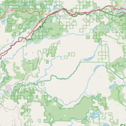

Leaflet | <a href="https://www.openstreetmap.org/copyright">© OpenStreetMap contributors</a>
Item
| Property | Value |
|---|---|
| id | 4051 |
| downstream_mainstem_id | https://geoconnex.us/ref/mainstems/1904 |
| encompassing_mainstem_basins | ['https://geoconnex.us/ref/mainstems/1904', 'https://geoconnex.us/ref/mainstems/1235', 'https://geoconnex.us/ref/mainstems/602', 'https://geoconnex.us/ref/mainstems/1'] |
| featuretype | ['https://www.opengis.net/def/schema/hy_features/hyf/HY_FlowPath', 'https://www.opengis.net/def/schema/hy_features/hyf/HY_WaterBody'] |
| fid | 32522 |
| head_2020huc12 | 180201280207 |
| head_nhdpv1_comid | 14997393 |
| head_nhdpv2_comid | https://geoconnex.us/nhdplusv2/comid/14997393 |
| head_nhdpv2huc12 | https://geoconnex.us/nhdplusv2/huc12/180201280207 |
| head_rf1id | 57562 |
| lengthkm | 30.3 |
| name_at_outlet | Pilot Creek |
| name_at_outlet_gnis_id | 230656 |
| new_mainstemid | |
| outlet_2020huc12 | 180201280207 |
| outlet_drainagearea_sqkm | 78.6 |
| outlet_nhdpv1_comid | 14997303 |
| outlet_nhdpv2_comid | https://geoconnex.us/nhdplusv2/comid/14997303 |
| outlet_nhdpv2huc12 | https://geoconnex.us/nhdplusv2/huc12/180201280207 |
| outlet_rf1id | 57562 |
| superseded | False |
| uri | https://geoconnex.us/ref/mainstems/4051 |
Graph Results
| monitoringLocation | https://geoconnex.us/iow/wqp/CEDEN-514PCAPC2 |
|---|---|
| siteName | CEDEN-514PCAPC2 |
| datasetDescription | Ammonia at CEDEN-514PCAPC2 |
| type | River/Stream |
| url | https://www.waterqualitydata.us/provider/STORET/CEDEN/CEDEN-514PCAPC2/ |
| variableMeasured | Ammonia |
| variableUnit | milligrams per liter |
| measurementTechnique | observation |
| temporalCoverage | 2018-01-01T00:00:00Z/2018-12-31T00:00:00Z |
| distributionName | Water Quality Portal |
| distributionURL | https://www.waterqualitydata.us/data/Result/search?siteid=CEDEN-514PCAPC2&CharacteristicName=Ammonia&mimeType=csv |
| distributionFormat | text/comma-separated-values |
| wkt | POINT (-120.507 38.9069) |
| monitoringLocation | https://geoconnex.us/iow/wqp/CEDEN-514PCAPC2 |
|---|---|
| siteName | CEDEN-514PCAPC2 |
| datasetDescription | Measured reach length at CEDEN-514PCAPC2 |
| type | River/Stream |
| url | https://www.waterqualitydata.us/provider/STORET/CEDEN/CEDEN-514PCAPC2/ |
| variableMeasured | Measured reach length |
| variableUnit | meters |
| measurementTechnique | observation |
| temporalCoverage | 2015-01-01T00:00:00Z/2019-12-31T00:00:00Z |
| distributionName | Water Quality Portal |
| distributionURL | https://www.waterqualitydata.us/data/Result/search?siteid=CEDEN-514PCAPC2&CharacteristicName=Measured reach length&mimeType=csv |
| distributionFormat | text/comma-separated-values |
| wkt | POINT (-120.507 38.9069) |
| monitoringLocation | https://geoconnex.us/iow/wqp/CEDEN-514PCAPC2 |
|---|---|
| siteName | CEDEN-514PCAPC2 |
| datasetDescription | Organic carbon at CEDEN-514PCAPC2 |
| type | River/Stream |
| url | https://www.waterqualitydata.us/provider/STORET/CEDEN/CEDEN-514PCAPC2/ |
| variableMeasured | Organic carbon |
| variableUnit | milligrams per liter |
| measurementTechnique | observation |
| temporalCoverage | 2018-01-01T00:00:00Z/2018-12-31T00:00:00Z |
| distributionName | Water Quality Portal |
| distributionURL | https://www.waterqualitydata.us/data/Result/search?siteid=CEDEN-514PCAPC2&CharacteristicName=Organic carbon&mimeType=csv |
| distributionFormat | text/comma-separated-values |
| wkt | POINT (-120.507 38.9069) |
| monitoringLocation | https://geoconnex.us/iow/wqp/CEDEN-514PCAPC2 |
|---|---|
| siteName | CEDEN-514PCAPC2 |
| datasetDescription | Total suspended solids at CEDEN-514PCAPC2 |
| type | River/Stream |
| url | https://www.waterqualitydata.us/provider/STORET/CEDEN/CEDEN-514PCAPC2/ |
| variableMeasured | Total suspended solids |
| variableUnit | milligrams per liter |
| measurementTechnique | observation |
| temporalCoverage | 2018-01-01T00:00:00Z/2018-12-31T00:00:00Z |
| distributionName | Water Quality Portal |
| distributionURL | https://www.waterqualitydata.us/data/Result/search?siteid=CEDEN-514PCAPC2&CharacteristicName=Total suspended solids&mimeType=csv |
| distributionFormat | text/comma-separated-values |
| wkt | POINT (-120.507 38.9069) |
| monitoringLocation | https://geoconnex.us/iow/wqp/CEDEN-514PCAPC2 |
|---|---|
| siteName | CEDEN-514PCAPC2 |
| datasetDescription | Stream wetted width at CEDEN-514PCAPC2 |
| type | River/Stream |
| url | https://www.waterqualitydata.us/provider/STORET/CEDEN/CEDEN-514PCAPC2/ |
| variableMeasured | Stream wetted width |
| variableUnit | meters |
| measurementTechnique | observation |
| temporalCoverage | 2015-01-01T00:00:00Z/2019-12-31T00:00:00Z |
| distributionName | Water Quality Portal |
| distributionURL | https://www.waterqualitydata.us/data/Result/search?siteid=CEDEN-514PCAPC2&CharacteristicName=Stream wetted width&mimeType=csv |
| distributionFormat | text/comma-separated-values |
| wkt | POINT (-120.507 38.9069) |
| monitoringLocation | https://geoconnex.us/iow/wqp/CEDEN-514PCAPC2 |
|---|---|
| siteName | CEDEN-514PCAPC2 |
| datasetDescription | Sulfate at CEDEN-514PCAPC2 |
| type | River/Stream |
| url | https://www.waterqualitydata.us/provider/STORET/CEDEN/CEDEN-514PCAPC2/ |
| variableMeasured | Sulfate |
| variableUnit | milligrams per liter |
| measurementTechnique | observation |
| temporalCoverage | 2018-01-01T00:00:00Z/2018-12-31T00:00:00Z |
| distributionName | Water Quality Portal |
| distributionURL | https://www.waterqualitydata.us/data/Result/search?siteid=CEDEN-514PCAPC2&CharacteristicName=Sulfate&mimeType=csv |
| distributionFormat | text/comma-separated-values |
| wkt | POINT (-120.507 38.9069) |
| monitoringLocation | https://geoconnex.us/iow/wqp/CEDEN-514PCAPC2 |
|---|---|
| siteName | CEDEN-514PCAPC2 |
| datasetDescription | Calcium at CEDEN-514PCAPC2 |
| type | River/Stream |
| url | https://www.waterqualitydata.us/provider/STORET/CEDEN/CEDEN-514PCAPC2/ |
| variableMeasured | Calcium |
| variableUnit | milligrams per liter |
| measurementTechnique | observation |
| temporalCoverage | 2018-01-01T00:00:00Z/2018-12-31T00:00:00Z |
| distributionName | Water Quality Portal |
| distributionURL | https://www.waterqualitydata.us/data/Result/search?siteid=CEDEN-514PCAPC2&CharacteristicName=Calcium&mimeType=csv |
| distributionFormat | text/comma-separated-values |
| wkt | POINT (-120.507 38.9069) |
| monitoringLocation | https://geoconnex.us/iow/wqp/CEDEN-514PCAPC2 |
|---|---|
| siteName | CEDEN-514PCAPC2 |
| datasetDescription | Count at CEDEN-514PCAPC2 |
| type | River/Stream |
| url | https://www.waterqualitydata.us/provider/STORET/CEDEN/CEDEN-514PCAPC2/ |
| variableMeasured | Count |
| variableUnit | count (no unit) |
| measurementTechnique | observation |
| temporalCoverage | 2015-01-01T00:00:00Z/2018-12-31T00:00:00Z |
| distributionName | Water Quality Portal |
| distributionURL | https://www.waterqualitydata.us/data/Result/search?siteid=CEDEN-514PCAPC2&CharacteristicName=Count&mimeType=csv |
| distributionFormat | text/comma-separated-values |
| wkt | POINT (-120.507 38.9069) |
| monitoringLocation | https://geoconnex.us/iow/wqp/CEDEN-514PCAPC2 |
|---|---|
| siteName | CEDEN-514PCAPC2 |
| datasetDescription | Chloride at CEDEN-514PCAPC2 |
| type | River/Stream |
| url | https://www.waterqualitydata.us/provider/STORET/CEDEN/CEDEN-514PCAPC2/ |
| variableMeasured | Chloride |
| variableUnit | milligrams per liter |
| measurementTechnique | observation |
| temporalCoverage | 2018-01-01T00:00:00Z/2018-12-31T00:00:00Z |
| distributionName | Water Quality Portal |
| distributionURL | https://www.waterqualitydata.us/data/Result/search?siteid=CEDEN-514PCAPC2&CharacteristicName=Chloride&mimeType=csv |
| distributionFormat | text/comma-separated-values |
| wkt | POINT (-120.507 38.9069) |
| monitoringLocation | https://geoconnex.us/iow/wqp/CEDEN-514PCAPC2 |
|---|---|
| siteName | CEDEN-514PCAPC2 |
| datasetDescription | Nitrate at CEDEN-514PCAPC2 |
| type | River/Stream |
| url | https://www.waterqualitydata.us/provider/STORET/CEDEN/CEDEN-514PCAPC2/ |
| variableMeasured | Nitrate |
| variableUnit | milligrams per liter as nitrogen |
| measurementTechnique | observation |
| temporalCoverage | 2019-01-01T00:00:00Z/2019-12-31T00:00:00Z |
| distributionName | Water Quality Portal |
| distributionURL | https://www.waterqualitydata.us/data/Result/search?siteid=CEDEN-514PCAPC2&CharacteristicName=Nitrate&mimeType=csv |
| distributionFormat | text/comma-separated-values |
| wkt | POINT (-120.507 38.9069) |
| monitoringLocation | https://geoconnex.us/iow/wqp/CEDEN-514PCAPC2 |
|---|---|
| siteName | CEDEN-514PCAPC2 |
| datasetDescription | Magnesium at CEDEN-514PCAPC2 |
| type | River/Stream |
| url | https://www.waterqualitydata.us/provider/STORET/CEDEN/CEDEN-514PCAPC2/ |
| variableMeasured | Magnesium |
| variableUnit | percent |
| measurementTechnique | observation |
| temporalCoverage | 2018-01-01T00:00:00Z/2018-12-31T00:00:00Z |
| distributionName | Water Quality Portal |
| distributionURL | https://www.waterqualitydata.us/data/Result/search?siteid=CEDEN-514PCAPC2&CharacteristicName=Magnesium&mimeType=csv |
| distributionFormat | text/comma-separated-values |
| wkt | POINT (-120.507 38.9069) |
| monitoringLocation | https://geoconnex.us/iow/wqp/CEDEN-514PCAPC2 |
|---|---|
| siteName | CEDEN-514PCAPC2 |
| datasetDescription | Canopy Cover at CEDEN-514PCAPC2 |
| type | River/Stream |
| url | https://www.waterqualitydata.us/provider/STORET/CEDEN/CEDEN-514PCAPC2/ |
| variableMeasured | Canopy Cover |
| variableUnit | count (no unit) |
| measurementTechnique | observation |
| temporalCoverage | 2018-01-01T00:00:00Z/2019-12-31T00:00:00Z |
| distributionName | Water Quality Portal |
| distributionURL | https://www.waterqualitydata.us/data/Result/search?siteid=CEDEN-514PCAPC2&CharacteristicName=Canopy Cover&mimeType=csv |
| distributionFormat | text/comma-separated-values |
| wkt | POINT (-120.507 38.9069) |
| monitoringLocation | https://geoconnex.us/iow/wqp/CEDEN-514PCAPC2 |
|---|---|
| siteName | CEDEN-514PCAPC2 |
| datasetDescription | Embeddedness at CEDEN-514PCAPC2 |
| type | River/Stream |
| url | https://www.waterqualitydata.us/provider/STORET/CEDEN/CEDEN-514PCAPC2/ |
| variableMeasured | Embeddedness |
| variableUnit | percent |
| measurementTechnique | observation |
| temporalCoverage | 2015-01-01T00:00:00Z/2019-12-31T00:00:00Z |
| distributionName | Water Quality Portal |
| distributionURL | https://www.waterqualitydata.us/data/Result/search?siteid=CEDEN-514PCAPC2&CharacteristicName=Embeddedness&mimeType=csv |
| distributionFormat | text/comma-separated-values |
| wkt | POINT (-120.507 38.9069) |
| monitoringLocation | https://geoconnex.us/iow/wqp/CEDEN-514PCAPCR |
|---|---|
| siteName | CEDEN-514PCAPCR |
| datasetDescription | Sulfate at CEDEN-514PCAPCR |
| type | River/Stream |
| url | https://www.waterqualitydata.us/provider/STORET/CEDEN/CEDEN-514PCAPCR/ |
| variableMeasured | Sulfate |
| variableUnit | milligrams per liter |
| measurementTechnique | observation |
| temporalCoverage | 2014-01-01T00:00:00Z/2014-12-31T00:00:00Z |
| distributionName | Water Quality Portal |
| distributionURL | https://www.waterqualitydata.us/data/Result/search?siteid=CEDEN-514PCAPCR&CharacteristicName=Sulfate&mimeType=csv |
| distributionFormat | text/comma-separated-values |
| wkt | POINT (-120.481 38.9241) |
| monitoringLocation | https://geoconnex.us/iow/wqp/CEDEN-514PCAPCR |
|---|---|
| siteName | CEDEN-514PCAPCR |
| datasetDescription | Measured reach length at CEDEN-514PCAPCR |
| type | River/Stream |
| url | https://www.waterqualitydata.us/provider/STORET/CEDEN/CEDEN-514PCAPCR/ |
| variableMeasured | Measured reach length |
| variableUnit | meters |
| measurementTechnique | observation |
| temporalCoverage | 2014-01-01T00:00:00Z/2014-12-31T00:00:00Z |
| distributionName | Water Quality Portal |
| distributionURL | https://www.waterqualitydata.us/data/Result/search?siteid=CEDEN-514PCAPCR&CharacteristicName=Measured reach length&mimeType=csv |
| distributionFormat | text/comma-separated-values |
| wkt | POINT (-120.481 38.9241) |
| monitoringLocation | https://geoconnex.us/iow/wqp/CEDEN-514PCAPCR |
|---|---|
| siteName | CEDEN-514PCAPCR |
| datasetDescription | Count at CEDEN-514PCAPCR |
| type | River/Stream |
| url | https://www.waterqualitydata.us/provider/STORET/CEDEN/CEDEN-514PCAPCR/ |
| variableMeasured | Count |
| variableUnit | count (no unit) |
| measurementTechnique | observation |
| temporalCoverage | 2014-01-01T00:00:00Z/2014-12-31T00:00:00Z |
| distributionName | Water Quality Portal |
| distributionURL | https://www.waterqualitydata.us/data/Result/search?siteid=CEDEN-514PCAPCR&CharacteristicName=Count&mimeType=csv |
| distributionFormat | text/comma-separated-values |
| wkt | POINT (-120.481 38.9241) |
| monitoringLocation | https://geoconnex.us/iow/wqp/CEDEN-514PCAPCR |
|---|---|
| siteName | CEDEN-514PCAPCR |
| datasetDescription | Embeddedness at CEDEN-514PCAPCR |
| type | River/Stream |
| url | https://www.waterqualitydata.us/provider/STORET/CEDEN/CEDEN-514PCAPCR/ |
| variableMeasured | Embeddedness |
| variableUnit | percent |
| measurementTechnique | observation |
| temporalCoverage | 2014-01-01T00:00:00Z/2014-12-31T00:00:00Z |
| distributionName | Water Quality Portal |
| distributionURL | https://www.waterqualitydata.us/data/Result/search?siteid=CEDEN-514PCAPCR&CharacteristicName=Embeddedness&mimeType=csv |
| distributionFormat | text/comma-separated-values |
| wkt | POINT (-120.481 38.9241) |
| monitoringLocation | https://geoconnex.us/iow/wqp/CEDEN-514PCAPCR |
|---|---|
| siteName | CEDEN-514PCAPCR |
| datasetDescription | Stream wetted width at CEDEN-514PCAPCR |
| type | River/Stream |
| url | https://www.waterqualitydata.us/provider/STORET/CEDEN/CEDEN-514PCAPCR/ |
| variableMeasured | Stream wetted width |
| variableUnit | meters |
| measurementTechnique | observation |
| temporalCoverage | 2014-01-01T00:00:00Z/2014-12-31T00:00:00Z |
| distributionName | Water Quality Portal |
| distributionURL | https://www.waterqualitydata.us/data/Result/search?siteid=CEDEN-514PCAPCR&CharacteristicName=Stream wetted width&mimeType=csv |
| distributionFormat | text/comma-separated-values |
| wkt | POINT (-120.481 38.9241) |
| monitoringLocation | https://geoconnex.us/iow/wqp/CEDEN-514PCAPCR |
|---|---|
| siteName | CEDEN-514PCAPCR |
| datasetDescription | Suspended Sediment Concentration (SSC) at CEDEN-514PCAPCR |
| type | River/Stream |
| url | https://www.waterqualitydata.us/provider/STORET/CEDEN/CEDEN-514PCAPCR/ |
| variableMeasured | Suspended Sediment Concentration (SSC) |
| variableUnit | milligrams per liter |
| measurementTechnique | observation |
| temporalCoverage | 2014-01-01T00:00:00Z/2014-12-31T00:00:00Z |
| distributionName | Water Quality Portal |
| distributionURL | https://www.waterqualitydata.us/data/Result/search?siteid=CEDEN-514PCAPCR&CharacteristicName=Suspended Sediment Concentration (SSC)&mimeType=csv |
| distributionFormat | text/comma-separated-values |
| wkt | POINT (-120.481 38.9241) |
| monitoringLocation | https://geoconnex.us/iow/wqp/CEDEN-514PCAPCR |
|---|---|
| siteName | CEDEN-514PCAPCR |
| datasetDescription | Total suspended solids at CEDEN-514PCAPCR |
| type | River/Stream |
| url | https://www.waterqualitydata.us/provider/STORET/CEDEN/CEDEN-514PCAPCR/ |
| variableMeasured | Total suspended solids |
| variableUnit | milligrams per liter |
| measurementTechnique | observation |
| temporalCoverage | 2014-01-01T00:00:00Z/2014-12-31T00:00:00Z |
| distributionName | Water Quality Portal |
| distributionURL | https://www.waterqualitydata.us/data/Result/search?siteid=CEDEN-514PCAPCR&CharacteristicName=Total suspended solids&mimeType=csv |
| distributionFormat | text/comma-separated-values |
| wkt | POINT (-120.481 38.9241) |
| monitoringLocation | https://geoconnex.us/iow/wqp/CEDEN-514PCAPCR |
|---|---|
| siteName | CEDEN-514PCAPCR |
| datasetDescription | Organic carbon at CEDEN-514PCAPCR |
| type | River/Stream |
| url | https://www.waterqualitydata.us/provider/STORET/CEDEN/CEDEN-514PCAPCR/ |
| variableMeasured | Organic carbon |
| variableUnit | milligrams per liter |
| measurementTechnique | observation |
| temporalCoverage | 2014-01-01T00:00:00Z/2014-12-31T00:00:00Z |
| distributionName | Water Quality Portal |
| distributionURL | https://www.waterqualitydata.us/data/Result/search?siteid=CEDEN-514PCAPCR&CharacteristicName=Organic carbon&mimeType=csv |
| distributionFormat | text/comma-separated-values |
| wkt | POINT (-120.481 38.9241) |
| monitoringLocation | https://geoconnex.us/iow/wqp/CEDEN-514PCAPCR |
|---|---|
| siteName | CEDEN-514PCAPCR |
| datasetDescription | Chloride at CEDEN-514PCAPCR |
| type | River/Stream |
| url | https://www.waterqualitydata.us/provider/STORET/CEDEN/CEDEN-514PCAPCR/ |
| variableMeasured | Chloride |
| variableUnit | milligrams per liter |
| measurementTechnique | observation |
| temporalCoverage | 2014-01-01T00:00:00Z/2014-12-31T00:00:00Z |
| distributionName | Water Quality Portal |
| distributionURL | https://www.waterqualitydata.us/data/Result/search?siteid=CEDEN-514PCAPCR&CharacteristicName=Chloride&mimeType=csv |
| distributionFormat | text/comma-separated-values |
| wkt | POINT (-120.481 38.9241) |
| monitoringLocation | https://geoconnex.us/iow/wqp/CEDEN-514PCAPCR |
|---|---|
| siteName | CEDEN-514PCAPCR |
| datasetDescription | Phosphorus at CEDEN-514PCAPCR |
| type | River/Stream |
| url | https://www.waterqualitydata.us/provider/STORET/CEDEN/CEDEN-514PCAPCR/ |
| variableMeasured | Phosphorus |
| variableUnit | parts per billion |
| measurementTechnique | observation |
| temporalCoverage | 2014-01-01T00:00:00Z/2014-12-31T00:00:00Z |
| distributionName | Water Quality Portal |
| distributionURL | https://www.waterqualitydata.us/data/Result/search?siteid=CEDEN-514PCAPCR&CharacteristicName=Phosphorus&mimeType=csv |
| distributionFormat | text/comma-separated-values |
| wkt | POINT (-120.481 38.9241) |
| monitoringLocation | https://geoconnex.us/iow/wqp/CEDEN-514PCASMR |
|---|---|
| siteName | CEDEN-514PCASMR |
| datasetDescription | Organic carbon at CEDEN-514PCASMR |
| type | River/Stream |
| url | https://www.waterqualitydata.us/provider/STORET/CEDEN/CEDEN-514PCASMR/ |
| variableMeasured | Organic carbon |
| variableUnit | milligrams per liter |
| measurementTechnique | observation |
| temporalCoverage | 2014-01-01T00:00:00Z/2018-12-31T00:00:00Z |
| distributionName | Water Quality Portal |
| distributionURL | https://www.waterqualitydata.us/data/Result/search?siteid=CEDEN-514PCASMR&CharacteristicName=Organic carbon&mimeType=csv |
| distributionFormat | text/comma-separated-values |
| wkt | POINT (-120.55 38.8959) |
| monitoringLocation | https://geoconnex.us/iow/wqp/CEDEN-514PCASMR |
|---|---|
| siteName | CEDEN-514PCASMR |
| datasetDescription | Count at CEDEN-514PCASMR |
| type | River/Stream |
| url | https://www.waterqualitydata.us/provider/STORET/CEDEN/CEDEN-514PCASMR/ |
| variableMeasured | Count |
| variableUnit | count (no unit) |
| measurementTechnique | observation |
| temporalCoverage | 2014-01-01T00:00:00Z/2018-12-31T00:00:00Z |
| distributionName | Water Quality Portal |
| distributionURL | https://www.waterqualitydata.us/data/Result/search?siteid=CEDEN-514PCASMR&CharacteristicName=Count&mimeType=csv |
| distributionFormat | text/comma-separated-values |
| wkt | POINT (-120.55 38.8959) |
| monitoringLocation | https://geoconnex.us/iow/wqp/CEDEN-514PCASMR |
|---|---|
| siteName | CEDEN-514PCASMR |
| datasetDescription | Ammonia at CEDEN-514PCASMR |
| type | River/Stream |
| url | https://www.waterqualitydata.us/provider/STORET/CEDEN/CEDEN-514PCASMR/ |
| variableMeasured | Ammonia |
| variableUnit | milligrams per liter |
| measurementTechnique | observation |
| temporalCoverage | 2018-01-01T00:00:00Z/2018-12-31T00:00:00Z |
| distributionName | Water Quality Portal |
| distributionURL | https://www.waterqualitydata.us/data/Result/search?siteid=CEDEN-514PCASMR&CharacteristicName=Ammonia&mimeType=csv |
| distributionFormat | text/comma-separated-values |
| wkt | POINT (-120.55 38.8959) |
| monitoringLocation | https://geoconnex.us/iow/wqp/CEDEN-514PCASMR |
|---|---|
| siteName | CEDEN-514PCASMR |
| datasetDescription | Chloride at CEDEN-514PCASMR |
| type | River/Stream |
| url | https://www.waterqualitydata.us/provider/STORET/CEDEN/CEDEN-514PCASMR/ |
| variableMeasured | Chloride |
| variableUnit | milligrams per liter |
| measurementTechnique | observation |
| temporalCoverage | 2014-01-01T00:00:00Z/2018-12-31T00:00:00Z |
| distributionName | Water Quality Portal |
| distributionURL | https://www.waterqualitydata.us/data/Result/search?siteid=CEDEN-514PCASMR&CharacteristicName=Chloride&mimeType=csv |
| distributionFormat | text/comma-separated-values |
| wkt | POINT (-120.55 38.8959) |
| monitoringLocation | https://geoconnex.us/iow/wqp/CEDEN-514PCASMR |
|---|---|
| siteName | CEDEN-514PCASMR |
| datasetDescription | Magnesium at CEDEN-514PCASMR |
| type | River/Stream |
| url | https://www.waterqualitydata.us/provider/STORET/CEDEN/CEDEN-514PCASMR/ |
| variableMeasured | Magnesium |
| variableUnit | percent |
| measurementTechnique | observation |
| temporalCoverage | 2018-01-01T00:00:00Z/2018-12-31T00:00:00Z |
| distributionName | Water Quality Portal |
| distributionURL | https://www.waterqualitydata.us/data/Result/search?siteid=CEDEN-514PCASMR&CharacteristicName=Magnesium&mimeType=csv |
| distributionFormat | text/comma-separated-values |
| wkt | POINT (-120.55 38.8959) |
| monitoringLocation | https://geoconnex.us/iow/wqp/CEDEN-514PCASMR |
|---|---|
| siteName | CEDEN-514PCASMR |
| datasetDescription | Embeddedness at CEDEN-514PCASMR |
| type | River/Stream |
| url | https://www.waterqualitydata.us/provider/STORET/CEDEN/CEDEN-514PCASMR/ |
| variableMeasured | Embeddedness |
| variableUnit | percent |
| measurementTechnique | observation |
| temporalCoverage | 2014-01-01T00:00:00Z/2019-12-31T00:00:00Z |
| distributionName | Water Quality Portal |
| distributionURL | https://www.waterqualitydata.us/data/Result/search?siteid=CEDEN-514PCASMR&CharacteristicName=Embeddedness&mimeType=csv |
| distributionFormat | text/comma-separated-values |
| wkt | POINT (-120.55 38.8959) |
| monitoringLocation | https://geoconnex.us/iow/wqp/CEDEN-514PCASMR |
|---|---|
| siteName | CEDEN-514PCASMR |
| datasetDescription | Canopy Cover at CEDEN-514PCASMR |
| type | River/Stream |
| url | https://www.waterqualitydata.us/provider/STORET/CEDEN/CEDEN-514PCASMR/ |
| variableMeasured | Canopy Cover |
| variableUnit | count (no unit) |
| measurementTechnique | observation |
| temporalCoverage | 2017-01-01T00:00:00Z/2019-12-31T00:00:00Z |
| distributionName | Water Quality Portal |
| distributionURL | https://www.waterqualitydata.us/data/Result/search?siteid=CEDEN-514PCASMR&CharacteristicName=Canopy Cover&mimeType=csv |
| distributionFormat | text/comma-separated-values |
| wkt | POINT (-120.55 38.8959) |
| monitoringLocation | https://geoconnex.us/iow/wqp/CEDEN-514PCASMR |
|---|---|
| siteName | CEDEN-514PCASMR |
| datasetDescription | Phosphorus at CEDEN-514PCASMR |
| type | River/Stream |
| url | https://www.waterqualitydata.us/provider/STORET/CEDEN/CEDEN-514PCASMR/ |
| variableMeasured | Phosphorus |
| variableUnit | parts per billion |
| measurementTechnique | observation |
| temporalCoverage | 2014-01-01T00:00:00Z/2014-12-31T00:00:00Z |
| distributionName | Water Quality Portal |
| distributionURL | https://www.waterqualitydata.us/data/Result/search?siteid=CEDEN-514PCASMR&CharacteristicName=Phosphorus&mimeType=csv |
| distributionFormat | text/comma-separated-values |
| wkt | POINT (-120.55 38.8959) |
| monitoringLocation | https://geoconnex.us/iow/wqp/CEDEN-514PCASMR |
|---|---|
| siteName | CEDEN-514PCASMR |
| datasetDescription | Calcium at CEDEN-514PCASMR |
| type | River/Stream |
| url | https://www.waterqualitydata.us/provider/STORET/CEDEN/CEDEN-514PCASMR/ |
| variableMeasured | Calcium |
| variableUnit | milligrams per liter |
| measurementTechnique | observation |
| temporalCoverage | 2018-01-01T00:00:00Z/2018-12-31T00:00:00Z |
| distributionName | Water Quality Portal |
| distributionURL | https://www.waterqualitydata.us/data/Result/search?siteid=CEDEN-514PCASMR&CharacteristicName=Calcium&mimeType=csv |
| distributionFormat | text/comma-separated-values |
| wkt | POINT (-120.55 38.8959) |
| monitoringLocation | https://geoconnex.us/iow/wqp/CEDEN-514PCASMR |
|---|---|
| siteName | CEDEN-514PCASMR |
| datasetDescription | Measured reach length at CEDEN-514PCASMR |
| type | River/Stream |
| url | https://www.waterqualitydata.us/provider/STORET/CEDEN/CEDEN-514PCASMR/ |
| variableMeasured | Measured reach length |
| variableUnit | meters |
| measurementTechnique | observation |
| temporalCoverage | 2014-01-01T00:00:00Z/2019-12-31T00:00:00Z |
| distributionName | Water Quality Portal |
| distributionURL | https://www.waterqualitydata.us/data/Result/search?siteid=CEDEN-514PCASMR&CharacteristicName=Measured reach length&mimeType=csv |
| distributionFormat | text/comma-separated-values |
| wkt | POINT (-120.55 38.8959) |
| monitoringLocation | https://geoconnex.us/iow/wqp/CEDEN-514PCASMR |
|---|---|
| siteName | CEDEN-514PCASMR |
| datasetDescription | Nitrate at CEDEN-514PCASMR |
| type | River/Stream |
| url | https://www.waterqualitydata.us/provider/STORET/CEDEN/CEDEN-514PCASMR/ |
| variableMeasured | Nitrate |
| variableUnit | milligrams per liter as nitrogen |
| measurementTechnique | observation |
| temporalCoverage | 2018-01-01T00:00:00Z/2018-12-31T00:00:00Z |
| distributionName | Water Quality Portal |
| distributionURL | https://www.waterqualitydata.us/data/Result/search?siteid=CEDEN-514PCASMR&CharacteristicName=Nitrate&mimeType=csv |
| distributionFormat | text/comma-separated-values |
| wkt | POINT (-120.55 38.8959) |
| monitoringLocation | https://geoconnex.us/iow/wqp/CEDEN-514PCASMR |
|---|---|
| siteName | CEDEN-514PCASMR |
| datasetDescription | Stream wetted width at CEDEN-514PCASMR |
| type | River/Stream |
| url | https://www.waterqualitydata.us/provider/STORET/CEDEN/CEDEN-514PCASMR/ |
| variableMeasured | Stream wetted width |
| variableUnit | meters |
| measurementTechnique | observation |
| temporalCoverage | 2014-01-01T00:00:00Z/2019-12-31T00:00:00Z |
| distributionName | Water Quality Portal |
| distributionURL | https://www.waterqualitydata.us/data/Result/search?siteid=CEDEN-514PCASMR&CharacteristicName=Stream wetted width&mimeType=csv |
| distributionFormat | text/comma-separated-values |
| wkt | POINT (-120.55 38.8959) |
| monitoringLocation | https://geoconnex.us/iow/wqp/CEDEN-514PCASMR |
|---|---|
| siteName | CEDEN-514PCASMR |
| datasetDescription | Sulfate at CEDEN-514PCASMR |
| type | River/Stream |
| url | https://www.waterqualitydata.us/provider/STORET/CEDEN/CEDEN-514PCASMR/ |
| variableMeasured | Sulfate |
| variableUnit | milligrams per liter |
| measurementTechnique | observation |
| temporalCoverage | 2014-01-01T00:00:00Z/2018-12-31T00:00:00Z |
| distributionName | Water Quality Portal |
| distributionURL | https://www.waterqualitydata.us/data/Result/search?siteid=CEDEN-514PCASMR&CharacteristicName=Sulfate&mimeType=csv |
| distributionFormat | text/comma-separated-values |
| wkt | POINT (-120.55 38.8959) |