Lightning Creek
Map
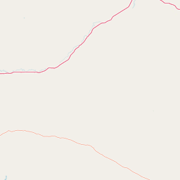
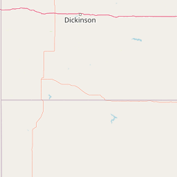

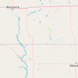

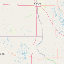
Leaflet | <a href="https://www.openstreetmap.org/copyright">© OpenStreetMap contributors</a>
Item
| Property | Value |
|---|---|
| id | 405318 |
| downstream_mainstem_id | https://geoconnex.us/ref/mainstems/351896 |
| encompassing_mainstem_basins | ['https://geoconnex.us/ref/mainstems/351896', 'https://geoconnex.us/ref/mainstems/333604', 'https://geoconnex.us/ref/mainstems/312532', 'https://geoconnex.us/ref/mainstems/312091'] |
| featuretype | ['https://www.opengis.net/def/schema/hy_features/hyf/HY_FlowPath', 'https://www.opengis.net/def/schema/hy_features/hyf/HY_WaterBody'] |
| fid | 16998 |
| head_2020huc12 | 101303010304 |
| head_nhdpv1_comid | 21848805 |
| head_nhdpv2_comid | https://geoconnex.us/nhdplusv2/comid/21848805 |
| head_nhdpv2huc12 | https://geoconnex.us/nhdplusv2/huc12/101303010304 |
| head_rf1id | 26735 |
| lengthkm | 56.7 |
| name_at_outlet | Lightning Creek |
| name_at_outlet_gnis_id | 1029885 |
| new_mainstemid | |
| outlet_2020huc12 | 101303010305 |
| outlet_drainagearea_sqkm | 215.3 |
| outlet_nhdpv1_comid | 21850703 |
| outlet_nhdpv2_comid | https://geoconnex.us/nhdplusv2/comid/21850703 |
| outlet_nhdpv2huc12 | https://geoconnex.us/nhdplusv2/huc12/101303010305 |
| outlet_rf1id | 26735 |
| superseded | False |
| uri | https://geoconnex.us/ref/mainstems/405318 |