Bloody Dick Creek
Map


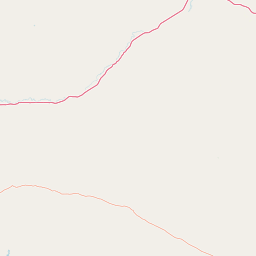


Leaflet | <a href="https://www.openstreetmap.org/copyright">© OpenStreetMap contributors</a>
Item
| Property | Value |
|---|---|
| id | 407302 |
| downstream_mainstem_id | https://geoconnex.us/ref/mainstems/385593 |
| encompassing_mainstem_basins | ['https://geoconnex.us/ref/mainstems/385593', 'https://geoconnex.us/ref/mainstems/312532', 'https://geoconnex.us/ref/mainstems/312091'] |
| featuretype | ['https://www.opengis.net/def/schema/hy_features/hyf/HY_FlowPath', 'https://www.opengis.net/def/schema/hy_features/hyf/HY_WaterBody'] |
| fid | 14454 |
| head_2020huc12 | 100200011002 |
| head_nhdpv1_comid | 4165554 |
| head_nhdpv2_comid | https://geoconnex.us/nhdplusv2/comid/4165554 |
| head_nhdpv2huc12 | https://geoconnex.us/nhdplusv2/huc12/100200011002 |
| head_rf1id | 28445 |
| lengthkm | 44.0 |
| name_at_outlet | Bloody Dick Creek |
| name_at_outlet_gnis_id | 780125 |
| new_mainstemid | |
| outlet_2020huc12 | 100200011004 |
| outlet_drainagearea_sqkm | 482.0 |
| outlet_nhdpv1_comid | 4165032 |
| outlet_nhdpv2_comid | https://geoconnex.us/nhdplusv2/comid/940020070 |
| outlet_nhdpv2huc12 | https://geoconnex.us/nhdplusv2/huc12/100200011004 |
| outlet_rf1id | 28437 |
| superseded | False |
| uri | https://geoconnex.us/ref/mainstems/407302 |