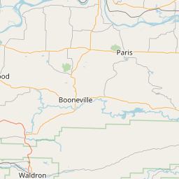
Panther Creek
Map
Leaflet | <a href="https://www.openstreetmap.org/copyright">© OpenStreetMap contributors</a>
Item
| Property | Value |
|---|---|
| id | 410436 |
| downstream_mainstem_id | https://geoconnex.us/ref/mainstems/367973 |
| encompassing_mainstem_basins | ['https://geoconnex.us/ref/mainstems/367973', 'https://geoconnex.us/ref/mainstems/332790', 'https://geoconnex.us/ref/mainstems/320872', 'https://geoconnex.us/ref/mainstems/312091'] |
| featuretype | ['https://www.opengis.net/def/schema/hy_features/hyf/HY_FlowPath', 'https://www.opengis.net/def/schema/hy_features/hyf/HY_WaterBody'] |
| fid | 20024 |
| head_2020huc12 | 110100140804 |
| head_nhdpv1_comid | 11780379 |
| head_nhdpv2_comid | https://geoconnex.us/nhdplusv2/comid/11780379 |
| head_nhdpv2huc12 | https://geoconnex.us/nhdplusv2/huc12/110100140804 |
| head_rf1id | 34262 |
| lengthkm | 28.2 |
| name_at_outlet | Panther Creek |
| name_at_outlet_gnis_id | 53161 |
| new_mainstemid | |
| outlet_2020huc12 | 110100140804 |
| outlet_drainagearea_sqkm | 155.5 |
| outlet_nhdpv1_comid | 11780231 |
| outlet_nhdpv2_comid | https://geoconnex.us/nhdplusv2/comid/11780231 |
| outlet_nhdpv2huc12 | https://geoconnex.us/nhdplusv2/huc12/110100140804 |
| outlet_rf1id | 34262 |
| superseded | False |
| uri | https://geoconnex.us/ref/mainstems/410436 |