Hutchinson Creek
Map
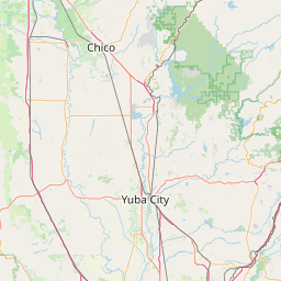
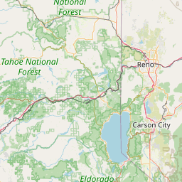
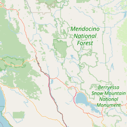
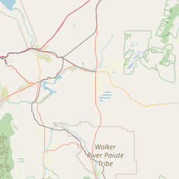
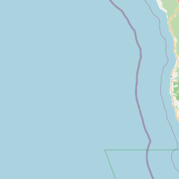
Leaflet | <a href="https://www.openstreetmap.org/copyright">© OpenStreetMap contributors</a>
Item
| Property | Value |
|---|---|
| id | 4129 |
| downstream_mainstem_id | https://geoconnex.us/ref/mainstems/3062 |
| encompassing_mainstem_basins | ['https://geoconnex.us/ref/mainstems/3062', 'https://geoconnex.us/ref/mainstems/1554', 'https://geoconnex.us/ref/mainstems/322', 'https://geoconnex.us/ref/mainstems/1'] |
| featuretype | ['https://www.opengis.net/def/schema/hy_features/hyf/HY_FlowPath', 'https://www.opengis.net/def/schema/hy_features/hyf/HY_WaterBody'] |
| fid | 32622 |
| head_2020huc12 | 180201590301 |
| head_nhdpv1_comid | 7970561 |
| head_nhdpv2_comid | https://geoconnex.us/nhdplusv2/comid/7970561 |
| head_nhdpv2huc12 | https://geoconnex.us/nhdplusv2/huc12/180201590301 |
| head_rf1id | None |
| lengthkm | 30.4 |
| name_at_outlet | Hutchinson Creek |
| name_at_outlet_gnis_id | 225809 |
| new_mainstemid | |
| outlet_2020huc12 | 180201590301 |
| outlet_drainagearea_sqkm | 80.9 |
| outlet_nhdpv1_comid | 7970973 |
| outlet_nhdpv2_comid | https://geoconnex.us/nhdplusv2/comid/7970973 |
| outlet_nhdpv2huc12 | https://geoconnex.us/nhdplusv2/huc12/180201590301 |
| outlet_rf1id | None |
| superseded | False |
| uri | https://geoconnex.us/ref/mainstems/4129 |
Graph Results
| monitoringLocation | https://geoconnex.us/iow/usgs/sta/USGS-390828121225901 |
|---|---|
| siteName | USGS-390828121225901 |
| datasetDescription | Elevation, lake/res, NAVD88 / USGS-390828121225901-65c0b1cc7cb94613b17782193f008323 |
| type | Lake |
| url | https://waterdata.usgs.gov/monitoring-location/390828121225901/#parameterCode=62615 |
| variableMeasured | Elevation |
| variableUnit | ft |
| measurementTechnique | observation |
| temporalCoverage | 2025-02-15T09:15:06Z/2025-02-25T11:00:06Z |
| distributionName | USGS Instantaneous Values Service |
| distributionURL | https://waterservices.usgs.gov/nwis/iv/?parameterCd=62615&sites=USGS:390828121225901&format=rdb |
| distributionFormat | text/tab-separated-values |
| wkt | POINT (-121.383080555556 39.1411888888889) |
| monitoringLocation | https://geoconnex.us/iow/usgs/sta/USGS-390828121225901 |
|---|---|
| siteName | USGS-390828121225901 |
| datasetDescription | Elevation, lake/res, NAVD88 / USGS-390828121225901-65c0b1cc7cb94613b17782193f008323 |
| type | Lake |
| url | https://waterdata.usgs.gov/monitoring-location/390828121225901/#parameterCode=62615 |
| variableMeasured | Elevation |
| variableUnit | ft |
| measurementTechnique | observation |
| temporalCoverage | 2025-02-15T09:15:06Z/2025-02-25T11:00:06Z |
| distributionName | USGS SensorThings API |
| distributionURL | https://labs.waterdata.usgs.gov/sta/v1.1/Datastreams('65c0b1cc7cb94613b17782193f008323')?$expand=Thing,Observations |
| distributionFormat | application/json |
| wkt | POINT (-121.383080555556 39.1411888888889) |
| monitoringLocation | https://geoconnex.us/iow/usgs/sta/USGS-390800121230701 |
|---|---|
| siteName | USGS-390800121230701 |
| datasetDescription | Lake or reservoir water surface elevation above NAVD 1988, feet / USGS-390800121230701-c23bf6b894024720a815e70927b16d73 |
| type | Lake |
| url | https://waterdata.usgs.gov/monitoring-location/390800121230701/#parameterCode=62615 |
| variableMeasured | Lake or reservoir water surface elevation above NAVD 1988 |
| variableUnit | ft |
| measurementTechnique | observation |
| temporalCoverage | 2025-02-15T09:15:15Z/2025-02-25T11:00:16Z |
| distributionName | USGS Instantaneous Values Service |
| distributionURL | https://waterservices.usgs.gov/nwis/iv/?parameterCd=62615&sites=USGS:390800121230701&format=rdb |
| distributionFormat | text/tab-separated-values |
| wkt | POINT (-121.385144444444 39.1333611111111) |
| monitoringLocation | https://geoconnex.us/iow/usgs/sta/USGS-390800121230701 |
|---|---|
| siteName | USGS-390800121230701 |
| datasetDescription | Lake or reservoir water surface elevation above NAVD 1988, feet / USGS-390800121230701-c23bf6b894024720a815e70927b16d73 |
| type | Lake |
| url | https://waterdata.usgs.gov/monitoring-location/390800121230701/#parameterCode=62615 |
| variableMeasured | Lake or reservoir water surface elevation above NAVD 1988 |
| variableUnit | ft |
| measurementTechnique | observation |
| temporalCoverage | 2025-02-15T09:15:15Z/2025-02-25T11:00:16Z |
| distributionName | USGS SensorThings API |
| distributionURL | https://labs.waterdata.usgs.gov/sta/v1.1/Datastreams('c23bf6b894024720a815e70927b16d73')?$expand=Thing,Observations |
| distributionFormat | application/json |
| wkt | POINT (-121.385144444444 39.1333611111111) |
| monitoringLocation | https://geoconnex.us/iow/usgs/sta/USGS-390800121230701 |
|---|---|
| siteName | USGS-390800121230701 |
| datasetDescription | Gage height, feet / USGS-390800121230701-6867dbb80967494b9d3add91dc7a0710 |
| type | Lake |
| url | https://waterdata.usgs.gov/monitoring-location/390800121230701/#parameterCode=00065 |
| variableMeasured | Gage height |
| variableUnit | ft |
| measurementTechnique | observation |
| temporalCoverage | 2025-02-15T09:15:15Z/2025-02-25T11:00:16Z |
| distributionName | USGS SensorThings API |
| distributionURL | https://labs.waterdata.usgs.gov/sta/v1.1/Datastreams('6867dbb80967494b9d3add91dc7a0710')?$expand=Thing,Observations |
| distributionFormat | application/json |
| wkt | POINT (-121.385144444444 39.1333611111111) |
| monitoringLocation | https://geoconnex.us/iow/usgs/sta/USGS-390800121230701 |
|---|---|
| siteName | USGS-390800121230701 |
| datasetDescription | Gage height, feet / USGS-390800121230701-6867dbb80967494b9d3add91dc7a0710 |
| type | Lake |
| url | https://waterdata.usgs.gov/monitoring-location/390800121230701/#parameterCode=00065 |
| variableMeasured | Gage height |
| variableUnit | ft |
| measurementTechnique | observation |
| temporalCoverage | 2025-02-15T09:15:15Z/2025-02-25T11:00:16Z |
| distributionName | USGS Instantaneous Values Service |
| distributionURL | https://waterservices.usgs.gov/nwis/iv/?parameterCd=00065&sites=USGS:390800121230701&format=rdb |
| distributionFormat | text/tab-separated-values |
| wkt | POINT (-121.385144444444 39.1333611111111) |