Item 414590
Map
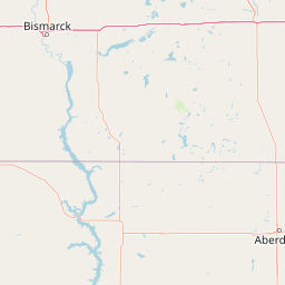

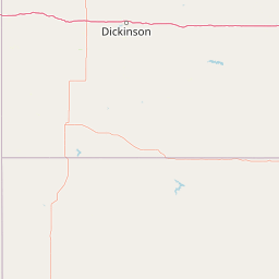
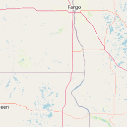


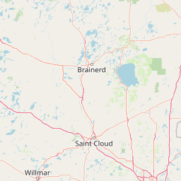


Leaflet | <a href="https://www.openstreetmap.org/copyright">© OpenStreetMap contributors</a>
Item
| Property | Value |
|---|---|
| id | 414590 |
| downstream_mainstem_id | https://geoconnex.us/ref/mainstems/370014 |
| encompassing_mainstem_basins | ['https://geoconnex.us/ref/mainstems/370014', 'https://geoconnex.us/ref/mainstems/312532', 'https://geoconnex.us/ref/mainstems/312091'] |
| featuretype | ['https://www.opengis.net/def/schema/hy_features/hyf/HY_FlowPath', 'https://www.opengis.net/def/schema/hy_features/hyf/HY_WaterBody'] |
| fid | 16868 |
| head_2020huc12 | 101301050102 |
| head_nhdpv1_comid | 19244785 |
| head_nhdpv2_comid | https://geoconnex.us/nhdplusv2/comid/19244785 |
| head_nhdpv2huc12 | https://geoconnex.us/nhdplusv2/huc12/101301050102 |
| head_rf1id | 28389 |
| lengthkm | 49.8 |
| name_at_outlet | |
| name_at_outlet_gnis_id | None |
| new_mainstemid | |
| outlet_2020huc12 | 101301050108 |
| outlet_drainagearea_sqkm | 375.6 |
| outlet_nhdpv1_comid | 19244879 |
| outlet_nhdpv2_comid | https://geoconnex.us/nhdplusv2/comid/19244879 |
| outlet_nhdpv2huc12 | https://geoconnex.us/nhdplusv2/huc12/101301050108 |
| outlet_rf1id | 28392 |
| superseded | False |
| uri | https://geoconnex.us/ref/mainstems/414590 |