Wiggington Creek
Map


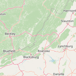
Leaflet | <a href="https://www.openstreetmap.org/copyright">© OpenStreetMap contributors</a>
Item
| Property | Value |
|---|---|
| id | 418234 |
| downstream_mainstem_id | https://geoconnex.us/ref/mainstems/349639 |
| encompassing_mainstem_basins | ['https://geoconnex.us/ref/mainstems/349639', 'https://geoconnex.us/ref/mainstems/327120', 'https://geoconnex.us/ref/mainstems/314849', 'https://geoconnex.us/ref/mainstems/312091'] |
| featuretype | ['https://www.opengis.net/def/schema/hy_features/hyf/HY_FlowPath', 'https://www.opengis.net/def/schema/hy_features/hyf/HY_WaterBody'] |
| fid | 8874 |
| head_2020huc12 | 051100020801 |
| head_nhdpv1_comid | 4035422 |
| head_nhdpv2_comid | https://geoconnex.us/nhdplusv2/comid/4035422 |
| head_nhdpv2huc12 | https://geoconnex.us/nhdplusv2/huc12/051100020801 |
| head_rf1id | 14599 |
| lengthkm | 67.1 |
| name_at_outlet | Wiggington Creek |
| name_at_outlet_gnis_id | 506716 |
| new_mainstemid | |
| outlet_2020huc12 | 051100020805 |
| outlet_drainagearea_sqkm | 547.9 |
| outlet_nhdpv1_comid | 4033028 |
| outlet_nhdpv2_comid | https://geoconnex.us/nhdplusv2/comid/4033028 |
| outlet_nhdpv2huc12 | https://geoconnex.us/nhdplusv2/huc12/051100020805 |
| outlet_rf1id | 14599 |
| superseded | False |
| uri | https://geoconnex.us/ref/mainstems/418234 |