Weeping Water Creek
Map
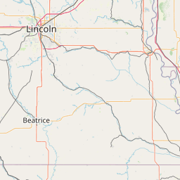
Leaflet | <a href="https://www.openstreetmap.org/copyright">© OpenStreetMap contributors</a>
Item
| Property | Value |
|---|---|
| id | 419610 |
| downstream_mainstem_id | https://geoconnex.us/ref/mainstems/312532 |
| encompassing_mainstem_basins | ['https://geoconnex.us/ref/mainstems/312532', 'https://geoconnex.us/ref/mainstems/312091'] |
| featuretype | ['https://www.opengis.net/def/schema/hy_features/hyf/HY_FlowPath', 'https://www.opengis.net/def/schema/hy_features/hyf/HY_WaterBody'] |
| fid | 18475 |
| head_2020huc12 | 102400010201 |
| head_nhdpv1_comid | 7311401 |
| head_nhdpv2_comid | https://geoconnex.us/nhdplusv2/comid/7311401 |
| head_nhdpv2huc12 | https://geoconnex.us/nhdplusv2/huc12/102400010201 |
| head_rf1id | 23701 |
| lengthkm | 84.9 |
| name_at_outlet | Weeping Water Creek |
| name_at_outlet_gnis_id | 834530 |
| new_mainstemid | |
| outlet_2020huc12 | 102400010207 |
| outlet_drainagearea_sqkm | 649.8 |
| outlet_nhdpv1_comid | 7312347 |
| outlet_nhdpv2_comid | https://geoconnex.us/nhdplusv2/comid/7312347 |
| outlet_nhdpv2huc12 | https://geoconnex.us/nhdplusv2/huc12/102400010207 |
| outlet_rf1id | 23698 |
| superseded | False |
| uri | https://geoconnex.us/ref/mainstems/419610 |
Graph Results
| monitoringLocation | https://sta.geoconnex.dev/collections/USGS/Things/items/'USGS-06806500' |
|---|---|
| siteName | USGS-06806500 |
| datasetDescription | Gage height / USGS-06806500-c8c3a44be5484dbb9e9617f7d953a18f |
| type | Stream |
| url | https://waterdata.usgs.gov/monitoring-location/06806500/#parameterCode=00065 |
| variableMeasured | Gage height / USGS-06806500-c8c3a44be5484dbb9e9617f7d953a18f |
| variableUnit | ft |
| measurementTechnique | observation |
| temporalCoverage | 2024-08-30T09:15:00Z/2024-09-09T18:15:00Z |
| distributionName | USGS SensorThings API |
| distributionURL | https://labs.waterdata.usgs.gov/sta/v1.1/Datastreams('c8c3a44be5484dbb9e9617f7d953a18f')?$expand=Thing,Observations |
| distributionFormat | application/json |
| wkt | POINT (-95.9113888888889 40.7941666666667) |
| monitoringLocation | https://sta.geoconnex.dev/collections/USGS/Things/items/'USGS-06806500' |
|---|---|
| siteName | USGS-06806500 |
| datasetDescription | Gage height / USGS-06806500-c8c3a44be5484dbb9e9617f7d953a18f |
| type | Stream |
| url | https://waterdata.usgs.gov/monitoring-location/06806500/#parameterCode=00065 |
| variableMeasured | Gage height / USGS-06806500-c8c3a44be5484dbb9e9617f7d953a18f |
| variableUnit | ft |
| measurementTechnique | observation |
| temporalCoverage | 2024-08-30T09:15:00Z/2024-09-09T18:15:00Z |
| distributionName | USGS Instantaneous Values Service |
| distributionURL | https://waterservices.usgs.gov/nwis/iv/?sites=USGS:06806500¶meterCd=00065&format=rdb |
| distributionFormat | text/tab-separated-values |
| wkt | POINT (-95.9113888888889 40.7941666666667) |
| monitoringLocation | https://sta.geoconnex.dev/collections/USGS/Things/items/'USGS-06806500' |
|---|---|
| siteName | USGS-06806500 |
| datasetDescription | Discharge / USGS-06806500-cbd672f806f04134ad3c48a8ed381005 |
| type | Stream |
| url | https://waterdata.usgs.gov/monitoring-location/06806500/#parameterCode=00060 |
| variableMeasured | Discharge / USGS-06806500-cbd672f806f04134ad3c48a8ed381005 |
| variableUnit | ft^3/s |
| measurementTechnique | observation |
| temporalCoverage | 2024-08-30T09:15:00Z/2024-09-09T18:15:00Z |
| distributionName | USGS Instantaneous Values Service |
| distributionURL | https://waterservices.usgs.gov/nwis/iv/?sites=USGS:06806500¶meterCd=00060&format=rdb |
| distributionFormat | text/tab-separated-values |
| wkt | POINT (-95.9113888888889 40.7941666666667) |
| monitoringLocation | https://sta.geoconnex.dev/collections/USGS/Things/items/'USGS-06806500' |
|---|---|
| siteName | USGS-06806500 |
| datasetDescription | Discharge / USGS-06806500-cbd672f806f04134ad3c48a8ed381005 |
| type | Stream |
| url | https://waterdata.usgs.gov/monitoring-location/06806500/#parameterCode=00060 |
| variableMeasured | Discharge / USGS-06806500-cbd672f806f04134ad3c48a8ed381005 |
| variableUnit | ft^3/s |
| measurementTechnique | observation |
| temporalCoverage | 2024-08-30T09:15:00Z/2024-09-09T18:15:00Z |
| distributionName | USGS SensorThings API |
| distributionURL | https://labs.waterdata.usgs.gov/sta/v1.1/Datastreams('cbd672f806f04134ad3c48a8ed381005')?$expand=Thing,Observations |
| distributionFormat | application/json |
| wkt | POINT (-95.9113888888889 40.7941666666667) |