Deep Holes Creek
Map
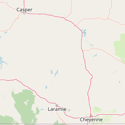


Leaflet | <a href="https://www.openstreetmap.org/copyright">© OpenStreetMap contributors</a>
Item
| Property | Value |
|---|---|
| id | 419738 |
| downstream_mainstem_id | https://geoconnex.us/ref/mainstems/314333 |
| encompassing_mainstem_basins | ['https://geoconnex.us/ref/mainstems/314333', 'https://geoconnex.us/ref/mainstems/313255', 'https://geoconnex.us/ref/mainstems/312532', 'https://geoconnex.us/ref/mainstems/312091'] |
| featuretype | ['https://www.opengis.net/def/schema/hy_features/hyf/HY_FlowPath', 'https://www.opengis.net/def/schema/hy_features/hyf/HY_WaterBody'] |
| fid | 17828 |
| head_2020huc12 | 101800091004 |
| head_nhdpv1_comid | 17513196 |
| head_nhdpv2_comid | https://geoconnex.us/nhdplusv2/comid/17513196 |
| head_nhdpv2huc12 | https://geoconnex.us/nhdplusv2/huc12/101800091004 |
| head_rf1id | 22441 |
| lengthkm | 37.9 |
| name_at_outlet | Deep Holes Creek |
| name_at_outlet_gnis_id | 828641 |
| new_mainstemid | |
| outlet_2020huc12 | 101800091005 |
| outlet_drainagearea_sqkm | 243.6 |
| outlet_nhdpv1_comid | 17512986 |
| outlet_nhdpv2_comid | https://geoconnex.us/nhdplusv2/comid/17512986 |
| outlet_nhdpv2huc12 | https://geoconnex.us/nhdplusv2/huc12/101800091005 |
| outlet_rf1id | 22441 |
| superseded | False |
| uri | https://geoconnex.us/ref/mainstems/419738 |
Graph Results
| monitoringLocation | https://geoconnex.us/iow/wqp/USGS-413500102534301 |
|---|---|
| siteName | USGS-413500102534301 |
| datasetDescription | Metribuzin at USGS-413500102534301 |
| type | Well |
| url | https://www.waterqualitydata.us/provider/NWIS/USGS-NE/USGS-413500102534301/ |
| variableMeasured | Metribuzin |
| variableUnit | Unknown |
| measurementTechnique | observation |
| temporalCoverage | 1991-01-01T00:00:00Z/1991-12-31T00:00:00Z |
| distributionName | Water Quality Portal |
| distributionURL | https://www.waterqualitydata.us/data/Result/search?siteid=USGS-413500102534301&CharacteristicName=Metribuzin&mimeType=csv |
| distributionFormat | text/comma-separated-values |
| wkt | POINT (-102.900482 41.58428196) |
| monitoringLocation | https://geoconnex.us/iow/wqp/USGS-413500102534301 |
|---|---|
| siteName | USGS-413500102534301 |
| datasetDescription | Propazine at USGS-413500102534301 |
| type | Well |
| url | https://www.waterqualitydata.us/provider/NWIS/USGS-NE/USGS-413500102534301/ |
| variableMeasured | Propazine |
| variableUnit | ug/l |
| measurementTechnique | observation |
| temporalCoverage | 1991-01-01T00:00:00Z/1991-12-31T00:00:00Z |
| distributionName | Water Quality Portal |
| distributionURL | https://www.waterqualitydata.us/data/Result/search?siteid=USGS-413500102534301&CharacteristicName=Propazine&mimeType=csv |
| distributionFormat | text/comma-separated-values |
| wkt | POINT (-102.900482 41.58428196) |
| monitoringLocation | https://geoconnex.us/iow/wqp/USGS-413500102534301 |
|---|---|
| siteName | USGS-413500102534301 |
| datasetDescription | Cyanazine at USGS-413500102534301 |
| type | Well |
| url | https://www.waterqualitydata.us/provider/NWIS/USGS-NE/USGS-413500102534301/ |
| variableMeasured | Cyanazine |
| variableUnit | Unknown |
| measurementTechnique | observation |
| temporalCoverage | 1991-01-01T00:00:00Z/1991-12-31T00:00:00Z |
| distributionName | Water Quality Portal |
| distributionURL | https://www.waterqualitydata.us/data/Result/search?siteid=USGS-413500102534301&CharacteristicName=Cyanazine&mimeType=csv |
| distributionFormat | text/comma-separated-values |
| wkt | POINT (-102.900482 41.58428196) |
| monitoringLocation | https://geoconnex.us/iow/wqp/USGS-413500102534301 |
|---|---|
| siteName | USGS-413500102534301 |
| datasetDescription | Temperature, water at USGS-413500102534301 |
| type | Well |
| url | https://www.waterqualitydata.us/provider/NWIS/USGS-NE/USGS-413500102534301/ |
| variableMeasured | Temperature, water |
| variableUnit | deg C |
| measurementTechnique | observation |
| temporalCoverage | 1991-01-01T00:00:00Z/1991-12-31T00:00:00Z |
| distributionName | Water Quality Portal |
| distributionURL | https://www.waterqualitydata.us/data/Result/search?siteid=USGS-413500102534301&CharacteristicName=Temperature, water&mimeType=csv |
| distributionFormat | text/comma-separated-values |
| wkt | POINT (-102.900482 41.58428196) |
| monitoringLocation | https://geoconnex.us/iow/wqp/USGS-413500102534301 |
|---|---|
| siteName | USGS-413500102534301 |
| datasetDescription | pH at USGS-413500102534301 |
| type | Well |
| url | https://www.waterqualitydata.us/provider/NWIS/USGS-NE/USGS-413500102534301/ |
| variableMeasured | pH |
| variableUnit | None |
| measurementTechnique | observation |
| temporalCoverage | 1991-01-01T00:00:00Z/1991-12-31T00:00:00Z |
| distributionName | Water Quality Portal |
| distributionURL | https://www.waterqualitydata.us/data/Result/search?siteid=USGS-413500102534301&CharacteristicName=pH&mimeType=csv |
| distributionFormat | text/comma-separated-values |
| wkt | POINT (-102.900482 41.58428196) |
| monitoringLocation | https://geoconnex.us/iow/wqp/USGS-413500102534301 |
|---|---|
| siteName | USGS-413500102534301 |
| datasetDescription | Inorganic nitrogen (nitrate and nitrite) at USGS-413500102534301 |
| type | Well |
| url | https://www.waterqualitydata.us/provider/NWIS/USGS-NE/USGS-413500102534301/ |
| variableMeasured | Inorganic nitrogen (nitrate and nitrite) |
| variableUnit | mg/l as N |
| measurementTechnique | observation |
| temporalCoverage | 1991-01-01T00:00:00Z/1991-12-31T00:00:00Z |
| distributionName | Water Quality Portal |
| distributionURL | https://www.waterqualitydata.us/data/Result/search?siteid=USGS-413500102534301&CharacteristicName=Inorganic nitrogen (nitrate and nitrite)&mimeType=csv |
| distributionFormat | text/comma-separated-values |
| wkt | POINT (-102.900482 41.58428196) |
| monitoringLocation | https://geoconnex.us/iow/wqp/USGS-413500102534301 |
|---|---|
| siteName | USGS-413500102534301 |
| datasetDescription | Desisopropyl atrazine at USGS-413500102534301 |
| type | Well |
| url | https://www.waterqualitydata.us/provider/NWIS/USGS-NE/USGS-413500102534301/ |
| variableMeasured | Desisopropyl atrazine |
| variableUnit | Unknown |
| measurementTechnique | observation |
| temporalCoverage | 1991-01-01T00:00:00Z/1991-12-31T00:00:00Z |
| distributionName | Water Quality Portal |
| distributionURL | https://www.waterqualitydata.us/data/Result/search?siteid=USGS-413500102534301&CharacteristicName=Desisopropyl atrazine&mimeType=csv |
| distributionFormat | text/comma-separated-values |
| wkt | POINT (-102.900482 41.58428196) |
| monitoringLocation | https://geoconnex.us/iow/wqp/USGS-413500102534301 |
|---|---|
| siteName | USGS-413500102534301 |
| datasetDescription | Ametryn at USGS-413500102534301 |
| type | Well |
| url | https://www.waterqualitydata.us/provider/NWIS/USGS-NE/USGS-413500102534301/ |
| variableMeasured | Ametryn |
| variableUnit | Unknown |
| measurementTechnique | observation |
| temporalCoverage | 1991-01-01T00:00:00Z/1991-12-31T00:00:00Z |
| distributionName | Water Quality Portal |
| distributionURL | https://www.waterqualitydata.us/data/Result/search?siteid=USGS-413500102534301&CharacteristicName=Ametryn&mimeType=csv |
| distributionFormat | text/comma-separated-values |
| wkt | POINT (-102.900482 41.58428196) |
| monitoringLocation | https://geoconnex.us/iow/wqp/USGS-413500102534301 |
|---|---|
| siteName | USGS-413500102534301 |
| datasetDescription | Prometon at USGS-413500102534301 |
| type | Well |
| url | https://www.waterqualitydata.us/provider/NWIS/USGS-NE/USGS-413500102534301/ |
| variableMeasured | Prometon |
| variableUnit | Unknown |
| measurementTechnique | observation |
| temporalCoverage | 1991-01-01T00:00:00Z/1991-12-31T00:00:00Z |
| distributionName | Water Quality Portal |
| distributionURL | https://www.waterqualitydata.us/data/Result/search?siteid=USGS-413500102534301&CharacteristicName=Prometon&mimeType=csv |
| distributionFormat | text/comma-separated-values |
| wkt | POINT (-102.900482 41.58428196) |
| monitoringLocation | https://geoconnex.us/iow/wqp/USGS-413500102534301 |
|---|---|
| siteName | USGS-413500102534301 |
| datasetDescription | Alachlor at USGS-413500102534301 |
| type | Well |
| url | https://www.waterqualitydata.us/provider/NWIS/USGS-NE/USGS-413500102534301/ |
| variableMeasured | Alachlor |
| variableUnit | Unknown |
| measurementTechnique | observation |
| temporalCoverage | 1991-01-01T00:00:00Z/1991-12-31T00:00:00Z |
| distributionName | Water Quality Portal |
| distributionURL | https://www.waterqualitydata.us/data/Result/search?siteid=USGS-413500102534301&CharacteristicName=Alachlor&mimeType=csv |
| distributionFormat | text/comma-separated-values |
| wkt | POINT (-102.900482 41.58428196) |
| monitoringLocation | https://geoconnex.us/iow/wqp/USGS-413500102534301 |
|---|---|
| siteName | USGS-413500102534301 |
| datasetDescription | Oxygen at USGS-413500102534301 |
| type | Well |
| url | https://www.waterqualitydata.us/provider/NWIS/USGS-NE/USGS-413500102534301/ |
| variableMeasured | Oxygen |
| variableUnit | mg/l |
| measurementTechnique | observation |
| temporalCoverage | 1991-01-01T00:00:00Z/1991-12-31T00:00:00Z |
| distributionName | Water Quality Portal |
| distributionURL | https://www.waterqualitydata.us/data/Result/search?siteid=USGS-413500102534301&CharacteristicName=Oxygen&mimeType=csv |
| distributionFormat | text/comma-separated-values |
| wkt | POINT (-102.900482 41.58428196) |
| monitoringLocation | https://geoconnex.us/iow/wqp/USGS-413500102534301 |
|---|---|
| siteName | USGS-413500102534301 |
| datasetDescription | Atrazine at USGS-413500102534301 |
| type | Well |
| url | https://www.waterqualitydata.us/provider/NWIS/USGS-NE/USGS-413500102534301/ |
| variableMeasured | Atrazine |
| variableUnit | Unknown |
| measurementTechnique | observation |
| temporalCoverage | 1991-01-01T00:00:00Z/1991-12-31T00:00:00Z |
| distributionName | Water Quality Portal |
| distributionURL | https://www.waterqualitydata.us/data/Result/search?siteid=USGS-413500102534301&CharacteristicName=Atrazine&mimeType=csv |
| distributionFormat | text/comma-separated-values |
| wkt | POINT (-102.900482 41.58428196) |
| monitoringLocation | https://geoconnex.us/iow/wqp/USGS-413500102534301 |
|---|---|
| siteName | USGS-413500102534301 |
| datasetDescription | Prometryn at USGS-413500102534301 |
| type | Well |
| url | https://www.waterqualitydata.us/provider/NWIS/USGS-NE/USGS-413500102534301/ |
| variableMeasured | Prometryn |
| variableUnit | ng/L |
| measurementTechnique | observation |
| temporalCoverage | 1991-01-01T00:00:00Z/1991-12-31T00:00:00Z |
| distributionName | Water Quality Portal |
| distributionURL | https://www.waterqualitydata.us/data/Result/search?siteid=USGS-413500102534301&CharacteristicName=Prometryn&mimeType=csv |
| distributionFormat | text/comma-separated-values |
| wkt | POINT (-102.900482 41.58428196) |
| monitoringLocation | https://geoconnex.us/iow/wqp/USGS-413500102534301 |
|---|---|
| siteName | USGS-413500102534301 |
| datasetDescription | 2-Chloro-4-isopropylamino-6-amino-s-triazine at USGS-413500102534301 |
| type | Well |
| url | https://www.waterqualitydata.us/provider/NWIS/USGS-NE/USGS-413500102534301/ |
| variableMeasured | 2-Chloro-4-isopropylamino-6-amino-s-triazine |
| variableUnit | Unknown |
| measurementTechnique | observation |
| temporalCoverage | 1991-01-01T00:00:00Z/1991-12-31T00:00:00Z |
| distributionName | Water Quality Portal |
| distributionURL | https://www.waterqualitydata.us/data/Result/search?siteid=USGS-413500102534301&CharacteristicName=2-Chloro-4-isopropylamino-6-amino-s-triazine&mimeType=csv |
| distributionFormat | text/comma-separated-values |
| wkt | POINT (-102.900482 41.58428196) |
| monitoringLocation | https://geoconnex.us/iow/wqp/USGS-413500102534301 |
|---|---|
| siteName | USGS-413500102534301 |
| datasetDescription | Simazine at USGS-413500102534301 |
| type | Well |
| url | https://www.waterqualitydata.us/provider/NWIS/USGS-NE/USGS-413500102534301/ |
| variableMeasured | Simazine |
| variableUnit | Unknown |
| measurementTechnique | observation |
| temporalCoverage | 1991-01-01T00:00:00Z/1991-12-31T00:00:00Z |
| distributionName | Water Quality Portal |
| distributionURL | https://www.waterqualitydata.us/data/Result/search?siteid=USGS-413500102534301&CharacteristicName=Simazine&mimeType=csv |
| distributionFormat | text/comma-separated-values |
| wkt | POINT (-102.900482 41.58428196) |
| monitoringLocation | https://geoconnex.us/iow/wqp/USGS-413500102534301 |
|---|---|
| siteName | USGS-413500102534301 |
| datasetDescription | Metolachlor at USGS-413500102534301 |
| type | Well |
| url | https://www.waterqualitydata.us/provider/NWIS/USGS-NE/USGS-413500102534301/ |
| variableMeasured | Metolachlor |
| variableUnit | ug/L |
| measurementTechnique | observation |
| temporalCoverage | 1991-01-01T00:00:00Z/1991-12-31T00:00:00Z |
| distributionName | Water Quality Portal |
| distributionURL | https://www.waterqualitydata.us/data/Result/search?siteid=USGS-413500102534301&CharacteristicName=Metolachlor&mimeType=csv |
| distributionFormat | text/comma-separated-values |
| wkt | POINT (-102.900482 41.58428196) |
| monitoringLocation | https://geoconnex.us/iow/wqp/USGS-413523102551001 |
|---|---|
| siteName | USGS-413523102551001 |
| datasetDescription | Chromium at USGS-413523102551001 |
| type | Well |
| url | https://www.waterqualitydata.us/provider/NWIS/USGS-NE/USGS-413523102551001/ |
| variableMeasured | Chromium |
| variableUnit | ppb |
| measurementTechnique | observation |
| temporalCoverage | 1991-01-01T00:00:00Z/1991-12-31T00:00:00Z |
| distributionName | Water Quality Portal |
| distributionURL | https://www.waterqualitydata.us/data/Result/search?siteid=USGS-413523102551001&CharacteristicName=Chromium&mimeType=csv |
| distributionFormat | text/comma-separated-values |
| wkt | POINT (-102.919927 41.5896983) |
| monitoringLocation | https://geoconnex.us/iow/wqp/USGS-413523102551001 |
|---|---|
| siteName | USGS-413523102551001 |
| datasetDescription | Oxygen at USGS-413523102551001 |
| type | Well |
| url | https://www.waterqualitydata.us/provider/NWIS/USGS-NE/USGS-413523102551001/ |
| variableMeasured | Oxygen |
| variableUnit | mg/l |
| measurementTechnique | observation |
| temporalCoverage | 1991-01-01T00:00:00Z/1991-12-31T00:00:00Z |
| distributionName | Water Quality Portal |
| distributionURL | https://www.waterqualitydata.us/data/Result/search?siteid=USGS-413523102551001&CharacteristicName=Oxygen&mimeType=csv |
| distributionFormat | text/comma-separated-values |
| wkt | POINT (-102.919927 41.5896983) |
| monitoringLocation | https://geoconnex.us/iow/wqp/USGS-413523102551001 |
|---|---|
| siteName | USGS-413523102551001 |
| datasetDescription | Inorganic nitrogen (nitrate and nitrite) at USGS-413523102551001 |
| type | Well |
| url | https://www.waterqualitydata.us/provider/NWIS/USGS-NE/USGS-413523102551001/ |
| variableMeasured | Inorganic nitrogen (nitrate and nitrite) |
| variableUnit | mg/l as N |
| measurementTechnique | observation |
| temporalCoverage | 1991-01-01T00:00:00Z/1991-12-31T00:00:00Z |
| distributionName | Water Quality Portal |
| distributionURL | https://www.waterqualitydata.us/data/Result/search?siteid=USGS-413523102551001&CharacteristicName=Inorganic nitrogen (nitrate and nitrite)&mimeType=csv |
| distributionFormat | text/comma-separated-values |
| wkt | POINT (-102.919927 41.5896983) |
| monitoringLocation | https://geoconnex.us/iow/wqp/USGS-413523102551001 |
|---|---|
| siteName | USGS-413523102551001 |
| datasetDescription | Specific conductance at USGS-413523102551001 |
| type | Well |
| url | https://www.waterqualitydata.us/provider/NWIS/USGS-NE/USGS-413523102551001/ |
| variableMeasured | Specific conductance |
| variableUnit | umho/cm |
| measurementTechnique | observation |
| temporalCoverage | 1991-01-01T00:00:00Z/1991-12-31T00:00:00Z |
| distributionName | Water Quality Portal |
| distributionURL | https://www.waterqualitydata.us/data/Result/search?siteid=USGS-413523102551001&CharacteristicName=Specific conductance&mimeType=csv |
| distributionFormat | text/comma-separated-values |
| wkt | POINT (-102.919927 41.5896983) |
| monitoringLocation | https://geoconnex.us/iow/wqp/USGS-413523102551001 |
|---|---|
| siteName | USGS-413523102551001 |
| datasetDescription | 3-Hydroxycarbofuran at USGS-413523102551001 |
| type | Well |
| url | https://www.waterqualitydata.us/provider/NWIS/USGS-NE/USGS-413523102551001/ |
| variableMeasured | 3-Hydroxycarbofuran |
| variableUnit | Unknown |
| measurementTechnique | observation |
| temporalCoverage | 1991-01-01T00:00:00Z/1991-12-31T00:00:00Z |
| distributionName | Water Quality Portal |
| distributionURL | https://www.waterqualitydata.us/data/Result/search?siteid=USGS-413523102551001&CharacteristicName=3-Hydroxycarbofuran&mimeType=csv |
| distributionFormat | text/comma-separated-values |
| wkt | POINT (-102.919927 41.5896983) |
| monitoringLocation | https://geoconnex.us/iow/wqp/USGS-413523102551001 |
|---|---|
| siteName | USGS-413523102551001 |
| datasetDescription | Molybdenum at USGS-413523102551001 |
| type | Well |
| url | https://www.waterqualitydata.us/provider/NWIS/USGS-NE/USGS-413523102551001/ |
| variableMeasured | Molybdenum |
| variableUnit | ppb |
| measurementTechnique | observation |
| temporalCoverage | 1991-01-01T00:00:00Z/1991-12-31T00:00:00Z |
| distributionName | Water Quality Portal |
| distributionURL | https://www.waterqualitydata.us/data/Result/search?siteid=USGS-413523102551001&CharacteristicName=Molybdenum&mimeType=csv |
| distributionFormat | text/comma-separated-values |
| wkt | POINT (-102.919927 41.5896983) |
| monitoringLocation | https://geoconnex.us/iow/wqp/USGS-413523102551001 |
|---|---|
| siteName | USGS-413523102551001 |
| datasetDescription | Nickel at USGS-413523102551001 |
| type | Well |
| url | https://www.waterqualitydata.us/provider/NWIS/USGS-NE/USGS-413523102551001/ |
| variableMeasured | Nickel |
| variableUnit | ppm |
| measurementTechnique | observation |
| temporalCoverage | 1991-01-01T00:00:00Z/1991-12-31T00:00:00Z |
| distributionName | Water Quality Portal |
| distributionURL | https://www.waterqualitydata.us/data/Result/search?siteid=USGS-413523102551001&CharacteristicName=Nickel&mimeType=csv |
| distributionFormat | text/comma-separated-values |
| wkt | POINT (-102.919927 41.5896983) |
| monitoringLocation | https://geoconnex.us/iow/wqp/USGS-413523102551001 |
|---|---|
| siteName | USGS-413523102551001 |
| datasetDescription | Lead at USGS-413523102551001 |
| type | Well |
| url | https://www.waterqualitydata.us/provider/NWIS/USGS-NE/USGS-413523102551001/ |
| variableMeasured | Lead |
| variableUnit | ug/l |
| measurementTechnique | observation |
| temporalCoverage | 1991-01-01T00:00:00Z/1991-12-31T00:00:00Z |
| distributionName | Water Quality Portal |
| distributionURL | https://www.waterqualitydata.us/data/Result/search?siteid=USGS-413523102551001&CharacteristicName=Lead&mimeType=csv |
| distributionFormat | text/comma-separated-values |
| wkt | POINT (-102.919927 41.5896983) |
| monitoringLocation | https://geoconnex.us/iow/wqp/USGS-413523102551001 |
|---|---|
| siteName | USGS-413523102551001 |
| datasetDescription | Carbaryl at USGS-413523102551001 |
| type | Well |
| url | https://www.waterqualitydata.us/provider/NWIS/USGS-NE/USGS-413523102551001/ |
| variableMeasured | Carbaryl |
| variableUnit | Unknown |
| measurementTechnique | observation |
| temporalCoverage | 1991-01-01T00:00:00Z/1991-12-31T00:00:00Z |
| distributionName | Water Quality Portal |
| distributionURL | https://www.waterqualitydata.us/data/Result/search?siteid=USGS-413523102551001&CharacteristicName=Carbaryl&mimeType=csv |
| distributionFormat | text/comma-separated-values |
| wkt | POINT (-102.919927 41.5896983) |
| monitoringLocation | https://geoconnex.us/iow/wqp/USGS-413523102551001 |
|---|---|
| siteName | USGS-413523102551001 |
| datasetDescription | Silver at USGS-413523102551001 |
| type | Well |
| url | https://www.waterqualitydata.us/provider/NWIS/USGS-NE/USGS-413523102551001/ |
| variableMeasured | Silver |
| variableUnit | Unknown |
| measurementTechnique | observation |
| temporalCoverage | 1991-01-01T00:00:00Z/1991-12-31T00:00:00Z |
| distributionName | Water Quality Portal |
| distributionURL | https://www.waterqualitydata.us/data/Result/search?siteid=USGS-413523102551001&CharacteristicName=Silver&mimeType=csv |
| distributionFormat | text/comma-separated-values |
| wkt | POINT (-102.919927 41.5896983) |
| monitoringLocation | https://geoconnex.us/iow/wqp/USGS-413523102551001 |
|---|---|
| siteName | USGS-413523102551001 |
| datasetDescription | Beryllium at USGS-413523102551001 |
| type | Well |
| url | https://www.waterqualitydata.us/provider/NWIS/USGS-NE/USGS-413523102551001/ |
| variableMeasured | Beryllium |
| variableUnit | ppm |
| measurementTechnique | observation |
| temporalCoverage | 1991-01-01T00:00:00Z/1991-12-31T00:00:00Z |
| distributionName | Water Quality Portal |
| distributionURL | https://www.waterqualitydata.us/data/Result/search?siteid=USGS-413523102551001&CharacteristicName=Beryllium&mimeType=csv |
| distributionFormat | text/comma-separated-values |
| wkt | POINT (-102.919927 41.5896983) |
| monitoringLocation | https://geoconnex.us/iow/wqp/USGS-413523102551001 |
|---|---|
| siteName | USGS-413523102551001 |
| datasetDescription | Carbon dioxide at USGS-413523102551001 |
| type | Well |
| url | https://www.waterqualitydata.us/provider/NWIS/USGS-NE/USGS-413523102551001/ |
| variableMeasured | Carbon dioxide |
| variableUnit | mg/l |
| measurementTechnique | observation |
| temporalCoverage | 1991-01-01T00:00:00Z/1991-12-31T00:00:00Z |
| distributionName | Water Quality Portal |
| distributionURL | https://www.waterqualitydata.us/data/Result/search?siteid=USGS-413523102551001&CharacteristicName=Carbon dioxide&mimeType=csv |
| distributionFormat | text/comma-separated-values |
| wkt | POINT (-102.919927 41.5896983) |
| monitoringLocation | https://geoconnex.us/iow/wqp/USGS-413523102551001 |
|---|---|
| siteName | USGS-413523102551001 |
| datasetDescription | Vanadium at USGS-413523102551001 |
| type | Well |
| url | https://www.waterqualitydata.us/provider/NWIS/USGS-NE/USGS-413523102551001/ |
| variableMeasured | Vanadium |
| variableUnit | mg/kg |
| measurementTechnique | observation |
| temporalCoverage | 1991-01-01T00:00:00Z/1991-12-31T00:00:00Z |
| distributionName | Water Quality Portal |
| distributionURL | https://www.waterqualitydata.us/data/Result/search?siteid=USGS-413523102551001&CharacteristicName=Vanadium&mimeType=csv |
| distributionFormat | text/comma-separated-values |
| wkt | POINT (-102.919927 41.5896983) |
| monitoringLocation | https://geoconnex.us/iow/wqp/USGS-413523102551001 |
|---|---|
| siteName | USGS-413523102551001 |
| datasetDescription | Fluoride at USGS-413523102551001 |
| type | Well |
| url | https://www.waterqualitydata.us/provider/NWIS/USGS-NE/USGS-413523102551001/ |
| variableMeasured | Fluoride |
| variableUnit | mg/l |
| measurementTechnique | observation |
| temporalCoverage | 1991-01-01T00:00:00Z/1991-12-31T00:00:00Z |
| distributionName | Water Quality Portal |
| distributionURL | https://www.waterqualitydata.us/data/Result/search?siteid=USGS-413523102551001&CharacteristicName=Fluoride&mimeType=csv |
| distributionFormat | text/comma-separated-values |
| wkt | POINT (-102.919927 41.5896983) |
| monitoringLocation | https://geoconnex.us/iow/wqp/USGS-413523102551001 |
|---|---|
| siteName | USGS-413523102551001 |
| datasetDescription | Oxamyl at USGS-413523102551001 |
| type | Well |
| url | https://www.waterqualitydata.us/provider/NWIS/USGS-NE/USGS-413523102551001/ |
| variableMeasured | Oxamyl |
| variableUnit | Unknown |
| measurementTechnique | observation |
| temporalCoverage | 1991-01-01T00:00:00Z/1991-12-31T00:00:00Z |
| distributionName | Water Quality Portal |
| distributionURL | https://www.waterqualitydata.us/data/Result/search?siteid=USGS-413523102551001&CharacteristicName=Oxamyl&mimeType=csv |
| distributionFormat | text/comma-separated-values |
| wkt | POINT (-102.919927 41.5896983) |
| monitoringLocation | https://geoconnex.us/iow/wqp/USGS-413523102551001 |
|---|---|
| siteName | USGS-413523102551001 |
| datasetDescription | Propoxur at USGS-413523102551001 |
| type | Well |
| url | https://www.waterqualitydata.us/provider/NWIS/USGS-NE/USGS-413523102551001/ |
| variableMeasured | Propoxur |
| variableUnit | Unknown |
| measurementTechnique | observation |
| temporalCoverage | 1991-01-01T00:00:00Z/1991-12-31T00:00:00Z |
| distributionName | Water Quality Portal |
| distributionURL | https://www.waterqualitydata.us/data/Result/search?siteid=USGS-413523102551001&CharacteristicName=Propoxur&mimeType=csv |
| distributionFormat | text/comma-separated-values |
| wkt | POINT (-102.919927 41.5896983) |
| monitoringLocation | https://geoconnex.us/iow/wqp/USGS-413523102551001 |
|---|---|
| siteName | USGS-413523102551001 |
| datasetDescription | Cobalt at USGS-413523102551001 |
| type | Well |
| url | https://www.waterqualitydata.us/provider/NWIS/USGS-NE/USGS-413523102551001/ |
| variableMeasured | Cobalt |
| variableUnit | mg/L |
| measurementTechnique | observation |
| temporalCoverage | 1991-01-01T00:00:00Z/1991-12-31T00:00:00Z |
| distributionName | Water Quality Portal |
| distributionURL | https://www.waterqualitydata.us/data/Result/search?siteid=USGS-413523102551001&CharacteristicName=Cobalt&mimeType=csv |
| distributionFormat | text/comma-separated-values |
| wkt | POINT (-102.919927 41.5896983) |
| monitoringLocation | https://geoconnex.us/iow/wqp/USGS-413523102551001 |
|---|---|
| siteName | USGS-413523102551001 |
| datasetDescription | Potassium at USGS-413523102551001 |
| type | Well |
| url | https://www.waterqualitydata.us/provider/NWIS/USGS-NE/USGS-413523102551001/ |
| variableMeasured | Potassium |
| variableUnit | mg/l |
| measurementTechnique | observation |
| temporalCoverage | 1991-01-01T00:00:00Z/1991-12-31T00:00:00Z |
| distributionName | Water Quality Portal |
| distributionURL | https://www.waterqualitydata.us/data/Result/search?siteid=USGS-413523102551001&CharacteristicName=Potassium&mimeType=csv |
| distributionFormat | text/comma-separated-values |
| wkt | POINT (-102.919927 41.5896983) |
| monitoringLocation | https://geoconnex.us/iow/wqp/USGS-413523102551001 |
|---|---|
| siteName | USGS-413523102551001 |
| datasetDescription | Manganese at USGS-413523102551001 |
| type | Well |
| url | https://www.waterqualitydata.us/provider/NWIS/USGS-NE/USGS-413523102551001/ |
| variableMeasured | Manganese |
| variableUnit | ug/l |
| measurementTechnique | observation |
| temporalCoverage | 1991-01-01T00:00:00Z/1991-12-31T00:00:00Z |
| distributionName | Water Quality Portal |
| distributionURL | https://www.waterqualitydata.us/data/Result/search?siteid=USGS-413523102551001&CharacteristicName=Manganese&mimeType=csv |
| distributionFormat | text/comma-separated-values |
| wkt | POINT (-102.919927 41.5896983) |
| monitoringLocation | https://geoconnex.us/iow/wqp/USGS-413523102551001 |
|---|---|
| siteName | USGS-413523102551001 |
| datasetDescription | Radium-226 at USGS-413523102551001 |
| type | Well |
| url | https://www.waterqualitydata.us/provider/NWIS/USGS-NE/USGS-413523102551001/ |
| variableMeasured | Radium-226 |
| variableUnit | pCi/L |
| measurementTechnique | observation |
| temporalCoverage | 1991-01-01T00:00:00Z/1991-12-31T00:00:00Z |
| distributionName | Water Quality Portal |
| distributionURL | https://www.waterqualitydata.us/data/Result/search?siteid=USGS-413523102551001&CharacteristicName=Radium-226&mimeType=csv |
| distributionFormat | text/comma-separated-values |
| wkt | POINT (-102.919927 41.5896983) |
| monitoringLocation | https://geoconnex.us/iow/wqp/USGS-413523102551001 |
|---|---|
| siteName | USGS-413523102551001 |
| datasetDescription | Zinc at USGS-413523102551001 |
| type | Well |
| url | https://www.waterqualitydata.us/provider/NWIS/USGS-NE/USGS-413523102551001/ |
| variableMeasured | Zinc |
| variableUnit | Unknown |
| measurementTechnique | observation |
| temporalCoverage | 1991-01-01T00:00:00Z/1991-12-31T00:00:00Z |
| distributionName | Water Quality Portal |
| distributionURL | https://www.waterqualitydata.us/data/Result/search?siteid=USGS-413523102551001&CharacteristicName=Zinc&mimeType=csv |
| distributionFormat | text/comma-separated-values |
| wkt | POINT (-102.919927 41.5896983) |
| monitoringLocation | https://geoconnex.us/iow/wqp/USGS-413523102551001 |
|---|---|
| siteName | USGS-413523102551001 |
| datasetDescription | 1-Naphthol at USGS-413523102551001 |
| type | Well |
| url | https://www.waterqualitydata.us/provider/NWIS/USGS-NE/USGS-413523102551001/ |
| variableMeasured | 1-Naphthol |
| variableUnit | Unknown |
| measurementTechnique | observation |
| temporalCoverage | 1991-01-01T00:00:00Z/1991-12-31T00:00:00Z |
| distributionName | Water Quality Portal |
| distributionURL | https://www.waterqualitydata.us/data/Result/search?siteid=USGS-413523102551001&CharacteristicName=1-Naphthol&mimeType=csv |
| distributionFormat | text/comma-separated-values |
| wkt | POINT (-102.919927 41.5896983) |
| monitoringLocation | https://geoconnex.us/iow/wqp/USGS-413523102551001 |
|---|---|
| siteName | USGS-413523102551001 |
| datasetDescription | Chloride at USGS-413523102551001 |
| type | Well |
| url | https://www.waterqualitydata.us/provider/NWIS/USGS-NE/USGS-413523102551001/ |
| variableMeasured | Chloride |
| variableUnit | mg/l |
| measurementTechnique | observation |
| temporalCoverage | 1991-01-01T00:00:00Z/1991-12-31T00:00:00Z |
| distributionName | Water Quality Portal |
| distributionURL | https://www.waterqualitydata.us/data/Result/search?siteid=USGS-413523102551001&CharacteristicName=Chloride&mimeType=csv |
| distributionFormat | text/comma-separated-values |
| wkt | POINT (-102.919927 41.5896983) |
| monitoringLocation | https://geoconnex.us/iow/wqp/USGS-413523102551001 |
|---|---|
| siteName | USGS-413523102551001 |
| datasetDescription | Sulfate at USGS-413523102551001 |
| type | Well |
| url | https://www.waterqualitydata.us/provider/NWIS/USGS-NE/USGS-413523102551001/ |
| variableMeasured | Sulfate |
| variableUnit | mg/l |
| measurementTechnique | observation |
| temporalCoverage | 1991-01-01T00:00:00Z/1991-12-31T00:00:00Z |
| distributionName | Water Quality Portal |
| distributionURL | https://www.waterqualitydata.us/data/Result/search?siteid=USGS-413523102551001&CharacteristicName=Sulfate&mimeType=csv |
| distributionFormat | text/comma-separated-values |
| wkt | POINT (-102.919927 41.5896983) |
| monitoringLocation | https://geoconnex.us/iow/wqp/USGS-413523102551001 |
|---|---|
| siteName | USGS-413523102551001 |
| datasetDescription | Lithium at USGS-413523102551001 |
| type | Well |
| url | https://www.waterqualitydata.us/provider/NWIS/USGS-NE/USGS-413523102551001/ |
| variableMeasured | Lithium |
| variableUnit | ug/l |
| measurementTechnique | observation |
| temporalCoverage | 1991-01-01T00:00:00Z/1991-12-31T00:00:00Z |
| distributionName | Water Quality Portal |
| distributionURL | https://www.waterqualitydata.us/data/Result/search?siteid=USGS-413523102551001&CharacteristicName=Lithium&mimeType=csv |
| distributionFormat | text/comma-separated-values |
| wkt | POINT (-102.919927 41.5896983) |
| monitoringLocation | https://geoconnex.us/iow/wqp/USGS-413523102551001 |
|---|---|
| siteName | USGS-413523102551001 |
| datasetDescription | Iron at USGS-413523102551001 |
| type | Well |
| url | https://www.waterqualitydata.us/provider/NWIS/USGS-NE/USGS-413523102551001/ |
| variableMeasured | Iron |
| variableUnit | % |
| measurementTechnique | observation |
| temporalCoverage | 1991-01-01T00:00:00Z/1991-12-31T00:00:00Z |
| distributionName | Water Quality Portal |
| distributionURL | https://www.waterqualitydata.us/data/Result/search?siteid=USGS-413523102551001&CharacteristicName=Iron&mimeType=csv |
| distributionFormat | text/comma-separated-values |
| wkt | POINT (-102.919927 41.5896983) |
| monitoringLocation | https://geoconnex.us/iow/wqp/USGS-413523102551001 |
|---|---|
| siteName | USGS-413523102551001 |
| datasetDescription | Methomyl at USGS-413523102551001 |
| type | Well |
| url | https://www.waterqualitydata.us/provider/NWIS/USGS-NE/USGS-413523102551001/ |
| variableMeasured | Methomyl |
| variableUnit | ng/L |
| measurementTechnique | observation |
| temporalCoverage | 1991-01-01T00:00:00Z/1991-12-31T00:00:00Z |
| distributionName | Water Quality Portal |
| distributionURL | https://www.waterqualitydata.us/data/Result/search?siteid=USGS-413523102551001&CharacteristicName=Methomyl&mimeType=csv |
| distributionFormat | text/comma-separated-values |
| wkt | POINT (-102.919927 41.5896983) |
| monitoringLocation | https://geoconnex.us/iow/wqp/USGS-413523102551001 |
|---|---|
| siteName | USGS-413523102551001 |
| datasetDescription | Alkalinity at USGS-413523102551001 |
| type | Well |
| url | https://www.waterqualitydata.us/provider/NWIS/USGS-NE/USGS-413523102551001/ |
| variableMeasured | Alkalinity |
| variableUnit | mg/l CaCO3 |
| measurementTechnique | observation |
| temporalCoverage | 1991-01-01T00:00:00Z/1991-12-31T00:00:00Z |
| distributionName | Water Quality Portal |
| distributionURL | https://www.waterqualitydata.us/data/Result/search?siteid=USGS-413523102551001&CharacteristicName=Alkalinity&mimeType=csv |
| distributionFormat | text/comma-separated-values |
| wkt | POINT (-102.919927 41.5896983) |
| monitoringLocation | https://geoconnex.us/iow/wqp/USGS-413523102551001 |
|---|---|
| siteName | USGS-413523102551001 |
| datasetDescription | Temperature, water at USGS-413523102551001 |
| type | Well |
| url | https://www.waterqualitydata.us/provider/NWIS/USGS-NE/USGS-413523102551001/ |
| variableMeasured | Temperature, water |
| variableUnit | deg C |
| measurementTechnique | observation |
| temporalCoverage | 1991-01-01T00:00:00Z/1991-12-31T00:00:00Z |
| distributionName | Water Quality Portal |
| distributionURL | https://www.waterqualitydata.us/data/Result/search?siteid=USGS-413523102551001&CharacteristicName=Temperature, water&mimeType=csv |
| distributionFormat | text/comma-separated-values |
| wkt | POINT (-102.919927 41.5896983) |
| monitoringLocation | https://geoconnex.us/iow/wqp/USGS-413523102551001 |
|---|---|
| siteName | USGS-413523102551001 |
| datasetDescription | Calcium at USGS-413523102551001 |
| type | Well |
| url | https://www.waterqualitydata.us/provider/NWIS/USGS-NE/USGS-413523102551001/ |
| variableMeasured | Calcium |
| variableUnit | mg/L |
| measurementTechnique | observation |
| temporalCoverage | 1991-01-01T00:00:00Z/1991-12-31T00:00:00Z |
| distributionName | Water Quality Portal |
| distributionURL | https://www.waterqualitydata.us/data/Result/search?siteid=USGS-413523102551001&CharacteristicName=Calcium&mimeType=csv |
| distributionFormat | text/comma-separated-values |
| wkt | POINT (-102.919927 41.5896983) |
| monitoringLocation | https://geoconnex.us/iow/wqp/USGS-413523102551001 |
|---|---|
| siteName | USGS-413523102551001 |
| datasetDescription | Arsenic at USGS-413523102551001 |
| type | Well |
| url | https://www.waterqualitydata.us/provider/NWIS/USGS-NE/USGS-413523102551001/ |
| variableMeasured | Arsenic |
| variableUnit | ppm |
| measurementTechnique | observation |
| temporalCoverage | 1991-01-01T00:00:00Z/1991-12-31T00:00:00Z |
| distributionName | Water Quality Portal |
| distributionURL | https://www.waterqualitydata.us/data/Result/search?siteid=USGS-413523102551001&CharacteristicName=Arsenic&mimeType=csv |
| distributionFormat | text/comma-separated-values |
| wkt | POINT (-102.919927 41.5896983) |
| monitoringLocation | https://geoconnex.us/iow/wqp/USGS-413523102551001 |
|---|---|
| siteName | USGS-413523102551001 |
| datasetDescription | Sodium at USGS-413523102551001 |
| type | Well |
| url | https://www.waterqualitydata.us/provider/NWIS/USGS-NE/USGS-413523102551001/ |
| variableMeasured | Sodium |
| variableUnit | mg/l |
| measurementTechnique | observation |
| temporalCoverage | 1991-01-01T00:00:00Z/1991-12-31T00:00:00Z |
| distributionName | Water Quality Portal |
| distributionURL | https://www.waterqualitydata.us/data/Result/search?siteid=USGS-413523102551001&CharacteristicName=Sodium&mimeType=csv |
| distributionFormat | text/comma-separated-values |
| wkt | POINT (-102.919927 41.5896983) |
| monitoringLocation | https://geoconnex.us/iow/wqp/USGS-413523102551001 |
|---|---|
| siteName | USGS-413523102551001 |
| datasetDescription | Selenium at USGS-413523102551001 |
| type | Well |
| url | https://www.waterqualitydata.us/provider/NWIS/USGS-NE/USGS-413523102551001/ |
| variableMeasured | Selenium |
| variableUnit | ug/l |
| measurementTechnique | observation |
| temporalCoverage | 1991-01-01T00:00:00Z/1991-12-31T00:00:00Z |
| distributionName | Water Quality Portal |
| distributionURL | https://www.waterqualitydata.us/data/Result/search?siteid=USGS-413523102551001&CharacteristicName=Selenium&mimeType=csv |
| distributionFormat | text/comma-separated-values |
| wkt | POINT (-102.919927 41.5896983) |
| monitoringLocation | https://geoconnex.us/iow/wqp/USGS-413523102551001 |
|---|---|
| siteName | USGS-413523102551001 |
| datasetDescription | Aldicarb sulfone at USGS-413523102551001 |
| type | Well |
| url | https://www.waterqualitydata.us/provider/NWIS/USGS-NE/USGS-413523102551001/ |
| variableMeasured | Aldicarb sulfone |
| variableUnit | Unknown |
| measurementTechnique | observation |
| temporalCoverage | 1991-01-01T00:00:00Z/1991-12-31T00:00:00Z |
| distributionName | Water Quality Portal |
| distributionURL | https://www.waterqualitydata.us/data/Result/search?siteid=USGS-413523102551001&CharacteristicName=Aldicarb sulfone&mimeType=csv |
| distributionFormat | text/comma-separated-values |
| wkt | POINT (-102.919927 41.5896983) |
| monitoringLocation | https://geoconnex.us/iow/wqp/USGS-413523102551001 |
|---|---|
| siteName | USGS-413523102551001 |
| datasetDescription | Methiocarb at USGS-413523102551001 |
| type | Well |
| url | https://www.waterqualitydata.us/provider/NWIS/USGS-NE/USGS-413523102551001/ |
| variableMeasured | Methiocarb |
| variableUnit | Unknown |
| measurementTechnique | observation |
| temporalCoverage | 1991-01-01T00:00:00Z/1991-12-31T00:00:00Z |
| distributionName | Water Quality Portal |
| distributionURL | https://www.waterqualitydata.us/data/Result/search?siteid=USGS-413523102551001&CharacteristicName=Methiocarb&mimeType=csv |
| distributionFormat | text/comma-separated-values |
| wkt | POINT (-102.919927 41.5896983) |
| monitoringLocation | https://geoconnex.us/iow/wqp/USGS-413523102551001 |
|---|---|
| siteName | USGS-413523102551001 |
| datasetDescription | Hardness, Ca, Mg at USGS-413523102551001 |
| type | Well |
| url | https://www.waterqualitydata.us/provider/NWIS/USGS-NE/USGS-413523102551001/ |
| variableMeasured | Hardness, Ca, Mg |
| variableUnit | mg/l CaCO3 |
| measurementTechnique | observation |
| temporalCoverage | 1991-01-01T00:00:00Z/1991-12-31T00:00:00Z |
| distributionName | Water Quality Portal |
| distributionURL | https://www.waterqualitydata.us/data/Result/search?siteid=USGS-413523102551001&CharacteristicName=Hardness, Ca, Mg&mimeType=csv |
| distributionFormat | text/comma-separated-values |
| wkt | POINT (-102.919927 41.5896983) |
| monitoringLocation | https://geoconnex.us/iow/wqp/USGS-413523102551001 |
|---|---|
| siteName | USGS-413523102551001 |
| datasetDescription | Beta particle at USGS-413523102551001 |
| type | Well |
| url | https://www.waterqualitydata.us/provider/NWIS/USGS-NE/USGS-413523102551001/ |
| variableMeasured | Beta particle |
| variableUnit | pCi/L |
| measurementTechnique | observation |
| temporalCoverage | 1991-01-01T00:00:00Z/1991-12-31T00:00:00Z |
| distributionName | Water Quality Portal |
| distributionURL | https://www.waterqualitydata.us/data/Result/search?siteid=USGS-413523102551001&CharacteristicName=Beta particle&mimeType=csv |
| distributionFormat | text/comma-separated-values |
| wkt | POINT (-102.919927 41.5896983) |
| monitoringLocation | https://geoconnex.us/iow/wqp/USGS-413523102551001 |
|---|---|
| siteName | USGS-413523102551001 |
| datasetDescription | Alpha particle at USGS-413523102551001 |
| type | Well |
| url | https://www.waterqualitydata.us/provider/NWIS/USGS-NE/USGS-413523102551001/ |
| variableMeasured | Alpha particle |
| variableUnit | ug/l |
| measurementTechnique | observation |
| temporalCoverage | 1991-01-01T00:00:00Z/1991-12-31T00:00:00Z |
| distributionName | Water Quality Portal |
| distributionURL | https://www.waterqualitydata.us/data/Result/search?siteid=USGS-413523102551001&CharacteristicName=Alpha particle&mimeType=csv |
| distributionFormat | text/comma-separated-values |
| wkt | POINT (-102.919927 41.5896983) |
| monitoringLocation | https://geoconnex.us/iow/wqp/USGS-413523102551001 |
|---|---|
| siteName | USGS-413523102551001 |
| datasetDescription | Strontium at USGS-413523102551001 |
| type | Well |
| url | https://www.waterqualitydata.us/provider/NWIS/USGS-NE/USGS-413523102551001/ |
| variableMeasured | Strontium |
| variableUnit | ug/L |
| measurementTechnique | observation |
| temporalCoverage | 1991-01-01T00:00:00Z/1991-12-31T00:00:00Z |
| distributionName | Water Quality Portal |
| distributionURL | https://www.waterqualitydata.us/data/Result/search?siteid=USGS-413523102551001&CharacteristicName=Strontium&mimeType=csv |
| distributionFormat | text/comma-separated-values |
| wkt | POINT (-102.919927 41.5896983) |
| monitoringLocation | https://geoconnex.us/iow/wqp/USGS-413523102551001 |
|---|---|
| siteName | USGS-413523102551001 |
| datasetDescription | Boron at USGS-413523102551001 |
| type | Well |
| url | https://www.waterqualitydata.us/provider/NWIS/USGS-NE/USGS-413523102551001/ |
| variableMeasured | Boron |
| variableUnit | Unknown |
| measurementTechnique | observation |
| temporalCoverage | 1991-01-01T00:00:00Z/1991-12-31T00:00:00Z |
| distributionName | Water Quality Portal |
| distributionURL | https://www.waterqualitydata.us/data/Result/search?siteid=USGS-413523102551001&CharacteristicName=Boron&mimeType=csv |
| distributionFormat | text/comma-separated-values |
| wkt | POINT (-102.919927 41.5896983) |
| monitoringLocation | https://geoconnex.us/iow/wqp/USGS-413523102551001 |
|---|---|
| siteName | USGS-413523102551001 |
| datasetDescription | Barium at USGS-413523102551001 |
| type | Well |
| url | https://www.waterqualitydata.us/provider/NWIS/USGS-NE/USGS-413523102551001/ |
| variableMeasured | Barium |
| variableUnit | ug/L |
| measurementTechnique | observation |
| temporalCoverage | 1991-01-01T00:00:00Z/1991-12-31T00:00:00Z |
| distributionName | Water Quality Portal |
| distributionURL | https://www.waterqualitydata.us/data/Result/search?siteid=USGS-413523102551001&CharacteristicName=Barium&mimeType=csv |
| distributionFormat | text/comma-separated-values |
| wkt | POINT (-102.919927 41.5896983) |
| monitoringLocation | https://geoconnex.us/iow/wqp/USGS-413523102551001 |
|---|---|
| siteName | USGS-413523102551001 |
| datasetDescription | Total dissolved solids at USGS-413523102551001 |
| type | Well |
| url | https://www.waterqualitydata.us/provider/NWIS/USGS-NE/USGS-413523102551001/ |
| variableMeasured | Total dissolved solids |
| variableUnit | mg/l |
| measurementTechnique | observation |
| temporalCoverage | 1991-01-01T00:00:00Z/1991-12-31T00:00:00Z |
| distributionName | Water Quality Portal |
| distributionURL | https://www.waterqualitydata.us/data/Result/search?siteid=USGS-413523102551001&CharacteristicName=Total dissolved solids&mimeType=csv |
| distributionFormat | text/comma-separated-values |
| wkt | POINT (-102.919927 41.5896983) |
| monitoringLocation | https://geoconnex.us/iow/wqp/USGS-413523102551001 |
|---|---|
| siteName | USGS-413523102551001 |
| datasetDescription | Cadmium at USGS-413523102551001 |
| type | Well |
| url | https://www.waterqualitydata.us/provider/NWIS/USGS-NE/USGS-413523102551001/ |
| variableMeasured | Cadmium |
| variableUnit | ug/L |
| measurementTechnique | observation |
| temporalCoverage | 1991-01-01T00:00:00Z/1991-12-31T00:00:00Z |
| distributionName | Water Quality Portal |
| distributionURL | https://www.waterqualitydata.us/data/Result/search?siteid=USGS-413523102551001&CharacteristicName=Cadmium&mimeType=csv |
| distributionFormat | text/comma-separated-values |
| wkt | POINT (-102.919927 41.5896983) |
| monitoringLocation | https://geoconnex.us/iow/wqp/USGS-413523102551001 |
|---|---|
| siteName | USGS-413523102551001 |
| datasetDescription | Sodium, percent total cations at USGS-413523102551001 |
| type | Well |
| url | https://www.waterqualitydata.us/provider/NWIS/USGS-NE/USGS-413523102551001/ |
| variableMeasured | Sodium, percent total cations |
| variableUnit | % |
| measurementTechnique | observation |
| temporalCoverage | 1991-01-01T00:00:00Z/1991-12-31T00:00:00Z |
| distributionName | Water Quality Portal |
| distributionURL | https://www.waterqualitydata.us/data/Result/search?siteid=USGS-413523102551001&CharacteristicName=Sodium, percent total cations&mimeType=csv |
| distributionFormat | text/comma-separated-values |
| wkt | POINT (-102.919927 41.5896983) |
| monitoringLocation | https://geoconnex.us/iow/wqp/USGS-413523102551001 |
|---|---|
| siteName | USGS-413523102551001 |
| datasetDescription | Radon-222 at USGS-413523102551001 |
| type | Well |
| url | https://www.waterqualitydata.us/provider/NWIS/USGS-NE/USGS-413523102551001/ |
| variableMeasured | Radon-222 |
| variableUnit | pCi/L |
| measurementTechnique | observation |
| temporalCoverage | 1991-01-01T00:00:00Z/1991-12-31T00:00:00Z |
| distributionName | Water Quality Portal |
| distributionURL | https://www.waterqualitydata.us/data/Result/search?siteid=USGS-413523102551001&CharacteristicName=Radon-222&mimeType=csv |
| distributionFormat | text/comma-separated-values |
| wkt | POINT (-102.919927 41.5896983) |
| monitoringLocation | https://geoconnex.us/iow/wqp/USGS-413523102551001 |
|---|---|
| siteName | USGS-413523102551001 |
| datasetDescription | pH at USGS-413523102551001 |
| type | Well |
| url | https://www.waterqualitydata.us/provider/NWIS/USGS-NE/USGS-413523102551001/ |
| variableMeasured | pH |
| variableUnit | None |
| measurementTechnique | observation |
| temporalCoverage | 1991-01-01T00:00:00Z/1991-12-31T00:00:00Z |
| distributionName | Water Quality Portal |
| distributionURL | https://www.waterqualitydata.us/data/Result/search?siteid=USGS-413523102551001&CharacteristicName=pH&mimeType=csv |
| distributionFormat | text/comma-separated-values |
| wkt | POINT (-102.919927 41.5896983) |
| monitoringLocation | https://geoconnex.us/iow/wqp/USGS-413523102551001 |
|---|---|
| siteName | USGS-413523102551001 |
| datasetDescription | Carbofuran at USGS-413523102551001 |
| type | Well |
| url | https://www.waterqualitydata.us/provider/NWIS/USGS-NE/USGS-413523102551001/ |
| variableMeasured | Carbofuran |
| variableUnit | ug/L |
| measurementTechnique | observation |
| temporalCoverage | 1991-01-01T00:00:00Z/1991-12-31T00:00:00Z |
| distributionName | Water Quality Portal |
| distributionURL | https://www.waterqualitydata.us/data/Result/search?siteid=USGS-413523102551001&CharacteristicName=Carbofuran&mimeType=csv |
| distributionFormat | text/comma-separated-values |
| wkt | POINT (-102.919927 41.5896983) |
| monitoringLocation | https://geoconnex.us/iow/wqp/USGS-413523102551001 |
|---|---|
| siteName | USGS-413523102551001 |
| datasetDescription | Copper at USGS-413523102551001 |
| type | Well |
| url | https://www.waterqualitydata.us/provider/NWIS/USGS-NE/USGS-413523102551001/ |
| variableMeasured | Copper |
| variableUnit | Unknown |
| measurementTechnique | observation |
| temporalCoverage | 1991-01-01T00:00:00Z/1991-12-31T00:00:00Z |
| distributionName | Water Quality Portal |
| distributionURL | https://www.waterqualitydata.us/data/Result/search?siteid=USGS-413523102551001&CharacteristicName=Copper&mimeType=csv |
| distributionFormat | text/comma-separated-values |
| wkt | POINT (-102.919927 41.5896983) |
| monitoringLocation | https://geoconnex.us/iow/wqp/USGS-413523102551001 |
|---|---|
| siteName | USGS-413523102551001 |
| datasetDescription | Silica at USGS-413523102551001 |
| type | Well |
| url | https://www.waterqualitydata.us/provider/NWIS/USGS-NE/USGS-413523102551001/ |
| variableMeasured | Silica |
| variableUnit | mg/l |
| measurementTechnique | observation |
| temporalCoverage | 1991-01-01T00:00:00Z/1991-12-31T00:00:00Z |
| distributionName | Water Quality Portal |
| distributionURL | https://www.waterqualitydata.us/data/Result/search?siteid=USGS-413523102551001&CharacteristicName=Silica&mimeType=csv |
| distributionFormat | text/comma-separated-values |
| wkt | POINT (-102.919927 41.5896983) |
| monitoringLocation | https://geoconnex.us/iow/wqp/USGS-413523102551001 |
|---|---|
| siteName | USGS-413523102551001 |
| datasetDescription | Aldicarb sulfoxide at USGS-413523102551001 |
| type | Well |
| url | https://www.waterqualitydata.us/provider/NWIS/USGS-NE/USGS-413523102551001/ |
| variableMeasured | Aldicarb sulfoxide |
| variableUnit | Unknown |
| measurementTechnique | observation |
| temporalCoverage | 1991-01-01T00:00:00Z/1991-12-31T00:00:00Z |
| distributionName | Water Quality Portal |
| distributionURL | https://www.waterqualitydata.us/data/Result/search?siteid=USGS-413523102551001&CharacteristicName=Aldicarb sulfoxide&mimeType=csv |
| distributionFormat | text/comma-separated-values |
| wkt | POINT (-102.919927 41.5896983) |
| monitoringLocation | https://geoconnex.us/iow/wqp/USGS-413523102551001 |
|---|---|
| siteName | USGS-413523102551001 |
| datasetDescription | Aldicarb at USGS-413523102551001 |
| type | Well |
| url | https://www.waterqualitydata.us/provider/NWIS/USGS-NE/USGS-413523102551001/ |
| variableMeasured | Aldicarb |
| variableUnit | Unknown |
| measurementTechnique | observation |
| temporalCoverage | 1991-01-01T00:00:00Z/1991-12-31T00:00:00Z |
| distributionName | Water Quality Portal |
| distributionURL | https://www.waterqualitydata.us/data/Result/search?siteid=USGS-413523102551001&CharacteristicName=Aldicarb&mimeType=csv |
| distributionFormat | text/comma-separated-values |
| wkt | POINT (-102.919927 41.5896983) |
| monitoringLocation | https://geoconnex.us/iow/wqp/USGS-413523102551001 |
|---|---|
| siteName | USGS-413523102551001 |
| datasetDescription | Magnesium at USGS-413523102551001 |
| type | Well |
| url | https://www.waterqualitydata.us/provider/NWIS/USGS-NE/USGS-413523102551001/ |
| variableMeasured | Magnesium |
| variableUnit | % |
| measurementTechnique | observation |
| temporalCoverage | 1991-01-01T00:00:00Z/1991-12-31T00:00:00Z |
| distributionName | Water Quality Portal |
| distributionURL | https://www.waterqualitydata.us/data/Result/search?siteid=USGS-413523102551001&CharacteristicName=Magnesium&mimeType=csv |
| distributionFormat | text/comma-separated-values |
| wkt | POINT (-102.919927 41.5896983) |
| monitoringLocation | https://geoconnex.us/iow/wqp/USGS-413523102551001 |
|---|---|
| siteName | USGS-413523102551001 |
| datasetDescription | Propham at USGS-413523102551001 |
| type | Well |
| url | https://www.waterqualitydata.us/provider/NWIS/USGS-NE/USGS-413523102551001/ |
| variableMeasured | Propham |
| variableUnit | Unknown |
| measurementTechnique | observation |
| temporalCoverage | 1991-01-01T00:00:00Z/1991-12-31T00:00:00Z |
| distributionName | Water Quality Portal |
| distributionURL | https://www.waterqualitydata.us/data/Result/search?siteid=USGS-413523102551001&CharacteristicName=Propham&mimeType=csv |
| distributionFormat | text/comma-separated-values |
| wkt | POINT (-102.919927 41.5896983) |
| monitoringLocation | https://geoconnex.us/iow/wqp/USGS-413523102551001 |
|---|---|
| siteName | USGS-413523102551001 |
| datasetDescription | Uranium at USGS-413523102551001 |
| type | Well |
| url | https://www.waterqualitydata.us/provider/NWIS/USGS-NE/USGS-413523102551001/ |
| variableMeasured | Uranium |
| variableUnit | ug/l |
| measurementTechnique | observation |
| temporalCoverage | 1991-01-01T00:00:00Z/1991-12-31T00:00:00Z |
| distributionName | Water Quality Portal |
| distributionURL | https://www.waterqualitydata.us/data/Result/search?siteid=USGS-413523102551001&CharacteristicName=Uranium&mimeType=csv |
| distributionFormat | text/comma-separated-values |
| wkt | POINT (-102.919927 41.5896983) |
| monitoringLocation | https://geoconnex.us/iow/wqp/USGS-413500102524601 |
|---|---|
| siteName | USGS-413500102524601 |
| datasetDescription | Simazine at USGS-413500102524601 |
| type | Well |
| url | https://www.waterqualitydata.us/provider/NWIS/USGS-NE/USGS-413500102524601/ |
| variableMeasured | Simazine |
| variableUnit | Unknown |
| measurementTechnique | observation |
| temporalCoverage | 1991-01-01T00:00:00Z/1991-12-31T00:00:00Z |
| distributionName | Water Quality Portal |
| distributionURL | https://www.waterqualitydata.us/data/Result/search?siteid=USGS-413500102524601&CharacteristicName=Simazine&mimeType=csv |
| distributionFormat | text/comma-separated-values |
| wkt | POINT (-102.885204 41.5838654) |
| monitoringLocation | https://geoconnex.us/iow/wqp/USGS-413500102524601 |
|---|---|
| siteName | USGS-413500102524601 |
| datasetDescription | Propazine at USGS-413500102524601 |
| type | Well |
| url | https://www.waterqualitydata.us/provider/NWIS/USGS-NE/USGS-413500102524601/ |
| variableMeasured | Propazine |
| variableUnit | ug/l |
| measurementTechnique | observation |
| temporalCoverage | 1991-01-01T00:00:00Z/1991-12-31T00:00:00Z |
| distributionName | Water Quality Portal |
| distributionURL | https://www.waterqualitydata.us/data/Result/search?siteid=USGS-413500102524601&CharacteristicName=Propazine&mimeType=csv |
| distributionFormat | text/comma-separated-values |
| wkt | POINT (-102.885204 41.5838654) |
| monitoringLocation | https://geoconnex.us/iow/wqp/USGS-413500102524601 |
|---|---|
| siteName | USGS-413500102524601 |
| datasetDescription | Desisopropyl atrazine at USGS-413500102524601 |
| type | Well |
| url | https://www.waterqualitydata.us/provider/NWIS/USGS-NE/USGS-413500102524601/ |
| variableMeasured | Desisopropyl atrazine |
| variableUnit | Unknown |
| measurementTechnique | observation |
| temporalCoverage | 1991-01-01T00:00:00Z/1991-12-31T00:00:00Z |
| distributionName | Water Quality Portal |
| distributionURL | https://www.waterqualitydata.us/data/Result/search?siteid=USGS-413500102524601&CharacteristicName=Desisopropyl atrazine&mimeType=csv |
| distributionFormat | text/comma-separated-values |
| wkt | POINT (-102.885204 41.5838654) |
| monitoringLocation | https://geoconnex.us/iow/wqp/USGS-413500102524601 |
|---|---|
| siteName | USGS-413500102524601 |
| datasetDescription | pH at USGS-413500102524601 |
| type | Well |
| url | https://www.waterqualitydata.us/provider/NWIS/USGS-NE/USGS-413500102524601/ |
| variableMeasured | pH |
| variableUnit | None |
| measurementTechnique | observation |
| temporalCoverage | 1991-01-01T00:00:00Z/1991-12-31T00:00:00Z |
| distributionName | Water Quality Portal |
| distributionURL | https://www.waterqualitydata.us/data/Result/search?siteid=USGS-413500102524601&CharacteristicName=pH&mimeType=csv |
| distributionFormat | text/comma-separated-values |
| wkt | POINT (-102.885204 41.5838654) |
| monitoringLocation | https://geoconnex.us/iow/wqp/USGS-413500102524601 |
|---|---|
| siteName | USGS-413500102524601 |
| datasetDescription | Metolachlor at USGS-413500102524601 |
| type | Well |
| url | https://www.waterqualitydata.us/provider/NWIS/USGS-NE/USGS-413500102524601/ |
| variableMeasured | Metolachlor |
| variableUnit | ug/L |
| measurementTechnique | observation |
| temporalCoverage | 1991-01-01T00:00:00Z/1991-12-31T00:00:00Z |
| distributionName | Water Quality Portal |
| distributionURL | https://www.waterqualitydata.us/data/Result/search?siteid=USGS-413500102524601&CharacteristicName=Metolachlor&mimeType=csv |
| distributionFormat | text/comma-separated-values |
| wkt | POINT (-102.885204 41.5838654) |
| monitoringLocation | https://geoconnex.us/iow/wqp/USGS-413500102524601 |
|---|---|
| siteName | USGS-413500102524601 |
| datasetDescription | Alachlor at USGS-413500102524601 |
| type | Well |
| url | https://www.waterqualitydata.us/provider/NWIS/USGS-NE/USGS-413500102524601/ |
| variableMeasured | Alachlor |
| variableUnit | Unknown |
| measurementTechnique | observation |
| temporalCoverage | 1991-01-01T00:00:00Z/1991-12-31T00:00:00Z |
| distributionName | Water Quality Portal |
| distributionURL | https://www.waterqualitydata.us/data/Result/search?siteid=USGS-413500102524601&CharacteristicName=Alachlor&mimeType=csv |
| distributionFormat | text/comma-separated-values |
| wkt | POINT (-102.885204 41.5838654) |
| monitoringLocation | https://geoconnex.us/iow/wqp/USGS-413500102524601 |
|---|---|
| siteName | USGS-413500102524601 |
| datasetDescription | Atrazine at USGS-413500102524601 |
| type | Well |
| url | https://www.waterqualitydata.us/provider/NWIS/USGS-NE/USGS-413500102524601/ |
| variableMeasured | Atrazine |
| variableUnit | Unknown |
| measurementTechnique | observation |
| temporalCoverage | 1991-01-01T00:00:00Z/1991-12-31T00:00:00Z |
| distributionName | Water Quality Portal |
| distributionURL | https://www.waterqualitydata.us/data/Result/search?siteid=USGS-413500102524601&CharacteristicName=Atrazine&mimeType=csv |
| distributionFormat | text/comma-separated-values |
| wkt | POINT (-102.885204 41.5838654) |
| monitoringLocation | https://geoconnex.us/iow/wqp/USGS-413500102524601 |
|---|---|
| siteName | USGS-413500102524601 |
| datasetDescription | 2-Chloro-4-isopropylamino-6-amino-s-triazine at USGS-413500102524601 |
| type | Well |
| url | https://www.waterqualitydata.us/provider/NWIS/USGS-NE/USGS-413500102524601/ |
| variableMeasured | 2-Chloro-4-isopropylamino-6-amino-s-triazine |
| variableUnit | Unknown |
| measurementTechnique | observation |
| temporalCoverage | 1991-01-01T00:00:00Z/1991-12-31T00:00:00Z |
| distributionName | Water Quality Portal |
| distributionURL | https://www.waterqualitydata.us/data/Result/search?siteid=USGS-413500102524601&CharacteristicName=2-Chloro-4-isopropylamino-6-amino-s-triazine&mimeType=csv |
| distributionFormat | text/comma-separated-values |
| wkt | POINT (-102.885204 41.5838654) |
| monitoringLocation | https://geoconnex.us/iow/wqp/USGS-413500102524601 |
|---|---|
| siteName | USGS-413500102524601 |
| datasetDescription | Inorganic nitrogen (nitrate and nitrite) at USGS-413500102524601 |
| type | Well |
| url | https://www.waterqualitydata.us/provider/NWIS/USGS-NE/USGS-413500102524601/ |
| variableMeasured | Inorganic nitrogen (nitrate and nitrite) |
| variableUnit | mg/l as N |
| measurementTechnique | observation |
| temporalCoverage | 1991-01-01T00:00:00Z/1991-12-31T00:00:00Z |
| distributionName | Water Quality Portal |
| distributionURL | https://www.waterqualitydata.us/data/Result/search?siteid=USGS-413500102524601&CharacteristicName=Inorganic nitrogen (nitrate and nitrite)&mimeType=csv |
| distributionFormat | text/comma-separated-values |
| wkt | POINT (-102.885204 41.5838654) |
| monitoringLocation | https://geoconnex.us/iow/wqp/USGS-413500102524601 |
|---|---|
| siteName | USGS-413500102524601 |
| datasetDescription | Temperature, water at USGS-413500102524601 |
| type | Well |
| url | https://www.waterqualitydata.us/provider/NWIS/USGS-NE/USGS-413500102524601/ |
| variableMeasured | Temperature, water |
| variableUnit | deg C |
| measurementTechnique | observation |
| temporalCoverage | 1991-01-01T00:00:00Z/1991-12-31T00:00:00Z |
| distributionName | Water Quality Portal |
| distributionURL | https://www.waterqualitydata.us/data/Result/search?siteid=USGS-413500102524601&CharacteristicName=Temperature, water&mimeType=csv |
| distributionFormat | text/comma-separated-values |
| wkt | POINT (-102.885204 41.5838654) |
| monitoringLocation | https://geoconnex.us/iow/wqp/USGS-413500102524601 |
|---|---|
| siteName | USGS-413500102524601 |
| datasetDescription | Cyanazine at USGS-413500102524601 |
| type | Well |
| url | https://www.waterqualitydata.us/provider/NWIS/USGS-NE/USGS-413500102524601/ |
| variableMeasured | Cyanazine |
| variableUnit | Unknown |
| measurementTechnique | observation |
| temporalCoverage | 1991-01-01T00:00:00Z/1991-12-31T00:00:00Z |
| distributionName | Water Quality Portal |
| distributionURL | https://www.waterqualitydata.us/data/Result/search?siteid=USGS-413500102524601&CharacteristicName=Cyanazine&mimeType=csv |
| distributionFormat | text/comma-separated-values |
| wkt | POINT (-102.885204 41.5838654) |
| monitoringLocation | https://geoconnex.us/iow/wqp/USGS-413500102524601 |
|---|---|
| siteName | USGS-413500102524601 |
| datasetDescription | Prometon at USGS-413500102524601 |
| type | Well |
| url | https://www.waterqualitydata.us/provider/NWIS/USGS-NE/USGS-413500102524601/ |
| variableMeasured | Prometon |
| variableUnit | Unknown |
| measurementTechnique | observation |
| temporalCoverage | 1991-01-01T00:00:00Z/1991-12-31T00:00:00Z |
| distributionName | Water Quality Portal |
| distributionURL | https://www.waterqualitydata.us/data/Result/search?siteid=USGS-413500102524601&CharacteristicName=Prometon&mimeType=csv |
| distributionFormat | text/comma-separated-values |
| wkt | POINT (-102.885204 41.5838654) |
| monitoringLocation | https://geoconnex.us/iow/wqp/USGS-413500102524601 |
|---|---|
| siteName | USGS-413500102524601 |
| datasetDescription | Metribuzin at USGS-413500102524601 |
| type | Well |
| url | https://www.waterqualitydata.us/provider/NWIS/USGS-NE/USGS-413500102524601/ |
| variableMeasured | Metribuzin |
| variableUnit | Unknown |
| measurementTechnique | observation |
| temporalCoverage | 1991-01-01T00:00:00Z/1991-12-31T00:00:00Z |
| distributionName | Water Quality Portal |
| distributionURL | https://www.waterqualitydata.us/data/Result/search?siteid=USGS-413500102524601&CharacteristicName=Metribuzin&mimeType=csv |
| distributionFormat | text/comma-separated-values |
| wkt | POINT (-102.885204 41.5838654) |
| monitoringLocation | https://geoconnex.us/iow/wqp/USGS-413500102524601 |
|---|---|
| siteName | USGS-413500102524601 |
| datasetDescription | Ametryn at USGS-413500102524601 |
| type | Well |
| url | https://www.waterqualitydata.us/provider/NWIS/USGS-NE/USGS-413500102524601/ |
| variableMeasured | Ametryn |
| variableUnit | Unknown |
| measurementTechnique | observation |
| temporalCoverage | 1991-01-01T00:00:00Z/1991-12-31T00:00:00Z |
| distributionName | Water Quality Portal |
| distributionURL | https://www.waterqualitydata.us/data/Result/search?siteid=USGS-413500102524601&CharacteristicName=Ametryn&mimeType=csv |
| distributionFormat | text/comma-separated-values |
| wkt | POINT (-102.885204 41.5838654) |
| monitoringLocation | https://geoconnex.us/iow/wqp/USGS-413500102524601 |
|---|---|
| siteName | USGS-413500102524601 |
| datasetDescription | Prometryn at USGS-413500102524601 |
| type | Well |
| url | https://www.waterqualitydata.us/provider/NWIS/USGS-NE/USGS-413500102524601/ |
| variableMeasured | Prometryn |
| variableUnit | ng/L |
| measurementTechnique | observation |
| temporalCoverage | 1991-01-01T00:00:00Z/1991-12-31T00:00:00Z |
| distributionName | Water Quality Portal |
| distributionURL | https://www.waterqualitydata.us/data/Result/search?siteid=USGS-413500102524601&CharacteristicName=Prometryn&mimeType=csv |
| distributionFormat | text/comma-separated-values |
| wkt | POINT (-102.885204 41.5838654) |
| monitoringLocation | https://geoconnex.us/iow/wqp/USGS-413500102524601 |
|---|---|
| siteName | USGS-413500102524601 |
| datasetDescription | Oxygen at USGS-413500102524601 |
| type | Well |
| url | https://www.waterqualitydata.us/provider/NWIS/USGS-NE/USGS-413500102524601/ |
| variableMeasured | Oxygen |
| variableUnit | mg/l |
| measurementTechnique | observation |
| temporalCoverage | 1991-01-01T00:00:00Z/1991-12-31T00:00:00Z |
| distributionName | Water Quality Portal |
| distributionURL | https://www.waterqualitydata.us/data/Result/search?siteid=USGS-413500102524601&CharacteristicName=Oxygen&mimeType=csv |
| distributionFormat | text/comma-separated-values |
| wkt | POINT (-102.885204 41.5838654) |