Deckers Creek
Map
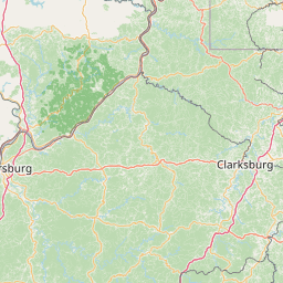
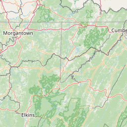
Leaflet | <a href="https://www.openstreetmap.org/copyright">© OpenStreetMap contributors</a>
Item
| Property | Value |
|---|---|
| id | 425823 |
| downstream_mainstem_id | https://geoconnex.us/ref/mainstems/331549 |
| encompassing_mainstem_basins | ['https://geoconnex.us/ref/mainstems/331549', 'https://geoconnex.us/ref/mainstems/314849', 'https://geoconnex.us/ref/mainstems/312091'] |
| featuretype | ['https://www.opengis.net/def/schema/hy_features/hyf/HY_FlowPath', 'https://www.opengis.net/def/schema/hy_features/hyf/HY_WaterBody'] |
| fid | 7745 |
| head_2020huc12 | 050200030201 |
| head_nhdpv1_comid | 3768728 |
| head_nhdpv2_comid | https://geoconnex.us/nhdplusv2/comid/3768728 |
| head_nhdpv2huc12 | https://geoconnex.us/nhdplusv2/huc12/050200030201 |
| head_rf1id | 12191 |
| lengthkm | 38.4 |
| name_at_outlet | Deckers Creek |
| name_at_outlet_gnis_id | 1538098 |
| new_mainstemid | |
| outlet_2020huc12 | 050200030202 |
| outlet_drainagearea_sqkm | 164.1 |
| outlet_nhdpv1_comid | 3768866 |
| outlet_nhdpv2_comid | https://geoconnex.us/nhdplusv2/comid/3768866 |
| outlet_nhdpv2huc12 | https://geoconnex.us/nhdplusv2/huc12/050200030202 |
| outlet_rf1id | 12189 |
| superseded | False |
| uri | https://geoconnex.us/ref/mainstems/425823 |
Graph Results
| monitoringLocation | https://sta.geoconnex.dev/collections/USGS/Things/items/'USGS-03062500' |
|---|---|
| siteName | USGS-03062500 |
| datasetDescription | Discharge / USGS-03062500-8d3253200fd24fcdbc646fa78aebfb00 |
| type | Stream |
| url | https://waterdata.usgs.gov/monitoring-location/03062500/#parameterCode=00060 |
| variableMeasured | Discharge / USGS-03062500-8d3253200fd24fcdbc646fa78aebfb00 |
| variableUnit | ft^3/s |
| measurementTechnique | observation |
| temporalCoverage | 2024-08-30T09:15:00Z/2024-09-09T18:00:00Z |
| distributionName | USGS Instantaneous Values Service |
| distributionURL | https://waterservices.usgs.gov/nwis/iv/?sites=USGS:03062500¶meterCd=00060&format=rdb |
| distributionFormat | text/tab-separated-values |
| wkt | POINT (-79.9525633407051 39.6292482568592) |
| monitoringLocation | https://sta.geoconnex.dev/collections/USGS/Things/items/'USGS-03062500' |
|---|---|
| siteName | USGS-03062500 |
| datasetDescription | Discharge / USGS-03062500-8d3253200fd24fcdbc646fa78aebfb00 |
| type | Stream |
| url | https://waterdata.usgs.gov/monitoring-location/03062500/#parameterCode=00060 |
| variableMeasured | Discharge / USGS-03062500-8d3253200fd24fcdbc646fa78aebfb00 |
| variableUnit | ft^3/s |
| measurementTechnique | observation |
| temporalCoverage | 2024-08-30T09:15:00Z/2024-09-09T18:00:00Z |
| distributionName | USGS SensorThings API |
| distributionURL | https://labs.waterdata.usgs.gov/sta/v1.1/Datastreams('8d3253200fd24fcdbc646fa78aebfb00')?$expand=Thing,Observations |
| distributionFormat | application/json |
| wkt | POINT (-79.9525633407051 39.6292482568592) |
| monitoringLocation | https://sta.geoconnex.dev/collections/USGS/Things/items/'USGS-03062500' |
|---|---|
| siteName | USGS-03062500 |
| datasetDescription | Gage height, feet / USGS-03062500-c42b3b25de6d452f9ad532587455630d |
| type | Stream |
| url | https://waterdata.usgs.gov/monitoring-location/03062500/#parameterCode=00065 |
| variableMeasured | Gage height |
| variableUnit | ft |
| measurementTechnique | observation |
| temporalCoverage | 2024-08-30T09:15:00Z/2024-09-09T18:00:00Z |
| distributionName | USGS Instantaneous Values Service |
| distributionURL | https://waterservices.usgs.gov/nwis/iv/?sites=USGS:03062500¶meterCd=00065&format=rdb |
| distributionFormat | text/tab-separated-values |
| wkt | POINT (-79.9525633407051 39.6292482568592) |
| monitoringLocation | https://sta.geoconnex.dev/collections/USGS/Things/items/'USGS-03062500' |
|---|---|
| siteName | USGS-03062500 |
| datasetDescription | Gage height, feet / USGS-03062500-c42b3b25de6d452f9ad532587455630d |
| type | Stream |
| url | https://waterdata.usgs.gov/monitoring-location/03062500/#parameterCode=00065 |
| variableMeasured | Gage height |
| variableUnit | ft |
| measurementTechnique | observation |
| temporalCoverage | 2024-08-30T09:15:00Z/2024-09-09T18:00:00Z |
| distributionName | USGS SensorThings API |
| distributionURL | https://labs.waterdata.usgs.gov/sta/v1.1/Datastreams('c42b3b25de6d452f9ad532587455630d')?$expand=Thing,Observations |
| distributionFormat | application/json |
| wkt | POINT (-79.9525633407051 39.6292482568592) |