North Fork White Oak Creek
Map


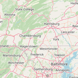
Leaflet | <a href="https://www.openstreetmap.org/copyright">© OpenStreetMap contributors</a>
Item
| Property | Value |
|---|---|
| id | 437817 |
| downstream_mainstem_id | https://geoconnex.us/ref/mainstems/370938 |
| encompassing_mainstem_basins | ['https://geoconnex.us/ref/mainstems/370938', 'https://geoconnex.us/ref/mainstems/314849', 'https://geoconnex.us/ref/mainstems/312091'] |
| featuretype | ['https://www.opengis.net/def/schema/hy_features/hyf/HY_FlowPath', 'https://www.opengis.net/def/schema/hy_features/hyf/HY_WaterBody'] |
| fid | 8634 |
| head_2020huc12 | 050902010903 |
| head_nhdpv1_comid | 1915976 |
| head_nhdpv2_comid | https://geoconnex.us/nhdplusv2/comid/1915976 |
| head_nhdpv2huc12 | https://geoconnex.us/nhdplusv2/huc12/050902010903 |
| head_rf1id | 14229 |
| lengthkm | 36.9 |
| name_at_outlet | North Fork White Oak Creek |
| name_at_outlet_gnis_id | 1057875 |
| new_mainstemid | |
| outlet_2020huc12 | 050902010904 |
| outlet_drainagearea_sqkm | 174.7 |
| outlet_nhdpv1_comid | 1916664 |
| outlet_nhdpv2_comid | https://geoconnex.us/nhdplusv2/comid/1916664 |
| outlet_nhdpv2huc12 | https://geoconnex.us/nhdplusv2/huc12/050902010904 |
| outlet_rf1id | 14229 |
| superseded | False |
| uri | https://geoconnex.us/ref/mainstems/437817 |