Cripple Deer Creek
Map
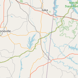
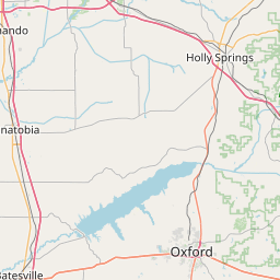
Leaflet | <a href="https://www.openstreetmap.org/copyright">© OpenStreetMap contributors</a>
Item
| Property | Value |
|---|---|
| id | 457907 |
| downstream_mainstem_id | https://geoconnex.us/ref/mainstems/343261 |
| encompassing_mainstem_basins | ['https://geoconnex.us/ref/mainstems/343261', 'https://geoconnex.us/ref/mainstems/316088', 'https://geoconnex.us/ref/mainstems/314849', 'https://geoconnex.us/ref/mainstems/312091'] |
| featuretype | ['https://www.opengis.net/def/schema/hy_features/hyf/HY_FlowPath', 'https://www.opengis.net/def/schema/hy_features/hyf/HY_WaterBody'] |
| fid | 10280 |
| head_2020huc12 | 060300060302 |
| head_nhdpv1_comid | 19567216 |
| head_nhdpv2_comid | https://geoconnex.us/nhdplusv2/comid/19567216 |
| head_nhdpv2huc12 | https://geoconnex.us/nhdplusv2/huc12/060300060302 |
| head_rf1id | 16823 |
| lengthkm | 29.6 |
| name_at_outlet | Cripple Deer Creek |
| name_at_outlet_gnis_id | 668948 |
| new_mainstemid | |
| outlet_2020huc12 | 060300060302 |
| outlet_drainagearea_sqkm | 149.5 |
| outlet_nhdpv1_comid | 19567280 |
| outlet_nhdpv2_comid | https://geoconnex.us/nhdplusv2/comid/19567280 |
| outlet_nhdpv2huc12 | https://geoconnex.us/nhdplusv2/huc12/060300060302 |
| outlet_rf1id | 16821 |
| superseded | False |
| uri | https://geoconnex.us/ref/mainstems/457907 |