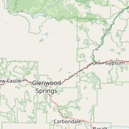
Ralston Creek
Map
Leaflet | <a href="https://www.openstreetmap.org/copyright">© OpenStreetMap contributors</a>
Item
| Property | Value |
|---|---|
| id | 461532 |
| downstream_mainstem_id | https://geoconnex.us/ref/mainstems/391977 |
| encompassing_mainstem_basins | ['https://geoconnex.us/ref/mainstems/391977', 'https://geoconnex.us/ref/mainstems/313255', 'https://geoconnex.us/ref/mainstems/312532', 'https://geoconnex.us/ref/mainstems/312091'] |
| featuretype | ['https://www.opengis.net/def/schema/hy_features/hyf/HY_FlowPath', 'https://www.opengis.net/def/schema/hy_features/hyf/HY_WaterBody'] |
| fid | 18003 |
| head_2020huc12 | 101900040301 |
| head_nhdpv1_comid | 2884866 |
| head_nhdpv2_comid | https://geoconnex.us/nhdplusv2/comid/2884866 |
| head_nhdpv2huc12 | https://geoconnex.us/nhdplusv2/huc12/101900040301 |
| head_rf1id | 22804 |
| lengthkm | 49.2 |
| name_at_outlet | Ralston Creek |
| name_at_outlet_gnis_id | 181545 |
| new_mainstemid | |
| outlet_2020huc12 | 101900040304 |
| outlet_drainagearea_sqkm | 237.5 |
| outlet_nhdpv1_comid | 2885048 |
| outlet_nhdpv2_comid | https://geoconnex.us/nhdplusv2/comid/2885048 |
| outlet_nhdpv2huc12 | https://geoconnex.us/nhdplusv2/huc12/101900040304 |
| outlet_rf1id | 22801 |
| superseded | False |
| uri | https://geoconnex.us/ref/mainstems/461532 |