Item 46305
Map
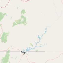
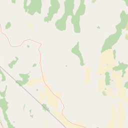

Leaflet | <a href="https://www.openstreetmap.org/copyright">© OpenStreetMap contributors</a>
Item
| Property | Value |
|---|---|
| id | 46305 |
| downstream_mainstem_id | https://geoconnex.us/ref/mainstems/31552 |
| encompassing_mainstem_basins | ['https://geoconnex.us/ref/mainstems/31552', 'https://geoconnex.us/ref/mainstems/29559'] |
| featuretype | ['https://www.opengis.net/def/schema/hy_features/hyf/HY_FlowPath', 'https://www.opengis.net/def/schema/hy_features/hyf/HY_WaterBody'] |
| fid | 26524 |
| head_2020huc12 | 140802050201 |
| head_nhdpv1_comid | 1382790 |
| head_nhdpv2_comid | https://geoconnex.us/nhdplusv2/comid/1382790 |
| head_nhdpv2huc12 | https://geoconnex.us/nhdplusv2/huc12/140802050201 |
| head_rf1id | 43022 |
| lengthkm | 93.5 |
| name_at_outlet | |
| name_at_outlet_gnis_id | None |
| new_mainstemid | |
| outlet_2020huc12 | 140802050205 |
| outlet_drainagearea_sqkm | 467.3 |
| outlet_nhdpv1_comid | 1383378 |
| outlet_nhdpv2_comid | https://geoconnex.us/nhdplusv2/comid/1383378 |
| outlet_nhdpv2huc12 | https://geoconnex.us/nhdplusv2/huc12/140802050205 |
| outlet_rf1id | 43022 |
| superseded | False |
| uri | https://geoconnex.us/ref/mainstems/46305 |