Cartoogechaye Creek
Map
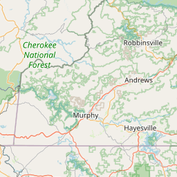
Leaflet | <a href="https://www.openstreetmap.org/copyright">© OpenStreetMap contributors</a>
Item
| Property | Value |
|---|---|
| id | 468698 |
| downstream_mainstem_id | https://geoconnex.us/ref/mainstems/363917 |
| encompassing_mainstem_basins | ['https://geoconnex.us/ref/mainstems/363917', 'https://geoconnex.us/ref/mainstems/339723', 'https://geoconnex.us/ref/mainstems/316088', 'https://geoconnex.us/ref/mainstems/314849', 'https://geoconnex.us/ref/mainstems/312091'] |
| featuretype | ['https://www.opengis.net/def/schema/hy_features/hyf/HY_FlowPath', 'https://www.opengis.net/def/schema/hy_features/hyf/HY_WaterBody'] |
| fid | 9985 |
| head_2020huc12 | 060102020104 |
| head_nhdpv1_comid | 19736571 |
| head_nhdpv2_comid | https://geoconnex.us/nhdplusv2/comid/19736571 |
| head_nhdpv2huc12 | https://geoconnex.us/nhdplusv2/huc12/060102020104 |
| head_rf1id | 16316 |
| lengthkm | 28.8 |
| name_at_outlet | Cartoogechaye Creek |
| name_at_outlet_gnis_id | 1010072 |
| new_mainstemid | |
| outlet_2020huc12 | 060102020105 |
| outlet_drainagearea_sqkm | 148.8 |
| outlet_nhdpv1_comid | 19735951 |
| outlet_nhdpv2_comid | https://geoconnex.us/nhdplusv2/comid/19735951 |
| outlet_nhdpv2huc12 | https://geoconnex.us/nhdplusv2/huc12/060102020105 |
| outlet_rf1id | 16314 |
| superseded | False |
| uri | https://geoconnex.us/ref/mainstems/468698 |
Graph Results
| monitoringLocation | https://sta.geoconnex.dev/collections/USGS/Things/items/'USGS-0350011450' |
|---|---|
| siteName | USGS-0350011450 |
| datasetDescription | Discharge, cubic feet per second / USGS-0350011450-2c868d9567ba4678ac9ce34801b7a919 |
| type | Stream |
| url | https://waterdata.usgs.gov/monitoring-location/0350011450/#parameterCode=00060 |
| variableMeasured | Discharge |
| variableUnit | ft^3/s |
| measurementTechnique | observation |
| temporalCoverage | 2024-08-30T09:15:00Z/2024-09-09T18:30:00Z |
| distributionName | USGS Instantaneous Values Service |
| distributionURL | https://waterservices.usgs.gov/nwis/iv/?sites=USGS:0350011450¶meterCd=00060&format=rdb |
| distributionFormat | text/tab-separated-values |
| wkt | POINT (-83.4243694444445 35.1577694444444) |
| monitoringLocation | https://sta.geoconnex.dev/collections/USGS/Things/items/'USGS-0350011450' |
|---|---|
| siteName | USGS-0350011450 |
| datasetDescription | Discharge, cubic feet per second / USGS-0350011450-2c868d9567ba4678ac9ce34801b7a919 |
| type | Stream |
| url | https://waterdata.usgs.gov/monitoring-location/0350011450/#parameterCode=00060 |
| variableMeasured | Discharge |
| variableUnit | ft^3/s |
| measurementTechnique | observation |
| temporalCoverage | 2024-08-30T09:15:00Z/2024-09-09T18:30:00Z |
| distributionName | USGS SensorThings API |
| distributionURL | https://labs.waterdata.usgs.gov/sta/v1.1/Datastreams('2c868d9567ba4678ac9ce34801b7a919')?$expand=Thing,Observations |
| distributionFormat | application/json |
| wkt | POINT (-83.4243694444445 35.1577694444444) |
| monitoringLocation | https://sta.geoconnex.dev/collections/USGS/Things/items/'USGS-0350011450' |
|---|---|
| siteName | USGS-0350011450 |
| datasetDescription | Gage height, feet / USGS-0350011450-a2facb0786f446e2b92cb93b13131ca2 |
| type | Stream |
| url | https://waterdata.usgs.gov/monitoring-location/0350011450/#parameterCode=00065 |
| variableMeasured | Gage height |
| variableUnit | ft |
| measurementTechnique | observation |
| temporalCoverage | 2024-08-30T09:15:00Z/2024-09-09T18:30:00Z |
| distributionName | USGS Instantaneous Values Service |
| distributionURL | https://waterservices.usgs.gov/nwis/iv/?sites=USGS:0350011450¶meterCd=00065&format=rdb |
| distributionFormat | text/tab-separated-values |
| wkt | POINT (-83.4243694444445 35.1577694444444) |
| monitoringLocation | https://sta.geoconnex.dev/collections/USGS/Things/items/'USGS-0350011450' |
|---|---|
| siteName | USGS-0350011450 |
| datasetDescription | Gage height, feet / USGS-0350011450-a2facb0786f446e2b92cb93b13131ca2 |
| type | Stream |
| url | https://waterdata.usgs.gov/monitoring-location/0350011450/#parameterCode=00065 |
| variableMeasured | Gage height |
| variableUnit | ft |
| measurementTechnique | observation |
| temporalCoverage | 2024-08-30T09:15:00Z/2024-09-09T18:30:00Z |
| distributionName | USGS SensorThings API |
| distributionURL | https://labs.waterdata.usgs.gov/sta/v1.1/Datastreams('a2facb0786f446e2b92cb93b13131ca2')?$expand=Thing,Observations |
| distributionFormat | application/json |
| wkt | POINT (-83.4243694444445 35.1577694444444) |
| monitoringLocation | https://sta.geoconnex.dev/collections/USGS/Things/items/'USGS-0350011450' |
|---|---|
| siteName | USGS-0350011450 |
| datasetDescription | Stream water level elevation above NAVD 1988, in feet / USGS-0350011450-c4b0004c197b4d86be98b8a52ef98a2f |
| type | Stream |
| url | https://waterdata.usgs.gov/monitoring-location/0350011450/#parameterCode=63160 |
| variableMeasured | Stream water level elevation above NAVD 1988 |
| variableUnit | ft |
| measurementTechnique | observation |
| temporalCoverage | 2024-08-30T09:15:00Z/2024-09-09T18:30:00Z |
| distributionName | USGS Instantaneous Values Service |
| distributionURL | https://waterservices.usgs.gov/nwis/iv/?sites=USGS:0350011450¶meterCd=63160&format=rdb |
| distributionFormat | text/tab-separated-values |
| wkt | POINT (-83.4243694444445 35.1577694444444) |
| monitoringLocation | https://sta.geoconnex.dev/collections/USGS/Things/items/'USGS-0350011450' |
|---|---|
| siteName | USGS-0350011450 |
| datasetDescription | Stream water level elevation above NAVD 1988, in feet / USGS-0350011450-c4b0004c197b4d86be98b8a52ef98a2f |
| type | Stream |
| url | https://waterdata.usgs.gov/monitoring-location/0350011450/#parameterCode=63160 |
| variableMeasured | Stream water level elevation above NAVD 1988 |
| variableUnit | ft |
| measurementTechnique | observation |
| temporalCoverage | 2024-08-30T09:15:00Z/2024-09-09T18:30:00Z |
| distributionName | USGS SensorThings API |
| distributionURL | https://labs.waterdata.usgs.gov/sta/v1.1/Datastreams('c4b0004c197b4d86be98b8a52ef98a2f')?$expand=Thing,Observations |
| distributionFormat | application/json |
| wkt | POINT (-83.4243694444445 35.1577694444444) |