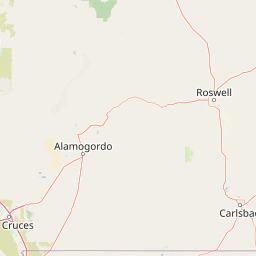
Spring Creek
Map
Leaflet | <a href="https://www.openstreetmap.org/copyright">© OpenStreetMap contributors</a>
Item
| Property | Value |
|---|---|
| id | 48087 |
| downstream_mainstem_id | https://geoconnex.us/ref/mainstems/36807 |
| encompassing_mainstem_basins | ['https://geoconnex.us/ref/mainstems/36807', 'https://geoconnex.us/ref/mainstems/32464', 'https://geoconnex.us/ref/mainstems/31261', 'https://geoconnex.us/ref/mainstems/29559'] |
| featuretype | ['https://www.opengis.net/def/schema/hy_features/hyf/HY_FlowPath', 'https://www.opengis.net/def/schema/hy_features/hyf/HY_WaterBody'] |
| fid | 27311 |
| head_2020huc12 | 150601050103 |
| head_nhdpv1_comid | 22432216 |
| head_nhdpv2_comid | https://geoconnex.us/nhdplusv2/comid/22432216 |
| head_nhdpv2huc12 | https://geoconnex.us/nhdplusv2/huc12/150601050103 |
| head_rf1id | 44138 |
| lengthkm | 40.4 |
| name_at_outlet | Spring Creek |
| name_at_outlet_gnis_id | 34726 |
| new_mainstemid | |
| outlet_2020huc12 | 150601050106 |
| outlet_drainagearea_sqkm | 380.3 |
| outlet_nhdpv1_comid | 22428600 |
| outlet_nhdpv2_comid | https://geoconnex.us/nhdplusv2/comid/22428600 |
| outlet_nhdpv2huc12 | https://geoconnex.us/nhdplusv2/huc12/150601050106 |
| outlet_rf1id | 44138 |
| superseded | False |
| uri | https://geoconnex.us/ref/mainstems/48087 |