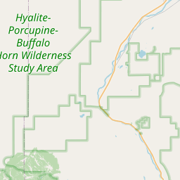
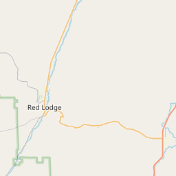
Wounded Man Creek
Map
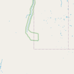
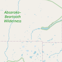
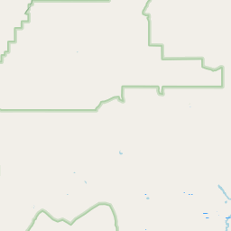
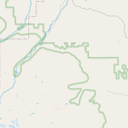
Leaflet | <a href="https://www.openstreetmap.org/copyright">© OpenStreetMap contributors</a>
Item
| Property | Value |
|---|---|
| id | 492655 |
| downstream_mainstem_id | https://geoconnex.us/ref/mainstems/361426 |
| encompassing_mainstem_basins | ['https://geoconnex.us/ref/mainstems/361426', 'https://geoconnex.us/ref/mainstems/315571', 'https://geoconnex.us/ref/mainstems/312532', 'https://geoconnex.us/ref/mainstems/312091'] |
| featuretype | ['https://www.opengis.net/def/schema/hy_features/hyf/HY_FlowPath', 'https://www.opengis.net/def/schema/hy_features/hyf/HY_WaterBody'] |
| fid | 15536 |
| head_2020huc12 | 100700050103 |
| head_nhdpv1_comid | 7185094 |
| head_nhdpv2_comid | https://geoconnex.us/nhdplusv2/comid/7185094 |
| head_nhdpv2huc12 | https://geoconnex.us/nhdplusv2/huc12/100700050103 |
| head_rf1id | 31636 |
| lengthkm | 12.6 |
| name_at_outlet | Wounded Man Creek |
| name_at_outlet_gnis_id | 793549 |
| new_mainstemid | |
| outlet_2020huc12 | 100700050103 |
| outlet_drainagearea_sqkm | 74.8 |
| outlet_nhdpv1_comid | 7186466 |
| outlet_nhdpv2_comid | https://geoconnex.us/nhdplusv2/comid/7186466 |
| outlet_nhdpv2huc12 | https://geoconnex.us/nhdplusv2/huc12/100700050103 |
| outlet_rf1id | 31636 |
| superseded | False |
| uri | https://geoconnex.us/ref/mainstems/492655 |