West Prong Waterman Wash
Map
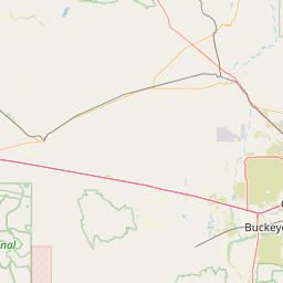
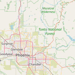
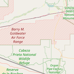
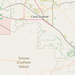
Leaflet | <a href="https://www.openstreetmap.org/copyright">© OpenStreetMap contributors</a>
Item
| Property | Value |
|---|---|
| id | 60506 |
| downstream_mainstem_id | https://geoconnex.us/ref/mainstems/343928 |
| encompassing_mainstem_basins | ['https://geoconnex.us/ref/mainstems/343928', 'https://geoconnex.us/ref/mainstems/31261', 'https://geoconnex.us/ref/mainstems/29559'] |
| featuretype | ['https://www.opengis.net/def/schema/hy_features/hyf/HY_FlowPath', 'https://www.opengis.net/def/schema/hy_features/hyf/HY_WaterBody'] |
| fid | 27396 |
| head_2020huc12 | 150701010104 |
| head_nhdpv1_comid | 20427644 |
| head_nhdpv2_comid | https://geoconnex.us/nhdplusv2/comid/20427644 |
| head_nhdpv2huc12 | https://geoconnex.us/nhdplusv2/huc12/150701010104 |
| head_rf1id | 44264 |
| lengthkm | 20.5 |
| name_at_outlet | West Prong Waterman Wash |
| name_at_outlet_gnis_id | 13523 |
| new_mainstemid | |
| outlet_2020huc12 | 150701010104 |
| outlet_drainagearea_sqkm | 182.8 |
| outlet_nhdpv1_comid | 20427286 |
| outlet_nhdpv2_comid | https://geoconnex.us/nhdplusv2/comid/20427286 |
| outlet_nhdpv2huc12 | https://geoconnex.us/nhdplusv2/huc12/150701010104 |
| outlet_rf1id | 44264 |
| superseded | False |
| uri | https://geoconnex.us/ref/mainstems/60506 |