Tank Pond Creek
Map
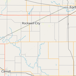
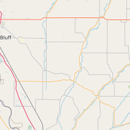
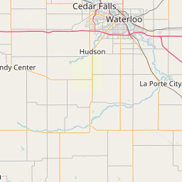
Leaflet | <a href="https://www.openstreetmap.org/copyright">© OpenStreetMap contributors</a>
Item
| Property | Value |
|---|---|
| id | 935923 |
| downstream_mainstem_id | https://geoconnex.us/ref/mainstems/467837 |
| encompassing_mainstem_basins | ['https://geoconnex.us/ref/mainstems/467837', 'https://geoconnex.us/ref/mainstems/336345', 'https://geoconnex.us/ref/mainstems/321168', 'https://geoconnex.us/ref/mainstems/312091'] |
| featuretype | ['https://www.opengis.net/def/schema/hy_features/hyf/HY_FlowPath', 'https://www.opengis.net/def/schema/hy_features/hyf/HY_WaterBody'] |
| fid | 11915 |
| head_2020huc12 | 071000061201 |
| head_nhdpv1_comid | 6607250 |
| head_nhdpv2_comid | https://geoconnex.us/nhdplusv2/comid/6607250 |
| head_nhdpv2huc12 | https://geoconnex.us/nhdplusv2/huc12/071000061201 |
| head_rf1id | None |
| lengthkm | 8.9 |
| name_at_outlet | Tank Pond Creek |
| name_at_outlet_gnis_id | 462178 |
| new_mainstemid | |
| outlet_2020huc12 | 071000061201 |
| outlet_drainagearea_sqkm | 50.5 |
| outlet_nhdpv1_comid | 6608058 |
| outlet_nhdpv2_comid | https://geoconnex.us/nhdplusv2/comid/6608058 |
| outlet_nhdpv2huc12 | https://geoconnex.us/nhdplusv2/huc12/071000061201 |
| outlet_rf1id | None |
| superseded | False |
| uri | https://geoconnex.us/ref/mainstems/935923 |