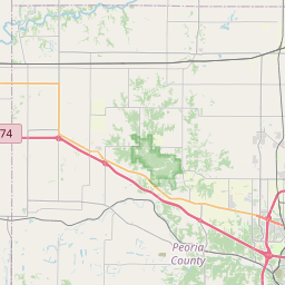
DUNLAP
Map

Leaflet | <a href="https://www.openstreetmap.org/copyright">© OpenStreetMap contributors</a>
Item
| Property | Value |
|---|---|
| id | IL1430250 |
| boundary_type | Water Service Area - as specified in source_url |
| centroid_lat | 40.85745765 |
| centroid_lon | -89.67881427 |
| centroid_quality | CALCULATED FROM GEOMETRY |
| city_served | DUNLAP |
| contact_email | jess@gosimplelab.com |
| contribution_date | 2022-07-05 |
| county_served | PEORIA |
| data_source | SimpleLab |
| fid | 33000 |
| is_wholesaler_ind | False |
| owner_type_code | L |
| place_uri | https://geoconnex.us/ref/places/ |
| population_served_count | 1386 |
| pred_05 | None |
| pred_50 | None |
| pred_95 | None |
| primacy_agency_code | IL |
| primacy_type | State |
| primary_source_code | SWP |
| primary_water_source | Purchased Surface Water |
| pws_name | DUNLAP |
| sdwis_link | https://enviro.epa.gov/enviro/sdw_report_v3.first_table?pws_id=IL1430250&state=IL&source=0&population=0 |
| service_area_type | Municipality |
| service_connections_count | 586 |
| source_date | 2022-07-05 |
| source_url | https://www.hydroshare.org/resource/b11b8982eebd4843833932f085f71d92/data/contents/temm.geojson |
| state_code | IL |
| state_uri | https://geoconnex.us/ref/states/17 |
| tier | 1 |
| uri | https://geoconnex.us/ref/pws/IL1430250 |
| wholesaler | Is not a wholesaler |