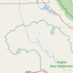
USGS NWIS Stream/River/Lake Site 06717000: FALL RIVER NEAR IDAHO SPRINGS, CO.
Map
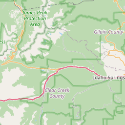

Leaflet | <a href="https://www.openstreetmap.org/copyright">© OpenStreetMap contributors</a>
Item
| Property | Value |
|---|---|
| id | 1036721 |
| cluster | https://geoconnex.us/ref/gages/1189975 |
| dasqkm_diff | -0.299999999999997 |
| description | USGS NWIS Stream/River/Lake Site 06717000: FALL RIVER NEAR IDAHO SPRINGS, CO. |
| fid | 186483 |
| gage_totdasqkm | 60.9 |
| mainstem_uri | https://geoconnex.us/ref/mainstems/494493 |
| name | FALL RIVER NEAR IDAHO SPRINGS, CO. |
| nhdpv2_comid | 2885162.0 |
| nhdpv2_link_source | https://www.epa.gov/waterdata/nhdplus-national-hydrography-dataset-plus |
| nhdpv2_offset_m | 54.6279712375121 |
| nhdpv2_reach_measure | 6.8637 |
| nhdpv2_reachcode | 10190004000057 |
| nhdpv2_totdasqkm | 60.6 |
| nws_url | None |
| provider | https://waterdata.usgs.gov |
| provider_id | 06717000 |
| subjectof | https://waterdata.usgs.gov/monitoring-location/06717000 |
| uri | https://geoconnex.us/ref/gages/1036721 |