/
https://geoconnex.us/ref/hu08/04130002
JSON
JSON-LD
Resources
Collections
Processes
Documentation
Geoconnex Docs
API Definition
Conformance
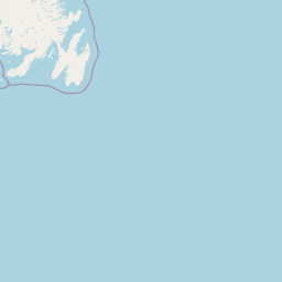
Upper Genesee
Map
+
−
Leaflet
| <a href="https://www.openstreetmap.org/copyright">© OpenStreetMap contributors</a>
Previous
Next
Item
Property
Value
id
04130002
fid
371
gnis_id
None
gnis_url
hucs
https://geoconnex.us/iow/wqp/21NYDECA-04041001
https://geoconnex.us/iow/wqp/21NYDECA-04032102
https://geoconnex.us/iow/wqp/21NYDECA-04030133
https://geoconnex.us/iow/wqp/21NYDECA-04031301
https://geoconnex.us/iow/wqp/21NYDECA-04031601
https://geoconnex.us/iow/wqp/21NYDECA_WQX-04031A01
https://geoconnex.us/iow/wqp/USGS-04220394
https://geoconnex.us/iow/wqp/USGS-422500078100001
https://geoconnex.us/iow/wqp/USGS-423449078152000
https://geoconnex.us/iow/wqp/USGS-04220350
https://geoconnex.us/iow/wqp/USGS-04224740
https://geoconnex.us/iow/wqp/USGS-04225670
https://geoconnex.us/iow/wqp/USGS-422040078065301
https://geoconnex.us/iow/wqp/USGS-04221650
https://geoconnex.us/iow/wqp/USGS-422616078114401
https://geoconnex.us/iow/wqp/USGS-423436078152001
https://geoconnex.us/iow/wqp/USGS-424133077495201
https://geoconnex.us/iow/wqp/USGS-423320078091300
https://geoconnex.us/iow/wqp/USGS-423559078140601
https://geoconnex.us/iow/wqp/USGS-422747078065100
https://geoconnex.us/iow/wqp/USGS-423303077485101
https://geoconnex.us/iow/wqp/USGS-421242078073301
https://geoconnex.us/iow/wqp/USGS-423943077460400
https://geoconnex.us/iow/wqp/21NYDECA_WQX-04031E08_10
https://geoconnex.us/iow/wqp/21NYDECA_WQX-04041001
https://geoconnex.us/iow/wqp/21NYDECA_WQX-AMITYL_110159_DH
https://geoconnex.us/iow/wqp/USGS-421208078075601
https://geoconnex.us/iow/wqp/USGS-0422151210
https://geoconnex.us/iow/wqp/USGS-04224660
https://geoconnex.us/iow/wqp/21NYDECA_WQX-MOSSL_110144_C
https://geoconnex.us/iow/wqp/USGS-424428077495401
https://geoconnex.us/iow/wqp/USGS-420526077552201
https://geoconnex.us/iow/wqp/USGS-424352077555201
https://geoconnex.us/iow/wqp/USGS-422018078071901
https://geoconnex.us/iow/wqp/USGS-04221200
https://geoconnex.us/iow/wqp/21NYDECA_WQX-04041001_05
https://geoconnex.us/iow/wqp/USGS-421823078010600
https://geoconnex.us/iow/wqp/USGS-423418077353401
https://geoconnex.us/iow/wqp/USGS-423219077571701
https://geoconnex.us/iow/wqp/USGS-422031078063100
https://geoconnex.us/iow/wqp/21NYDECA_WQX-HANGINGBP_110150_BL
https://geoconnex.us/iow/wqp/USGS-04224900
https://geoconnex.us/iow/wqp/USGS-421016077584000
https://geoconnex.us/iow/wqp/USGS-04225600
https://geoconnex.us/iow/wqp/USGS-420219077462301
https://geoconnex.us/iow/wqp/21NYDECA_WQX-04031900
https://geoconnex.us/iow/wqp/USGS-423212078034301
https://geoconnex.us/iow/wqp/NALMS-F955977
https://geoconnex.us/iow/wqp/21NYDECA_WQX-04030133
https://geoconnex.us/iow/wqp/21NYDECA_WQX-ANDOVERP_110164_SE
https://geoconnex.us/iow/wqp/NARS_WQX-NYSS-1253
https://geoconnex.us/iow/wqp/USGS-423802078025500
https://geoconnex.us/iow/wqp/USGS-415812077510401
https://geoconnex.us/iow/wqp/USGS-420428077443401
https://geoconnex.us/iow/wqp/USGS-421021078001201
https://geoconnex.us/iow/wqp/USGS-423416077374001
https://geoconnex.us/iow/wqp/USGS-04220370
https://geoconnex.us/iow/wqp/USGS-04220458
https://geoconnex.us/iow/wqp/USGS-04223920
https://geoconnex.us/iow/wqp/USGS-422024078063101
https://geoconnex.us/iow/wqp/USGS-04224978
https://geoconnex.us/iow/wqp/USGS-415858077515301
https://geoconnex.us/iow/wqp/USGS-421321078004001
https://geoconnex.us/iow/wqp/USGS-04221725
https://geoconnex.us/iow/wqp/USGS-423334077414500
https://geoconnex.us/iow/wqp/USGS-426400078130001
https://geoconnex.us/iow/wqp/USGS-423931078055401
https://geoconnex.us/iow/wqp/USGS-420448077551001
https://geoconnex.us/iow/wqp/USGS-420921077480001
https://geoconnex.us/iow/wqp/USGS-420219077462201
https://geoconnex.us/iow/wqp/USGS-420223077460501
https://geoconnex.us/iow/wqp/21NYDECA_WQX-04031401_10
https://geoconnex.us/iow/wqp/USGS-420927077474600
https://geoconnex.us/iow/wqp/USGS-421403078023301
https://geoconnex.us/iow/wqp/USGS-424129077495502
https://geoconnex.us/iow/wqp/USGS-421401078021202
https://geoconnex.us/iow/wqp/USGS-04220372
https://geoconnex.us/iow/wqp/USGS-423308078160101
https://geoconnex.us/iow/wqp/USGS-424100077493001
https://geoconnex.us/iow/wqp/USGS-420927077471501
https://geoconnex.us/iow/wqp/USGS-420931077470701
https://geoconnex.us/iow/wqp/USGS-04227000
https://geoconnex.us/iow/wqp/USGS-415745077503901
https://geoconnex.us/iow/wqp/USGS-422741077464400
https://geoconnex.us/iow/wqp/USGS-04221600
https://geoconnex.us/iow/wqp/21NYDECA_WQX-04031800_10
https://geoconnex.us/iow/wqp/21NYDECA_WQX-04030133A
https://geoconnex.us/iow/wqp/USGS-420521078010601
https://geoconnex.us/iow/wqp/USGS-422301078132301
https://geoconnex.us/iow/wqp/USGS-423226077550501
https://geoconnex.us/iow/wqp/21NYDECA_WQX-04030133_05
https://geoconnex.us/iow/wqp/21NYDECA_WQX-04031401
https://geoconnex.us/iow/wqp/21NYDECA_WQX-RUSHFORDL_110146_DH
https://geoconnex.us/iow/wqp/USGS-423222077373201
https://geoconnex.us/iow/wqp/USGS-424318077593500
https://geoconnex.us/iow/wqp/USGS-423313077352401
https://geoconnex.us/iow/wqp/USGS-423937078050200
https://geoconnex.us/iow/wqp/USGS-04220455
https://geoconnex.us/iow/wqp/21NYDECA_WQX-FOSTERL_110161_D
https://geoconnex.us/iow/wqp/USGS-421804078012001
https://geoconnex.us/iow/wqp/USGS-01521550
https://geoconnex.us/iow/wqp/USGS-04220430
https://geoconnex.us/iow/wqp/USGS-04223900
https://geoconnex.us/iow/wqp/USGS-421102077584101
https://geoconnex.us/iow/wqp/USGS-04220500
https://geoconnex.us/iow/wqp/USGS-421152078035301
https://geoconnex.us/iow/wqp/USGS-04225500
https://geoconnex.us/iow/wqp/USGS-423712077423401
https://geoconnex.us/iow/wqp/USGS-422635077515701
https://geoconnex.us/iow/wqp/21NYDECA_WQX-04031601_05
https://geoconnex.us/iow/wqp/21NYDECA_WQX-ANDOVERP_110164_SWO
https://geoconnex.us/iow/wqp/USGS-423846077391501
https://geoconnex.us/iow/wqp/USGS-425800078040001
https://geoconnex.us/iow/wqp/USGS-04220376
https://geoconnex.us/iow/wqp/USGS-04221710
https://geoconnex.us/iow/wqp/USGS-415817077530101
https://geoconnex.us/iow/wqp/USGS-423621078044201
https://geoconnex.us/iow/wqp/USGS-04224940
https://geoconnex.us/iow/wqp/USGS-423823077520501
https://geoconnex.us/iow/wqp/USGS-421235078075000
https://geoconnex.us/iow/wqp/USGS-421529078000501
https://geoconnex.us/iow/wqp/21NYDECA_WQX-04031103
https://geoconnex.us/iow/wqp/21NYDECA_WQX-TROUTP_110124_C
https://geoconnex.us/iow/wqp/USGS-420133077554501
https://geoconnex.us/iow/wqp/USGS-04221760
https://geoconnex.us/iow/wqp/21PA_WQX-WQN0001
https://geoconnex.us/iow/wqp/USGS-04220600
https://geoconnex.us/iow/wqp/USGS-422749078065201
https://geoconnex.us/iow/wqp/USGS-424330077533501
https://geoconnex.us/iow/wqp/USGS-423939077465201
https://geoconnex.us/iow/wqp/USGS-04221000
https://geoconnex.us/iow/wqp/USGS-423955077461301
https://geoconnex.us/iow/wqp/USGS-423311078104401
https://geoconnex.us/iow/wqp/21NYDECA_WQX-04031502
https://geoconnex.us/iow/wqp/USGS-421404078023001
https://geoconnex.us/iow/wqp/USGS-423247078145101
https://geoconnex.us/iow/wqp/USGS-04220480
https://geoconnex.us/iow/wqp/USGS-415350077551401
https://geoconnex.us/iow/wqp/USGS-422857077401501
https://geoconnex.us/iow/wqp/USGS-04222530
https://geoconnex.us/iow/wqp/USGS-421401078021201
https://geoconnex.us/iow/wqp/USGS-04224550
https://geoconnex.us/iow/wqp/USGS-04221510
https://geoconnex.us/iow/wqp/USGS-04221830
https://geoconnex.us/iow/wqp/USGS-423357077564801
https://geoconnex.us/iow/wqp/USGS-424123077494901
https://geoconnex.us/iow/wqp/USGS-424313077530301
https://geoconnex.us/iow/wqp/USGS-423200078070701
https://geoconnex.us/iow/wqp/USGS-04221500
https://geoconnex.us/iow/wqp/21NYDECA_WQX-04031213
https://geoconnex.us/iow/wqp/21NYDECA_WQX-04031701_10
https://geoconnex.us/iow/wqp/USGS-422755078065301
https://geoconnex.us/iow/wqp/USGS-424131077495802
https://geoconnex.us/iow/wqp/USGS-415914077454601
https://geoconnex.us/iow/wqp/USGS-422912077483001
https://geoconnex.us/iow/wqp/USGS-04224930
https://geoconnex.us/iow/wqp/USGS-424313077530300
https://geoconnex.us/iow/wqp/USGS-422830078080801
https://geoconnex.us/iow/wqp/USGS-415747077502801
https://geoconnex.us/iow/wqp/USGS-04220489
https://geoconnex.us/iow/wqp/USGS-04221700
https://geoconnex.us/iow/wqp/USGS-04225950
https://geoconnex.us/iow/wqp/USGS-421204078075701
https://geoconnex.us/iow/wqp/USGS-424237078012801
https://geoconnex.us/iow/wqp/USGS-04224650
https://geoconnex.us/iow/wqp/NARS-OWW04440-0319
https://geoconnex.us/iow/wqp/USGS-04220384
https://geoconnex.us/iow/wqp/USGS-04220450
https://geoconnex.us/iow/wqp/USGS-423930078054401
https://geoconnex.us/iow/wqp/USGS-424129077495501
https://geoconnex.us/iow/wqp/USGS-423417077354002
https://geoconnex.us/iow/wqp/USGS-423606078044901
https://geoconnex.us/iow/wqp/USGS-422023078080201
https://geoconnex.us/iow/wqp/USGS-422747078065101
https://geoconnex.us/iow/wqp/USGS-421317077481701
https://geoconnex.us/iow/wqp/USGS-421402078021301
https://geoconnex.us/iow/wqp/USGS-423357077564800
https://geoconnex.us/iow/wqp/USGS-04221560
https://geoconnex.us/iow/wqp/USGS-420448077550901
https://geoconnex.us/iow/wqp/USGS-04220392
https://geoconnex.us/iow/wqp/USGS-04222900
https://geoconnex.us/iow/wqp/USGS-423911078091101
https://geoconnex.us/iow/wqp/USGS-04225000
https://geoconnex.us/iow/wqp/USGS-04222540
https://geoconnex.us/iow/wqp/USGS-421139078082901
https://geoconnex.us/iow/wqp/USGS-423406077353200
https://geoconnex.us/iow/wqp/USGS-422718078005301
https://geoconnex.us/iow/wqp/USGS-415836077504701
https://geoconnex.us/iow/wqp/USGS-423323078092201
https://geoconnex.us/iow/wqp/USGS-04224800
https://geoconnex.us/iow/wqp/USGS-04225915
https://geoconnex.us/iow/wqp/21NYDECA_WQX-04042102
https://geoconnex.us/iow/wqp/USGS-04220390
https://geoconnex.us/iow/wqp/NARS_WQX-OWW04440-0319
https://geoconnex.us/iow/wqp/USGS-04223000
https://geoconnex.us/iow/wqp/USGS-04220410
https://geoconnex.us/iow/wqp/USGS-421210077921001
https://geoconnex.us/iow/wqp/USGS-424318078014601
https://geoconnex.us/iow/wqp/USGS-04222700
https://geoconnex.us/iow/wqp/21NYDECA_WQX-SPRINGL_110142_O
https://geoconnex.us/iow/wqp/NALMS-F965260
https://geoconnex.us/iow/wqp/USGS-420450077550801
https://geoconnex.us/iow/wqp/USGS-04221810
https://geoconnex.us/iow/wqp/USGS-423124077414901
https://geoconnex.us/iow/wqp/21NYDECA_WQX-SILVERL_110115_DH
https://geoconnex.us/iow/wqp/21NYDECA_WQX-04031301_05
https://geoconnex.us/iow/wqp/USGS-04220371
https://geoconnex.us/iow/wqp/USGS-04223400
https://geoconnex.us/iow/wqp/USGS-04222850
https://geoconnex.us/iow/wqp/USGS-421056077583001
https://geoconnex.us/iow/wqp/USGS-422537078092801
https://geoconnex.us/iow/wqp/USGS-423651078043201
https://geoconnex.us/iow/wqp/21PA_WQX-GENESEERIVER
https://geoconnex.us/iow/wqp/USGS-04226000
https://geoconnex.us/iow/wqp/USGS-420428077443301
https://geoconnex.us/iow/wqp/USGS-422729077465601
https://geoconnex.us/iow/wqp/USGS-421940077561301
https://geoconnex.us/iow/wqp/USGS-421402078021300
https://geoconnex.us/iow/wqp/USGS-04224848
https://geoconnex.us/iow/wqp/USGS-423600078041001
https://geoconnex.us/iow/wqp/USGS-421819078095401
https://geoconnex.us/iow/wqp/USGS-422031078063101
https://geoconnex.us/iow/wqp/21NYDECA_WQX-04032102_05
https://geoconnex.us/iow/wqp/21NYDECA_WQX-NUNDAR_110084_DH
https://geoconnex.us/iow/wqp/USGS-422515078093400
https://geoconnex.us/iow/wqp/USGS-425600077696001
https://geoconnex.us/iow/wqp/USGS-421356078033701
https://geoconnex.us/iow/wqp/USGS-04220374
https://geoconnex.us/iow/wqp/USGS-415643077485701
https://geoconnex.us/iow/wqp/USGS-422752078064801
https://geoconnex.us/iow/wqp/USGS-420448077541601
https://geoconnex.us/iow/wqp/USGS-422033078073701
https://geoconnex.us/iow/wqp/21NYDECA_WQX-04031701
https://geoconnex.us/iow/wqp/21NYDECA_WQX-04031800
https://geoconnex.us/iow/wqp/USGS-04221800
https://geoconnex.us/iow/wqp/USGS-415409077454401
https://geoconnex.us/iow/wqp/USGS-04224775
https://geoconnex.us/iow/wqp/USGS-424131077495801
https://geoconnex.us/iow/wqp/USGS-415624077484701
https://geoconnex.us/iow/wqp/USGS-422736077465401
https://geoconnex.us/iow/wqp/USGS-420705077565101
https://geoconnex.us/iow/wqp/USGS-04222300
https://geoconnex.us/iow/wqp/21NYDECA_WQX-04031E08
https://geoconnex.us/iow/wqp/USGS-04221520
https://geoconnex.us/iow/wqp/USGS-424421077495301
https://geoconnex.us/iow/wqp/USGS-04224700
https://geoconnex.us/iow/wqp/USGS-423550077435301
https://geoconnex.us/ref/hu10/0413000201
https://geoconnex.us/ref/hu10/0413000202
https://geoconnex.us/ref/hu10/0413000203
https://geoconnex.us/ref/hu10/0413000204
https://geoconnex.us/ref/hu10/0413000205
https://geoconnex.us/ref/hu10/0413000206
https://geoconnex.us/ref/hu10/0413000207
https://geoconnex.us/ref/hu10/0413000208
https://geoconnex.us/ref/hu10/0413000209
https://geoconnex.us/ref/hu10/0413000210
loaddate
2018-02-01 16:59:26+00:00
name
Upper Genesee
uri
https://geoconnex.us/ref/hu08/04130002