/
https://geoconnex.us/ref/hu08/09010005
JSON
JSON-LD
Resources
Collections
Processes
Documentation
Geoconnex Docs
API Definition
Conformance
Deep
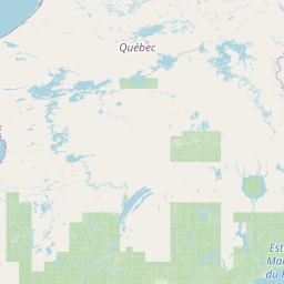
Map
+
−
Leaflet
| <a href="https://www.openstreetmap.org/copyright">© OpenStreetMap contributors</a>
Previous
Next
Item
Property
Value
id
09010005
fid
28
gnis_id
None
gnis_url
hucs
https://geoconnex.us/iow/wqp/21NDHDWQ_WQX-383005
https://geoconnex.us/iow/wqp/21NDHDWQ_WQX-383008
https://geoconnex.us/iow/wqp/21NDHDWQ-380100
https://geoconnex.us/iow/wqp/USGS-483617101214402
https://geoconnex.us/iow/wqp/USGS-481423101074201
https://geoconnex.us/iow/wqp/USGS-483624101215401
https://geoconnex.us/iow/wqp/USGS-483807101203601
https://geoconnex.us/iow/wqp/USGS-483003100480401
https://geoconnex.us/iow/wqp/USGS-481522101105701
https://geoconnex.us/iow/wqp/21NDHDWQ-383005
https://geoconnex.us/iow/wqp/21NDHDWQ-383006
https://geoconnex.us/iow/wqp/21NDHDWQ-383007
https://geoconnex.us/iow/wqp/USGS-483143101140302
https://geoconnex.us/iow/wqp/USGS-482002100452101
https://geoconnex.us/iow/wqp/USGS-482549100491401
https://geoconnex.us/iow/wqp/USGS-483342101270601
https://geoconnex.us/iow/wqp/USGS-483419101140401
https://geoconnex.us/iow/wqp/USGS-482825100565502
https://geoconnex.us/iow/wqp/USGS-481417101075101
https://geoconnex.us/iow/wqp/USGS-484500101231601
https://geoconnex.us/iow/wqp/USGS-482357101021901
https://geoconnex.us/iow/wqp/USGS-483003100503202
https://geoconnex.us/iow/wqp/USGS-481512100543001
https://geoconnex.us/iow/wqp/USGS-05123600
https://geoconnex.us/iow/wqp/USGS-482825101010001
https://geoconnex.us/iow/wqp/USGS-481410101075101
https://geoconnex.us/iow/wqp/USGS-483622101085001
https://geoconnex.us/iow/wqp/USGS-483003100503201
https://geoconnex.us/iow/wqp/USGS-483729101215401
https://geoconnex.us/iow/wqp/USGS-483703101205501
https://geoconnex.us/iow/wqp/USGS-485657101333201
https://geoconnex.us/iow/wqp/USGS-483524100582401
https://geoconnex.us/iow/wqp/USGS-05123700
https://geoconnex.us/iow/wqp/21NDHDWQ-384133
https://geoconnex.us/iow/wqp/USGS-480821100553501
https://geoconnex.us/iow/wqp/USGS-481519101031101
https://geoconnex.us/iow/wqp/USGS-483240101085401
https://geoconnex.us/iow/wqp/USGS-481430101075101
https://geoconnex.us/iow/wqp/USGS-483333101135401
https://geoconnex.us/iow/wqp/USGS-483418100475501
https://geoconnex.us/iow/wqp/NARS_WQX-NLA12_ND-106
https://geoconnex.us/iow/wqp/USGS-480841100531001
https://geoconnex.us/iow/wqp/USGS-484553101335201
https://geoconnex.us/iow/wqp/USGS-481440100590901
https://geoconnex.us/iow/wqp/21NDHDWQ_WQX-384133
https://geoconnex.us/iow/wqp/USGS-481423101075101
https://geoconnex.us/iow/wqp/USGS-481605100560601
https://geoconnex.us/iow/wqp/USGS-483240100502201
https://geoconnex.us/iow/wqp/USGS-483755101214401
https://geoconnex.us/iow/wqp/USGS-482028100503201
https://geoconnex.us/iow/wqp/USGS-481519100560601
https://geoconnex.us/iow/wqp/USGS-481519101071301
https://geoconnex.us/iow/wqp/USGS-482457100411401
https://geoconnex.us/iow/wqp/USGS-484737101323301
https://geoconnex.us/iow/wqp/USGS-482357101023801
https://geoconnex.us/iow/wqp/USGS-481756100514901
https://geoconnex.us/iow/wqp/USGS-483333101135402
https://geoconnex.us/iow/wqp/USGS-483504101112701
https://geoconnex.us/iow/wqp/USGS-482028100475601
https://geoconnex.us/iow/wqp/USGS-481341101004502
https://geoconnex.us/iow/wqp/USGS-481538101004501
https://geoconnex.us/iow/wqp/USGS-483456100434003
https://geoconnex.us/iow/wqp/USGS-482405100474601
https://geoconnex.us/iow/wqp/USGS-483610101085001
https://geoconnex.us/iow/wqp/USGS-481522101055501
https://geoconnex.us/iow/wqp/USGS-483701101060401
https://geoconnex.us/iow/wqp/USGS-485750101410501
https://geoconnex.us/iow/wqp/USGS-484500101294901
https://geoconnex.us/iow/wqp/USGS-481611101001601
https://geoconnex.us/iow/wqp/USGS-483800101214401
https://geoconnex.us/iow/wqp/USGS-484123101124601
https://geoconnex.us/iow/wqp/USGS-483845101112801
https://geoconnex.us/iow/wqp/USGS-483247100593201
https://geoconnex.us/iow/wqp/USGS-480913100474701
https://geoconnex.us/iow/wqp/USGS-481341101004501
https://geoconnex.us/iow/wqp/21NDHDWQ_WQX-552010
https://geoconnex.us/iow/wqp/USGS-05123770
https://geoconnex.us/iow/wqp/USGS-481519101032001
https://geoconnex.us/iow/wqp/USGS-482821101044501
https://geoconnex.us/iow/wqp/USGS-480907100592801
https://geoconnex.us/iow/wqp/USGS-481423101071201
https://geoconnex.us/iow/wqp/USGS-483516100442001
https://geoconnex.us/iow/wqp/USGS-481512100554701
https://geoconnex.us/iow/wqp/USGS-484816101345101
https://geoconnex.us/iow/wqp/USGS-483742101242001
https://geoconnex.us/iow/wqp/USGS-483819100475100
https://geoconnex.us/iow/wqp/USGS-483003100503203
https://geoconnex.us/iow/wqp/USGS-481410101074201
https://geoconnex.us/iow/wqp/USGS-483709101173901
https://geoconnex.us/iow/wqp/USGS-482917100494201
https://geoconnex.us/iow/wqp/USGS-485434101434301
https://geoconnex.us/iow/wqp/USGS-483431100475501
https://geoconnex.us/iow/wqp/USGS-485434101372801
https://geoconnex.us/iow/wqp/USGS-483516100445001
https://geoconnex.us/iow/wqp/USGS-483248101141301
https://geoconnex.us/iow/wqp/USGS-480913100474702
https://geoconnex.us/iow/wqp/21NDHDWQ_WQX-552013
https://geoconnex.us/iow/wqp/USGS-485852101354501
https://geoconnex.us/iow/wqp/USGS-483503100435101
https://geoconnex.us/iow/wqp/USGS-482735101150201
https://geoconnex.us/iow/wqp/USGS-483748101222301
https://geoconnex.us/iow/wqp/USGS-485155101351501
https://geoconnex.us/iow/wqp/USGS-482827101135301
https://geoconnex.us/iow/wqp/USGS-481403101075101
https://geoconnex.us/iow/wqp/USGS-482405100474600
https://geoconnex.us/iow/wqp/USGS-482035100475601
https://geoconnex.us/iow/wqp/NARS_WQX-NLA06608-0334
https://geoconnex.us/iow/wqp/21NDHDWQ_WQX-552073
https://geoconnex.us/iow/wqp/USGS-483852101170101
https://geoconnex.us/iow/wqp/USGS-485105101253301
https://geoconnex.us/iow/wqp/USGS-483549101062900
https://geoconnex.us/iow/wqp/USGS-482405100412401
https://geoconnex.us/iow/wqp/USGS-483856101223801
https://geoconnex.us/iow/wqp/USGS-483143101140301
https://geoconnex.us/iow/wqp/USGS-481506100591901
https://geoconnex.us/iow/wqp/USGS-482357100502301
https://geoconnex.us/iow/wqp/USGS-05123650
https://geoconnex.us/iow/wqp/USGS-481410101074202
https://geoconnex.us/iow/wqp/USGS-481750100424401
https://geoconnex.us/iow/wqp/USGS-483219100384801
https://geoconnex.us/iow/wqp/USGS-483240100503201
https://geoconnex.us/iow/wqp/USGS-484123101124602
https://geoconnex.us/iow/wqp/NARS_WQX-NLA_ND-10015
https://geoconnex.us/iow/wqp/USGS-481426100413001
https://geoconnex.us/iow/wqp/USGS-483624101223302
https://geoconnex.us/iow/wqp/USGS-481849100455001
https://geoconnex.us/iow/wqp/USGS-481420100443601
https://geoconnex.us/iow/wqp/USGS-483009100490301
https://geoconnex.us/iow/wqp/USGS-483517101095901
https://geoconnex.us/iow/wqp/USGS-482825101010002
https://geoconnex.us/iow/wqp/USGS-485707101373301
https://geoconnex.us/iow/wqp/USGS-484041101284901
https://geoconnex.us/iow/wqp/USGS-483008100400602
https://geoconnex.us/iow/wqp/USGS-05123750
https://geoconnex.us/iow/wqp/USGS-481528101072201
https://geoconnex.us/iow/wqp/USGS-482825100565501
https://geoconnex.us/iow/wqp/USGS-483518101152201
https://geoconnex.us/iow/wqp/USGS-480913100502401
https://geoconnex.us/iow/wqp/USGS-482930100451801
https://geoconnex.us/iow/wqp/USGS-482357100502302
https://geoconnex.us/iow/wqp/USGS-483240100475401
https://geoconnex.us/iow/wqp/USGS-483755101173901
https://geoconnex.us/iow/wqp/USGS-05123760
https://geoconnex.us/iow/wqp/USGS-05123510
https://geoconnex.us/ref/hu10/0901000501
https://geoconnex.us/ref/hu10/0901000502
https://geoconnex.us/ref/hu10/0901000503
https://geoconnex.us/ref/hu10/0901000504
https://geoconnex.us/ref/hu10/0901000505
https://geoconnex.us/ref/hu10/0901000506
https://geoconnex.us/ref/hu10/0901000507
https://geoconnex.us/ref/hu10/0901000508
https://geoconnex.us/ref/hu10/0901000509
loaddate
2012-06-11 12:54:56+00:00
name
Deep
uri
https://geoconnex.us/ref/hu08/09010005