/
https://geoconnex.us/ref/hu08/16040201
JSON
JSON-LD
Resources
Collections
Processes
Documentation
Geoconnex Docs
API Definition
Conformance
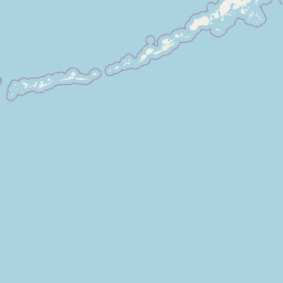
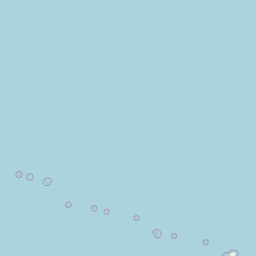
Upper Quinn
Map
+
−
Leaflet
| <a href="https://www.openstreetmap.org/copyright">© OpenStreetMap contributors</a>
Previous
Next
Item
Property
Value
id
16040201
fid
223
gnis_id
None
gnis_url
hucs
https://geoconnex.us/iow/wqp/21NEV1_WQX-BLK02EFkQuinn-1
https://geoconnex.us/iow/wqp/21NEV1_WQX-BLK02SFkQuinn-1
https://geoconnex.us/iow/wqp/21NEV1_WQX-p-NVW04485-080
https://geoconnex.us/iow/wqp/USGS-412646117472201
https://geoconnex.us/iow/wqp/USGS-413006117480001
https://geoconnex.us/iow/wqp/USGS-414016117541701
https://geoconnex.us/iow/wqp/USGS-413800117533001
https://geoconnex.us/iow/wqp/USGS-414230118102001
https://geoconnex.us/iow/wqp/USGS-413625117532201
https://geoconnex.us/iow/wqp/USGS-412603117535801
https://geoconnex.us/iow/wqp/USGS-413019118041801
https://geoconnex.us/iow/wqp/USGS-414310118102001
https://geoconnex.us/iow/wqp/USGS-412835118071001
https://geoconnex.us/iow/wqp/USGS-412902117525501
https://geoconnex.us/iow/wqp/USGS-415103117413501
https://geoconnex.us/iow/wqp/USGS-415921117435601
https://geoconnex.us/iow/wqp/USGS-413139117482201
https://geoconnex.us/iow/wqp/USGS-413320117482001
https://geoconnex.us/iow/wqp/USGS-414010117485301
https://geoconnex.us/iow/wqp/NARS_WQX-FW08NV022
https://geoconnex.us/iow/wqp/USGS-412730117494201
https://geoconnex.us/iow/wqp/USGS-413324117482801
https://geoconnex.us/iow/wqp/USGS-413717117491701
https://geoconnex.us/iow/wqp/USGS-413715117475201
https://geoconnex.us/iow/wqp/OREGONDEQ-31530-ORDEQ
https://geoconnex.us/iow/wqp/NARS-NV47930
https://geoconnex.us/iow/wqp/USGS-411225118210801
https://geoconnex.us/iow/wqp/USGS-413758117510201
https://geoconnex.us/iow/wqp/USGS-412756117465701
https://geoconnex.us/iow/wqp/USGS-411308118293501
https://geoconnex.us/iow/wqp/USGS-414057117523001
https://geoconnex.us/iow/wqp/USGS-413326117493101
https://geoconnex.us/iow/wqp/USGS-413605117521101
https://geoconnex.us/iow/wqp/USGS-412721117544701
https://geoconnex.us/iow/wqp/USGS-405726118121901
https://geoconnex.us/iow/wqp/USGS-412835117513801
https://geoconnex.us/iow/wqp/USGS-412728117442901
https://geoconnex.us/iow/wqp/USGS-413011117502101
https://geoconnex.us/iow/wqp/USGS-10353500
https://geoconnex.us/iow/wqp/USGS-413941117511001
https://geoconnex.us/iow/wqp/USGS-405651118105301
https://geoconnex.us/iow/wqp/OREGONDEQ-31533-ORDEQ
https://geoconnex.us/iow/wqp/OREGONDEQ-31534-ORDEQ
https://geoconnex.us/iow/wqp/USGS-414114117543101
https://geoconnex.us/iow/wqp/USGS-414422118124201
https://geoconnex.us/iow/wqp/USGS-412903118153001
https://geoconnex.us/iow/wqp/USGS-413110117500701
https://geoconnex.us/iow/wqp/USGS-413444117491701
https://geoconnex.us/iow/wqp/USGS-410949118245601
https://geoconnex.us/iow/wqp/USGS-411919118195701
https://geoconnex.us/iow/wqp/USGS-413153117530301
https://geoconnex.us/iow/wqp/USGS-412042117552301
https://geoconnex.us/iow/wqp/USGS-413955117454801
https://geoconnex.us/iow/wqp/USGS-414636118134701
https://geoconnex.us/iow/wqp/NARS-NV50633
https://geoconnex.us/iow/wqp/21NEV1_WQX-p-FW08-NV054
https://geoconnex.us/iow/wqp/USGS-413625117543601
https://geoconnex.us/iow/wqp/USGS-413654117502601
https://geoconnex.us/iow/wqp/USGS-413706117535801
https://geoconnex.us/iow/wqp/USGS-413035118090901
https://geoconnex.us/iow/wqp/NV012-415159117212501
https://geoconnex.us/iow/wqp/USGS-415920117430201
https://geoconnex.us/iow/wqp/USGS-414257117474701
https://geoconnex.us/iow/wqp/USGS-414315117511001
https://geoconnex.us/iow/wqp/USGS-412920118122401
https://geoconnex.us/iow/wqp/USGS-414211118143101
https://geoconnex.us/iow/wqp/USGS-415628117414102
https://geoconnex.us/iow/wqp/USGS-410234118270301
https://geoconnex.us/iow/wqp/21NEV1_WQX-BLK03Anderson-1
https://geoconnex.us/iow/wqp/21NEV1_WQX-BLK03EFkQuinnTrib-1
https://geoconnex.us/iow/wqp/21NEV1_WQX-BLK04Cold-1
https://geoconnex.us/iow/wqp/21NEV1_WQX-BLK04NFkKings-1
https://geoconnex.us/iow/wqp/USGS-412934117483001
https://geoconnex.us/iow/wqp/USGS-413017117482101
https://geoconnex.us/iow/wqp/USGS-10352500
https://geoconnex.us/iow/wqp/USGS-410504118150401
https://geoconnex.us/iow/wqp/USGS-413715117501001
https://geoconnex.us/iow/wqp/21NEV1_WQX-CROW-1
https://geoconnex.us/iow/wqp/NARS-NV52961
https://geoconnex.us/iow/wqp/USGS-412441118010801
https://geoconnex.us/iow/wqp/USGS-415719117425101
https://geoconnex.us/iow/wqp/USGS-404934118220101
https://geoconnex.us/iow/wqp/USGS-414030117500101
https://geoconnex.us/iow/wqp/USGS-412457117582201
https://geoconnex.us/iow/wqp/USGS-412509117444201
https://geoconnex.us/iow/wqp/USGS-413012117484401
https://geoconnex.us/iow/wqp/NARS_WQX-FW08NV054
https://geoconnex.us/iow/wqp/USGS-411921118151201
https://geoconnex.us/iow/wqp/USGS-412725118170701
https://geoconnex.us/iow/wqp/USGS-10353600
https://geoconnex.us/iow/wqp/21NEV1_WQX-p-FW08-NV038
https://geoconnex.us/iow/wqp/USGS-10353000
https://geoconnex.us/iow/wqp/NARS_WQX-NRS_OR-10680
https://geoconnex.us/iow/wqp/21NEV1_WQX-FALLS
https://geoconnex.us/iow/wqp/21NEV1_WQX-HC1
https://geoconnex.us/iow/wqp/USGS-414925117450201
https://geoconnex.us/iow/wqp/USGS-415620117394801
https://geoconnex.us/iow/wqp/USGS-413656117531401
https://geoconnex.us/iow/wqp/USGS-413933117532801
https://geoconnex.us/iow/wqp/USGS-412752117504801
https://geoconnex.us/iow/wqp/USGS-413359117474101
https://geoconnex.us/iow/wqp/USGS-413935117525501
https://geoconnex.us/iow/wqp/USGS-413617118070301
https://geoconnex.us/iow/wqp/USGS-411606118050901
https://geoconnex.us/iow/wqp/USGS-413031117492301
https://geoconnex.us/iow/wqp/USGS-412557118035201
https://geoconnex.us/iow/wqp/USGS-412947118110901
https://geoconnex.us/iow/wqp/USGS-412538117575201
https://geoconnex.us/iow/wqp/21NEV1_WQX-NV02-201-T-010
https://geoconnex.us/iow/wqp/USGS-413821117533601
https://geoconnex.us/iow/wqp/USGS-414233118080201
https://geoconnex.us/iow/wqp/USGS-415946117401601
https://geoconnex.us/iow/wqp/USGS-415703117363801
https://geoconnex.us/iow/wqp/USGS-413024117502001
https://geoconnex.us/iow/wqp/USGS-412538117564701
https://geoconnex.us/iow/wqp/USGS-412728117441201
https://geoconnex.us/iow/wqp/USGS-413906117563501
https://geoconnex.us/iow/wqp/OREGONDEQ-31532-ORDEQ
https://geoconnex.us/iow/wqp/USGS-412453118151701
https://geoconnex.us/iow/wqp/21NEV1_WQX-WASH-1
https://geoconnex.us/iow/wqp/21NEV1_WQX-Kings-1
https://geoconnex.us/iow/wqp/NARS-NV42032
https://geoconnex.us/iow/wqp/USGS-415932117432801
https://geoconnex.us/iow/wqp/USGS-410816117481401
https://geoconnex.us/iow/wqp/USGS-413821117514301
https://geoconnex.us/iow/wqp/USGS-415233117414901
https://geoconnex.us/iow/wqp/USGS-412503118035801
https://geoconnex.us/iow/wqp/NV012-411316117521101
https://geoconnex.us/iow/wqp/USGS-410644118094501
https://geoconnex.us/iow/wqp/USGS-413918118123901
https://geoconnex.us/iow/wqp/USGS-414047117482001
https://geoconnex.us/iow/wqp/USGS-414257117485301
https://geoconnex.us/iow/wqp/USGS-412125117501601
https://geoconnex.us/iow/wqp/USGS-412717117522201
https://geoconnex.us/iow/wqp/USGS-413623117501001
https://geoconnex.us/iow/wqp/USGS-405250118263401
https://geoconnex.us/iow/wqp/OREGONDEQ-31529-ORDEQ
https://geoconnex.us/iow/wqp/21NEV1_WQX-p-FW08-NV022
https://geoconnex.us/iow/wqp/USGS-410321118164001
https://geoconnex.us/iow/wqp/USGS-412341117490101
https://geoconnex.us/iow/wqp/USGS-414057117534101
https://geoconnex.us/iow/wqp/USGS-414219118154801
https://geoconnex.us/iow/wqp/USGS-413321117513701
https://geoconnex.us/iow/wqp/USGS-413908117460801
https://geoconnex.us/iow/wqp/USGS-411311118122801
https://geoconnex.us/iow/wqp/USGS-414020118110801
https://geoconnex.us/iow/wqp/USGS-413802117514601
https://geoconnex.us/iow/wqp/USGS-412510118024801
https://geoconnex.us/iow/wqp/USGS-415956117465201
https://geoconnex.us/iow/wqp/USGS-412738117441801
https://geoconnex.us/iow/wqp/USGS-414243118113101
https://geoconnex.us/iow/wqp/USGS-412730117451501
https://geoconnex.us/iow/wqp/NARS_WQX-FW08NV038
https://geoconnex.us/iow/wqp/USGS-414327117463501
https://geoconnex.us/iow/wqp/USGS-411559118215201
https://geoconnex.us/iow/wqp/21NEV1_WQX-MCDT-1
https://geoconnex.us/iow/wqp/USGS-405813118230501
https://geoconnex.us/iow/wqp/USGS-413717117515101
https://geoconnex.us/iow/wqp/USGS-413613117540101
https://geoconnex.us/iow/wqp/USGS-410741117495001
https://geoconnex.us/iow/wqp/USGS-412156117455301
https://geoconnex.us/iow/wqp/USGS-413043117505201
https://geoconnex.us/iow/wqp/USGS-413347118131501
https://geoconnex.us/iow/wqp/USGS-414224117520801
https://geoconnex.us/iow/wqp/NARS_WQX-NVLS-1069
https://geoconnex.us/iow/wqp/USGS-411612117490601
https://geoconnex.us/iow/wqp/USGS-415642117460402
https://geoconnex.us/iow/wqp/USGS-412754117444501
https://geoconnex.us/iow/wqp/21NEV1_WQX-NV02-201-T-001
https://geoconnex.us/iow/wqp/NARS_WQX-NRS_NV-10484
https://geoconnex.us/iow/wqp/USGS-413328117485001
https://geoconnex.us/iow/wqp/USGS-412732117551201
https://geoconnex.us/iow/wqp/OREGONDEQ-31531-ORDEQ
https://geoconnex.us/iow/wqp/USGS-415317117402901
https://geoconnex.us/iow/wqp/USGS-415659117402701
https://geoconnex.us/iow/wqp/USGS-410109118165601
https://geoconnex.us/ref/hu10/1604020101
https://geoconnex.us/ref/hu10/1604020102
https://geoconnex.us/ref/hu10/1604020103
https://geoconnex.us/ref/hu10/1604020104
https://geoconnex.us/ref/hu10/1604020105
https://geoconnex.us/ref/hu10/1604020106
https://geoconnex.us/ref/hu10/1604020107
https://geoconnex.us/ref/hu10/1604020108
https://geoconnex.us/ref/hu10/1604020109
https://geoconnex.us/ref/hu10/1604020110
https://geoconnex.us/ref/hu10/1604020111
https://geoconnex.us/ref/hu10/1604020112
https://geoconnex.us/ref/hu10/1604020113
loaddate
2012-06-11 12:54:56+00:00
name
Upper Quinn
uri
https://geoconnex.us/ref/hu08/16040201