/
https://geoconnex.us/ref/hu08/16040203
JSON
JSON-LD
Resources
Collections
Processes
Documentation
Geoconnex Docs
API Definition
Conformance
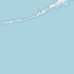
Smoke Creek Desert
Map
+
−
Leaflet
| <a href="https://www.openstreetmap.org/copyright">© OpenStreetMap contributors</a>
Previous
Next
Item
Property
Value
id
16040203
fid
220
gnis_id
None
gnis_url
hucs
https://geoconnex.us/iow/wqp/21NEV1_WQX-p-NVW04485-100
https://geoconnex.us/iow/wqp/21NEV1_WQX-BLK04Rock-1
https://geoconnex.us/iow/wqp/21NEV1_WQX-BUFF-1
https://geoconnex.us/iow/wqp/USGS-405157119182001
https://geoconnex.us/iow/wqp/USGS-405501119331701
https://geoconnex.us/iow/wqp/21NEV1_WQX-NC-1
https://geoconnex.us/iow/wqp/NARS_WQX-NWC_CA-10309
https://geoconnex.us/iow/wqp/USGS-401840119471901
https://geoconnex.us/iow/wqp/USGS-405138119190510
https://geoconnex.us/iow/wqp/USGS-402557119274101
https://geoconnex.us/iow/wqp/USGS-405138119190507
https://geoconnex.us/iow/wqp/USGS-405145119163301
https://geoconnex.us/iow/wqp/USGS-405532119185301
https://geoconnex.us/iow/wqp/PYRAMIDLAKE-WTLDSS
https://geoconnex.us/iow/wqp/USGS-402056119250501
https://geoconnex.us/iow/wqp/USGS-402802119511201
https://geoconnex.us/iow/wqp/USGS-403637119445101
https://geoconnex.us/iow/wqp/USGS-403903119230201
https://geoconnex.us/iow/wqp/USGS-403907119244601
https://geoconnex.us/iow/wqp/USGS-405102119210501
https://geoconnex.us/iow/wqp/USGS-402449119505201
https://geoconnex.us/iow/wqp/USGS-401957119482501
https://geoconnex.us/iow/wqp/USGS-403603119433701
https://geoconnex.us/iow/wqp/USGS-404229119275401
https://geoconnex.us/iow/wqp/USGS-404806119182901
https://geoconnex.us/iow/wqp/USGS-410048119151701
https://geoconnex.us/iow/wqp/USGS-403903119230202
https://geoconnex.us/iow/wqp/USGS-402639119274301
https://geoconnex.us/iow/wqp/USGS-405258119193701
https://geoconnex.us/iow/wqp/USGS-403614119445401
https://geoconnex.us/iow/wqp/USGS-405138119190508
https://geoconnex.us/iow/wqp/NARS_WQX-NWC_CA-10306
https://geoconnex.us/iow/wqp/USGS-405152119215701
https://geoconnex.us/iow/wqp/USGS-405632119181601
https://geoconnex.us/iow/wqp/USGS-404305119290001
https://geoconnex.us/iow/wqp/PYRAMIDLAKE-WTLDSUL
https://geoconnex.us/iow/wqp/USGS-405101119210501
https://geoconnex.us/iow/wqp/USGS-405211119162002
https://geoconnex.us/iow/wqp/USGS-404809119303301
https://geoconnex.us/iow/wqp/USGS-404917119313901
https://geoconnex.us/iow/wqp/USGS-403903119230204
https://geoconnex.us/iow/wqp/21NEV1_WQX-SCR-1
https://geoconnex.us/iow/wqp/21NEV1_WQX-SMC-1
https://geoconnex.us/iow/wqp/21NEV1_WQX-SMC-2
https://geoconnex.us/iow/wqp/USGS-10353799
https://geoconnex.us/iow/wqp/USGS-402916119485001
https://geoconnex.us/iow/wqp/USGS-404233119272501
https://geoconnex.us/iow/wqp/USGS-405437119163701
https://geoconnex.us/iow/wqp/USGS-404739119185901
https://geoconnex.us/iow/wqp/USGS-405020119324501
https://geoconnex.us/iow/wqp/USGS-405305119200001
https://geoconnex.us/iow/wqp/USGS-10353770
https://geoconnex.us/iow/wqp/USGS-405138119190512
https://geoconnex.us/iow/wqp/USGS-405420119194501
https://geoconnex.us/iow/wqp/USGS-405312119185401
https://geoconnex.us/iow/wqp/USGS-405138119190502
https://geoconnex.us/iow/wqp/USGS-404321119274501
https://geoconnex.us/iow/wqp/USGS-404928119290501
https://geoconnex.us/iow/wqp/USGS-402700119250001
https://geoconnex.us/iow/wqp/USGS-403504119465001
https://geoconnex.us/iow/wqp/21NEV1_WQX-SMC-3
https://geoconnex.us/iow/wqp/NARS_WQX-NLA12_CA-154
https://geoconnex.us/iow/wqp/USGS-10353800
https://geoconnex.us/iow/wqp/USGS-403013119261101
https://geoconnex.us/iow/wqp/USGS-405247119174501
https://geoconnex.us/iow/wqp/USGS-401849119474301
https://geoconnex.us/iow/wqp/USGS-403906119223501
https://geoconnex.us/iow/wqp/PYRAMIDLAKE-WTLDSP
https://geoconnex.us/iow/wqp/USGS-404338119313801
https://geoconnex.us/iow/wqp/USGS-404651119223901
https://geoconnex.us/iow/wqp/USGS-405138119190506
https://geoconnex.us/iow/wqp/USGS-405200119205401
https://geoconnex.us/iow/wqp/USGS-405329119185401
https://geoconnex.us/iow/wqp/USGS-405733119195701
https://geoconnex.us/iow/wqp/USGS-402357119493001
https://geoconnex.us/iow/wqp/USGS-404300119285401
https://geoconnex.us/iow/wqp/USGS-402846119490601
https://geoconnex.us/iow/wqp/NARS-WNVP99-0679
https://geoconnex.us/iow/wqp/USGS-404823119192801
https://geoconnex.us/iow/wqp/USGS-410126119172801
https://geoconnex.us/iow/wqp/NARS_WQX-WNVP99-0679
https://geoconnex.us/iow/wqp/USGS-404434119261001
https://geoconnex.us/iow/wqp/USGS-404443119261401
https://geoconnex.us/iow/wqp/USGS-405308119200401
https://geoconnex.us/iow/wqp/USGS-405501119185601
https://geoconnex.us/iow/wqp/USGS-403905119251801
https://geoconnex.us/iow/wqp/21NEV1_WQX-p-NVW04485-095
https://geoconnex.us/iow/wqp/USGS-402914119482501
https://geoconnex.us/iow/wqp/USGS-405138119190509
https://geoconnex.us/iow/wqp/USGS-404928119290502
https://geoconnex.us/iow/wqp/USGS-405128119191601
https://geoconnex.us/iow/wqp/USGS-405138119190501
https://geoconnex.us/iow/wqp/USGS-401654119470101
https://geoconnex.us/iow/wqp/USGS-404029119362701
https://geoconnex.us/iow/wqp/USGS-404447119504001
https://geoconnex.us/iow/wqp/USGS-404738119200301
https://geoconnex.us/iow/wqp/USGS-403903119230203
https://geoconnex.us/iow/wqp/USGS-404252119284401
https://geoconnex.us/iow/wqp/USGS-405610119213901
https://geoconnex.us/iow/wqp/USGS-405138119190511
https://geoconnex.us/iow/wqp/CEDEN-639L12154
https://geoconnex.us/iow/wqp/CEDEN-639PS1279
https://geoconnex.us/ref/hu10/1604020301
https://geoconnex.us/ref/hu10/1604020302
https://geoconnex.us/ref/hu10/1604020303
https://geoconnex.us/ref/hu10/1604020304
https://geoconnex.us/ref/hu10/1604020305
https://geoconnex.us/ref/hu10/1604020306
https://geoconnex.us/ref/hu10/1604020307
https://geoconnex.us/ref/hu10/1604020308
https://geoconnex.us/ref/hu10/1604020309
https://geoconnex.us/ref/hu10/1604020310
https://geoconnex.us/ref/hu10/1604020311
loaddate
2012-06-11 12:54:56+00:00
name
Smoke Creek Desert
uri
https://geoconnex.us/ref/hu08/16040203