/
https://geoconnex.us/ref/hu08/17020010
JSON
JSON-LD
Resources
Collections
Sitemap
Processes
Documentation
Geoconnex Docs
API Definition
Conformance
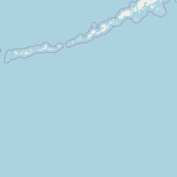
Upper Columbia-Entiat
Map
+
−
Leaflet
| <a href="https://www.openstreetmap.org/copyright">© OpenStreetMap contributors</a>
Previous
Next
Item
Property
Value
id
17020010
fid
1698
gnis_id
None
gnis_url
hucs
https://geoconnex.us/ref/hu10/1702001001
https://geoconnex.us/ref/hu10/1702001002
https://geoconnex.us/ref/hu10/1702001003
https://geoconnex.us/ref/hu10/1702001004
https://geoconnex.us/ref/hu10/1702001005
https://geoconnex.us/iow/wqp/1119USBR-CBP034
https://geoconnex.us/iow/wqp/1119USBR-CBP102
https://geoconnex.us/iow/wqp/1119USBR-CBP075
https://geoconnex.us/iow/wqp/1119USBR-CBP086
https://geoconnex.us/iow/wqp/USGS-471349120013801
https://geoconnex.us/iow/wqp/USGS-472234120085001
https://geoconnex.us/iow/wqp/OST_SHPD-NRS18_WA_10039
https://geoconnex.us/iow/wqp/USGS-470720119561901
https://geoconnex.us/iow/wqp/1119USBR_WQX-CBP086
https://geoconnex.us/iow/wqp/NARS_WQX-NLA12_WA-R08
https://geoconnex.us/iow/wqp/USGS-474516120113901
https://geoconnex.us/iow/wqp/USGS-465426119451701
https://geoconnex.us/iow/wqp/USGS-472938120180801
https://geoconnex.us/iow/wqp/USGS-472616120181301
https://geoconnex.us/iow/wqp/USGS-473156120171801
https://geoconnex.us/iow/wqp/USGS-473209120171101
https://geoconnex.us/iow/wqp/USGS-465519119460401
https://geoconnex.us/iow/wqp/OREGONDEQ-35241-ORDEQ
https://geoconnex.us/iow/wqp/USGS-12462545
https://geoconnex.us/iow/wqp/USGS-465000119554301
https://geoconnex.us/iow/wqp/1119USBR-CBP094
https://geoconnex.us/iow/wqp/1119USBR-CBP095
https://geoconnex.us/iow/wqp/1119USBR_WQX-CBP554
https://geoconnex.us/iow/wqp/OREGONDEQ-35240-ORDEQ
https://geoconnex.us/iow/wqp/1119USBR_WQX-CBP101
https://geoconnex.us/iow/wqp/USGS-470733119594222
https://geoconnex.us/iow/wqp/OREGONDEQ-35244-ORDEQ
https://geoconnex.us/iow/wqp/OREGONDEQ-35245-ORDEQ
https://geoconnex.us/iow/wqp/USGS-465425119591701
https://geoconnex.us/iow/wqp/USGS-465433119484001
https://geoconnex.us/iow/wqp/1119USBR_WQX-CBP103
https://geoconnex.us/iow/wqp/1119USBR_WQX-CBP034
https://geoconnex.us/iow/wqp/1119USBR_WQX-CBP075
https://geoconnex.us/iow/wqp/USGS-474400120210101
https://geoconnex.us/iow/wqp/USGS-473735120131801
https://geoconnex.us/iow/wqp/USGS-471630120104501
https://geoconnex.us/iow/wqp/USGS-472228120094801
https://geoconnex.us/iow/wqp/1119USBR_WQX-CBP107
https://geoconnex.us/iow/wqp/CRK_WQX-38062-ORDEQ
https://geoconnex.us/iow/wqp/USGS-12464606
https://geoconnex.us/iow/wqp/USGS-473943120121701
https://geoconnex.us/iow/wqp/OREGONDEQ-35248-ORDEQ
https://geoconnex.us/iow/wqp/USGS-465657119483501
https://geoconnex.us/iow/wqp/USGS-465717119535802
https://geoconnex.us/iow/wqp/USGS-473240120164001
https://geoconnex.us/iow/wqp/USGS-473201120172501
https://geoconnex.us/iow/wqp/WSDANRAS-EN01.6
https://geoconnex.us/iow/wqp/1119USBR-CBP101
https://geoconnex.us/iow/wqp/USGS-12453000
https://geoconnex.us/iow/wqp/USGS-473220120170601
https://geoconnex.us/iow/wqp/USGS-474220120113901
https://geoconnex.us/iow/wqp/USGS-473209120172401
https://geoconnex.us/iow/wqp/USGS-473213120172401
https://geoconnex.us/iow/wqp/USGS-465428119451701
https://geoconnex.us/iow/wqp/USGS-472218120082401
https://geoconnex.us/iow/wqp/USGS-471403119561001
https://geoconnex.us/iow/wqp/USGS-470748119561301
https://geoconnex.us/iow/wqp/1119USBR_WQX-CBP095
https://geoconnex.us/iow/wqp/USGS-474605120090402
https://geoconnex.us/iow/wqp/WA_ECOLOGY-46A070
https://geoconnex.us/iow/wqp/WSDANRAS-SC00.4
https://geoconnex.us/iow/wqp/USGS-473152120173301
https://geoconnex.us/iow/wqp/USGS-474234120115802
https://geoconnex.us/iow/wqp/1119USBR-CBP103
https://geoconnex.us/iow/wqp/OREGONDEQ-35237-ORDEQ
https://geoconnex.us/iow/wqp/USGS-472213120115401
https://geoconnex.us/iow/wqp/1119USBR_WQX-CBP094
https://geoconnex.us/iow/wqp/OREGONDEQ-35251-ORDEQ
https://geoconnex.us/iow/wqp/USGS-471751120071301
https://geoconnex.us/iow/wqp/USGS-465651120020001
https://geoconnex.us/iow/wqp/USGS-474010120175801
https://geoconnex.us/iow/wqp/NARS_WQX-NRS_WA-10466
https://geoconnex.us/iow/wqp/USGS-12452800
https://geoconnex.us/iow/wqp/USGS-473202120171101
https://geoconnex.us/iow/wqp/1119USBR_WQX-CBP102
https://geoconnex.us/iow/wqp/1119USBR-CBP107
https://geoconnex.us/iow/wqp/USGS-472615120181601
https://geoconnex.us/iow/wqp/USGS-473156120172601
https://geoconnex.us/iow/wqp/1119USBR_WQX-CBP108
https://geoconnex.us/iow/wqp/USGS-12462640
https://geoconnex.us/iow/wqp/USGS-474234120115801
https://geoconnex.us/iow/wqp/USGS-12464607
https://geoconnex.us/iow/wqp/USGS-465649119513901
https://geoconnex.us/iow/wqp/USGS-472243120153701
https://geoconnex.us/iow/wqp/USGS-464926119553221
https://geoconnex.us/iow/wqp/USGS-12452990
https://geoconnex.us/iow/wqp/USGS-465455119370001
https://geoconnex.us/iow/wqp/NARS_WQX-NRS_WA-10442
https://geoconnex.us/iow/wqp/1119USBR-CBP108
https://geoconnex.us/iow/wqp/USGS-472506120180900
https://geoconnex.us/iow/wqp/USGS-473517120091501
https://geoconnex.us/iow/wqp/USGS-472609120180001
https://geoconnex.us/iow/wqp/USGS-465016119555101
https://geoconnex.us/iow/wqp/USGS-473159120172501
https://geoconnex.us/iow/wqp/USGS-465558119593201
https://geoconnex.us/iow/wqp/OREGONDEQ-35249-ORDEQ
https://geoconnex.us/iow/wqp/USGS-12462600
https://geoconnex.us/iow/wqp/USGS-465137119564701
https://geoconnex.us/iow/wqp/USGS-474156120191801
https://geoconnex.us/iow/wqp/USGS-474348120124801
https://geoconnex.us/iow/wqp/1119USBR-CBP554
loaddate
2013-01-18 19:55:15+00:00
name
Upper Columbia-Entiat
uri
https://geoconnex.us/ref/hu08/17020010