/
https://geoconnex.us/ref/hu08/17070204
JSON
JSON-LD
Resources
Collections
Sitemap
Processes
Documentation
Geoconnex Docs
API Definition
Conformance
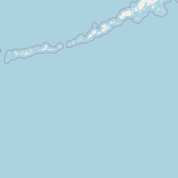
Lower John Day
Map
+
−
Leaflet
| <a href="https://www.openstreetmap.org/copyright">© OpenStreetMap contributors</a>
Previous
Next
Item
Property
Value
id
17070204
fid
1663
gnis_id
None
gnis_url
hucs
https://geoconnex.us/ref/hu10/1707020401
https://geoconnex.us/ref/hu10/1707020402
https://geoconnex.us/ref/hu10/1707020403
https://geoconnex.us/ref/hu10/1707020404
https://geoconnex.us/ref/hu10/1707020405
https://geoconnex.us/ref/hu10/1707020406
https://geoconnex.us/ref/hu10/1707020407
https://geoconnex.us/ref/hu10/1707020408
https://geoconnex.us/ref/hu10/1707020409
https://geoconnex.us/ref/hu10/1707020410
https://geoconnex.us/ref/hu10/1707020411
https://geoconnex.us/ref/hu10/1707020412
https://geoconnex.us/ref/hu10/1707020413
https://geoconnex.us/ref/hu10/1707020414
https://geoconnex.us/iow/wqp/NARS-WORP99-0696
https://geoconnex.us/iow/wqp/NARS-WORP99-0606
https://geoconnex.us/iow/wqp/1119USBR_WQX-TUL002
https://geoconnex.us/iow/wqp/ADVENTURESCIENTISTS-45.48.120.46
https://geoconnex.us/iow/wqp/NARS-WORP99-0798
https://geoconnex.us/iow/wqp/NARS_WQX-ORRM-1002
https://geoconnex.us/iow/wqp/NARS_WQX-WORP99-0883
https://geoconnex.us/iow/wqp/OREGONDEQ-36239-ORDEQ
https://geoconnex.us/iow/wqp/USGS-452859120434301
https://geoconnex.us/iow/wqp/OREGONDEQ-11634-ORDEQ
https://geoconnex.us/iow/wqp/NARS_WQX-ORR9-0907
https://geoconnex.us/iow/wqp/OREGONDEQ-25416-ORDEQ
https://geoconnex.us/iow/wqp/OREGONDEQ-25907-ORDEQ
https://geoconnex.us/iow/wqp/OREGONDEQ-35006-ORDEQ
https://geoconnex.us/iow/wqp/OREGONDEQ-11631-ORDEQ
https://geoconnex.us/iow/wqp/NARS_WQX-FW08OR037
https://geoconnex.us/iow/wqp/NARS_WQX-WORP99-0685
https://geoconnex.us/iow/wqp/USFS0614-14210003
https://geoconnex.us/iow/wqp/NARS_WQX-NRS_OR-10568
https://geoconnex.us/iow/wqp/NARS-WORP99-0535
https://geoconnex.us/iow/wqp/USGS-445500120252801
https://geoconnex.us/iow/wqp/OREGONDEQ-11636-ORDEQ
https://geoconnex.us/iow/wqp/NARS-WORP99-0547
https://geoconnex.us/iow/wqp/NARS-WORP99-0623
https://geoconnex.us/iow/wqp/OREGONDEQ-14468-ORDEQ
https://geoconnex.us/iow/wqp/OREGONDEQ-11648-ORDEQ
https://geoconnex.us/iow/wqp/OST_SHPD-NRS18_OR_10026
https://geoconnex.us/iow/wqp/OREGONDEQ-14501-ORDEQ
https://geoconnex.us/iow/wqp/OREGONDEQ-30398-ORDEQ
https://geoconnex.us/iow/wqp/NARS_WQX-WORP99-0547
https://geoconnex.us/iow/wqp/OREGONDEQ-11826-ORDEQ
https://geoconnex.us/iow/wqp/PIBO_MP-1062
https://geoconnex.us/iow/wqp/OREGONDEQ-11632-ORDEQ
https://geoconnex.us/iow/wqp/OREGONDEQ-11630-ORDEQ
https://geoconnex.us/iow/wqp/NARS-WORP99-0678
https://geoconnex.us/iow/wqp/NARS-WORP99-0775
https://geoconnex.us/iow/wqp/NARS_WQX-FW08OR021
https://geoconnex.us/iow/wqp/OREGONDEQ-31457-ORDEQ
https://geoconnex.us/iow/wqp/NARS-WORP99-0977
https://geoconnex.us/iow/wqp/NARS-WORP99-0685
https://geoconnex.us/iow/wqp/NARS-WORP99-0689
https://geoconnex.us/iow/wqp/OREGONDEQ-14511-ORDEQ
https://geoconnex.us/iow/wqp/USFS0614-14210002
https://geoconnex.us/iow/wqp/NARS_WQX-WORP99-0792
https://geoconnex.us/iow/wqp/NARS-WORP99-0799
https://geoconnex.us/iow/wqp/NARS-WORP99-0792
https://geoconnex.us/iow/wqp/NARS_WQX-ORRM-1006
https://geoconnex.us/iow/wqp/NARS_WQX-WORP99-0852
https://geoconnex.us/iow/wqp/OST_SHPD-NRSA0809-OR037
https://geoconnex.us/iow/wqp/OREGONDEQ-25906-ORDEQ
https://geoconnex.us/iow/wqp/USGS-445722120362201
https://geoconnex.us/iow/wqp/NARS-WORP99-0852
https://geoconnex.us/iow/wqp/NARS_WQX-WORP99-0977
https://geoconnex.us/iow/wqp/OST_SHPD-NRSA1314-ORR9-0907
https://geoconnex.us/iow/wqp/OREGONDEQ-14510-ORDEQ
https://geoconnex.us/iow/wqp/NARS-WORP99-0929
https://geoconnex.us/iow/wqp/OST_SHPD-NRS18_OR_10042
https://geoconnex.us/iow/wqp/OREGONDEQ-14509-ORDEQ
https://geoconnex.us/iow/wqp/OREGONDEQ-25909-ORDEQ
https://geoconnex.us/iow/wqp/OREGONDEQ-25910-ORDEQ
https://geoconnex.us/iow/wqp/NARS_WQX-WORP99-0775
https://geoconnex.us/iow/wqp/NARS_WQX-WORP99-0929
https://geoconnex.us/iow/wqp/NARS_WQX-NRS_OR-10485
https://geoconnex.us/iow/wqp/NARS-WORP99-0923
https://geoconnex.us/iow/wqp/NARS-WORP99-0768
https://geoconnex.us/iow/wqp/USGS-14048000
https://geoconnex.us/iow/wqp/NARS_WQX-NRS_OR-10629
https://geoconnex.us/iow/wqp/NARS_WQX-WORP99-0923
https://geoconnex.us/iow/wqp/NARS-WORP99-0883
https://geoconnex.us/iow/wqp/OREGONDEQ-25911-ORDEQ
https://geoconnex.us/iow/wqp/OREGONDEQ-37719-ORDEQ
https://geoconnex.us/iow/wqp/OREGONDEQ-10400-ORDEQ
https://geoconnex.us/iow/wqp/OREGONDEQ-14484-ORDEQ
https://geoconnex.us/iow/wqp/NARS-WORP99-0912
https://geoconnex.us/iow/wqp/NARS-WORP99-0702
https://geoconnex.us/iow/wqp/OREGONDEQ-14502-ORDEQ
https://geoconnex.us/iow/wqp/NARS_WQX-WORP99-0768
https://geoconnex.us/iow/wqp/OREGONDEQ-14483-ORDEQ
https://geoconnex.us/iow/wqp/OREGONDEQ-41718-ORDEQ
https://geoconnex.us/iow/wqp/USGS-14047390
https://geoconnex.us/iow/wqp/OREGONDEQ-11014-ORDEQ
https://geoconnex.us/iow/wqp/NARS_WQX-NRS_OR-10564
https://geoconnex.us/iow/wqp/NARS_WQX-WORP99-0606
https://geoconnex.us/iow/wqp/USGS-14046500
https://geoconnex.us/iow/wqp/OREGONDEQ-25908-ORDEQ
loaddate
2013-01-18 19:55:15+00:00
name
Lower John Day
uri
https://geoconnex.us/ref/hu08/17070204