/
https://geoconnex.us/ref/hu08/19010207
JSON
JSON-LD
Resources
Collections
Processes
Documentation
Geoconnex Docs
API Definition
Conformance
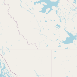
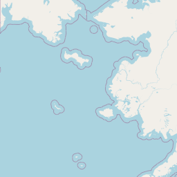
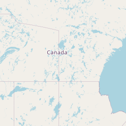
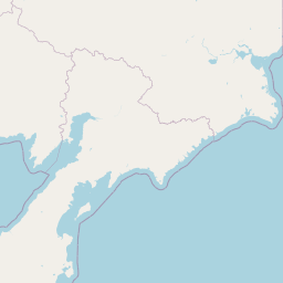
Stikine River
Map
+
−
Leaflet
| <a href="https://www.openstreetmap.org/copyright">© OpenStreetMap contributors</a>
Previous
Next
Item
Property
Value
id
19010207
fid
2153
gnis_id
None
gnis_url
hucs
https://geoconnex.us/ref/hu10/1901020709
https://geoconnex.us/ref/hu10/1901020701
https://geoconnex.us/ref/hu10/1901020704
https://geoconnex.us/ref/hu10/1901020710
https://geoconnex.us/ref/hu10/1901020706
https://geoconnex.us/ref/hu10/1901020702
https://geoconnex.us/ref/hu10/1901020711
https://geoconnex.us/ref/hu10/1901020708
https://geoconnex.us/ref/hu10/1901020707
https://geoconnex.us/ref/hu10/1901020705
https://geoconnex.us/ref/hu10/1901020703
https://geoconnex.us/iow/wqp/AKDECAKMAP-NRS18-AK-Stik2
https://geoconnex.us/iow/wqp/AKDECAKMAP-NRS18-AK-10143
https://geoconnex.us/iow/wqp/AKDECAKMAP-SDM17-STIK-7
https://geoconnex.us/iow/wqp/AKDECAKMAP-NRS18-AK-10140
https://geoconnex.us/iow/wqp/AKDECAKMAP-NRS18-AK-10064
https://geoconnex.us/iow/wqp/AKDECAKMAP-NRS18-AK-10147
https://geoconnex.us/iow/wqp/AKDECAKMAP-NRS18-AK-10150
https://geoconnex.us/iow/wqp/AKDECAKMAP-NRS18-AK-Stik1
https://geoconnex.us/iow/wqp/AKDECAKMAP-NRS18-AK-10139
https://geoconnex.us/iow/wqp/USGS-15024800
https://geoconnex.us/iow/wqp/USGS-15024750
https://geoconnex.us/iow/wqp/USGS-15024740
https://geoconnex.us/iow/wqp/USGS-564327132022701
loaddate
2017-01-10 15:54:35+00:00
name
Stikine River
uri
https://geoconnex.us/ref/hu08/19010207