Walla Walla River
Map


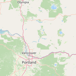


Leaflet | <a href="https://www.openstreetmap.org/copyright">© OpenStreetMap contributors</a>
Item
| Property | Value |
|---|---|
| id | 1431581 |
| downstream_mainstem_id | https://geoconnex.us/ref/mainstems/1423587 |
| encompassing_mainstem_basins | ['https://geoconnex.us/ref/mainstems/1423587'] |
| featuretype | ['https://www.opengis.net/def/schema/hy_features/hyf/HY_FlowPath', 'https://www.opengis.net/def/schema/hy_features/hyf/HY_WaterBody'] |
| fid | 30716 |
| head_2020huc12 | 170701020101 |
| head_nhdpv1_comid | 23637884 |
| head_nhdpv2_comid | https://geoconnex.us/nhdplusv2/comid/23637884 |
| head_nhdpv2huc12 | https://geoconnex.us/nhdplusv2/huc12/170701020101 |
| head_rf1id | 51443 |
| lengthkm | 125.3 |
| name_at_outlet | Walla Walla River |
| name_at_outlet_gnis_id | 1513408 |
| new_mainstemid | |
| outlet_2020huc12 | 170701021105 |
| outlet_drainagearea_sqkm | 4576.6 |
| outlet_nhdpv1_comid | 24235594 |
| outlet_nhdpv2_comid | https://geoconnex.us/nhdplusv2/comid/24235594 |
| outlet_nhdpv2huc12 | https://geoconnex.us/nhdplusv2/huc12/170701021105 |
| outlet_rf1id | 52259 |
| superseded | False |
| uri | https://geoconnex.us/ref/mainstems/1431581 |
Graph Results
| monitoringLocation | https://sta.geoconnex.dev/collections/USGS/Things/items/'USGS-14018500' |
|---|---|
| siteName | USGS-14018500 |
| datasetDescription | Discharge, cubic feet per second / USGS-14018500-8bb3f0dd7bf746919371f1a613121a96 |
| type | Stream |
| url | https://waterdata.usgs.gov/monitoring-location/14018500/#parameterCode=00060 |
| variableMeasured | Discharge |
| variableUnit | ft^3/s |
| measurementTechnique | observation |
| temporalCoverage | 2024-08-30T09:15:00Z/2024-09-09T18:30:00Z |
| distributionName | USGS Instantaneous Values Service |
| distributionURL | https://waterservices.usgs.gov/nwis/iv/?sites=USGS:14018500¶meterCd=00060&format=rdb |
| distributionFormat | text/tab-separated-values |
| wkt | POINT (-118.729711187854 46.0276341406007) |
| monitoringLocation | https://sta.geoconnex.dev/collections/USGS/Things/items/'USGS-14018500' |
|---|---|
| siteName | USGS-14018500 |
| datasetDescription | Discharge, cubic feet per second / USGS-14018500-8bb3f0dd7bf746919371f1a613121a96 |
| type | Stream |
| url | https://waterdata.usgs.gov/monitoring-location/14018500/#parameterCode=00060 |
| variableMeasured | Discharge |
| variableUnit | ft^3/s |
| measurementTechnique | observation |
| temporalCoverage | 2024-08-30T09:15:00Z/2024-09-09T18:30:00Z |
| distributionName | USGS SensorThings API |
| distributionURL | https://labs.waterdata.usgs.gov/sta/v1.1/Datastreams('8bb3f0dd7bf746919371f1a613121a96')?$expand=Thing,Observations |
| distributionFormat | application/json |
| wkt | POINT (-118.729711187854 46.0276341406007) |
| monitoringLocation | https://sta.geoconnex.dev/collections/USGS/Things/items/'USGS-14018500' |
|---|---|
| siteName | USGS-14018500 |
| datasetDescription | Gage height, feet / USGS-14018500-c64a56ac2749434d98be356a7f7fe44c |
| type | Stream |
| url | https://waterdata.usgs.gov/monitoring-location/14018500/#parameterCode=00065 |
| variableMeasured | Gage height |
| variableUnit | ft |
| measurementTechnique | observation |
| temporalCoverage | 2024-08-30T09:15:00Z/2024-09-09T18:30:00Z |
| distributionName | USGS Instantaneous Values Service |
| distributionURL | https://waterservices.usgs.gov/nwis/iv/?sites=USGS:14018500¶meterCd=00065&format=rdb |
| distributionFormat | text/tab-separated-values |
| wkt | POINT (-118.729711187854 46.0276341406007) |
| monitoringLocation | https://sta.geoconnex.dev/collections/USGS/Things/items/'USGS-14018500' |
|---|---|
| siteName | USGS-14018500 |
| datasetDescription | Gage height, feet / USGS-14018500-c64a56ac2749434d98be356a7f7fe44c |
| type | Stream |
| url | https://waterdata.usgs.gov/monitoring-location/14018500/#parameterCode=00065 |
| variableMeasured | Gage height |
| variableUnit | ft |
| measurementTechnique | observation |
| temporalCoverage | 2024-08-30T09:15:00Z/2024-09-09T18:30:00Z |
| distributionName | USGS SensorThings API |
| distributionURL | https://labs.waterdata.usgs.gov/sta/v1.1/Datastreams('c64a56ac2749434d98be356a7f7fe44c')?$expand=Thing,Observations |
| distributionFormat | application/json |
| wkt | POINT (-118.729711187854 46.0276341406007) |